
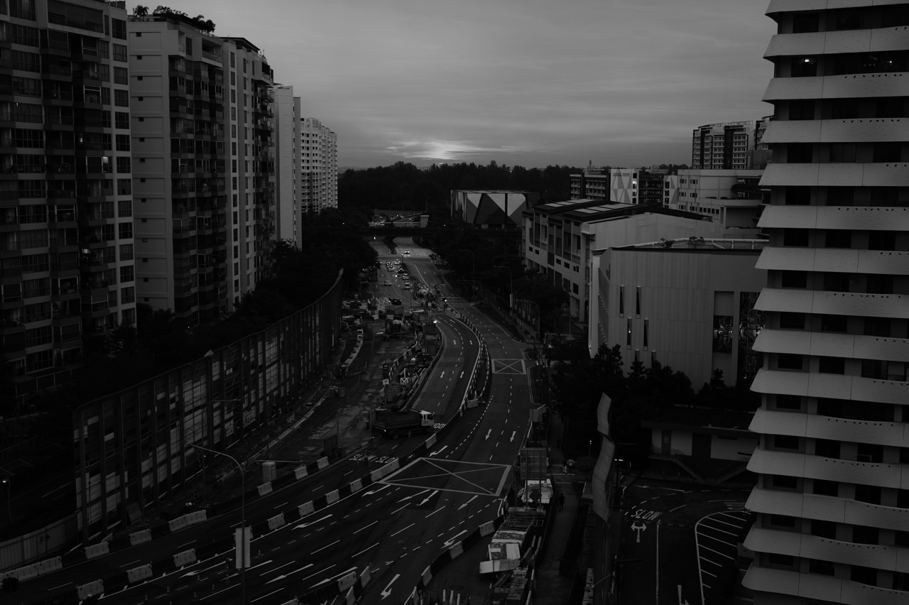
Punggol haze is usually part of a wider Singapore air-quality episode, not a separate cloud of pollution belonging to the estate. During regional forest and land fires, fine smoke particles can travel across borders on prevailing winds. Dry weather, changing winds and rain help explain why a Punggol morning can look different from yesterday evening. Check NEA’s live haze readings rather than deciding from the colour of the sky alone.
If you are asking why Punggol smells smoky, why PM2.5 rises, or whether the haze is coming from Sumatra or Kalimantan, begin with the evidence: official air-quality readings, dated NEA situation updates and regional hotspot-and-wind maps. They describe different parts of the same story. This guide explains the causes and science; the existing Punggol haze PSI and PM2.5 guide explains which number to use when making an activity decision.
Quick read: the answer before the science
Smoke becomes a Punggol problem when there is a source, a route through the atmosphere and enough pollution in the air people breathe. Regional fire activity supplies some of the smoke; winds carry it; showers and changing conditions can alter it; monitoring stations measure the resulting air quality. No single photograph proves where today’s pollution originated.
The three questions worth separating are: Where did the particles come from? What is the outdoor air like now? What should my household do next? The first needs meteorology and fire data, the second needs current official readings, and the third depends on the applicable health advisory and the people involved.
On 16 October 2026, NEA reported smoke moving from Kalimantan under prevailing southeasterly winds and warned that winds could change how much smoke reached Singapore. This is a dated example, not a description of Punggol’s air quality every day or a live reading for your block. Read the dated NEA update, then consult the live service before acting.
Haze is a mixture, not a single substance
A hazy atmosphere can contain fine solid and liquid particles suspended in air. During transboundary smoke episodes, combustion of vegetation and other materials produces a complex mixture. The composition changes with the fuel, temperature of the fire, distance travelled and atmospheric chemistry along the way. Calling all of it simply ‘dust’ hides important differences.
PM2.5 means particulate matter with an aerodynamic diameter of 2.5 micrometres or smaller. That is a category of particle sizes, not the name of a chemical. Some particles are emitted directly by fires. Others form later when gases react in the atmosphere. The result can stay suspended and be transported large distances, which is why the absence of a fire in Punggol does not mean the air cannot be affected by smoke.
Not every air pollutant is a particle. Singapore’s PSI calculation accounts for six measured pollutants, including particulate matter, sulphur dioxide, nitrogen dioxide, ozone and carbon monoxide. During significant regional smoke events, fine particles are often the leading practical concern, but a haze day is not an excuse to assume other pollutants stop existing. NEA explains the distinction in its air-pollution FAQ.
How a fire hundreds of kilometres away changes a waterfront town
Picture three stages. First, the fire emits gases and particles. Second, atmospheric winds move the smoke plume, sometimes over sea and land and sometimes through changing layers of air. Third, residents encounter the resulting outdoor air conditions. By the time the smoke reaches Singapore, the particles may have mixed with other air masses and undergone chemical or physical changes.
A map of fires does not show an invisible tube connecting every detected hotspot to Punggol. Instead, meteorologists examine the location and intensity of fires, prevailing winds, satellite observations, smoke movement and ground measurements. These different sources reinforce or constrain one another. If the winds change, the likely transport route changes too.
The geography of Punggol matters to local experience: a waterfront promenade is open to the sky, residential blocks form sheltered and wind-exposed sides, and people often spend time on park connectors. None of that means Punggol has a separate official PSI category from the North reporting region. A person’s actual exposure also depends on time spent outdoors and effort, not merely the view from a high floor.
Why the source is often regional open burning
NEA describes the recurring haze problem as linked to regional forest fires and open burning to clear land for agricultural use. Fires may affect vegetation, forest soils and in some circumstances peat. Dry conditions can make fires harder to contain. It is important, though, to distinguish a general explanation from the attribution of a specific day’s haze to a specific fire.
Peat is partly decomposed organic material accumulated in wet environments. When drained, it can become more vulnerable to fire and may smoulder, releasing smoke over extended periods. This is one mechanism that helps explain persistent regional smoke in some years. It should not become a claim that every hotspot visible on a map is a peat fire; verifying fuel and burn conditions requires more evidence.
Nor does the science justify blaming every resident of a neighbouring country. Land use, fire prevention, enforcement, agricultural practices, weather and commercial incentives form a complex regional problem. The practical response combines better prevention with cross-border monitoring and protection of people’s health in affected places.
The invisible role of wind direction
A prevailing wind tells us the direction from which air generally flows. A southeasterly wind, for example, blows from the southeast toward the northwest. If a smoke plume lies upwind of Singapore, such a flow may increase the possibility of transport; if the flow shifts, the effect may lessen or a different source region may become relevant.
The important words are may and possibility. Ground-level wind felt beside Punggol Waterway is not necessarily the same as the wind at the altitude carrying a smoke plume. Wind direction may change across the day, and rainfall can affect both the burning region and the receiving city. Read official meteorological analysis rather than drawing a straight line from a fire icon on a screenshot.
When friends exchange haze messages, a clearer statement is ‘NEA’s update dated 16 October reported smoke transport under prevailing winds’ rather than ‘that country is sending smoke directly into this block right now’. The former gives readers the date, source and uncertainty. The latter promises local precision that has not been established.
Does rain clear haze?
Rainfall can remove some airborne particles through wet deposition, and rain in a fire-prone region can help reduce active burning. That gives rainfall two possible roles: it can affect pollution transport and the source of smoke. It does not mean one local shower guarantees clean air across the rest of the evening.
Imagine a brief rain shower in Punggol while fires remain active elsewhere. The view may improve temporarily, but new smoke can arrive later if the wind continues to carry polluted air towards Singapore. Conversely, rain over a source region can weaken fire activity even if Punggol itself stays dry.
Humidity complicates what the eye sees. Tiny particles can absorb water and scatter light differently in humid air. A grey skyline therefore need not track the health-relevant particle level precisely. Rain also has other weather hazards: lightning and slippery paths are separate reasons to change a plan. The correct question is not ‘did it rain?’ but ‘what do updated official readings and advisories now say?’
Why a clear-looking sky may still deserve a check
Visibility depends on light, particle properties, moisture, sun angle and viewing distance. At dusk, the same surroundings may look more dramatic than at noon. People comparing phone photographs taken with different cameras and exposures may infer a trend that the images cannot measure.
Smell has similar limits. People differ in sensitivity; some pollutants are noticeable at low concentrations, while important particle exposure cannot be reliably estimated by smell. A smoky odour deserves attention, but it is not a substitute for the air-quality indicator or a method of identifying the exact source.
This matters in Punggol when someone says the Waterway looks fine, the Northshore sky looks brown, or the view from a high-rise has cleared. Those observations can be useful descriptions. They do not replace a timestamped measurement. Keep the observation and the health decision on separate lines.
Which official region represents Punggol?
NEA groups its public readings into five reporting regions. Its air-pollution FAQ lists Punggol in the North region, alongside areas such as Sengkang and Yishun. The North reading is regional information, not a sensor at every Punggol block, school, playground or balcony. Do not label it ‘Punggol PSI’ as though NEA publishes an estate-specific official station value.
If you are choosing a reading for a family outing, check the North region and the time shown. A person travelling to another part of Singapore may want to check the relevant region there as well. Actual exposure is influenced by indoor time, duration, physical exertion and personal susceptibility.
For the separate issue of 1-hour PM2.5 for immediate decisions versus the 24-hour PSI forecast for planning ahead, use our dedicated Punggol haze check. This science article concentrates on what produces the changes, not a second copy of the decision guide.
Why today’s number can differ from yesterday’s
There are several clocks in a haze episode. A fire changes through hours and days. A smoke plume moves as atmospheric conditions develop. A one-hour concentration captures a shorter window of recent outdoor air quality, while a 24-hour index represents a longer rolling period. A forecast estimates conditions ahead and may be revised.
Consequently, a sudden change in the one-hour figure need not move the 24-hour PSI by the same amount at that instant. Nor is yesterday’s forecast proof of today’s actual conditions. Treat ‘forecast’, ‘observed now’ and ‘observed over a longer period’ as distinct labels.
For example, suppose someone screenshots a reading at 8am, then another at 2pm. Before comparing the numbers, ask whether both show the same pollutant, region, units and averaging period. An attractive but mistaken chart can be produced simply by mixing a PM2.5 concentration with a PSI number. They have different scales and cannot be subtracted directly.
What satellite hotspots can and cannot prove
A satellite hotspot is a thermal detection, not a complete ground-level fire report. Detection can be limited by cloud cover, smoke, sensor passes, viewing geometry and resolution. NEA and the ASEAN Specialised Meteorological Centre use satellite information alongside other evidence to evaluate regional fire and smoke conditions.
A cluster of hotspots can help answer where burning may be occurring. It does not, on its own, give the exact PM2.5 concentration at Punggol Central at 5pm. Nor does an empty-looking part of a map prove that no fires exist there. When cloud cover is extensive, the limitations become especially important.
If you are reading a screenshot circulating on a residents’ chat, look for its publication date, scale, legend and origin. Does ‘smoke haze’ mean observed satellite haze? Does the arrow show winds at a particular altitude? Is the image yesterday’s map? These simple checks prevent a lot of accidental misinformation.
Haze, fog, mist, construction dust and odour are not interchangeable
Haze in an air-quality alert may be associated with suspended particles from combustion. Fog or mist is mainly an atmospheric condition involving water droplets. Construction dust can arise from activities in a local worksite. Odours may have local or transported sources, and some are not smoke-related at all.
One Punggol resident may notice a strong smell while official regional particle readings show a smaller change; another may see poor visibility because of humid conditions. Neither observation alone can diagnose the source. Never reassure someone with a health concern solely because a photograph looks normal, and never announce a transboundary fire source from one smell.
For persistent unusual odours or a suspected local incident, use the appropriate official reporting channel rather than treating every smell as a haze event. The NEA FAQ separately discusses smell incidents. Where there are acute symptoms or danger, health and emergency needs take precedence over internet investigation.
A worked example: build a better explanation from three clues
Imagine a fictional Tuesday in Punggol. At 7am a parent reports a dull grey skyline. At 9am the official North region’s one-hour PM2.5 band is checked. At noon a friend shares an old satellite hotspot image with no timestamp. What is the safe conclusion?
The skyline is a visual observation; the official reading describes measured regional outdoor air during its stated period; the undated image cannot reliably establish the cause of conditions at noon. A responsible explanation joins what is known and acknowledges what is missing. It does not convert a residents’ chat into a meteorological bulletin.
Now add a dated NEA advisory that discusses regional fires, changing winds and expected showers. That improves the picture because there is an identified authoritative analysis. It still does not make a precise prediction for the air on a single stairwell, nor does it guarantee the next three hours will stay unchanged.
The lesson transfers beyond haze: label observations, forecasts and hypotheses separately. That is a useful science skill for students, parents and anyone who shares local information.
A practical five-step haze information routine
- Check the official live page. Go to haze.gov.sg and read the timestamp, reporting region and current one-hour PM2.5 band for immediate outdoor plans.
- Check the forecast when planning ahead. Use the latest 24-hour PSI forecast and the corresponding health advice during haze season. Do not quietly substitute today’s reading.
- Check official explanations for the cause. NEA situation updates and ASMC regional assessments explain observed fires, smoke and winds, with dates and acknowledged limits.
- Look at the person and the activity. A short commute, a vigorous run and an outing involving someone with chronic lung disease may need different choices under the same regional reading.
- Recheck before acting. Weather and plume movement can change; saving a screenshot is not equivalent to checking the live information when plans start.
This routine is intentionally modest. It takes a few minutes and gives a family enough structure to decide without turning every haze day into a research project. It also guards against overreaction: not every moderate reading calls for cancelling the whole day.
How Punggol families can explain haze to children
A useful age-appropriate explanation is: ‘Small particles from fires can travel with the wind. We cannot always see them. Scientists measure the air so we know when to change outdoor activities.’ Younger children need a practical reason for a changed plan, not a long lecture about regional politics.
For an older student, invite them to draw a three-stage model: source, movement, measurement. Ask what evidence would support each stage and what would remain uncertain. The discussion makes invisible environmental science concrete without frightening the child.
Avoid making exaggerated health promises such as ‘all the smoke is gone now’ or ‘one breath outside will make you sick’. Describe a measured decision: ‘We checked the guidance, and we are changing the park outing today.’ If a child feels unwell, respond to symptoms and obtain appropriate medical help instead of offering reassurance based only on a number.
What households can change, and what they cannot
Residents cannot control the regional winds, rainfall or burning conditions. They can reduce exposure through proportionate activity decisions, by managing indoor air when necessary and by checking official updates. A well-fitted respirator may have a place in particular prolonged outdoor exposures under official guidance, but masking is not the single answer to every haze situation.
For room ventilation, filtration and cleaning, follow the companion Punggol indoor haze guidance while reading current NEA household recommendations. For how the rest of a school week changes, that existing family article provides a separate routine-focused perspective.
At the regional scale, preventing land and forest burning, monitoring hotspots, exchanging data and managing fires are longer-term tasks. NEA describes work with ASEAN partners through the ASEAN Specialised Meteorological Centre. It is more accurate to present these as sustained collaborative efforts than to pretend one day’s breeze ‘solves’ the haze problem.
Six mistakes that make haze discussions less useful
- Treating Punggol as its own official reporting region. NEA includes Punggol in North; regional readings are not block-by-block sensors.
- Confusing PM2.5 with PSI. One is a fine-particle concentration; the other is an index calculated from pollutant measurements over a longer period.
- Using a yesterday screenshot for today’s outing. Check the date and time against the actual plan.
- Assuming clear skies prove clean air. Visibility and odour cannot replace the readings.
- Interpreting a hotspot icon as proof of a precise source. Satellite detections have important limitations.
- Announcing a fixed answer for everyone. Health status, duration and exertion are part of the official advice.
The correction is simple: say what you measured, what you inferred and what you have not established. People can make good decisions with uncertainty when it is clearly labelled.
Frequently asked questions
Why is Punggol hazy when I cannot see a nearby fire?
Fine smoke particles can travel long distances. Regional fire activity and wind direction may affect Singapore even when there is no fire close to Punggol. Use dated NEA and ASMC updates to understand a particular episode rather than guessing a precise source from the view.
Is Punggol more polluted than Sengkang during haze?
Both are listed in NEA’s North region reporting guide. A regional number cannot establish which estate, block or apartment had the higher personal exposure. Outdoor micro-environments and time spent inside or outside can differ, but avoid treating informal phone readings as an official town ranking.
Does rain always end the haze?
No. Showers may remove airborne particles and rain in burning regions may help, but new smoke can arrive later if fires continue and winds remain favourable for transport. Check updated readings rather than relying on rain alone.
Is the smell of smoke a reliable PM2.5 monitor?
No. Smell, visibility and particle concentration are related only imperfectly. Use official measurements for air-quality planning and seek help for symptoms or concerning local incidents instead of diagnosing the cause from odour.
Which reading should a Punggol resident use?
NEA lists Punggol under the North reporting region. For immediate outdoor plans, use the current one-hour PM2.5 band and advisory; for next-day planning during haze season, use the 24-hour PSI forecast and advisory. The original Punggol indicator guide walks through that decision.
Can I use photos of the skyline to compare haze across days?
Photos can record appearances, but exposure, lens settings, weather, humidity and sun angle change what the camera captures. A more useful educational record pairs a dated photograph with the relevant official reading and its measurement period, clearly labelled as two different types of evidence.
What should I do if someone feels unwell?
Follow current official health advice and seek medical attention when someone develops symptoms, especially if they are a child, older person or someone with chronic heart or lung disease. A regional air-quality number is not an individual diagnosis. For severe or urgent symptoms, seek urgent medical assessment.
Official sources and continue reading
This explainer was reviewed on 17 October 2026. The October 2026 episode is a dated illustration; air-quality numbers and forecasts change. For any current decision, open the live services rather than treating the article as a real-time bulletin.
- NEA: live air-quality readings, advisories and haze maps
- NEA: air-pollution FAQs, reporting regions and indicator meaning
- NEA: managing regional haze and ASEAN monitoring
- NEA: haze situation update, 16 October 2026
- Punggol haze check: PM2.5, PSI and the right time horizon
- What happens in Punggol during haze: family routines
- Science improvements in Punggol: air pollution and atmospheric chemistry
A healthier haze conversation begins with a small distinction: what we observe is not always the same as what we can explain. Use the evidence, make the proportionate adjustment, and keep the rest of family life moving where possible.
Punggol Haze: Complete Reading Guide
Use these connected, reader-first guides for the latest official air-quality checks, practical home decisions, health precautions and Punggol outdoor planning. Start with the question you need answered; the official live advisories always take priority.
- Punggol Haze Check: PM2.5 Versus PSI — check which indicator and forecast to use
- What Happens in Punggol During Haze — adjust school and household routines
- Punggol Haze at Home — manage windows, filters and air conditioning
- Punggol Haze Health Guide — protect vulnerable family members
- Punggol Haze Outdoor Activities — plan Waterway walks, cycling, school and nature outings
Punggol Haze Reference Library: Related Reading
Use these distinct Punggol guides to move from the current air-quality advisory to the right practical question. Always check NEA’s live service for current readings; these articles are evergreen explanations and planning tools.
- Punggol 48-hour haze preparedness — Plan the next two days without panic
- Punggol haze and pets — Dog walks, cats, birds and vet signs
- Punggol haze and schools — Preschools, PE, CCAs, school closures and exams
- Punggol haze at work — MOM advice, delivery riders and employers
Punggol Haze: Connected Reading Library
These reader-first guides answer different questions about Punggol and Singapore haze. For a decision about today, check the official NEA live readings and advisories rather than using an old article as a real-time report.
- Indoor destinations and verified PA haze shelters
- Balcony plants, laundry, vegetables and safe dust cleaning
- Reading PM2.5 graphs, PSI, satellite hotspots and wind maps
- Indoor Science, Geography, Mathematics and English learning projects
- Punggol Haze Check: one-hour PM2.5 and 24-hour PSI
- What happens in Punggol during haze: family routines
- eduKateSG Singapore Haze: transboundary smoke and connectivity
- eduKateSG Punggol Haze Lifestyle: work, school and daily errands
New Punggol Haze References: History, Law, Nature and Household Costs
These related guides explain distinct parts of the haze problem, from historical episodes and regional governance to local nature and HDB household expenses. For decisions about today, consult NEA’s live advice.
Punggol Haze: Photography, Climate, Buildings and Local Dust
Explore separate reader-first guides on documenting visibility, understanding climate patterns, how Punggol buildings work and recognising local construction dust. For today’s health decisions, use NEA’s official live readings and advisories.
More Punggol Haze References: Facts, Water, Fairness and Economics
Continue to four distinct reference guides covering common misconceptions, water-quality evidence, unequal exposure and the economics of prevention. For current air quality, always check NEA’s live haze advice.


