
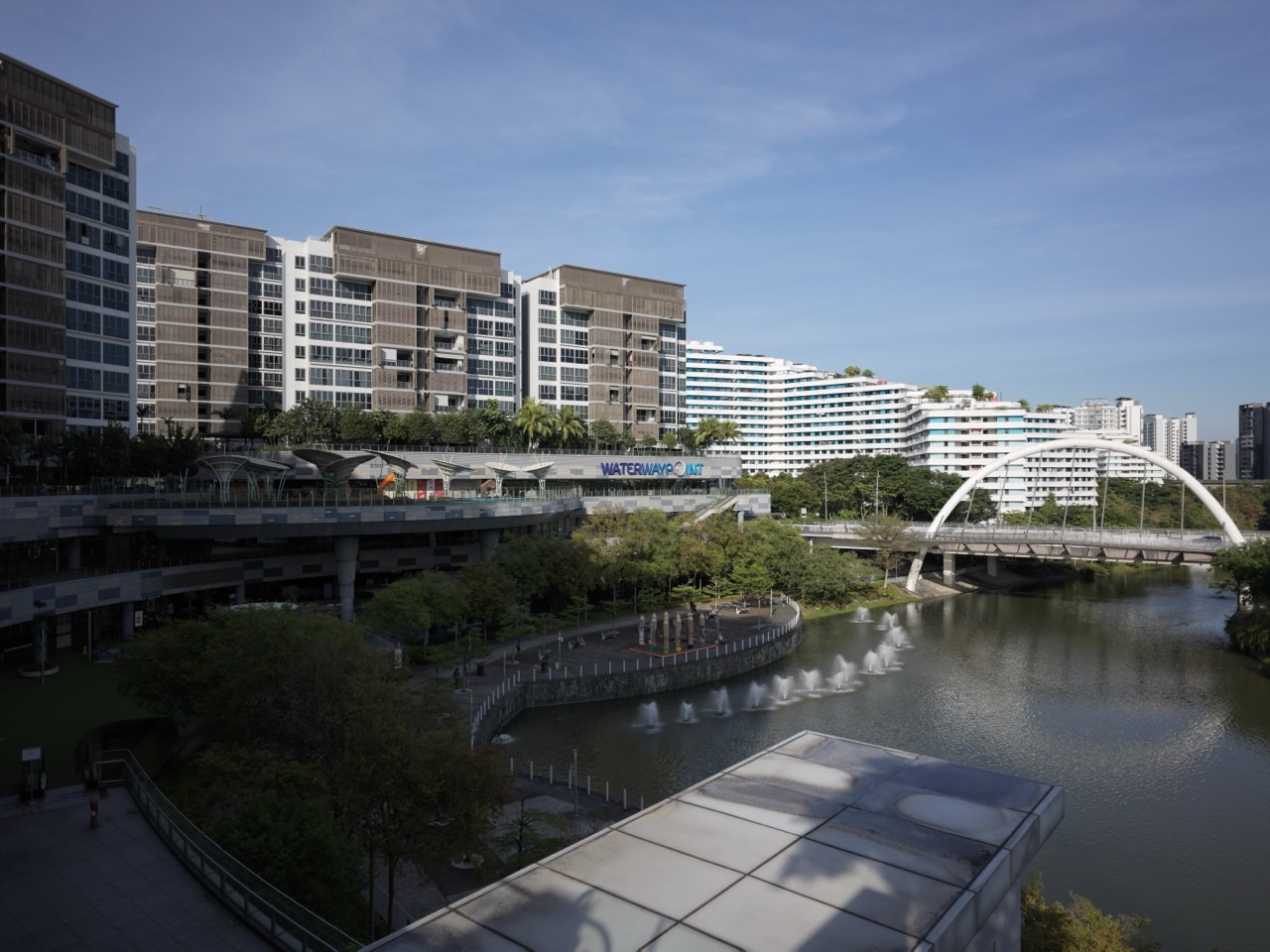
Lorong Halus Wetland is one of the most unusual walks connected to Punggol because the landscape is doing several jobs at once. It is a wetland, a water-treatment system, a birding area, a park-connector crossing between Punggol and Pasir Ris, and part of the old Lorong Halus landfill story. The bright red bridge across Serangoon Reservoir makes it visually memorable, but the wetland is more interesting once you understand what the reeds and treatment cells are actually doing.
Important 2026 access note: NParks currently lists a partial closure of Lorong Halus Park Connector from 23 November 2024 to 31 December 2026 for MRT works. Visitors should follow current on-site diversion signs rather than relying on an old cycling or walking map. This guide explains the walk as it exists in that temporary construction context.
Lorong Halus is physically across Serangoon Reservoir from Punggol, but it belongs to Punggol’s real environmental system. The east entrance of Coney Island sits near the wetland, the red bridge links the Punggol side to the Lorong Halus/Pasir Ris side, and the wetland helps protect the reservoir’s water quality.
Lorong Halus Wetland at a glance
| Feature | Current information |
|---|---|
| Landscape | Constructed wetland / environmental treatment system |
| Connector | Lorong Halus Park Connector, about 3km |
| Access | Walk / cycle from Punggol East / Coney Island or Pasir Ris side |
| Red bridge | Crosses Serangoon Reservoir between Punggol and Lorong Halus |
| Birding | NParks highlights species such as Chestnut Munias and Little Grebes |
| Accessibility | Park connector listed wheelchair-friendly, subject to current diversion works |
| 2026 works | Partial PCN closure until 31 Dec 2026 for MRT works |
The red bridge route from Punggol
The simplest Punggol-side approach is from the Punggol East / Riviera / Coney Island side. The exact route can shift during construction, so use a live map and follow NParks/LTA diversion signs.
A typical walk links:
- Punggol East / Punggol Promenade Riverside Walk;
- Serangoon Reservoir edge;
- red Lorong Halus bridge;
- wetland treatment cells and birding areas;
- the wider Lorong Halus Park Connector toward Pasir Ris.
If you enter Coney Island from its east gate, Lorong Halus becomes part of a longer nature/cycling route rather than a standalone visit.
What the wetland is actually for
Lorong Halus was historically used for waste-related functions including landfill activity. When Sungei Serangoon was dammed to create Serangoon Reservoir, the site needed environmental treatment so contaminated groundwater and leachate would not simply enter the reservoir.
The wetland system uses engineered treatment cells and vegetation to help treat water before discharge. This is why Lorong Halus is a particularly useful place for students: the “nature area” is also environmental infrastructure.
Use Why Lorong Halus Matters to Punggol for the deeper environmental-history owner.
The birding layer
NParks specifically identifies Lorong Halus Wetlands as a birdwatching stop. The park-connector description mentions species including Chestnut Munias and Little Grebes, while the reservoir, reed beds and open landscape can also support other resident and migratory birds.
Birding is best approached quietly:
- walk slowly;
- use binoculars if available;
- stay on paths;
- avoid loud playback calls;
- do not enter reed beds;
- do not feed birds.
Best time to visit
Early morning and late afternoon are usually more comfortable than midday because the site is exposed and shade can be limited.
- Morning: cooler walking, active birds, softer light.
- Late afternoon: good light over the reservoir and red bridge.
- Midday: hotter and more exposed.
- After rain: surfaces may be wet or muddy around natural edges.
What to bring
- water;
- sun protection;
- insect repellent;
- walking shoes;
- binoculars / camera if birding;
- rain protection;
- charged phone with live map.
Walking with children
Lorong Halus can be an excellent real-world Science/Geography walk for older Primary children and teenagers because the site connects water treatment, wetlands, land-use history, reservoirs and biodiversity.
For young children, the long exposed route can be tiring. Keep the walk short, use the red bridge as the main objective and avoid turning the outing into a forced environmental lesson.
Cycling
The Lorong Halus Park Connector is part of the North Eastern Riverine Loop and wider Round Island Route. It is therefore a major cycling link between Punggol, Pasir Ris and the eastern coastal network.
But the current partial closure matters. Cyclists must follow detours and slow down around construction interfaces and mixed pedestrian areas.
Wheelchair / stroller accessibility
NParks lists Lorong Halus Park Connector as wheelchair-friendly, but temporary works can change the smoothness or directness of the route. Families with wheelchairs or strollers should check the current diversion and weather before making the wetland a long outing.
The Coney Island connection
Coney Island’s East Entrance is near Lorong Halus Wetland. A longer route can combine the island and wetland, but remember that Coney Island is open 7am–7pm and closes at night.
Fishing?
Do not assume every reservoir edge is a legal fishing point. Fishing is allowed only in designated areas under current NParks/PUB rules. Use the official fishing-area information rather than choosing a quiet bank because it “looks fishable”.
Use Prawning & Fishing in Punggol 2026.
Photography
The red bridge is the obvious photo subject, but the better images often include:
- reed beds;
- reflections on Serangoon Reservoir;
- birds using the wetland edge;
- industrial/environmental contrast;
- cyclists crossing between urban Punggol and the rustic Lorong Halus side.
Why the construction closure should not be hidden
A current walking guide that does not mention the 2024–2026 partial Park Connector closure can send visitors directly into a detour. Local guide quality depends on operational truth, not timeless prose.
The route should be refreshed after 31 December 2026 when the current closure period is expected to end, subject to any extension or new notice.
Current official sources
- NParks — Lorong Halus Park Connector
- NParks — current PCN notices / closure
- NParks — Coney Island Park
Last checked: 26 September 2026.
Continue the nature route
- Why Lorong Halus Matters to Punggol
- Coney Island Park Guide
- Cycling in Punggol 2026
- The Complete Punggol Guide
Lorong Halus is not simply a pretty red bridge. It is where Punggol’s reservoir, old landfill history, water treatment, birdlife and regional park-connector network meet. Walk slowly enough to see the system.
Punggol nature web: Coney Island · Waterway Park · Punggol Point / Closure · Punggol Promenade · Sunrise & Sunset · Birds & Wildlife · Photo Spots · Picnic & BBQ · Accessible Routes · Punggol & Serangoon Reservoirs · Complete Punggol Guide.
Estate routing: Return to the eduKatePunggol Atlas for the full learning, family and town knowledge graph, or continue through the parks and nature routes above.
Lorong Halus: RFE Environment, History and Rolling-Access System
Standards + RFE gate: this extension preserves the canonical owner, separates current official status from stable context, and requires RFE-0 through RFE-5 before publication.
RFE-0 | Current Problem
The current problem is understanding Lorong Halus as environment, historical landscape and walking/birding route while current closure or access conditions may change.
RFE-1 | Operational Job
Verify current access, choose the relevant entry and route, account for weather and receiver needs, define the return path and prepare one backup.
RFE-2 | Receiver
The receiver is the walker, cyclist, birdwatcher, student, family or local-history reader actually using or studying the area. The route should be judged from that person’s actual use rather than an abstract “best spot” claim.
RFE-3 | Observable Closure
Closure is reached when the reader can separate environmental function, historical context and current access, verify today’s route condition, and choose a safe alternative if the intended path is unavailable.
RFE-4 | Historical / Functional Hypothesis
Lorong Halus carries layers of waste-management history, wetland transformation, water treatment and ecological use; those layers should be explained without pretending historical function equals present access. This is a functional interpretation, not a claim that every visitor uses the place the same way.
RFE-5 | Cost, Conflict and Retirement
retire stale closure or route claims whenever official status changes; keep history stable but refresh current access independently. Costs include time, heat, weather exposure, transport, family coordination and displaced alternatives.
Authority boundary: relevant public agencies and park/environment authorities own current access, closure, works and safety information.
Canonical owner
Keep one owner for the reader job. Ordinary access drift should refresh this page rather than create a second park, closure or promenade root.
Apply the same RFE sequence to this Lorong Halus visit: identify the present problem, the operational job, the receiver, observable closure, the function of the place, then the cost and retirement condition. If one current fact could change the decision, verify that fact before adding more information.
Current official status
Before travel, verify the official source that owns access, maintenance, closure or facility conditions. A dated article should never overrule a newer agency notice.
Apply the same RFE sequence to this Lorong Halus visit: identify the present problem, the operational job, the receiver, observable closure, the function of the place, then the cost and retirement condition. If one current fact could change the decision, verify that fact before adding more information.
RFE-0 problem
State the current problem in one sentence. A park article works better when the reader knows whether the job is exercise, play, photography, birding, heritage, a family outing or simply getting from one place to another.
Apply the same RFE sequence to this Lorong Halus visit: identify the present problem, the operational job, the receiver, observable closure, the function of the place, then the cost and retirement condition. If one current fact could change the decision, verify that fact before adding more information.
RFE-1 operational job
Translate the intention into an operating route: entry point, duration, weather, facilities, return path and backup. This is the part that turns local information into an executable plan.
Apply the same RFE sequence to this Lorong Halus visit: identify the present problem, the operational job, the receiver, observable closure, the function of the place, then the cost and retirement condition. If one current fact could change the decision, verify that fact before adding more information.
RFE-2 receiver
Name who is actually using the route. A toddler family, teenager, runner, older adult, cyclist and birdwatcher can rationally need different answers from the same place.
Apply the same RFE sequence to this Lorong Halus visit: identify the present problem, the operational job, the receiver, observable closure, the function of the place, then the cost and retirement condition. If one current fact could change the decision, verify that fact before adding more information.
RFE-3 closure
Define when planning is complete. The reader should stop comparing once the route, access and return conditions are sufficiently clear for the intended job.
Apply the same RFE sequence to this Lorong Halus visit: identify the present problem, the operational job, the receiver, observable closure, the function of the place, then the cost and retirement condition. If one current fact could change the decision, verify that fact before adding more information.
RFE-4 function
Ask what function the place or route currently serves for the receiver: movement, play, exercise, observation, heritage, nature contact or family time. This prevents every attractive feature from becoming mandatory.
Apply the same RFE sequence to this Lorong Halus visit: identify the present problem, the operational job, the receiver, observable closure, the function of the place, then the cost and retirement condition. If one current fact could change the decision, verify that fact before adding more information.
RFE-5 cost conflict retirement
Count heat, rain exposure, walking distance, time, transport, family coordination and opportunity cost. The route should be shortened, changed or retired when those costs exceed the intended benefit.
Apply the same RFE sequence to this Lorong Halus visit: identify the present problem, the operational job, the receiver, observable closure, the function of the place, then the cost and retirement condition. If one current fact could change the decision, verify that fact before adding more information.
Entry point
Choose the entry that reduces unnecessary backtracking. The first useful decision is often where to begin, not which landmark looks best in a list.
Apply the same RFE sequence to this Lorong Halus visit: identify the present problem, the operational job, the receiver, observable closure, the function of the place, then the cost and retirement condition. If one current fact could change the decision, verify that fact before adding more information.
Exit point
Plan the exit before the outing grows. A route without an intentional end can become too long once heat, rain or tired children appear.
Apply the same RFE sequence to this Lorong Halus visit: identify the present problem, the operational job, the receiver, observable closure, the function of the place, then the cost and retirement condition. If one current fact could change the decision, verify that fact before adding more information.
Return journey
The return path is part of the route. The family should know whether it is retracing, looping, transferring to public transport or ending at a different pickup point.
Apply the same RFE sequence to this Lorong Halus visit: identify the present problem, the operational job, the receiver, observable closure, the function of the place, then the cost and retirement condition. If one current fact could change the decision, verify that fact before adding more information.
Walking
Walking fit depends on distance, shade, surface, traffic interfaces and the receiver’s capacity. A short map distance can feel different under midday heat.
Apply the same RFE sequence to this Lorong Halus visit: identify the present problem, the operational job, the receiver, observable closure, the function of the place, then the cost and retirement condition. If one current fact could change the decision, verify that fact before adding more information.
Cycling
Cyclists need route continuity, shared-path awareness, current access and a safe way to handle interruptions. Do not assume every pedestrian segment is equally suitable for cycling.
Apply the same RFE sequence to this Lorong Halus visit: identify the present problem, the operational job, the receiver, observable closure, the function of the place, then the cost and retirement condition. If one current fact could change the decision, verify that fact before adding more information.
Running
A running route should be chosen for continuity, distance and safe return rather than only scenery. Training value comes from repeatability.
Apply the same RFE sequence to this Lorong Halus visit: identify the present problem, the operational job, the receiver, observable closure, the function of the place, then the cost and retirement condition. If one current fact could change the decision, verify that fact before adding more information.
Stroller use
Families with strollers should check surface continuity, lifts where relevant, shelter and the final approach. The activity should not depend on carrying the stroller through an unplanned barrier.
Apply the same RFE sequence to this Lorong Halus visit: identify the present problem, the operational job, the receiver, observable closure, the function of the place, then the cost and retirement condition. If one current fact could change the decision, verify that fact before adding more information.
Wheelchair and mobility
Mobility needs should be checked against current access rather than inferred from a general description. Where accessibility is material, current official facility information should control the plan.
Apply the same RFE sequence to this Lorong Halus visit: identify the present problem, the operational job, the receiver, observable closure, the function of the place, then the cost and retirement condition. If one current fact could change the decision, verify that fact before adding more information.
Young children
Young children change pace, rest-stop and toilet requirements. A family outing should leave enough margin for play without making the return leg a struggle.
Apply the same RFE sequence to this Lorong Halus visit: identify the present problem, the operational job, the receiver, observable closure, the function of the place, then the cost and retirement condition. If one current fact could change the decision, verify that fact before adding more information.
Teenagers
Teenagers can gradually own route planning, meeting points and return timing. Independence is strongest when the route is understood rather than simply permitted.
Apply the same RFE sequence to this Lorong Halus visit: identify the present problem, the operational job, the receiver, observable closure, the function of the place, then the cost and retirement condition. If one current fact could change the decision, verify that fact before adding more information.
Older family members
Older adults may value seating, shade, toilets and short exit options more than total route length. Those are legitimate fit variables, not secondary details.
Apply the same RFE sequence to this Lorong Halus visit: identify the present problem, the operational job, the receiver, observable closure, the function of the place, then the cost and retirement condition. If one current fact could change the decision, verify that fact before adding more information.
Family visitors
Visitors may not share a resident’s mental map. Use clear landmarks and one simple route instead of assuming familiarity with local station names or connectors.
Apply the same RFE sequence to this Lorong Halus visit: identify the present problem, the operational job, the receiver, observable closure, the function of the place, then the cost and retirement condition. If one current fact could change the decision, verify that fact before adding more information.
School holiday
School holidays can increase crowds and family activity. Build the plan around current conditions rather than treating a weekday pattern as universal.
Apply the same RFE sequence to this Lorong Halus visit: identify the present problem, the operational job, the receiver, observable closure, the function of the place, then the cost and retirement condition. If one current fact could change the decision, verify that fact before adding more information.
Weekend
Weekend demand can affect parking, food stops and popular waterfront sections. One anchor plus one fallback is usually enough.
Apply the same RFE sequence to this Lorong Halus visit: identify the present problem, the operational job, the receiver, observable closure, the function of the place, then the cost and retirement condition. If one current fact could change the decision, verify that fact before adding more information.
Public holiday
A public holiday can change transport loads, venue demand and family rhythms. Verify any provider-dependent stop separately from park access.
Apply the same RFE sequence to this Lorong Halus visit: identify the present problem, the operational job, the receiver, observable closure, the function of the place, then the cost and retirement condition. If one current fact could change the decision, verify that fact before adding more information.
Morning
Morning can reduce heat and improve exercise or wildlife observation, but the route still needs current access and a known breakfast or return plan if the outing is long.
Apply the same RFE sequence to this Lorong Halus visit: identify the present problem, the operational job, the receiver, observable closure, the function of the place, then the cost and retirement condition. If one current fact could change the decision, verify that fact before adding more information.
Midday
Midday requires stronger heat management. Shade, water and the option to shorten the route matter more than completing every planned stop.
Apply the same RFE sequence to this Lorong Halus visit: identify the present problem, the operational job, the receiver, observable closure, the function of the place, then the cost and retirement condition. If one current fact could change the decision, verify that fact before adding more information.
Evening
Evening brings cooler conditions but makes lighting, closing times, last transport and the return path more important.
Apply the same RFE sequence to this Lorong Halus visit: identify the present problem, the operational job, the receiver, observable closure, the function of the place, then the cost and retirement condition. If one current fact could change the decision, verify that fact before adding more information.
Night
Do not assume every waterfront or park segment is equally suitable at night. Current access, lighting and official guidance should determine the plan.
Apply the same RFE sequence to this Lorong Halus visit: identify the present problem, the operational job, the receiver, observable closure, the function of the place, then the cost and retirement condition. If one current fact could change the decision, verify that fact before adding more information.
Rain
Rain changes surfaces, visibility, shelter and walking speed. A wet-weather plan should be a genuine alternative, not a promise to continue regardless.
Apply the same RFE sequence to this Lorong Halus visit: identify the present problem, the operational job, the receiver, observable closure, the function of the place, then the cost and retirement condition. If one current fact could change the decision, verify that fact before adding more information.
Lightning
Lightning is a safety boundary. Follow current official and facility guidance rather than trying to finish the outing because the family has already travelled there.
Apply the same RFE sequence to this Lorong Halus visit: identify the present problem, the operational job, the receiver, observable closure, the function of the place, then the cost and retirement condition. If one current fact could change the decision, verify that fact before adding more information.
Heat
Heat affects children, older adults, runners and cyclists differently. Plan water, shade, duration and start time around the receiver.
Apply the same RFE sequence to this Lorong Halus visit: identify the present problem, the operational job, the receiver, observable closure, the function of the place, then the cost and retirement condition. If one current fact could change the decision, verify that fact before adding more information.
Haze
Air-quality conditions can change outdoor plans. Current official guidance should outrank the itinerary.
Apply the same RFE sequence to this Lorong Halus visit: identify the present problem, the operational job, the receiver, observable closure, the function of the place, then the cost and retirement condition. If one current fact could change the decision, verify that fact before adding more information.
Coastal wind
Wind can change comfort and cycling effort along exposed sections. Treat it as a condition rather than a permanent feature that behaves the same every day.
Apply the same RFE sequence to this Lorong Halus visit: identify the present problem, the operational job, the receiver, observable closure, the function of the place, then the cost and retirement condition. If one current fact could change the decision, verify that fact before adding more information.
Water
Bring enough water for the real route and receiver. Do not assume a convenient refill point unless it is currently verified.
Apply the same RFE sequence to this Lorong Halus visit: identify the present problem, the operational job, the receiver, observable closure, the function of the place, then the cost and retirement condition. If one current fact could change the decision, verify that fact before adding more information.
Food
Food can be an optional anchor or the endpoint of the route. A park guide should not become dependent on one tenant or outlet remaining unchanged.
Apply the same RFE sequence to this Lorong Halus visit: identify the present problem, the operational job, the receiver, observable closure, the function of the place, then the cost and retirement condition. If one current fact could change the decision, verify that fact before adding more information.
Toilets
Where toilets are important to the receiver, confirm current facility availability. This can be a decisive variable for families and older adults.
Apply the same RFE sequence to this Lorong Halus visit: identify the present problem, the operational job, the receiver, observable closure, the function of the place, then the cost and retirement condition. If one current fact could change the decision, verify that fact before adding more information.
Seating
Rest opportunities can determine whether a longer route remains comfortable. Plan rest rather than waiting until fatigue forces an improvised stop.
Apply the same RFE sequence to this Lorong Halus visit: identify the present problem, the operational job, the receiver, observable closure, the function of the place, then the cost and retirement condition. If one current fact could change the decision, verify that fact before adding more information.
Play
For children, play may be the main job rather than a detour. The family should not turn an outing into a forced march between adult-selected landmarks.
Apply the same RFE sequence to this Lorong Halus visit: identify the present problem, the operational job, the receiver, observable closure, the function of the place, then the cost and retirement condition. If one current fact could change the decision, verify that fact before adding more information.
Photography
Photography depends on light, weather and access. The page can identify useful environments without promising a particular sky, crowd level or view.
Apply the same RFE sequence to this Lorong Halus visit: identify the present problem, the operational job, the receiver, observable closure, the function of the place, then the cost and retirement condition. If one current fact could change the decision, verify that fact before adding more information.
Birdwatching
Wildlife observation should respect current access and official safety guidance. Observation is not a reason to approach or disturb animals.
Apply the same RFE sequence to this Lorong Halus visit: identify the present problem, the operational job, the receiver, observable closure, the function of the place, then the cost and retirement condition. If one current fact could change the decision, verify that fact before adding more information.
Nature learning
A family can use the route to observe water, plants, birds, surfaces and weather. Distinguish observation from explanation so the outing remains evidence-based.
Apply the same RFE sequence to this Lorong Halus visit: identify the present problem, the operational job, the receiver, observable closure, the function of the place, then the cost and retirement condition. If one current fact could change the decision, verify that fact before adding more information.
History learning
Historical interpretation should remain sourced and separate from current access. A place can have an important past even when today’s route is altered or closed.
Apply the same RFE sequence to this Lorong Halus visit: identify the present problem, the operational job, the receiver, observable closure, the function of the place, then the cost and retirement condition. If one current fact could change the decision, verify that fact before adding more information.
Environmental function
Wetlands, waterways and managed landscapes can serve infrastructure and ecological functions at once. Explain function without turning a simplified story into a complete technical claim.
Apply the same RFE sequence to this Lorong Halus visit: identify the present problem, the operational job, the receiver, observable closure, the function of the place, then the cost and retirement condition. If one current fact could change the decision, verify that fact before adding more information.
Construction and works
Works can alter access quickly. Current official notices should update the route while the stable background sections remain intact.
Apply the same RFE sequence to this Lorong Halus visit: identify the present problem, the operational job, the receiver, observable closure, the function of the place, then the cost and retirement condition. If one current fact could change the decision, verify that fact before adding more information.
Closure status
Closure is a state, not an identity. The article should record the date and owner of the status, and remove or rewrite the closure emphasis when official conditions change.
Apply the same RFE sequence to this Lorong Halus visit: identify the present problem, the operational job, the receiver, observable closure, the function of the place, then the cost and retirement condition. If one current fact could change the decision, verify that fact before adding more information.
Reopening status
A reopening announcement should replace stale closure language. Do not keep both without explaining the chronology.
Apply the same RFE sequence to this Lorong Halus visit: identify the present problem, the operational job, the receiver, observable closure, the function of the place, then the cost and retirement condition. If one current fact could change the decision, verify that fact before adding more information.
Partial access
Partial access needs route-level precision. “Open” and “closed” can both be misleading if different segments have different conditions.
Apply the same RFE sequence to this Lorong Halus visit: identify the present problem, the operational job, the receiver, observable closure, the function of the place, then the cost and retirement condition. If one current fact could change the decision, verify that fact before adding more information.
Detour
A detour should be presented only when it can be supported by current official or observable route information. Do not invent a workaround around a closure.
Apply the same RFE sequence to this Lorong Halus visit: identify the present problem, the operational job, the receiver, observable closure, the function of the place, then the cost and retirement condition. If one current fact could change the decision, verify that fact before adding more information.
Parking
Parking conditions, rates and access can change. Use current operator or authority information rather than freezing old terms.
Apply the same RFE sequence to this Lorong Halus visit: identify the present problem, the operational job, the receiver, observable closure, the function of the place, then the cost and retirement condition. If one current fact could change the decision, verify that fact before adding more information.
MRT access
MRT is only part of the trip. Include the last mile, especially for visitors who may underestimate the walk or transfer.
Apply the same RFE sequence to this Lorong Halus visit: identify the present problem, the operational job, the receiver, observable closure, the function of the place, then the cost and retirement condition. If one current fact could change the decision, verify that fact before adding more information.
LRT access
LRT can change which entry point is most practical. The best station depends on the route job, not simply the nearest station name.
Apply the same RFE sequence to this Lorong Halus visit: identify the present problem, the operational job, the receiver, observable closure, the function of the place, then the cost and retirement condition. If one current fact could change the decision, verify that fact before adding more information.
Bus access
Current bus service information belongs to operators. The page should explain how bus access fits the route without pretending route numbers never change.
Apply the same RFE sequence to this Lorong Halus visit: identify the present problem, the operational job, the receiver, observable closure, the function of the place, then the cost and retirement condition. If one current fact could change the decision, verify that fact before adding more information.
Pickup and drop-off
Families should define a safe, clear meeting point. Pickup friction is part of the outing’s total cost.
Apply the same RFE sequence to this Lorong Halus visit: identify the present problem, the operational job, the receiver, observable closure, the function of the place, then the cost and retirement condition. If one current fact could change the decision, verify that fact before adding more information.
Phone battery
For independent teenagers, long walks or evening routes, phone battery and communication are practical dependencies. They should be prepared before departure.
Apply the same RFE sequence to this Lorong Halus visit: identify the present problem, the operational job, the receiver, observable closure, the function of the place, then the cost and retirement condition. If one current fact could change the decision, verify that fact before adding more information.
Meeting point
A named meeting point reduces ambiguity when groups split or several adults share the outing.
Apply the same RFE sequence to this Lorong Halus visit: identify the present problem, the operational job, the receiver, observable closure, the function of the place, then the cost and retirement condition. If one current fact could change the decision, verify that fact before adding more information.
Budget
Parks and promenades may be low-cost, but transport, meals, rentals and parking can create recurring cost. Make the total outing budget visible.
Apply the same RFE sequence to this Lorong Halus visit: identify the present problem, the operational job, the receiver, observable closure, the function of the place, then the cost and retirement condition. If one current fact could change the decision, verify that fact before adding more information.
Time budget
Plan by available time, not by how many attractions exist. A shorter successful route is better than an overfilled itinerary.
Apply the same RFE sequence to this Lorong Halus visit: identify the present problem, the operational job, the receiver, observable closure, the function of the place, then the cost and retirement condition. If one current fact could change the decision, verify that fact before adding more information.
Normal Tuesday
Test the route under an ordinary weekday. Commute flows, school dismissal and weather can make the same place feel different from a Sunday morning.
Apply the same RFE sequence to this Lorong Halus visit: identify the present problem, the operational job, the receiver, observable closure, the function of the place, then the cost and retirement condition. If one current fact could change the decision, verify that fact before adding more information.
Wet Tuesday
The wet-Tuesday test asks whether the family has a genuine alternative when normal outdoor use is poor. If not, the outing may need to move rather than shrink.
Apply the same RFE sequence to this Lorong Halus visit: identify the present problem, the operational job, the receiver, observable closure, the function of the place, then the cost and retirement condition. If one current fact could change the decision, verify that fact before adding more information.
Busy Saturday
Crowds, popular dining periods and family traffic can change the plan. Margin is more valuable than a rigid sequence.
Apply the same RFE sequence to this Lorong Halus visit: identify the present problem, the operational job, the receiver, observable closure, the function of the place, then the cost and retirement condition. If one current fact could change the decision, verify that fact before adding more information.
First visit
The first visit should favour a simple route and easy exit. Complexity can be added after the receiver has a mental map.
Apply the same RFE sequence to this Lorong Halus visit: identify the present problem, the operational job, the receiver, observable closure, the function of the place, then the cost and retirement condition. If one current fact could change the decision, verify that fact before adding more information.
Repeat visit
Repeat visits can go deeper: a different segment, birding, running, history or photography. The canonical owner should support reuse without demanding novelty every time.
Apply the same RFE sequence to this Lorong Halus visit: identify the present problem, the operational job, the receiver, observable closure, the function of the place, then the cost and retirement condition. If one current fact could change the decision, verify that fact before adding more information.
Editorial review
Remove features that do not change the reader’s route or decision. The page should become clearer even as it becomes more comprehensive.
Apply the same RFE sequence to this Lorong Halus visit: identify the present problem, the operational job, the receiver, observable closure, the function of the place, then the cost and retirement condition. If one current fact could change the decision, verify that fact before adding more information.
Evidence review
Ask which clue would change the plan: access status, weather, receiver mobility, route continuity, transport or time. Then verify that clue first.
Apply the same RFE sequence to this Lorong Halus visit: identify the present problem, the operational job, the receiver, observable closure, the function of the place, then the cost and retirement condition. If one current fact could change the decision, verify that fact before adding more information.
Source routing
Park status goes to official owners, transport to operators, history to sourced historical sections, wildlife safety to official guidance, and local fit to this Punggol owner.
Apply the same RFE sequence to this Lorong Halus visit: identify the present problem, the operational job, the receiver, observable closure, the function of the place, then the cost and retirement condition. If one current fact could change the decision, verify that fact before adding more information.
Refresh trigger
Refresh when closure, reopening, route works, facilities, public access or a material transport dependency changes. Do not create a duplicate URL for normal drift.
Apply the same RFE sequence to this Lorong Halus visit: identify the present problem, the operational job, the receiver, observable closure, the function of the place, then the cost and retirement condition. If one current fact could change the decision, verify that fact before adding more information.
Retirement condition
Planning can retire once the route works. The family does not need to keep optimising a local outing that already reliably serves its purpose.
Apply the same RFE sequence to this Lorong Halus visit: identify the present problem, the operational job, the receiver, observable closure, the function of the place, then the cost and retirement condition. If one current fact could change the decision, verify that fact before adding more information.
Worked RFE Scenarios
Family with a toddler
Keep the route short, make toilets and shade visible, and let play be the main activity. RFE closure occurs when the family has a comfortable loop and easy return, not when every landmark is visited.
The scenario closes when the route is executable under current conditions and the family knows what would make it change. The goal is a working local plan, not maximum itinerary density.
Teen travelling independently
Rehearse the route, agree on the meeting point and return time, then transfer navigation gradually. The receiver’s independence is part of the benefit.
The scenario closes when the route is executable under current conditions and the family knows what would make it change. The goal is a working local plan, not maximum itinerary density.
Older adult visit
Prioritise seating, shade, toilets and a short exit. A scenic long route may be the wrong operational answer despite attractive photos.
The scenario closes when the route is executable under current conditions and the family knows what would make it change. The goal is a working local plan, not maximum itinerary density.
Runner
Choose continuity, known distance and weather fit. Do not let a tourist itinerary dictate a training route.
The scenario closes when the route is executable under current conditions and the family knows what would make it change. The goal is a working local plan, not maximum itinerary density.
Birdwatcher
Verify access and follow wildlife guidance. The observation job does not justify entering a closed or restricted segment.
The scenario closes when the route is executable under current conditions and the family knows what would make it change. The goal is a working local plan, not maximum itinerary density.
Photographer
Treat sunrise, sunset and golden hour as conditions, not guaranteed outputs. Build a route that remains worthwhile even if the sky is ordinary.
The scenario closes when the route is executable under current conditions and the family knows what would make it change. The goal is a working local plan, not maximum itinerary density.
Heavy rain begins
Use the predetermined backup or end the outdoor route. Sunk travel time is not a reason to ignore weather conditions.
The scenario closes when the route is executable under current conditions and the family knows what would make it change. The goal is a working local plan, not maximum itinerary density.
Closure changes
Update the canonical status owner and remove stale instructions. Do not open a second article just to announce an ordinary status transition.
The scenario closes when the route is executable under current conditions and the family knows what would make it change. The goal is a working local plan, not maximum itinerary density.
Family visitors
Use one entry, one anchor and one return. A resident’s full mental map is not required for a good first visit.
The scenario closes when the route is executable under current conditions and the family knows what would make it change. The goal is a working local plan, not maximum itinerary density.
Successful repeat routine
Once the family has a route that works, stop researching. RFE retirement means the plan can run until conditions materially change.
The scenario closes when the route is executable under current conditions and the family knows what would make it change. The goal is a working local plan, not maximum itinerary density.
Final RFE Publication Check
The canonical owner remains unique; current access/closure facts stay with official owners; history and environment are separated from status; the receiver and closure are explicit; cost and conflict are visible; and the plan has a retirement condition. Publication is a dated state, not permanent validation.


