
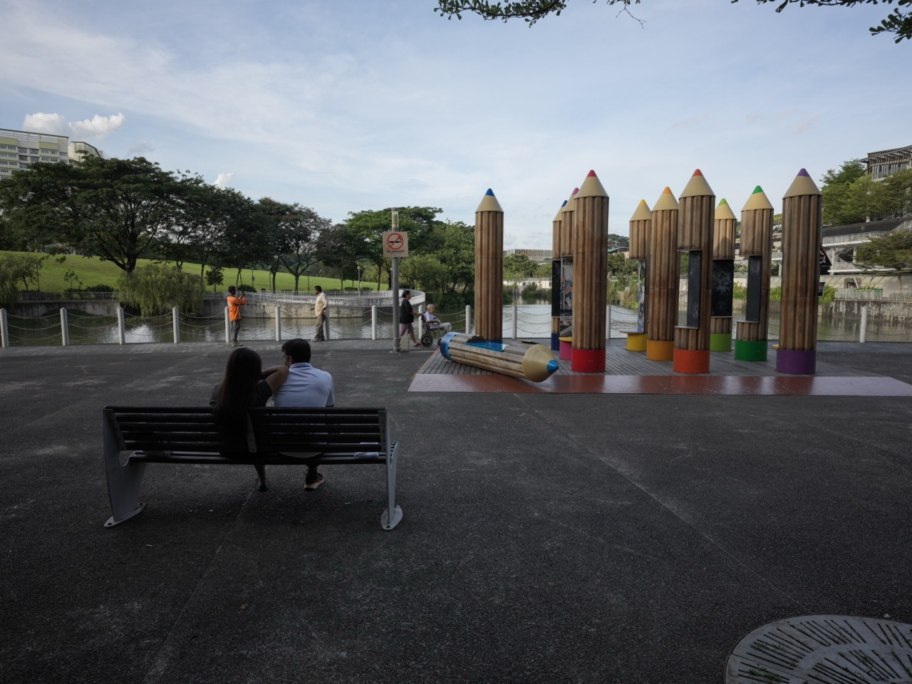
Lorong Halus Wetland is one of the most unexpected chapters in Crazy Rich Punggol: a former waste landscape transformed into a constructed wetland that helps protect Serangoon Reservoir. What looks like reeds, ponds and bird habitat is also part of a water-treatment system.
Did you know? NParks describes Lorong Halus Wetland as a former landfill transformed into a wetland roughly the size of 18 football fields. The system collects and treats rainwater passing through the former dumping ground before it reaches the adjacent reservoir, while cattails and other wetland plants form part of a natural bio-remediation process. Across the red Lorong Halus Bridge, this engineered wetland connects back into Punggol’s promenade and park-connector network.
The Crazy-Rich Idea: A Place Can Become More Valuable After Its Dirtiest Job Is Over
Lorong Halus once belonged to the less glamorous side of Singapore’s growth: waste, sludge, dumping and disposal. When the surrounding river system became part of Singapore’s freshwater-reservoir network, that old land created a new environmental problem.
The answer was not to pretend the past had disappeared. The site had to be managed precisely because its history still mattered underground.
That is why Lorong Halus is such a useful environmental lesson. Sustainability is not only about building clean new systems. It is also about taking responsibility for the systems left behind.
The Wetland Protects Water by Slowing and Treating Contaminated Flow
Rain falling on a former landfill can carry dissolved contaminants through the ground. That polluted liquid is called leachate.
At Lorong Halus, engineered collection and wetland-treatment processes help prevent contaminated water from flowing untreated into Serangoon Reservoir. Reed beds and wetland vegetation support natural treatment processes that remove or reduce pollutants before the water moves onward.
It is a striking example of biology and engineering cooperating instead of competing.
A Wetland Can Be Treatment Plant, Habitat and Park at the Same Time
Lorong Halus Wetland is not valuable only because it treats water. NParks also identifies it as a birdwatching site, with species such as Chestnut Munias and Little Grebes found around the wetland and reservoir landscape.
The wider Lorong Halus Park Connector stretches about 3 km and links Pasir Ris and Punggol while forming part of a green corridor toward Coney Island. Once again, one piece of infrastructure performs several jobs: treatment, habitat, recreation and movement.
The Red Bridge Is More Than a Photo Spot
The Lorong Halus Bridge has become one of the area’s visual landmarks, but its deeper job is connection. It lets pedestrians and cyclists cross the reservoir edge between Punggol Promenade and Lorong Halus, turning an environmental-treatment site into part of a larger public landscape.
That matters because environmental infrastructure becomes easier to value when people can actually encounter it.
What a Student Can Learn at Lorong Halus
- Science: filtration, plant uptake, water quality, decomposition and ecosystems.
- Geography: land use, landfill legacy, reservoirs and human alteration of landscapes.
- Mathematics: flow rates, pollutant concentration, area and treatment efficiency.
- History: how yesterday’s infrastructure creates tomorrow’s environmental responsibilities.
- English: explain how a place can change function without erasing its past.
The most important lesson is systems thinking: the wetland makes sense only when landfill history, rainfall, groundwater, plants, reservoirs, wildlife and public access are understood together.
Keep the Search Intent Clean
For current access, walking routes, the red bridge, birdwatching and closure information, use the practical Lorong Halus Wetland Guide 2026. This page keeps the deeper environmental story: why a former landfill matters to Punggol’s water security and how wetlands can become working infrastructure.
Continue Through the Punggol Water Story
For the reservoir system, continue with Crazy Rich Punggol | Punggol Waterway, Reservoirs and the Luxury of Water as Public Life. For rain gardens and bioswales, read Crazy Rich Punggol | Rain Gardens, Bioswales and the Luxury of Nature as Infrastructure.
Current Official Sources
- NParks — Lorong Halus Park Connector
- NParks — North Eastern Riverine Loop
- PUB — Lorong Halus Wetland Treatment Process
The crazy-rich Lorong Halus story is not that a landfill became pretty. It is that a difficult environmental legacy was turned into a working wetland that protects water, supports wildlife and teaches the next generation how cities can repair what earlier cities left behind.
Lorong Halus is not in the middle of Punggol.
That is exactly why it is easy to misunderstand.
On a neighbourhood map, Lorong Halus sits on the eastern bank of Serangoon Reservoir, on the Pasir Ris–Tampines side of the water.
But environmental systems do not stop at town boundaries.
Water moves.
Groundwater moves.
Pollutants move.
Birds move.
Cyclists move.
And the eastern edge of Serangoon Reservoir is part of the same north-eastern water geography that shapes Punggol, Coney Island, the Punggol Promenade and the wider Punggol–Serangoon reservoir system.
That makes Lorong Halus one of the best places in Singapore to understand a difficult systems idea:
the past can remain physically active underneath the future.
For decades, Lorong Halus handled things a growing city wanted out of sight: sewage sludge, night soil and solid waste. Its landfill eventually became Singapore’s last mainland dumping ground and closed in 1999. Yet closure did not make the buried waste disappear. When Serangoon Reservoir was created beside it, old landfill water became a new water-security problem.
PUB’s answer was not merely to beautify the site.
It built a containment-and-treatment system.
An underground barrier reduces seepage from the former landfill toward the reservoir. Water passing through the landfill is collected. Leachate is treated through engineered wetland processes using selected reed beds and ponds. The treated flow is kept out of the drinking-water reservoir system and discharged into the used-water network.
The visible wetland therefore sits on top of a much deeper story:
waste legacy → contamination risk → containment → treatment → reservoir protection → habitat → public learning.
This pillar owns that canonical job: why Lorong Halus matters to Punggol as environmental memory, water-protection infrastructure, a biodiversity site and a physical connector across the north-eastern landscape.
For the complete Punggol reading system, return to the parent hub: What about Punggol?
The surrounding pillars keep separate ownership. How Punggol Uses Nature as Infrastructure owns the town-wide rain-garden, bioswale and biodiversity strategy. The Geography of Punggol owns the wider rivers, reservoirs, coastline and Coney Island geography. How Punggol Waterway Works owns the Waterway and Punggol–Serangoon reservoir mechanics. This article stays with Lorong Halus itself.
The first important correction: Lorong Halus is not simply “a former landfill turned into a wetland”
That phrase is useful.
It is also incomplete.
The Lorong Halus story contains several different waste-management eras layered on top of one another.
- Before major waste facilities, the area was part of a swampy estuarine landscape.
- In 1941, the Municipal Commission completed the Serangoon Sludge Disposal Works.
- The site later handled night soil as well as sewage sludge.
- From the 1950s, parts of the surrounding swampland were increasingly used for refuse dumping.
- From 1970 to 1999, Lorong Halus functioned as a major solid-waste landfill.
- After landfill closure, the buried waste remained in the ground.
- When Serangoon Reservoir was created beside the former landfill, water moving through that buried waste became a reservoir-protection problem.
- The Lorong Halus Wetland was built as part of the treatment response and opened in 2011.
So the proper story is not:
dump → close → plant trees.
It is:
estuary → sanitation infrastructure → waste landscape → closed landfill → contamination legacy → reservoir protection system → wetland habitat and public landscape.
Before the landfill, Lorong Halus was wet country
PUB’s educational material describes the older Lorong Halus area as part of an expansive mangrove and mudflat estuarine ecosystem along what was then Sungei Serangoon.
This matters because the modern wetland can otherwise create a false impression that “nature” simply returned to exactly what had existed before.
It did not.
The old estuary was a naturally evolving tidal system.
The present treatment wetland is engineered infrastructure beside a freshwater reservoir.
Both contain water, plants and wildlife.
They do not perform the same ecological or hydraulic job.
This distinction is central to evidence discipline.
A green-looking landscape may be natural, restored, designed, managed, engineered—or several of those at once.
1941: sanitation arrives before modern Singapore does
National Heritage Board records that the Serangoon Sludge Disposal Works was completed in 1941 as part of a sewerage scheme serving northern and eastern Singapore.
The facility worked with the Sewage Disposal Works at Kim Chuan Road.
Sludge left after sewage treatment could be sold as fertiliser or used in reclaiming swampy ground.
This is an early reminder that urban sanitation has always required geography.
A city does not make human waste disappear by installing toilets.
It creates a collection system.
Then transport.
Then treatment.
Then disposal or reuse.
Every clean urban surface therefore depends on less visible places doing dirty work somewhere else.
Lorong Halus was Singapore’s last night-soil disposal station
This is one of the strangest but most revealing pieces of the site’s history.
Before universal modern sewer connections, human excrement from some properties was collected manually in buckets.
The system was known as night-soil collection.
As Singapore expanded modern sanitation during the 1970s and 1980s, the old system contracted.
Lorong Halus became the last night-soil disposal station remaining in Singapore.
The system officially ended in January 1987.
That date is historically useful because it reminds us how recent some basic infrastructure transitions actually are.
Within the lifetime of many Singaporeans, the country moved from manual bucket collection in some areas to a highly engineered used-water system integrated with water reclamation and NEWater production.
Lorong Halus sits physically inside that transition.
The landfill grew with Singapore
Waste increases when population and consumption increase.
This sounds obvious.
Its spatial consequences are enormous.
National Heritage Board records that refuse dumping expanded around Lorong Halus from the 1950s. By the later landfill era, the site had grown to approximately 234 hectares, with waste mounds reaching heights described as equivalent to about ten storeys.
PUB’s Lorong Halus educational timeline records the main solid-waste landfill period as about 30 years, from 1970 to 1999.
That makes the landfill a physical record of Singapore’s rapid urban development.
Every demolished object, discarded household product, industrial residue and piece of ordinary rubbish had to go somewhere.
The clean city generated a dirty edge.
Waste creates secondary economies
Lorong Halus did not contain only waste-management infrastructure.
It also generated informal and semi-formal economic activity around recoverable materials.
NHB records scrap dealers operating around Tampines Road in the 1980s, purchasing metal from lorry drivers bringing industrial waste to Lorong Halus.
This is a simple circular-economy principle appearing before the phrase became fashionable:
one person’s waste stream can become another person’s material supply.
But informal material recovery does not solve the whole landfill problem.
Valuable metals can be removed.
Large volumes of mixed waste still remain.
The buried mass continues changing chemically and physically after disposal.
1999: the mainland landfill closes, but the landfill does not disappear
Lorong Halus ceased landfill operations on 31 March 1999.
The next day, Semakau Landfill opened offshore and became Singapore’s only remaining solid-waste disposal site.
NEA describes Semakau as the national response to mainland landfill exhaustion, with Lorong Halus having reached maximum capacity during the 1990s.
Closure solved one operational problem.
No new rubbish would be dumped there.
It did not solve the legacy problem.
Millions of cubic metres of old material remained underground.
Rain continued falling on the site.
Groundwater continued moving through and around it.
Buried organic and industrial material continued decomposing or releasing dissolved compounds.
This is why a closed landfill remains an engineering object.
What is leachate?
The central word in the Lorong Halus Wetland system is leachate.
Imagine rainwater moving through buried waste.
As water passes through the waste mass, it can dissolve or carry substances from what has been buried.
The resulting contaminated liquid is broadly described as landfill leachate.
The exact chemistry varies with:
- what was dumped,
- how old the landfill is,
- rainfall,
- oxygen conditions,
- temperature,
- microbial activity,
- groundwater movement.
This variability is one reason landfill-water management cannot be reduced to simply “filtering dirty water”.
The treatment system must respond to a complex and changing chemical mixture.
Then Singapore created a freshwater reservoir beside the old landfill
This is where Lorong Halus becomes directly relevant to Punggol’s modern water story.
The Punggol–Serangoon Reservoir Scheme began construction in 2006 and was completed in 2011.
By damming the mouths of the Punggol and Serangoon Rivers, Singapore created Punggol and Serangoon Reservoirs to increase local water catchment.
PUB records that the completion of Marina, Punggol and Serangoon Reservoirs increased Singapore’s water catchment from about half to about two-thirds of the island’s land area.
That was a national water-security gain.
But it changed the risk around Lorong Halus.
The former dumping ground now formed part of the bank beside a freshwater reservoir intended for the local water-supply system.
The old waste legacy and the new water asset suddenly occupied the same hydraulic neighbourhood.
yesterday’s disposal site had become tomorrow’s reservoir-edge risk.
The engineering response begins underground
The most important part of Lorong Halus Wetland may be the part visitors cannot see.
The Ministry of Sustainability and the Environment states that an underground wall was built along the former landfill, which forms part of the bank of Serangoon Reservoir.
The purpose is containment.
Water from the landfill is prevented from simply seeping into the reservoir.
Instead, the water is collected for treatment.
This creates the first protective barrier in the system:
control the path before trying to clean the water.
This is a widely useful engineering principle.
If contamination is moving unpredictably, treatment becomes harder.
Containment creates a manageable flow.
A manageable flow can be monitored and treated.
The wetland treats the contaminated flow before it can threaten reservoir water
PUB’s current Lorong Halus Wetland page describes the system directly.
The wetland collects and treats water passing through the former landfill, preventing it from flowing into Serangoon Reservoir and helping safeguard reservoir water quality.
PUB’s field-study guidance is even more specific: the wetland treats leachate abstracted from the Lorong Halus Landfill along the eastern bank of the reservoir.
MSE explains that the collected water passes through specially selected reed beds and ponds before discharge into the sewerage system.
This is a critical detail.
The wetland is not a decorative pond that simply “cleans water and puts it back into the reservoir”.
Its purpose is to intercept and treat landfill-derived water so that the drinking-water catchment is protected.
Why use a wetland process?
Wetland treatment systems can combine several physical, chemical and biological processes.
Water moves slowly through planted treatment zones.
Particles can settle.
Plant roots create surfaces and habitats for microorganisms.
Microbial communities can transform certain pollutants.
Plants and substrates can take up, bind or help immobilise selected substances.
Different treatment zones can be designed for different hydraulic and chemical conditions.
This does not mean plants magically remove every contaminant.
Engineered wetlands have operating limits.
They require hydraulic design, monitoring, maintenance and appropriate downstream handling.
The plant is part of the treatment train.
It is not the whole explanation.
Bio-remediation is not the same as “nature fixes pollution”
The word bio-remediation can be misunderstood as passive optimism.
Put plants there.
Wait.
Nature solves it.
Lorong Halus shows the opposite.
Successful bioengineering is highly designed.
- The contaminated flow has to be intercepted.
- The hydraulic path has to be controlled.
- The correct treatment zones have to be created.
- Suitable plant species have to be selected.
- Flow rates have to remain within operating limits.
- Water quality has to be monitored.
- Vegetation and infrastructure need maintenance.
- There must be a safe destination for treated water.
Nature is doing work.
Engineering determines the conditions under which that work becomes reliable enough to protect a reservoir.
The wetland is a buffer between two incompatible land histories
The eastern bank of Serangoon Reservoir contains an extraordinary adjacency.
On one side:
a former waste landscape containing buried material from decades of urban growth.
On the other:
a freshwater reservoir integrated into Singapore’s water-supply catchment.
Those two uses are fundamentally incompatible if unmanaged.
The wetland-and-barrier system makes the adjacency manageable.
This is why Lorong Halus matters beyond its own site boundary.
It is an interface.
Interfaces are where complex systems either fail or become intelligent.
Why this matters specifically to Punggol
Punggol’s modern identity depends heavily on clean, usable water.
The Waterway.
Reservoir edges.
Coney Island.
Punggol Promenade.
Waterfront housing.
All of these depend on water being treated as infrastructure rather than scenery.
Serangoon Reservoir forms Punggol’s eastern water edge.
Lorong Halus forms part of the opposite bank.
Pollution crossing that boundary would not respect the distinction between “Punggol side” and “Pasir Ris side”.
Water security is catchment-scale governance.
That is the deeper lesson.
The bridge makes the environmental relationship visible
Today, residents and cyclists can cross between Punggol and Lorong Halus over the reservoir.
The route makes a hidden environmental relationship physically legible.
From the Punggol side, Lorong Halus does not feel like a distant industrial backland.
It becomes reachable.
A person can cycle from Punggol’s park-connector network across to the wetland, continue toward Pasir Ris and reconnect with the wider eastern recreational system.
NParks’ current Lorong Halus Park Connector page describes a 3 km route linking Pasir Ris and Punggol and forming a green-corridor connection between Pasir Ris Park and Coney Island Park.
The infrastructure story therefore gains a public-mobility layer.
the place that once received Singapore’s waste now helps people move through one of Singapore’s greenest recreational networks.
Lorong Halus is now part of Coney Island’s eastern gateway
NParks’ current Coney Island guidance identifies two park entrances.
The west entrance sits near Punggol Point and Punggol Promenade.
The east entrance sits near Lorong Halus Wetland.
This places Lorong Halus inside a larger ecological-and-recreational sequence:
Pasir Ris → Lorong Halus → Serangoon Reservoir → Coney Island → Punggol Promenade → Punggol Point.
The administrative labels change along the route.
The ecological and mobility network remains continuous.
Biodiversity is a real outcome—but it is not the first job
Visitors often experience Lorong Halus first as a birdwatching and landscape site.
NParks highlights species including Chestnut Munias and Little Grebes around the wetlands.
NHB describes the site as a haven for biodiversity.
Those are genuine values.
But the main purpose should remain clear.
Lorong Halus Wetland exists first because a closed landfill beside a new reservoir required water-quality protection.
Habitat emerged within and around that engineered solution.
This ordering matters because it prevents attractive greenery from hiding the infrastructure purpose.
A wetland can be infrastructure and habitat at the same time
Modern planning often creates false choices.
Engineering or nature.
Infrastructure or biodiversity.
Utility or beauty.
Lorong Halus demonstrates a more useful model.
The wetland is engineered infrastructure.
Because that infrastructure uses plants, water and habitat structure, it can also support wildlife.
Because it is publicly accessible around the treatment areas, it can also support recreation and learning.
One land parcel therefore performs several jobs.
That is especially valuable in land-scarce Singapore.
But multiple functions create trade-offs
A treatment wetland cannot be managed exactly like a nature reserve.
A recreation site cannot allow unlimited access into operational reed beds.
A biodiversity site may require vegetation structures that look untidy compared with ornamental landscaping.
Water-quality protection may require maintenance at times inconvenient to visitors.
PUB’s learning guidance explicitly prohibits entry into the wetland reed beds.
This is an excellent example of operating boundaries.
public access is added around infrastructure; it does not erase the infrastructure’s safety requirements.
The site is also a lesson in environmental debt
Financial debt carries obligations from the past into the future.
Environmental debt can behave similarly.
A city benefits from decades of convenient landfill disposal.
The landfill closes.
Future generations inherit monitoring, containment, land restrictions and treatment costs.
Lorong Halus is therefore not simply a rehabilitation success story.
It is also a reminder that waste disposal transfers obligations across time.
What is cheap today may become expensive to manage later.
Closed landfill land is not ordinary land
Old landfill ground can present long-term engineering constraints.
Buried waste can settle unevenly.
Decomposition can generate gases.
Leachate can require management.
Soil and groundwater conditions can complicate redevelopment.
NEA has described the wider Lorong Halus closed-landfill area as carrying significant redevelopment potential but also major remediation challenges.
This is why “Singapore has very little land” does not mean every square metre is immediately interchangeable.
Land has memory through its physical condition.
The Punggol lesson: every waterfront has an upstream and an opposite bank
Modern waterfront development encourages us to look toward the view.
The system requires us to look beyond it.
What enters the reservoir upstream?
What lies beneath the opposite bank?
What drainage systems feed the water body?
Where could contamination originate?
Which barriers and treatment systems keep the water usable?
This is why a resident standing at Punggol looking across Serangoon Reservoir is also looking at part of the infrastructure protecting that waterfront.
Systems view: the Lorong Halus protection chain
Layer 1: Buried waste legacy
Decades of landfill operation leave material underground after closure.
Layer 2: Rain and groundwater
Water interacts with the former landfill and can carry dissolved contaminants.
Layer 3: Containment
An underground barrier reduces direct seepage toward Serangoon Reservoir.
Layer 4: Collection
Landfill-derived water is abstracted rather than allowed to migrate uncontrolled.
Layer 5: Wetland treatment
Engineered reed beds and ponds provide physical, chemical and biological treatment processes.
Layer 6: Safe discharge route
The treated flow is discharged into the sewerage system rather than into the reservoir.
Layer 7: Reservoir protection
Serangoon Reservoir remains protected from one important historical contamination pathway.
Layer 8: Secondary public value
The treatment landscape supports biodiversity, environmental learning and park-connector recreation.
The order matters.
Public beauty rests on invisible control.
What can go wrong?
A landfill-edge treatment system has characteristic failure modes.
- Barrier failure: contaminated groundwater may bypass intended collection paths.
- Hydraulic overload: unusually high flows can reduce treatment performance if the system is pushed beyond design conditions.
- Vegetation failure: treatment plants can decline because of disease, unsuitable water chemistry or maintenance problems.
- Clogging: sediment or biological growth can alter flow through treatment zones.
- Monitoring gaps: water-quality change can be missed if sampling is inadequate.
- Misleading aesthetics: visitors may assume a green wetland is self-maintaining when it actually requires active engineering management.
- Unsafe public access: recreation must remain separated from operational reed beds and infrastructure.
- Redevelopment pressure: the value of land can create pressure to forget the physical constraints of buried waste.
The correct response is not fear.
It is observability, maintenance and respect for the operating envelope.
How do we know the system is working?
A wetland can look healthy and still underperform chemically.
So visual appearance is not enough.
A proper operational assessment would depend on measurements such as:
- flow volumes,
- water chemistry before and after treatment,
- groundwater conditions,
- barrier performance,
- plant health,
- hydraulic residence time,
- maintenance history.
PUB’s public learning trail includes water-quality testing precisely because the site is an unusually good place to teach that environmental quality is measured, not merely admired.
Lorong Halus is an example of circularity—but not the simplistic kind
It is tempting to describe the site as:
waste became nature.
That is emotionally satisfying and technically weak.
The waste is still there.
The wetland does not transform the entire buried landfill back into pristine ecology.
The more accurate circularity is functional.
A damaged or constrained landscape is given a new role that helps manage the consequences of its previous role.
The treatment site then creates additional ecological and educational value.
The past is not erased. It is managed intelligently enough that the land can perform new work.
For Science, Lorong Halus is a living laboratory in contaminant transport
A student can begin with one question:
If rubbish is buried underground, why can it still affect water years later?
That opens several scientific ideas.
- solubility,
- diffusion and transport,
- groundwater flow,
- microbial decomposition,
- pH,
- oxidation and reduction,
- plant uptake,
- filtration and sedimentation.
The wetland turns an abstract environmental-science chapter into a place that can be walked.
For Mathematics, it is a mass-balance problem
Environmental treatment can be described through mass balance.
How much contaminated water enters?
What concentration of a substance does it contain?
How much leaves?
What concentration remains?
What fraction was removed, transformed or immobilised?
The wetland therefore offers a practical route into:
- rates,
- percentages,
- concentration,
- flow,
- volume,
- time-series data,
- uncertainty.
Mathematics becomes environmental decision-making.
For Geography, Lorong Halus teaches that a town boundary is not a system boundary
This may be the most important Punggol lesson.
Lorong Halus is associated administratively and historically with the Pasir Ris–Tampines side.
Yet it matters directly to Punggol because:
- it borders Serangoon Reservoir,
- that reservoir shapes Punggol’s eastern geography,
- the reservoir is part of Singapore’s water-supply catchment,
- the park connector physically links Pasir Ris and Punggol,
- Lorong Halus provides the eastern gateway to Coney Island.
Geography asks us to follow flows rather than labels.
For History, the site compresses eighty years of infrastructure change
One site contains a remarkable sequence.
- 1941: sludge-disposal infrastructure.
- Post-war decades: refuse dumping expands.
- 1970–1999: major landfill era.
- 1987: Singapore’s night-soil system ends at Lorong Halus.
- 1999: mainland landfill operations cease; Semakau takes over the national landfill role.
- 2006–2011: Punggol–Serangoon Reservoir Scheme transforms the regional water system.
- 2011: Lorong Halus Wetland opens as reservoir-protection infrastructure.
- Today: the site is simultaneously treatment landscape, biodiversity habitat, learning trail and recreational corridor.
This is not a story of one transformation.
It is a stack of transformations in which each new system had to manage the remains of the previous one.
For Civics, Lorong Halus asks who pays for yesterday’s convenience
Waste disposal feels cheap when the long-term cost is postponed.
Future governments may have to contain the site.
Future engineers may have to treat the water.
Future taxpayers may have to fund monitoring.
Future planners may have fewer redevelopment options.
This is why responsible waste policy has to consider lifecycle cost rather than disposal-day cost.
Singapore’s current waste strategy explicitly recognises that mainland landfill space is exhausted and that Semakau’s lifespan must be extended by reducing the waste sent there.
Lorong Halus is the historical evidence beneath that policy.
The final return: why does Lorong Halus matter to Punggol?
Because Punggol’s waterfront is only as healthy as the larger water system around it.
Lorong Halus shows what that means in practice.
- It preserves environmental memory. Beneath the wetland lies one of Singapore’s most important historical waste landscapes.
- It protects Serangoon Reservoir. The former landfill sits beside a freshwater reservoir that forms part of Singapore’s local catchment system.
- It demonstrates containment before treatment. An underground wall and collection system manage the pathway of contaminated water.
- It uses engineered wetlands for bio-remediation. Reed beds and ponds treat landfill-derived water before safe downstream discharge.
- It proves infrastructure can carry ecological value. The wetland supports birds and other biodiversity while performing a water-quality job.
- It connects Punggol physically. Park connectors link Punggol to Lorong Halus, Pasir Ris and the eastern entrance of Coney Island.
- It reveals environmental debt. A landfill can close operationally while remaining a management obligation for decades.
- It teaches scale. Water, pollution and ecological networks ignore administrative boundaries.
The deepest lesson is therefore larger than the wetland itself:
Punggol’s clean-water future depends partly on whether Singapore continues to manage the dirty physical consequences of its past.
Lorong Halus is where that responsibility becomes visible.
Continue through the Punggol pillar system
- What about Punggol? — parent hub for the complete Punggol reading system.
- The Geography of Punggol — rivers, reservoirs, coastline, Coney Island and Singapore’s northern edge.
- How Punggol Waterway Works — the Punggol–Serangoon reservoir system and the 4.2 km Waterway.
- How Punggol Uses Nature as Infrastructure — rain gardens, bioswales, trees, water and biodiversity across the town.
- The Corridors of Punggol — Waterway, Heritage Trail, Promenade, Campus Boulevard and mobility links.
Evidence anchors
The factual spine of this pillar is grounded in current and historical Singapore government sources. PUB’s current Lorong Halus Wetland page states that the wetland collects and treats water passing through the former landfill, preventing it from entering Serangoon Reservoir and helping safeguard reservoir water quality. PUB’s water-study guidance specifies that the site treats leachate abstracted from the former landfill. The Ministry of Sustainability and the Environment’s current water policy explains that an underground wall along the former landfill prevents seepage into Serangoon Reservoir and that collected water is treated through selected reed beds and ponds before discharge into the sewerage system. National Heritage Board’s Lorong Halus Wetland heritage record documents the 1941 sludge works, night-soil role, landfill growth, 234-hectare scale and transformation into the 2011 wetland. NEA’s Semakau history confirms Lorong Halus as Singapore’s last inland dumping ground before Semakau opened in 1999. NParks’ current Lorong Halus Park Connector page records the 3 km Pasir Ris–Punggol connection and the green corridor toward Coney Island, while NParks’ current Coney Island Park page identifies Lorong Halus as the island’s eastern access point. Where the article explains general landfill chemistry, wetland-treatment processes or failure modes, those passages are systems explanation rather than claims about undisclosed Lorong Halus operating data.
Return to the parent hub: What about Punggol?


