
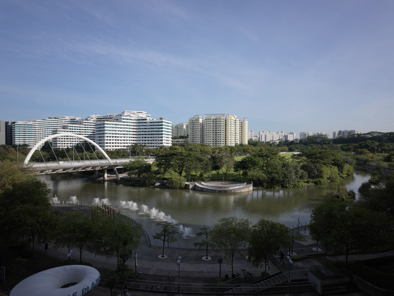
Punggol Promenade is a lovely place to go without trying to do everything. Choose a stretch of water, give yourself time to notice it, and know how you will get home. That is enough for a good first visit. A longer walk, a family cycle or an afternoon with a camera can come later.
The three named sections are Riverside Walk, Nature Walk and Punggol Point Walk. They are connected parts of a waterfront route, not three names for the same park. This guide helps you choose between them, estimate the whole outing, understand the neighbouring island and Waterway, and avoid relying on an entrance or facility affected by works.
Access checked on 3 October 2026: the NParks closure notice closes Punggol Point Park and its adjacent carpark from 11 August 2026. It gives 31 December 2027 as expected works completion, not a guaranteed reopening date. The notice also identifies toilets remaining available and a temporary footpath. Those details matter more than an older photograph of the park.
The walk suggestions below are planning examples, not surveyed tracks or promises that every connection is unobstructed. Match them to the latest notices, the signs you encounter and the people coming with you.
Punggol Promenade at a glance
| Section | Published length | Useful starting idea |
|---|---|---|
| Riverside Walk | 1.2 kilometres | A reservoir-side introduction from the Punggol East side. |
| Nature Walk | 2.4 kilometres | A longer middle section for a slower nature walk. |
| Punggol Point Walk | 1.3 kilometres | A coastal outing with particular attention to park-upgrading boundaries. |
| Three lengths added together | 4.9 kilometres | A nominal one-way total, before station approaches, deviations and the journey home. |
The section lengths come from the NParks pages for Riverside Walk, Nature Walk and Punggol Point Walk. The total is their arithmetic sum; it is not a measured route around today’s works.
Choose your reading route: Understand the map · Riverside · Nature Walk · Point Walk and closure · Getting there · Three walking plans.
Plan for your group: Children and mobility · Running and cycling · Coney Island and Lorong Halus · Fishing · Wildlife · Weather and facilities.
Enjoy the details: Food and the return journey · Photography · Learning outdoors · Common questions.
1. Understand the map before choosing a distance
Start by separating a place name from a journey. “Punggol Promenade” tells you which waterfront system you want to visit. It does not tell a driver where to stop, a friend where to meet you, or a child how much walking remains. Your actual plan needs a named section, an arrival point and an exit.
NParks describes Riverside Walk beside Serangoon Reservoir and Nature Walk as the middle section between Riverside and Point Walk. Its Point Walk page describes the northern seaside setting. Together they offer a change of scene, rather than a single view repeated for almost five kilometres. The three official section pages above are the starting map; the current notices supply the interruptions.
Do not confuse this route with Punggol Waterway Park. The Waterway is a separate park running through the town, although the networks connect. Coney Island is another separate destination. Visiting the promenade does not require entering the island, and reaching the Waterway does not mean you have completed all three promenade sections. The Waterway Park guide is a better starting point when bridges and an inland park outing are your priority.
This distinction becomes practical when someone suggests “a quick five-kilometre loop”. The published promenade total is not a loop. Walking the same three sections out and back would nominally be 9.8 kilometres, before approaches and diversions. A person who parks at one end has not solved the return merely by reaching the other.
Use a simple sentence: “We will start from this side, walk to this point, and return this way.” Then decide what would make you shorten it. For example, the outing could end after one reservoir lookout if a child is tired, or before Nature Walk if the return would fall after dark. That sentence is more useful than saving twenty attractive location pins.
A little map reading also leaves room for spontaneity. Once the journey home is understood, you can stop for a photograph or spend longer watching the water without worrying that an unknown final leg is waiting. The aim is not to control every minute. It is to remove the avoidable uncertainty around the beginning and end.
2. Riverside Walk: a manageable first introduction
Riverside Walk is the section to consider for a first taste of the promenade. NParks identifies the area near Tebing Lane, gives its length as 1.2 kilometres and describes lookout points facing Serangoon Reservoir. Its page also provides an official directions link and identifies the Riviera transport area. Use those references to plan the approach rather than navigating to a restaurant that happened to feature in an old article.
For a first visit, arrive without promising to reach the coast. Walk to a suitable public lookout, pause, and decide whether another stretch would add anything. A child watching the surface of the water may be having exactly the outing they need. An adult taking a short break may prefer twenty quiet minutes to a complete route.
An out-and-back plan is particularly easy to understand here. You see the path once on the way out, so the return is familiar. Note your entrance and any junction before continuing. When several paths meet, take a photograph of the sign rather than assuming you will remember which branch you used. This is a useful habit for visitors who do not yet have a mental map of Punggol East.
Do not use the published section length as the distance from the station. The approach is extra. If you walk only part of Riverside Walk and then return to your starting point, calculate the waterfront portion twice. Add whatever distance you travelled to reach it. Your phone’s walking route can help estimate the complete trip, but compare its suggestion with the signs on the ground.
Tebing Lane can also create a misleading sense that food is automatically waiting at the end. Before naming a business as your lunch stop, check it independently and read the Container Park closure guide. A familiar cluster name is not a current booking confirmation. Keep the walk worthwhile even when you choose to eat elsewhere.
Try a small observation game: choose one fixed position and make three descriptions. What is directly in front of you? What changes when you look across the reservoir? What sounds do you notice without looking at their source? There is no need to identify every bird or structure. Riverside can be the place where a family practises slowing down, rather than the opening stage of a compulsory march.
3. Nature Walk: leave room for the middle of the journey
Nature Walk is the longest of the three named sections. NParks describes a meandering 2.4-kilometre middle route with fishing platforms and rest shelters. That combination suggests a useful way to experience it: make progress, stop somewhere appropriate, look around, then continue. It does not need to be treated as a corridor you hurry through to reach something better.
Decide whether you are visiting the section or passing through it. A visit might involve walking into a portion, sitting where space allows, and retracing your route. A through-walk requires a confirmed onward exit. These are different commitments even when both begin at the same point. The second should not happen accidentally because the first kilometre felt pleasant.
For a group, agree on how to regroup before anyone moves ahead. “Wait at the next signposted junction” is clearer than “we will catch up”. A runner, a child on a bicycle and an adult stopping for photographs can separate surprisingly quickly. Choose a rule that does not require constant phone calls or someone standing in the middle of a shared path.
The quieter-looking scene can tempt visitors off the route. Resist the urge to make your own shortcut through plants or follow an informal opening for a photograph. NParks’ Nature Walk notice specifically asks visitors to stay on designated paths and keep their distance from wild boars. The wildlife chapter below explains how to build that into an ordinary outing without turning the walk into an animal search.
A shelter or platform is also a shared space. Before stopping, look at how it is being used. Someone fishing needs safe room for tackle; someone resting should not have a bicycle placed across the access. If a place is occupied, continue to another appropriate stopping point rather than trying to fit the entire family into the same small area.
For an enjoyable first Nature Walk visit, choose one thing to notice: changes in sound, light through vegetation, or how the view opens and closes along the route. Let that be enough. A return visit can explore something else. You do not need an impressive species list, a personal distance record and a picnic to justify being here.
4. Punggol Point Walk: read the closure map, not just the destination name
Punggol Point Walk and Punggol Point Park are not interchangeable. The former is a named promenade section. The latter is the park affected by the upgrading notice. Confusing them can produce opposite errors: promising access to closed park facilities, or announcing that the entire northern waterfront is closed.
The two-page NParks notice is unusually useful. Page one marks the closed park and adjacent carpark, identifies toilets remaining open, and locates the area beside The Punggol Settlement. Page two illustrates a temporary footpath. It does not publish a surveyed, all-user detour covering every possible approach.
Before leaving, inspect the map at a readable size. On arrival, follow the current signs rather than matching an old aerial image point for point. Construction arrangements can change. Do not enter a work area because a former path, playground or viewing feature appears on a general park description.
The date also needs care. An expected completion date is a project target. It is not a promise that visitors may enter on that day, nor permission to assume the next morning will be the reopening. Plan future visits using a fresh access announcement. For now, use the Punggol Point closure guide alongside the official notice.
The continuing toilet provision is helpful, but it should not become a guarantee about every accessibility detail. A parent with a stroller or a visitor using a mobility aid should still establish a suitable approach. “The toilet remains open” answers one question; “we can comfortably reach it from our chosen start” answers another.
Treat the coastal outing as modular. You can visit an accessible section, have a meal at a separately operating venue and leave without entering the park. Conversely, a restaurant reservation does not entitle you to use the closed adjacent carpark. Separate the walk, the facilities and the meal when planning; join them only after the connections are clear.
5. Getting there: choose your end of the promenade first
For Riverside, start your journey planning with Punggol East and the Riviera area. For the northern section, start with the Point Walk side and the particular public destination you intend to reach. Do not select whichever station contains “Punggol” and assume the final walk will be negligible. The destination name is broad; the last part of the journey is specific.
The official section pages provide directions links. Use them to identify the location, then check current rail and bus information for your travel day. This guide deliberately does not freeze a bus roster, first train or last train into the walking instructions. Those details can differ from the operating hours of the park, a restaurant or an island gate.
Public transport makes a one-way walk possible, but it needs planning at both ends. Work out the arrival first, then the return from your intended exit. A station that is convenient at the start is not automatically convenient after several kilometres along the waterfront. Saving both journeys before departure is a small task that prevents a much larger discussion later.
Driving changes the problem rather than removing it. If your car stays at the beginning, choose an out-and-back route or make an explicit plan to retrieve it. Do not quietly expect a tired relative to walk back alone. Use current carpark information, and remember that the adjacent Punggol Point Park carpark is part of the closure shown above.
For private-hire journeys, choose a legitimate vehicle-accessible meeting point. A map pin on a waterfront footpath is not necessarily a place where a driver can collect you. Share the recognised location with everyone before the walk. With two families, decide which adult holds the booking and where the children wait while the vehicle arrives.
On the first visit, leave extra time for the approach rather than adding an extra attraction. Finding the correct entrance, checking a sign and orienting a visitor are real parts of the outing. Once you know the route, later visits become easier. That is a better reward than trying to make the first trip look perfectly efficient.
6. Three walking plans, with the return included
The following plans are examples built from the published section lengths. They are not GPS tracks. Choose an exact accessible starting point before using them, and adjust for works, weather and your group’s pace. The important difference is not how ambitious the walk sounds. It is whether the shape of the route fits the time you have.
Plan A: a short Riverside out-and-back
Begin from a confirmed public approach on the Punggol East side. Walk into Riverside, stop at a suitable lookout and return the way you came. You do not have to complete the section. Set a turnaround time before starting, especially with young children. The outward journey should use less than half the available time so pauses and the final approach do not make you late.
For illustration, walking 600 metres out and 600 metres back gives 1.2 kilometres of waterfront walking. It does not include the journey from a station, home or carpark. At an assumed moving pace of three kilometres per hour, the waterfront portion takes 24 minutes before stops. That is arithmetic for planning, not an estimate of a particular child’s ability.
This plan is useful when the walk is one part of the day: before breakfast, after a visit to relatives, or during a short afternoon break. You can leave with a clear sense of the reservoir edge without turning it into a long-distance outing.
Plan B: a Nature Walk visit with a deliberate turning point
Approach through a currently accessible connecting route and choose how much of Nature Walk you want to explore. Remember that completing the 2.4-kilometre section and returning along it makes 4.8 kilometres before access legs. That is a different proposition from a casual stroll into the first part of the route.
Use a time limit rather than waiting for someone to complain. A group might agree to walk outward for 25 minutes, then turn back after a pause. The exact distance will depend on pace and stops, but the return remains understandable. A family stopping frequently for birds or photographs should expect a shorter distance within the same time.
Do not set the turning point inside Coney Island unless island access is genuinely part of the plan. A tempting connection is still an extra destination. Keeping the first Nature Walk visit on the mainland makes the route simpler to learn.
Plan C: a longer one-way promenade outing
The three published lengths total 4.9 kilometres. At assumed uninterrupted walking speeds of three to four kilometres per hour, that distance alone takes roughly 74 to 98 minutes. Add station approaches, any permitted deviations, rest, photographs and food. A two-to-three-hour allowance can therefore be a sensible planning starting point for a leisurely visit, but it is not a promised duration.
Confirm the accessible connection around the northern works and a suitable exit before setting off. The full named route should not become a challenge to complete regardless of conditions. If access is unclear, change to a shorter out-and-back plan rather than inventing a bypass.
For all three plans, reserve energy for getting home. A walk is not finished when the attractive part ends; it is finished when everyone has reached the agreed destination comfortably.
7. Children, strollers and mobility: design around the actual group
NParks lists all three promenade sections as wheelchair friendly. That is useful baseline information, not a guarantee about every temporary approach or the suitability of an extended island route. The person using a wheelchair, walking aid or stroller should help choose the plan. Ask what makes an outing comfortable rather than assuming every accessible route feels equally easy.
For a first visit with a stroller, try a short section whose entrance and return you can inspect. Note the surface, space to pass and any changes near works. Do not plan on carrying the stroller around a barrier; choose a route that works without that improvisation. A short successful visit gives you reliable knowledge for the next one.
With toddlers, decide whether the purpose is adult exercise or child exploration. Both are reasonable, but they produce different outings. A toddler stopping to examine a leaf is not failing to keep the walking schedule. Make room for that pace, or use a clearly different exercise session when an adult needs continuous movement.
For siblings with different interests, give each a small role. One child can look for the next sign; another can choose a place for the family photograph. Keep both tasks on the public path. A role helps them participate without turning the entire walk into a competition over who goes fastest or notices the most.
Older relatives may prefer a seated pause before they feel tired. Ask early, and make changing the plan ordinary. “Shall we return after this view?” is easier to answer than “Can you manage another kilometre?” when everyone else has already started walking. The route should leave room for the person to choose a shorter day without feeling responsible for disappointing the group.
A useful agreement is that the slowest participant sets the travelling pace while stops are chosen together. Faster walkers can enjoy a different run or cycle another day. Trying to combine a training session, a toddler outing and a grandparent visit into one uninterrupted route often asks the same path to serve incompatible purposes.
For more detailed planning, continue to the stroller and wheelchair route guide. Keep the first promenade visit modest enough that you can learn what matters to your own family rather than relying only on a general accessibility label.
8. Running and cycling without making the path difficult for others
A promenade can be part of a training route, but other visitors are not moving obstacles. The NParks park-connector etiquette guidance asks users to keep left, give way appropriately and slow near attention zones. Follow the designated path signs for your activity. The practical goal is predictable movement, especially where people pause, paths meet or space narrows.
For runners, choose a familiar turnaround before aiming for an exact distance. A watch can tell you how far you have travelled; it cannot make an obstructed section suitable for the last 400 metres of a target. Complete extra distance elsewhere rather than running through a work boundary or repeatedly weaving around a busy platform.
Keep the first run exploratory. Notice junctions, narrow points and places where you may need to slow. On a later visit, you can use that knowledge to create a more continuous route. The Punggol running guide provides a separate home for training-oriented options so a family walking article does not have to become a workout prescription.
Cyclists should plan for stopping as well as riding. Before setting off with children, practise bringing the bicycle under control, moving aside and waiting at an agreed point. If the group reaches a crowded or confusing section, dismounting can be the simplest solution. No part of a pleasant family ride requires proving that you can remain on the saddle throughout.
Discuss junctions before the leading rider disappears around one. A child should know whether to stop at each junction or wait at a named landmark. Avoid a system in which the slowest rider has to guess which direction everyone took. One adult can lead while another remains with the rear of the group when the family’s size allows it.
Rentals add a separate clock. Confirm the return location, permitted return arrangements and closing time with the actual rental provider. Do not assume that a bicycle collected near one end can be left near the other. An end-to-end promenade ride may be short on paper while the journey back to the rental point is the part that determines the day.
The Punggol cycling guide is the next step for a longer ride. On the promenade itself, leave enough attention for children, anglers and walkers to enjoy their own reason for being there.
9. Adding Coney Island or Lorong Halus: make it a separate decision
Coney Island is an optional extension, not a required stage of Punggol Promenade. The NParks park page lists opening from 7am to 7pm and two entrances: the west end near Punggol Point Walk and the east end near Lorong Halus Wetland. It also warns that some terrain is rugged, despite accessible ends. An island crossing needs its own time and mobility assessment.
Choose between a short island visit and a through-route before entering. A short visit can return through the same entrance. A through-route commits you to a different exit and a different journey home. Neither is automatically better. With small children, the first can offer enough contrast without adding an unfamiliar return.
Do not use the island as an evening shortcut. A plan that only succeeds by reaching or leaving a gate after the published operating day is not a workable route. Allow enough margin to leave calmly, including any time needed for slower walkers or a bicycle problem. There is no need to make a sunset walk dependent on the last possible minute at a gate.
Lorong Halus also needs a separate access check. The NParks notices page currently lists a partial Lorong Halus Park Connector closure for rail works through 31 December 2026. That notice should not be stretched into a claim that every wetland path or the whole area is closed. Equally, it should not be ignored when a mapping app draws a convenient connection.
Use the Lorong Halus guide for that extension and the Coney Island guide for the island. Read them as separate visits with separate boundaries. The reward is a route you understand, not the longest possible chain of names on a map.
10. Fishing: permission belongs to a marked location
A fishing platform does not turn the entire waterfront into a fishing area. Nature Walk’s official description mentions fishing platforms, while NParks’ fishing guidance restricts angling to designated areas and tells visitors to observe no-fishing signs. Use the marked facility and current on-site instructions. Do not choose an unmarked railing simply because someone else has set up there.
Keep adjacent places separate. Punggol Waterway Park explicitly prohibits fishing. Coney Island’s rules also prohibit it. A nearby permitted area cannot extend that permission into either park. For a Point Walk fishing visit, verify both the designated location and an accessible approach around the park works before carrying equipment there.
Walkers and cyclists can help by recognising casting space. Do not squeeze between a person and their equipment or stop a child directly behind an active rod for a photograph. Anglers, in turn, should keep transparent line and tackle away from the shared path. The official fishing guidance explains casting awareness, waste disposal and respecting other users; those are practical requirements for sharing a narrow waterfront.
Commercial prawning is another activity altogether. A paid pond has an operator, booking terms and venue rules. Public fishing has site-specific permissions. The Prawning and Fishing in Punggol guide keeps those choices together without treating them as interchangeable.
For a mixed family outing, decide whether fishing is the main activity. Carrying tackle for a speculative stop can make the walking route cumbersome and encourage everyone to accept a poor location. A clearly planned fishing session or a clearly planned walk is usually easier to enjoy than an improvised compromise that does neither comfortably.
11. Wildlife: notice more by asking less of the animals
The current Nature Walk notice reports wild boars in the area. That is a reason to behave appropriately, not a promise of a sighting. The AVS wild-boar guidance advises distance, no chasing or cornering, no feeding and no flash photography. It also asks pet owners to keep dogs close on a tight leash. Follow that guidance rather than trying to produce a memorable close encounter.
Before the walk, give children a simple expectation: we may see wildlife, and we will not approach it. This removes the idea that a successful nature outing requires touching, feeding or photographing an animal at close range. A child can be excited without running toward the subject of that excitement.
If an animal occupies the route, pause at a distance and keep the group together. Do not send the faster members ahead to investigate while younger children wait behind. A longer pause or a return along the known path is an ordinary change of plan. The walk does not become unsuccessful because another living creature needed space.
For birdwatching, choose a quiet stopping position that leaves room for others. Listen first, then look. Describe what you can actually see: size, colours, movement and where the bird is sitting. A broad description is more useful than a confident species name guessed from a blurred photograph. Identification can happen later with a suitable reference.
Keep food packed away and take rubbish with you. Even a family that does not deliberately feed animals can leave accessible scraps while everyone is taking pictures. The wildlife guide provides the next reading route for encounters. On this walk, the best habit is simple: observe without making the animal respond to you.
12. Weather, water, toilets and places to stop
Plan the first stop before planning the last kilometre. A group may have enough energy for a long walk but not enough water, a suitable toilet plan or a comfortable place to wait if conditions change. These are not minor details added after the route. They can determine which section is the right choice.
Carry water for the outing you actually intend to make. Do not rely on an unverified refill point or a shop you have not checked. With a larger family, distribute what needs carrying rather than leaving one person with every bottle and bag. Keep the kit manageable enough that the walk remains pleasant: water, a small snack where appropriate, sun protection, a charged phone and the personal items your group needs.
At the northern end, the closure notice identifies toilets remaining open. That is a specific facility statement, not a complete toilet map for the promenade. Locate the marked facility and its current approach before relying on it. For another starting area, establish an available toilet before setting off. Do not invent a regular spacing of toilets, water points or emergency exits from the existence of a long park connector.
Rest shelters can be useful for a pause, but a roof should not be treated as proof of protection from every weather hazard. If thunderstorms threaten, end exposed activity and follow current official safety advice. Do not keep walking toward a distant lunch reservation simply because the group has already invested time in the trip. Changing the outing is preferable to defending the original plan.
Rain also changes the practical route. Put the phone away while moving over a wet or uneven section. Slow down, give others room and avoid an unmarked diversion around standing water. A visible path is a better choice than a seemingly convenient gap through vegetation. If the route is no longer comfortable for a mobility aid, return using an approach you understand.
The coast is not an invitation to climb down from the path. NParks’ notices describe managed access to sensitive intertidal areas, and its intertidal information explains the habitat. Stay within permitted access. Looking at water, entering the shore and swimming are different activities; this promenade route does not authorise the latter two.
A useful weather fallback is a genuinely different plan: go home, have an indoor meal at a confirmed venue, or switch to a library visit if it is open. “We will continue but walk faster” is not much of a fallback. Give the family permission to enjoy a different afternoon.
13. Food and the journey home: finish the day deliberately
A meal can give the walk a satisfying ending, but choose the route before attaching a restaurant to it. A northern meal works best when the family has already planned to finish on that side. A familiar Punggol East option can be easier after a Riverside out-and-back. Neither needs to be presented as the best food choice for everybody.
The Punggol Settlement directory lists its restaurants separately, with individual opening arrangements. Check the particular business, not just the development name. A place that serves dinner may not solve an early breakfast plan; a weekend schedule may not apply on a weekday. A reservation also does not establish access through the adjoining closed park.
For Tebing Lane, read the current Container Park guide before using an old leisure recommendation. This promenade article does not establish a tenant’s final trading day or a replacement address. Keep the commercial question with the business and the dedicated update, rather than turning every walking plan into a promise about a shop.
With children, carry enough flexibility that a queue does not control the outing. Decide on a fallback meal before hunger becomes urgent. It may be a different provider along the return journey or food at home. The walk remains worthwhile even when the original lunch plan changes.
For relatives arriving separately, send one complete message: starting place, likely finish, meal location and who is travelling with whom. Do not ask someone unfamiliar with Punggol to decode “we will meet near the water”. At the end, check that everyone knows their onward route before the group disperses.
The Punggol Food Guide is the wider dining reference. Here, the useful goal is smaller: finish the walk with enough energy and clarity to enjoy the rest of the day. A modest meal close to the planned exit often achieves that better than another journey to chase a famous dish.
14. Photography: make a story about the walk
You do not need a dramatic sky to make the promenade worth photographing. Give yourself a simple assignment: show the place, show a detail, and show how someone uses the space. An establishing view, a close observation and a human-scale image can tell a clearer story than twenty nearly identical horizons.
At Riverside, try relating the path to the reservoir rather than cropping out everything except water. On Nature Walk, look for how the route passes through its surroundings. At Point Walk, make the current condition part of the record instead of framing a work boundary out and implying that the old park remains freely accessible. These are composition suggestions, not guaranteed views from particular coordinates.
Stop somewhere suitable before raising the camera. Do not step backward into a cycling path while looking through a screen, place a tripod across a narrow connection, or block a fishing platform for a family portrait. A quick glance around the frame is not enough; check what is happening outside it too.
Keep captions honest. Record the location and capture date when an image shows access, works or a changing facility. An older park image can still be useful, but label it as an earlier view rather than using it to demonstrate today’s access. Do not describe a stranger’s occupation, relationship or feelings merely from how they appear in a photograph.
Try a five-frame family record: arrival sign, water view, small detail, shared moment and the way home. Let each family member choose one frame. That provides variety without needing to move everyone to another attraction. Someone who prefers not to be photographed can choose the landscape or detail image instead.
For an extended photography outing, use the Punggol photo guide. For this walk, keep the camera as a way of noticing rather than a reason to interrupt every moment. The family should still have memories that were not organised around taking a picture.
15. A promenade learning walk that still feels like a walk
Punggol offers plenty to discuss without turning an afternoon into a worksheet. Choose one small question before leaving, then let the walk supply the material. Children do not need to complete English, mathematics and science tasks on the same day. The examples below are alternatives, designed to take only a few minutes of attention.
English: write directions someone could actually follow
Ask an older child to describe the route for a cousin visiting for the first time. Begin with a specific meeting point, explain one decision at a junction, and finish with a clear return instruction. The test is not whether the paragraph sounds impressive. It is whether another person could understand it without already knowing Punggol.
Compare two sentences: “Walk along the promenade until you get there” and “We will return to the entrance where we started after our second stopping point.” The second still needs the entrance and stops identified, but it exposes what information is missing. Discuss which nouns, landmarks and sequence words would make the directions usable.
For descriptive vocabulary, choose a few words attached to observations: sheltered, exposed, winding, reflected, distant or crowded. Ask the child to justify one word with something they noticed. That creates a stronger connection than memorising a list detached from a real place. A single accurate sentence can be the whole writing activity.
Mathematics: compare the outward trip with the whole journey
Use a hypothetical route of 800 metres outward followed by the same path home. The waterfront distance is 1.6 kilometres, not 800 metres. Add a hypothetical 300-metre approach at each end and the complete walking distance becomes 2.2 kilometres. Label those numbers as an exercise, not measurements of an actual station route.
Then ask what happens to the time estimate. At an assumed pace of four kilometres per hour, 2.2 kilometres takes 33 minutes of movement. A ten-minute pause makes 43 minutes before any further delays. The child can see why a small distance on a map and the time occupied by an outing are not the same thing.
Older students can compare an estimate with a phone-recorded journey, noting the limitations. Stops, deviations and location accuracy can affect the result. The useful lesson is to make assumptions visible, not to insist that the device must agree exactly with a calculation.
Science: separate observation from explanation
Choose one view and ask for an observation that another person could check. “There are small ripples on the surface” is different from “a boat caused those ripples”. The first records what is visible; the second proposes a cause that may need more evidence. Several explanations can be considered without pretending to settle them on the spot.
The same applies to wildlife. “The bird moved after we approached” is a sequence of observations. “The bird dislikes people” is a much broader claim. Encourage children to describe carefully and research later rather than making the walk a test of instant expertise.
At home, keep only a small record: a direction paragraph, one calculation or a labelled photograph. Families looking for a longer rhythm can continue to the school holiday guide. The promenade itself can remain what it ought to be: a place to move, look, talk and enjoy being outside together.
16. Common questions before a first visit
How long is Punggol Promenade?
The three published section lengths add to 4.9 kilometres. Your actual trip may be longer because that excludes access from transport, current deviations and the return. It is not automatically a five-kilometre loop.
Which section should a beginner choose?
Consider a short Riverside out-and-back when a simple introduction is the priority. Choose part of Nature Walk for a longer nature-focused visit, or Point Walk for a coastal outing after checking the closure boundary. These are planning suggestions, not a ranking or a claim that one section suits every visitor.
Is the whole promenade closed because Punggol Point Park is closed?
The notice identifies the park and adjacent carpark, not a blanket closure of all three promenade sections. It also shows continuing toilet provision and a temporary footpath. Follow current signs for your particular approach; this guide does not certify every end-to-end connection.
Can we use Coney Island to get back after an evening walk?
Only plan an island route within its published operating day and with enough time to leave before closing. An accessible mainland route does not extend the island’s hours.
Are strollers and wheelchairs suitable?
The official promenade pages give wheelchair-friendly designations, but temporary approaches and individual needs still matter. Do not extend that designation to every route inside Coney Island. Start with a manageable section and verify the connection that your group needs.
Can we fish anywhere along the water?
No. Use designated fishing locations and current signs. Fishing is not permitted in Punggol Waterway Park or Coney Island Park. A place that looks suitable is not necessarily authorised.
What should we check immediately before leaving?
Check the notice affecting your chosen section, the weather, and the opening or access conditions of any essential additional stop. Then confirm the way home. Those few checks are more useful than adding more places to the itinerary.
Continue around Punggol
For the neighbouring routes, use Punggol Waterway Park, Coney Island and Lorong Halus Wetland. For a wider day out, return to the Complete Punggol Guide or browse the Punggol Atlas.
Source and access check: 3 October 2026. Official links are placed beside the details they support. Published lengths describe the named sections; temporary access follows current notices and signs. The examples are suggested plans, not an on-site inspection or an accessibility certification.
Choose a stretch that fits the people coming with you. Leave room to stop. Know the way home. Punggol Promenade does not need to become a checklist to give you a very good afternoon.


