
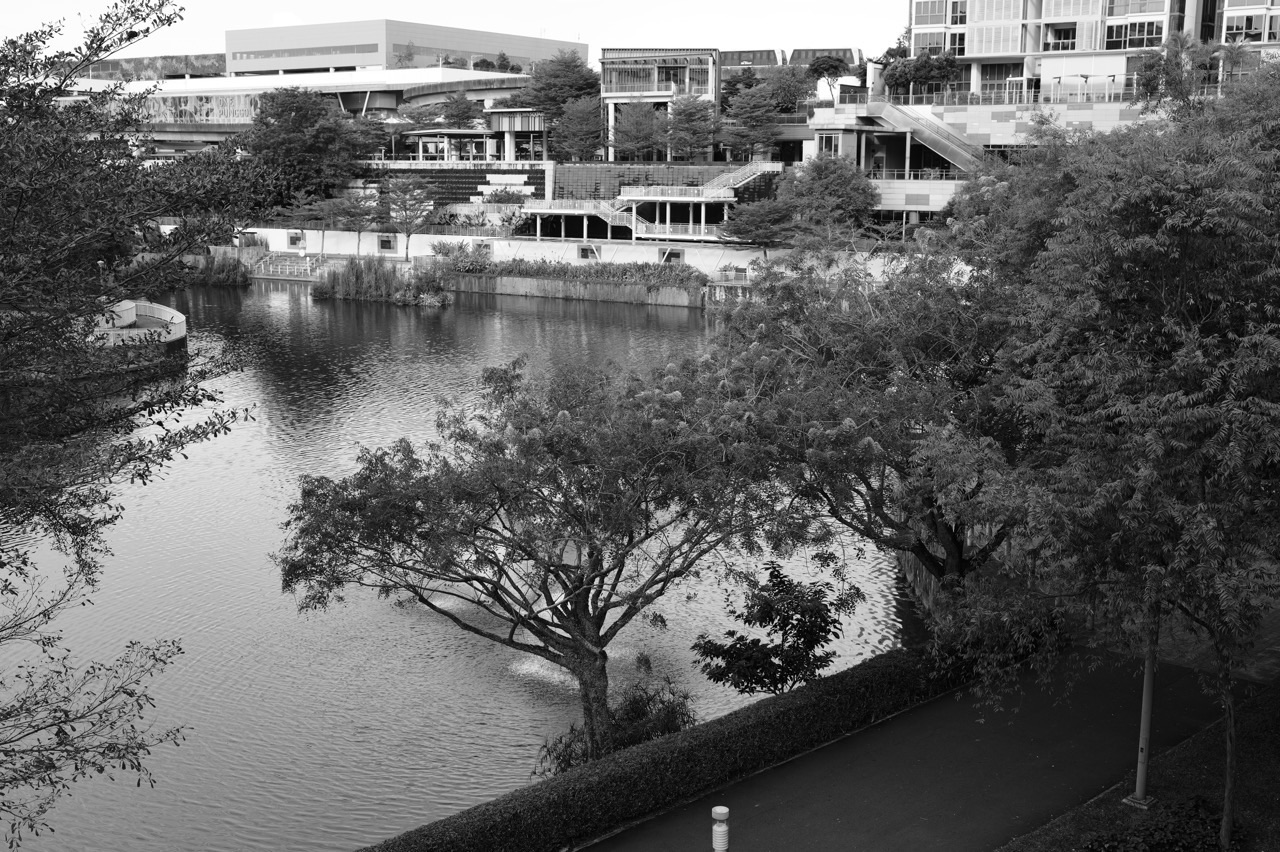
Looking for the best parks in Punggol? Start with Punggol Waterway Park for easy green time, Coney Island Park for a rustic daytime walk, Punggol Green for a quick community outing and the open part of Punggol Heritage Trail for nature and local history. The wider Punggol green network also includes the therapeutic garden, three sections of Punggol Promenade and several park connectors that link to neighbouring areas. This guide covers 14 named parks, gardens, promenades and green routes without numbering, ranking or inventing parks to fill a headline.
Punggol is unusually interesting because a short urban stroll and a much longer nature walk can begin in the same town but feel completely different. You can sit beside the landscaped waterway, discover coastal forest on Coney Island, see a piece of Old Punggol Road preserved as a trail, or follow a waterfront connector for exercise. The trick is matching the place to the person: a pram, a keen walker, a child who wants wildlife and someone who needs shaded seating do not all need the same route.
Important for 2026 visits: NParks’ current notice closes Punggol Point Park from 11 August 2026, with works expected to finish by 31 December 2027. The Lorong Halus Park Connector has a separate partial MRT-works closure until 31 December 2026. These should not be mistaken for a blanket closure of Punggol Waterway Park and Coney Island. Coney Island has its own 7am–7pm opening hours. Treat every current notice as stronger than an older travel article or the opening hours copied into a map listing.
Punggol parks and green spaces at a glance
A park, garden, promenade and park connector are different kinds of place. The table tells you which is which, what it is suitable for and the access detail that could change your plan. It is arranged from Punggol’s central and island destinations through the connected routes, with the closed park clearly identified. This is a practical directory, not a list of “first”, “second” and “third” winners.
| Place or route | Official type | Area | Opening or access | Useful for |
|---|---|---|---|---|
| Punggol Waterway Park | NParks town park | Along Sentul Crescent, through Punggol town | Open 24 hours | Families, first-time visitors, flat walking routes |
| Coney Island Park | NParks island nature park | Pulau Serangoon, just off Punggol’s coast | 7am–7pm | Rustic nature, wildlife observation, unhurried daytime walks |
| Punggol Heritage Trail | NParks green heritage trail, opening in stages | Punggol Digital District, from Punggol North Avenue towards Campus Boulevard | Publicly opened section listed as 24 hours; follow work-site signs | Heritage, plants, family discovery, Punggol Coast visits |
| Punggol Green | Community linear green park | 1 Punggol Drive, next to One Punggol | Open-air green space; use posted facility rules | Everyday family play, short walks, group activities |
| Therapeutic Garden at Punggol Waterway Park | Garden within Punggol Waterway Park, not a separate park | Near Carpark A, Sentul Crescent | Open 24 hours | Gentle visits, reflective time, sensory garden exploration |
| Punggol Waterway Park Connector | Park connector, not a second Waterway Park | Both banks of the Punggol Waterway, along Sentul Crescent | Outdoor shared route; check diversions and lighting | Jogging, cycling and choosing a longer waterway route |
| Punggol Promenade Riverside Walk | Park connector promenade | Near Tebing Lane and Riviera LRT, Punggol East | Public riverside route; check onsite notices | Gentle waterfront strolling, dining and shorter walks |
| Punggol Promenade Nature Walk | Park connector nature route | Middle section of Punggol Promenade, connecting the northern and eastern waterfront | Public route; check local warnings and diversions | Coastal scenery, rest shelters, longer riverside walks |
| Punggol Promenade Punggol Point Walk | Coastal park connector, access affected by adjoining works | Northern coast near Punggol Point and the end of Punggol Road | Check NParks closure maps and open sections before visiting | Coastal-view route research; not a through-route guarantee in 2026 |
| Punggol Park Connector | 6.1 km regional park connector | Gerald Drive towards Punggol Promenade, spanning northeast neighbourhoods | Shared route; verify diversion notices | Longer walking, jogging and cycling routes across the northeast |
| Sungei Serangoon Park Connector | 2.1 km park connector linking into Punggol East | From Sengkang East Drive/Buangkok Drive towards Punggol East | Public shared route; check works notices | Longer east-side walks and understanding natural drainage |
| Lorong Halus Wetland | Nearby PUB wetland across the reservoir, not inside Punggol town | Eastern bank of Serangoon Reservoir, approached from Punggol’s eastern side | Check current wetland/bridge and connector notices | Wetland birds, science learning, water-treatment story |
| Lorong Halus Park Connector | 3 km connector with a partial 2026 closure | Pasir Ris Farmway 3 and Lorong Halus Wetland side, connecting towards Punggol | Partially closed until expected 31 December 2026; check diversions | Route research, longer nature rides after diversion verification |
| Punggol Point Park — currently closed | NParks coastal park, closed for upgrading | End of Punggol Road, beside Punggol Point Jetty | Closed since 11 August 2026; works completion expected 31 December 2027 | Read the status before making future plans; not an open 2026 park visit |
Want to skip straight to a short walk? Read the Waterway Park or Punggol Green profile. Looking for more natural habitat? Begin with Coney Island. Planning to cycle beyond Punggol? Read the Park Connector sections and the current diversions. The detailed eduKatePunggol guides linked under every place own the deeper, place-specific directions; this page helps you decide which destination to investigate.
Parks, nature spaces and green routes around Punggol
Punggol Waterway Park
Type: NParks town park. Where: Along Sentul Crescent, through Punggol town. Access: Open 24 hours. Good for: Families, first-time visitors, flat walking routes.

A simple park with more than one experience
If you are visiting Punggol for the first time, this is the most straightforward public park to understand. NParks lists Punggol Waterway Park as a 25.79-hectare town park running along Sentul Crescent, with nearby access at Punggol MRT and Damai LRT. It is open 24 hours and has broadly accessible paths and several places to sit. You do not need to commit to a long hike. A family can walk gently, stop at a bridge, enjoy the reflections and return towards town for a snack. The waterway is the organising feature, but the whole park is much more than one waterfront photograph.
The four sections have different moods
NParks names four themed areas: Nature Cove, Recreation Zone, Heritage Zone and Green Gallery. Nature Cove makes space for looking at the water and planted landscape. The Recreation Zone is more active, with space for families and a history of sand-play and activity areas. The Heritage Zone retains reminders of Old Punggol Road and an old bus-stop scene. Green Gallery brings planted corridors and garden-like experiences closer to the everyday pedestrian path. These are zones within one park, not four additional ticketed parks. Choose the one that fits the people coming rather than racing to complete every label.
A lovely first visit
Begin somewhere you can return to easily, such as the town-centre side, and agree on one bridge as a comfortable turning point. Older children can be given the task of spotting a plant that grows near water and one that grows on drier ground. Adults can take photographs without blocking the shared route. If you prefer a longer exercise session, use the connector network described in a separate section below. A park map and shared-path signs are better for choosing a route than relying on the word “Waterway” in a business listing.
Safety and present facilities
NParks specifically prohibits fishing at Punggol Waterway Park. Do not enter the water or assume a water feature is safe for paddling. Older walking leaflets mention a water playground in the Recreation Zone, but the former water-play feature has been removed; families should not promise children that it is operating. As with any outdoor area, moving towards indoor shelter is the right response to lightning, and cyclists should slow around walkers, children and mobility-aid users. The park is open 24 hours, but that does not mean a late-night solo visit is right for every family.
Explore this place further: eduKatePunggol’s detailed local guide. Official source: the managing authority’s current information.
Coney Island Park
Type: NParks island nature park. Where: Pulau Serangoon, just off Punggol’s coast. Access: 7am–7pm. Good for: Rustic nature, wildlife observation, unhurried daytime walks.
A very different kind of Punggol nature visit
Coney Island Park, also known as Pulau Serangoon, gives Punggol an island-nature experience rather than a landscaped town park. NParks lists it as an 81-hectare nature park beside Punggol Promenade Nature Walk. The vegetation, coastal forest, mangroves and natural terrain make it appealing to anyone who wants to pay closer attention to the landscape. There are two access points, the West entrance by the Punggol Point/Punggol Promenade side and the East entrance by the Lorong Halus side. Choosing the entrance before setting off matters more than whether your destination looks close on a phone map.
Opening hours and terrain are non-negotiable
The official opening hours are 7am to 7pm. The gates are not an invitation to begin a late sunset expedition without enough return time. NParks describes the ends of the park as wheelchair- and stroller-friendly, while other parts have rugged surfaces that may be unsuitable for younger children or visitors with mobility difficulties. That is a more precise statement than calling the entire island “pram friendly” or “inaccessible”. Check the actual path you intend to use, bring water and wear covered footwear. Do not expect the same amenities you would find next to Waterway Point.
How to enjoy it without disturbing wildlife
A good nature visit can be wonderfully simple: listen for birds, compare coastal tree shapes, watch how light reaches the forest floor and record an interesting observation. NParks tells visitors not to camp, fish, leave designated trails, feed monkeys or enter restricted property such as Haw Par Beach Villa. Give wild boars, dogs and other animals a wide berth; wildlife observations should never require close contact. Do not wade into the sea. If a child wants to photograph an animal, teach them to keep their distance and accept that some sightings are fleeting.
Plan an exit, not just an entrance
The most comfortable island walk includes a realistic return plan before the group becomes tired. Families with young children may prefer one section near an entrance instead of traversing the entire park. The island itself has no carpark; NParks points to parking near Punggol Settlement on the mainland. The western approach is also affected by the separate Punggol Point Park upgrading works, so check current access maps and temporary footpaths rather than assuming you can cross the closed park. A good Coney Island day feels like discovery, not a race with a closing gate.
Explore this place further: eduKatePunggol’s detailed local guide. Official source: the managing authority’s current information.
Punggol Heritage Trail
Type: NParks green heritage trail, opening in stages. Where: Punggol Digital District, from Punggol North Avenue towards Campus Boulevard. Access: Publicly opened section listed as 24 hours; follow work-site signs. Good for: Heritage, plants, family discovery, Punggol Coast visits.

A new green corridor built around old Punggol
The Punggol Heritage Trail is a different kind of destination: a landscaped, pedestrian-oriented route within the Digital District that preserves elements of Old Punggol Road. NParks’ public description covers undulating terrain, old-road memories, planted native trees and interpretive signage about the district’s past. JTC says the first 400 metres, linking Punggol North Avenue to Campus Boulevard, are open. The future 1.3-kilometre corridor is a planned whole; visitors should not treat it as fully walkable simply because the project appears on a promotional masterplan.
Where history becomes visible
This is a lovely place to ask what the neighbourhood used to be. The official heritage descriptions recall the former kampong, farming communities and changing transport arrangements, along with retained vegetation. Native coastal plants and older trees help make the story physical instead of abstract. Children can compare a recreated old-style bus-stop shelter with a modern MRT entrance and talk about how travelling, housing and working in Punggol have changed. That kind of observation can make a simple green walk interesting even for people who do not normally go on hikes.
Useful for walkers, with accessibility limits
The NParks detail page lists the trail as accessible to wheelchair users but recommends assistance because of the undulating terrain, while stepping stones and grass mounds are not wheelchair-friendly. The safe interpretation is that access can differ from one path to another. Choose the open public walkway and plan a return that does not depend on stairs, uneven stepping stones or future sections. For families with prams or older relatives, the current map and onsite route are more important than the glossy drawing of the eventual completed trail.
Current status belongs to the authority
NParks has previously identified additional phases with end-2026 completion targets, but a target is not evidence that a particular new section has opened today. JTC’s community page still advertises the first 400-metre stretch as open. Until a fresh public access notice states otherwise, that is the section visitors can plan around. Use Punggol Coast MRT as an easy starting point, take the marked public routes through the district, and keep the nearby mall or hawker centre as a convenient food and rain fallback.
Explore this place further: eduKatePunggol’s detailed local guide. Official source: the managing authority’s current information.
Punggol Green
Type: Community linear green park. Where: 1 Punggol Drive, next to One Punggol. Access: Open-air green space; use posted facility rules. Good for: Everyday family play, short walks, group activities.

A park woven into ordinary life
Punggol Green is a useful example of an urban park that does not need a large forest or waterfront to matter. The People’s Association describes it as a 12,000-square-metre linear green park integrated with One Punggol. Its activity spaces serve residents of different ages: toddler and children’s playgrounds, fitness corners and basketball facilities. This can make a quick outdoor break feel accessible for a household that has a library visit, a community class or a meal already planned in the town-centre area. It is more a place to return to regularly than a one-time tourist attraction.
Different generations can use the same area
A family group may not all want to do the same thing. The younger child can enjoy age-appropriate equipment while older children practise a sport or have time with friends and adults sit nearby. The PA’s facilities description identifies different play ages rather than implying that one piece of equipment should suit everyone. Parents still need to supervise children, especially near shared routes or busy community spaces. If one person is only able to do a short walk, a reliable exit near One Punggol is a practical advantage.
Combine green time with an indoor fallback
One Punggol houses the regional library, community facilities and food, allowing a walk to become a simple half-day outing. An example is a play session, water and a snack, followed by a book at the library. The green area is outdoors: when thunder approaches, leave exposed spaces rather than treating the nearby building as permission to continue playing. Punggol Green is not the same thing as Punggol Green Primary School or Punggol Waterway Park, despite the shared place name.
How to make the most of a short visit
Choose one family goal: play for twenty minutes, take a quick evening stroll or enjoy a quiet conversation while someone else uses a community facility. Do not overload the visit with a town-wide itinerary. Check current court bookings or event access separately, since a public green park and a programmed facility can have different rules. A successful neighbourhood park needs to be easy to revisit, and this is an especially helpful model of that principle.
Explore this place further: eduKatePunggol’s detailed local guide. Official source: the managing authority’s current information.
Therapeutic Garden at Punggol Waterway Park
Type: Garden within Punggol Waterway Park, not a separate park. Where: Near Carpark A, Sentul Crescent. Access: Open 24 hours. Good for: Gentle visits, reflective time, sensory garden exploration.
A quieter choice within the larger park
The Therapeutic Garden is a separate named feature inside Punggol Waterway Park, and it serves a different need from the activity-heavy recreation areas. NParks lists this 900-square-metre garden near Carpark A and dates its opening to May 2020. The planted spaces, elevated view of the waterway and areas for relaxation make it suitable for visitors who want a calmer encounter with greenery. You do not have to complete a long park walk to appreciate it. A short, comfortable visit can be valuable for someone recovering from a tiring day or who prefers a slower pace.
What therapeutic means here
NParks uses therapeutic garden design to support interaction with nature, sensory experience and general well-being. The garden includes a wellness area, communal planting features and a fitness area. These are designed public amenities, not a substitute for medical treatment or a guarantee that visiting the garden will treat a health condition. The garden can offer a pleasant environment to pause, notice scent and texture or participate in an appropriate organised horticulture activity where one is available. Visitors should be considerate towards people who need a quieter setting.
Planning for older family members
Begin by choosing a parking or arrival point that works for the least mobile member of the group. NParks places the garden near Carpark A; that can be more useful than walking a longer connector route from town centre. Make sure there is seating where you need it, ask whether an event requires registration and avoid pushing anyone to complete a circuit beyond their comfort. If a relative wants to spend most of the visit resting and looking out at the water, that is a perfectly worthwhile use of a garden.
Garden etiquette and learning
This is an especially good setting for observation without collection. Ask a child to describe one leaf shape, one fragrance and a change in light across the garden. Do not pick plants or rearrange community planters. If a caregiver is helping a person with mobility or sensory needs, keeping paths clear and speaking calmly can make the public space more welcoming. The wider park is open all day, but the best visit is still the one matched to comfort and weather.
Explore this place further: eduKatePunggol’s detailed local guide. Official source: the managing authority’s current information.
Punggol Waterway Park Connector
Type: Park connector, not a second Waterway Park. Where: Both banks of the Punggol Waterway, along Sentul Crescent. Access: Outdoor shared route; check diversions and lighting. Good for: Jogging, cycling and choosing a longer waterway route.

Why a park connector belongs in this guide
NParks lists an 8.4-kilometre Punggol Waterway Park Connector running along both sides of the waterway. That is a route distance, not the distance a visitor must walk to enjoy Punggol Waterway Park. This is the right option to investigate when you want exercise, a steady run or a bicycle ride rather than a short visit to a park zone. Because it follows the same waterway landscape, people sometimes count it as another park; this guide makes the distinction explicit.
How to plan your own distance
Pick a comfortable start and finish instead of trying to complete all 8.4 kilometres. A family with a preschooler may choose an out-and-back near a bridge or an LRT station, while a confident walker might follow a much longer stretch. The official route length should not be converted into an assumed journey time without considering pace, stops, crowds and connecting paths. If you are cycling, choose the route based on the least confident rider and use the designated path signs.
Shared-path courtesy keeps the visit pleasant
A picturesque path can be busy with runners, grandparents, children on scooters and groups stopping to photograph the water. Cyclists should slow before blind corners, intersections and congested bridges. Walkers should avoid occupying the whole path when others need to pass. A ringing bicycle bell is a request for attention, not permission to pass at an unsafe speed. Be especially careful where the route crosses entrances, crossings or areas used by children.
Choose a good break point
One of this connector’s strengths is that it passes through a lived-in town. There are routes towards Waterway Point and One Punggol for food, toilets and convenient transport, although access details depend on where you begin. A family can decide to stop before exhaustion, and a student can make a short exercise break without turning it into an expedition. Check the NParks route map and any current repair or diversion notice for the exact stretch you intend to use.
Explore this place further: eduKatePunggol’s detailed local guide. Official source: the managing authority’s current information.
Punggol Promenade Riverside Walk
Type: Park connector promenade. Where: Near Tebing Lane and Riviera LRT, Punggol East. Access: Public riverside route; check onsite notices. Good for: Gentle waterfront strolling, dining and shorter walks.

A compact waterfront route
Punggol Promenade Riverside Walk is one of the easiest ways to enjoy the river edge without making the outing a full nature expedition. NParks lists this wheelchair-friendly section at 1.2 kilometres, near Tebing Lane and Pasir Ris Industrial Drive 1. The route gives views of Serangoon Reservoir and nearby dining choices, making it a gentle option for people who want fresh air and a meal on the same visit. The promenade is a park connector route, not a separate formal NParks park.
Start with the people, not the distance
Older relatives may enjoy only a short part of the path; families with young children may prefer a simple return before dinner. A couple may choose a longer stroll to talk and watch the light change. The 1.2-kilometre official section length is useful for orientation, but walking to the access point and back can change the whole outing. NParks lists bus routes serving the Riviera area, and the exact final approach should be checked against current public transport information.
Riverside nature in ordinary life
The reservoir, planted edges and water-facing boardwalks are enough to make this a satisfying nature stop. Look for birds from a respectful distance and use a camera without blocking people behind you. The dining cluster near Tebing Lane can become a convenient rest stop, but a restaurant’s opening hours have nothing to do with the route’s access. Pick the actual restaurant and the walking portion separately so the day still works if one venue is crowded.
A few practical cautions
The Riverside Walk is shared with other users and can become slippery when wet. When thunderstorms threaten, do not remain exposed for a better photograph. Wheelchair-friendly in a route description does not guarantee every temporary path and adjacent restaurant has the same access standard. Confirm the specific approach if mobility matters, and avoid planning a route that depends on a closed facility farther north.
Explore this place further: eduKatePunggol’s detailed local guide. Official source: the managing authority’s current information.
Punggol Promenade Nature Walk
Type: Park connector nature route. Where: Middle section of Punggol Promenade, connecting the northern and eastern waterfront. Access: Public route; check local warnings and diversions. Good for: Coastal scenery, rest shelters, longer riverside walks.
The longer, quieter-feeling promenade
NParks describes Punggol Promenade Nature Walk as a 2.4-kilometre wheelchair-friendly section in the middle of the promenade system. It lies between the Riverside Walk and Punggol Point Walk and includes rest shelters and designated fishing platforms. It is worth considering if you want a more extended waterside experience than the short Riverside Walk. The official listing does not turn its whole length into a park with separate gates or an admission ticket.
Fishing platforms are not a blanket fishing permission
NParks refers to fishing platforms, but that does not mean anglers may fish everywhere they can reach or that all the riverbanks are safe places to cast. Read local signage and the relevant reservoir or park regulations at the specific site. Children who have come to enjoy nature should be supervised near railings, exposed edges and fishing activity. There is also no need to carry fishing gear to enjoy the lookout points and shelters.
Wildlife may be nearer than expected
NParks’ notices warn that wild boars have been spotted around Punggol Promenade Nature Walk. The right response is to give wildlife space, stay on designated paths and never feed or corner an animal. Families with young children should keep them close and avoid interpreting a sighting as an opportunity for a selfie. The route may provide memorable nature observations precisely because animals are living in their own habitat.
Check the northern connection
A promenade section can remain a legitimate destination while a neighbouring park is closed for works. Punggol Point Park is under upgrading, so it would be careless to assume all former walking connections at the northern end remain open. Check the NParks notice and onsite diversion signs before choosing a long walk that requires passing the point. A good alternative is to select a stretch from the Riverside side and return the same way.
Explore this place further: eduKatePunggol’s detailed local guide. Official source: the managing authority’s current information.
Punggol Promenade Punggol Point Walk
Type: Coastal park connector, access affected by adjoining works. Where: Northern coast near Punggol Point and the end of Punggol Road. Access: Check NParks closure maps and open sections before visiting. Good for: Coastal-view route research; not a through-route guarantee in 2026.
The northern coastal section has a separate identity
Punggol Promenade Punggol Point Walk is a named 1.3-kilometre section of the overall promenade, with views towards Pulau Ubin and the Johor Strait. Older NParks descriptive pages mention the ship-inspired viewing deck, sandy play spaces and access from Punggol Point Park. These descriptions explain why it became a popular coastal attraction. But they were written for a different operating condition and should not be read as permission to enter the park or any route currently closed for upgrading.
Why this is not currently a carefree itinerary
The present NParks notice closes Punggol Point Park and the adjacent carpark for upgrading from 11 August 2026, with expected completion by 31 December 2027. This applies directly to a key park at the northern end of the route. The notice does not establish that every separate metre of the wider promenade is closed, but it does require visitors to check the official closure map and onsite signs. Do not tell family members that the old point-deck route is accessible without a current verified approach.
How to plan around the works
If your goal is simply coastal water views, investigate an open section of Punggol Promenade Riverside Walk or Nature Walk instead. Those are formally named alternative sections with their own public descriptions, and they give you ways to enjoy the landscape without crossing the closed park. If you are dining near Punggol Settlement, verify the business and its vehicle access independently; the park notice does not in itself close every business nearby.
Reopening will be an announcement, not a guess
An expected works completion date is not the same thing as a confirmed public reopening. When NParks announces a new arrangement, the closure map and permitted paths may change. The responsible article is one that describes the destination’s appeal while being unambiguous about current access. For 2026 families, this route belongs on the watch-and-check list, not on a guaranteed stroller itinerary.
Explore this place further: eduKatePunggol’s detailed local guide. Official source: the managing authority’s current information.
Punggol Park Connector
Type: 6.1 km regional park connector. Where: Gerald Drive towards Punggol Promenade, spanning northeast neighbourhoods. Access: Shared route; verify diversion notices. Good for: Longer walking, jogging and cycling routes across the northeast.
Do not mistake the name for Punggol Park
Punggol Park Connector is a named 6.1-kilometre park-connector route, not the same place as Punggol Park, the separate formal park in Hougang. NParks describes the route linking Gerald Drive to Punggol Promenade, running beside the reservoir and broader water-themed corridor. It is useful to walkers and cyclists who want a more extended journey through different neighbourhoods. The route can connect into the wider North Eastern Riverine Loop, but visitors should not equate the full regional loop with one casual park visit.
The ecology of a connector
NParks highlights birdlife along the route, including herons and kingfishers, and the way park connectors join residential areas with water. A park connector is a practical piece of city infrastructure as well as a recreational landscape: residents can use it to move between places without depending exclusively on roads. This is why a route name belongs in a guide to Punggol’s green network even though it is not a standalone park with a gate and central lawn.
Choose your entry and exit before leaving
Start with the part of the route that suits your home and end destination. A person seeking a long jog may enjoy the full corridor, while a family should choose a small portion and a reliable turning point. The official 6.1-kilometre length does not tell you the distance from the nearest MRT station or whether every connecting leg is sheltered. Carry water, check path works and understand how you will return after the longest part of the journey.
The route crosses more than one locality
This is also a useful reminder that “Punggol” in a route name need not mean every metre lies inside Punggol town. It is a connector serving the broader northeast. Visitors looking for a park directly beside their Punggol HDB block may be happier at Punggol Green or Waterway Park, while a cyclist seeking a connected exercise route may value the wider corridor. Choosing by function prevents a lot of unnecessary travel.
Explore this place further: eduKatePunggol’s detailed local guide. Official source: the managing authority’s current information.
Sungei Serangoon Park Connector
Type: 2.1 km park connector linking into Punggol East. Where: From Sengkang East Drive/Buangkok Drive towards Punggol East. Access: Public shared route; check works notices. Good for: Longer east-side walks and understanding natural drainage.
A useful route on the edge of Punggol
Sungei Serangoon Park Connector is a 2.1-kilometre official route which NParks says begins near the junction of Sengkang East Drive and Buangkok Drive and ends at Punggol East. That makes it a link between neighbourhoods, not a small park inside central Punggol. It is relevant if your walking plan connects the eastern parts of the town with broader northeast routes. NParks lists it as wheelchair-friendly, but the complete approach from your home or station still has to be checked for crossings and any temporary works.
A lesson in green drainage design
The connector’s distinctive feature is its bioswales: shallow landscaped areas designed to treat and slow stormwater. Rather than seeing them as ordinary roadside ditches, an observant walker can understand how plants, soil and gentle slopes work as infrastructure. The point is not to climb down into them or collect water samples without permission. The landscape itself provides enough evidence for a family conversation about rainfall, flooding, vegetation and the way a city manages its water.
Choose a realistic stretch
Parents with young children are not obliged to walk from one end of the connector to another. Look at the current route map, identify a safe entry on the Punggol East side and decide where to turn back. The path works particularly well as part of a longer route for experienced walkers or cyclists, with the option to visit the promenade afterwards only if the group remains comfortable. It is always acceptable to stop at one good view and return early.
Shared infrastructure deserves shared courtesy
Keep the path open for residents travelling through, not only recreational visitors. Avoid blocking entrances, watch for cyclists and do not stop on narrow bridges with a large group. In rain, drainage landscapes can fill quickly; do not venture into them. The route is an example of how everyday movement and environmental management are combined in the northeast, and respecting that design improves the experience for everyone.
Explore this place further: eduKatePunggol’s detailed local guide. Official source: the managing authority’s current information.
Lorong Halus Wetland
Type: Nearby PUB wetland across the reservoir, not inside Punggol town. Where: Eastern bank of Serangoon Reservoir, approached from Punggol’s eastern side. Access: Check current wetland/bridge and connector notices. Good for: Wetland birds, science learning, water-treatment story.
A nearby destination worth making the geographic distinction for
Lorong Halus Wetland is one of the most interesting green places to visit from Punggol, but it is not formally a park inside Punggol town. PUB places it on the eastern bank of Serangoon Reservoir, across the water from the Punggol side. The site treats water associated with a former landfill before it reaches the reservoir. That gives the area a very different identity from a landscape built mainly for exercise and play. It is a functioning water-quality feature and ecological space with public learning value.
Why the wetland exists
PUB explains that water passing through the former landfill is collected and treated using wetland processes, protecting the reservoir. The learning trail introduces concepts including the Four National Taps, water treatment and the use of plants and engineered wetland features. Older children can discuss why a former landfill requires careful management long after waste dumping stopped. The landscape gives a practical answer to a big civic question: what must a city do to keep its water clean?
Birdwatching is a bonus, not a guarantee
Wetlands can attract birds because water, vegetation and food sources create suitable habitats. Look quietly from public paths and note the species you recognise; do not leave the trail or feed wildlife to force a sighting. A pair of binoculars can be useful but is not essential. The most satisfying family exercise may simply be watching how plants and channels are arranged and comparing them with the public waterway on the opposite side.
Check the crossing and diversions
Lorong Halus Bridge, commonly called the red bridge, is a well-known pedestrian and cycling landmark. However, the Lorong Halus Park Connector has a recorded partial closure for MRT works through 31 December 2026. A bridge, a wetland and a connector route are separate assets: one being accessible does not prove every onward path is continuous. Check NParks’ current diversion notice and PUB’s visitor guidance, and avoid entering fenced water-treatment or work areas.
Explore this place further: eduKatePunggol’s detailed local guide. Official source: the managing authority’s current information.
Lorong Halus Park Connector
Type: 3 km connector with a partial 2026 closure. Where: Pasir Ris Farmway 3 and Lorong Halus Wetland side, connecting towards Punggol. Access: Partially closed until expected 31 December 2026; check diversions. Good for: Route research, longer nature rides after diversion verification.
A route connecting Punggol with Pasir Ris
NParks lists Lorong Halus Park Connector as a three-kilometre route connecting the Punggol and Pasir Ris sides, passing wetlands, old farmway landscapes and the edge of Serangoon Reservoir. It is part of the wider network that allows longer runs, rides and walks across the northeast. It is not a new neighbourhood park, and it is not the same thing as the Lorong Halus Wetland itself. The distinction is useful when planning a route rather than one static lookout point.
The closure is the first planning fact
The official NParks notices page identifies a partial Lorong Halus Park Connector closure from 23 November 2024 until 31 December 2026 for MRT track works. The closure is of a section, not necessarily every route leading towards the wetland. But a long public route can fail when the one segment connecting two sides is unavailable. Until you have confirmed the current diversion map, do not promise an uninterrupted bike ride from Punggol all the way to Pasir Ris.
Plan a short, verifiable outing
If you only want to see Lorong Halus Wetland, make that the anchor and use an approach that is publicly open. If you want the full connector experience, examine the active notices and choose another turn-back point if the works interfere. A longer route should not be attempted simply because a mapping app still draws a continuous green line. The safest plan is one that uses the available paths, not an unofficial shortcut through construction.
What to notice along the route
This corridor makes the relationship between urban and natural systems easy to see. Water, vegetation, earlier land use and transport construction are all present in a single landscape. Students can learn that a road, bridge or connector is not just a line on a map: its opening, maintenance and traffic rules shape how people use it. That makes the route interesting even when part of it cannot currently be followed as originally designed.
Explore this place further: eduKatePunggol’s detailed local guide. Official source: the managing authority’s current information.
Punggol Point Park — currently closed
Type: NParks coastal park, closed for upgrading. Where: End of Punggol Road, beside Punggol Point Jetty. Access: Closed since 11 August 2026; works completion expected 31 December 2027. Good for: Read the status before making future plans; not an open 2026 park visit.
Why people remember it
Punggol Point Park is a real formal NParks coastal park at the northern tip of mainland Punggol. The normal park guide describes a compact 0.4-hectare area, sea views, a ship-inspired viewing deck and its relationship to the nearby jetty and Punggol Promenade. Those features explain why visitors previously included it in waterfront day trips. The park also sits in a historically significant part of Punggol. A respectful visitor understands both its leisure setting and the area’s remembrance sites, rather than treating every landmark as a photo backdrop.
The current access rule comes first
NParks’ specific notice states that Punggol Point Park is closed for upgrading from 11 August 2026, with completion expected on 31 December 2027. That is a works target, not a guaranteed public reopening date. A general park-detail page can still display the park’s ordinary “open 24 hours” entry because it describes normal operations. For an actual 2026 visit, the dated closure notice overrides that old pattern. Do not tell family or visitors to enter a closed viewing deck or carpark because an online map still labels the park open.
The wider coast has separate rules
The closure affects the park and its adjacent carpark, but it does not by itself prove that every restaurant, Coney Island gate or kilometre of Punggol Promenade is shut. The difference matters: a visitor can still investigate other public destinations, provided the exact open routes and onsite signs are checked. Any temporary footpath shown in a closure map should be treated as a designated route rather than a licence to wander near active construction.
What to choose instead
For a scenic waterway experience, Punggol Waterway Park remains a good town-centre alternative. For a longer waterfront walk, investigate a permitted stretch of Riverside Walk or Nature Walk. For rustic biodiversity, Coney Island Park offers its own separately governed 7am–7pm visiting window. When the authorities later issue a reopening notice, verify what actually becomes accessible before updating a family itinerary. In the meantime, the most useful service is clear closure information, not a stale “must visit” recommendation.
Explore this place further: eduKatePunggol’s detailed local guide. Official source: the managing authority’s current information.
Which Punggol park should you visit?
For a family with toddlers or a pram
For a first trip with a stroller, Punggol Waterway Park is a useful place to begin because there are landscaped paths and routes near the town centre. You can keep the outing short and head towards food or transport without spending the whole day outdoors. Punggol Green also provides a quick open-air option near One Punggol. Do not use the word “stroller friendly” as a blanket claim for all of Coney Island: NParks says its ends are friendlier while the terrain becomes rugged in places. Choose the specific segment, not the general park name.
For a child who is interested in play equipment more than nature, the Top 10 Playgrounds in Punggol guide makes a better companion than this park directory. It distinguishes free HDB play, Happy Park, Coney Island’s Casuarina Exploratory and paid indoor options. If a child needs a change of clothes or a nearby toilet, plan that before setting out rather than assuming every green path has mall-style facilities.
For an older visitor who likes a gentle outing
The therapeutic garden near Carpark A within Punggol Waterway Park is designed for calmer visits. It provides landscaped seating, an elevated view and a shorter purpose than completing a connector loop. Punggol Green, close to One Punggol, is another helpful choice when a seated break and an indoor meal or library visit may be needed. Older visitors who enjoy waterside scenery may also consider a short portion of Punggol Promenade Riverside Walk near Tebing Lane, where NParks describes a wheelchair-friendly main route.
However, “wheelchair friendly” is not a promise that every carpark, crossing, bus stop, entry path and construction diversion is step-free. Plan from the visitor’s actual arrival point. If someone needs regular rest or has difficulty with gradients, choose an out-and-back instead of a route with an uncertain far-side exit. A pleasant half-hour that everyone can finish comfortably is a successful visit.
For someone who wants genuine nature, not a long shopping trip
Coney Island Park is the strongest match when you want coastal habitat, birds and an intentionally rustic experience. The same conditions that make it attractive—less manicured terrain, more vegetation and a sense of distance—make it less appropriate as an improvised late-afternoon outing. Enter while the park is open, wear suitable shoes, carry water and keep to the designated trails. The island is not a place for feeding animals, entering restricted beaches or collecting wildlife.
Lorong Halus Wetland offers another kind of nature experience, but it is across the reservoir from Punggol, not in the town itself. It is partly a water-treatment system, so a visit can be a lesson about ecology and infrastructure. The current Lorong Halus Park Connector diversion matters, so verify the actual walking or cycling approach. If you need a shorter trip, choose a planted section of Waterway Park and look for aquatic plants and common birds instead.
For a sunset or waterside photograph
Punggol Waterway Park and its bridges are useful for a sunset-minded visitor, especially around the public routes near the town centre. A photograph can include a bridge, reflection, trees and the changing light without needing an elevated ship deck. Punggol Promenade Riverside Walk also provides water views. For more coastal scenery, Nature Walk may be worth investigating after checking open routes and the northern park works. The value of a photograph does not increase because it was taken from a fenced or prohibited area.
Leave shared paths clear, do not climb barriers or lean over railings and avoid blocking cyclists. Personal photography and commercial productions are not automatically governed by the same permit requirements, so check the relevant rules if planning a large setup. Weather can change quickly in Singapore, and an approaching thunderstorm is a reason to move to shelter rather than wait for one more frame.
For runners and cyclists planning longer distances
Use the route you really want to cover. The official Punggol Waterway Park Connector is 8.4 kilometres; Punggol Promenade Riverside Walk is 1.2 kilometres; Nature Walk is 2.4 kilometres; Punggol Park Connector is 6.1 kilometres; and Sungei Serangoon Park Connector is 2.1 kilometres. These are individual route lengths, not automatically consecutive legs in a safe continuous itinerary. Access, crossings and temporary works can change where you can connect them.
The most comfortable active outing begins with a reliable route map and an exit plan. Avoid converting route length into a precise journey duration without allowing for stops and travel speed. Cyclists should give priority to safety around pedestrians and families. NParks’ current park connector listings and closure notices help you distinguish a green line on an older map from what is actually open.
For school-aged children who enjoy learning outdoors
Punggol is a valuable outdoor classroom when a walk stays curious and relaxed. At the Waterway, ask why some plants are close to the water and others are higher on the bank. Along a bioswale, ask how water may be slowed or filtered. At Lorong Halus Wetland, explain why Singapore needs engineered systems to prevent pollutants reaching a reservoir. At Punggol Heritage Trail, connect historical land use with the older trees and reconstructed features now visible.
A small notebook is enough. Give each child a task to record two observations, one possible explanation and a question to investigate later. The distinction between observation and inference is an important habit for Science, English and Mathematics. The outing need not become a worksheet; curiosity is often strongest when a child chooses something interesting to notice. For deeper connections, see Punggol as a classroom: water, transport and buildings.
An easy way to plan a Punggol green day
A short after-school green break
Choose Punggol Green, the nearest part of Punggol Waterway Park or another public landscaped path close to home. A child can enjoy a short walk, look at the surroundings and return for dinner. The point is not the distance completed but the chance to spend time outdoors without making the rest of the day harder. Bring water and know where the nearest sheltered option is if a storm begins.
A half-day town-centre nature outing
Begin around Punggol MRT or One Punggol, select a comfortable part of the Waterway Park path, visit a bridge or quieter garden section, and stop for lunch or the library afterwards if time permits. Parents can give children one nature-observation challenge each. The route is flexible and can be shortened when someone gets tired. This is often a more enjoyable first Punggol visit than trying to squeeze the island, north coast and eastern wetlands into the same morning.
A purposeful Coney Island nature walk
Start by choosing the West or East entrance and checking how you will reach it without entering Punggol Point Park’s closed work area. Arrive during the park’s 7am–7pm gate hours, wear covered footwear and bring water. Stay on marked trails, look at the plant habitat and choose an exit with enough time for a calm journey home. Coney Island should not be a late-evening afterthought because gate closing and rugged terrain change the risk.
A wetland and eastern connector field trip
If the goal is PUB’s Lorong Halus Wetland, make that a single, deliberate outing. Confirm access across the reservoir and check the partial Lorong Halus Park Connector diversion. Look at PUB’s learning-trail information and plan to observe the wetland treatment landscape from public paths. Have a fallback if construction, weather or the needs of a younger child make the longer connection unsuitable. This day is about water, landscape and learning—not reaching every nature landmark.
Mistakes visitors should avoid
Confusing Punggol Park with Punggol Waterway Park
Punggol Park is a real NParks park, but its formal address is in Hougang, around Hougang Avenues 8 and 10. Punggol Waterway Park is the large town park along Sentul Crescent in Punggol. The names are similar enough to send people to the wrong place, especially if an online search result uses “Punggol Park” loosely. If you want the Punggol town waterway, use the longer exact name.
Treating the four Waterway Park zones as four separate parks
Nature Cove, Recreation Zone, Heritage Zone and Green Gallery are parts of one Punggol Waterway Park. They do not have separate admission systems. The 8.4-kilometre Punggol Waterway Park Connector likewise represents a named walking and cycling route along the waterway, not another standalone public park. Choose the section or route that suits your visit rather than treating each name as an additional destination.
Treating a closed park as open because a map shows ordinary hours
Punggol Point Park’s general listing may still show its normal 24-hour operating pattern, but NParks’ active closure notice is the relevant source for current access. The park is closed for upgrading. Do not enter hoardings or ask a taxi driver to drop you at a closed carpark. A completion target in December 2027 is not yet a reopening appointment.
Assuming every park connector is continuously open
Lorong Halus Park Connector has a documented partial closure for MRT works through the end of 2026. The north Punggol promenade connects to areas affected by Punggol Point Park upgrading. Other paths can be repaired or temporarily diverted. A map’s green line is an orientation tool, not proof that every junction is currently usable.
Assuming the whole of Coney Island is an easy pram route
NParks says the ends are accessible, while some interior terrain is rugged. It also sets a 7am–7pm gate schedule. Families should not use one overall “wheelchair accessible” symbol as a promise that every trail is suitable for every stroller or visitor with limited mobility. Look at the exact route, time and return.
Confusing a wetland with a swimming or fishing destination
The public waterway and Lorong Halus Wetland are not places for casual swimming. NParks prohibits fishing in Punggol Waterway Park. Other designated fishing platforms have their own rules and should not be treated as blanket permission to cast anywhere. The water-management purpose of a place matters as much as its scenery.
Frequently asked questions about parks in Punggol
How many parks are there in Punggol?
Punggol has several named park destinations, including Punggol Waterway Park, Coney Island Park and Punggol Point Park, plus community green spaces such as Punggol Green. The area also has heritage trails, gardens and named park connectors. Those are distinct categories, so a “Top 10” search headline should not be mistaken for proof of ten separately designated NParks parks.
What is the easiest park to visit from Punggol MRT?
Punggol Waterway Park is a good starting point for many first-time visitors, with landscaped paths near the town centre. Punggol Green and One Punggol are also near the MRT and Sam Kee LRT area. Choose the actual entrance or meeting point rather than simply typing “Punggol Park” into a map.
What is the best Punggol park for nature?
Coney Island Park is a good choice for visitors who want a rustic, biodiverse island experience during its 7am–7pm opening hours. Punggol Waterway Park offers an easier urban-nature visit. Lorong Halus Wetland is a nearby water-management and habitat destination across the reservoir.
Which park in Punggol is open 24 hours?
NParks lists Punggol Waterway Park as open 24 hours and the therapeutic garden within it as open 24 hours. Punggol Heritage Trail’s open section is also listed with 24-hour access, subject to works restrictions. Coney Island Park closes at 7pm. Punggol Point Park is currently closed for upgrading despite its ordinary-hours listing.
Is Punggol Point Park open in October 2026?
No. NParks’ current notice says it closed for upgrading on 11 August 2026. Completion is expected on 31 December 2027, but that is not the same as a confirmed reopening date. Avoid the closed park and adjacent carpark.
Is Coney Island Park part of Punggol?
Coney Island, also called Pulau Serangoon, is a nature park just off Punggol’s coast with West and East entrances. It is a common Punggol-area outing, but is a separate island nature park with its own 7am–7pm hours and rugged terrain in places.
Is Punggol Park the same as Punggol Waterway Park?
No. Punggol Park is at Hougang Avenues 8 and 10 in Hougang, whereas Punggol Waterway Park runs through Punggol town along Sentul Crescent. The similar names create frequent wrong-location searches.
Can I walk from Punggol to Lorong Halus Wetland?
The wetland is reachable from Punggol’s eastern side via the public pedestrian/cycling connections, but check the exact crossing and active NParks notices first. The Lorong Halus Park Connector has a partial closure for MRT works through 31 December 2026; do not assume every longer through-route is continuous.
Can I cycle in Punggol Waterway Park?
NParks describes the Punggol Waterway Park Connector as an 8.4 km route for walking, jogging and cycling. Follow the designated shared-path signs and give way safely to pedestrians. The official route length does not mean everyone should complete all of it.
Is Punggol Heritage Trail fully open?
JTC says the first 400 metres are currently open, and NParks describes more than one kilometre of meandering walks within the opened area. The future 1.3 km corridor is planned in stages, with additional works targets. Use present public signs and current NParks/JTC updates rather than assuming all planned sections are accessible.
Where can seniors enjoy a quiet green space?
The Therapeutic Garden near Carpark A within Punggol Waterway Park is designed for gentle garden experiences. Punggol Green and a short section of the Riverside Walk may suit other visitors. Check seating, weather and the entire accessible arrival route for the individual person.
Can I fish in Punggol Waterway Park?
No. NParks expressly says fishing is not allowed at Punggol Waterway Park. Any separate fishing areas on other reservoir or promenade routes have their own location-specific rules and signs.
Are these parks free to enter?
The public parks, open green spaces, promenades and park connectors described here generally do not charge a park-entry fee. Costs can arise from transport, parking, paid activities, food or registered programmes. Some areas are subject to time restrictions or temporary closures, notably Coney Island and Punggol Point Park.
Is Lorong Halus Wetland inside Punggol town?
No. PUB locates Lorong Halus Wetland on the eastern bank of Serangoon Reservoir. It is a useful nature and water-engineering outing from Punggol, but this guide labels it as nearby rather than inventing an administrative location inside Punggol.
Which park should I choose on a very hot or stormy day?
Outdoor parks are not a sensible place to wait out lightning. For heat, shorten the route, carry water and choose shade and cooler hours. For thunderstorms or unsafe air quality, change to a genuine indoor alternative such as Punggol Regional Library rather than relying on a roofed outdoor shelter. Check weather and health advisories before leaving.
Sources, park maps and more eduKatePunggol guides
The current-status authority for parks and park connectors is NParks’ live notices page. For specific landscapes and routes, use Punggol Waterway Park, Coney Island Park, Punggol Heritage Trail, the Waterway therapeutic garden, Punggol Waterway Park Connector, Punggol Promenade Riverside Walk, Punggol Promenade Nature Walk, Punggol Point Walk, Punggol Park Connector, Sungei Serangoon Park Connector and Lorong Halus Park Connector.
For local government information outside the NParks network, see the People’s Association’s Punggol Green information, JTC’s Punggol Heritage Trail opening status and PUB’s Lorong Halus Wetland explanation and learning resources. Each agency explains the part of the public landscape that it manages; a business map or old destination review cannot override official closure or safety notices.
Continue through the local ecosystem: Outdoor Things to Do in Punggol for activities rather than park definitions; Understanding Punggol’s Parks and Nature Rules for the systems and wildlife etiquette; Top 10 Playgrounds in Punggol for children’s play; Birdwatching for Beginners in Punggol; Punggol Without a Car; and The Complete Punggol Guide for food, transport, schools and the wider town.
Reviewed 21 October 2026. This unranked guide covers 14 named parks, gardens, promenades and connecting green routes in and around Punggol. Gardens within larger parks, nearby destinations and places affected by closures are labelled separately. Route access, park notices and works completion dates can change; check the managing authority’s latest information before a special visit.


