
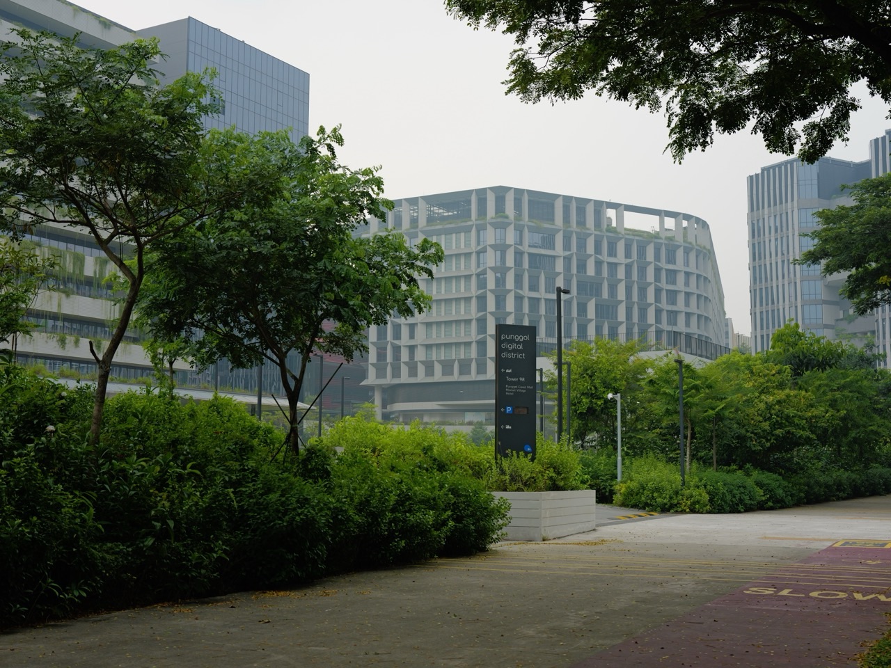
What are Punggol’s green innovations? Singapore’s first designated HDB Eco-Town combines practical features that people can see—Treelodge’s landscaped Eco-Deck, Northshore’s biodiversity habitats, the 4.2 km Punggol Waterway, Oasis Terraces’ planted public spaces and car-lite access—with infrastructure hidden inside buildings, including rainwater systems, district cooling and the solar-and-battery smart grid at Punggol Digital District. There are also larger environmental links, such as the existing trees retained along Punggol Heritage Trail and Lorong Halus Wetland across the reservoir. This guide explains the actual systems, their locations and what their announced benefits do and do not prove.
Punggol was designated Singapore’s first Eco-Town in 2010. HDB calls it a living laboratory because ideas tested in real homes and neighbourhoods can inform how towns are designed later. The newest developments add a broader economic district, university campus and digital infrastructure, creating opportunities to improve resource management at scale. That makes Punggol interesting for parents, students, residents and anyone curious about cities. You can understand the technology without being a scientist, provided you keep completed facilities, pilots, future targets and measured operating results separate.
These are unranked innovations and named examples, not a quality contest. Some are components of the same HDB development or Digital District because they solve genuinely different problems. An environmental feature is not automatically an open tourist attraction: carpark plant rooms, solar roofs, research systems, gardens inside secure residential estates and maintenance corridors have access rules. Enjoy the visible public realm and learn about the underlying engineering from the official authority’s descriptions.
Punggol’s green innovations at a glance
The directory groups systems by the setting where they belong. A green roof manages shade and landscape, while a smart grid manages electricity; a neighbourhood path supports everyday journeys, while a wetland protects a reservoir. None of those improvements can fairly be compared with a single rating score. Click each feature to see what it does, how to understand it and where the official sources place boundaries on claims.
| Innovation or feature | Where it belongs | Environmental function | Evidence / status |
|---|---|---|---|
| Treelodge@Punggol’s Eco-Deck and naturally ventilated podium | Treelodge@Punggol, near Punggol Road / Punggol Place | Housing layout, shade and natural airflow | Completed HDB eco-precinct |
| Treelodge’s rainwater harvesting, efficient lighting and regenerative lifts | Treelodge@Punggol, common-area infrastructure | Water reuse and energy demand in everyday housing | Installed building systems described by HDB |
| Punggol Northshore’s biophilic town planning | Punggol Northshore district | Sun, breeze, vegetation, bird and insect habitats | HDB district planning and completed landscaped habitats |
| Northshore’s smart parking, lighting and estate sensors | Punggol Northshore residential precincts and selected parking areas | Sensors to support resource-efficient estate management | Documented test-beds and smart-planning features; deployment varies |
| Northshore Plaza’s open-air design and community spine | Blocks 407 and 418 Northshore Drive | Naturally ventilated connections, green common space and mobility | Completed HDB neighbourhood centre, opened July 2022 |
| Oasis Terraces’ planted gardens and mixed-use neighbourhood centre | 681 Punggol Drive near Oasis LRT | Integrated greenery, community plazas and everyday services | Completed New Generation Neighbourhood Centre |
| My Waterway@Punggol’s freshwater and green corridor | 4.2 km waterway through Punggol town | Freshwater landscape, ecological planting and active lifestyles | Completed landmark, with ongoing public maintenance |
| Punggol Digital District’s passive building orientation | Punggol Digital District business park and SIT campus | Daylight, sun-shading, airflow and building massing | Built district designed under JTC and URA sustainability guidance |
| District cooling that serves multiple Punggol Digital District buildings | Shared central cooling infrastructure for JTC and SIT precincts | Efficient cooling through shared chilled-water plants | District system built by ENGIE; published energy benefits are estimates at development scale |
| The solar-and-battery smart grid at Punggol Digital District | PDD rooftop solar and district-level electrical infrastructure | Solar power, battery storage and demand management | JTC appointed an operating consortium; performance targets should not be treated as achieved results |
| The Open Digital Platform and data-driven estate management | Punggol Digital District estate operations | Using building data to reduce waste and manage operations | Digital infrastructure for district-wide integration and ongoing improvement |
| Circular waste handling and rainwater reuse in the Digital District | Business park and wider Punggol Digital District utilities | Reducing waste and reusing resources within the district | Design and operating programme with published recycling targets |
| Mass-engineered timber and lower-carbon construction at PDD | Punggol Digital District commercial precinct | Reducing embodied environmental impact of building materials | Built specialised structure within the district |
| The Punggol Heritage Trail’s retained trees and coastal habitat | Punggol Digital District, from Punggol North Avenue towards Campus Boulevard | Protecting existing landscape and supporting local biodiversity | First 400 m publicly opened August 2025; further sections staged |
| Car-lite access through Punggol Coast MRT and cycling paths | Punggol Coast MRT and the PDD public walking/cycling network | Reducing dependence on short car trips | Public MRT connection in use; other precinct routes continue to develop |
| Punggol Green and the shared amenities of One Punggol | 1 Punggol Drive, next to One Punggol community hub | Green social infrastructure and reducing unnecessary cross-town trips | Completed civic hub and linear green park |
| Lorong Halus Wetland’s engineered nature-based treatment | Eastern bank of Serangoon Reservoir, across from Punggol | Protecting reservoir water near a former landfill | Established PUB wetland; nearby but not inside Punggol town |
Want a short visit rather than a technical reading session? Start with HDB’s Explorer Trail around Treelodge and Punggol Waterway, or the public areas near Northshore Plaza. For Punggol Digital District, JTC’s community and Heritage Trail guide is a good starting point. Both routes help connect the explanations to places people can genuinely reach, without promising entry to technical plant rooms, residences or private research spaces.
The green features and how they work
Treelodge@Punggol
Treelodge@Punggol’s Eco-Deck and naturally ventilated podium
Location: Treelodge@Punggol, near Punggol Road / Punggol Place. Status: Completed HDB eco-precinct. What it addresses: Housing layout, shade and natural airflow.
What is innovative? Treelodge@Punggol was HDB’s first eco-precinct and a Green Mark Platinum project. An ordinary podium carpark becomes part of the environmental design. HDB explains that its taller-than-usual carpark ceiling helps heat dissipate and improves ventilation and light, while the carpark’s configuration allows the residential towers to stand farther apart for cross-ventilation. The building geometry matters: where blocks sit, how air moves and where heat accumulates influence everyday comfort without needing a new gadget in every home.
Look for the Eco-Deck and Green Spine. The carpark roof is used as landscaped activity space, with greenery linking facilities within the estate and moderating glare and heat. A landscaped deck can serve residents and soften hard building surfaces, though it should not be described as cooling the entire town by a measured number of degrees. The green roof is part of an HDB residential precinct, not a tourist rooftop with unrestricted entry. Follow the publicly signed HDB Explorer Trail and respect estate gates, service spaces and residents’ privacy.
Why should a family care? Passive design is the environmental improvement you can sometimes feel before you notice the equipment: a sheltered path, more daylight, a breeze between buildings or a comfortable meeting area. A child can compare a shaded footpath with an exposed paved space and ask why both feel different. The answer involves surfaces, air movement, time of day and weather, not just whether there are many trees. The design lesson is useful for understanding homes and city planning far beyond this one development.
Official source: the managing authority’s explanation. Related local reading: the detailed eduKatePunggol guide.
Treelodge’s rainwater harvesting, efficient lighting and regenerative lifts
Location: Treelodge@Punggol, common-area infrastructure. Status: Installed building systems described by HDB. What it addresses: Water reuse and energy demand in everyday housing.
The less visible innovation is in building operations. HDB identifies a rainwater collection system at Treelodge that stores water for common corridor washing and irrigating plants. It also describes regenerative lifts, energy-saving common-area lighting and rooftop solar-photovoltaic features in the wider Treelodge sustainability programme. These systems show that reducing a building’s environmental impact is not only about planting a garden: the daily use of water, lighting and lift machinery can be redesigned.
Rainwater collection is not drinking-water production. The HDB Explorer Trail identifies non-potable purposes such as washing and irrigation. Visitors should not assume that harvested water is suitable for human consumption or that the estate is independent of Singapore’s national water supply. Similarly, a regenerative lift can recover energy in certain operating conditions, but it does not mean the lift generates all the electricity it needs. The value lies in reducing demand over repeated ordinary operations.
Make the idea concrete. A student could estimate how many litres are used for cleaning over a month, then ask which activities could safely use harvested rainwater instead of high-quality potable supply. The arithmetic can be useful, but a reader should not invent Treelodge’s actual water-savings total without measurement. The design is an opportunity to discuss resource efficiency; its maintenance records and operating performance remain the responsibilities of building managers. Do not enter private plant rooms or water tanks to investigate.
Official source: the managing authority’s explanation. Related local reading: the detailed eduKatePunggol guide.
Punggol Northshore
Punggol Northshore’s biophilic town planning
Location: Punggol Northshore district. Status: HDB district planning and completed landscaped habitats. What it addresses: Sun, breeze, vegetation, bird and insect habitats.

What does “biophilic” mean in an HDB town? Punggol Northshore was the first district in Punggol to use HDB’s Biophilic Town Framework. HDB describes environmental simulations used to orient housing blocks and maximise wind flow while minimising heat from the sun. Greenery and terrain features are planned to improve comfort and support habitats rather than added only as decoration after buildings are constructed. The Northshore landscape becomes part of the neighbourhood’s infrastructure for people and biodiversity.
Look for the ecological connections. HDB’s official explanation identifies butterfly gardens, dragonfly ponds and bird sanctuaries as examples of habitats designed with local flora and fauna in mind. Residents may spot butterflies or dragonflies during ordinary walks, but wildlife sightings are not guaranteed and not all habitat spaces are intended as visitor attractions. Stay on permitted public paths. A planted habitat needs time, maintenance and protection from disturbance to work; trampling through it for a photograph undermines the purpose.
The lesson for families: It is possible to think about building placement, landscape planting and public routes as one environmental system. A child can identify where sun strikes in the late afternoon, where airflow seems stronger and which plants attract insects without collecting or disturbing animals. The aim is to understand what planners considered, not to claim that every part of Northshore has the same temperature or that greenery makes outdoor play safe during thunderstorms or unhealthy air quality.
Official source: the managing authority’s explanation. Related local reading: the detailed eduKatePunggol guide.
Northshore’s smart parking, lighting and estate sensors
Location: Punggol Northshore residential precincts and selected parking areas. Status: Documented test-beds and smart-planning features; deployment varies. What it addresses: Sensors to support resource-efficient estate management.
Digital systems can have a physical environmental purpose. HDB says Punggol Northshore was selected in 2014 as a first district for smart-public-housing test-beds, including parking-demand monitoring, sensor-equipped common-area lighting and smarter waste-management arrangements. Its Parking@HDB report describes camera-based vehicle recognition and bay-availability indicators piloted at Northshore Residences I and II. These systems are intended to help operations use resources more efficiently and reduce unnecessary manual processes.
Keep pilot, rollout and availability separate. A pilot parking arrangement in particular blocks does not mean every carpark in Punggol uses identical hardware in October 2026. A proposed smart-waste approach does not prove an individual chute currently operates as described in an earlier concept report. Equipment may be replaced or adapted. For parking charges, access and enforcement, use today’s site signage and HDB’s actual service instead of relying on a technology article written at a pilot stage.
What can students learn? A sensor-based light can respond to use rather than illuminate an empty space at full demand throughout the day. A parking system can collect occupancy information to inform management decisions. But more data is not automatically an environmental benefit: measuring something is useful only if the decision that follows actually improves efficiency or service. Ask what is being measured, what action changes because of it, and how reliability and privacy are safeguarded.
Official source: the managing authority’s explanation. Related local reading: the detailed eduKatePunggol guide.
Northshore Plaza’s open-air design and community spine
Location: Blocks 407 and 418 Northshore Drive. Status: Completed HDB neighbourhood centre, opened July 2022. What it addresses: Naturally ventilated connections, green common space and mobility.

Sometimes the green feature is how a building is connected. HDB describes Northshore Plaza as its first seafront New Generation Neighbourhood Centre within an HDB estate. Blocks 407 and 418 Northshore Drive form the retail precinct, and a naturally ventilated community spine connects nearby homes, Samudera LRT, the common green and Punggol Promenade. That helps residents link shopping, food and an outdoor waterfront break without designing a completely separate car journey for every small errand.
Notice ventilation, daylight and public walking space. An open-concept centre can bring air and light into circulation areas while integrating planted spaces. It is not the same thing as saying every shop is naturally cooled; enclosed retail and dining spaces may still use mechanical air conditioning. The useful environmental question is how much of the everyday route can remain comfortable and efficient, including access to shops, lifts and public transport. A shade-providing path matters because people actually use it.
Look at the two-block geography. Plaza I is at Block 407 and Plaza II at Block 418. A shopper may cross between them, and the public promenade adds another possible direction, but it is important to know the precise destination rather than wander through residential areas. HDB’s town guide describes the infrastructure, not the opening hours of every current tenant. Stay on public paths, follow maintenance notices and do not assume the entire waterfront route is covered or free of all stairs.
Official source: the managing authority’s explanation. Related local reading: the detailed eduKatePunggol guide.
Oasis Terraces
Oasis Terraces’ planted gardens and mixed-use neighbourhood centre
Location: 681 Punggol Drive near Oasis LRT. Status: Completed New Generation Neighbourhood Centre. What it addresses: Integrated greenery, community plazas and everyday services.
Oasis Terraces shows how daily errands and greenery can overlap. HDB developed the centre at 681 Punggol Drive with shops, food, public services, a polyclinic, childcare and terraces overlooking Punggol Waterway. Landscaped areas and outdoor community spaces make it more than a retail container. A resident can visit nearby services and enjoy a short green break without organising a separate drive to a major park. That combination of local services, transit and public landscape matters for a town whose households may have young children or older relatives.
The terraces are part of the neighbourhood identity. A visitor can notice the relationship between open courts, planting, views towards the waterway and the ordinary movement of shoppers or patients. For a school-aged child, the design presents a useful observation task: where are public spaces shaded, where do people naturally stop, and how does greenery change the experience of a busy building? Do not infer that a green-looking space automatically provides safe access to every level. Follow the actual lift and public-route guidance.
Distinguish planned facilities from live operation. HDB’s original descriptions included a water-play facility, but current local reports indicate the upper-level water feature has had an extended closure. This guide does not advertise it as currently operational. The gardens and dry public areas are different from the wet-play service, and a polyclinic has healthcare rules distinct from shop hours. If a specific feature is the reason for a family trip, confirm its current availability directly with the managing agent before leaving.
Official source: the managing authority’s explanation. Related local reading: the detailed eduKatePunggol guide.
Around Punggol
My Waterway@Punggol’s freshwater and green corridor
Location: 4.2 km waterway through Punggol town. Status: Completed landmark, with ongoing public maintenance. What it addresses: Freshwater landscape, ecological planting and active lifestyles.

The most visible eco-town innovation is the waterway itself. HDB designed and built a 4.2-kilometre man-made waterway through Punggol, connecting the two reservoirs formed from Sungei Punggol and Sungei Serangoon. The waterway shaped waterfront public housing and introduced landscaped public routes that residents use for exercise, recreation and ordinary journeys. HDB’s Explorer Trail identifies freshwater mangroves and reused materials in the design, alongside bridges that make local heritage visible. It is an example of water infrastructure becoming part of a town’s everyday identity.
Look beyond the pretty reflections. Rain, drains, reservoirs, planting and public paths form a linked urban environment. A child can ask where runoff comes from after a tropical downpour, what role plants play near the banks, and why people should not enter the water. An important distinction is that attractive landscaping does not mean the canal is a free swimming area. NParks prohibits fishing in Punggol Waterway Park. The waterway is not a public playground pool; wildlife, water quality and flood safety must be respected.
Use a small section to understand a large system. A family can begin near Punggol MRT or One Punggol, walk to a public bridge, and compare planted and hard-edged areas. This is much easier than attempting the entire park connector. The 4.2-kilometre waterway length is not the same as the 8.4-kilometre named Waterway Park Connector route along its banks. A visitor planning exercise should choose the actual path length and a comfortable return point rather than confusing the civil engineering feature with a walking itinerary.
Official source: the managing authority’s explanation. Related local reading: the detailed eduKatePunggol guide.
Punggol Digital District
Punggol Digital District’s passive building orientation
Location: Punggol Digital District business park and SIT campus. Status: Built district designed under JTC and URA sustainability guidance. What it addresses: Daylight, sun-shading, airflow and building massing.

Buildings can reduce energy needs before an air conditioner is switched on. JTC says advanced environmental simulations informed the orientation and shape of Punggol Digital District buildings to improve natural light, limit solar heat gain and support airflow. URA’s urban design guidance also emphasises greenery, the existing undulating topography, waterfront views and a pedestrian-friendly public realm. These features are examples of passive design: the physical architecture helps shape comfort rather than asking technology alone to solve heat and lighting demands.
Do not confuse simulation with a guaranteed temperature. A model can guide good decisions about massing, shade or airflow, but weather, occupancy and operation will affect the experience. A sunny plaza at midday will not automatically feel cool simply because the district has a Green Mark award. Likewise, a naturally ventilated public corridor may lead into an air-conditioned shop or university building. The environmental value is a thoughtful mix of passive and mechanical strategies, not a promise that no energy will be needed.
For students, the district is an observation prompt. Compare a shaded walkway with an exposed path, then look at building setbacks and planted decks from publicly accessible space. Ask which surfaces receive the strongest sun and why a plaza needs shade. URA’s current guidelines help explain the planning intention, while JTC’s pages describe the broader district. Do not enter non-public SIT teaching areas or office premises to inspect design features; the visible public architecture is already enough for a useful field note.
Official source: the managing authority’s explanation. Related local reading: the detailed eduKatePunggol guide.
Around Punggol
District cooling that serves multiple Punggol Digital District buildings
Location: Shared central cooling infrastructure for JTC and SIT precincts. Status: District system built by ENGIE; published energy benefits are estimates at development scale. What it addresses: Efficient cooling through shared chilled-water plants.
Why share the air-conditioning infrastructure? Ordinary buildings may each maintain large sets of cooling equipment. A district cooling system instead produces chilled water centrally and distributes it through a network of insulated pipes to connected users. JTC describes Punggol Digital District’s ENGIE-designed, built and operated system, including underground plant space and links to offices, the SIT campus, shops and community facilities. The system can make energy management more efficient across multiple buildings and leave more rooftop space for greenery or other uses.
Read the headline figures correctly. JTC’s published engineering material says district cooling has the potential to reduce energy consumption by up to 30% compared with standard commercial buildings and reduce carbon dioxide emissions by an estimated 3,700 tonnes annually at full development. These are design-level estimates using particular assumptions, not measured savings for every tenant in October 2026. As the district opens in phases, demand, plant operation and performance reporting may differ from the headline scenario.
A practical comparison: Imagine several buildings sharing a piece of equipment rather than each buying and running a complete independent system. The benefit depends on combined demand, efficient technology, effective controls and maintenance. District cooling is interesting because it works at neighbourhood scale: one building’s cooling requirements become part of a shared operational problem. Visitors need not see the equipment to understand the idea. Do not enter plant rooms or underground service corridors; use JTC’s published diagrams for the technical explanation.
Official source: the managing authority’s explanation. Related local reading: the detailed eduKatePunggol guide.
Punggol Digital District
The solar-and-battery smart grid at Punggol Digital District
Location: PDD rooftop solar and district-level electrical infrastructure. Status: JTC appointed an operating consortium; performance targets should not be treated as achieved results. What it addresses: Solar power, battery storage and demand management.

A smart grid is more than a row of solar panels. JTC appointed Univers and PacificLight to develop the district-level system integrating rooftop solar photovoltaic panels, a battery energy-storage system, real-time monitoring and connections to the Open Digital Platform. Solar energy varies with sunlight, while users need electricity at different times. Storage, forecasts and smart controls can help balance this changing supply and demand. JTC describes the project as Singapore’s first district-level smart grid, aimed at testing solutions in a real mixed-use business environment.
What the published numbers actually mean: JTC projects rooftop solar generation of about 3,000 megawatt-hours annually and estimates a 1,700-tonne carbon-emissions reduction associated with the smart grid. Those are forecasts or design estimates in the relevant announcement, not a live public dashboard proving the same performance for every completed calendar year. They also cannot be applied directly to an individual HDB household’s electricity bill. The local value is understanding how generation, batteries and changing demand interact at district scale.
Make the science approachable: A student can draw a simple curve showing solar generation rising around midday and falling towards evening while electricity demand follows a different pattern. What happens when both curves do not line up? A battery can move some available energy across time, but storage has finite capacity and efficiency losses. The goal is better system management, not infinite renewable power. This is an excellent example of how school Physics, Mathematics and computing connect to a real Punggol project.
Official source: the managing authority’s explanation. Related local reading: the detailed eduKatePunggol guide.
The Open Digital Platform and data-driven estate management
Location: Punggol Digital District estate operations. Status: Digital infrastructure for district-wide integration and ongoing improvement. What it addresses: Using building data to reduce waste and manage operations.
The most important green feature may be the one you cannot see. JTC’s Open Digital Platform is intended to integrate information from multiple building and estate systems. Cooling, lighting, energy use, security and logistics can otherwise be managed in isolated silos, each with a limited view. The platform enables joined-up monitoring and new optimisation tools, including digital-twin models that can test operational scenarios. A design that joins data across a district can uncover energy or maintenance opportunities that one building would not notice on its own.
Data collection is a means, not the final result. It is easy to say that AI will save energy, but the important steps are measurement, a defensible analysis, an operational decision and evidence that the change improved performance. For example, a control system might reduce lighting or cooling in suitable unoccupied spaces. The savings depend on the actual occupancy and equipment and must preserve safety and comfort. JTC’s published goal of lower energy use should not be described as a proven percentage for every future tenant without reporting.
What might students investigate? They can begin with fictional or authorised example data rather than private building sensor feeds: compare demand during school hours and evening hours, look for unexpected peaks and discuss what additional measurements would help. The idea of a digital twin raises interesting questions about model error, privacy, cybersecurity and responsible automated control. Only authorised systems and datasets should be used. Public visitors do not gain permission to access private operational dashboards merely because the district is called a living laboratory.
Official source: the managing authority’s explanation. Related local reading: the detailed eduKatePunggol guide.
Circular waste handling and rainwater reuse in the Digital District
Location: Business park and wider Punggol Digital District utilities. Status: Design and operating programme with published recycling targets. What it addresses: Reducing waste and reusing resources within the district.
Why is waste management an innovation? A busy district produces food scraps, horticultural trimmings and other waste alongside normal retail activity. JTC describes a pneumatic waste conveyance system to automate parts of collection and support resource-efficient operations. It also identifies biodigester technology for organic material and a programme aiming to convert food and horticultural waste into fertiliser. This goes beyond putting a decorative recycling symbol on a bin: collection, treatment and reuse all have to be designed into a working process.
Targets are not achievements. JTC’s published 100% food-and-horticultural-waste recycling goal is an aspiration for the district. An actual year’s performance would depend on participating tenants, source separation, contamination, plant capacity and reporting. It would be misleading to tell readers that every scrap produced by every shop is already recycled. The same caution applies to rainwater harvesting and irrigation initiatives: having a designed water-reuse route does not mean the district produces drinking water or no longer depends on the public network.
Bring the idea home thoughtfully. For a household, the first questions are what can be avoided, what can be reused and which materials go into the proper collection system. Food scraps and packaging are not the same waste stream. The town’s industrial-scale biodigester and pneumatic systems are not instructions for residents to put arbitrary food waste into recycling chutes. Check NEA and HDB’s current disposal guidance for household behaviour. Learning about circularity should make sorting more accurate, not create contamination through good intentions.
Official source: the managing authority’s explanation. Related local reading: the detailed eduKatePunggol guide.
Mass-engineered timber and lower-carbon construction at PDD
Location: Punggol Digital District commercial precinct. Status: Built specialised structure within the district. What it addresses: Reducing embodied environmental impact of building materials.

Sustainability starts before a building opens. JTC identifies an eight-storey building in Punggol Digital District that uses mass-engineered timber. Engineered timber can offer a different approach to structural construction, with possible embodied-carbon benefits depending on sourcing, manufacturing, design and the building’s whole life cycle. The point is not simply to choose a material that looks natural. Embodied carbon describes emissions associated with producing and constructing the physical building, as distinct from the energy used to operate it later.
One green material does not settle the whole environmental picture. Buildings combine foundations, fire protection, acoustic design, mechanical systems, waterproofing, interior works and ongoing maintenance. A claim about one construction product’s emissions cannot automatically be applied to an entire building without the correct assessment boundary. JTC describes the timber project as part of the district’s broader Green Mark Platinum programme; readers should treat specialist comparative percentages as scenario-specific until they consult the original lifecycle assessment.
An observation for older students: Compare operational energy savings with embodied-carbon savings. A building can be efficient to cool and still consume resources during construction; another can have a lower-carbon structure but use more electricity in operation. Sustainable design tries to consider both across the building’s life. Visitors can learn this distinction from JTC’s published material without needing to enter construction areas or claim that every timber-looking façade is structural timber.
Official source: the managing authority’s explanation. Related local reading: the detailed eduKatePunggol guide.
The Punggol Heritage Trail’s retained trees and coastal habitat
Location: Punggol Digital District, from Punggol North Avenue towards Campus Boulevard. Status: First 400 m publicly opened August 2025; further sections staged. What it addresses: Protecting existing landscape and supporting local biodiversity.
New development does not always require a completely new landscape. The Punggol Heritage Trail preserves elements of Old Punggol Road’s undulating ground and older vegetation while integrating new paths and interpretive signage. NParks and JTC opened the first 400-metre section in August 2025, with more than a kilometre of meandering walking paths inside that opened area. The planting palette includes species associated with the original coastal forest and kampong landscape. This makes the trail a meeting point between memory and biodiversity rather than merely another exercise track.
Look for the difference between old and new growth. Retained mature trees may provide shade and ecological continuity that small replacement saplings need years to develop. Native coastal species can support certain local wildlife and connect the landscape to Punggol’s pre-development habitats. A child can compare bark, leaf patterns and where plants thrive, using interpretive signs rather than picking flowers or collecting seed pods. The trail is an opportunity to appreciate conservation in a lived-in district, not permission to enter fenced habitat plots.
Remember the opening stage. JTC’s community page still confirms the first 400 metres as the publicly open portion, while the future 1.3-kilometre connection is a phased development. The project has published target completion dates for further sections, but a target is not proof that a gate has opened. Punggol Point Park is separately closed for upgrading. Follow current public signs and avoid assuming the whole green corridor is continuous through work sites. An informative short walk is better than crossing a temporary barrier to complete a line on a map.
Official source: the managing authority’s explanation. Related local reading: the detailed eduKatePunggol guide.
Car-lite access through Punggol Coast MRT and cycling paths
Location: Punggol Coast MRT and the PDD public walking/cycling network. Status: Public MRT connection in use; other precinct routes continue to develop. What it addresses: Reducing dependence on short car trips.

A green building is less useful if every visitor must drive to it. URA describes Punggol Digital District as a public-transport-oriented, walkable and cycling-friendly district. Its planning guidelines call for integrated paths, pedestrian links and connections with the surrounding waterfront and green networks. Punggol Coast MRT puts a North East Line station at the district, distinct from Punggol MRT near Waterway Point and One Punggol. That distinction matters both for visitors and for residents considering how often they can use the area without a car.
Walking needs thoughtful design, not just a line on a map. Paths must connect to real entrances, safe crossings, public space and somewhere useful to reach. Cycling infrastructure also has to work with pedestrians, users of mobility aids and people arriving with children. A person deciding whether to walk to lunch or drive needs to consider distance, shade, weather, route continuity and return carrying belongings. A connected but exposed or confusing route may be less attractive than the planning diagram suggests, which is why onsite experience matters.
Do not confuse “car-lite” with a ban on all vehicles. The district still needs deliveries, accessible drop-off, emergency services and some parking. The idea is to make alternatives easy and sensible for many everyday trips. Use official public transport information and current route notices rather than assuming every footbridge and future Heritage Trail section is accessible now. Sharing narrow paths safely with cyclists and walkers is part of making low-car travel a practical town habit.
Official source: the managing authority’s explanation. Related local reading: the detailed eduKatePunggol guide.
One Punggol
Punggol Green and the shared amenities of One Punggol
Location: 1 Punggol Drive, next to One Punggol community hub. Status: Completed civic hub and linear green park. What it addresses: Green social infrastructure and reducing unnecessary cross-town trips.

Sustainability also depends on how people use their town. The People’s Association describes Punggol Green as a 12,000-square-metre linear park alongside One Punggol, with children’s play, older-adult fitness corners and basketball areas. The integrated hub brings the Regional Library, community club, hawker centre and civic services into a shared location. This is a different innovation from a solar panel or a sensor: a town that places useful services together can make everyday travel more convenient and support social connection across generations.
Co-location has practical value. A parent can combine a library visit with community enquiries and a meal, while older relatives may use nearby green space at their own pace. Several organisations can also coordinate services more easily when they share a place. That does not mean every errand eliminates a car journey or that all facilities open at identical hours. The actual environmental effect depends on how residents travel and use the services. The PA’s description is an explanation of design intention, not a calculated household-emissions saving.
Try an ordinary outing as a lesson in sustainable living. Instead of a special trip, use an existing library or community commitment to take a short public walk or share a meal. Ask whether placing services close together changed how the family travelled today. Respect the age guidance for playgrounds, the rules of sports courts and the boundaries of community gardening areas. A pleasant, repeatable short journey shows why sustainability often depends on the small choices people can actually maintain.
Official source: the managing authority’s explanation. Related local reading: the detailed eduKatePunggol guide.
Lorong Halus Wetland
Lorong Halus Wetland’s engineered nature-based treatment
Location: Eastern bank of Serangoon Reservoir, across from Punggol. Status: Established PUB wetland; nearby but not inside Punggol town. What it addresses: Protecting reservoir water near a former landfill.
A neighbouring water-management innovation worth understanding. PUB operates Lorong Halus Wetland on the eastern bank of Serangoon Reservoir, outside Punggol’s actual town boundary but accessible from the wider Punggol area by public connections. The site treats water passing through the former landfill before that water can affect the reservoir. Wetland plants and designed treatment systems help protect a resource that Singapore depends on. This is not just a scenic red-bridge photo stop; it is an example of environmental repair and infrastructure working together.
What makes the system educational? The former waste-disposal area’s history explains why potential contaminants still require attention. PUB’s learning trail introduces water sustainability, treatment stages, bioengineering methods and local biodiversity. A student can ask what enters the system, what has to be removed or reduced, and how the treated flow relates to the reservoir. The wetland is not a drinking fountain or a place for unsupervised water sampling. Do not enter reed beds, service structures or areas closed for maintenance.
Check access before making a longer field trip. The pedestrian red bridge, wetland paths and Lorong Halus Park Connector are different assets. NParks has advertised partial connector diversions related to MRT works, so an old cycling map cannot guarantee an uninterrupted route. PUB’s visitor guidelines also identify lightning-warning signals and safety rules. Use the public paths, give wildlife space and distinguish this nearby site from Punggol Waterway Park itself. The geographical distinction prevents readers from thinking it is another HDB estate feature in central Punggol.
Official source: the managing authority’s explanation. Related local reading: the detailed eduKatePunggol guide.
The difference between a green claim and a verified result
A completed building does not prove a published energy target
Punggol Digital District may display completed façades, retailers, a university campus and landscaped public routes, but different systems can be commissioned or occupied in stages. JTC’s targets for solar generation, district-cooling savings and waste recycling should be read together with their stated assumptions and dates. A percentage “up to” is a potential performance ceiling within a specified comparison, not the exact result that every connected building has already achieved. If you see one large numerical claim repeated elsewhere, ask whether it is a design estimate, an annual reporting figure or a measured result.
The baseline matters. Saying a district is 30% more efficient than a standard commercial building is meaningful only if the comparison uses a consistent definition of energy and similar service levels. Changes in weather, occupancy, hours and equipment all affect outcomes. It is possible for a green building to have an excellent design and still require thoughtful operations and maintenance. That is why the authority’s current reporting is stronger evidence than an image of a green rooftop.
An eco-town is not a place with zero environmental impact
Punggol still uses electricity, water, materials, transport, waste disposal and land. The designation Eco-Town describes a programme to reduce impacts and test better systems; it is not a guarantee that the town produces no emissions or imports no resources. Even renewable-energy equipment has material requirements and finite output. A wetland can protect a reservoir without making the water automatically safe to drink at the site. Green infrastructure is about reducing pressure and designing better outcomes, not escaping basic physical limits.
The term “sustainable” also includes how a place works for people. A public transport connection that residents can actually use and a shaded walking route near daily services can shape travel habits. A cool, accessible community centre supports people of different ages. The environmental story becomes stronger when infrastructure works together rather than when every place advertises the same slogan.
Pilot, operating system and future proposal are three different statuses
HDB’s Northshore report on smart parking describes an actual piloted system, while older masterplan material described other smart-estate features to be tested. Those are not identical evidence. Likewise, JTC’s Digital District cooling and grid announcements include built plant descriptions and published future performance goals. A family reading a 2024 article should not automatically assume every proposed function is complete throughout the district in 2026. Look for current completion, commissioning and ongoing operation notes before repeating a status claim.
Punggol Heritage Trail is a useful example. JTC confirms its first 400 metres open from August 2025, with additional work staged towards a longer future route. That is more useful to a visitor than telling them simply that the entire 1.3-kilometre trail exists. NParks has also closed Punggol Point Park for upgrading, so green paths on old maps may no longer form an uninterrupted route. Clear, dated access facts are part of honest sustainability communication.
A publicly visible eco-feature is not unlimited public access
People can enjoy Punggol Waterway Park, public portions of Punggol Digital District and the open community corridors in the housing estates. That does not provide access to residents’ secure corridors, rooftops, solar-power plant areas, lift controls, university facilities or district cooling tunnels. A school project about renewable energy can be completed through official technical material and observations from a public path. No learning goal justifies entering a fenced construction or service area.
Visitors should also avoid treating planted habitats as outdoor classrooms that can be entered freely. Dragonfly ponds, butterfly gardens and wetland reed beds work because vegetation and wildlife can establish themselves without continual disturbance. Observe from the permitted route and record what you can verify rather than manipulating the ecosystem for a photograph or experiment.
A simple field trip for families and students
HDB Explorer Trail: building design and the waterway
Use HDB’s official Explorer Trail to learn about Treelodge’s eco-precinct design and the waterway near the town centre. Begin with the map, select a sensible starting point and stay on public routes. At Treelodge, examine how planted common areas connect with homes and roads. At the waterway, compare planted banks and footpaths. The design question might be: what parts of this environment use physical layout to make the town more comfortable?
A child could make a two-column note headed “What I can observe” and “What the authority explains”. For example, greenery on a carpark roof is directly visible if the public path allows a view, while the precise operation of the rainwater tank is learned from HDB’s published document. Distinguishing observation from source-based explanation avoids treating a guess as a fact. The family need not enter residential facilities to understand the main idea.
Northshore: nature and everyday circulation
Use the public approaches around Samudera LRT and Northshore Plaza to observe the community spine, naturally ventilated links and planted surroundings. HDB’s biophilic description helps explain why breeze, planting and habitat are considered together in the district. Make the route short enough for children and people who need breaks. Do not enter bird-sanctuary areas, private housing corridors or maintenance spaces.
Ask which design features make walking or shopping easier than on an exposed route. A child might notice tree cover, openings that allow air movement or the location of public seating. These are grounded observations. A photograph of one plaza cannot prove overall energy savings; it can illustrate where sustainable design decisions appear in daily life.
Punggol Digital District: three layers of sustainability
Begin at Punggol Coast MRT and use JTC’s public wayfinding to understand how the district is laid out. From publicly accessible paths, look at buildings, planted spaces and transport connections. The visible layer is passive architecture and landscape. The less visible layer is district-scale cooling, solar and storage. The data layer is the Open Digital Platform that supports coordinated operations. Explaining these layers separately helps students see why one smart building does not make a fully sustainable town on its own.
The currently open section of Punggol Heritage Trail offers a separate opportunity to think about retained trees and the older landscape. Do not assume the whole future connection is open, or treat private university teaching spaces as public study rooms. Finish by recording three claims from JTC, labelling each as a confirmed feature, a stated design aim or a forecast benefit. This is a straightforward way to practise scientific literacy.
Lorong Halus: water quality and geographic accuracy
Lorong Halus Wetland is an optional separate outing across Serangoon Reservoir. PUB explains how the engineered wetland protects the reservoir near a former landfill. Choose the current publicly open access route and check NParks’ connector diversions before travelling. At the wetland, observe the public water-treatment landscape without entering reed beds or disturbing birds.
Ask what a wetland must do before water can safely enter the reservoir and why even a former waste site may require ongoing monitoring. A good Science learning journey is clear about location: Lorong Halus is nearby, not inside Punggol’s administrative town boundary. Families with toddlers may prefer a shorter urban green route instead.
Questions people ask about Punggol’s sustainability
Why is Punggol called Singapore’s first Eco-Town?
HDB says Punggol was designated Singapore’s first Eco-Town in 2010 and used to test sustainable housing and town-planning ideas. Treelodge@Punggol was an early eco-precinct, while Northshore later became an important smart and biophilic district. The designation describes a development and learning programme rather than a claim of zero environmental impact.
What is Treelodge@Punggol’s Eco-Deck?
It is a landscaped activity space above the precinct’s podium carpark. HDB explains that the Green Spine links amenities and that planting helps moderate glare and heat. The carpark and residential spacing also support ventilation. Treelodge remains a residential estate; stay in permitted public areas.
Does Treelodge harvest rainwater?
Yes. HDB describes a collection system used for non-drinking purposes such as common-corridor cleaning and plant watering. The system is not an independent household drinking-water supply.
What does biophilic design mean at Punggol Northshore?
HDB describes environmental modelling, wind and sun-sensitive building layouts and habitats that support birds, butterflies and dragonflies. The goal is to integrate nature with the neighbourhood, not simply decorate buildings with plants.
Are all Punggol HDB carparks smart carparks?
No such town-wide claim follows from HDB’s Northshore pilot. HDB documented a smart parking trial at Northshore Residences I and II, but individual carparks may have different equipment or current arrangements. Follow the actual site’s payment and access rules.
Is Northshore Plaza air-conditioned?
Different spaces are treated differently. HDB describes an open-concept centre and naturally ventilated community spine, but enclosed shops and restaurants can have their own mechanical cooling. Do not assume every part of the development is either outdoors or air-conditioned.
Is the 4.2-kilometre Punggol Waterway a reservoir?
HDB describes a 4.2 km man-made freshwater waterway through the town that connects two reservoir systems. It is a public landscape and water infrastructure, not a designated public swimming venue.
Is Punggol Digital District carbon-neutral?
JTC has published sustainability systems and longer-term low-carbon goals, but those should not be treated as proof that the entire district currently has zero emissions. The result depends on the definition, boundaries, occupancy and measured reporting period.
How does Punggol Digital District’s smart grid work?
JTC describes a district-level system combining rooftop solar power, battery storage, sensors and energy-management software. It is designed to coordinate supply and demand. Published emissions or generation figures should be identified as forecasts or reported performance, not assumed to apply to individual households.
Is district cooling the same as the smart grid?
No. District cooling distributes chilled water from shared central plants to buildings. The smart grid coordinates electrical resources such as solar and batteries. Data systems can connect and optimise both, but they serve distinct functions.
What does the Open Digital Platform do?
JTC’s platform joins information from different district systems so operators can monitor, model and improve estate management. It is not an invitation for public visitors to view private security, occupancy or energy data.
Does Punggol recycle all of its food waste?
JTC describes a goal of recycling all food and horticulture waste at Punggol Digital District through suitable systems. A goal is not proof that every shop or household in Punggol already achieves 100% recycling. Follow present NEA and HDB disposal instructions.
Is the full Punggol Heritage Trail open?
JTC confirms the first 400-metre section and more than a kilometre of meandering walks within that opened landscape. Later portions of the planned 1.3 km route have separate development milestones. Follow current public access notices.
Is Punggol Coast MRT part of the Eco-Town idea?
It supports a public-transport-oriented district by making the Digital District accessible without a car. URA’s guidance includes walkable and cycling-friendly links. A car-lite concept does not mean vehicles or parking are completely prohibited.
Does Lorong Halus Wetland belong to Punggol?
It is a nearby PUB wetland on the eastern bank of Serangoon Reservoir, outside the town boundary. PUB uses engineered wetland treatment to protect the reservoir from water associated with a former landfill. It is an important neighbouring environmental example.
Can students visit solar roofs or district cooling equipment?
Not without permission. Private rooftops, plant rooms and operational technology areas are not generally walk-in attractions. Use publicly accessible spaces, authorised educational programmes and the official descriptions of the infrastructure.
What are the easiest sustainability sites for a family visit?
HDB’s public Explorer Trail, Punggol Waterway Park, the public Northshore neighbourhood corridors and the currently opened section of Punggol Heritage Trail offer practical starting points. Check the weather, access rules and a comfortable route for the least mobile person.
Official references and the wider eduKatePunggol guides
Housing and neighbourhood design: HDB’s Punggol Eco-Town overview, HDB Explorer Trail and Treelodge features, HDB’s Northshore Biophilic Town Framework, HDB smart parking pilot, HDB Punggol neighbourhood-centre information and HDB’s New Generation Neighbourhood Centres. Each document has a different role; a planning milestone from 2014 should not be mistaken for live availability across every estate in 2026.
District systems: JTC Punggol Digital District sustainability, JTC and ENGIE’s district cooling explanation, JTC’s district smart-grid partnership announcement, the Open Digital Platform explanation, JTC’s circular water, waste and engineered-timber article, URA’s Punggol Digital District urban design guidance and JTC and NParks’ first-stretch Heritage Trail opening notice. These sources should be read alongside their dates when interpreting completed features, projected benefits and future paths.
Wider environmental context: NParks Punggol Waterway Park, People’s Association Punggol Green information, PUB Lorong Halus Wetland, and NParks’ current park-connector and access notices. If a special trip depends on the opening of a trail or waterfront path, current signs and notices take priority over a historical promotional diagram.
Continue with topic-specific local reading: Treelodge Eco-Precinct History, Northshore Biophilic Framework, Northshore Plaza Guide, Oasis Terraces Guide, Punggol Digital District Cooling and Smart Grid, Punggol Heritage Trail Guide, Punggol Waterway Park Guide, Lorong Halus Wetland Guide, Top 10 Parks in Punggol, and The Complete Punggol Guide. These pieces go into the particular location or system; this guide is the town-wide directory that helps readers find the right subject.
Reviewed 23 October 2026. This is an unranked explanatory directory of actual Punggol green features and a clearly labelled neighbouring PUB wetland. It distinguishes built design, documented trials and published future-performance goals. Sustainability figures depend on the source’s comparison baseline, development phase and reporting date. Buildings, plant rooms, protected habitats and restricted campuses are not public-access sites without permission.


