
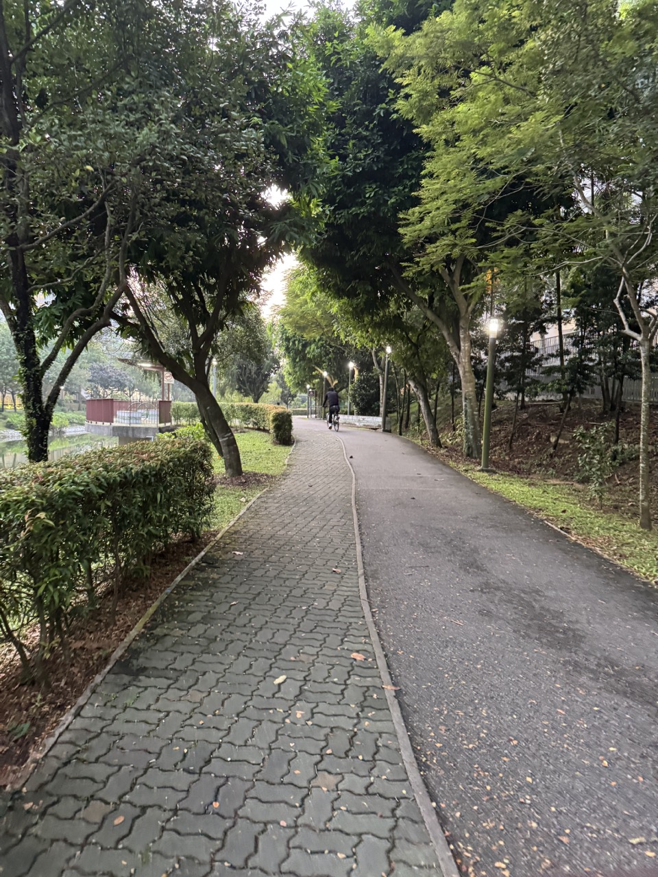
How can a family practise map-reading and beginner orienteering at Coney Island Park in Punggol? Use NParks’ current park information and a map to plan a safe, on-trail nature navigation walk, not an off-trail orienteering race. Coney Island Park is open 7am to 7pm and has two entrances: the West entrance near Punggol Point and the East entrance near Lorong Halus Wetland. Stay on designated trails, watch the time and make sure everyone knows the exit they will use. NParks provides a self-guided 3.6 km easy route with an estimated two-hour walking time, but families may choose a shorter suitable visit.
This Coney Island Map-Reading and Orienteering from Punggol 2026 guide helps parents, students, walkers and adults practise map orientation, route choice, estimating walking time, recognising habitat landmarks, using a compass or phone appropriately, planning a safe exit and observing wildlife without disturbance. It deliberately distinguishes a map-reading learning walk from competitive orienteering, which often involves navigating through terrain under different organised rules. The broader Punggol Waterway Park guide covers the urban waterway, while this page focuses on Coney Island’s protected trails and navigation literacy.
Coney Island map-reading walk: quick answers
| Question | Grounded answer | What not to assume |
|---|---|---|
| Park opening hours | 7am–7pm, according to NParks. | Not a 24-hour park or safe place after dark. |
| Where are the entrances? | West near Punggol Point; East near Lorong Halus Wetland. | Do not assume only one gate. |
| How large is Coney Island Park? | NParks lists approximately 81 hectares. | Park size is not a walking distance. |
| Is there an official walking route? | NParks recommends an easy 3.6 km route, estimated two hours. | Do not assume every visitor moves at that pace. |
| Can children practise map-reading? | Yes, under suitable supervision using designated trails. | No need to enter vegetation or compete for speed. |
| Can I go off trail to find a hidden marker? | No. NParks expressly requires visitors to stay on designated trails. | Formal off-trail orienteering methods do not override park rules. |
| Can families use wheelchairs or strollers? | NParks identifies the East and West ends as friendly to both. | Rugged sections elsewhere can be unsuitable. |
| Is this an official timed orienteering course? | No. It is a self-guided educational map-reading activity. | Do not invent an organiser, checkpoint or prize. |
| What hazards matter? | Heat, rain, lightning, mosquitoes, wildlife and closure time. | A digital map does not replace awareness and preparation. |
| What if we cannot finish the route? | Shorten the visit and use an accessible known exit. | A map exercise is successful without completing 3.6 km. |
1. A navigation lesson can be safer and more useful than a race
True sport orienteering, as described by the International Orienteering Federation, involves using a detailed map to navigate between controls, sometimes across rough terrain and often at speed. Coney Island’s conservation rules mean that format should not be improvised there. The island has valuable habitats and park trails that should not be left to chase an imagined checkpoint. Our activity is a slower introductory form of map-reading that stays where NParks permits visitors to walk.
Why teach navigation this way? Many modern residents can tap a blue dot on a map but have not learnt to understand entrances, paths, scale, direction, symbols or distance. A child who can say “We entered at the West gate, and the East gate is on the other side” is developing a usable geographical skill. An adult who can estimate the time required to return before seven is applying the same reasoning to a real wellbeing decision.
There is no need to bring a stopwatch or hide objects in nature. A family may choose three permitted observation goals from existing park features and discuss where they appear on NParks material. The exercise should remain optional and calm. If the weather is uncomfortable, a participant becomes tired or the exit looks too distant, stop and return. Safe judgement is part of successful navigation.
This is especially suitable for readers of eduKateSG’s Geography and Science materials: ideas like scale, route choice, environmental stewardship and habitat observation become meaningful when linked to an actual Punggol location. But a school-style assignment must never override the park’s wildlife protection rules.
2. The basic geography of Coney Island Park
Coney Island Park sits beside Punggol Promenade Nature Walk on Singapore’s northeastern edge. NParks’ official Coney Island park page lists the park as 81 hectares, with a West entrance near Punggol Point and an East entrance near Lorong Halus Wetland. The nearby Punggol Coast MRT station and local public transport can help visitors reach the wider area, but the final walking connection still needs to be planned.
The entrances matter more than they first appear. A visitor who enters from the west and assumes all friends will meet there may be surprised when someone else approaches from the east. A family with children can choose one entrance and agree to return there instead of attempting an island traverse. An actual safe return path is more useful than the shortest hypothetical straight line across the park.
NParks lists no carpark on the island itself, with Punggol Settlement offering the nearest parking near the West side. Bicycle parking is available at both entrances, subject to present conditions. This means the journey to the gate is part of the activity; the official self-guided trail distance does not necessarily include the walk from your home, bus stop or parking location.
Coney Island should not be confused with Punggol Waterway Park, which is a different landscaped park nearer the town’s centre. The Waterway is often used for everyday exercise; Coney Island has more rustic protected habitats, different operating hours and potentially rougher surfaces. The distinction changes how families should plan water, footwear, timing, accessibility and routes.
3. First map skill: identify the start, finish and north
Before entering, look at the park map on the official NParks page. Identify the West and East entrances, the main permitted trail and a logical return. Find the orientation arrow or north indication if the map provides one, and compare it with the actual path and landmarks. You can rotate a printed map or phone view to make the layout easier to understand, but do not let the act of using a compass distract you from the ground directly ahead.
The difference between north and “the direction I am facing” is fundamental. A map can remain north-up while a person turns around to see a bird. If a child confuses these, use a simple example: the West gate stays where it is on the map even after you turn around. Ask the child to point to the route back, then compare that with the visible path. This is a gentle form of spatial reasoning, not an outdoor examination.
Use official landmarks rather than invented treasure markers. NParks identifies West Promenade, bird hides, beaches and other features on its park information pages. These provide meaningful opportunities to identify symbols and compare map features with actual scenery, but specific side paths or features may be restricted or affected by maintenance. Follow on-site signs rather than assuming every map item is open for access.
4. Distance, scale and the trap of measuring straight lines
A map scale helps estimate distance, but a route may curve, detour around protected areas or be longer than the apparent straight-line separation between two points. A beginner should learn to trace the permitted path, not draw a direct line through vegetation. Coney Island is a conservation park; the straightest line is not an invitation to leave the trail.
NParks’ self-guided walking page describes a recommended 3.6 km route with an estimated two-hour duration. That example averages 1.8 km per hour when observation and stops are included. It is not a speed recommendation or a promise for a particular family. A parent with a toddler, someone with mobility needs or an amateur photographer may take a different amount of time.
| Distance or time fact | Calculation or interpretation | Planning lesson |
|---|---|---|
| Official walk | 3.6 km estimated two hours | Observation time is part of the itinerary. |
| Simple average speed | 3.6 ÷ 2 = 1.8 km/h | Do not treat it as a mandatory pace. |
| Park area | 81 hectares | Area and route length are different units. |
| Opening window | 7am–7pm | You must finish and leave before gate closure. |
| Two entrance gates | West and East | Choose the correct start and exit. |
A useful practical exercise is to estimate how far you have come along a known segment and compare that with the original route. Do not demand exact GPS accuracy. Phones may give approximate positions, especially under trees, and a downloaded old map might not reflect temporary works. If signage differs from your digital plan, use the signed safe route and adjust your target. No educational challenge is worth getting trapped behind a closed gate.
5. The simplest three-checkpoint exercise
For a family doing a beginner map lesson, a “checkpoint” can simply mean a safe pause beside an existing permitted trail feature, not a hidden object placed in the habitat. Begin at a chosen entrance and review the map. At a legal and safe location, ask which direction the path runs and where the next known landmark is represented. Later, pause at another permitted location to compare an environmental feature with the legend. Finally, identify the return route and time remaining.
Choose observations appropriate to the actual day. A bird hide might be a useful feature if open and reachable along a permitted path. A view of a beach habitat can be interesting without walking into sensitive vegetation or restricted areas. A shaded resting point may be more important to a tired grandparent than a distant wildlife landmark. The point is to make better decisions, not complete three mandatory stations.
The adult can ask each participant to explain one idea: how they know which entrance they used, why they cannot cross the vegetation, or how they will return if the next section becomes unsuitable. That answer demonstrates navigation literacy more than a rushed photograph of every feature. If a child seems anxious, simplify the questions and enjoy the outing without scoring them.
No flags, hidden geocaches or markers should be installed by visitors without the relevant permission. Do not collect natural objects as proof of completing the activity. If you want a true orienteering event with timed controls and specialised maps, look for an authorised organiser at an appropriate venue instead of creating one within Coney Island’s protected land.
6. The ecology makes map-reading more interesting
NParks describes Coney Island as a mix of coastal forest, grassland, mangroves, casuarina woodland and beach habitats. The five themed beach areas feature different plants, including rare and locally reintroduced species. This gives students a reason to connect symbols and places with ecology: why are mangroves found at one shore, and why might forest birds favour another habitat?
The NParks birdwatching page reports more than eighty resident and migratory bird species observed at Coney Island and describes hides near various trail sections. A family can listen to calls and watch respectfully without promising sightings. Wildlife observation cannot be guaranteed, particularly when weather, season and disturbance vary.
The beaches and habitats page explains the five areas and their plants, including coastal trees and mangrove-related species. Families can discuss why conservation is more valuable than obtaining a close photograph. An animal should not be chased or fed for a school project, and the presence of rare plants is an argument for staying on established trails.
Map reading can also help students understand that a protected park is not simply leftover land. Different zones have different ecological functions and require visitor behaviour that respects them. Human movement through the park is deliberately organised, and official paths help reduce damage. That is a real-world example of balancing recreation with environmental management.
7. The park’s explicit do’s and don’ts override every challenge
NParks clearly says do not stray into vegetation; remain on designated trails. It also prohibits camping, fishing and access to Haw Par Beach Villa. Visitors are told not to feed monkeys and to keep a safe distance from wildlife such as wild boars, stray dogs and box jellyfish in relevant areas. It recommends long pants and covered shoes to help with insects, including sandflies. These are practical risk controls, not optional quiz answers.
If a child sees a narrow track leading away from the official path, do not treat that as a challenge to find a shortcut. If an animal is resting near the path, keep distance rather than approaching it for a photograph. If a beach area has warning signs or appears unsafe, leave it alone. A successful navigation outing never requires breaking conservation boundaries.
An adult should also plan hydration and first aid according to individual needs. Do not expect shops on the island itself or assume every rest place has a working tap. Carry appropriate water and a phone with enough power, particularly with younger children or older participants. This does not require hauling excessive equipment, but it does require knowing the limits of what is available.
8. Wildlife encounters are not a chance to test courage
The park’s natural setting creates possibilities for unusual encounters, including birds, monkeys, wild boars, stray dogs and aquatic wildlife. None of these should be sought out aggressively. NParks provides specific guidance for animals; visitors should observe calmly and give them space. Do not feed wildlife or put children in close proximity to obtain a photograph.
Sometimes an animal appears near a path that a family planned to use. The response is to keep a safe distance, wait or return by the route already used when appropriate. An activity should not require children to pass uncomfortably close to wildlife. An adult can use the opportunity to explain how responsible tourism adapts around the habitat rather than expecting animals to move for people.
Avoid leaving food waste or litter. In natural environments, even small scraps can change animal behaviour and attract pests. Taking a snack is fine when appropriate, but waste should be kept securely and disposed of in suitable bins. Respectful observation is part of a healthy relationship with Punggol’s green spaces.
9. Accessibility: wheelchair-friendly ends do not mean a fully accessible circuit
NParks says the East and West ends of Coney Island Park are wheelchair accessible and stroller friendly, while some internal terrain is rugged and may be unsuitable for young children and people with mobility difficulties. This is a critical distinction. A map showing a continuous-looking route does not guarantee that a wheelchair user can traverse every part comfortably or safely.
For someone using a mobility aid, the goal may be an enjoyable short visit near an accessible entrance. Check the actual path surface, current works, transport link and return. The entire 3.6 km walk is not necessary to experience the place. A companion should ask what the participant wants and how they prefer to manage the journey rather than force a route based on an assumed accessibility icon.
The site’s Accessible Exercise in Punggol guide offers a wider access audit for movement venues, while Active Ageing in Punggol deals with seniors’ route confidence. Coney Island map reading should expand choice, not turn a disability-related constraint into a failed challenge.
10. Timing: why 7pm is a hard planning boundary
Unlike Punggol Waterway Park, Coney Island Park has an official 7am–7pm access window. NParks says the park is not lit for night visiting, supporting wildlife and making late exploration unsuitable. A visitor should not begin a long nature walk near closing time simply because there appears to be enough daylight. Gate hours are important even when a person is familiar with the island.
For an afternoon trip, plan the intended walking duration, observation stops and the route back. Add a buffer for children, photographs, weather and any unexpected closure. If you are running late, end the activity and leave by an appropriate existing trail. Do not take a shortcut through forest to reach the gate faster. A map that leads to unsafe behaviour is being used badly.
A family that cannot comfortably complete the self-guided 3.6 km route can choose a shorter visit. The aim is an outdoor learning experience, not finishing a fixed distance. A late afternoon may be better spent near Punggol Point Park or another permitted public area than attempting to enter Coney Island without adequate time to exit.
11. Heat, haze, rain and lightning change the field exercise
Coney Island’s trees can provide shade on parts of the trail, but heat and humidity remain relevant. During prolonged outdoor exertion, Singapore’s Meteorological Service uses WBGT guidance to assess heat stress. Check MSS heat stress, adjust duration and rest, and consider the needs of children, older adults and people with medical conditions.
Haze is assessed differently. Check official haze and air-quality information rather than guessing from the clarity of the sky. A nice view is not proof that prolonged brisk outdoor walking is suitable. In uncomfortable conditions, postpone the activity or choose a safe indoor lesson about maps and nature rather than forcing the outing.
Lightning is a direct danger. Consult MSS lightning information and avoid outdoor activity when thunderstorms threaten. A forest trail shelter is not a guarantee of protection. The ability to postpone is part of a sensible exercise and learning routine. You can use an official park map indoors to practise symbol recognition on a rainy day without entering the island.
12. Map-reading as a Geography teaching moment
A child studying Geography can learn several concepts in one safe trip: direction, map scale, land-use zones, location names, route choice, accessibility, transport, conservation and the difference between a straight-line distance and the path a person can lawfully travel. But teachers and parents should avoid giving children so many tasks that the nature experience turns into another examination.
A good method is asking a question and listening to the explanation. “Why did we choose the West entrance?” A child might say it was closer to the family’s transport, while another points out that the East entrance is nearer Lorong Halus. Those answers can both be reasonable under different starting conditions. The family is learning to justify decisions with map evidence rather than memorise one correct route.
The site’s Punggol Outdoor Learning and 1967 Orienteering History gives a separate historical lens. This article is the practical 2026 family skill guide: it does not claim a historic OBS event remains active or that Coney Island hosts an official competitive navigation course.
13. Three worked navigation examples
Example A: a family arriving through Punggol Point
The family plans to enter via the West gate. Before going in, one child identifies the gate on the NParks map and shows which way they will return. They choose a short observation destination rather than committing to an entire crossing. During the walk they compare a real trail junction with the displayed path. The successful outcome is a comfortable return before closing, even if they do not visit every beach area.
Example B: a visitor approaching from Lorong Halus
A visitor’s public transport and previous activity place them near Lorong Halus Wetland, so the East entrance is more logical. They check the official map, verify access and choose a realistic out-and-back section. Their route need not copy that of someone entering from Punggol Point. This illustrates why the best path depends on origin, mobility and time rather than a universal online itinerary.
Example C: a class trying to run a compass challenge
A group of students wants to set up timed markers through the island’s forest. The supervisor reads NParks’ conservation rules and recognises that leaving designated trails would be inappropriate. They replace the idea with a permitted path-based observation activity and discussion of map symbols. If the students want genuine competitive orienteering, they seek an authorised organiser and appropriate venue. The educational goal survives without damaging habitat.
14. A four-stage Coney Island navigation learning plan
| Stage | What to learn | A suitable activity | Safety condition |
|---|---|---|---|
| 1 — Indoor preparation | Entrances, map symbols and park hours. | Read official NParks pages and identify the planned gate. | Avoid unverified route assumptions. |
| 2 — Easy observation | Match visible features to mapped ones. | Walk a short permitted segment with company. | Remain on designated trails. |
| 3 — Route judgement | Choose a turnaround and alternative exit. | Discuss time, weather and different abilities. | Return before gates close. |
| 4 — Reflection | Explain what made the route a good choice. | Write a short observation or map explanation. | No need to collect objects or enter sensitive areas. |
The stages are educational, not a timetable for training competitive orienteers. Families might complete the preparation and one short walk in one day or revisit across weeks. A younger child may need a simpler map and shorter journey. An adult who enjoys more advanced navigation can explore authorised orienteering events elsewhere. The key lesson is that safe path use and conservation always come before speed.
15. Mistakes that can spoil a Coney Island map walk
- Assuming the park is open 24 hours. Coney Island Park closes at 7pm.
- Confusing the West and East entrances. They serve different approach routes.
- Using a straight line through vegetation as a shortcut. Stay on designated trails.
- Calling a self-guided map walk an official orienteering event. Do not invent organiser or controls.
- Assuming the whole park is stroller friendly. Rugged terrain makes suitability uneven.
- Treating 3.6 km as a required target. Shorter appropriate visits are valid.
- Leaving too late in the day. Plan enough time for exit.
- Relying solely on a phone’s blue dot. Use official map context and signs.
- Entering vegetation to photograph rare plants or birds. Respect habitat boundaries.
- Feeding monkeys or other wildlife. Follow NParks guidance.
- Assuming shade eliminates heat stress. Check conditions and personal needs.
- Continuing outdoors through lightning risk. Postpone the field exercise.
16. The complete family map-reading checklist
- Choose West or East entrance using actual journey and accessibility needs.
- Check the official 7am–7pm operating window.
- Download or view the current NParks map and park notices before travel.
- Understand the main permitted trail and suitable turnaround.
- Consider whether the official 3.6 km example is appropriate for the participants.
- Bring suitable drinking water, clothing and closed shoes.
- Provide age-appropriate adult supervision for children.
- Know that wheelchairs and strollers may be suited mainly to park ends.
- Keep to trails and obey temporary closures.
- Identify the safe exit before entering an unfamiliar segment.
- Respect wildlife, plants and other visitors.
- Check lightning, heat stress, haze and heavy rain as relevant.
- Carry a charged phone while not depending solely on GPS.
- Do not hide objects, race through vegetation or obstruct paths.
- Plan a buffer to leave the park before gate closure.
- Be willing to shorten or cancel the activity.
17. Frequently asked questions
Can I practise orienteering in Coney Island Park?
A safe path-based map-reading activity is possible, but do not organise off-trail controls or assume a formal event is authorised.
What time does Coney Island Park close?
7pm, with opening at 7am according to NParks.
Where is the West entrance?
Near Punggol Point Walk and Punggol Promenade.
Where is the East entrance?
Near Lorong Halus Wetland.
How long is the official self-guided route?
NParks recommends 3.6 km and estimates around two hours.
Must we finish the 3.6 km?
No. Choose a shorter suitable visit with a safe return.
Is the route accessible to everyone?
No blanket guarantee. NParks highlights accessible/stroller-friendly East and West ends while warning about rugged internal sections.
Can I use a compass?
Yes for a permitted educational activity, provided it does not distract from the actual trail or surroundings.
Can I go off trail to locate an animal?
No. Stay on designated trails and keep a safe distance from wildlife.
Are there bird hides?
NParks describes birdwatching hides at several park locations; check current access.
Is Coney Island Park the same as Punggol Waterway Park?
No. They are separate parks with different terrain and operating characteristics.
Can I cycle the whole self-guided walking route?
Follow actual cycling-path permissions and signs; a walking guide is not proof that every section is rideable.
Can we visit at night for better wildlife viewing?
No. The park’s 7pm closure and unlit setting must be respected.
Is camping permitted?
No. NParks lists no camping or fishing at Coney Island Park.
Are there dangerous animals?
NParks advises keeping distance from wildlife including wild boars and stray dogs and other local hazards.
What should children learn from the map?
Entrances, directions, safe path choice, scale, observation and how to explain a return.
Does GPS replace a map?
No. Digital positioning can help but does not override signs, opening hours or closures.
Can a school group set up a race here?
Only if the activity is authorised and complies with park rules; no off-trail improvised course.
How does this connect with the 1967 outdoor-learning history?
History is a separate topic; this guide teaches present-day navigation without claiming a historic event is still active.
Related Punggol lifestyle, nature and education guides
- Life in Punggol — Master Lifestyle Guide
- Punggol Waterway Park Guide
- History of Punggol Outdoor Learning and Orienteering
- Nature and Mental Wellbeing in Punggol
- Punggol Waterway Science Trail
- Accessible Exercise in Punggol
- Things to Do in Punggol for Nature Lovers
- First Golf Lesson in Punggol
- 1-Star Kayaking Award from Punggol
- Walking Football near Punggol
- eduKateSG — Transport Geography and Accessibility
- eduKateSG — Punggol Waterway Student Life
Official reference links and review date
- NParks — Coney Island Park, Hours, Entrances and Rules
- NParks — 3.6 km Two-Hour Self-Guided Coney Island Walk
- NParks — Birdwatching and Hides
- NParks — Coney Island Beaches and Coastal Habitats
- NParks — Coast-to-Coast Trail, Ending at Coney Island
- International Orienteering Federation — Nature of Competitive Orienteering
- International Orienteering Federation — Map Standards
- MSS — Heat Stress
- MSS — Lightning Information
- Singapore Official Haze Guidance
Reviewed 18 October 2026. This is a self-guided educational map-reading activity, not a formal orienteering competition, live route navigation, a guided tour booking or a guarantee of access to every trail. Stay on designated paths, heed closures and opening hours, and follow NParks rules. Worked scenarios are illustrative.


