
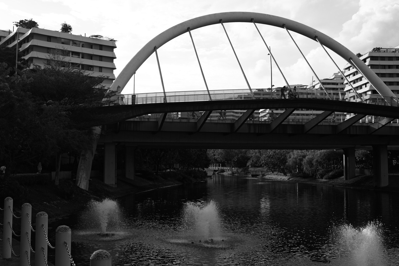
Want to turn Punggol Waterway Park into a family Science outing? Bring a notebook and start with one accessible, open section of the waterway. Observe a bridge’s shape, compare shade beneath trees, find a plant with roots near water and describe how a wet path differs from a dry one. Every activity in this trail is designed to be done from a safe public viewpoint: no reaching into the canal, no collecting water, no dropping objects, no picking plants and no crossing park barriers. A 20-minute science walk is complete if the family leaves with one careful observation and a better question.
Things to do at Punggol Waterway Park with children who love Science, Mathematics, geography and nature can remain enjoyable without a formal field trip. NParks identifies aquatic plants, fruit trees, resident birds, Kelong Bridge and Sunrise Bridge in its park material. HDB describes My Waterway@Punggol as a 4.2-kilometre man-made waterway, while NParks describes an 8.4-kilometre park connector route around both sides. These are different measures of related infrastructure, not two contradictory ‘distances of the park’. They create an excellent starting point for learning to read sources and distinguish what a measurement describes.
Updated 17 October 2026. This is an independent, family-friendly observation trail, not an official school-organised activity, lab experiment or invitation to interact with park water. Routes must be checked against current NParks maps, path and construction signs. The park is listed as open 24 hours, but that does not guarantee every area is suitable at night or during maintenance. Check haze, weather, lightning and individual mobility needs before choosing any outdoor activity. For a less academically structured park visit, use Punggol nature without hiking.
Punggol Waterway Science activities at a glance
| Observation | What a child can notice | Useful idea | Safety boundary |
|---|---|---|---|
| A park bridge | Curves, straight members, supports | Shape and structure | Stay on permitted paths; no climbing |
| The water surface | Reflections, ripples, changing colour | Light and movement | Never enter or reach over water |
| Planting along the bank | Terraces, grass, aquatic plants | Habitats and runoff | Observe without picking |
| Shade in public places | Shadow and sunlit spots | Light, heat and design | Avoid excessive heat |
| Different tree leaves | Leaf arrangements and outlines | Plant classification | No touching unsafe or unknown plants |
| Visible birds | Location, motion, size and call | Adaptations and observation | Do not feed or chase wildlife |
| Signs and routes | Park zones, distances and crossing rules | Maps and data literacy | Follow signs, not guesses |
| Historical bridge or bus-stop design | Kelong-inspired elements, retained features | Engineering and heritage | No access to closed sections |
The important distinction: learning by observing is not taking samples
Observation, inference and evidence are different
A child may say ‘The water looks green, so it must be dirty.’ The first part is a visual description; the second is a conclusion that cannot be established by colour alone. Reflection, algae, particles, lighting and other factors can affect appearance. A reliable Science habit is to record what was seen, state possible explanations and identify what evidence would be needed before drawing a conclusion.
Try three headings in a notebook: ‘I saw’, ‘I think’, and ‘I would need to check’. The phrase ‘I would need to check’ is not a weakness; it protects against guessing. Families should not attempt unsupervised water-quality tests or collect canal water merely to satisfy curiosity.
A designed waterway is not the same as a natural untouched river
HDB states My Waterway@Punggol is a 4.2km man-made waterway built as part of Punggol Eco-Town. It creates water frontage, public space and ecological opportunities within a planned housing district. Its attractive appearance does not mean it has no engineering or maintenance requirements. PUB’s ABC Waters approach explains how water management and appealing urban landscapes can work together.
Stand at a permitted viewpoint and ask what looks engineered: the bridge, hard edges, planted terraces or path drainage. Ask what looks living: trees, birds and aquatic plants. These categories can overlap. A habitat can be intentionally designed and still support living things.
The numbers on different signs may describe different things
HDB’s waterway length and NParks’ longer park connector distance are not competing claims about one identical line. A path along both banks can travel much farther than a single central water alignment. A visitor should identify whether a number refers to the waterbody, route, loop, distance to a particular entrance or total park connector.
A child’s mathematical question might be: ‘What exactly does this number measure?’ Do not force a calculation until the unit and object are clear. This is useful beyond the park, including school maps, public transport, graphs and product comparisons.
Nature observation should leave the place unchanged
A flower is part of a plant’s life cycle, a leaf may be feeding an insect and a branch can be supporting a resting bird. Picking, feeding or chasing animals changes what you are trying to observe. A family Science trail is therefore best when it produces notebook evidence and questions rather than a bag of specimens.
Do not remove water plants, seeds, soil, shells or insects from public land. Use field sketches, photographs and trusted labels. The site already has an extensive plant-learning branch; link to it for identification rather than encouraging guesses based on a single image.
Science should not override the park’s ordinary purposes
A public park supports walkers, cyclists, families, wildlife watchers and visitors who simply want leisure. A student exercise must not block a shared path or demand that strangers stop for an impromptu survey. Some bridges and boardwalks have ‘no riding’ conditions. The park is a shared public space, not a reserved laboratory.
Choose a safe wide stopping area, work with one family or a small responsible group, and put away the notebook when someone needs to pass. A two-minute observation is a valid learning experience if the path is busy.
Punggol’s weather is part of the scientific setting
Sunlight, cloud, wind and rain influence what a visitor sees. But a family should not stand outside in a thunderstorm to investigate rainfall or stay out during unhealthy haze to collect data. Singapore publishes official weather and air-quality observations; use those from a safe place when field conditions are unsuitable.
If the day is hot or the park is exposed, choose a short shaded route or an indoor follow-up. For poor air, follow current MOH/NEA guidance. A Science activity can be postponed without losing its educational value.
Parents can make learning enjoyable by not making it an exam
A student may be less willing to discuss the waterway if every answer is corrected immediately. Let curiosity lead. Ask one question, allow the child’s idea, and gently separate the observed evidence from the claim. A student who says ‘I don’t know’ may be giving the most scientifically careful answer.
Finish the outing with a simple favourite observation. No worksheet grade, no forced essay and no demand to identify every tree. The whole purpose is to make local science part of leisure, not to recreate an after-school lesson.
The 12-stop Punggol Waterway Science Trail—choose any three
1. A bridge as an engineering puzzle
Try this from public ground: From a safe public stopping point, identify straight beams, arches, supports and the path people walk on. Ask which part is holding up which other part. The answer is not always visible, and that is a chance to recognise the need for drawings or engineering information.
Safety and evidence limit: Do not climb, lean over railings or block people crossing. Kelong Bridge reflects Punggol’s fishing heritage; its visual form can create a separate history question without suggesting it is an actual working kelong.
2. Reflection and the water’s appearance
Try this from public ground: Notice whether the bridge or sky appears reflected and how small ripples alter the image. If clouds move, ask whether the reflection changes even when the object stays in place. This encourages careful description of light and surfaces.
Safety and evidence limit: Never drop a stone, paper boat, leaf or other object into the water to make waves. Litter and interference with the waterbody are not part of the activity.
3. The path of water after rain—without standing in it
Try this from public ground: When conditions are safe on a later day, observe dry marks, slopes and existing drainage infrastructure along a public path. Ask where a puddle would drain when the ground slopes. This can prompt a discussion of runoff, but the direction should be based on an actual visible slope, not an imagined map.
Safety and evidence limit: Do not visit during lightning, wade through pooled water or remove drain covers. If you cannot safely determine a slope, mark the question as unresolved.
4. Aquatic plants as a living design feature
Try this from public ground: Look for publicly visible water-edge plants and compare where they are growing with ordinary lawn grass. NParks identifies Red Thalia, Bulrush and Swamp Cabbage among Punggol’s planted waterway vegetation. Their presence shows an intentional relationship between planted landscapes and water environments.
Safety and evidence limit: Do not pick leaves or pretend a quick visual check measures water purity. Use the Punggol aquatic plants guide for species detail and remember plants are only part of a larger managed system.
5. Terraced planting and landscape levels
Try this from public ground: Observe a series of planted levels if one is safely visible. Ask how a flat planting bed differs from a sloped or terraced arrangement in the way water might move. NParks’ historical park guide discusses terraced planting as part of the waterway’s designed landscape.
Safety and evidence limit: Do not claim every stepped planting feature is technically a PUB-certified rain garden. Confirm its actual function from signage or a reliable plan. Remain outside planted beds.
6. Different leaf shapes from one viewpoint
Try this from public ground: Identify two kinds of visible leaf outline or canopy structure. A child can record ‘long and thin’ or ‘broad and rounded’ without requiring an exact tree name. This encourages classification based on observable differences.
Safety and evidence limit: Do not collect samples. A leaf alone may be insufficient for species identification, and an unknown fruit should never be treated as edible.
7. A bird’s behaviour instead of its name
Try this from public ground: If a bird is visible, note whether it is perching, walking, calling or flying, and where it is in relation to trees and water. NParks identifies Yellow-vented Bulbul, Black-naped Oriole and Long-tailed Parakeet among the park’s birds, but sightings are never guaranteed.
Safety and evidence limit: Do not feed, approach, imitate calls loudly or disturb nests. A description such as ‘small bird with pale underside near a shrub’ is useful even if identification remains uncertain.
8. Shade comparison
Try this from public ground: From a safe resting place, look for one shaded and one sunny section of the path. Ask why they differ—tree canopy, building shadow, orientation or time of day. Discuss how the shadow’s location can change as the sun moves.
Safety and evidence limit: Do not stay exposed to heat simply to make the comparison. An observation is enough; the child does not need to stand in a hot place or look toward the sun.
9. Bridge design and Punggol history
Try this from public ground: Compare the Kelong Bridge idea with what an offshore fishing platform looks like in a reliable picture or description. Ask why an architect might refer to an older occupation when designing a modern public structure. This links engineering, history and design without conflating a public bridge with the original fishing activity.
Safety and evidence limit: Use official heritage descriptions and do not invent a historic event at the exact span. The bridge is a designed reference to heritage, not an original surviving kelong.
10. A map as a model of the real park
Try this from public ground: Take a current NParks map and identify the zone you are actually in. Compare the map’s symbols with one bridge, crossing or path junction. What has been simplified? A map is useful precisely because it omits some details and emphasises others.
Safety and evidence limit: Do not assume the drawing perfectly reflects temporary closures or step-free access. Follow live signs on the ground. Adults remain responsible for navigating with children.
11. A public-transport observation
Try this from public ground: Near a safe accessible station approach, note how transport, parks and housing connect. Ask why a town might place footpaths close to a waterway, but separate some cycling routes and play areas. This makes Science and geography about urban systems, not just plants.
Safety and evidence limit: Do not conduct observations from platform edges or cross roads for a better angle. Public transport travel requires valid fares and safe supervision.
12. A photograph with a scientific caption
Try this from public ground: Choose one permitted subject and take a photograph that supports a specific description. For example: ‘Three visible planting bands beside a path’ is an observable statement. ‘These bands completely clean the river’ is a claim requiring separate engineering evidence.
Safety and evidence limit: Protect other visitors’ privacy and avoid taking a picture from a restricted area. Label the date and location if it matters, and keep any inference separate from the evidence.
Worked example 1: Mathematics using a hypothetical shaded path
Suppose a child looks along a safe public viewpoint and sketches ten equally sized visible paving sections. In this made-up practice example, six are shaded and four are sunlit. The shaded fraction is 6/10, which simplifies to 3/5. Multiplying by 100 converts the fraction to 60%. The arithmetic is correct for this hypothetical count; it does not establish that 60% of Punggol Waterway Park is shaded.
The Science extension is to ask why the six sections are shaded at that moment and whether the result would change at another hour. The limitation matters: a count at one particular time and viewpoint is not a survey of the whole park. Parents can connect this to eduKateSG’s Punggol map-scale and distance reasoning without claiming it is a national school assessment question.
Worked example 2: what 4.2km and 8.4km do—and do not—tell you
HDB describes the constructed Waterway as 4.2km long. NParks separately describes an 8.4km park connector route alongside the waterway. Because 8.4 is twice 4.2 numerically, a child may guess the park connector is ‘exactly the return trip around the water’. That conclusion needs more care. The figures describe different objects and official route alignments, and actual walking distances depend on entry point, crossings, detours and which part of the route the family chooses.
Here is the stronger reasoning process: write the label, unit, object being measured and source next to each number. Only then compare. This small example teaches the difference between a valid numerical operation and an overconfident interpretation. A 4.2km waterbody is not an instruction that children must walk 4.2km; a short family outing can cover only a few hundred metres or less, according to comfort.
Three practical trail formats
The 20-minute first science walk
Begin at a known public access near Punggol MRT or another appropriate station, choose one safe Waterway stretch and observe a bridge, a plant or shade from a suitable stopping point. Ask one question and record one answer as observation or uncertainty. Turn around while the outing is still comfortable.
This is ideal for families who want to add curiosity to a normal stroll. No equipment is needed except perhaps a notebook. Do not spend most of the time seeking every named bridge or trying to complete a long route.
The 45-minute plant-and-structure outing
Choose a manageable open route where a bridge and planted area are visibly accessible. Spend ten minutes on shapes, ten on plants, a short break on shade or wildlife, then return. If a child loves recording evidence, take two safe photographs and describe the difference.
Keep the whole route within the group’s real mobility and energy. The science activities are optional, not a fixed tour or timed challenge. In poor weather, use the site’s aquarium and plant reference articles indoors instead of going outside.
The 75-minute interdisciplinary visit
Spend time near a current open section of Punggol Waterway Park, choose a safe environmental observation, discuss a heritage-related public design such as Kelong Bridge if accessible, and finish with an ordinary food or community stop. The value is comparing human infrastructure and living systems—not covering the entire park.
If a visiting child asks a question you cannot answer, record it for later. Do not guess at water-quality measurements, engineering certification or a historical detail. Respect everyone else enjoying the park.
How to adapt the Waterway Science Trail to age and ability
Preschool children
One shape or colour prompt is enough. Point to a bridge, cloud or leaf and describe what is seen. The adult is responsible for remaining a safe distance from water and traffic. Stop when the child is tired rather than forcing a worksheet.
Primary 1–3
Try classifying two visible plant forms, drawing a bridge and making a simple observation statement. Introduce the difference between ‘I saw’ and ‘I think’. The point is accurate noticing, not memorising botanical names.
Primary 4–6
Use a sketch map, compare a fraction from a hypothetical visual count or distinguish the measured length of a waterway from a path. Let students ask how the built landscape manages people, water and greenery.
Secondary students
Compare evidence and limitations, interpret PUB’s ABC Waters design descriptions and ask what monitoring would be required to validate a claim about pollutant removal. Do not take unapproved samples or infer engineering performance from the appearance of plants.
Visitors with sensory or mobility preferences
Choose a short step-free route with seating and an easy turnaround where possible. Real accessibility depends on the full approach and current site conditions. A library-based photo discussion is an equally valid alternative when outdoor exposure is unsuitable.
Parents and adults who do not enjoy academic activities
Pick one interesting question and enjoy the park. A science trail should not become compulsory educational performance. Adults can take pleasure in a simple sketch or bird observation without any quiz.
Frequently asked questions about Punggol Waterway Science activities
Can children do a Science field trip at Punggol Waterway Park?
Families can do supervised public observation activities where park access and conditions permit. A formal school-organised trip has its own supervision and institutional requirements.
Is this an official NParks or MOE Science trail?
No. This is an independently written family observation guide using official park and water-management reference information.
Can we collect water samples from the canal?
Do not collect or test water without the relevant authorisation and safety arrangements. The activities in this guide require no water contact.
Can children drop leaves or boats into the Waterway?
No. Do not throw or release objects into park water or litter public space. Use sketches and observation instead.
How many themed zones does the park have?
NParks identifies Nature Cove, Recreation Zone, Heritage Zone and Green Gallery. A short family visit does not need to cover all four.
What birds might visitors observe?
NParks lists Yellow-vented Bulbul, Black-naped Oriole and Long-tailed Parakeet among the park’s birds. A sighting is not guaranteed and should be enjoyed at a respectful distance.
Which aquatic plants does NParks mention?
Red Thalia, Bulrush and Swamp Cabbage are among the waterway’s listed planted species. Correct identification requires evidence rather than a quick guess.
Do the aquatic plants purify all of Punggol’s water?
No such claim should be made. NParks describes their waterway pollution-removal roles, while broader water-quality management involves multiple engineered and environmental systems. Plant presence alone cannot prove total water purity.
What is a rain garden?
In PUB’s ABC Waters framework, a bioretention basin uses plants, soil and designed layers to help manage and treat rainwater runoff. Do not assume every landscaped depression is technically a rain garden without site-specific information.
Are there actual rain gardens at every Waterway viewpoint?
No. Public design features vary. Use official signs and plans before labelling a particular planted structure a rain garden or bioswale.
Why is Kelong Bridge called that?
NParks describes its design as a reference to traditional kelongs linked with Punggol’s fishing-village history. The contemporary bridge is a tribute, not an original working kelong.
Is cycling allowed on Kelong Bridge?
NParks’ current shared-path guidance restricts cycling on selected bridges including Kelong, Wave and Adventure Bridges. Follow on-site no-riding signs.
Is the park 4.2km or 8.4km long?
HDB’s 4.2km refers to the man-made Waterway; NParks’ 8.4km refers to the park connector route. They measure different related features.
Can children swim in the canal?
No. Do not treat the Waterway itself as a public swimming facility. Stay on designated public paths and observe barriers.
Is the park open at night?
NParks lists 24-hour opening, but specific paths and amenities may have restrictions. Lighting, personal safety, weather and children’s routines all matter.
What if we cannot identify a bird or tree?
Record its visible characteristics and consult a reliable source later. Guessing a name is not a requirement for enjoying the activity.
What if there is haze?
Follow current MOH/NEA advice, with special attention to children’s exposure and health needs. You may need to shorten, reduce or cancel outdoor activities.
What if it rains heavily or lightning is nearby?
Leave exposed outdoor areas and use a safe alternative. Do not conduct the ‘rainwater experiment’ during a thunderstorm.
Are photographs evidence?
A photograph can document a particular viewpoint and moment, but it can omit context and is not automatically proof of a cause or a measurement. Record the date and source when relevant.
Can this help with Primary Science?
It offers real examples of observation, classification and reasoning. Do not mistake it for a guaranteed syllabus-complete tutorial or formal exam question.
Can we compare plant growth from different public beds?
Only by observing lawfully, without entering the beds or damaging plants. Differences could arise from multiple conditions and should not be attributed to one factor without evidence.
Where should we start if we have only 20 minutes?
Use one accessible open public Waterway section near a convenient transport point, choose one observation and return. The correct start depends on where the group actually arrives.
What should a child bring?
A notebook and suitable personal supplies may be enough. Use weather-appropriate clothing and water where needed; no chemicals, sampling bottles or specialist equipment are necessary.
Where can we learn more about the Waterway’s engineering?
PUB’s ABC Waters pages and HDB’s Explorer Trail explain the broader design approach; NParks’ Waterway Park guide gives the park’s plants, bridges and visitor rules.
Continue through eduKate’s connected local and learning guides
- Punggol Waterway Park Guide — park zones, entrances and feature owners.
- Punggol Nature Without Hiking — a less academic nature day.
- Punggol Garden Explorer — plant viewing and respectful garden visits.
- Punggol Aquatic Plants Guide — Red Thalia, Bulrush and Swamp Cabbage.
- Punggol Birdwatching for Beginners — identification and habitat.
- Screen-Free Punggol Family Activities — creative everyday activities.
- Punggol Playdate Planner — turn a short science walk into a friend meetup.
- Punggol Eco-Friendly Things to Do — wider sustainable lifestyle.
- eduKateSG: Map Scale and Geographical Thinking in Punggol — the meaning of distance.
- eduKateSG: Green Learning and School Gardens — school-oriented sustainability.
Related Punggol lifestyle activities: Third Places in Punggol. These guides cover different needs, so choose the one that fits the family or visitor rather than repeating the same destination list.
Official references and 2026 update discipline
Primary references: NParks Punggol Waterway Park, NParks family nature walk, NParks park connector and route lengths, HDB Sustainability Explorer Trail, PUB ABC Waters design features, PUB ABC Waters maintenance, NParks current shared-path restrictions and NEA current haze information. Updated 17 October 2026. Activities are suggested observation prompts, not park-authorised experiments, scientific measurements or live condition reports.


