
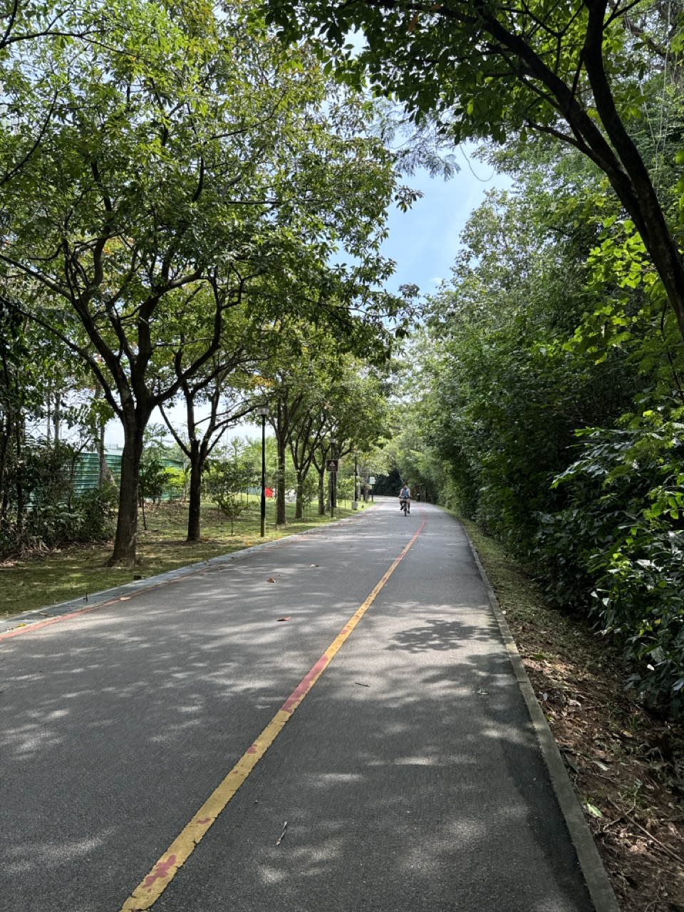
In 1967, a teenage Lee Hsien Loong attended one of Singapore’s first Outward Bound courses on Pulau Ubin and took part in an orienteering exercise in rural Punggol North. He later recalled struggling to navigate with a map, getting lost among the tracks and learning to work with his teammates. The course was based at Pulau Ubin; Punggol was part of an expedition, not the location of a newly invented mainland OBS campus in 1967.
The recollection appears in two official speeches. At the opening of Punggol Waterway on 23 October 2011, Lee described coming to Punggol with a map but without a compass. At OBS’s 50th-anniversary celebration on 29 November 2017, he spoke of a 17-day course involving canoeing to Coney Island, sailing to Pulau Seletar and orienteering in Punggol North. These memories illuminate the geography and educational atmosphere of Singapore’s early post-independence years.
The story now has a remarkable later chapter: on 11 September 2026, Prime Minister Lawrence Wong officially opened an OBS campus on Coney Island. That is almost six decades after the 1967 expedition and must be dated as a modern development, not retroactively placed in the 1960s. This guide connects historical evidence, the old Punggol landscape, outdoor education, modern programme developments and practical ways to study the sources accurately.
Choose your reading route
1967 source chronology · Why Punggol was difficult · Original OBS purpose · 2011 and 2017 speeches · September 2026 campus
Contents for the complete guide
- 1. The historical record: three speeches and one original experience
- 2. What Outward Bound School of Singapore was in 1967
- 3. The teenage course: seventeen days and unfamiliar tasks
- 4. Punggol North in 1967: why navigation was difficult
- 5. Map reading and the meaning of getting lost
- 6. Pulau Ubin, Coney Island and Pulau Seletar: different places, same expedition world
- 7. From a rural Punggol to a waterfront new town
- 8. Why Dr Goh Keng Swee wanted a rugged generation
- 9. The long path from Outward Bound School to OBS
- 10. The 2011 speech: a memory resurfacing beside Punggol Waterway
- 11. The 2017 speech: fifty years of memory and meaning
- 12. The 2026 Coney Island OBS campus: a new chapter, not a 1967 site
- 13. Outdoor education now: safety, accessibility and group responsibility
- 14. How historians can reconstruct the old landscape without inventing a route
- 15. School learning across History, English, Geography and Mathematics
- 16. What a family should do if searching for an OBS visit in Punggol
- 17. Frequently asked questions about the 1967 Punggol OBS exercise
- 18. Sources, dating rules and the larger Punggol reading route
1. The historical record: three speeches and one original experience
The central event took place in 1967. Lee Hsien Loong, then a school student aged fifteen, attended one of the early Outward Bound School of Singapore courses. His main training site was Pulau Ubin. In the course of wider activities, his group went to Punggol North for a land-navigation exercise. The specific Punggol event is supported by his later official recollections, not by a newly discovered course itinerary published on this page.
The 23 October 2011 speech matters because it was delivered at the opening of Punggol Waterway, in the town whose changed landscape triggered the memory. Lee referred to the old alignment of Punggol Road and remembered a much earlier time when a group navigated from point to point using a map without a compass. He recalled the presence of tracks and attap houses and the experience of becoming lost. The setting is central to the memory.
The 29 November 2017 anniversary speech supplies additional detail. Lee placed himself among OBS’s first intakes and described a seventeen-day course, basic equipment, instructors and several forms of adventure. He explicitly identified orienteering in Punggol North alongside other activities in the neighbouring islands. The speech was commemorative and retrospective; it was not a real-time diary from 1967.
The third official milestone is very recent. The Prime Minister’s Office records that Lawrence Wong opened the OBS Coney Island campus on 11 September 2026. His speech looked back to the organisation’s 1967 origins while describing modern educational needs and new facilities. This is excellent material for a continuity-and-change essay, provided the current campus is not confused with the site of the original 1967 school.
A simple evidence table therefore has three columns for 2011 recollection, 2017 recollection and 2026 opening, each linked to a distinct event and source. A fourth line identifies the original 1967 episode recalled by the earlier speakers. That prevents the common chronological mistake of writing as though a 2017 speech described something that first happened in 2017.
2. What Outward Bound School of Singapore was in 1967
The present OBS organisation’s official history traces the Singapore institution to 1967, when Dr Goh Keng Swee founded the Outward Bound School of Singapore. Its purpose was to develop leadership, endurance, initiative, discipline, self-reliance and public-spirited young people. This was the early post-independence period when educators and leaders were thinking about how a small new nation could cultivate resilience and social cohesion.
The original school was on Pulau Ubin, not in Punggol North. Its connection with Punggol came through expedition training that crossed familiar boundaries between an island base, surrounding waters and the northeastern mainland. The difference matters when historical captions or tourism descriptions refer to ‘OBS Punggol in 1967’. The source supports Punggol orienteering during an OBS course, not a standalone mainland school operating there at that date.
In his 2017 speech, Lee described British Army involvement in the earliest courses, including instructors and officers, with locally recruited personnel and volunteers also contributing. He referred to Dr Goh’s purpose of building physical and psychological resilience. The official OBS history adds later institutional changes, including renaming to Outward Bound Singapore in April 1991 and incorporation into the National Youth Council from January 2015. Those later arrangements should not be projected backwards as the 1967 organisational structure.
The National Library Board’s essay ‘A Rugged Society: Adventure and Nation-Building’ explains the wider educational context. Outdoor activities, physical education, school groups and demands for initiative were part of a broader discussion about character after independence. OBS was one manifestation of that programme rather than the entire history of Singapore’s outdoor education.
A good school answer separates founding purpose from observed effect. The government hoped outdoor challenge would develop resilience and teamwork. Participants, including Lee, later described personal lessons from the experience. Those recollections are informative; they do not alone constitute a controlled study proving the same outcome for every student.
3. The teenage course: seventeen days and unfamiliar tasks
Lee’s 2017 anniversary address places his own course at seventeen days. He remembered meeting peers from different schools, language backgrounds and social groups. The students had to learn unfamiliar skills, support one another and manage the demands of being away from their ordinary school routines. This mix of shared physical challenge and social contact was one of the striking features of the course.
The equipment was basic by later standards. The speech mentions canoes, sailing dinghies, compasses, topographic maps and simple rope and obstacle courses. Some facilities were temporary or makeshift. An account of the 1967 expedition must distinguish general course equipment from what was carried during the particular Punggol exercise. The 2011 speech specifically remembered map-based navigation without a compass for that exercise.
Lee also remembered using the surrounding landscape during water activities: canoeing towards Coney Island and sailing towards Pulau Seletar. These references are valuable geographic evidence of the kinds of destinations that could be reached from the Ubin course. They do not establish exact maritime routes, precise landing points or weather conditions on every day. A historical illustration should therefore avoid drawing a definitive track unless a period map or course log supports it.
A seventeen-day stay feels long compared with many present-day school camps, and the speaker himself commented on the duration. Time allowed learners to move beyond the excitement of the first morning and discover how they reacted when tired, uncertain or dependent on teammates. That is a plausible educational interpretation of the course design, not a claim that every participant responded identically.
The human lesson lies in the gap between planned and lived experience. A course can intend to build self-reliance, yet a novice navigator may first experience confusion. Learning emerges as a group tries a strategy, realises it has not worked and adjusts. That cycle is visible in the recollection of getting lost and continuing together.
4. Punggol North in 1967: why navigation was difficult
Punggol North in the late 1960s did not resemble the streets around a modern MRT station. The 2011 speech remembered attap houses, paths and a shortage of the signs and clear roads that make orientation easier today. That is important because orienteering is shaped by terrain. A map is only as useful as the navigator’s ability to connect symbols with things actually seen in front of them.
The history of Punggol Road and its numbered tracks helps explain the setting. Older road accounts describe branches serving farms and kampong areas, long before the modern residential network covered much of the district. But this general road history should not be treated as a turn-by-turn record of the 1967 course. We know Punggol was rural, and we know the group was there. We do not know every checkpoint from the official speeches alone.
When there are few obvious street signs, a navigator must identify natural and built features—watercourses, junctions, clearings, house clusters, terrain changes—and judge whether a particular feature matches the map. Mistaking one path for another can send a team far away from its intended direction. On a network of small rural tracks, the error may be hard to recognise immediately.
Lee’s 2011 memory of using a map without a compass is especially useful. Readers sometimes assume every orienteering exercise requires a compass. In fact, navigation can involve map interpretation, route choice and directional reasoning without one. The point of the recollection is the task and its difficulty, not a technical claim about every instrument available to the whole OBS course.
For a child who now uses turn-by-turn phone navigation, the contrast is striking. The old exercise asked students to interpret an unfamiliar environment through a map and a team discussion. A present-day heritage lesson should not try to recreate unsupervised off-trail navigation in restricted land. It can teach the same cognitive distinction using safe, approved school or public settings.
5. Map reading and the meaning of getting lost
What does it mean to ‘get lost’ in a historical recollection? It tells us that the participants could not immediately match their position to the required route. It does not necessarily mean they faced life-threatening danger, walked a specific distance or failed the entire course. Those additional details would require evidence. The more interesting point is that difficulty was part of the learning experience.
A map translates a physical landscape into a set of symbols. Roads appear as lines, buildings as shapes and elevations or natural features through conventions chosen by the mapmaker. The reader must reverse that translation outdoors. In a place where tracks branch repeatedly, a small assumption can turn into a large error. A good navigator checks what is visible rather than forcing the scenery to match a preferred interpretation.
Working in a group adds another layer. Someone may be confident and wrong; another may be cautious but observant. Members have to listen, compare interpretations and decide how to correct their route. A team that notices a discrepancy and revises its plan is demonstrating a valuable skill even if it does not reach a checkpoint on the first attempt.
The 2017 speech describes the group getting lost during map reading and orienteering. The later message was not that participants became perfect navigators in an afternoon. It was that the experience developed confidence, social bonds and the ability to face challenge. The cause-and-effect claim is a first-person retrospective judgment and should be attributed as such.
For students, practise the source distinction with two sentences. Factual: the speaker recalled orienteering in Punggol North during his 1967 OBS course. Interpretation: the experience illustrates how a difficult task can encourage group decision-making. One is supported directly by the speech; the other is a reasoned educational takeaway. Keeping the two separate improves historical writing.
6. Pulau Ubin, Coney Island and Pulau Seletar: different places, same expedition world
The 2017 anniversary speech mentions several destinations around Singapore’s northeastern waters. Lee recalled sailing towards Pulau Seletar, canoeing to Coney Island and orienteering in Punggol North. It would be a mistake to merge those into one single overland hike or to call all three places ‘Punggol’. They represent different islands and the mainland settings used by the broader course.
Pulau Ubin was the original school base. In the 1960s it was more rural than the present-day recreational destination, with plantations, quarries, villages, water and mangroves. Its physical features made it suitable for outdoor challenge but also unfamiliar to teenagers from ordinary city neighbourhoods. The official speech’s descriptions of Ubin give context for why excursions to surrounding destinations felt adventurous.
Coney Island—also called Pulau Serangoon—is linked to Punggol’s coastal geography but has its own history and landform. The 1967 recollection concerns a canoe trip to the island. It does not establish that an OBS campus existed on Coney Island then. The latter campus was opened nearly six decades later, in September 2026, as recorded by the Prime Minister’s Office.
Pulau Seletar is another distinct place. Its mention in the sailing memory should not be replaced with a generic label such as ‘some island near Punggol’. Historical geography becomes inaccurate when similar-sounding island names or sea routes are silently swapped. Use a map with the date shown, and label island positions while avoiding invented launch points.
The educational theme connecting these places was learning through changing environments. Water travel asks for attention to weather, craft and group coordination; land navigation asks for map reading and route choices; shared camp life asks for cooperation. The 1967 course combined forms of challenge without pretending they were one identical activity.
7. From a rural Punggol to a waterfront new town
A child standing beside Punggol Waterway today can see planned paths, bridges, housing and landscaping. That environment is not what the 1967 group described. The old Punggol road-and-track network was gradually transformed by new infrastructure, reclamation and extensive housing development. The comparison helps make a simple historical point: places change, so memories of how people moved through them also change.
At the 2011 Waterway opening, Lee explicitly contrasted his earlier orienteering experience with the new landscape. The speech also described the old Punggol Road alignment and reflected on coastal seafood outings. This mixture of personal memory and public planning is instructive. A modern ceremony often celebrates new infrastructure while placing it against older local uses.
The waterway was opened in October 2011 as part of the Punggol 21 Plus vision. It belonged to a carefully designed environment for residents and visitors. The older Punggol exercise took place in a setting without many of those amenities. It would be misleading to show a new canal bridge as though OBS trainees crossed it in 1967; the structure belongs to a different period.
Older landscapes also supported people whose lives were not recreational expeditions. Fishing and farming communities inhabited Punggol’s wider area. Students visiting for an outdoor course briefly encountered rural terrain that for residents was home and work. A respectful historical article therefore connects the learning exercise to the history of those communities rather than treating Punggol as an empty adventure playground awaiting students from elsewhere.
A map comparison can be built around three dates: a historical map from before the new town, the 2011 waterway milestone and a current 2026 map. Instead of trying to draw the exact OBS route, which remains unsupported, ask how a navigator’s available clues changed. That lets the student learn geography and historical caution at the same time.
8. Why Dr Goh Keng Swee wanted a rugged generation
OBS’s official history identifies Dr Goh Keng Swee as the founder of the 1967 Singapore school and places resilience, self-reliance, discipline and leadership at the centre of its purpose. The National Library Board’s historical essay situates that purpose in the political and social conditions of the years following independence. Leaders were concerned with how young Singaporeans would manage uncertainty and take responsibility for a small new nation.
Ruggedness in this context was more than physical strength. The programme connected endurance with initiative, teamwork and the willingness to continue under difficulty. It also tried to bring students from different backgrounds together. In his 2017 recollection, Lee spoke about meeting peers from different schools and learning to encourage one another during the course. This is personal testimony of what the experience meant to him.
The word ‘rugged’ can sound harsh to modern ears if it is interpreted as simply exposing children to unnecessary danger. The source context deserves care. Contemporary outdoor education emphasises structured challenge with safety and nurturing support. A rigorous historical article can explain the 1960s language while recognising that policies, standards and educational expectations have evolved.
The official OBS site describes four pillars of its wider educational philosophy: physical fitness, self-reliance, craftsmanship and compassion. That mix reminds us that the goal is not only to endure discomfort but also to develop skill and look after others. These values offer an interpretive framework for the 1967 Punggol exercise, though they should not be mistaken for a precise checklist copied from Lee’s actual 1967 course notebook.
A useful classroom discussion compares ‘I can do a hard task’ with ‘I can help my team do a hard task’. The first describes personal capability, the second shared responsibility. Outdoor exercises can bring both into view because a group’s success may depend on listening, pacing, checking and encouraging, not simply on who runs fastest.
9. The long path from Outward Bound School to OBS
A history of the Punggol recollection should not stop in 1967, because its later retelling shows how the institution itself changed. The official OBS chronology says the Outward Bound School of Singapore began in 1967, was later managed under different government and community arrangements, was renamed Outward Bound Singapore in April 1991 and joined the National Youth Council from 1 January 2015.
Institutional dates can be confusing because several bodies may be involved as founders, administrators, instructors or programme partners. Lee’s 2017 anniversary speech recalls early British Army officers and local instructors while explaining Dr Goh’s founding intention. The present OBS history provides a higher-level organisational chronology. Those records can be read together without turning every instructor into the same sort of official.
The 2017 fiftieth-anniversary celebration is one milestone in that long path. Its purpose was commemorative: recognising people, programmes and the value of challenge. An anniversary speech may select memories that illuminate a message rather than list every administrative reform. The official institutional chronology is better suited to dates of renaming and organisational placement.
By the mid-2010s, national education policy increasingly treated structured outdoor experiences as a way for more students to learn beyond classrooms. The 2017 speech referred to plans for additional facilities and wider participation. It is tempting to write that a particular promised facility had already opened at that point. The source said it was planned; the official opening followed on 11 September 2026.
This distinction gives students an excellent source-evaluation exercise. Compare the future tense in a 2017 speech with the past tense in a 2026 opening announcement. They are evidence of different stages: policy intention and completed facility. A serious history does not confuse an aspiration with an accomplished event.
10. The 2011 speech: a memory resurfacing beside Punggol Waterway
The 23 October 2011 speech is special because it directly connects the old orienteering memory to a physical place undergoing transformation. The event being celebrated was the opening of Punggol Waterway. The speaker described the waterway’s landscaping and residential role, then turned to the old road alignment and his recollections of seaside meals and outdoor navigation.
He remembered a map-based expedition without a compass and the difficulty of interpreting tracks and attap houses. The anecdote did important rhetorical work: it made the new town’s difference visible through one person’s experience of the old landscape. Instead of a purely abstract comparison of development plans, listeners could imagine the earlier problem of finding one’s way.
The memory also has limits. We cannot reconstruct the exercise’s exact route from the speech. The speaker did not provide official checkpoint coordinates, every member’s name or a minute-by-minute timetable. The claim belongs in the category ‘later first-person recollection of an earlier experience’. It is strong evidence that the speaker remembered the event, but a map diagram would need independent historical corroboration for precision.
The speech included other historical context, including changes to Punggol Road and the idea of remembering the town’s fishing-village identity. Those elements help a researcher avoid treating the exercise as a detached story about a famous visitor. It was one strand in a broader account of a place where roads, social life and landforms had been transformed.
For English and History students, ask how an anecdote can make a public speech accessible. Identify the direct historical memory, the visual contrast with the new development and the larger argument the speaker was making. Then ask what evidence would be necessary if a journalist wanted to draw the exact 1967 route on a contemporary map.
11. The 2017 speech: fifty years of memory and meaning
At OBS’s fiftieth-anniversary celebration in November 2017, Lee retold the experience within a fuller account of the early school. He discussed the instructors, basic equipment, different school backgrounds, course duration and the activities the group undertook. The Punggol North orienteering appears in a series alongside canoeing and sailing. This broader context helps us see that the expedition was part of a programme rather than a standalone excursion.
The speech portrays the experience as both challenging and enjoyable. Participants built confidence, friendships and a greater capacity to work together. Lee described the seventeen days as influential in his own life. The statement is significant as first-person testimony, but historians should not turn it into a claim that all former participants derived the same lifelong benefits or that a single weekend of similar activity guarantees identical outcomes.
The commemorative setting also mattered. At a fiftieth anniversary, an earlier participant can speak to current students and instructors about continuity of mission. Memories are selected for their power to communicate values. That does not make the memories untrustworthy, but it does mean readers should recognise their rhetorical purpose.
The source is also helpful for place naming. ‘Punggol North’ identifies the mainland orientation area. ‘Coney Island’ and ‘Pulau Seletar’ identify destinations in other parts of the outdoor course. A reader who sees the names together should not silently move the historic school to one of those destinations.
A good comparative paragraph might say: the 2011 account highlights how much Punggol’s landscape changed, while the 2017 account highlights what the adventure taught the participants. Both describe the same early experience from different angles. That is an example of how context influences historical storytelling without necessarily creating a factual contradiction.
12. The 2026 Coney Island OBS campus: a new chapter, not a 1967 site
On 11 September 2026, Prime Minister Lawrence Wong attended the opening of the Outward Bound Singapore Coney Island campus. This is a recent and officially dated milestone. It creates a striking geographical connection with Lee’s memory of canoeing to Coney Island in 1967. The connection is meaningful, but the two events are separated by almost six decades of educational and urban change.
The Prime Minister’s Office transcript says the campus was designed to accommodate participants of different abilities and to integrate with its natural environment. It described new opportunities for expeditions linking Coney Island with other OBS sites at Pulau Ubin and East Coast. These are aims and features stated at the opening; actual admission and use are governed by current OBS programmes, not by this historical article.
The same speech described the MOE-OBS Challenge as a five-day, four-night programme for Secondary 3 students, introduced in 2017. It reported that around 18,000 Secondary 3 students participated in 2025, approximately half of that year’s cohort, and expressed an intention to make the experience available more broadly. The figures are dated and attributed; they should not be converted into a claim that every student had completed a course by October 2026.
The historical irony is compelling. In 1967, a student paddled to a relatively rural island as part of an early adventure course based elsewhere. In 2026, a newly opened campus expanded opportunities around that same island. The story is not a simple circle, because the institutional mission, facilities, population and safety expectations all evolved.
For a research timeline, write two separate entries: ‘1967—Coney Island mentioned as a canoeing destination in Lee’s later account’ and ’11 September 2026—official opening of an OBS campus on Coney Island’. A reader who keeps those entries separate has already avoided the most tempting error in this branch of Punggol history.
13. Outdoor education now: safety, accessibility and group responsibility
Contemporary families may wonder what the old exercise can teach a teenager attending an outdoor programme today. The most useful connection is not to recreate 1967 conditions exactly. It is to recognise enduring goals—self-reliance, cooperation, careful decision-making and respect for the environment—within modern standards of supervision, risk management and accessibility.
The September 2026 opening speech emphasised inclusion, safety and the roles of instructors. It described a campus designed to be accessible to young people with different abilities and highlighted the work required to help participants manage challenges. This matters because responsible outdoor education is not a test of whether children can be left unsupported. It uses trained staff, appropriate tasks and careful design to create opportunities for learning.
Navigation can be taught at many levels. A younger child may learn to recognise a few safe landmarks with an adult. A Secondary student in a supervised programme may practise route planning, map orientation and communication. An experienced group may face more complex tasks within a structured expedition. The correct challenge depends on age, ability, environment and programme design.
Families should not use the 1967 story as an invitation to enter restricted or undeveloped land in Punggol North. Today’s landscape includes roads, private property, ecological areas and safety rules. A map from the 1960s cannot be used as a modern permissions document. The appropriate way to experience organised adventure learning is through authorised programmes and supervised public activities.
The deeper lesson is that resilience includes knowing when to ask for help. Getting lost can be a teaching moment in a well-managed exercise; concealing confusion in a risky environment is not courageous. Listening, checking a route and protecting teammates are positive forms of confidence that apply beyond outdoor education.
14. How historians can reconstruct the old landscape without inventing a route
The available speeches establish the area and experience, not a definitive map of checkpoints. To reconstruct the geography responsibly, a researcher needs additional material from the period: maps showing the old tracks, course plans if preserved, archived photographs with known locations and possibly interviews with other participants. The first step is finding the records, not drawing the route and then seeking evidence to fit it.
Map dates are especially important. An early-1960s topographic map may include road and settlement features relevant to the recollection. A modern map offers a different frame. Comparing them can reveal how rural paths became new roads or disappeared under housing, but it cannot, by itself, tell us which junction an individual team visited on a particular day in 1967.
Oral history offers another avenue. Separate memories from different participants could corroborate that the exercise involved particular kinds of terrain or challenges. Yet memory can shift over decades, and participants may remember different details. The aim is to compare accounts, not force them into total agreement. A surviving course log would have a different evidentiary role from a recollection delivered at a public ceremony.
Photography also requires care. A National Library Board article reproduces 1967 OBS images from Pulau Ubin. Such photographs establish the school’s activities and period appearance but should not automatically be captioned as photographs of the Punggol North exercise. Place-specific captions must rest on place-specific records. An illustrative photograph of today’s Punggol paths is a modern comparison, not 1967 evidence.
A practical research note can use five columns: claim, document, date, location and confidence. For example, ‘1967 Punggol North orienteering’ can be associated with the official 2017 recollection; ‘navigation without compass’ with the 2011 speech; ‘original OBS site on Pulau Ubin’ with the institutional history. A box for exact course route should read ‘not established from these sources’. That is a result, not a failure.
15. School learning across History, English, Geography and Mathematics
The Punggol OBS recollection works especially well as an interdisciplinary project because it has precise dates, reliable official sources and an understandable human problem: a group of students tried to find their way and sometimes failed. Start with the first three paragraphs of this article to establish the answer, then give students the actual source links and ask them to check one fact independently.
In History, students can build a chronology: founding of OBSS and a Punggol exercise in 1967, a later recollection at the 2011 waterway opening, the 2017 fiftieth-anniversary speech and the opening of the Coney Island campus in 2026. Each event should have one sentence explaining whether it happened then or was merely remembered then. This makes chronology active rather than a test of memorisation.
In Geography, compare how maps represent landforms, rivers, tracks, roads and new infrastructure. Ask which features would help a navigator in a rural area and which are visible in a modern town. Work only with safe maps and simulated exercises; do not send children into unmanaged or restricted locations to recreate a historic route.
In English, analyse the speaker’s use of a brief personal story to explain a larger idea. Students can identify the scene, obstacle, response and lesson, then write a short feature that attributes the source. Encourage them to distinguish vivid writing from invention. They may describe uncertainty generally but should not fabricate dialogue among 1967 participants.
In Mathematics, practise scale and estimation with a clearly hypothetical map. If a classroom map says one centimetre represents 200 metres, a three-centimetre straight-line separation represents 600 metres, not necessarily the distance someone would walk on real paths. The numbers are teaching examples, not the actual checkpoint distances of the course.
For character and citizenship education, discuss how effective teams share knowledge. When one navigator is unsure, another can check a landmark and someone else can monitor the group’s condition. The point is not that mistakes make a team weak. It is that groups can recover by communicating and staying responsible for one another.
16. What a family should do if searching for an OBS visit in Punggol
There are two separate reasons someone may search for ‘Punggol OBS’: historical curiosity about the 1967 orienteering memory and present-day information about a programme or campus. This article answers the first in detail and provides official sources for the second. Do not infer present-day booking availability, campus access or programme places from a historical essay.
The Coney Island campus opened in September 2026, according to the Prime Minister’s Office. That official opening does not necessarily mean members of the public can freely enter the grounds for sightseeing. OBS training facilities have operational and programme requirements. Families seeking current participation should consult OBS’s official site or their school for eligibility and instructions.
For a heritage walk, use accessible public places in modern Punggol to understand how the landscape changed. You do not need to stand at a speculative 1967 checkpoint to appreciate the story. A view of modern roadways or Punggol Waterway makes the contrast with the original rural description clear, as long as the accompanying caption identifies it as a present-day comparison.
A family can also read the 2011 and 2017 speeches together. Ask the child what is the same: Punggol, outdoor navigation and the memory of difficulty. Then ask what changes: why the story is told, which landmarks are emphasised and what larger message the speaker offers. This develops critical reading without requiring specialised historical equipment.
If a reader possesses a dated photograph or course record from the early OBS years, it may help the local historical record. Preserve the original context, avoid publishing private student information without permission and seek a suitable archive for long-term access. An accurate source label may contribute more than a polished but unverified anecdote.
17. Frequently asked questions about the 1967 Punggol OBS exercise
Did OBS have a campus in Punggol North in 1967? The documented early school base was Pulau Ubin. Punggol North was an expedition location for the orienteering exercise.
Who described the exercise? Lee Hsien Loong recalled it in official speeches delivered in 2011 and 2017.
How old was he? In his 2017 speech, he said he was fifteen when he attended the course in 1967.
How long was the course? He described a seventeen-day course. That duration belongs to his 1967 experience, not every current OBS programme.
Were the participants using phones? The recollection concerns map reading in a time and setting very different from modern smartphone navigation. No source supports adding a modern device to that story.
Did they have a compass? In the 2011 Punggol Waterway speech, Lee specifically recalled navigating the Punggol exercise with a map but without a compass.
What made the area difficult? The speech remembered rural tracks, attap houses and limited signage; the broader historic road network differed greatly from today’s.
Did they also visit Coney Island? Lee’s 2017 speech recalls canoeing there during the wider course. That was a different activity from mainland orienteering.
When was OBS founded? The official organisation history gives 1967 for Outward Bound School of Singapore, founded by Dr Goh Keng Swee.
When did the name change to OBS? The official history records the April 1991 renaming to Outward Bound Singapore.
When did OBS become part of NYC? The official history says 1 January 2015.
When did the OBS Coney Island campus open? Prime Minister’s Office records the opening on 11 September 2026.
Is the 1967 route still walkable? No reliable exact route is established from the cited speeches; do not assume old paths, private land or restricted areas are safe and accessible today.
Does every Secondary 3 student already attend OBS? The September 2026 opening speech discussed an expansion goal and gave 2025 participation as around 18,000 students, about half the cohort. Do not misrepresent an intention as a completed universal programme.
How can schools study this safely? Compare official sources and dated maps, practise navigation in supervised settings and keep modern access and safety requirements separate from historical descriptions.
18. Sources, dating rules and the larger Punggol reading route
The most direct first-person evidence comes from official Prime Minister’s Office transcripts. The 23 October 2011 Punggol Waterway speech records the map-without-compass memory; the 29 November 2017 OBS anniversary speech provides the course duration, original school setting and wider island activities. The 11 September 2026 Coney Island campus opening speech establishes a modern institutional milestone.
The official OBS history provides foundation, name-change and administrative details. The National Library Board’s essay on the ‘rugged society’ supplies the broader educational climate of the 1960s. Its article on Pulau Ubin provides further historical context for the early site. Those sources are close to official or researched institutional records, but they still have distinct purposes and should be labelled.
Two kinds of error deserve particular attention. First, do not shift the 1967 school base from Pulau Ubin to Punggol merely because an expedition happened on the mainland. Second, do not use the 2026 campus to imply that a Coney Island training facility was already present in the 1960s. One geographical region can connect events separated by decades without turning them into the same event.
This history also connects with the broader Punggol timeline, the former rural road network, Kampong Wak Sumang, the transformation of Punggol Waterway and contemporary Punggol institutions. These connections should be navigational links rather than copied bodies of text. Every separate page should own a distinct historical question and return readers to the original evidence.
What remains unverified is the exact route of the 1967 Punggol North exercise, individual checkpoints, which branches of the old tracks were used and the minute-by-minute experience of the group. A trustworthy history ends with those boundaries visible and an invitation to consult archives, not with a made-up route map that looks authoritative.
Quick answers: Punggol, OBS and Coney Island
Was the original course held on Coney Island?
No. The 1967 school base was Pulau Ubin; Coney Island was recalled as one destination during a canoe outing.
Why was Punggol North used?
The retrospective accounts describe a rural, unfamiliar landscape where trainees practised land navigation. They do not provide a full site-selection memorandum.
What did ‘without a compass’ mean?
It was how Lee described the Punggol exercise in his 2011 speech; it should not be generalised to every activity in the course.
Are 2011 and 2017 conflicting accounts?
No obvious conflict is established. The speeches recalled the same early experience in different settings and with different details.
Why did the 2011 speaker mention Punggol?
He was attending the opening of the new waterway and contrasted the planned modern town with memories of older roads and rural navigation.
Can today’s children safely recreate the route?
The exact historical route is not established. Use supervised approved learning programmes, not speculative paths or restricted land.
What is the main primary source?
The official first-person speeches published by the Prime Minister’s Office, supplemented by official OBS institutional history.
Does a 1967 OBS photo from Pulau Ubin show Punggol?
Not unless the archive’s caption specifically identifies Punggol. Photographs from the school base should be labelled as such.
When was the Coney Island campus finished?
The Prime Minister’s Office records its official opening on 11 September 2026.
Does the opening mean all members of the public can visit?
Not necessarily. It is a training facility; consult current OBS programme and access information.
What is the best exam writing approach?
State the event and date first, cite the source, explain what it shows and separate inference from documented detail.
What does the 2026 programme figure mean?
The opening speech reported about 18,000 Secondary 3 participants in 2025, not complete participation by every student.
What is continuity here?
Outdoor challenge, teamwork and personal growth remain part of the educational intention even as landscapes and facilities change.
What is change here?
Institutional administration, reach, campus design, accessibility and the built environment of Punggol have evolved.
How should a timeline distinguish a recollection?
Write ‘1967 event recalled in 2011’ rather than claiming that the 1967 exercise took place during the 2011 speech.
Original official documents and related histories
- PMO 23 October 2011: opening of Punggol Waterway and 1967 recollection
- PMO 29 November 2017: OBS 50th anniversary recollection
- PMO 11 September 2026: OBS Coney Island Campus opening
- Outward Bound Singapore: official history and philosophy
- National Library Board: A Rugged Society and Nation-Building
- National Library Board: Pulau Ubin historical overview
- Punggol complete historical timeline and links
- The old Punggol Road and its numbered tracks
- History of Punggol Ranch and outdoor recreation
- National Heritage Board: Waterfront Living at Punggol
Photo and evidence note: contemporary illustrations of Punggol paths are not photographs of the 1967 OBS exercise. The exact 1967 orienteering route and checkpoints remain unestablished from the cited official speeches. The new OBS Coney Island campus opened on 11 September 2026, not in 1967.


