
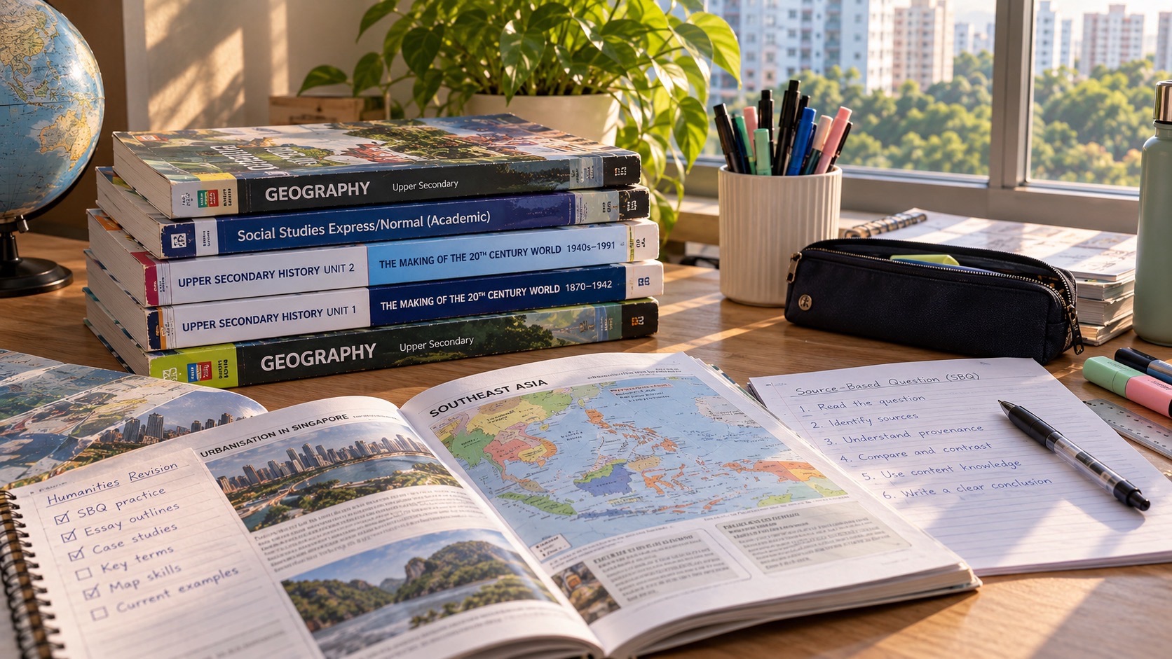
PG3 is Posting Group 3, a Secondary 1 school-admission route under Full Subject-Based Banding. It does not entitle a student to a separate PG3 field trip or determine which geographic investigation a school must conduct. Lower-secondary Geography at G3 develops map interpretation, understanding of natural and built environments, geographical inquiry and careful use of observations, measurements and evidence. Punggol is a useful local context because families can see waterway landscapes, housing, public transport and green spaces in everyday life.
MOE’s published lower-secondary G2/G3 Geography syllabus addresses the sustainable management of resources and the building of cities, including water, forests and mangroves, housing and transport. It also places geographical investigation and fieldwork at the centre of learning. NParks describes Punggol Waterway Park as a public park with heritage, recreation and ecological features, while URA’s October 2026 Punggol Digital District guidance discusses walkable, cycling-friendly development. These public descriptions can support thoughtful family observation; they do not establish that any particular secondary school has scheduled a field trip there.
- PG3 is an admission group; G3 Geography develops spatial reasoning and evidence-based geographical inquiry.
- Read map title, orientation, legend, symbols, scale, boundaries and date before interpreting a location.
- Geographical investigation begins with an answerable question, a suitable method and ethical data collection.
- Field observations, samples and surveys are limited evidence; avoid claims about the whole estate from one visit.
- MOE’s lower-secondary syllabus explores water, forests and mangroves, housing and transport sustainability.
- Punggol Waterway Park is a public example for observing land use, accessibility, shared paths and green spaces.
- URA’s published Punggol Digital District planning vision is a source for official intentions, not proof that every feature is completed.
- Use school-approved fieldwork, keep public-space activities safe and distinguish your own family exercises from official school lessons.
Definition lock: map skills and geographical investigation
| Term | Meaning | Common mistake |
|---|---|---|
| Map scale | Relationship between map and ground distance | Assuming a map length is walking-route length |
| Field observation | What was seen or recorded at a defined place and time | Claiming it represents every resident |
| Sampling | Selection of sites, times or observations | Choosing only a convenient extreme |
| Planning evidence | Official development intentions or guidelines | Treating plans as already completed |
| Geographical conclusion | Reasoned answer consistent with evidence | Ignoring uncertainty and other stakeholders |

Guide chapters
- Why Geography begins with the question ‘Where?’ but does not end there
- PG3 is not the name of a fieldwork assessment
- Geographical inquiry has a beginning, middle and end
- Map titles and dates matter before the first symbol
- Orientation and direction are the first map-reading tools
- Legends and symbols turn shapes into information
- Scale explains the difference between a diagram and a distance
- Fieldwork observations are not the same as data about every resident
- Choose a sampling method that suits the question
- An observation sheet needs clear categories
- Maps and photographs provide different kinds of evidence
- Punggol Waterway Park provides a local place-based example
- Shared paths involve geography and civic responsibility
- The built environment can be investigated without trespassing
- URA’s Punggol Digital District page is planning evidence
- Water as a resource: geography is not just a scenic photograph
- Trees, vegetation and urban microclimates
- Transport geography is about access, not only distance
- Tables, diagrams and graphs require honest interpretation
- Different stakeholders see the same place differently
- Geospatial technology is useful only with critical thinking
- Fieldwork ethics: do not turn residents into unwilling subjects
- The difference between school fieldwork and a family walk
- A four-week map and fieldwork readiness plan
- What to ask the receiving Punggol school
Why Geography begins with the question ‘Where?’ but does not end there
A student may think Geography means remembering the names of countries and places. Those facts can be useful, but they are only an entry point. Geographical thinking asks where a phenomenon occurs, why it may be distributed that way, how people and environments interact and which impacts follow. The learner must connect location, process and evidence rather than memorise a map as though it were a poster.
Consider a family noticing that some public areas in Punggol have more shade than others. The geographical question could be where shade is concentrated, how the built environment and plants affect it and why different users might value it. Answering responsibly would require observations and appropriate measurements, not simply declaring one area ‘better’.
Parents can build the habit through conversation: ‘What is different about these two places, and how do you know?’ This trains geographical inquiry without needing a formal excursion.
PG3 is not the name of a fieldwork assessment
Posting Group 3 affects Secondary 1 admission and generally the initial level of many subjects. The school’s Geography timetable, fieldwork assignments and assessment conditions are separate matters. A pupil taking G3 Geography may conduct school-approved investigations, analyse supplied data or use maps and photographs in class. The specific method depends on the teacher’s learning objectives and available arrangements.
MOE’s syllabus describes geographical investigation as integral to learning and encourages student-directed inquiry with fieldwork. It is not accurate to promise that every school visits the same Punggol landmark, uses the same equipment or conducts fieldwork on one particular Saturday. Teachers determine the activity and its safety and assessment expectations.
The family should understand the process rather than assume fieldwork is a recreational trip. It is a way to gather evidence that can inform an argument about places and processes.
Geographical inquiry has a beginning, middle and end
An investigation usually starts with a focused geographical question. Students then decide what information is required, choose suitable sources or data collection methods, examine the evidence and communicate a conclusion. They should also recognise limits. A question that cannot be answered using the available evidence needs to be narrowed or reworked.
Imagine a pupil asking whether the public path near a residential block is used more by walkers than cyclists during a particular observation period. That is narrower than ‘Do Punggol residents prefer walking?’ The narrow question defines a location, time and observation method; the broad question would require far more comprehensive evidence.
Parents can help the child rewrite an ambitious topic as one realistic question. A manageable investigation produces more reliable reasoning than a sweeping claim dressed up with several photographs.
Map titles and dates matter before the first symbol
Maps are created for particular purposes and times. A transport map may emphasise connectivity while omitting building details, and a land-use map may identify planning categories without showing current pedestrian flows. The student should check the title, date, publisher and spatial extent before interpreting anything. A map is evidence, but it is a selective representation of a place.
Punggol has evolved rapidly. A map from an older development phase may depict roads, facilities or planned connections differently from a more recent official map. The child should not infer that a planned feature is already operating just because it appears on a document. The legend and explanatory notes may distinguish existing from proposed elements.
Teach the pupil to ask what the map is intended to show. Without that question, even correct symbol reading can lead to a misleading conclusion.
Orientation and direction are the first map-reading tools
North arrows and coordinate conventions help students describe where features lie in relation to one another. Yet not every map is oriented identically, and digital maps can rotate. The learner should check orientation before stating that a facility lies east or west of another. A wrong direction can undermine an otherwise accurate route or geographical description.
Try a paper exercise with a simplified fictional neighbourhood map. Ask the child to identify a park southwest of a library and describe the direction from one point to another. Then rotate the map and ask whether the geographic relationship itself has changed. The printed page moved, but the features did not.
This simple exercise develops spatial reasoning without requiring an unsupervised journey. It can support later work with topographic maps, GIS and field observations.
Legends and symbols turn shapes into information
Maps compress complex places into symbols, colours and lines. A blue area may represent water on one map but a category in a statistical map; a thick line may indicate a major road, a route boundary or a data trend. Students must use the legend and map context rather than assume every symbol has one universal meaning.
Imagine two maps of the same area, one showing transport connections and another showing tree cover. A student who treats both colour schemes alike may infer that a transport corridor is a green space. The error is conceptual, not just visual. Ask the pupil to explain the legend before forming a conclusion.
Parents should make this a habit when looking at diagrams online. Professional-looking colour does not remove the need to read how the map encodes information.
Scale explains the difference between a diagram and a distance
A map scale connects distances represented on the map to distances on the ground. Without it, two features that look close on a screen may be much farther apart than expected. Digital zooming can also change what a fixed visual length means. Students should distinguish measured map distance, ground distance and realistic travel route.
Use a simple fictional scale: one centimetre on paper represents two hundred metres in the real area. A line that measures three centimetres then represents six hundred metres along that line. The actual walking route may be longer because paths curve around buildings or water. The calculation gives one kind of spatial information, not an exact journey time.
Teach the child to state the units and method. A neat number is not sufficient if the map scale was misunderstood.
Fieldwork observations are not the same as data about every resident
Walking through a place produces useful firsthand observations, but the sample is limited by location, time and who happened to be present. A pupil who sees three cyclists on a park path cannot conclude that most Punggol residents cycle daily. That larger claim would require a different sampling design and probably more extensive data.
Students should identify what they actually observed and avoid extrapolating beyond the evidence. The child may record that, during a ten-minute supervised observation, three cyclists used one selected segment. That is a narrower and more defensible statement than announcing a population-wide habit.
Parents can encourage honest limits in the report: the observation occurred at one time, at one site, in particular weather. Those details make the evidence more useful rather than less impressive.
Choose a sampling method that suits the question
Sampling means selecting observations or locations in a way that helps answer the investigation question. A pupil might compare several predefined points along a route or observe one site at different times. These methods are not interchangeable, and each has advantages and limits. The teacher should guide formal fieldwork designs and any permissions required.
A student who chooses only the busiest-looking place to estimate average path use risks a biased result. Conversely, choosing too few points may miss meaningful variation. Ask what the sample is intended to represent and why these locations or times were selected. The answer should be connected to the question, not simply convenience.
Use hypothetical tables to discuss sampling before any public-space data collection. Young students should not interview strangers or collect sensitive details independently.
An observation sheet needs clear categories
A field observation should record the information relevant to the question in a consistent format. For a public-path study, categories might distinguish pedestrians, cyclists and other users, with a stated time interval and location. Ambiguous labels create inconsistent data. The pupil should decide how to record a person pushing a bicycle before the observation, not change categories halfway through.
Keep the exercise proportionate and respectful. Do not identify individual residents or publish photographs of people without appropriate consent. Where a school activity involves surveys or interviews, follow its ethics and permission procedures. Public spaces contain people who have not agreed to become research subjects.
A clear observation sheet supports reliable comparison and protects privacy. Both qualities belong to good geographical practice.
Maps and photographs provide different kinds of evidence
A map emphasises spatial relationships through scale and symbols, while a photograph records what appeared within a particular frame at a particular time. Neither shows everything. A photograph may reveal shade and surface condition, but not establish how a place is used throughout the day. A map may show a cycle path, but not whether it was obstructed at the moment of a visit.
Students should ask what each source contributes. If a map labels a public path and a family photograph shows part of it, the combination may support a more informed description. It does not automatically justify a claim about accessibility for every person or under every condition.
Encourage precise captions: location, date if known, what is actually visible and relevant limitations. Avoid presenting an illustrative photograph as a measurement.
Punggol Waterway Park provides a local place-based example
NParks describes Punggol Waterway Park as a public park along Sentul Crescent, with themed areas including Nature Cove, Recreation Zone, Heritage Zone and Green Gallery. The park integrates greenery, paths and water frontage with the surrounding estate. Its official page provides a reliable starting point for learning about the place’s features and visitor rules.
A family can use a safe public walk to notice how different paths connect, where seating and shade appear and how people use green spaces. The activity may inspire geographical questions about recreation, accessibility or land use. The student should record observations carefully rather than assume the intended planning purpose from appearance alone.
This is an optional family learning example. It is not a claim that a Punggol secondary school runs a particular assessed investigation at the park.
Shared paths involve geography and civic responsibility
Punggol’s park connectors support movement by different users, including pedestrians and cyclists. NParks describes the Punggol Waterway Park Connector as a route along the town’s waterway. Such spaces provide an example of how transport, recreation and land use overlap. A student can discuss competing needs without declaring that one category of user automatically deserves every metre of the route.
Ask which information would help evaluate a proposal to change a path: usage counts, safety concerns, accessibility needs and official guidelines. The discussion should include the limitations of each data source. A single irritated online comment cannot establish the experience of every user.
Families should follow park rules while observing and avoid conducting activities that block circulation. Fieldwork is never a reason to create a hazard for other people.
The built environment can be investigated without trespassing
Housing, transport networks, workplaces and public facilities create patterns of urban land use. Geography asks how these components relate and how decisions affect access and sustainability. In Punggol, a student can observe building types, path connections and public transport nodes from lawful public spaces. They do not need to enter private areas to collect useful observations.
An original exercise could ask the child to compare two public routes: Which offers more continuous shade? Which has more crossings? The conclusion should be confined to the routes and conditions observed. It would be misleading to claim a general ranking for the whole estate from one family outing.
Observe safely and respect residents’ privacy. Do not photograph private homes or identifiable people for public distribution simply because the images might make a presentation more interesting.
URA’s Punggol Digital District page is planning evidence
The Urban Redevelopment Authority’s October 2026 Punggol Digital District guidance describes a development combining SIT and JTC’s business park components. It emphasises walkable and cycling-friendly design, public transport orientation, integration with greenery and waterfront features. This official page is evidence of planning goals and development guidelines, not a guarantee that every described feature is already completed.
Students can compare a planning statement with an observation, but they should label each correctly. ‘URA intends a connected cycling environment’ differs from ‘all residents can cycle continuously between every building today’. The second requires separate current evidence. This distinction between plan, implementation and outcome is central to geography.
Ask the pupil which features could be verified with a map or site observation and which claims would require official performance data. A sophisticated answer respects both policy intention and empirical limits.
Water as a resource: geography is not just a scenic photograph
MOE’s lower-secondary Geography themes include questions about the sustainable management of resources, including water. A waterway landscape can lead to discussions of water use, environmental management and the needs of people and ecosystems. Yet students should not assume they know the function of every pond, canal or drain from appearance alone.
If a child wants to understand water management, begin with official sources explaining the particular facility. Observe only from safe permitted locations and do not collect water samples without an authorised educational programme. Different systems serve different functions; unsupported speculation can lead to incorrect explanations.
The strongest inquiry distinguishes what the landscape looks like from what a relevant authority says it was designed to do and what independent evidence could establish its actual effects.
Trees, vegetation and urban microclimates
Plant cover and built surfaces can influence local experiences of shade, exposure and heat. A family may notice that a sheltered path feels more comfortable than an open paved area, but that impression alone does not quantify temperature differences. To make a defensible scientific or geographical claim, the pupil must define the measurement and control relevant conditions.
An original paper-based investigation might compare hypothetical observations from similarly timed locations and identify confounding factors such as wind or surface type. This teaches the role of data without requiring unapproved use of instruments or risky exploration in hot weather.
Encourage the child to make a careful statement: ‘This location appeared more shaded during our visit’ is supported by observation, whereas a year-round temperature claim requires much stronger evidence.
Transport geography is about access, not only distance
Map distance is one component of accessibility. Real journeys also depend on crossings, transfers, service frequency, barriers, weather and users’ physical abilities. A school, library or park that is close by straight-line distance may be less convenient than a more distant destination linked by a direct route. Geography invites students to think about these relationships.
Suppose two fictional families travel to the same public facility. One takes a direct bus; another needs a transfer. The most relevant comparison may involve reliability, time and access rather than distance alone. Students should not invent exact travel times; those would need a real route check at the appropriate time.
A geography discussion can consider who benefits from a transport change and who may face new difficulties. Good evaluation includes different user groups.
Tables, diagrams and graphs require honest interpretation
Geographical data may appear as maps, bar charts, time-series graphs or tables of surveyed responses. Before explaining a trend, pupils should read headings, units, scales and sample size. A chart of observations across four days does not automatically establish a long-term pattern. Different graph types can also exaggerate or obscure variation.
Ask the student to write three statements: what the graph directly shows, what might explain it, and what remains uncertain. This separates description from inference and evaluation. A clear geographical answer usually uses both data and relevant concepts rather than presenting numbers without explanation.
Parents should encourage appropriate caution when the information is partial. Acknowledging that a sample was small is evidence of reasoning, not an excuse for a weak answer.
Different stakeholders see the same place differently
An urban-planning decision may affect residents, businesses, cyclists, visitors, people with mobility needs and maintenance teams in different ways. Geographical evaluation considers relevant interests, evidence and trade-offs without assuming every claim is equally reliable. Students should identify what a stakeholder values and whether the proposed policy addresses that concern.
Imagine a proposal to add more seating beside a busy shared path. Families might appreciate resting places, while path users could worry about obstruction if design is poor. A serious evaluation would consider location, available space and actual usage rather than choosing a winner based on one anecdote.
This approach develops empathy and analytical judgement together. Geography becomes a way to understand complex places rather than merely memorise their features.
Geospatial technology is useful only with critical thinking
Digital mapping tools can show layers, routes and spatial patterns, but their outputs are still constructed from underlying data. Students should check who published the layer, when it was updated and which features it includes. A map pin may not represent the exact pedestrian entrance, and different routing modes can produce different paths.
MOE’s lower-secondary syllabus discusses geospatial technology in geographical inquiry. That does not mean every class uses the same platform or requires a pupil to buy specialist software. The school determines what tools are appropriate to the learning task.
Ask what the map can answer and where a ground observation might add information. The combination of digital data and responsible inquiry is more useful than treating the screen as infallible.
Fieldwork ethics: do not turn residents into unwilling subjects
Students may be curious about how people use public space, but inquiry must respect privacy, safety and consent. Do not ask minors to interview strangers alone, photograph identifiable individuals unnecessarily or enter restricted locations. School-led investigations follow the teacher’s procedures and any applicable permissions. A family observation can be designed using non-identifying information from lawful public areas.
Anonymised counts and publicly available official data may be adequate for many simple questions. If a project requires sensitive information, the school should guide whether and how the task may proceed. Academic curiosity never overrides a person’s dignity or safety.
Teach the child that ethical limitations belong in the research method. A well-designed investigation makes those choices explicit before evidence collection begins.
The difference between school fieldwork and a family walk
A school geographical investigation is a structured learning activity with a defined question, assessment expectations and supervision. A family walk can be useful preparation but does not automatically qualify as a formal school investigation. Parents should not complete teacher-assigned data collection on the student’s behalf or fabricate observations when the family cannot visit.
If a school requires a report, read the instructions carefully. Identify which work is collaborative, what must be individual and whether particular locations or tools have been approved. A polished report made from invented site notes undermines the learning and may breach school integrity rules.
Family activities work best as optional curiosity-building. One thoughtful question and a short reflection are often enough to help the child understand what geographical inquiry feels like.
A four-week map and fieldwork readiness plan
In week one, practise orientation, legends and scale on a fictional map. In week two, develop one focused geographical question and identify possible evidence sources. In week three, analyse an official park or planning page and distinguish stated intentions from observed outcomes. In week four, use a supplied data table to write a conclusion with a clear limitation.
Each task can be short and independent. After feedback, give the student a different map or scenario to test transfer. Do they identify units without prompting? Can they explain the sampling limits? Can they separate what the map shows from what they merely suspect? These are meaningful indicators of developing skill.
Keep the school programme at the centre. The family plan should complement teachers’ instructions and leave room for reading, other subjects, CCA participation and rest.
What to ask the receiving Punggol school
Ask which Geography themes are covered in the actual Secondary 1 and 2 programme, how geographical investigation is organised and whether students use maps, fieldwork or geospatial tools. Enquire about permissions, equipment and assessment criteria. Different schools may use different field sites and schedules, so a public guide should not claim one common Punggol trip for every cohort.
For students who struggle, ask whether the problem lies in reading maps, interpreting data, explaining causes or writing an evidence-based answer. Each needs targeted teaching. A child who reads directions accurately but overgeneralises from a sample does not need the same lesson as one who misreads a scale.
The aim of Geography is a student who can see relationships between people and places, ask answerable questions and make claims that fit the evidence. PG3 determines an entry context, not a final limit on curiosity.

Frequently asked questions about PG3 Geography
Does PG3 guarantee a Geography field trip to Punggol Waterway?
No. PG3 is a posting group. The school’s actual fieldwork locations and requirements must be verified.
What is geographical investigation?
An inquiry process that frames a question, gathers and analyses evidence, evaluates findings and communicates a defensible conclusion.
What themes appear in MOE’s lower-secondary Geography syllabus?
The published G2/G3 syllabus includes resource sustainability and sustainable cities, with water, forests, housing and transport among topics.
Is a satellite map enough to prove current conditions?
Not necessarily. Check the data source and date and recognise where ground observations may be needed.
Can a pupil survey strangers for schoolwork?
Follow school ethics and permission guidance. Minors should not conduct unsupervised interviews or collect sensitive personal information.
What does scale mean?
A representation of the relationship between a distance on a map and a distance on the ground.
Can one observation support a whole-estate conclusion?
Usually not. Identify the sample size, location, time and limits before generalising.
Is Punggol Digital District’s plan the same as a completed feature?
No. URA guidelines describe planning intentions and requirements; current completion needs separate evidence.
What can families safely observe at Punggol Waterway?
Public paths, land-use patterns, greenery and wayfinding from permitted locations, while following park rules and respecting other users.
Do students need to buy GIS software?
Not automatically. Follow school requirements; MOE supports use of suitable geospatial tools but does not imply one universal private purchase.
Is a detailed graph always reliable?
No. Read axes, scales, units and source, and consider how data were collected.
What is the most useful first Geography habit?
Ask ‘Where, why there, what evidence, and what remains uncertain?’ before making a broad claim.
Continue the PG3 subject skills series: PG3 Science laboratory practical skills | PG3 Prose, Poetry and Drama | PG3 History sources and Punggol heritage
Official Geography, planning and public-place sources
- MOE Lower Secondary G2/G3 Geography syllabus and geographical investigation
- NParks: Punggol Waterway Park current public information and features
- NParks: Punggol Waterway Park Connector
- URA Punggol Digital District urban-design guidelines, updated October 2026
- PG3 G3 Science and Humanities foundations
- PG3 school ALP and LLP programmes
Your next step
Give the pupil a current official map and a photograph from a permitted public space. Ask them to explain the map’s purpose, symbol key and scale, then make one specific observation that the photograph supports and one claim it cannot establish. Check the receiving school’s actual Geography tasks before organising any field visit.


