
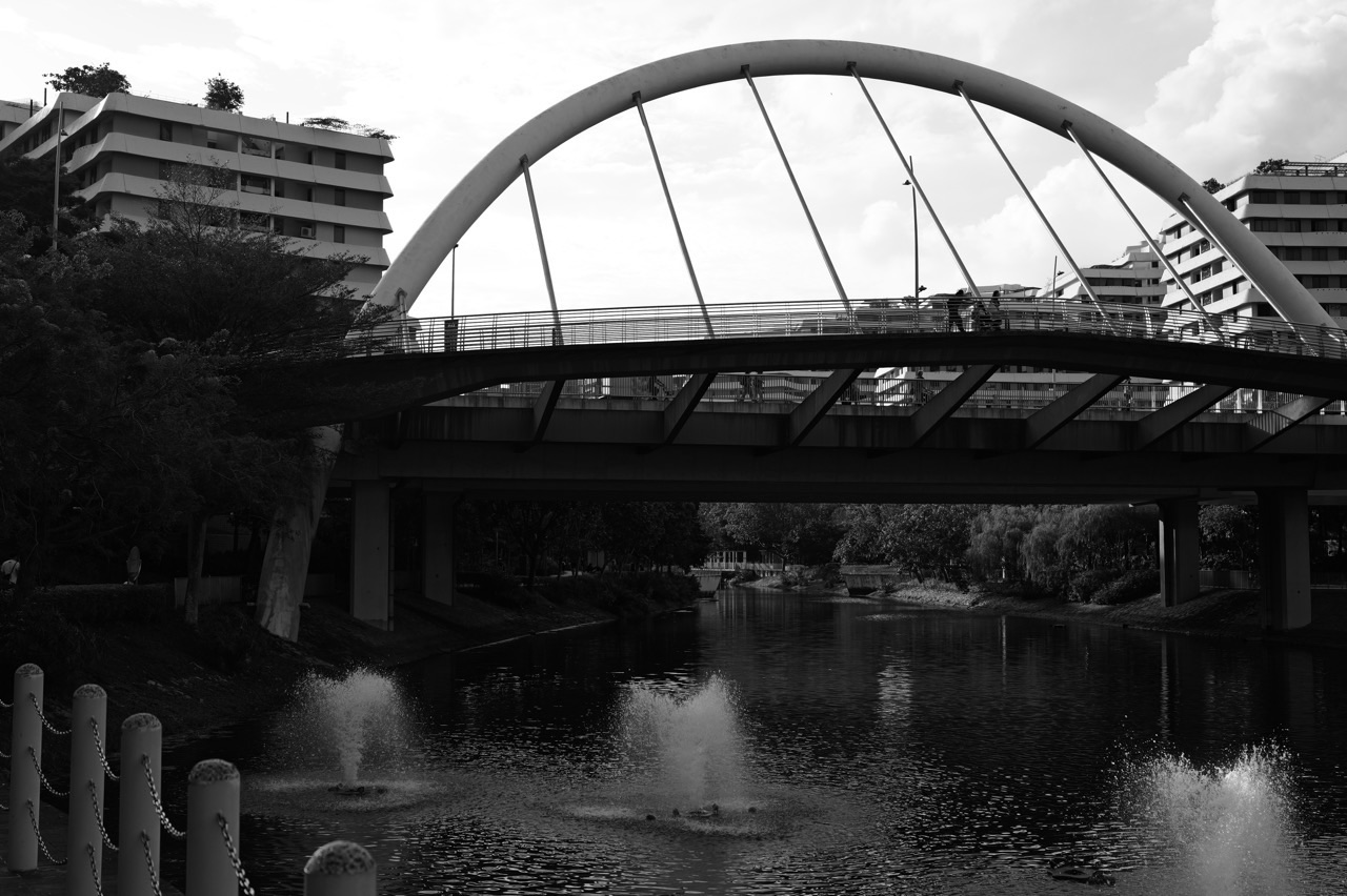
Want a free Punggol treasure hunt that children can do without hiding objects? Turn the neighbourhood into a series of safe urban clues: identify an MRT or LRT sign, find a bridge’s shape, notice a planted Waterway edge, read a directional arrow, or look at a public mural. Choose one short public zone—central Punggol around the MRT and Waterway, the civic facilities near One Punggol, or the completed parts of Punggol Digital District—and let children explain what they discovered. No paid organiser, geocache, hidden package or advance ticket is required.
A Punggol urban scavenger hunt is distinct from a nature-only hunt. Its clues come from wayfinding, transport, bridges, architecture, heritage, language and public spaces. A child might notice a lift symbol; an older student might explain why a future trail drawn on a masterplan is not yet an open pedestrian route. The activity can be completed with a notebook rather than a phone. Set a firm turnaround point, keep adults responsible for crossings, and never treat clues as permission to enter schools, construction sites, workplaces or private residential facilities.
Updated 17 October 2026. Punggol Point Park is under upgrading and Punggol Heritage Trail remains phased: JTC confirms its first 400m is open, not the full future 1.3km connection. Plans in this article remain optional and route-dependent. The dedicated Punggol nature scavenger hunt is the better choice when the family’s interest is mainly plants and wildlife; this article focuses on the town’s human-made environment.
Choose a treasure-hunt route in 30 seconds
| Participants | Starting cluster | Pick 3–6 clues | Time to allow |
|---|---|---|---|
| Primary 1–2 with caregiver | Central Punggol public areas | Circle, triangle, directional arrow, seat | 20–30 minutes |
| Primary 3–4 with caregiver | One Punggol and a short Waterway segment | Library sign, bridge, crossing, map | 30–45 minutes |
| Older Primary or Secondary | Punggol Coast public district | Mural, transport, heritage contrast, route legend | 45–75 minutes |
| Mixed-age family | Nearest familiar public neighbourhood | Three visible symbols and one conversation | Until the youngest needs a break |
| Visitors with mobility requirements | End-to-end checked public accessible route | Signs, building features, one viewpoint | Flexible, with an easy exit |
| Thunderstorms or unhealthy haze | At home or appropriate indoor area | Map and photo clues | As convenient |
The eight rules that keep the family hunt safe and enjoyable
Look, describe and explain—do not collect
The treasure is a piece of information: a sign, pattern, building detail or historical question. A child never needs to pick flowers, move public furniture, take something from an HDB common area, uncover hidden objects, climb structures or explore a secluded drain. Physical tokens or small prizes, if any, stay with the supervising adult.
At the end, reward noticing or helping rather than collecting. A treasure hunt that leaves the neighbourhood unchanged is easier to repeat and much kinder to other users.
One neighbourhood is more than enough
Punggol MRT, Northshore Plaza and Punggol Coast MRT are not interchangeable names for one site. Moving between them consumes travel time and can turn a fun afternoon into a list of station transfers. Choose one main cluster with a known safe return path, then select clues appropriate to what is actually there.
A short Waterway route is not a full loop of the park’s four themed areas. A short Coast route is not proof that every planned walkway has been completed. The Punggol lifestyle planner can help with time and energy.
A map is not permission to use a closed connection
The town’s future masterplan may show appealing continuous routes. In October 2026, Punggol Heritage Trail opens in phases and the Punggol Point upgrading closure changes northern itineraries. Schools, SIT teaching spaces and tenant offices have their own access rules. Adults should check current signposts and official access notices.
If a clue needs a closed path, substitute another rather than improvising a shortcut through a worksite. Never send a child past a hoarding because a photograph taken in a previous year makes it look open.
Train stations are for commuters first
Station codes, line colours and lift symbols are excellent puzzles. The challenge should occur from a safe place where a family can stop without interrupting passenger flow. Avoid platform-edge photographs, running races across escalators and games that require children to push through crowds.
Use a current LTA map and the signage at the actual station. Adults handle fares, crossings and supervision. A child can describe a sign without becoming the family’s sole navigator.
A good clue has evidence, not an invented answer
If a pupil sees an arched bridge, they can describe its shape. They cannot infer every structural load or the engineering design merely from one view. Similarly, a historical mural is a contemporary visual interpretation rather than a certified archival photograph. Encourage ‘I see…’, ‘I think…’ and ‘I would check…’ as separate claims.
This is a natural way to connect the outing with Science, Mathematics, Geography and English, but it should not become an extra examination. Curious observation is the objective.
Make room for age differences
A six-year-old may enjoy spotting colours and circles while an older sibling wants to compare architecture or map distance. They can walk together and answer different questions at the same point. The activity should not measure which child reads fastest or remembers the most technical vocabulary.
Offer two ways to participate: verbal description or a simple drawing. An older participant can help explain without taking all the decisions. Finish when the group is still enjoying itself.
Photograph objects, not unsuspecting people
Photos can help remember a sign or shape, but cameras are optional. Avoid identifiable bystanders and especially other people’s children. Do not stop in shared cycling paths for photos or stand close to water edges to improve a composition.
Sketching or writing the observation is usually enough. If someone in the family wants to publish photographs, ask consent and avoid representing a private space as a tourist attraction.
Weather cancels the outdoor part, not the idea
Punggol has thunderstorms, heat and haze. If it is unsafe or unsuitable to be outdoors, switch to map reading at home or a permitted indoor library browse. No amount of enthusiasm makes an exposed waterfront safe during lightning or overrides official air-quality guidance.
Define a cancellation rule before setting out. The hunt can be repeated another day without any loss of money or meaning.
Four zones that support an urban treasure hunt
Central Punggol and Waterway Park
Choose a clearly signed public start near Punggol MRT. Potential clues include line colours, a lift icon, an arch or truss form, planting beside paths, a water reflection and a safe return sign. The Waterway is a large park, so select just one public segment and avoid taking a group on an unplanned long loop.
The Punggol Waterway Park guide owns route details. Respect pedestrian priority, some no-riding bridge restrictions and the difference between a public bridge and a private or restricted path.
One Punggol community and library areas
An integrated hub brings together civic services, food and library functions. A small hunt can ask children to find the word ‘library’, identify a lift and explain the wayfinding to a suitable public area. In the ordinary library, visitors can locate a book category or community exhibition without turning a reading space into a noisy game.
Some zones have specific age, quiet, booking or no-food rules. Clues must be compatible with those rules. The One Punggol guide handles building facts.
Punggol Coast Digital District public spaces
JTC confirms public amenities including the Shaping Hearts mural and the first open part of Punggol Heritage Trail. Clues here can compare a modern building, retained old-road landscape, a mural’s title and a transit sign. It is a good zone for older children interested in art and urban development.
Use the current public map, remain outside worksites and do not assume SIT interior areas are open for games. The Punggol public-art walk explains the mural’s documented cultural context.
Neighbourhoods on the East and West LRT loops
Some families simply want to explore outside their own block. Near a familiar residential LRT stop, a small hunt can feature a station code, covered walkway, planting, crossing signal and public transport sign. It does not need a major mall or expensive ticketed attraction.
Respect estates, schools and workplaces. Check the exact route and step-free paths when relevant. The East Loop things-to-do guide and West Loop guide give neighbourhood context.
Twenty original Punggol urban clues
1. Find a transport line’s identifying colour
Look: Observe a current official station map and identify the line colour. Location: Near the station entrance. Safety: You need not board the train; stay out of commuter flows. Proof: describe it, sketch it or take an appropriate object-only photograph. Use only three to six clues per outing; this list is a menu, not a required marathon.
2. Find a lift pictogram
Look: Describe how the icon differs from an escalator symbol. Location: MRT or suitable civic hub. Safety: The full onward route still needs accessibility checking. Proof: describe it, sketch it or take an appropriate object-only photograph. Use only three to six clues per outing; this list is a menu, not a required marathon.
3. Find a safe marked crossing
Look: Identify a signal or public crossing’s purpose. Location: Roadside safe waiting point. Safety: Only an adult directs the real crossing. Proof: describe it, sketch it or take an appropriate object-only photograph. Use only three to six clues per outing; this list is a menu, not a required marathon.
4. Find a straight line and a curve
Look: Point to both shapes in a public bridge or railing. Location: Waterway viewpoint. Safety: Do not lean over an edge or step into a cycle lane. Proof: describe it, sketch it or take an appropriate object-only photograph. Use only three to six clues per outing; this list is a menu, not a required marathon.
5. Find a repeated architectural form
Look: Notice the same panel, column or window shape twice. Location: Public building exterior. Safety: Describe visible repetition without inventing a designer’s intention. Proof: describe it, sketch it or take an appropriate object-only photograph. Use only three to six clues per outing; this list is a menu, not a required marathon.
6. Find a map legend
Look: Explain what one symbol or colour represents. Location: Public map board. Safety: Check the actual current legend, not your guess. Proof: describe it, sketch it or take an appropriate object-only photograph. Use only three to six clues per outing; this list is a menu, not a required marathon.
7. Find two directions
Look: Use left and right or north and south from a known reference. Location: Safe open path. Safety: A child should never race ahead to test the route. Proof: describe it, sketch it or take an appropriate object-only photograph. Use only three to six clues per outing; this list is a menu, not a required marathon.
8. Find one tree near something built
Look: Compare canopy with walkway shade. Location: Landscaped public area. Safety: Do not enter planting or collect leaves. Proof: describe it, sketch it or take an appropriate object-only photograph. Use only three to six clues per outing; this list is a menu, not a required marathon.
9. Find a shelter from ordinary rain
Look: Notice a roof or covered link. Location: Neighbourhood path. Safety: Rain shelter does not imply safety during lightning exposure. Proof: describe it, sketch it or take an appropriate object-only photograph. Use only three to six clues per outing; this list is a menu, not a required marathon.
10. Find one bridge reflection
Look: Observe how light and water change the view. Location: Waterway public path. Safety: Stay away from water edges. Proof: describe it, sketch it or take an appropriate object-only photograph. Use only three to six clues per outing; this list is a menu, not a required marathon.
11. Find a sign protecting other path users
Look: Read a cycling or access notice. Location: Park connector. Safety: Follow it; don’t test a prohibited action. Proof: describe it, sketch it or take an appropriate object-only photograph. Use only three to six clues per outing; this list is a menu, not a required marathon.
12. Find the purpose of a civic building
Look: Look for the words library, community or information. Location: One Punggol public areas. Safety: Do not enter staff-only rooms. Proof: describe it, sketch it or take an appropriate object-only photograph. Use only three to six clues per outing; this list is a menu, not a required marathon.
13. Find one free seat
Look: Locate a suitable shared public bench. Location: Park or plaza. Safety: Do not claim exclusive access or leave belongings unattended. Proof: describe it, sketch it or take an appropriate object-only photograph. Use only three to six clues per outing; this list is a menu, not a required marathon.
14. Find two materials
Look: Compare stone, glass, metal or concrete from public view. Location: Building exterior. Safety: Do not touch construction areas. Proof: describe it, sketch it or take an appropriate object-only photograph. Use only three to six clues per outing; this list is a menu, not a required marathon.
15. Find an old-and-new contrast
Look: Compare a sourced historical image with a current view. Location: Library or heritage segment. Safety: Differentiate old physical remains from a modern recreation. Proof: describe it, sketch it or take an appropriate object-only photograph. Use only three to six clues per outing; this list is a menu, not a required marathon.
16. Find the public mural’s title
Look: Read or research Our Punggol Story at the appropriate public space. Location: Punggol Coast. Safety: Credit the artists and follow public access restrictions. Proof: describe it, sketch it or take an appropriate object-only photograph. Use only three to six clues per outing; this list is a menu, not a required marathon.
17. Find a visible number used for directions
Look: Check a platform code, floor number or building sign. Location: Station or civic facility. Safety: Do not infer that the same number means distance. Proof: describe it, sketch it or take an appropriate object-only photograph. Use only three to six clues per outing; this list is a menu, not a required marathon.
18. Find a safe place for a meal
Look: Identify a confirmed open food venue or known public eating option. Location: Same chosen district. Safety: A clue should not require an unwanted purchase. Proof: describe it, sketch it or take an appropriate object-only photograph. Use only three to six clues per outing; this list is a menu, not a required marathon.
19. Find the end of a permitted public route
Look: Notice where signs tell you to turn or not enter. Location: Current public park or district. Safety: Never cross a works fence to finish a clue. Proof: describe it, sketch it or take an appropriate object-only photograph. Use only three to six clues per outing; this list is a menu, not a required marathon.
20. Find your way home
Look: Identify the correct return transport and meeting point. Location: Final agreed point. Safety: An adult confirms real directions and supervises children. Proof: describe it, sketch it or take an appropriate object-only photograph. Use only three to six clues per outing; this list is a menu, not a required marathon.
Four ready-made family missions
The 25-minute Primary 1 shape hunt
Meet at a familiar central public location. The child identifies a circle, a straight line, a curved rail and a directional arrow while an adult handles the route. Turn back before the child is tired. The same shapes can be found indoors if the weather is unsuitable.
The purpose is observation and fun. Do not introduce a scoring system that rewards running ahead or touching public objects.
The 45-minute Punggol MRT and Waterway hunt
Choose a station symbol, one bridge shape, a path-rule sign, a tree next to a constructed surface and the agreed return direction. Use a short signed public route only. Pause at a safe space where the family can discuss answers without blocking others.
An older child can explain why the path must be shared by different people. Do not extend the route to another part of town simply to find a missing clue.
The 60-minute Punggol Coast heritage and art hunt
From an official public access, find a transit sign, a visible modern design feature, the title of a documented mural, a heritage-related landscaped element in an open public section, and the route back. Compare older and newer Punggol without claiming the entire future Heritage Trail is open.
The group must remain in completed public areas. The optional artwork is a visual prompt, not proof of a historic event’s exact appearance.
The indoor map mystery
Use public transport and district maps at home. Make children identify two different stations, a park symbol, the route to a library and an area marked under development. Follow with one fictional itinerary that they must explain to an adult.
This is a good no-travel choice during haze, thunderstorm warnings or illness. A guessed route is not actual permission to travel or enter a restricted location.
How to use clues for gentle real-world learning
In Mathematics, shapes are the beginning of a deeper question, not the entire lesson. The bridge’s curve can encourage a student to think about geometry. A published map scale can encourage careful distance estimation. For example, when a map explicitly states 1:5,000, one centimetre on paper represents 50 metres on the ground. A four-centimetre line represents 200 metres at that scale. But the actual walk may be longer because the path cannot go straight through buildings or across every water feature. The eduKateSG map and distance guide teaches that distinction.
In English, ask children to compare ‘the sign is beside the lift’ with ‘the arrow points toward the lift’. The first describes position; the second describes function. Both can be accurate, and the distinction helps a child become more precise. The eduKateSG Punggol prepositions guide extends the idea. In Science, observe a planted bank or path surface without claiming one casual glance proves its whole ecological or engineering function. Curiosity followed by checking sources is enough.
If you want a light game score, reward observing carefully, explaining the evidence and helping someone else. An adult might give one point for each of those three behaviours. No scoreboard is needed, and nobody has to finish all twenty clues. A child who notices that a map is out of date or a route is closed has made a thoughtful observation; that is a stronger result than completing a dangerous shortcut.
Playdate, group and weather rules
A two-family hunt is still a shared outing with supervision, transport and photography agreements. When children join, parents should agree who is responsible at crossings and where the group meets if split. For a large ticketed or equipment-based park event, NParks’ event-venue rules can apply. This article describes an ordinary small family activity, not a licensed event.
Plan the outing around current weather rather than a calendar promise. The Punggol waterway is exposed in places; heat, lightning and transboundary haze may make outdoor time inappropriate. Swap to indoor library clues or at-home route planning when needed. Do not encourage a child to remain beside a waterbody in a thunderstorm because the last clue has not been solved.
Frequently asked questions about a Punggol urban scavenger hunt
Is there a real hidden treasure?
No. The ‘treasure’ is observing public signs, shapes, art and neighbourhood features. There are no secret packages or objects to remove.
Is it free?
The self-guided activity is free to run. Public transport, food or optional paid activities are separate costs.
Where do we begin?
For an uncomplicated family outing, start with a known public place near Punggol MRT. For an art-oriented older group, Punggol Coast is an alternative.
How many clues do children need to complete?
A small set of three to six is plenty for many groups; adjust the length to age, energy and weather.
Can the activity be done without a phone?
Yes. Use spoken answers or a small notebook. Photography is optional and should respect other people.
Are public parks open for any kind of event?
Ordinary visits differ from ticketed, equipment-based or large organised events. Check NParks conditions for those specific purposes.
Can children collect plants as prizes?
No. Observe or draw them without removing or damaging vegetation.
Can we hunt inside a school?
No. Schools are not ordinary public tourist attractions. Stick to lawful public paths.
Can children use the Punggol MRT platforms as a game?
Do not create races or games near platform edges or busy commuter flows. Signs can be studied safely from permitted areas.
Can I enter Punggol Point Park in 2026?
Do not assume so; upgrading works are under way. Use current NParks closure notices and choose an open alternative.
Is the whole Punggol Heritage Trail open?
No. JTC’s public information identifies the first 400m open and the longer route as phased.
Can we use Punggol Regional Library?
Yes for suitable normal library browsing and quiet clues, subject to age and behaviour rules. Private activities or workshops may require booking.
Can younger siblings and teens do it together?
Yes, with different clue difficulty and shared safe movement. Older students can provide reasons while younger ones identify shapes.
What if the sign or art is not there?
Skip it or choose another clue. Maintenance and new-town development can change the physical setting.
What if rain or lightning begins?
Stop the outdoor activity and move to an appropriate safe alternative. A printed map puzzle can replace the walk.
What about haze?
Follow current NEA and MOH advice. Shorten, postpone or replace outdoor activity as appropriate for the participants.
Can I photograph the mural?
Follow the current public-space rules, credit creators and avoid obstructing people or entering restricted areas.
Can it help with school Geography?
It can prompt map reading, land-use comparison and evidence-based observation without replacing actual school lessons.
Can it help with English?
Describing directions, positions and visible facts creates natural language practice, but need not become an assignment.
How do I avoid an overly long outing?
Choose one neighbourhood and a clear return point. Do not attempt every clue or travel between distant clusters.
Is it the same as a nature scavenger hunt?
No. This one focuses on signs, transport, buildings and public art. The existing nature-focused hunt deals more with natural features.
What if the family wants other activity ideas?
Use the Punggol Lifestyle Planner, Punggol Waterway Park guide and the screen-free family activities series.
Explore the connected eduKate ecosystem
- Punggol nature scavenger hunt — a related but different natural-observation activity.
- Punggol Waterway Park guide — the park’s zones and public paths.
- Punggol public-art walk — documented mural and district art.
- Punggol Heritage Trail with Kids — historical observations.
- Punggol LRT Guide — transport station codes.
- Punggol screen-free family activities — more no-ticket play.
- Punggol group outing guide — coordination for several people.
- eduKateSG Punggol Map Scale and Distance — worked geographical thinking.
- eduKateSG Language of Direction — explanation and communication.
- Punggol Lifestyle Planner — when and where to go.
Sources and safety note
Primary references: NParks Punggol Waterway Park, LTA rail network map, JTC Punggol Digital District community, NLB Punggol Regional Library, NParks park connector etiquette and NParks organised events guidance. Updated 17 October 2026. This is a self-guided family idea, not an event booking or assurance that every public clue remains unchanged.


