
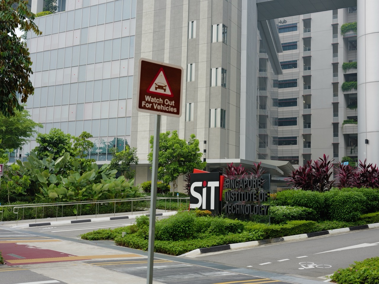
Punggol outdoor learning can turn an ordinary family walk into a surprisingly rich learning journey. The Waterway can teach Geography and Science. The LRT can teach Mathematics and systems thinking. Old Punggol Road can teach History. Rain gardens and Lorong Halus can teach ecology and water treatment. Punggol Digital District can teach urban design, energy, robotics and how a future city actually works.
Did you know? Punggol contains unusually strong examples of several school subjects within one town: reservoirs and a 4.2 km Waterway; Singapore’s first Eco-Town experiments; rain gardens, bioswales and wetlands; 14 LRT neighbourhood stations; a 1.3 km Heritage Trail following Old Punggol Road; SIT and Punggol Digital District; and historical places whose stories stretch from kampungs and farms to wartime memory and post-war recreation. The remarkable educational luxury is not that children need another lesson. It is that the town gives them more things worth asking questions about.
The Crazy-Rich Idea: A Rich Town Gives Children More Than Amenities—It Gives Them Evidence
A child can memorise that reservoirs store water. Standing beside Punggol Waterway makes the idea physical.
A child can learn that places change over time. Walking Old Punggol Road through a digital district makes that change visible.
A child can practise percentages in a workbook. Measuring walking times, comparing route lengths or analysing transport intervals turns the same mathematics into a decision.
That is the real luxury of place-based learning: the world supplies the evidence before the worksheet asks for the answer.
History: Start With What Is Missing
Old Punggol is especially good for historical thinking because so much of it no longer exists physically. Kampung Wak Sumang, the Basapa Zoo, the Japanese Fishing Pond, the Ponggol Rest House and old seafood landmarks survive through maps, photographs, archives and oral history rather than intact buildings.
That gives students a real research problem: how do we know something happened when the place itself has disappeared?
Start with Wak Sumang and Kampung Punggol, then compare it with the Lost Punggol Zoo and the Japanese Fishing Pond.
Geography: Read the Town From the Water Outwards
Punggol is a useful Geography classroom because rivers, reservoirs, coast, reclaimed land, Coney Island and Lorong Halus all sit within one local map.
Ask students to draw only the water first. Add Punggol Reservoir, Serangoon Reservoir, My Waterway@Punggol, the coast and Coney Island. Then add housing, transport and parks around them.
The exercise makes one planning fact obvious: modern Punggol did not simply add water features to housing. Its geography helped organise the housing in the first place.
Science: Follow One Drop of Rain
One of the best local Science questions is wonderfully simple: Where does this rain go?
From a roof or pavement, the answer can lead through drains, rain gardens, bioswales, reservoirs, wetlands, water treatment, evaporation and the national water cycle.
The nearby rain-gardens and bioswales pillar, Punggol Waterway pillar and Lorong Halus Wetland pillar turn one rainy afternoon into a complete systems lesson.
Mathematics: Measure the Town Instead of Inventing the Word Problem
- Measure walking or cycling distance between two landmarks.
- Compare route time by LRT, bus, bicycle and walking.
- Estimate average speed from distance and time.
- Graph travel times at different times of day.
- Calculate the percentage difference between two routes.
- Map nodes and edges in the LRT or town-centre network.
- Estimate area from maps and scale.
Real measurements are messy. That is exactly why they are educational. Students have to decide what to measure, which assumptions are fair and whether the answer makes sense.
English: A Town Is Full of Writing Prompts That Do Not Feel Like Prompts
Punggol also gives children something English tuition cannot manufacture perfectly: shared background knowledge.
A child who has watched the Waterway after heavy rain can describe it more precisely. A child who knows why Old Punggol Road was preserved can write about change and memory with more substance. A child who has compared Coney Island with Punggol Digital District has real material for contrast, argument and reflection.
Vocabulary grows more durable when words attach to observed things.
Urban Design: Ask Why the Town Looks the Way It Does
Children are very good at noticing design once someone gives them permission to ask why.
- Why does this block face that direction?
- Why is there shade here but not there?
- Why does Campus Boulevard prioritise walking and cycling?
- Why are carparks and service infrastructure pushed underground in parts of PDD?
- Why is Old Punggol Road curved instead of straightened?
- Why does one neighbourhood face the sea while another faces the Waterway?
Those questions turn architecture from background scenery into evidence about priorities.
The Best Family Learning Journey Does Not Need to Feel Like School
Parents do not need to lecture while walking.
One strong question is enough.
What do you notice here that would not make sense without knowing what this place is for?
Then let the child look.
The Crazy Rich version of education is not squeezing another lesson into the weekend. It is giving curiosity enough material that learning happens because the place is interesting.
Continue Through the Living Classroom
For local environmental systems, continue with Crazy Rich Punggol | Singapore’s First Eco-Town. For urban movement, read Crazy Rich Punggol | Waterway, Heritage Trail, Campus Boulevard and the Luxury of Connection. For the long town history, continue with Crazy Rich Punggol | From Kampung and Farms to Waterfront City.
The crazy-rich educational advantage of Punggol is not that every child lives inside a textbook. It is that enough real systems are visible nearby that a good question can turn an ordinary neighbourhood into evidence.
A child can learn an extraordinary amount without leaving Punggol.
Stand beside the Waterway and there is Geography.
Ask where the water comes from and there is Science.
Measure a route, compare travel times or map an LRT loop and there is Mathematics.
Walk Old Punggol Road as the Heritage Trail and there is History.
Look at why a shaded pedestrian boulevard is 18 metres wide, why housing faces water, why some streets disappear beneath new development and why a town needs more than one centre, and there is Urban Design.
The important point is not that Punggol is secretly a school.
It is not.
The point is more useful:
the town contains real systems that school subjects are trying to teach children how to understand.
That distinction matters. We are not inventing an official “Punggol classroom programme”, and this article is not claiming that every place mentioned is part of an MOE fieldwork route. Instead, it shows how a student, parent, tutor or teacher can use publicly accessible parts of Punggol as evidence-rich starting points for thinking.
This is the final supporting pillar in the current What about Punggol? build. It owns one canonical job: how to turn the physical town into an interdisciplinary learning environment without losing evidence discipline.
Return to the parent hub at any time: What about Punggol?
First principle: the world does not arrive divided into subjects
School needs subjects because beginners need structure.
History.
Geography.
Science.
Mathematics.
English.
Computing.
Art and Design.
The separation is pedagogically useful.
But the world itself does not respect it.
Lorong Halus Wetland is simultaneously:
- a former waste landscape,
- a water-protection system,
- a wetland habitat,
- a piece of environmental engineering,
- a public learning site,
- a cycling and walking connection,
- a case study in land-use change.
A student who asks only one subject question sees only one layer.
A student who learns to connect layers begins to understand the actual place.
This pillar is different from eduKatePunggol’s existing education pages
eduKatePunggol already has strong education ownership.
Education at eduKatePunggol owns the child’s wider education route.
School → SIT → Industry: A Learning Corridor Is Appearing in Punggol owns the conceptual progression from school learning toward applied higher education and industry.
The tuition and subject hubs own English, Mathematics, Science and examination support.
This article does not compete with them.
Its job is narrower and more physical:
what can a student learn by reading the town itself?
The Punggol learning method: Observe → Measure → Explain → Check → Connect → Return
A useful local-learning routine needs more than walking around and saying interesting things.
Use six moves.
1. Observe
What is actually visible?
Water level.
Shade.
Planting.
Building orientation.
Pedestrian flow.
A heritage marker.
An LRT station.
2. Measure
Can the observation become data?
Distance.
Time.
Temperature.
Count.
Frequency.
Proportion.
3. Explain
What mechanism could produce the pattern?
Why is this path shaded?
Why is the wetland beside the reservoir?
Why do both LRT loops return to Punggol?
4. Check
Does an authoritative source support the explanation?
HDB.
URA.
PUB.
NParks.
LTA.
National Heritage Board.
JTC.
5. Connect
Which other subject changes the answer?
A water question may also be a land-use question.
A transport question may also be a mathematical network question.
A heritage question may also be about geography and political power.
6. Return
What changed in the student’s original understanding?
The return matters because learning is incomplete until the new evidence changes the model in the learner’s head.
History: Punggol teaches that place names are evidence problems
Begin with the most ordinary historical object in the town.
The word Punggol.
Ask a simple question:
What does “Punggol” mean?
It immediately becomes difficult.
Different accounts connect the name to different Malay words and local explanations. Oral histories bring Wak Sumang into the story. Maps preserve changing spellings such as Ponggol. The evidence is uneven.
This is excellent History because the student cannot solve it by memorising one sentence.
The student has to ask:
- Who recorded this explanation?
- When?
- Was it oral memory or documentary evidence?
- Does an early map support the spelling?
- Does a later retelling become more certain than the original source?
- Can several possibilities remain open?
That is why What Does “Punggol” Mean? is useful far beyond one place name.
It teaches source discipline.
Wak Sumang teaches the difference between memory and proof
Kampung Wak Sumang occupies an important place in Punggol memory.
Stories about Wak Sumang connect a named person, a kampung, a road, a place name and later local identity.
The temptation is to turn an oral tradition into a perfectly documented biography.
A better lesson is to preserve different evidence states.
- Documented: maps and records establish places and changing landscapes.
- Remembered: oral histories preserve community stories and lived experience.
- Interpreted: later writers connect fragments into narratives.
- Uncertain: some details cannot be securely resolved.
The student learns that uncertainty is not failure.
Uncertainty is one possible honest conclusion.
See Wak Sumang and Kampung Punggol for the evidence problem in full.
The old zoo and Japanese Fishing Pond turn “rural Punggol” into a harder question
Students often imagine historical change as a simple line:
kampung → empty land → HDB town.
Old Punggol resists that simplification.
National Heritage Board material records a major private zoo near the seafront, the Japanese Fishing Pond that moved from Changi and opened in Punggol in 1927, country houses, later boatels, seafood restaurants and water-skiing.
That means pre-urban Punggol was not merely agricultural.
It contained an excursion economy.
Visitors travelled outward for leisure.
That one observation changes the historical model.
Use The Lost Punggol Zoo and The Japanese Fishing Pond at Punggol as case studies in how odd details can correct an oversimplified history.
Punggol Point teaches how one place can hold incompatible memories
Punggol Point is especially important because historical meaning changed sharply without the coastline moving very far.
Before the Second World War, the waterfront was associated with retreat and recreation.
During the Japanese Occupation, Punggol Beach became a Sook Ching execution site.
After the war, recreation returned through the Rest House, seafood, boatels and watersports.
Today, the area is again recreational—but memorial evidence remains.
This is sophisticated History because the student has to understand that a place does not have one permanent meaning.
Meaning changes through events, memory, redevelopment and use.
A respectful field observation at Punggol Point should never turn wartime mass killing into an “interesting attraction”. The learning task is to understand memory and evidence, not to consume trauma as novelty.
See Punggol Point for the full memory-and-recreation system.
Geography: begin with the shape of the town
Punggol sits at Singapore’s north-eastern edge.
Its geography is immediately legible through water.
Sungei Punggol.
Sungei Serangoon.
Punggol Reservoir.
Serangoon Reservoir.
The 4.2-kilometre Punggol Waterway.
The northern coast.
Coney Island.
A student can ask a deceptively simple question:
Which parts of this water landscape are inherited geography, and which parts are engineered geography?
The answer forces the student to distinguish rivers, reservoirs, reclaimed coastline and the man-made Waterway.
Use The Geography of Punggol as the map-reading companion.
A reservoir is not just “a lake”
When a student sees open water, the visual category is easy.
Water.
The geographic category is more demanding.
A reservoir is part of a water-supply system.
Its edge has operational rules.
Its catchment matters.
Water quality matters.
Nearby land use matters.
Recreation is permitted under constraints because the same body of water has another national function.
This is a powerful Geography lesson in multifunctional land and water use.
Reclamation teaches that coastlines can be historical records
A coastline feels permanent when we stand on it.
Punggol shows otherwise.
Large parts of the town’s modern urban form depend on reclamation and later planning.
Compare an older map with the present coast and the student can see geography changing under policy and engineering.
This leads to stronger questions:
- Why reclaim land here?
- What happened to former shorelines?
- What new flood, drainage and ecological questions appear?
- How does reclamation change access to water?
- Which historical places become impossible to locate precisely after major landform change?
The article How Punggol Became a Waterfront Town owns that transformation in detail.
Coney Island teaches that an urban edge can remain ecologically complex
NParks currently describes Coney Island Park as an 81-hectare, ecologically sustainable park with diverse natural habitats beside Punggol Promenade Nature Walk.
That immediately creates Geography and Science questions.
- How can a nature area remain connected to an increasingly urbanised town?
- What happens when cycling, recreation and biodiversity share space?
- Why do edge habitats matter?
- How do park connectors create ecological and human connectivity at the same time?
The east entrance’s connection toward Lorong Halus is especially useful because it links two very different ecological stories: a park island and an engineered wetland beside a former landfill.
Science: Punggol makes water treatment visible
Lorong Halus Wetland may be the strongest ready-made science classroom in the wider Punggol system.
PUB states that the wetland collects and treats water passing through the former landfill so that contaminated flow does not enter Serangoon Reservoir.
PUB also explicitly provides a self-guided ABC Waters Learning Trail there.
The official learning material covers:
- water sustainability and Singapore’s Four National Taps,
- the water cycle and treatment processes,
- ABC Waters design features,
- bioengineering through wetlands,
- local biodiversity,
- hands-on water-quality testing.
This is important evidence for the entire premise of this pillar.
The idea of Punggol as a place-based learning environment is not simply editorial imagination. At least some local sites are already deliberately equipped by public agencies for experiential learning.
See Why Lorong Halus Matters to Punggol for the full landfill-to-wetland mechanism.
A wetland is not magic: follow the mechanism
Students often hear that “plants clean water”.
That is too vague to be useful Science.
Ask instead:
- What contaminants are of concern?
- How does water enter the treatment system?
- What physical settling occurs?
- What role do roots and microorganisms play?
- How long does water remain in different treatment zones?
- How would we measure whether water quality improved?
The student moves from slogan to mechanism.
That is the central move in Science.
Punggol Waterway teaches that one structure can have several scientific jobs
The Waterway is visually beautiful.
That makes it easy to treat it as landscaping.
Its scientific value appears when the student asks what systems meet there.
- water movement,
- drainage and catchment,
- water quality,
- bank stability,
- planting,
- habitat,
- urban heat and shade,
- human recreation.
The separate pillar How Punggol Waterway Works follows the reservoir-to-public-life chain.
A student using the Waterway as a classroom should try to identify which observations belong to water engineering, which belong to ecology, and which belong to urban design.
Nature-based infrastructure teaches that biology can perform engineering work
Punggol’s rain gardens, bioswales, planted drainage and wetland systems are useful because they complicate the boundary between “nature” and “infrastructure”.
A concrete drain clearly looks engineered.
A planted depression may look decorative.
But if it slows runoff, filters sediment, stores stormwater temporarily and supports vegetation, it is performing infrastructure functions.
This is the core idea in How Punggol Uses Nature as Infrastructure.
For Science students, the learning challenge is to explain the causal chain rather than admire the planting.
Tropical design turns heat and wind into observable physics
Punggol’s environmental-planning work gives students an unusually direct way to think about heat transfer and airflow.
Stand in sun and shade.
Compare surfaces.
Watch how building gaps channel wind.
Notice tree canopies, sheltered routes and facade orientation.
The student can then connect everyday comfort to:
- solar radiation,
- conduction,
- convection,
- thermal mass,
- evapotranspiration,
- air movement.
See Punggol’s Tropical Design for the full heat → wind → shade → greenery system.
Punggol Digital District turns sensing into a live scientific question
JTC’s current Punggol Digital District platform describes a 50-hectare district where education, industry and smart infrastructure converge.
In July 2026, JTC stated that its Open Digital Platform aggregates real-time information from more than 20,000 sensors across PDD and its systems, while supporting a digital twin for visualisation, simulation and test-bedding.
For a Science student, the exciting question is not “Wow, 20,000 sensors.”
It is:
- What is each sensor actually measuring?
- How is it calibrated?
- How often is it sampled?
- What happens when a sensor disagrees with reality?
- How does the system distinguish signal from noise?
- Which decisions are made because of the measurement?
The existing article The Invisible City owns the deeper sensor-system discussion.
Mathematics: Punggol is full of graphs before anyone draws a graph
The Punggol LRT is a literal network.
LTA’s current information records two loops serving 14 Punggol stations, feeding Punggol MRT and the bus interchange.
To a Mathematics student:
- stations are nodes,
- track sections are edges,
- Punggol is a transfer node,
- Riviera is gaining a more important future network role through the Cross Island Line,
- Teck Lee changed utility when its surrounding destinations changed.
This allows real questions about shortest paths, transfer penalties and network centrality without needing advanced university notation.
Use How the Punggol LRT Shapes the Town as the transport-graph companion.
Distance is a Mathematics problem only after we define which distance
A student might ask:
How far is Waterway Point from my home?
There are several valid answers.
- straight-line distance,
- walking-route distance,
- cycling-route distance,
- road distance,
- LRT network distance,
- travel time.
These measurements answer different questions.
This is an important mathematical habit:
define the quantity before calculating it.
The Waterway creates ratio, rate and scale questions
HDB identifies the Punggol Waterway as 4.2 kilometres long.
That single number can support many mathematical tasks.
- If a student walks a measured section, what fraction of the full Waterway was covered?
- At a given walking speed, what is the estimated travel time?
- How does actual time differ from distance ÷ average speed once crossings and stops are included?
- How should a 4.2 km feature be represented on a map at a chosen scale?
- How large is the percentage error if a phone estimate differs from a mapped distance?
Real measurement is valuable because it includes imperfection.
The world does not hand students neat integers.
Counting people turns a public space into a statistics exercise
A student can choose one safe observation point and count:
- walkers,
- cyclists,
- prams,
- joggers,
- people stopping,
- people passing through.
But good Mathematics asks about sampling.
A ten-minute count at 7am on Sunday is not “Punggol pedestrian behaviour”.
It is one sample.
Repeat at different times.
Compare weekdays and weekends.
Keep the counting method consistent.
Then ask whether the observed difference is large enough to matter.
This is statistics as evidence rather than a worksheet table.
Urban design turns Mathematics into trade-offs
URA’s current Punggol Digital District guidelines specify Campus Boulevard as a minimum 18-metre-wide pedestrian mall, including a minimum 12-metre walking-and-cycling zone flanked by 3 metres of landscaping on each side.
These are numbers with design consequences.
A student can sketch a cross-section to scale.
Then ask:
- What proportion of the width is movement space?
- What proportion is landscaping?
- How would crowd capacity change if the clear walking width narrowed?
- How much shade can trees plausibly provide at different times of day?
- How does a maximum ramp gradient constrain the horizontal distance required to overcome a level change?
Mathematics becomes design because every dimension creates an operating consequence.
Urban Design: start by asking why things are where they are
A child often sees a town as finished scenery.
Urban design begins when scenery becomes decision.
Why is the main town centre at Punggol MRT?
Why does Waterway Point sit beside the transport interchange?
Why is Town Square attached to that cluster?
Why do both LRT loops return there?
Why are some community functions distributed instead of centralised?
The student begins to discover that a town is a designed network of proximity.
Use How Punggol Town Centre Works for the full centre mechanism.
The eleven districts teach how planners create difference inside repetition
Public housing needs standardisation.
Construction systems, flat types, infrastructure and maintenance all benefit from repeatable methods.
But residents also need orientation and identity.
HDB’s district framework for Punggol therefore gives different areas distinct landscape and design characters while keeping them inside one town system.
This becomes an Urban Design question:
how much repetition makes a town efficient, and how much difference makes it legible and memorable?
See Punggol’s Eleven Districts.
Corridors teach that a town needs lines as well as centres
A centre concentrates activity.
A corridor makes continuity.
Punggol’s Waterway, Heritage Trail, Promenade, Campus Boulevard and mobility corridors provide a useful town-scale language for this difference.
Students can compare corridor characters.
- The Waterway is a blue-green internal spine.
- The Heritage Trail preserves an older north-south line.
- The Promenade makes the coast traversable.
- Campus Boulevard is a new pedestrian-first urban spine.
- Road corridors carry buses, service vehicles and private traffic.
The comparison teaches that movement infrastructure is not one thing.
Read The Corridors of Punggol for the full system.
Campus Boulevard teaches that a street can be designed around people before vehicles
URA describes Campus Boulevard as the primary public thoroughfare linking Punggol Coast MRT through PDD toward the waterfront.
It is intended as a shaded pedestrian mall where SIT and JTC developments face a shared public space for movement and social interaction.
This gives students a useful contrast with a conventional road.
Ask what occupies the centre.
Cars?
Buses?
Walking?
Cycling?
Landscape?
Whatever occupies the most protected, continuous and generous space reveals the design hierarchy.
Northshore teaches the difference between a smart gadget and a smart estate
Punggol Northshore became the first HDB district to test smart technologies from the design stage.
Students can compare several scales of intelligence:
- environmental modelling before construction,
- smart-enabled flats,
- common-area lighting,
- parking allocation,
- maintenance access,
- waste systems.
The question becomes:
what recurring decision became better because the system could sense, model or respond?
That question protects students from technology hype.
See How Smart Housing Arrived in Punggol.
English is the operating system across the whole field study
The title of this pillar names History, Geography, Science, Mathematics and Urban Design.
English quietly holds them together.
A student has to:
- read a sign accurately,
- distinguish observation from inference,
- ask a precise question,
- summarise a source,
- compare two explanations,
- describe a pattern,
- write a causal chain,
- qualify uncertainty.
“There are many trees” is weak observation.
“The pedestrian route is shaded by continuous tree canopy along most of the visible section” is more precise.
“The trees reduce heat” is a hypothesis.
“Air temperature measured in the shaded section was lower at the same time than at the exposed comparison point” is evidence.
Language determines whether thinking survives transmission.
Primary School: begin with noticing correctly
Young students do not need a university fieldwork method.
They need disciplined curiosity.
At Primary level, Punggol can train five simple habits.
- Look carefully. What is actually there?
- Name accurately. River, reservoir, drain, Waterway, coast and wetland are not interchangeable words.
- Measure something. Count, time, compare or estimate.
- Explain one cause. Why might this shade, path or wetland exist?
- Check the answer. Read the official sign or source.
A good Primary outing should leave the child with one better model, not forty disconnected facts.
Secondary School: begin testing competing explanations
Secondary students can work at a harder level.
They can compare sources.
Design a sampling method.
Calculate uncertainty.
Separate correlation from mechanism.
Evaluate a planning trade-off.
For example:
Does a wider pedestrian route necessarily produce more walking?
No.
Width may help capacity and comfort.
But destination mix, shade, crossing friction, weather, safety, time of day and transport alternatives also matter.
This is the level where the town becomes a laboratory for multi-causal reasoning.
A three-stop Waterway lesson
A useful outing does not need to cover all of Punggol.
One compact Waterway-area lesson can move through three lenses.
Stop A: Town Centre edge
Ask how MRT, bus, LRT, retail, Town Square and the Waterway converge.
Subject: Urban Design + Mathematics.
Stop B: Waterway landscape
Distinguish engineered water infrastructure from recreational landscape.
Observe planting, bank edge, shade and path use.
Subject: Geography + Science.
Stop C: Heritage direction
Ask how Old Punggol Road and the Heritage Trail preserve an older spatial line inside a transformed town.
Subject: History + Urban Design.
The same outing produces several subjects because the same place has several functions.
A Punggol Point lesson: memory, coast and recreation
Punggol Point is better for older students because the historical material includes wartime violence.
A respectful learning sequence could ask:
- What was the area used for before the war?
- What happened on 28 February 1942?
- How should a public park acknowledge traumatic history?
- Why did recreation return after the war?
- How has the coastline and built environment changed?
- Which memories remain physically marked and which survive only in archives?
The student learns that History, Geography and memorial design cannot be separated cleanly.
A Lorong Halus lesson: landfill, wetland and evidence
Lorong Halus provides the clearest official learning infrastructure because PUB already provides a self-guided trail.
A strong student sequence is:
- Reconstruct the former landfill use.
- Identify why the adjacent reservoir changes the environmental risk.
- Follow the wetland treatment concept.
- Observe plant communities.
- Carry out only authorised learning activities and follow site instructions for water-quality testing.
- Ask what data would prove treatment effectiveness.
This is Science with a historical land-use cause.
The wetland exists because an earlier urban system left a continuing environmental problem.
A PDD lesson: the city as a cyber-physical system
Punggol Digital District is useful because it lets students connect physical urban design with digital systems.
Current official material gives several observable or researchable layers:
- Campus Boulevard and pedestrian priority,
- SIT and industry proximity,
- district energy systems,
- passive design,
- the Open Digital Platform,
- more than 20,000 sensors,
- digital-twin simulation,
- robotics and technology test-bedding.
The learning question should be:
where does information change a physical decision?
That is the bridge between computing and urban systems.
The best field question has a possible wrong answer
“Find five interesting things” produces a scrapbook.
“Does tree shade reduce measured surface temperature along this route?” can be tested.
“Does the LRT make every district equally accessible?” can be examined.
“Did Punggol always have the coastline we see now?” has documentary evidence.
“Is every wetland natural?” can be challenged directly at Lorong Halus.
A useful learning question allows reality to say no.
That is how the world corrects the learner.
Do not confuse observation with explanation
A child says:
The Waterway has many plants because HDB wanted it to look nice.
Maybe aesthetics are part of the design.
But the statement jumps from observation to purpose.
The correct sequence is:
- Observation: the bank contains extensive planting.
- Question: what functions does the planting serve?
- Hypotheses: aesthetics, habitat, shading, bank treatment, stormwater function.
- Evidence check: consult official planning or water-sensitive-design material.
- Conclusion: state only the functions the evidence supports.
This is a transferable reasoning skill for every subject.
Do not confuse a map with the territory
Maps simplify.
The LRT map removes most streets.
A district map emphasises planning boundaries.
A park map emphasises paths and facilities.
A historical map may use a coastline that no longer exists.
No map is wrong simply because it leaves something out.
The question is whether the simplification fits the job.
Students should compare maps with different purposes and ask what each one makes visible—and what it hides.
Do not measure people carelessly
Place-based learning can become invasive if students treat residents as data points without restraint.
Counting anonymous pedestrian flow from a public location is different from photographing identifiable people, following individuals or recording private conversations.
Students should use the least intrusive method that answers the question.
Good fieldwork protects other people’s ordinary use of public space.
Do not turn public infrastructure into a laboratory without permission
Observe infrastructure.
Do not tamper with it.
Do not enter restricted reservoir areas.
Do not collect plants, animals or water samples where rules do not allow it.
Do not climb barriers to obtain a “better reading”.
Where PUB or another agency provides an official learning trail or instructed activity, follow those materials and site requirements.
Scientific curiosity does not cancel public safety.
A parent does not need to lecture throughout the walk
The strongest parent move may be to ask one good question and remain quiet.
Why do you think this path is here?
Which direction is the reservoir?
How could we check that?
What changed between this old image and today?
Which part of your answer is observation and which part is a guess?
The child should do as much of the noticing as possible.
The adult supplies safety, context and the next useful question.
A tutor can use Punggol to repair disconnected school knowledge
Students sometimes know vocabulary but not reality.
Catchment.
Reclamation.
Biodiversity.
Gradient.
Interchange.
Primary source.
Sampling bias.
These words become more durable when the child can attach them to a real place.
A good tutor can therefore use Punggol as retrieval scaffolding.
“Remember the Lorong Halus wetland. What was the pollutant pathway?”
“Remember the two LRT loops. What makes Punggol a node?”
“Remember the changed coastline. Why does historical map comparison matter?”
The place becomes a retrieval cue.
The town can teach systems thinking better than isolated examples
Consider one question:
Why is Punggol Waterway pleasant to walk beside?
The answer may involve:
- shade,
- wind,
- water views,
- path continuity,
- distance from traffic,
- landscape planting,
- seating,
- connections to destinations,
- maintenance,
- safety,
- weather.
No single factor owns the experience.
The student learns to resist one-cause explanations.
That is systems thinking in its simplest form:
find the parts, find the connections, find the constraints, then ask what returns from the world.
Build a field notebook around claims, not decoration
A useful Punggol notebook can use six columns.
- Place — where was I?
- Observation — what did I directly see or measure?
- Question — what do I want to explain?
- Hypothesis — what might explain it?
- Source — what official or historical evidence helps?
- Revised answer — what changed after checking?
This format prevents a common failure.
The photograph becomes the activity.
A field notebook should preserve thinking, not merely prove attendance.
Question bank: History
- Which historical Punggol places survive physically and which survive only in records?
- How did recreation at Punggol Point change before, during and after the Second World War?
- What evidence supports different explanations of the name Punggol?
- How does Wak Sumang demonstrate the strengths and limitations of oral memory?
- Why did the Basapa Zoo and Japanese Fishing Pond make sense in Punggol in the 1920s?
- How did reclamation make some historical locations harder to reconstruct?
Question bank: Geography
- Which parts of Punggol’s water geography are natural, modified or entirely engineered?
- How do Punggol and Serangoon Reservoirs change the use of nearby land?
- How did reclamation alter the coastline?
- Why are Coney Island and Lorong Halus important at the urban edge?
- How do corridors connect different districts?
- Why might Punggol develop more than one centre of gravity?
Question bank: Science
- How does Lorong Halus Wetland protect Serangoon Reservoir?
- What evidence would show a wetland treatment system is working?
- How do trees and shade change thermal comfort?
- What physical processes influence wind around buildings?
- How do bioswales and rain gardens manage stormwater?
- What makes a sensor measurement trustworthy?
- How could biodiversity change when habitat connections are broken?
Question bank: Mathematics
- What is the shortest LRT route between two chosen stations?
- How does transfer time change total journey time?
- How accurately can you estimate a path length from a map?
- How should pedestrian counts be sampled fairly?
- What is the difference between mean travel time and the travel time most people experience?
- How does a fixed corridor width get divided among walking, cycling and landscape?
- What error is introduced when a curved route is approximated by straight segments?
Question bank: Urban Design
- Why do transport, retail and civic space cluster at Punggol Town Centre?
- What gives each Punggol district a distinct identity?
- How does a corridor differ from a centre?
- Why preserve Old Punggol Road as a Heritage Trail?
- What makes Campus Boulevard pedestrian-first?
- How can Punggol Coast become a second centre without disconnecting the older town?
- When does smart technology improve a town rather than merely add complexity?
The strongest interdisciplinary question: what problem was this system built to solve?
Ask that question almost anywhere in Punggol.
Punggol Waterway: what combination of water, drainage, urban identity and public-space problems did it solve?
LRT: what last-mile access problem did two neighbourhood loops solve?
Lorong Halus Wetland: what water-quality problem does it solve?
Campus Boulevard: what pedestrian-connectivity and public-space problem is it designed to solve?
Northshore smart systems: which estate-management problems are sensing and automation intended to improve?
Heritage Trail: what happens when development needs a new district but the town also wants continuity with an old road?
Once the problem is visible, school knowledge begins to organise itself around a real purpose.
Then ask the harder question: what new problem did the solution create?
Every intervention creates trade-offs.
Build more housing and pressure on transport increases.
Create more public access to nature and habitat disturbance can increase.
Automate estate systems and cybersecurity and maintenance become more important.
Create a strong town centre and crowding can concentrate there.
Add a second centre and connectivity between the two becomes critical.
This teaches an advanced systems principle:
solving one constraint changes the system and reveals the next constraint.
The town should be allowed to contradict the textbook
A textbook example is designed to be clear.
Reality is not.
A bioswale may be dry when the student arrives.
A shaded area may still feel hot.
A supposedly convenient route may involve an irritating crossing.
A historical marker may simplify a complicated story.
A busy place may be quiet during the observation period.
This is not a problem with field learning.
It is the reason to do it.
The world forces the student to revise the neat model.
Evidence ladder: how confident should the student be?
Use a simple confidence ladder.
- Direct observation: I saw or measured this.
- Official current source: a responsible agency states this.
- Historical primary evidence: map, photograph, newspaper or archival record supports this.
- Secondary interpretation: a later source reconstructs or explains it.
- Oral memory: valuable testimony, but not always independently verifiable.
- Hypothesis: plausible explanation awaiting evidence.
Do not collapse all six into “fact”.
Students who learn this distinction early become much harder to mislead.
The final return: what does Punggol teach that a worksheet cannot?
A worksheet can isolate a variable.
Punggol shows variables colliding.
A worksheet can give clean data.
Punggol gives measurement error, weather, human behaviour and incomplete evidence.
A worksheet can ask which answer is correct.
Punggol can ask whether the question itself was framed properly.
A worksheet can separate History, Geography, Science and Mathematics.
Punggol puts them back together.
The town can teach:
- that names carry uncertain history;
- that coastlines can be engineered;
- that reservoirs are part of national infrastructure;
- that wetlands can perform treatment work;
- that transport is a graph people experience physically;
- that urban comfort depends on heat, shade, wind and design;
- that public space depends on dimensions and interfaces;
- that technology is useful only when it improves a real decision;
- that historical memory and present recreation can occupy the same ground;
- that every solution creates another set of constraints.
Most importantly, Punggol can teach a child how to look at an ordinary place and realise that it is not ordinary at all.
The classroom gives the child concepts. The town gives the concepts consequences.
That is the purpose of this pillar.
Continue through the Punggol knowledge system
- What about Punggol? — parent hub for the complete Punggol reading system.
- How Punggol Became Punggol — the settlement-to-modern-town historical spine.
- The Geography of Punggol — rivers, reservoirs, coastline and Singapore’s edge.
- How Punggol Waterway Works — reservoirs, water security and public life.
- Why Lorong Halus Matters to Punggol — landfill, wetland and reservoir protection.
- How the Punggol LRT Shapes the Town — loops, stations and last-mile geography.
- The Corridors of Punggol — Waterway, Heritage Trail, Promenade, Campus Boulevard and mobility.
- Punggol’s Tropical Design — heat, wind, shade and outdoor comfort.
- How Smart Housing Arrived in Punggol — Northshore’s smart-estate layer.
- School → SIT → Industry — the separate formal learning-to-application corridor.
Evidence anchors
This pillar is built from current official Singapore sources and the already-published specialist pillars above. HDB’s Punggol town page records the Waterway, Eco-Town programme, Northshore smart-housing test-bedding and current district development. National Heritage Board’s Punggol: Waves of Recreation supplies evidence for pre-war leisure, the Japanese Fishing Pond, Basapa Zoo, wartime disruption and post-war recreation; NHB’s Punggol Beach Massacre historic-site record anchors the Sook Ching section. PUB’s Lorong Halus Wetland page explains the wetland’s reservoir-protection role and provides an official self-guided learning trail covering water sustainability, treatment, bioengineering, biodiversity and water-quality testing. NParks’ current Coney Island Park, Punggol Waterway Park and Punggol Heritage Trail pages establish the current public green-network context. LTA’s Sengkang-Punggol LRT page, updated 8 July 2026, records Punggol’s two loops and 14 current stations. URA’s Punggol Digital District urban-design guidelines specify the Heritage Trail and Campus Boulevard dimensions and connections. JTC’s current Punggol Digital District material establishes the 50-hectare district and education-industry setting, while JTC’s 9 July 2026 Open Digital Platform update records more than 20,000 sensors supporting live district operations and digital-twin test-bedding. Interpretive teaching activities in this article are eduKate learning suggestions, not representations of official MOE fieldwork programmes unless an agency source explicitly provides a learning trail.
Return to the parent hub: What about Punggol?


