
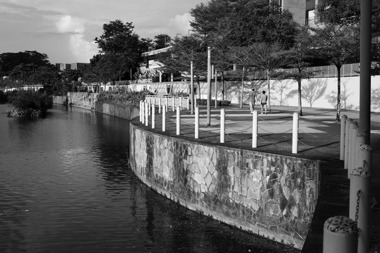
Punggol tropical design is one of the quietest forms of Crazy Rich Punggol: buildings and public spaces shaped so wind, shade, greenery and daylight can do part of the work before air-conditioning, fans and artificial lighting have to step in. In a hot, humid, rain-heavy climate, comfort is not an extra. It is infrastructure.
Did you know? Punggol’s sustainable housing experiments have repeatedly used block orientation, environmental modelling, cross-ventilation, shaded common spaces and greenery to improve outdoor comfort. At Treelodge@Punggol, blocks were oriented to catch prevailing north-eastern winds. At Northshore, HDB used environmental simulations to study wind flow, solar exposure and thermal comfort before construction. The rich idea is beautifully simple: design the geometry first, then spend energy only where nature cannot finish the job.
The Crazy-Rich Idea: Coolth Is a Public Luxury
In Singapore, shade is wealth.
A shaded walking route can make a five-minute trip feel easy instead of punishing. A breezy void deck can become somewhere people actually linger. Trees can make a path cooler while supporting biodiversity. A block that catches wind better may reduce the amount of mechanical cooling needed in shared spaces.
The value appears as comfort, but the system underneath is physics.
Wind Is Free—If the Buildings Let It Through
Tropical design starts with airflow. Buildings can block wind, funnel it, accelerate it or allow it to pass through. Orientation, spacing and height therefore change how comfortable outdoor and semi-outdoor spaces feel long before anyone switches on a fan.
This is why block layout matters. A plan can look attractive from above and still produce hot, stagnant ground conditions. Environmental modelling helps planners test these effects before the building exists.
Shade Is More Valuable Than a Beautiful Rendering
A public space can be visually impressive and still fail at 2 PM if nobody wants to cross it.
Deep overhangs, covered walkways, trees, canopies and thoughtful orientation reduce direct solar exposure. That matters for children walking home, older residents waiting outside, parents pushing strollers and anyone trying to use a public realm during the hottest part of the day.
The richer design is therefore not simply photogenic. It stays useful when the weather becomes inconvenient.
Greenery Does More Than Look Green
Trees and planting provide shade, evapotranspirative cooling, habitat and psychological relief from hard surfaces. In Punggol, greenery also connects to a larger system of water, biodiversity and public movement.
This is why tropical design and nature-based infrastructure overlap. The same tree can cool a path, support birds, slow rainfall, frame a view and make a walk pleasant enough that people choose it over a short car trip.
Outdoor Comfort Is Really a Systems Problem
- Sun: how much direct solar radiation reaches people and surfaces?
- Wind: can air move through the space?
- Humidity: how quickly can sweat evaporate?
- Materials: which surfaces store and release heat?
- Greenery: where can trees and planting cool and shade?
- Rain: can people keep moving when tropical weather changes suddenly?
- Distance: are comfortable routes direct enough that people will actually use them?
The best result is not one perfect feature. It is many small choices reinforcing one another.
The Science Lesson Hidden in a Breezy Walkway
A student can turn Punggol’s tropical design into a real science investigation.
- Compare shaded and unshaded surface temperatures.
- Observe wind direction at different building gaps.
- Measure how long a wet surface takes to dry in sun and shade.
- Map where people choose to sit at different times of day.
- Compare tree-covered routes with exposed routes.
That is how climate-responsive design becomes more than architecture vocabulary. It becomes observable evidence.
Continue Through the Punggol Sustainability Story
For the larger Eco-Town system, continue with Crazy Rich Punggol | Singapore’s First Eco-Town and the Luxury of Sustainable Living. For blue-green systems, read How Punggol Uses Nature as Infrastructure. For smart-enabled housing, continue with Crazy Rich Punggol | Punggol Northshore Smart Homes, Waterfront Living and the Future of HDB.
The crazy-rich Punggol lesson is that comfort does not always require more machinery. Sometimes the smartest luxury is a building that lets the breeze arrive before the electricity bill does.
Punggol’s tropical design begins with a simple fact: Singapore is not a temperate city that happens to be warm.
Heat, humidity, intense sun, heavy rain and changing wind conditions are not occasional disturbances. They are the operating environment.
A housing town can respond to that climate in two broad ways.
It can fight the climate after construction—adding more mechanical cooling, more powered ventilation and more technological compensation.
Or it can begin earlier, asking how block orientation, wind flow, building height, shade, greenery, covered routes and the location of outdoor amenities can reduce environmental stress before energy-intensive systems are asked to do the remaining work.
Punggol is valuable because both approaches can be seen there, but the stronger story is the upstream one: design the geometry first, then add technology where technology is genuinely useful.
This pillar owns that canonical job: how Punggol’s housing and public realm are shaped by heat, wind, solar exposure, shade, greenery and environmental modelling to improve outdoor and everyday comfort in a tropical climate.
For the complete Punggol reading system, return to the parent hub: What about Punggol?
The surrounding pillars keep separate ownership. Why Punggol Became Singapore’s First Eco-Town owns the living-laboratory sustainability programme. How Punggol Uses Nature as Infrastructure owns rain gardens, bioswales, trees, wetlands and biodiversity as working infrastructure. This article takes the climate-comfort layer.
First principle: thermal comfort is not the same thing as air temperature
When people say a place is “hot”, they are describing an experience, not one sensor reading.
Human thermal comfort depends on several interacting conditions:
- air temperature,
- humidity,
- wind speed,
- radiant heat from the sun and surrounding surfaces,
- shade,
- clothing,
- activity level,
- how long a person remains exposed.
This is why two spaces at similar air temperature can feel very different.
A shaded breezy corridor can feel tolerable.
An exposed hardscape with little air movement can feel much hotter.
Good tropical design therefore does not chase one temperature number. It manages the combination of sun, wind, surfaces and human activity.
Solar radiation is often the first load to reduce
Direct tropical sun adds radiant heat to people and buildings.
East- and west-facing façades are especially challenging because low-angle morning and afternoon sun can penetrate openings and heat external walls.
Treelodge@Punggol’s original design documentation is explicit about this. HDB oriented residential blocks to work with prevailing north-east and south-west wind directions while windows were designed to maximise natural lighting and minimise solar radiation from the east-west direction.
This reveals an important design trade-off.
A building wants daylight.
It also wants to avoid unnecessary solar heat gain.
The goal is not “more glass” or “less glass” in the abstract.
The goal is controlled daylight without excessive heat.
Prevailing wind became a planning input, not background weather
One of Treelodge@Punggol’s most important early design moves was to treat wind direction as something that should influence block orientation.
HDB’s Treelodge documentation records that the blocks were strategically oriented to face prevailing winds and maximise natural cross-ventilation.
The central Eco-Deck and landscape openings were also studied using computational fluid dynamics so that wind could move through the precinct rather than being unintentionally blocked.
This is passive environmental design.
The building is not generating the breeze.
It is avoiding unnecessary resistance to a breeze that may already exist.
The distinction matters because passive design often saves energy by reducing the amount of mechanical correction required later.
Cross-ventilation only works when air has somewhere to come from and somewhere to go
“Natural ventilation” can become a vague phrase unless the airflow path is understood.
Cross-ventilation requires pressure differences and openings that allow air to enter, move through and exit.
At unit scale, window position matters.
At block scale, corridor openness and building depth matter.
At precinct scale, the spacing between blocks matters.
At town scale, building clusters can either preserve wind paths or create sheltered zones with less airflow.
This is why HDB’s later environmental-modelling work became important. Wind comfort is not controlled by one block in isolation. It emerges from the interaction of multiple buildings and open spaces.
The car park affects the wind too
Treelodge provides a useful example of systems thinking because a component normally treated as separate from housing comfort—the car park—was used to improve precinct airflow.
HDB explains that the podium carpark allowed residential blocks to be spaced farther apart, supporting better cross-ventilation. Its higher ceiling also helps heat dissipate and improves ventilation and lighting within the carpark itself.
One design decision therefore propagates through several layers:
car-park geometry → block spacing → airflow → outdoor comfort → reduced environmental load.
This is why tropical design cannot be reduced to façade treatment.
The whole precinct participates.
Then Punggol moved from intuition and local simulation to integrated environmental modelling
The next major step was not simply a better building.
It was a better model of the environment before the building existed.
HDB and A*STAR developed the Integrated Environmental Modeller, or IEM, to simulate interacting environmental factors such as wind flow, temperature, solar irradiance and shadow conditions across high-resolution three-dimensional urban models.
Punggol was used as an important validation environment for this modelling work.
The Centre for Liveable Cities records that modelled results were compared with data collected over two months from sensors positioned across Punggol’s different microclimates. Measurements included wind speed and direction, ambient temperature, solar irradiation, relative humidity, mean radiant temperature and surface temperature.
The value of this is not that a computer “knows” the climate perfectly.
The value is that design choices can be tested before construction commits the geometry.
A model changes when the mistake is discovered
Without environmental modelling, a thermal-comfort problem may become obvious only after residents move in.
The playground is too exposed in the afternoon.
The walkway receives strong glare.
A row of blocks interrupts a wind path.
A paved plaza becomes a heat hotspot.
Once the buildings are complete, major geometric changes are expensive.
A model moves part of the learning upstream.
It allows planners to ask:
- what happens if this block becomes taller?
- what happens if two blocks are staggered?
- where does shadow fall at different times?
- where are wind speeds likely to be low?
- where should greenery be concentrated?
- which amenity locations remain shaded for longer?
The final design can then respond to simulated environmental conditions before residents become the first diagnostic instrument.
Punggol Northshore is where the tropical-design system becomes much more explicit
At Punggol Northshore, HDB used environmental simulation tools to maximise wind flow and minimise sun exposure for better thermal comfort.
HDB’s own descriptions of Waterfront I & II @ Northshore show how this analysis affected the design:
- building heights were staggered;
- block layouts were adjusted to optimise wind flow and natural ventilation;
- greenery was concentrated in potential hotspots;
- outdoor amenities such as playgrounds were placed in well-shaded locations.
This is a more sophisticated planning loop than “add shade after the playground is built.”
The playground location itself becomes part of climate design.
Shade is spatial timing
Shade is not a permanent property of a place.
It moves as the sun moves.
A playground can be shaded at 9 a.m. and exposed at 3 p.m.
A path can be comfortable in one season and more exposed in another because solar angles change.
This is why sun-shadow simulation is useful.
The design question is not merely:
“Is there shade?”
It is:
“Is there shade when the intended users are most likely to need the space?”
That is a much stronger performance question.
Greenery is part of heat design—but not magic cooling
Greenery can improve thermal comfort through shade, evapotranspiration, reduced radiant exposure and different surface behaviour compared with large exposed hard surfaces.
HDB’s Northshore planning uses vegetation and landforms specifically to reduce heat and noise in outdoor environments.
But good environmental writing should resist exaggeration.
A tree does not cool an entire district by itself.
A lawn is not a substitute for urban geometry.
Greenery works best when integrated with:
- block orientation,
- wind corridors,
- shaded routes,
- surface materials,
- covered connections,
- the location of amenities.
The climate-comfort system is stronger because no single element is expected to solve everything.
Trees can help define wind corridors rather than merely fill leftover space
HDB’s material on Punggol Northshore describes tree and plant selection in relation to air quality, wind flow and thermal comfort.
This is an important change in how greenery is understood.
A planting plan can respond to predicted airflow.
Dense vegetation in the wrong place may obstruct a useful breeze.
Well-placed trees can shade a pedestrian route without closing the wind channel needed for comfort.
The design task becomes three-dimensional:
where should the tree be, how large will its canopy become, what will it shade, and what airflow will remain around it?
A waterfront location helps—but waterfront does not guarantee comfort
Punggol Northshore benefits from its coastal exposure and open-water edge.
HDB oriented blocks partly to take advantage of the waterfront location and improve residents’ access to views and environmental conditions.
But being beside water does not automatically create a cool district.
Buildings can still block wind.
Hard surfaces can still heat under the sun.
Unshaded routes can still be uncomfortable.
The waterfront is an environmental opportunity, not a guarantee.
Design determines how much of that opportunity is preserved.
Naturally ventilated connectors matter because comfort is about the whole journey
A resident does not experience thermal design only inside the flat.
The daily journey includes:
- lift lobby,
- corridor,
- void deck or podium,
- footpath,
- playground,
- neighbourhood centre,
- LRT station,
- waterfront route.
HDB describes Northshore Plaza’s community spine as a naturally ventilated corridor connecting residential blocks, the Samudera LRT station and the Punggol Promenade.
This is significant because a climate-responsive town needs continuity.
A comfortable home connected to an exposed, unpleasant walking route still leaves the resident with a climate problem.
The thermal system should extend across the trip.
Covered does not automatically mean comfortable
A roof removes direct rain and part of the direct solar load.
That is valuable.
But a covered walkway can still feel hot if air movement is poor and nearby surfaces radiate heat.
This is why naturally ventilated sheltered routes are more sophisticated than simply adding cover.
The roof handles rain and direct solar exposure.
The open sides preserve air movement.
Tree canopy and adjacent greenery can further reduce radiant exposure.
Comfort emerges from the combination.
The playground is an environmental-design problem
Playgrounds are particularly useful because children generate more metabolic heat while running, climbing and playing.
A shaded playground can therefore have a very different comfort profile from an exposed one.
HDB’s Northshore modelling explicitly influenced where playgrounds and other outdoor amenities were placed, favouring well-shaded locations.
The Centre for Liveable Cities describes one Northshore example—the Community Wave area—where children can play in a shaded and breezy location near the childcare centre.
This is a small design decision with a large behavioural consequence.
If an outdoor space is too hot, people use it less.
If it is comfortable enough, the same square metres can support more social life.
Thermal comfort therefore changes not only physical sensation but the effective usefulness of public space.
Shade can increase the usable hours of the town
This gives us a powerful way to think about tropical design.
A public space has an area measured in square metres.
But it also has a time dimension.
If a space is comfortable only early in the morning and after sunset, its effective daily usefulness is lower.
If shade and airflow make it tolerable through more of the day, the same physical area gains more usable hours.
Tropical design can increase urban capacity without increasing land area by making existing space usable for longer.
This is especially important in a dense city where land is scarce.
Outdoor comfort is also an active-mobility problem
Walking and cycling depend on route quality.
Distance matters.
Safety matters.
But in Singapore, exposure matters too.
A shaded breezy walk feels different from an exposed walk of the same length.
This means thermal comfort influences whether walking or cycling becomes a realistic everyday option.
The existing article The 10-Minute Punggol owns active mobility as a transport question. This article contributes a supporting condition: the route must be climatically usable enough that people are willing to take it.
Thermal comfort affects social equity
Not everyone experiences heat in the same way.
Young children, older adults, outdoor workers and people with different health or mobility conditions may tolerate heat and humidity differently.
This means shaded, breezy public space is not only an aesthetic amenity.
It can widen who is able to use the town comfortably.
A neighbourhood that assumes every resident can cross long exposed routes at midday is less inclusive than one that distributes shelter, shade and rest opportunities intelligently.
Thermal design therefore belongs partly to accessibility.
More wind is not always better
A tropical-design article should not imply that maximum wind speed is the goal everywhere.
Very strong wind can make some spaces uncomfortable, create problems for lightweight objects, affect planting and intensify wind around tall-building corners.
Environmental modelling is useful because it allows planners to look for appropriate airflow rather than merely more airflow.
The question is not:
“How do we maximise wind?”
It is:
“How do we preserve useful ventilation without creating uncomfortable local conditions?”
More shade is not automatically better either
Shade can reduce radiant heat, but dense enclosure can also reduce airflow or daylight if poorly designed.
Trees can provide excellent canopy but need root space and maintenance.
Built canopies provide reliable cover but add materials, cost and maintenance.
Tall buildings cast useful shadow in some locations and undesirable darkness in others.
The tropical design problem is therefore a fit problem.
Wind, shade, daylight, greenery and density must be tuned together.
Building height becomes an environmental control
HDB’s Northshore work demonstrates this clearly through staggered-height façades and block layouts informed by environmental modelling.
Height affects:
- how wind is deflected,
- where shade falls,
- how much sky a space sees,
- how much solar radiation reaches surrounding surfaces,
- the pressure differences that drive airflow through openings.
A skyline is therefore not only visual composition.
It is part of the microclimate machinery.
Urban form creates microclimates
Two neighbourhoods in the same Singapore weather can produce different local experiences because their geometry differs.
One may have open wind paths and shaded communal spaces.
Another may contain large sun-exposed paved areas with weaker airflow.
The regional climate is shared.
The microclimate is partly designed.
This distinction is fundamental for children learning Geography and Science because it shows why “Singapore is hot” is only the beginning of the explanation.
Human design modifies how climatic forces are experienced locally.
Materials matter because surfaces store and re-radiate heat
Tropical urban comfort is not controlled only by air.
Sunlit walls, pavements and roofs absorb solar energy and can later release heat to the surrounding environment.
That means surface colour, reflectivity, thermal properties and shading affect how much heat accumulates.
HDB’s wider Green Towns Programme includes cool coatings as one strategy for reducing heat gain on building surfaces. Punggol’s specific tropical-design story is stronger when this is placed beside passive orientation and greenery rather than treated as a replacement for them.
A reflective surface can reduce some heat absorption.
But it cannot create a wind corridor.
A tree can create shade.
But it cannot fix a badly oriented block.
The system needs several layers.
The strongest design reduces loads before adding machines
This principle can be written as a sequence:
- Orient. Put blocks where wind and solar exposure can be managed more intelligently.
- Shape. Use height, spacing and geometry to preserve useful airflow and shade.
- Shade. Protect high-use routes and amenities from excessive direct sun.
- Green. Add vegetation where it improves shade, comfort, ecology and surface conditions without blocking valuable wind.
- Cover. Create sheltered connections for rain and sun while preserving natural ventilation.
- Model. Test likely microclimates before construction.
- Measure. Compare predictions against observed conditions.
- Mechanise only where needed. Use fans, efficient cooling and other powered systems for the remaining comfort gap.
This is not a rule that every building must follow identically.
It is a hierarchy of environmental intelligence.
Smart fans make more sense after passive design has done its share
Punggol Northshore’s smart-estate layer includes systems such as smart fans and smart lighting at Northshore Plaza and other smart technologies across the district.
The useful interpretation is not “technology solved tropical heat.”
The stronger interpretation is:
passive design reduces the baseline environmental load; smart systems then respond more selectively to remaining demand.
This layered approach generally has better resilience than relying entirely on powered systems from the start.
A tropical town must handle rain and heat in the same route
Singapore’s climate creates an apparent contradiction.
People want open, breezy spaces.
They also need shelter from intense rain.
A fully enclosed route protects against rain but can reduce natural ventilation.
A fully open route preserves wind but offers less rain protection.
The tropical design task is therefore to combine cover and openness.
Naturally ventilated covered connectors, generous overhangs, open-sided sheltered paths and tree-canopy transitions all negotiate that balance.
Comfort is a network property
A single comfortable courtyard is not enough if residents must cross several exposed spaces to reach it.
A town becomes climatically usable when comfortable segments connect.
Home to lift.
Lift to sheltered path.
Path to playground.
Path to neighbourhood centre.
Neighbourhood centre to LRT.
LRT to waterfront.
The resident experiences the chain, not the planning diagram.
This is why the thermal performance of connectors deserves as much attention as iconic public spaces.
Climate-responsive design changes energy demand indirectly
Passive urban design does not directly control every household’s electricity consumption.
But it changes the conditions under which residents decide whether to use fans, air-conditioning or outdoor space.
A naturally ventilated common corridor requires less powered ventilation.
A well-shaded public space may remain usable without mechanical cooling.
A unit that receives useful cross-ventilation may need less cooling under some conditions.
This is an indirect energy strategy.
The geometry changes the demand before the meter records anything.
Climate change makes the design problem harder, not obsolete
As Singapore warms, tropical-design strategies become more important—but they also face a higher performance threshold.
A shaded route designed for yesterday’s temperature range may still feel warmer in the future.
Plant species may face greater heat or drought stress.
Heavy rainfall can increase maintenance pressure on sheltered links, drainage and landscape systems.
This means climate-responsive planning cannot be a one-time specification.
It has to remain adaptive.
The model itself has to keep learning
The strongest part of Punggol’s environmental-modelling story is the feedback loop.
HDB did not merely build a digital model and trust it.
Punggol was used as a real validation environment.
Sensor data was compared with simulated conditions.
That creates a disciplined sequence:
- simulate the microclimate;
- build or observe the real environment;
- measure wind, heat and solar conditions;
- compare prediction with observation;
- refine the modelling approach;
- apply the improved tool elsewhere.
This is how a young town can teach the next town.
Punggol’s lesson travelled beyond Punggol
HDB and the Centre for Liveable Cities document the use of integrated environmental modelling beyond Punggol, including in Tengah and other later estates.
The transfer matters because it confirms the living-laboratory logic described in the Eco-Town pillar.
Punggol’s value is not only that some residents gained better-oriented blocks or better-shaded amenities.
The value increases when the design intelligence becomes portable.
A model validated in Punggol can influence buildings elsewhere.
A shaded-playground strategy can become standard design practice.
A better understanding of wind corridors can inform future district layouts.
This is infrastructure learning rather than site-specific decoration.
Systems view: Punggol’s tropical comfort stack
The tropical-design system can be organised as a stack.
Layer 1: Regional climate
Singapore’s heat, humidity, sun, rain and seasonal wind patterns form the external environment.
Layer 2: Site exposure
Coastline, water, surrounding buildings and topography change how the regional climate reaches the site.
Layer 3: Urban geometry
Block orientation, height and spacing alter wind and shadow.
Layer 4: Building envelope
Windows, openings, walls, roofs and shading devices determine how much heat and air enter the building.
Layer 5: Landscape
Trees, groundcover, green roofs and planted landforms provide shade, habitat and different surface conditions.
Layer 6: Public-space placement
Playgrounds, paths, seating and community spaces are located where shade and airflow can support actual use.
Layer 7: Sheltered connectivity
Covered and naturally ventilated routes protect people from sun and rain while preserving movement through the town.
Layer 8: Active systems
Fans, cooling systems and smart controls manage the remaining comfort demand.
Layer 9: Measurement
Sensors and environmental models compare intended performance with observed conditions.
The strength lies in the stack, not one layer.
What can go wrong?
Tropical design has failure modes.
- Blocks can unintentionally block useful wind.
- Amenity spaces can be shaded at the wrong time of day.
- Dense planting can reduce airflow where airflow is needed.
- Covered routes can trap heat if enclosure is excessive.
- Hard surfaces can become radiant heat sources.
- Models can be wrong if assumptions or input data are poor.
- Climate conditions can change over the lifetime of the development.
- Trees and landscape can decline if maintenance or root space is inadequate.
- Technology can become obsolete or expensive to maintain.
These failure modes do not invalidate climate-responsive design.
They explain why monitoring and adaptation matter.
For a Punggol child, heat becomes measurable science
A child can learn heat transfer from a textbook.
Punggol allows that child to compare real microclimates.
- Why does the shaded path feel cooler?
- Why is the playground comfortable at one time and hot at another?
- Why does moving air change how sweat cools the body?
- Why does dark pavement feel hotter than shaded grass?
- Why does a breezy corridor feel different from a sheltered corner?
- How do buildings create shadows?
- Why can a tree improve comfort without changing the regional weather forecast?
Those questions connect physics, biology, geography and urban design.
For Mathematics, the invisible environment becomes data
Environmental modelling converts climate into quantities.
Students can think about:
- wind speed and direction,
- temperature changes through the day,
- solar angles,
- shadow length,
- building height,
- percentage of shaded area,
- time-of-day comparisons,
- surface-temperature datasets,
- correlation between shade and observed thermal conditions.
The town becomes a real dataset.
For Geography, Punggol demonstrates scale
The national weather forecast describes a broad atmosphere.
The town modifies local exposure.
The precinct modifies it again.
The block changes airflow further.
The tree changes the experience of one path.
This is geographic scale in action.
The climate is not replaced by design.
Its local expression is modified through spatial decisions.
The strongest tropical design becomes invisible
Residents may never know that a playground was moved because of a solar-shadow simulation.
They may never know that block heights were staggered partly for wind.
They may simply notice that a route feels comfortable.
That invisibility can be a sign of mature design.
The best environmental intervention does not always demand attention.
It quietly improves the baseline condition.
The final return: what is Punggol’s tropical-design strategy?
It is not one technology.
It is a sequence of climate-responsive decisions.
- Read the climate. Understand prevailing wind, sun, heat and rain.
- Shape the town. Use block orientation, height and spacing to preserve useful airflow and reduce excessive solar exposure.
- Shade human activity. Put playgrounds, paths and communal spaces where buildings and trees can protect them.
- Use greenery strategically. Cool, shade and buffer without destroying valuable ventilation.
- Connect comfortably. Combine shelter from rain and sun with natural ventilation.
- Model before building. Simulate wind, solar heat and shadow so mistakes can be found upstream.
- Measure after building. Compare predicted conditions with real observations.
- Add active systems intelligently. Use fans, smart controls and mechanical cooling where passive design cannot close the remaining comfort gap.
The central lesson is simple:
a tropical town works better when it is designed with the climate before it is designed against the climate.
Punggol’s value is that this principle can be followed through time—from Treelodge’s early wind-flow simulations to Punggol Northshore’s integrated environmental modelling and shaded public-space planning.
The result is not a town without heat.
It is a town learning how geometry, wind, shade, greenery and data can make heat easier to live with.
Continue through the Punggol pillar system
- What about Punggol? — parent hub for the complete Punggol reading system.
- Why Punggol Became Singapore’s First Eco-Town — the living-laboratory sustainability strategy.
- How Punggol Uses Nature as Infrastructure — rain gardens, bioswales, trees, wetlands and biodiversity as working infrastructure.
- How Punggol Waterway Works — reservoirs, local catchment and public life.
- The 10-Minute Punggol — walking and cycling as meaningful transport.
Evidence anchors
The factual spine of this pillar is grounded in official Singapore sources. HDB’s Treelodge@Punggol documentation records the project’s prevailing-wind orientation, natural cross-ventilation, daylight and solar-radiation strategy, and computational-fluid-dynamics studies of airflow at precinct, block and unit scales. HDB’s Biophilic Towns material explains that Punggol Northshore used environmental simulation to maximise wind flow, minimise sun exposure and improve thermal comfort, while vegetation and landforms reduce heat and noise. HDB’s 2022 Awards account documents how modelling of wind flow, solar exposure and shadow casting influenced staggered building heights, block layout, greenery placement and the location of well-shaded playgrounds. The Centre for Liveable Cities’ Urban Environmental Modelling for Sustainable Town Design describes Punggol’s use as a validation environment for HDB and A*STAR’s Integrated Environmental Modeller and the comparison of simulations with observed microclimate data. Interpretive passages separate general climate reasoning from site-specific verified claims.
Return to the parent hub: What about Punggol?


