
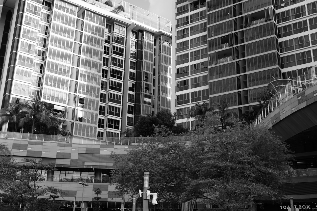
Punggol history is much richer than the story of a “new town”. Before Punggol HDB, Punggol Waterway and Punggol Digital District, this north-eastern edge of Singapore was a coastal world of waterways, kampungs, farms, fishing, seafood, plantations and recreation. Modern Punggol did not replace an empty landscape. It grew over layers of earlier lives.
Did you know? The transformation of Punggol can be read as a sequence: coastal settlement → rural and agricultural landscape → land reclamation and new-town planning → Punggol 21 → Remaking Our Heartland → My Waterway@Punggol → Eco-Town experiments → today’s waterfront, university and digital district. That sequence matters because the most interesting thing about Punggol is not how quickly it became modern. It is how many different versions of the place still remain visible inside the modern one.
The Crazy-Rich Idea: A Town Is Wealthier When It Has More Than One Past
New infrastructure can make a town easier to use. History makes it easier to understand.
Punggol’s wealth comes partly from the coexistence of opposites: a digital district beside an old road; smart housing beside mangroves; waterfront malls beside memories of seafood restaurants; reservoirs where tidal rivers once moved; new housing estates carrying names rooted in older geography.
The town becomes more interesting when progress does not erase the evidence that it arrived late.
Before the New Town, Punggol Was a Coastal Working Landscape
Historical Punggol was shaped first by water. Coastal settlements and waterways supported fishing and movement, while later rural Punggol became known for plantations, farms and food production. Oral histories and heritage accounts preserve memories of kampungs, pig farms, poultry, seafood and long roads leading toward Punggol Point.
This older Punggol was not picturesque in the simple sense. It was productive land. People worked there, transported goods, raised animals, fished and built livelihoods around the coast.
Reclamation Changed the Physical Punggol Before Housing Changed the Social Punggol
Modern Punggol required more than building flats. The physical coastline and landform had to change. Reclamation expanded the developable land and made possible the large-scale new-town plans that followed.
This is easy to forget because reclaimed land becomes ordinary once streets and blocks are built over it. But the modern town is partly a geographic construction project before it is a housing project.
Punggol 21 Gave the Future Town a Story
When the Punggol 21 vision was unveiled in 1996, the ambition was not simply to add another HDB estate. The town was framed around a waterfront identity, neighbourhood character and a different relationship between housing and water.
That mattered because planning works better when infrastructure has an organising idea. In Punggol, water eventually became that idea.
Remaking Our Heartland Turned Water Into the Town’s Spine
The 2007 Remaking Our Heartland programme accelerated that shift. The creation of Punggol and Serangoon Reservoirs and the 4.2 km My Waterway@Punggol allowed water management, public space, housing, movement and recreation to be planned together.
Punggol stopped being merely a town beside water and became a town organised by water.
Eco-Town Planning Added a New Layer: Punggol as Experiment
In 2010, HDB designated Punggol as Singapore’s first Eco-Town and described it as a living laboratory for sustainable development. That shifted Punggol again: from waterfront new town to testbed for how public housing could use energy, water, greenery and technology more intelligently.
Treelodge@Punggol, Northshore and later smart-town systems show the pattern clearly. Punggol repeatedly became the place where a future housing idea could be made ordinary enough to scale.
The Latest Punggol Adds University and Work to the Residential Story
For much of its modern history, Punggol was understood primarily as a place to live. The arrival of SIT, Punggol Digital District, Punggol Coast MRT, new retail and workplace clusters changes that identity again.
The town is becoming less of a residential endpoint and more of a place where learning, employment, technology, leisure and community life happen in the same geography.
Punggol History Is Best Read as Layers, Not Eras That Cancel One Another
- Coastal Punggol: rivers, sea, fishing and early settlement.
- Rural Punggol: kampungs, plantations, farms and food production.
- Recreational Punggol: seafood, seaside leisure, Punggol Point and weekend journeys north.
- New-Town Punggol: reclamation, housing and transport.
- Waterfront Punggol: reservoirs, Waterway, promenades and housing around water.
- Eco-Town Punggol: sustainability, biophilic planning and smart housing.
- Digital Punggol: SIT, PDD, AI, robotics and jobs closer to home.
All of these Punggols still matter because the newest layer makes more sense when the older ones remain legible.
Continue Through Punggol History
For the name and etymology, continue with Crazy Rich Punggol | Punggol Meaning, Malay Origins and the Luxury of a Name With Memory. For the waterfront transformation, read Crazy Rich Punggol | Punggol 21, My Waterway and the Luxury of a Waterfront Town. For Old Punggol Road, continue with Crazy Rich Punggol | Old Punggol Road, Heritage Trail and the Luxury of Memory.
The crazy-rich Punggol story is not that the town became new. It is that a place can keep accumulating new futures while still carrying enough of its older coast, farms, roads and memories to explain where it came from.
Punggol is easy to mistake for a new town because so much of what people see is new. The flats are relatively young. The Waterway looks deliberately composed. Punggol Coast, the Singapore Institute of Technology campus and Punggol Digital District have given the north-eastern edge of Singapore a vocabulary of smart systems, applied learning and future work. Yet if we begin the story there, we misunderstand the place.
Punggol is not a blank piece of land on which a twenty-first-century town was placed. It is a coast that became a settlement, a settlement that became an agricultural landscape, an agricultural landscape that was reorganised by reservoirs, roads, reclamation and housing, and a housing town that eventually learned to use water as part of its civic identity. The present Punggol is therefore not one story. It is several versions of the same place, laid over one another.
This article follows that transformation. It belongs to the wider What about Punggol? hub, where Punggol is examined not simply as an address but as a living system: history, geography, education, housing, transport, ecology, technology, childhood, work and community.
Punggol did not begin as a housing town
Long before the contemporary planning maps, Punggol belonged to the coastal world of northern Singapore. Its position matters. The area sits between waterways and the Johor Strait, with Sungei Punggol on one side and Sungei Serangoon on the other. That geography made Punggol a place where the sea, river mouths, mangrove edges, fishing routes and inland cultivation could meet.
The National Heritage Board’s Roots material describes Punggol as a place used by the Orang Seletar, a seafaring community that moved along the Singapore side of the Tebrau Strait and established temporary settlements along the coast. It also records Kampung Wak Sumang, or Kampung Punggol, at Punggol Point as one of the area’s important early Malay settlements. The exact founding chronology is not completely settled. Oral histories from descendants place the village before 1819; other accounts place its foundation later in the nineteenth century. An 1852 map based on surveys from the 1840s nevertheless shows a Malay community around Punggol Point.
That uncertainty is useful. History is not improved by forcing every surviving memory into one neat date. What matters is that Punggol possessed a human history before it possessed a modern town plan. People lived beside the water, moved through it, fished from it, built social institutions around it and understood the coastline as part of daily life.
The first Punggol was a relationship with water
Modern Punggol often sells itself visually through water. The promenades, bridges, waterfront housing and photographs of the Waterway make water look like an amenity added to a town. Historically, the direction was almost the reverse: human settlement gathered around a landscape already organised by the coast and rivers.
Fishing communities needed access to water because it was livelihood, movement and food. Boat sheds, fishery activity and waterfront recreation all existed in different forms before the new town. Even the later history of Punggol as a place people travelled to for seafood, fishing and weekend leisure grew from this older geographic fact. Punggol faced outward toward water before it faced inward toward a town centre.
This distinction becomes important later. When planners created the contemporary Waterway and waterfront districts, they were not inventing Punggol’s connection with water from nothing. They were transforming what water meant. Water changed from a working edge of a rural settlement into managed reservoir infrastructure, recreation, landscape, housing frontage and town identity.
A kampung is more than a collection of houses
To understand what disappeared when old Punggol changed, we need to avoid reducing the kampung to nostalgia. A kampung was not automatically idyllic, and rural life was not easier simply because photographs now look peaceful. But it did contain a different spatial logic from a planned new town.
Homes, work, water, small-scale trade, religious life, neighbour relationships and food production could overlap closely. Paths developed from repeated use. Social knowledge travelled through families. The landscape was not divided as sharply into residential, commercial, transport and recreational zones. People often lived inside the same geography that produced part of their livelihood.
Kampung Wak Sumang became one of the historical anchors of this older Punggol. The name survives in Sumang Walk, Sumang Lane, Sumang Link, Sumang Crescent and Sumang LRT station. This is one way a modern town carries memory: the physical settlement disappears, yet fragments of its language remain embedded in addresses used by people who may never have seen the original village.
Then Punggol became agricultural
As Punggol developed, it became associated not only with fishing but with plantations, poultry farming and pig rearing. HDB’s official history notes that Chinese immigrants who settled in the area took part in these activities. This broadened Punggol from a coastal settlement into a productive rural district connected to Singapore’s changing food system.
The agricultural phase matters because it changed the scale at which land was used. Farming tied Punggol to questions of food supply, waste, transport, public health and water pollution. Those questions would eventually become impossible to separate from national urban planning.
In 1974, land in Punggol was allocated for intensive commercial pig farming as farms were reorganised. The logic was partly one of consolidation and pollution control. Yet concentrated animal farming also produced environmental pressures of its own. Punggol’s later transformation therefore cannot be explained only as “Singapore needed more housing.” It was also part of a larger national transition away from extensive rural agriculture toward a denser urban economy with stricter management of land and water.
The road tells one version of the story
For much of old Punggol’s history, Punggol Road was more than another street. It was one of the principal lines connecting the interior of Singapore to the northern coast. The road gathered farms, villages, recreational places and later development along a long axis toward Punggol Point.
A separate pillar on this site, Old Punggol Road: Why a Future Town Still Needs Memory, owns that specific story. Here, its importance is structural: old Punggol was relatively linear. Access was constrained. Distance from central Singapore felt greater because transport choices were fewer. The geography of a place is partly the geography of how easily people can reach it.
This is why transport later becomes so important to Punggol’s reinvention. MRT, LRT, expressways and eventually new rail connections do not merely move residents. They alter the psychological location of Punggol within Singapore.
Reclamation changed what Punggol physically was
One of the most consequential changes is also one of the easiest to overlook: the land itself changed.
HDB’s Punggol Town Design Guide records land reclamation between the 1980s and early 2000s as part of the groundwork for modern development. Roots also records the approval of a major north-eastern coastal reclamation plan in the 1980s, with works carried out in phases and later activity near Coney Island. Reclamation altered shoreline geometry and created land on which later urban plans could operate.
This is a profound shift. A town plan normally looks as though it begins with land and decides what should be built on it. In Punggol, part of the modern story begins one level earlier: Singapore first changed the land-water boundary, then planned a town across the new geography.
That tells us something about cities. Urbanisation is not merely the construction of buildings. It can include reshaping coastlines, controlling rivers, creating reservoirs, inserting transport networks, changing drainage and reorganising the ecological relationship between land and water.
1996: Punggol 21 gave the future a name
In 1996, the blueprint for Punggol 21 was unveiled with the vision of creating a “Waterfront Town of the 21st Century”. The phrase is important because it shows that Punggol was being asked to do more than absorb housing demand. It was intended to represent a new model of public-housing town-making.
The aspiration combined higher-density living with a stronger relationship to the waterfront, a recognisable town identity and a new generation of housing environments. In principle, Punggol could become evidence that a dense public-housing town did not have to feel generic.
But plans do not travel from announcement to completion in a straight line. Roots records that construction began in the late 1990s and that the Asian financial crisis and subsequent construction slowdown affected the pace of development. Early Punggol residents therefore lived inside a town whose promise was larger than its completed reality.
This gap between master plan and lived town is worth remembering. New towns are often judged after they mature, when the transport lines, malls, parks, schools, trees and social routines are already established. The first residents experience something different: unfinished edges, longer trips, fewer shops and the uncertainty of living inside a plan that has not yet become a place.
A town is not finished when the flats are finished
This is one of Punggol’s most useful lessons.
Housing can be completed relatively quickly compared with the social maturation of a town. A neighbourhood becomes easier to live in as schools open, retail stabilises, transport frequency improves, trees mature, shortcuts become familiar, childcare networks form, children grow up together and residents acquire shared reference points.
The first version of a new town is therefore physical. The second version is operational. The third is social.
Punggol’s history after 2000 is partly the story of those layers catching up with one another.
2007: the water moved to the centre of the plan
In 2007, Punggol became one of the pilot towns under the Remaking Our Heartland programme. The plans reinforced the waterfront vision and gave it a piece of infrastructure that would eventually become Punggol’s most recognisable public landscape.
Sungei Punggol and Sungei Serangoon were dammed to form reservoirs. A 4.2-kilometre man-made waterway was introduced through the town to connect them. The result was not merely a scenic canal. It joined water management, reservoir infrastructure, public space, housing design, cycling and walking into one continuous urban system.
Construction of the Waterway began in 2009, and it opened in 2011. In historical terms, this is recent. Yet the feature became so closely associated with Punggol that it can now feel as if it has always been there.
A future supporting pillar, How Punggol Waterway Works, will examine that system technically. In the present story, the Waterway marks the moment when the planning vision became legible at ground level. Residents did not need to study a master plan to understand that Punggol was becoming a waterfront town. They could walk beside the evidence.
Water became infrastructure, landscape and identity at the same time
This is where Punggol becomes especially interesting as a piece of city-making.
Infrastructure is often hidden. Drains, pipes, substations and service roads do important work without becoming places people love. Punggol’s water system demonstrates another possibility. The engineering function and the civic function can overlap.
The Waterway helps connect reservoirs. The banks provide routes for walking and cycling. Housing faces the landscape. Bridges become landmarks. Public spaces gather around the edges. Wildlife uses parts of the system. Children learn the shape of their neighbourhood by following the water.
The same line on a map can therefore be hydraulic infrastructure, mobility corridor, ecological edge, exercise route, visual amenity and memory device.
That is not a small design achievement. It is a form of urban compression: one system performs several jobs.
2010: Punggol became Singapore’s first Eco-Town
In 2010, Punggol was selected for development as Singapore’s first Eco-Town. HDB describes the town as a “living laboratory” for testing sustainable ideas and technologies. Treelodge@Punggol became one of the early eco-friendly public-housing projects associated with that effort.
The significance lies less in the label than in the operating idea. Instead of treating sustainability as a special feature added to one building, Punggol could be used to test how environmental thinking works at neighbourhood and town scale.
That includes energy, shade, water, waste, greenery, mobility and resident behaviour. It also includes the less glamorous question that determines whether any sustainability strategy lasts: can it become ordinary enough that people use it without having to think about the system every day?
A future pillar, Why Punggol Became Singapore’s First Eco-Town, will own that subject in depth. Here, it marks another stage in Punggol’s changing role. The town was no longer merely being built. It was being used to test how Singapore might build differently.
Housing started to face the landscape
Waterfront housing projects such as Waterway Terraces and Waterway Ridges made the planning idea visible in architecture. Instead of placing housing near water by accident, the town increasingly used the Waterway as an organising feature.
This changed what an HDB view could mean. In a conventional internalised housing estate, the spatial experience may be dominated by roads, car parks, courtyards and neighbouring blocks. Along parts of Punggol, residents could instead orient themselves toward long water views, landscaped edges and bridges.
That does not make every Punggol home waterfront property, nor does it remove the practical realities of density. What it does is give the town a stronger shared landscape. Even residents who do not live directly beside the water can use it as public space.
The town was divided into districts so that it would not become one enormous sameness
Punggol’s planning increasingly used districts with different identities. This is a response to a basic problem of large-scale urban development: efficiency prefers repetition, but human orientation prefers distinction.
If every road, block and neighbourhood feels interchangeable, a town may function but remain difficult to remember. District identity gives residents a mental map. The landscape, architectural language, street pattern, waterfront condition or public spaces can help one part of the town feel recognisably different from another.
This is one reason Punggol should be read as more than a housing programme. It became a continuing experiment in how large public systems can create local identity without surrendering the economies of coordinated planning.
Smart Punggol began before the Digital District
It is tempting to associate “smart Punggol” entirely with Punggol Digital District. But the town’s smart-technology story also developed through housing.
In 2014, Punggol Northshore was announced as the first public-housing district to test-bed smart technologies. HDB highlights systems such as parking-demand monitoring, sensor-equipped lighting in common areas and smart waste management. By 2020, HDB’s town design history describes Punggol as a full-fledged Smart Town.
Again, the important idea is not the number of sensors. A town becomes meaningfully smart only when information improves a real urban decision: when lights respond better to use, waste systems become more efficient, maintenance becomes more predictive or limited space is allocated more intelligently.
Technology is therefore one more layer laid onto Punggol’s earlier transformations. Fishing settlement. Agricultural district. Reclaimed land. Public-housing town. Waterfront town. Eco-Town. Smart Town. Digital district. None of these completely erases the previous layer.
Punggol grew a centre—and then began growing another
For a period, Punggol MRT station, the bus interchange, Waterway Point and the surrounding town-centre functions became the obvious centre of gravity. The area gave residents the things new towns eventually need: interchange, shopping, meeting points, services and a place everyone can name without giving directions.
One Punggol added another civic layer through community, library, hawker, childcare, senior-care and other services. The town centre became less about retail alone and more about assembling ordinary life within a walkable cluster.
Now Punggol Coast, SIT and Punggol Digital District are creating a second centre of gravity. That future-facing story already has its own supporting article, Punggol Coast Is Becoming a Second Centre of Gravity. Its existence changes the historical interpretation of the town: Punggol is moving from a largely residential model organised around one town centre toward a more polycentric place where home, university, work, recreation and transport occupy multiple strong nodes.
The deepest change is not architectural. It is the changing amount of life Punggol can hold
A bedroom town performs one dominant urban function: people live there and leave for much of the day.
A mature mixed town can hold more of a person’s day. Children go to school nearby. Adults work nearby. Families exercise nearby. Older residents access services nearby. Students study nearby. People eat, borrow books, meet friends, shop, cycle and spend leisure time without crossing half the island.
Punggol’s transformation is therefore not complete merely because more structures exist. The larger transition is functional. The town is gaining the capacity to contain more kinds of life.
That is why the shift from “residential new town” to “waterfront city district” matters. It describes a change in urban complexity.
But progress creates a memory problem
The more successfully a place transforms, the harder it can become to remember what came before.
A child growing up beside the Waterway may reasonably assume that Punggol has always been a dense residential landscape. A resident arriving after Punggol Coast develops may experience the district as naturally connected to university and digital industry. A future visitor may find it difficult to imagine pig farms, boat sheds, kampung paths or the long quiet road to the coast.
This is not an argument against development. It is an argument for legibility.
A strong town should allow residents to see time. Names such as Sumang can preserve fragments of older settlement. Retained routes can carry memory. Heritage interpretation can explain vanished landscapes. Coney Island can preserve an ecological contrast. Punggol Point can still expose the town to the open northern edge. The past does not need to freeze the future, but the future is poorer when it becomes unable to explain how it arrived.
The history of Punggol is really a history of changing systems
If we compress the story too aggressively, it becomes:
- fishing village,
- farms,
- HDB flats,
- Waterway,
- Digital District.
That chronology is not wrong. It is simply too shallow.
The deeper sequence looks more like this:
- ecology created a coastal opportunity;
- settlement turned geography into community;
- agriculture turned land into production;
- roads and transport connected a remote edge to the rest of Singapore;
- reclamation changed the physical canvas;
- public housing changed the population scale;
- reservoir engineering changed the role of rivers;
- the Waterway fused infrastructure with public space;
- Eco-Town planning made Punggol a sustainability test bed;
- smart housing added sensing and optimisation;
- SIT and PDD added higher education and knowledge work;
- new transport continues to change what feels near.
Seen this way, Punggol is not simply getting newer. It is becoming more layered.
Why this matters to a child growing up here
For education, Punggol is unusually useful because the town can be read as a real-world textbook.
A student can learn history by asking what used to occupy the land. Geography appears in the coastline, reservoirs, rivers and reclamation. Science appears in water systems, wetlands, biodiversity, materials, energy and heat. Mathematics appears in transport networks, density, land-use trade-offs and flow. Economics appears in the movement of jobs closer to homes. Civics appears in the negotiation between individual preference and shared infrastructure. English appears when the student has to turn all of this into a precise explanation.
The town therefore becomes more educational when children are taught to notice systems rather than merely landmarks.
“That is Punggol Waterway” is recognition.
“Why does the Waterway exist, what jobs does it perform, what did the landscape look like before it, and what trade-offs were required to build the town around it?” is education.
How to read Punggol without romanticising either the past or the future
There are two easy mistakes.
The first is to romanticise old Punggol: kampung life becomes pure community, rural land becomes pure nature and development becomes a story of loss. This ignores hard work, limited infrastructure, pollution, access constraints and the reasons Singapore changed.
The second is to romanticise new Punggol: technology becomes automatically intelligent, density automatically efficient and every announced plan automatically successful. This ignores construction disruption, maintenance, ecological trade-offs, uneven convenience and the fact that a town must work for real families rather than render beautifully on planning diagrams.
A mature reading holds both truths at once. Development can improve life dramatically and still destroy things worth remembering. Heritage can matter deeply without requiring a city to remain economically or physically frozen. Technology can solve real problems and still introduce new dependencies. Nature can be protected and still be under pressure.
Punggol is interesting precisely because these forces are visible beside one another.
Punggol is still becoming Punggol
The title of this article sounds historical: How Punggol Became Punggol. But the verb is not actually finished.
SIT has changed the educational geography. Punggol Digital District is changing the employment geography. Punggol Coast is changing the town’s centre of gravity. New community and sports infrastructure is widening what residents can do without leaving the town. Future rail connections will change the mental map of Singapore from Punggol. Children growing up here will inherit a version of the town that today’s adults have not yet fully experienced.
The useful question is therefore not only what did Punggol become?
It is also:
What kind of place is Punggol becoming, and which parts of its earlier selves should remain visible when the next version arrives?
That question is larger than heritage. It is a way of judging urban progress.
A compact timeline of Punggol’s transformation
- Early coastal settlement: seafaring and fishing communities use Punggol’s northern coast and river mouths.
- Kampung Punggol / Kampung Wak Sumang: an important Malay settlement develops around Punggol Point; the exact founding chronology remains contested in surviving accounts.
- Nineteenth and twentieth centuries: agriculture, plantations, poultry, pig farming, fishing and recreation become important parts of Punggol’s landscape.
- 1970s–1980s: agricultural consolidation, environmental management and wider national urbanisation accelerate changes to rural Punggol.
- 1980s–2000s: reclamation reshapes parts of the north-eastern coastline in preparation for urban development.
- 1996: Punggol 21 is unveiled as a vision for a Waterfront Town of the 21st Century.
- Late 1990s onward: large-scale housing construction begins, though development proceeds unevenly through economic and construction cycles.
- 2007: Remaking Our Heartland renews the waterfront strategy.
- 2009–2011: Punggol Waterway is constructed and opened, making the waterfront vision physically legible.
- 2010: Punggol is selected as Singapore’s first Eco-Town.
- 2014: Northshore is announced as a test-bed for smart public-housing technologies.
- 2020s: Punggol develops further as a Smart Town while SIT, Punggol Digital District, Punggol Coast and new civic infrastructure add education, work and new public life.
The larger Punggol reading path
This pillar owns the whole historical transformation. It does not need to swallow every Punggol question. The larger architecture works better when specialist articles go deeper and then return to the hub.
- What about Punggol? — the parent hub for the complete Punggol reading system.
- Old Punggol Road: Why a Future Town Still Needs Memory — memory, continuity and the retained road.
- Punggol Is No Longer Only a Residential Town — the transition from housing town to mixed urban district.
- Punggol Coast Is Becoming a Second Centre of Gravity — how the town’s spatial structure is changing again.
- Punggol 2036: What Should We Protect While Everything Changes? — the forward-looking preservation question.
Sources and evidence
This article uses official and heritage sources as evidence anchors, including the Housing & Development Board’s Punggol town history and Punggol Town Design Guide, and the National Heritage Board / National Library Board material collected in History of Punggol and Punggol: Waves of Recreation. Where historical accounts disagree—particularly around the dating and naming traditions of early Punggol—the disagreement is preserved rather than converted into false certainty.
Return to the parent hub: What about Punggol?


