
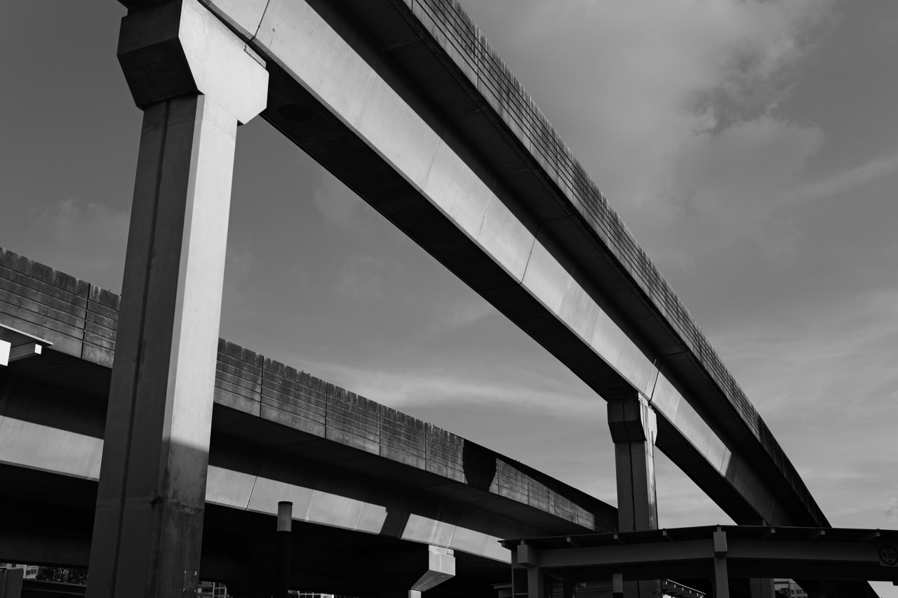
Punggol LRT is the quiet machine that makes a large waterfront town feel smaller. The East Loop and West Loop do not travel far by Singapore rail standards, but that is exactly why they matter: they connect neighbourhoods, schools, Northshore, Punggol Point, Punggol Digital District and everyday errands back to Punggol MRT, buses and the wider city.
Did you know? LTA says the Punggol LRT opened in 2005 and currently serves 14 stations across two loops. Teck Lee LRT station, the long-awaited PW2 stop beside SIT and Punggol Digital District, opened on 15 August 2024. The wider Sengkang-Punggol LRT fleet is also being renewed with new two-car trains, and in October 2026 LTA announced that the combined SPLRT fleet is planned to reach 41 two-car LRVs by 2030.
The Crazy-Rich Idea: The Last Mile Is Where Convenience Becomes Real
A major MRT line can bring you to Punggol. It cannot place every home, school or neighbourhood beside the platform. That is the LRT’s luxury: it takes the large promise of regional connectivity and distributes it into ordinary life. The richer transport system is not always the one with the longest line. It is the one that makes the final kilometre feel less expensive in time, heat, rain and family coordination.
For station codes, East Loop and West Loop order, and the nearest stop to specific destinations, use the canonical Punggol LRT Guide. This article keeps the larger Crazy Rich Punggol job: explaining how a small rail system can create large gains in access and time wealth.
Why Teck Lee Changed the West Loop Story
For years, Teck Lee existed as an unopened station on the map. Its 2024 opening changed the meaning of the West Loop because the stop now serves SIT and Punggol Digital District directly. A station that once looked strangely premature became evidence of long-horizon planning: infrastructure was built before the surrounding demand fully arrived.
That is one of Punggol’s recurring patterns. The town often looks unfinished right before the reason for an earlier decision becomes obvious.
Two Loops Let One Town Have Many Centres
The East and West Loops are useful because Punggol is not one continuous corridor. Different neighbourhoods have different everyday anchors: schools, plazas, Waterway sections, Northshore, Punggol Point, SIT, PDD and the Town Centre. The loop system lets those places connect back into a shared interchange without requiring every street to point directly toward one rail line.
That is transport geometry doing social work.
The Punggol LRT looks small on Singapore’s rail map because it does not travel very far.
That is precisely why it matters.
The North East Line connects Punggol to the wider city. The LRT does a different job. It reaches into the town itself. It takes a national transport node—Punggol MRT—and distributes its accessibility across residential districts that would otherwise sit at very different walking distances from heavy rail.
Land Transport Authority records that the Punggol LRT opened in 2005. The fully driverless system now runs along two loops and serves 14 neighbourhood stations, linking residential areas back to Punggol MRT on the North East Line and to Punggol Bus Interchange.
That sounds like a transport description.
It is also a description of urban form.
This pillar owns that canonical job: how the Punggol LRT changes last-mile geography, shapes neighbourhood access, concentrates transfers at the Town Centre, and allows different parts of a large planned town to function as one connected place.
For the complete Punggol reading system, return to the parent hub: What about Punggol?
The surrounding articles keep their own jobs. How Punggol Town Centre Works owns the MRT–bus–Waterway Point–Town Square convergence. Punggol’s Eleven Districts owns district identity. This article takes the transport geography between them.
The last mile is where a rail network becomes a neighbourhood system
Heavy rail can bring a commuter very close to home and still leave the hardest part of the journey unresolved.
The final distance matters.
Five minutes of sheltered walking feels different from twenty minutes in tropical sun or rain.
A direct LRT connection feels different from waiting for a bus whose route is less intuitive to a new resident.
A home beside an LRT station can therefore feel much closer to the MRT than its straight-line distance suggests.
This is the first major effect of the Punggol LRT:
it compresses perceived distance inside the town.
The LRT does not physically move a housing block closer to Punggol MRT.
It reduces the effort required to cross the distance.
Two loops create a different geometry from one straight line
Punggol’s LRT is organised around an East Loop and a West Loop.
The East Loop serves Cove, Meridian, Coral Edge, Riviera, Kadaloor, Oasis and Damai.
The West Loop serves Sam Kee, Teck Lee, Punggol Point, Samudera, Nibong, Sumang and Soo Teck.
Both loops converge at Punggol Town Centre.
This is a powerful shape because it is not trying to connect one end of the town to another as directly as possible.
It is trying to collect and distribute neighbourhood trips around a central interchange.
The system behaves more like two circulatory loops around a heart than one long corridor.
neighbourhood → loop → Punggol → MRT/bus → wider Singapore.
On the return journey, the logic reverses.
wider Singapore → Punggol → loop → neighbourhood.
The loops make Punggol MRT more valuable than its walking catchment alone
An MRT station has a natural walking catchment.
Homes very close to the station receive strong direct accessibility.
Homes farther away receive less.
The LRT changes the gradient.
A neighbourhood several kilometres from the Town Centre can still connect to the North East Line through a nearby LRT station.
This effectively enlarges the practical catchment of Punggol MRT.
The heavy-rail station and the LRT should therefore not be evaluated independently.
Their value multiplies through connection.
A feeder line changes where housing can work
Imagine building a large town around one MRT station without a secondary rail network.
Housing close to the station is easy to connect.
Housing farther away becomes increasingly dependent on buses, cars, bicycles or longer walks.
An LRT allows higher-density residential districts to extend farther from the central MRT while retaining a structured public-transport link.
This does not mean the LRT caused every housing decision in Punggol.
It means the transport system and housing system were planned as mutually supporting layers.
HDB’s Punggol Town Design Guide makes this visible on the town-scale transport map: the LRT loops run through multiple housing districts while major roads, MRT and bus systems form the larger hierarchy.
Stations are not identical dots
A transit map makes every station symbol look roughly equal.
On the ground, they are not.
One station may sit beside mature housing.
Another may connect to a neighbourhood centre.
Another may serve a waterfront.
Another may become an interchange with a future MRT line.
Another may remain unopened for years until surrounding development justifies service.
The station is therefore an interface between transport supply and urban maturity.
Teck Lee is the clearest example of transport waiting for the town
Teck Lee station is especially useful for understanding how Punggol developed over time.
The physical station existed long before passenger operations began.
LTA opened Teck Lee LRT station on 15 August 2024, specifically improving access to the Singapore Institute of Technology’s Punggol campus and the business park within Punggol Digital District. Covered linkways were provided for first-and-last-mile journeys between the station, SIT and the business park.
This is an unusually clear demonstration of staged infrastructure.
The rail alignment came first.
The urban demand came later.
The station became operational when the surrounding city was ready to use it.
That is not wasted planning.
It is infrastructure holding future capacity in reserve.
Teck Lee also changes the meaning of the West Loop
The West Loop originally read mainly as a residential feeder.
Teck Lee now connects directly into a major education-and-employment district.
That changes the trip pattern.
The LRT is no longer only:
home → Town Centre.
It can also support:
home → university, home → work, MRT → campus, bus → LRT → workplace.
A feeder network becomes more valuable when destinations appear along the feeder itself.
Punggol Point shows how the LRT follows the town’s northern expansion
Punggol Point station opened in 2016 as nearby residential development matured.
Its role illustrates the same principle as Teck Lee, but in a different urban setting.
Transport infrastructure can be built with future urbanisation in mind and activated progressively as catchment develops.
The West Loop therefore acts almost like a timeline of northern Punggol’s growth.
Stations that once sat beside incomplete development became meaningful as housing, parks, SIT and PDD arrived.
The East Loop reveals a different urban story: mature residential distribution
The East Loop’s stations—Cove, Meridian, Coral Edge, Riviera, Kadaloor, Oasis and Damai—serve a broad sweep of established residential Punggol.
This loop demonstrates the everyday strength of distributed stations.
The line does not need one spectacular destination at every stop.
Its value comes from repeated proximity to homes and local facilities.
One station may connect a school route.
Another may connect to a neighbourhood centre.
Another may become important for future regional rail.
The loop becomes useful through accumulation.
Riviera is the station whose scale is about to change
Today Riviera functions as an LRT station on the East Loop.
The Cross Island Line–Punggol Extension is changing that hierarchy.
LTA’s current project plan identifies Riviera as one of the future interchanges on the 7.3-kilometre extension, linking the Cross Island Line to the Punggol LRT.
The existing article The Cross Island Line and the Shrinking of Singapore from Punggol owns the wider 2032 transformation.
Here the significance is local:
a neighbourhood LRT station can become a regional MRT interchange without moving.
The network around the station changes its importance.
This is why station importance is relational
A station is not important only because of how many buildings surround it today.
Its importance also depends on what it connects to.
A small local station that gains an interchange can become more valuable without adding housing immediately around it.
A station beside a new university can gain a new daily demand pattern.
A station linked to a neighbourhood centre can support non-commuting trips.
The network changes the node.
The LRT changes the meaning of “near”
Urban proximity is not only measured in metres.
It is measured in effort.
A destination 1.5 kilometres away with a direct, frequent and sheltered connection may feel nearer than a destination 800 metres away across awkward roads and exposed walking routes.
The LRT therefore creates network proximity.
This is why property advertisements, school routes and daily family planning often use station names as location markers.
“Near Oasis LRT” means more than physical distance from a platform.
It implies a particular relationship to the rest of Punggol.
Stations become neighbourhood names
Transit systems often end up naming places as strongly as streets do.
Residents may describe where they live through the nearest LRT station:
- Oasis,
- Riviera,
- Samudera,
- Sumang,
- Punggol Point.
This turns transport infrastructure into cognitive geography.
A station sign becomes a neighbourhood reference.
Repeated journeys reinforce the association.
Over time, the station and the surrounding area begin to define one another.
Punggol’s historical names survive partly through the rail map
The LRT also preserves pieces of local naming and memory.
Names such as Sumang carry the memory of Wak Sumang and Kampung Punggol into everyday transport language.
Punggol Point keeps the old northern-edge name visible in the modern network.
The separate pillar What Does “Punggol” Mean? owns the deeper place-name problem.
Here, the important point is that transport maps are memory systems.
Millions of repeated station announcements can preserve a place name more effectively than a plaque nobody passes.
The LRT also creates boundaries in people’s minds
Infrastructure connects.
It also divides perception.
Residents may think in terms of East Loop and West Loop.
They may choose homes partly based on which loop they use.
They may experience a transfer through Punggol Town Centre as the natural boundary between one side of the town and another.
These are not official district boundaries.
They are mobility boundaries.
This is another way the LRT shapes Punggol’s mental map independently of the HDB district map.
A loop is efficient for coverage but creates direction choices
Loops have a trade-off.
They can cover many neighbourhoods with a compact rail system.
But users have to understand direction.
The same pair of rails can take a passenger around a loop in different directions depending on service pattern.
This raises a wayfinding requirement.
Signs, platform information, train displays and habitual knowledge have to help commuters answer:
Which direction gets me there with the least unnecessary loop?
A transport network can therefore be physically connected but cognitively difficult if wayfinding is weak.
The centre is where the loops reset the journey
Both loops return to Punggol.
This central convergence makes the Town Centre a transfer reset point.
A passenger arriving from Damai and another arriving from Sumang can both transfer into the same North East Line system.
The Town Centre therefore equalises very different local geographies.
Once the commuter reaches Punggol MRT, the neighbourhood distinction becomes less important for the onward national trip.
This is one reason How Punggol Town Centre Works treats transport concentration as the centre’s foundational mechanism.
Capacity tells us how the town has changed
Transport systems record urban growth through crowding pressure.
Punggol and Sengkang grew rapidly after their LRT systems opened.
LTA records that both systems were upgraded from one-car to two-car operations in 2016.
Then a further fleet-renewal programme began.
In July 2025, the first two of 25 new third-generation two-car Light Rail Vehicles entered passenger service. LTA said the programme would progressively replace the first-generation fleet while additional two-car vehicles increase capacity for growing demand.
The depot is also being expanded to support more two-car trains by 2027.
This is infrastructure adapting to the town it helped create.
The feedback loop is important
Transport improves accessibility.
Accessibility supports housing and activity.
More housing and activity increase ridership.
Higher ridership increases pressure for more capacity.
More capacity supports further growth.
The sequence is circular:
transport → development → demand → upgrade → more transport capacity.
This is why infrastructure should rarely be judged only at the moment it opens.
The real test is whether it can evolve with the city around it.
Reliability matters more in a feeder network than the map suggests
A short feeder journey can be a small fraction of total distance but a large fraction of total frustration.
If a commuter has a long MRT journey ahead, uncertainty in the first transfer can propagate through the whole trip.
Missing one LRT can mean missing an MRT connection.
Crowding can make boarding slower.
A service disruption can force buses or walking alternatives.
So a feeder system has a disproportionate psychological job:
it must make the first and last part of the journey feel dependable.
The current fleet and depot upgrades should therefore be read as reliability and resilience work as much as capacity expansion.
The LRT competes and cooperates with buses
Punggol’s internal mobility is not an LRT monopoly.
Buses provide direct routes that sometimes avoid a rail transfer.
They can be changed more flexibly as new developments open.
They can serve roads between LRT stations.
Walking and cycling can outperform both modes for short local trips.
The mature question is therefore not:
“Should residents use LRT or bus?”
It is:
“Which combination of rail, bus, walking and cycling gives each part of Punggol the lowest-friction access?”
The LRT can make walking more useful rather than replace it
Every LRT journey begins and ends on foot or through another local mode.
This makes station access crucial.
A station that is geographically close but difficult to reach across roads may underperform its map location.
A station connected by sheltered paths, crossings and direct neighbourhood routes can serve a larger practical catchment.
Teck Lee’s covered linkways to SIT and PDD are a contemporary example of this principle.
The station is the node.
The walking network determines how easily people enter the node.
Last-mile design can matter as much as train speed
A faster train saves little if reaching the platform is awkward.
A slightly slower feeder can still be attractive when station access is direct, sheltered and predictable.
Total journey time is composed of several parts:
- walk to station,
- wait,
- ride,
- transfer,
- wait again,
- ride again,
- walk to destination.
Good last-mile design attacks the first and final parts.
Good service frequency attacks waiting.
Good interchange design attacks transfer friction.
Urban transport is therefore a chain whose weakest link can dominate the experience.
Punggol Coast changed the hierarchy without making the LRT obsolete
When Punggol Coast MRT station opened on the North East Line in December 2024, northern Punggol gained direct heavy-rail access.
This reduces the need for some trips to feed all the way back to Punggol MRT.
But it does not eliminate the LRT’s usefulness.
The West Loop still connects housing, Punggol Point, Teck Lee, SIT/PDD access and the established Town Centre.
The network is becoming less monocentric.
Instead of every northern journey being organised around one MRT station, residents now have more route choices.
This is the same structural shift described in Punggol Coast Is Becoming a Second Centre of Gravity.
More route choice makes the network more resilient
A transport system is vulnerable when every trip depends on one node.
More connections can create alternatives.
Punggol Coast gives northern residents another NEL entry point.
Future Cross Island Line interchanges at Punggol and Riviera will add another rail axis.
Buses provide flexible parallel paths.
Walking and cycling networks provide short-distance alternatives.
The LRT’s future role should therefore be understood inside an increasingly connected mesh rather than as a standalone feeder.
Systems view: the Punggol LRT is a distributed accessibility machine
The transport system can be read as a stack.
Layer 1: Homes and local destinations
People begin from flats, schools, neighbourhood centres, parks, workplaces and community facilities.
Layer 2: Walking and cycling access
Paths and crossings determine how easily people reach the station.
Layer 3: LRT loops
Fourteen neighbourhood stations distribute rail access across east and west Punggol.
Layer 4: Punggol Town Centre
The loops converge with MRT, buses, retail and civic functions.
Layer 5: National rail
The North East Line connects Punggol outward; Punggol Coast now provides a second NEL node in the north.
Layer 6: Future cross-connections
The Cross Island Line–Punggol Extension will convert Punggol and Riviera into interchanges on another regional axis.
The LRT’s usefulness comes from how these layers connect, not simply from the kilometres of guideway it contains.
What can go wrong?
A feeder rail system has characteristic failure modes.
- Crowding: capacity can lag behind population growth.
- Transfer penalty: residents may prefer a direct bus when an LRT-to-MRT transfer feels too costly in time.
- Wayfinding complexity: loop directions can confuse occasional users.
- Station-access friction: poor walking connections shrink practical catchment.
- Single-node dependence: too much concentration at Punggol Town Centre can make disruptions more consequential.
- Reliability problems: short feeder disruptions can cascade into longer network journeys.
- Mismatch with new development: stations and service patterns must keep adapting as destinations shift.
The current fleet renewal and depot expansion are evidence that the network is being treated as an evolving system rather than fixed infrastructure.
The strongest metric is not kilometres travelled
The Punggol LRT covers short distances.
Its value should therefore not be judged by long-distance mileage.
Better questions are:
- How many homes gain convenient access to MRT and buses?
- How much walking effort does the system remove?
- How easily can residents reach schools, neighbourhood centres and local services?
- How well do stations connect to sheltered walking routes?
- How reliably can the system absorb peak demand?
- How many useful destinations now exist along the loops themselves?
- How well does the LRT integrate with new rail nodes rather than compete with them?
Those measures describe accessibility rather than distance.
For a child, the LRT is a lesson in graphs and networks
Mathematically, the Punggol LRT is an approachable real-world graph.
Stations are nodes.
Track segments are edges.
Punggol is a major transfer node.
Riviera is becoming another transfer node.
Students can ask:
- What is the shortest route between two stations?
- When is travelling through Punggol necessary?
- How does an interchange change network distance?
- What happens to average travel time if another connection is added?
- How does a loop differ mathematically from a straight line?
The town becomes a mathematics diagram that people ride every day.
For Geography, the LRT demonstrates accessibility better than a road map alone
Two places can be geographically close but poorly connected.
Two places can be farther apart but easy to reach through direct transport.
The LRT therefore teaches the difference between:
- absolute distance — metres or kilometres;
- network distance — how many links and transfers;
- travel time — how long the journey takes;
- perceived distance — how difficult the journey feels.
Urban geography is often governed more by the last three than the first.
For History, the station-opening sequence records Punggol’s growth
The Punggol LRT did not become fully meaningful in one day in 2005.
Stations opened progressively as neighbourhoods developed.
Punggol Point opened in 2016.
Samudera followed in 2017.
Teck Lee opened in 2024 with SIT and PDD.
The rail line therefore contains a development timeline.
A station opening tells us not only about transport.
It tells us that the urban geography around the station changed enough to justify a new level of connection.
The final return: how does the Punggol LRT shape the town?
It shapes Punggol by changing relationships.
- It changes which homes feel close to MRT. Fourteen neighbourhood stations spread rail accessibility beyond the Town Centre’s walking radius.
- It creates two mobility geographies. East and West Loops become intuitive ways residents understand different parts of Punggol.
- It strengthens Punggol Town Centre. Local trips are collected into the MRT and bus interchange.
- It allows stations to become neighbourhood anchors. Names such as Oasis, Sumang and Riviera enter everyday mental maps.
- It grows with the town. Punggol Point, Samudera and Teck Lee show station activation following urban development.
- It can acquire new jobs. Teck Lee now serves university and employment destinations as well as residential movement.
- It can change hierarchy without moving. Riviera will become an interchange when the Cross Island Line–Punggol Extension opens.
- It forces continual capacity adaptation. Two-car operations, new LRVs and depot expansion reflect growing demand.
- It works best as part of a mesh. MRT, buses, walking and cycling complete journeys the LRT cannot solve alone.
The Punggol LRT is therefore not simply a small train circulating around a housing estate.
It is the layer that turns one central MRT station into distributed neighbourhood accessibility.
That is why its short distance can have a large urban effect.
Continue through the Punggol pillar system
- What about Punggol? — parent hub for the complete Punggol reading system.
- How Punggol Town Centre Works — how MRT, buses, Waterway Point and Town Square form the established centre.
- Punggol’s Eleven Districts — how one town develops multiple local identities.
- Punggol Coast Is Becoming a Second Centre of Gravity — how northern Punggol’s transport and activity hierarchy is changing.
- The Cross Island Line and the Shrinking of Singapore from Punggol — the regional rail transformation ahead.
Evidence anchors
The factual spine of this pillar is grounded in current official transport and planning sources. LTA’s Sengkang-Punggol LRT page, updated 8 July 2026, records that Punggol LRT opened in 2005, links residential areas to Punggol MRT and the bus interchange, runs on two loops and currently serves 14 stations; it also records two-car operations and the continuing capacity programme. LTA’s Teck Lee LRT Station announcement records the station’s 15 August 2024 opening and its role serving SIT and Punggol Digital District with covered first-and-last-mile links. LTA’s 2025 fleet-renewal announcement documents 25 new third-generation two-car LRVs entering service progressively. HDB’s Punggol Town Design Guide shows the LRT loops as part of the town’s hierarchical transport network across multiple housing districts. LTA’s Cross Island Line–Punggol Extension material records Riviera’s future role as an interchange with the Punggol LRT. Interpretive passages distinguish systems reasoning from these verified transport facts.
Where this page sits in the Punggol knowledge graph
- What about Punggol? — return to the interpretive Punggol reading hub.
- Punggol LRT Guide — for station-by-station East and West Loop navigation.
- Complete Punggol Guide — for the wider town route.
- eduKatePunggol Atlas V2.3 — for the whole knowledge graph.


