
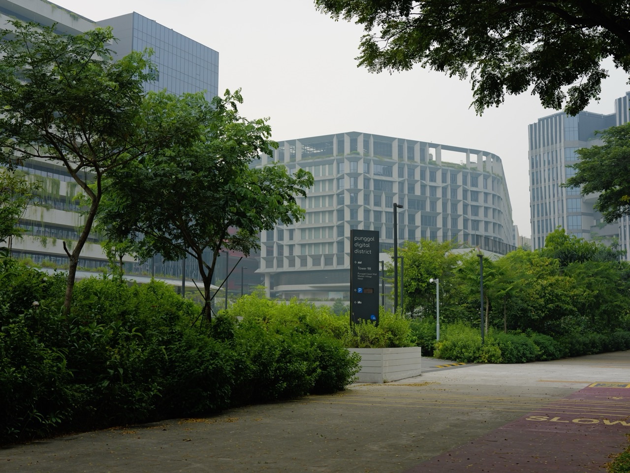
Quick answer: do not launch a drone around Punggol without checking CAAS OneMap Drone Query for the exact airspace and permissions, then verifying weather, visibility and the site’s own restrictions. Punggol’s proximity to Seletar makes exact location checks particularly important; a drone under 250g is not exempt from no-fly zones.
Haze can reduce visual tracking even when the camera stream appears clear. If you cannot maintain safe visual contact or the activity is not properly authorised, postpone and use ground photography instead.

Jump directly to your question: Quick answer: no drone takeoff until the location is checked · Under 250 grams does not mean ‘fly anywhere’ · Parks and nature areas have additional restrictions · Wind, rain and urban turbulence · Commercial filming around Punggol Digital District · Punggol haze drone flying: frequently asked questions
Quick answer: no drone takeoff until the location is checked
A Punggol drone owner should first use OneMap Drone Query, which CAAS identifies as Singapore’s authoritative no-fly-zone tool. Check the exact intended flight location, altitude, activity type and any temporary restrictions before deciding whether the flight is lawful. Then consider the real visibility and weather. A beautiful hazy sunset is not a reason to launch into airspace you do not understand. A small drone is still an unmanned aircraft, not a toy exempt from every rule.
If haze prevents reliable visual tracking of the drone, do not fly. If you cannot determine whether a particular waterfront or housing-block location is in a restricted zone, do not launch while guessing. Punggol is close enough to Seletar aviation activity that casual statements about ‘all clear skies over the Waterway’ are irresponsible. A ground photograph or a postponed shoot can produce an equally useful story without introducing aviation risk.
OneMap is the correct map, not a manufacturer’s global app
CAAS’s September 2026 guidance designates OneMap for finding no-fly zones, areas where permits are required and recommended unmanned-aircraft flying areas. Search the exact proposed Punggol location using the official interface and review each applicable restriction. Drone manufacturer apps may offer technical geofencing, but CAAS warns that their information cannot replace the authoritative national regulatory map.
Do not use last week’s screenshot of Punggol Point to justify a flight from Punggol Coast or Waterway Park. Temporary Restricted Areas may appear for special events and airspace circumstances. A flight path can cross multiple mapped zones even if the launch site appears clear. Keep the map and rule check part of every single flight plan.
Seletar: why the aerodrome boundary matters
Seletar Airport serves the northeast of Singapore, and some Punggol locations may be affected by aerodrome-related drone restrictions. CAAS sets requirements for specified drone flights within 5 kilometres of any aerodrome, including military airbases. The boundary has to be checked geographically. It is not scientifically or legally sound to describe every address in Punggol as ‘definitely inside’ or ‘definitely outside’ based on the neighbourhood name alone.
Use OneMap for the precise flight coordinates and altitude. Even a low-looking waterfront flight could be subject to rules unrelated to the view from the camera. Do not interpret a quiet runway morning or a lack of visible aircraft as permission; an aerodrome can have operating activity that the drone pilot does not see.
The 200-foot permit threshold is above mean sea level
Under CAAS’s current recreational outdoor rules, a craft of 25 kilograms or less requires a Class 2 Activity Permit for flight above 200 feet above mean sea level, within a qualifying aerodrome zone or in specified restricted or danger airspace. The measurement is not simply 200 feet above the nearest path, bridge or person’s head. That distinction is relevant in an urban area with elevated structures and buildings.
Do not assume that a controller display showing 50 metres above takeoff automatically meets the legal threshold. The aircraft’s barometric reference and regulatory altitude reference are different questions. If you cannot translate the plan into the proper rule, seek CAAS guidance rather than adjusting the flying display until it looks reassuring.
Under 250 grams does not mean ‘fly anywhere’
CAAS generally requires registration for unmanned aircraft weighing more than 250 grams. For outdoor operations above that weight, Broadcast Remote Identification is also generally required under the 2026 framework, subject to CAAS’s listed exemptions. A genuinely sub-250g recreational craft may not need those particular steps, but no-fly zones, safe flying, land-manager rules, privacy and permit triggers still apply.
Check the actual total flying weight with accessories rather than relying on a marketing product name. A small drone can still collide with people, distract drivers or disturb nesting birds. A family should not encourage a child to fly a mini-drone over a crowded Punggol bridge because a retailer’s advertisement says it is ‘registration free’.
Broadcast Remote Identification in 2026
CAAS introduced outdoor Broadcast Remote Identification for drones above 250 grams from 1 December 2025. It permits aircraft to transmit identification and location information through a compliant built-in feature or module. Certain permitted operators using the FlyItSafe system and indoor enclosed flights are exceptions under the detailed rules.
A serial number sticker or camera GPS label is not automatically the B-RID equipment required by CAAS. Check the model’s current technical certification and the official instructions. This matters for Punggol visitors carrying a drone purchased overseas: compliance with another country’s rules does not guarantee it is suitable under Singapore’s framework.
Recreational, educational and paid shoots
CAAS explicitly distinguishes recreational, educational and business unmanned-aircraft uses. A hobbyist making personal sunset photos has a different regulatory category from a company commissioned to film Punggol Digital District or an HDB construction project. Business flights can require a pilot licence, Operator Permit and Class 1 Activity Permit even when the drone itself is small. Other requirements may apply to the precise land and filming purpose.
A school should not label a promotional job ‘educational’ solely to avoid business rules. A paid freelance aerial photo may be commercial even if performed on a weekend. Check the actual purpose before flying, and treat any commercial project as a professional aviation activity with documented risk assessment and approvals.
When training or a pilot licence is relevant
CAAS’s May 2026 recreational guidance provides weight-based pilot competence requirements: for outdoor recreational flying with aircraft over 1.5 kilograms and up to 7 kilograms, a UA Basic Training Certificate or UA Pilot Licence is generally required; above 7 kilograms, a UA Pilot Licence is required. Business flights have their own more demanding framework. The operator should consult the exact category and exemptions.
A person who can operate camera controls well is not necessarily trained to handle airspace, emergencies, public safety or weather. Younger hobbyists benefit from learning the rules before buying equipment and from supervised educational activities in suitable permitted locations. Training and safety awareness are valuable even for a smaller craft with fewer formal requirements.
Parks and nature areas have additional restrictions
NParks says drones may be flown in parks without no-flying signage subject to CAAS requirements, while all nature reserves, nature parks and additional listed parks prohibit recreational drone flying. Rules can therefore depend on the precise land category and signs, not merely whether the satellite map shows trees. A flight lawful under airspace rules may still be disallowed by the relevant park manager.
At Punggol Waterway Park and other local green spaces, confirm the latest site signs and applicable rules. Do not assume Coney Island or a protected habitat is automatically open for drone launching because it is scenic. Wildlife may be disturbed by close flights. When the venue is unclear, use approved photo locations rather than inventing a suitable launch point in a conservation area.
High-rise Punggol has private balconies and windows
An aerial camera can see into residential surroundings that were not designed for public filming. Even with lawful flight permission, responsible drone operation involves respecting the privacy and comfort of occupants. Avoid hovering outside a neighbour’s window, tracking children on a playground or recording private activities. Camera and data-handling responsibilities do not disappear because the sky is hazy.
Professional filming may require further location, privacy or land-management approvals. If a community event is being photographed, obtain appropriate permission to use people’s images, especially where children are involved. The strongest Punggol aerial image tells a story about the town without exposing individual residents to unnecessary intrusion.
Haze can make visual line-of-sight unreliable
A remote-control camera may still stream a useful image even when the aircraft is difficult to see directly against grey buildings or clouds. That does not make the flight suitably observable. Losing sight of an aircraft makes it harder to judge orientation, separation from obstacles and other air traffic. Do not treat a good radio signal or automatic return-to-home feature as a substitute for proper flight visibility.
If the skyline is so obscured that reliable visual contact is doubtful, postpone. There is no value in testing how far a small drone can disappear into smoky air. Beyond-visual-line-of-sight operations involve a different regulated category and cannot be improvised by an ordinary recreational pilot.
A grey aerial skyline is not a PM2.5 reading
The visual appearance of Punggol Waterway, HDB rooftops or Seletar-side landscapes can be influenced by humidity, sunlight, exposure and editing. Aerial photos may look dramatic during haze, but the image does not measure particulate concentration, distinguish peat smoke from local dust or identify the origin of pollution. Claims about pollution levels require appropriate instruments and official data.
If you publish an archived photo with a current air-quality explanation, mark the image as archival and cite the real date and official reading separately. Do not label a highly colour-graded image as proof that the PSI reached a particular value. The Punggol air-quality data guide explains why a photograph cannot substitute for a certified sensor.
Wind, rain and urban turbulence
Punggol’s high-rise developments and open waterfront create different wind experiences at street and rooftop levels. A breeze at the operator’s feet is not always the same wind acting on a drone near a building. Haze seasons can include changing winds and showers; thunderstorms and rain introduce risks separate from particulate pollution.
Follow the aircraft’s published weather limits, monitor relevant weather alerts and avoid flying close to people, structures or traffic. When either visibility or weather is unsuitable, cancel. A postponed shoot is not a failed shoot: it is a successful exercise in recognising the environmental constraints of aviation.
Crowded Waterway bridges are not free launchpads
The promenades and bridges around Punggol Waterway Point can be busy with families, cyclists, delivery riders and older walkers. Operating a drone from a narrow shared path can create hazards even if the pilot believes a legal airspace category is satisfied. Do not block access with tripods, cases or batteries, and do not cause visitors to step into cycle lanes to avoid a hovering aircraft.
A responsible flight must have an appropriate and authorised site, not merely a photogenic angle. If you cannot establish a safe launch and landing area under the rules, do not improvise. Choose ground photography from a permitted spot and keep the shared public space comfortable for others.
What an Activity Permit actually covers
CAAS issues permits for defined operations, including location, type, schedule, altitude and risk controls. An approved permit is not a permanent right to fly wherever the pilot later wishes. A change in route, equipment or date may require a variation or new authorisation according to the terms. Protected areas may also involve a separate Singapore Police Force permit.
Check the actual approved conditions and any temporary airspace restrictions before flying, and follow the relevant CAAS system for applications rather than trusting a third party’s informal ‘permission’. Some areas are prohibited outright. Buying equipment, purchasing a ticket or asking a security guard casually is not equivalent to obtaining aviation permission.
The pilot is outdoors too
A pilot setting up a camera on Punggol’s promenade spends time outside, possibly carrying batteries and equipment. MOH’s haze advice depends on the latest PM2.5 band, duration, exertion and individual vulnerability. If a person has asthma or chronic heart disease, discretionary outdoor filming may be inappropriate even where the flight itself could otherwise be lawful.
A mask is not a general excuse to spend hours in poor air. If conditions make the optional shoot unsuitable, postpone. The health of the person on the ground and the safety of the people around them deserve as much attention as the remote aircraft.
Commercial filming around Punggol Digital District
Imagine a company wants an aerial marketing video showing the connection between SIT Punggol and industry buildings. This is not automatically a recreational activity because it uses a tiny drone. The operator must follow CAAS business rules, obtain necessary permits and professional permissions, check OneMap, respect land-management conditions and establish safe operation around buildings and people.
If haze affects visibility, the responsible operator may need to reschedule under its flight plan. A client request for an urgent sunset video cannot override airspace, permit or safety restrictions. The result may be a different shoot date or a ground-level version of the intended story.
Worked family scenario at the Waterway
A Punggol parent owns an under-250g recreational camera drone and thinks the haze could make the Waterway look atmospheric. They check the latest OneMap for the precise area, verify park signage and read the relevant CAAS rules. They also notice visibility is inconsistent across the skyline. Instead of launching and hoping to maintain contact, they make a legal ground-level photograph and save drone flying for another suitable date and location.
The family does not label every park in Punggol a permanent no-fly zone, nor declare small craft universally permitted. The case shows how to treat each rule as a separate factual question. Good decisions happen before the propellers begin to turn.
Five alternatives to a hazy drone flight
Try photographing the Waterway’s reflections from an appropriate path, drawing a map of Punggol’s bridges, creating an educational collage from owned images, analysing NEA wind and PM2.5 data, or planning a permitted future drone session using OneMap and the proper category. For families, these activities can connect photography, Science, Geography and civic responsibility.
An optional project should not require a child to operate expensive equipment in risky conditions. A simple smartphone photo with a truthful timestamp can make an excellent visual record. The Punggol haze photography guide offers grounded approaches to composition, while the visual evidence explainer addresses accuracy.
Eight common misunderstandings about Punggol drones
A 249g craft can fly anywhere: false. The 200-foot threshold is above takeoff: not the CAAS wording. My manufacturer’s map is the official Singapore no-fly map: false. A sunset’s colours prove the exact PSI: false. The controller video means I have proper visual line-of-sight: not necessarily. An airspace permit cancels NParks signs: false. Personal and paid jobs always have identical requirements: false. A quiet Waterway bridge is automatically a safe launchpad: false.
The correction is consistent: verify location and restrictions through OneMap, understand the activity and weight rules, respect local site managers, protect people and maintain safe visual contact. Haze adds an extra reason for caution rather than creating an exemption from aviation law.
Punggol haze drone flying: frequently asked questions
Can I fly at Waterway Park? Check CAAS OneMap and NParks rules for the precise site; no blanket permission is asserted. Is all of Punggol within 5 km of Seletar? Check the actual map boundary. Do I have to register a drone over 250g? Generally yes. Is B-RID required? Generally for outdoor UAs over 250g, subject to CAAS exceptions.
When does a Class 2 permit apply? For specified recreational outdoor operations such as above 200ft AMSL or inside certain areas. Does the camera view make haze flight safe? No. Can a small drone identify PM2.5 from its image? No. What if my flying spot has a no-flying sign? Respect it. Where are live restrictions? OneMap Drone Query.
The strongest Punggol aerial story is a safe one
Punggol’s waterfront, digital district and new town skyline offer visual stories worth telling. But people share that landscape, and aviation rules exist for reasons far more important than a dramatic sunset. A responsible flyer checks the law, mapped airspace, local access, visibility and health conditions before the aircraft leaves the ground.
When haze reduces visibility or the activity would be unsafe, postponement preserves both the future photo opportunity and the public’s trust. A quiet ground-level photo with an honest caption is often the better decision.
Drone rules that matter at a glance
| Question | CAAS principle | What the operator must do |
|---|---|---|
| UA over 250g | Registration generally required, plus outdoor B-RID with exceptions | Check actual aircraft specifications and CAAS records |
| Recreational outdoor flight | Class 2 permit triggered above 200ft AMSL or in specified zones | Use OneMap and obtain permits as needed |
| Commercial flight | Different and generally more stringent operator, pilot and activity requirements | Apply the business framework |
| Nature reserve or park | NParks signage and local restrictions also apply | Read site-specific rules |
| Haze / poor visibility | Safe visual tracking and weather remain essential | Postpone if conditions are unsuitable |
More Punggol photography and haze guides
- Punggol haze photography and Waterway sunsets
- Honest skyline photographic evidence
- Haze, Changi and Seletar flight operations
- Understanding Punggol haze data and wind maps
- Commercial photography permit at Waterway Park
- Punggol’s photographic locations
- eduKateSG Punggol things-to-do hub
Official CAAS and NParks references
- CAAS requirements for flying unmanned aircraft (updated May 2026)
- CAAS no-fly zones and temporary restricted areas (September 2026)
- OneMap official drone query
- CAAS operator and activity permits
- CAAS broadcast remote identification
- NParks parks dos and don’ts, including drone flying
- NEA current haze conditions
- MOH haze outdoor-activity health guidance
Reviewed 17 October 2026. Actual unmanned-aircraft restrictions and temporary zones may change. This article is general safety education and does not grant a permit or identify any Punggol location as currently authorised for flight.


