
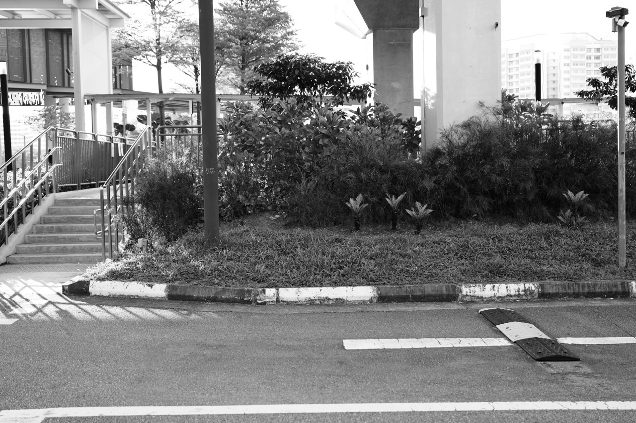
Living near Punggol Point LRT (PW3) is one of those Punggol choices that becomes clearer when you stop asking whether the area is simply “near the coast” and start mapping the journeys a real household repeats. The station sits on the Punggol LRT West Loop, close to Northshore housing, Northshore Primary School and the northern waterfront. At the same time, Punggol Coast MRT has changed the transport geography of Punggol North, while Punggol Point Park is temporarily closed for upgrading.
That combination makes PW3 interesting in 2026. The neighbourhood has an established LRT station, newer residential districts, a nearby primary school, access toward the Punggol waterfront and another main-line rail option farther east at Punggol Coast. Yet some familiar leisure routes around Punggol Point are changing during upgrading works. A useful guide therefore needs to distinguish what is open now, what is nearby on a map, what belongs to another station catchment and what must be checked again before a family acts.
This guide is written for that practical job. It does not rank Punggol Point against other estates, promise a school place, estimate property returns or turn station distance into a universal walking-time claim. Instead, it helps a family test transport, school, errands, recreation, accessibility and daily handovers from an exact address. Current operator and agency information should always take priority when a route, closure, timetable or facility changes.
Choose the part you need
Station and network · Northshore Primary · Punggol Point closure · Household trial
Understand the place
1. Read PW3 as a working station, not a neighbourhood slogan · 2. Compare Punggol Point LRT with Punggol Coast MRT · 3. Separate Punggol Point Park from the wider north-coast area · 4. Understand how Northshore changes the old “end of Punggol” picture
Run the family day
5. Plan school from the exact home address · 6. Build groceries, food and errands into one route · 7. Measure the complete weekday commute · 8. Use the waterfront without assuming every route is open · 9. Build safe independence for children and teenagers
Test the details
10. Check stroller, wheelchair and carrying routes · 11. Design for rain, heat and sudden route changes · 12. Inspect the actual home, not a station-wide reputation · 13. Give visitors a destination they can actually find · 14. Turn the neighbourhood into useful learning · 15. Run a three-visit decision test · 16. Know when a nearby Punggol node solves the job better
Transport, school and park information checked against current official sources on 2 October 2026. Suggested routines are planning examples, not promises about travel time, school admission, facility availability or property outcomes.
1. Read PW3 as a working station, not a neighbourhood slogan
Punggol Point is station PW3 on the Punggol LRT West Loop. SBS Transit records that the station opened for passenger service on 29 December 2016. That historical fact matters because older online discussions can still describe Punggol North as if rail access there were speculative or unfinished. PW3 is an established part of the operating LRT network; the questions for a household are the practical ones that come after that fact.
The first practical question is where the home sits in relation to the station entrance, lift access, crossings and the route used at the time the family actually travels. “Near PW3” can cover homes with very different last-mile experiences. A map pin is useful for orientation, but a parent carrying groceries, a child with a school bag and a grandparent using a mobility aid experience distance differently. Walk the route instead of converting map distance into a promise.
The second question is what the LRT is doing for that journey. Sometimes it is the first stage toward Punggol MRT and the North East Line. Sometimes it is the simplest connection to another part of the West Loop. Sometimes a bus or the newer Punggol Coast MRT produces a better complete trip. The value of PW3 is not that it must be used for every journey; it is that it gives the northern neighbourhood another reliable network connection.
The West Loop should also be read as an operating loop rather than as a row of equal, interchangeable stops. Waiting, platform direction, transfers and the final destination all affect the journey. If your household has a fixed morning deadline, test the actual sequence from the block to the destination entrance. Do the same in the evening. A route that feels easy at 11 a.m. may feel different during the school-and-work peak.
For current rail diagrams and service information, use SBS Transit’s system map and current train information. The eduKatePunggol Punggol LRT Guide helps with local orientation, but time-sensitive operator information remains with the operator. That source boundary is useful throughout this guide: a neighbourhood article can explain how to think, while the operator owns the live service.
When evaluating a home, write down five recurring destinations before you inspect the station. School, work, groceries, a regular activity and a caregiver or family support point are a good start. Mark which journeys use PW3, which use a bus, and which might use Punggol Coast. This small exercise prevents an attractive station label from becoming a substitute for the actual household timetable.
Back to contents · Continue to the next chapter
2. Compare Punggol Point LRT with Punggol Coast MRT
Punggol North no longer has to be understood through the LRT alone. Punggol Coast MRT opened on 10 December 2024 as the new North East Line terminal. LTA identifies two station entrances and links the station directly to the Punggol Digital District and Singapore Institute of Technology area. For some northern households, that creates a second main rail gateway that can change how they plan longer journeys.
This does not make PW3 redundant. The two stations serve different network jobs. Punggol Point is on the local LRT loop; Punggol Coast is on the North East Line. A family living closer to PW3 may still find the LRT-to-Punggol transfer natural for many trips, while using Punggol Coast for a particular destination or when the home-to-station route makes sense. The useful comparison is not “which station is better?” but “which complete journey is simpler today?”
Test both routes with the same measurement. Start timing at the same place—perhaps the block lobby—and finish at the same destination entrance. Include waiting, transfers, lifts and crossings. If you time one route platform-to-platform and the other door-to-door, the numbers look precise but the comparison is poor. Families often discover that the decisive minutes are in the first and last part of the trip rather than on the train itself.
Purpose matters too. A student heading to SIT may have a different preferred gateway from a parent travelling toward central Singapore. A grandparent may choose the route with fewer changes even if it is not the shortest on a journey planner. Someone carrying a musical instrument or sports equipment may value lifts and shelter more than a small time difference. Treat route choice as a household-design problem rather than a permanent verdict on a station.
Keep one normal route and one understood alternative. That is especially helpful when a service notice, heavy rain or a family handover changes the day. Children and teenagers travelling independently benefit from consistency: they should know the usual route, the approved backup and who to contact if both are disrupted. “Use whichever looks fastest” is less useful than two routes that have already been practised.
For a new home, perform this comparison before signing based on phrases such as “near MRT” or “near LRT”. The northern part of Punggol now has more network choice than older property descriptions may suggest, but the value of that choice depends on the exact address and destinations. The Punggol Map & Postal Codes guide can help you orient the address before the physical trial.
Back to contents · Continue to the next chapter
3. Separate Punggol Point Park from the wider north-coast area
The most important 2026 correction for any Punggol Point guide is simple: Punggol Point Park is closed for upgrading from 11 August 2026, and NParks currently gives an expected completion date of 31 December 2027. An expected works-completion date is not the same thing as a confirmed public reopening. If a leisure plan depends on the park, check the latest NParks notice before travelling.
That closure should not be stretched into a claim that the whole northern waterfront is closed. Punggol Point Park, Punggol Promenade, Coney Island, Punggol Settlement and other nearby routes have separate identities and access conditions. A notice affecting one area does not automatically certify or close every adjoining path. The right response is to identify the destination precisely and then check the owner responsible for it.
Use the eduKatePunggol Punggol Point Park closure guide for the local explanation, then follow the current NParks notice for the live condition. This is more useful than relying on old photographs, archived reviews or a route remembered from before the works began. A coastal neighbourhood can retain its waterfront identity even while a particular park entrance or facility is unavailable.
For families, the closure changes weekend planning more than it changes the basic residential geography. Children may need a different playground or cycling destination. A visitor who expects the old park layout may need a revised meeting point. A household that chose the area partly for recreation should trial the alternatives that are open now rather than assuming the future upgraded park is already part of everyday life.
There is also a useful decision discipline here: separate present benefit from future expectation. An operating LRT station is a present transport fact. An open school is a present institution. A closed park under upgrading is a present limitation with an expected works timeline. Keeping those categories separate prevents a housing decision from quietly counting a future condition as though it were available this weekend.
If the park reopens or the notice changes, this article should be refreshed rather than silently leaving the 2026 condition frozen. That is why the closure is treated as a dated status, not as a permanent characteristic of PW3. The neighbourhood guide remains useful because its core job is to teach the route-checking method, while the park owner supplies the latest operational state.
Back to contents · Continue to the next chapter
4. Understand how Northshore changes the old “end of Punggol” picture
Older memories of Punggol Point often centre on a road end, seafood restaurants, the jetty and a coast that felt far from the newer town centre. Modern Punggol North is different. Northshore housing, schools, retail and the wider Punggol Coast/PDD area have created multiple destinations in the north. A PW3 household is therefore not choosing between “town” and “nothing”; it is choosing among several local nodes that serve different jobs.
This distinction matters for errands. Waterway Point and Punggol Town Centre remain major retail and transport anchors, but not every grocery run needs to travel there. Northshore Plaza serves a different northern catchment, and Punggol Settlement serves a different dining and waterfront role. The household task is to decide which node handles ordinary weekdays and which one is for larger or occasional needs.
It also matters for social geography. A child’s friend may live in Northshore, a tuition class may be elsewhere in Punggol, a grandparent may arrive via the North East Line, and weekend visitors may know only Punggol MRT. The station closest to the home is only one part of those handovers. Clear meeting points and simple return routes become more valuable as the town offers more choices.
For a family moving from another estate, avoid judging Punggol North through a single inspection at the waterfront. Visit on a weekday morning, an ordinary evening and a weekend. Observe which shops are useful, where children actually walk, which crossings matter and whether the LRT feels naturally connected to the home. A neighbourhood is experienced in repeated small movements, not only in the scenery shown during a viewing.
The same principle helps with online research. A page about Punggol Digital District is not automatically a guide to Punggol Point. A Northshore Plaza tenant directory is not a full account of PW3. A park page is not a housing guide. Use each source for the job it actually owns, then combine them into the household picture instead of asking one source to answer everything.
That approach is also how eduKatePunggol’s town guides are intended to work. The Complete Punggol Guide is the discovery route; specialised pages own schools, transport, history, food, parks and family routines. This PW3 article connects those layers without taking over their jobs.
Back to contents · Continue to the next chapter
5. Plan school from the exact home address
Northshore Primary School is the clearest verified school relationship for PW3. The school’s current contact page lists its address as 30 Northshore Drive, identifies Punggol Point (PW3) as its nearest LRT station, and lists bus services 84 and 384. That gives families a reliable orientation point. It does not mean every home described as “near PW3” falls within a particular Primary 1 distance band.
For school planning, separate three questions. First: which schools are relevant to the family? Second: what is the official distance or registration position for the exact home address when that question matters? Third: what route will the child or caregiver actually use each day? The first can begin with a neighbourhood guide; the second belongs to official registration tools; the third requires a physical route trial.
Walk the school route at the time it will be used. Count crossings, unsheltered sections and places where a younger child may need close supervision. If the plan involves LRT or bus, include the walk to the stop and the final approach to the school gate. A family with two children at different schools should test the handover chain rather than assessing each school journey as though it happens independently.
Then test the afternoon. Dismissal may connect to student care, a caregiver pickup, a CCA, tuition or home. The morning route can be straightforward while the afternoon becomes complicated because the responsible adult is somewhere else. Write the actual sequence on paper: who collects, where they meet, what happens if one person is late, and how the child knows the plan has changed.
Use the Primary Schools in Punggol overview to compare the wider education landscape, then open the individual school owner for details. Do not infer admission from a station name, a marketing map or a walking route. A good neighbourhood guide makes that boundary explicit because school decisions are too important for casual distance language.
If tuition is part of the week, add it only after the school-day route works. A child who already spends a long time moving between school, care and home may not benefit from a schedule that adds another difficult transfer. The best local routine is one the family can repeat without turning every weekday into a transport project.
Back to contents · Continue to the next chapter
6. Build groceries, food and errands into one route
A home works better when ordinary errands fit the routes the family is already taking. Before deciding that a PW3 address is convenient or inconvenient, list the recurring jobs: groceries, breakfast, dinner on a late workday, pharmacy items, parcel collection, a quick household purchase and whatever the family repeatedly needs for school. Then locate those jobs along real journeys instead of asking whether a mall is “nearby” in the abstract.
Punggol Settlement is a recognisable dining destination near Punggol Point, but it should not be treated as a substitute for every daily retail need. Use the Punggol Settlement guide for that specific dining layer. Northshore Plaza, Punggol Town Centre and other neighbourhood shops can play different roles. The useful household system may involve more than one centre.
Try a “bag test” rather than a map test. Buy a normal grocery load and take it home by the route you expect to use. Notice the lift, shelter, crossings and the final walk. A route that looks trivial without bags can feel different with rice, milk, a child’s school materials or a stroller. If the family usually drives for a large weekly shop, then test the smaller top-up trip that will happen when the car is elsewhere.
Operating hours and tenants are time-sensitive, so avoid building the household plan around an old directory. Check the current operator or centre listing when a specific shop matters. The stable insight is not that a named tenant will always be there; it is that northern Punggol now has several retail and dining nodes, and a family can choose routes that reduce unnecessary backtracking.
Weekday food and weekend food can be different systems. A waterfront dinner may be part of what the family enjoys about the area, while an ordinary Tuesday needs something fast between pickup and homework. Design the Tuesday first. A neighbourhood that works on the hardest routine days will usually be easier to enjoy on the relaxed ones.
Children can help with this planning. Ask them to identify the safest simple errand they might eventually do independently, such as collecting a small item or meeting a parent at a known shop. The exercise teaches navigation, money, communication and responsibility while revealing whether the route feels clear enough for the family’s actual stage.
Back to contents · Continue to the next chapter
7. Measure the complete weekday commute
Commuting from PW3 should be tested as a chain: home to station or bus, waiting, the rail or bus leg, any transfer and the final walk. A single quoted train time can hide the part that creates stress. If two adults leave at different times, test both journeys. If one parent is responsible for school drop-off before work, measure the combined route rather than the work commute in isolation.
For an LRT-to-NEL route, the transfer at Punggol matters. For a Punggol Coast route, the home-to-station connection matters. For a bus route, traffic and the precise stop may matter. Instead of choosing one route forever at the desk, run each plausible option on a real weekday and record what actually happened. Keep notes simple: start time, arrival time, transfers, shelter and the point where delay was most likely.
Do not turn one trial into a permanent travel-time claim. Weather, crowds and service conditions vary. The purpose of the test is to understand the route’s structure and the amount of buffer the family needs. If arriving ten minutes late creates a serious problem, the family may prefer a route with more predictable handovers even when another route occasionally looks faster.
Late return is a separate test. SBS Transit publishes current first- and last-train information, but the family should check the timetable when the trip matters rather than relying on a screenshot or an old article. The eduKatePunggol Late-Night Transport Home to Punggol guide explains the fallback-planning method without promising that a particular connection will always be available.
If a teenager travels home after CCA or tuition, agree on the late-route boundary in advance. Which service should they aim for? At what point should they contact the parent rather than attempting a complicated alternative? Where is the approved pickup location? These decisions are easier to make calmly at home than after a missed connection.
A good commute test ends with a family rule, not just a number. For example: use PW3 for the normal school-and-work morning, use a second route for a particular destination, and keep an agreed pickup plan for disruption. The rule can change as services or family needs change, but it gives everyone a shared operating picture.
Back to contents · Continue to the next chapter
8. Use the waterfront without assuming every route is open
The north coast is a genuine part of Punggol’s identity, but a responsible 2026 guide must treat access route by route. NParks describes Punggol Promenade as a waterfront network with several distinct segments. Its Nature Walk is a 2.4 km section between Punggol Point Walk and Riverside Walk and is listed as wheelchair friendly. That does not override the current Punggol Point Park closure or certify every adjoining approach.
If your family values walking or cycling, choose a route that is confirmed open and appropriate for the people using it. A parent with a stroller, a child learning to cycle and an experienced adult cyclist can all describe the same path differently. Shared-path etiquette matters because speed differences create conflict. Treat a leisure route as a shared public space, not a private training lane.
Coney Island is another separate destination with its own access and terrain conditions. NParks notes that the park is wheelchair accessible and stroller friendly at the east and west ends, while some rugged sections may be unsuitable for young children or people with mobility issues. That is a useful example of why the word “accessible” needs detail: one accessible entrance does not make every internal path equally suitable.
For children, build a clear turn-around point. “Cycle until tired” creates a return problem; “cycle to this landmark and return” is easier to manage. Carry water, check weather and make sure the route back is understood. If the park or connector notice changes, update the plan rather than assuming yesterday’s path remains available.
Wildlife is part of the environment, not a sightseeing guarantee. Keep distance, do not feed or chase animals, and follow current NParks/AVS guidance. The Birdwatching & Wildlife in Punggol guide owns the more detailed encounter guidance. This neighbourhood article only needs the behavioural rule: enjoy the coast without turning wildlife into an attraction to approach.
The best way to value waterfront living is to use it on ordinary days. Try the route after dinner, on a humid afternoon and on a weekend morning. If the family naturally uses it, the amenity is part of daily life. If every visit requires a special plan, it may still be enjoyable, but it should be weighted differently in a housing decision.
Back to contents · Continue to the next chapter
9. Build safe independence for children and teenagers
A neighbourhood becomes much more useful to a family when older children can gradually handle simple journeys themselves. PW3 can support that learning because rail, school, residential paths and northern amenities create repeatable routes. Independence should still be staged. Start with a route the child has walked many times with an adult, then reduce supervision only when the child can explain what to do at every decision point.
Teach landmarks rather than only turn-by-turn instructions. A child who knows the station code, the correct exit, the school gate and two reliable meeting points can recover more easily from confusion than one who memorised “left, right, right”. Ask them to explain the route back to you. If the explanation is vague, practise again before making the journey independent.
Phone readiness is practical rather than glamorous. The child should have enough battery, know the essential contacts, understand the school’s phone rules and know when to call instead of messaging. Agree on what counts as a route problem. Missing one train is different from boarding the wrong service, being unable to find the meeting adult, or discovering that a planned path is closed.
For LRT travel, practise reading the station code and destination context, not just recognising familiar scenery. A disruption or unfamiliar direction should trigger the agreed backup plan, not improvisation. The eduKatePunggol Punggol LRT for Students guide is designed for that learning job.
Independence also involves time. A student should know the latest sensible departure for school, tuition or CCA rather than relying on the parent to chase every movement. Build a small buffer and define the check-in point. The goal is not surveillance; it is a predictable routine where both student and parent know when the plan is normal and when help is needed.
Use local errands as low-stakes practice. Meeting a parent at the station, buying one item or returning from an activity can teach planning before the child handles a longer trip. Each successful repetition turns the neighbourhood from a collection of places into a mental map the student can use.
Back to contents · Continue to the next chapter
10. Check stroller, wheelchair and carrying routes
Accessibility has to be checked across the whole journey. A station can have lifts while the route from a particular block includes awkward crossings, unsheltered gaps or a long detour. A park connector can be described as wheelchair friendly while a destination beyond it has different conditions. For a real household decision, inspect every transition from the home door to the destination entrance.
For a stroller, pay attention to kerbs, lift queues, narrow turns and where an adult can pause safely. For a wheelchair user, the slope, surface and available route around works may matter. For an older resident, a journey with several standing waits can be more difficult than a slightly longer route with places to rest. These are not details to infer from a generic “accessible” icon.
Carrying changes the route too. A parent with a toddler and groceries, a student carrying a large project, or a family returning from sports does not experience the same walk as an unencumbered adult. Test the route with the actual load when possible. The result may influence which grocery node, station or pickup point the family prefers.
Temporary works deserve special attention around a changing neighbourhood. Do not assume a route remembered from before construction or upgrading remains the most accessible path. Follow current signs and notices on site. If a family member cannot manage an unexpected detour, identify the alternative before making that route the default.
Accessibility planning also benefits visitors. When inviting an older relative or someone using a mobility aid, give the station or drop-off point, exit, meeting landmark and any known route constraint. “Come to Punggol Point” is not enough in an area where the station, park, settlement and waterfront can all be described with similar place names.
The objective is not to declare the entire neighbourhood accessible or inaccessible. It is to identify a complete route that works for the specific person. That is a more useful and more honest standard, and it can be rechecked when works finish or circumstances change.
Back to contents · Continue to the next chapter
11. Design for rain, heat and sudden route changes
Punggol’s outdoor routes are often part of the attraction, which means weather has to be part of the operating plan. A pleasant evening walk can be very different from a midday school pickup in heat or a sudden downpour. When testing a home, look for shelter, safe places to pause and the point where an outdoor route becomes inconvenient rather than assuming the shortest line on a map is the best year-round route.
For school mornings, decide what changes when it rains. Does the child still walk to PW3? Is there a bus option? Does the family leave earlier? Who carries the umbrella or rain cover? Small decisions sound trivial until they occur on a rushed morning. A written wet-weather rule reduces the number of choices that have to be made while everyone is late.
For outdoor recreation, weather and lightning are safety questions rather than comfort preferences. Use current official weather and alert information. The Staying Safe in Punggol guide keeps local emergency and weather routes separate from ordinary planning. Do not continue an exposed waterfront activity because the sky “looks fine” if official warnings say otherwise.
Heat matters for children and older people. A route that an adult comfortably walks during a breezy viewing may be tiring when a child returns at a hotter time of day. Check water access, shade and whether the family can shorten the trip. This is another reason to conduct visits at the times you will use the neighbourhood instead of relying on a single weekend inspection.
Service disruption is the transport version of bad weather. Know which adult can collect, what approved alternative a student can take and where the family meets if a usual route is temporarily unavailable. A backup plan is strongest when it has been practised before it is needed.
None of this removes spontaneity from living by the coast. It does the opposite: a family that knows its normal and fallback routes can enjoy the neighbourhood without turning every change into an emergency. The routine carries the boring decisions so that the enjoyable parts of Punggol remain enjoyable.
Back to contents · Continue to the next chapter
12. Inspect the actual home, not a station-wide reputation
A station name cannot tell you whether a particular unit is quiet, windy, bright, shaded or affected by nearby activity. Those characteristics vary by block, floor, orientation and immediate surroundings. Avoid claims that “Punggol Point is quiet” or “Northshore is noisy” as though a whole district shares one acoustic condition. Visit the exact home at relevant times and listen with the windows both open and closed.
Look at the first five minutes outside the door. How long to the lift? Is the ground-floor route intuitive? Where is the nearest safe crossing? Can a young child find the correct block? Where would a taxi or private-hire pickup occur without creating a dangerous road crossing? These details influence the daily experience more reliably than a broad description of the estate.
Then examine the home’s connection to the family’s support network. If grandparents help twice a week, their route matters. If a helper takes the child to school, practise that route with the person who will actually do it. If one parent works late, see whether the remaining adult can manage dinner, homework and another child’s activity without an unrealistic sequence of trips.
Do not turn transport access into an investment claim. An operating station can make a journey useful; that does not automatically establish a property premium or future return. Housing decisions involve price, tenure, condition, household needs and market factors beyond this neighbourhood guide. Keep the article focused on lived usability rather than forecasting financial outcomes.
If comparing two homes near different Punggol stations, use the same worksheet for both. Score neither station globally. Instead record the school route, work route, grocery route, care route, recreation route and fallback route. A household may prefer one address because three recurring journeys become simpler even if another address is closer to a headline attraction.
Finally, leave one space for “friction we did not expect”. Perhaps the lift is busy at pickup time, the route is exposed in rain, or a favourite shop is not on the way home. These observations are not reasons to reject an area automatically. They are the information that turns a viewing into a decision.
Back to contents · Continue to the next chapter
13. Give visitors a destination they can actually find
Punggol Point is a place name, an LRT station name and a phrase people may use loosely for the northern coast. That creates predictable confusion. A visitor may think the park, Punggol Settlement and PW3 are the same destination. During the current park closure, vague directions are even less useful. Give a precise meeting point and the route from the transport node the visitor will actually use.
If the visitor is arriving by LRT, say PW3 Punggol Point and give the exit or nearby landmark when known. If the destination is Punggol Settlement, say so explicitly. If the visitor is arriving via Punggol Coast, explain the onward leg instead of assuming “Punggol North” is self-explanatory. A one-line message with the exact place name and map pin can prevent ten minutes of phone calls.
For older visitors, confirm whether they are comfortable transferring to the LRT. Sometimes meeting them at Punggol MRT or another obvious node is kinder than asking them to navigate a local loop they rarely use. The nearest station to the home is not always the best meeting place for the visitor.
For children’s meetups, make the handover point observable and unambiguous. “Outside the station” may have multiple plausible spots. Choose one landmark and ensure both families know it. If a child is allowed to travel independently, the adult receiving them should know the service and approximate arrival window without turning that estimate into a rigid promise.
When a route is affected by works, update the invitation. Do not send an old family message because it worked last year. A temporary closure can change pedestrian flow even when the station itself is operating normally. The person who lives in the area should carry the burden of giving current, simple directions.
Clear visitor directions are a small test of whether you understand the neighbourhood yourself. If you cannot explain the relationship among PW3, Punggol Coast, Northshore and the Punggol Point destinations in simple language, spend another visit mapping the area before relying on it for complicated family handovers.
Back to contents · Continue to the next chapter
14. Turn the neighbourhood into useful learning
Punggol Point can be a rich learning environment because transport, water, ecology, urban development and local history meet in a small area. The trick is not to turn every family outing into a lesson. Instead, use questions that arise naturally. Why is an LRT loop different from a main-line MRT? Why does a park close for upgrading? Why do agencies distinguish a park, promenade and nature area?
For younger children, mapping is enough. Ask them to locate home, PW3, school and one safe meeting point. Estimate which route is longer, then walk it and compare. That turns geography and measurement into something visible. For older students, compare different transport networks or examine how new infrastructure such as Punggol Coast changes the set of possible journeys without making every older route obsolete.
The waterfront supports science questions too. What is a reservoir, coast, park connector or intertidal habitat? Why should wildlife not be fed? Why might an accessible route still have terrain that is difficult for some users? Use official descriptions to answer factual questions rather than inventing explanations from appearance alone.
History should be handled with the same evidence discipline. Punggol has strong memories of old settlements, seafood and earlier landscapes, but this PW3 guide is not the history owner. Route deeper questions to the established history pages instead of repeating half-remembered stories as fact. The separation keeps both the neighbourhood guide and the history work clearer.
For English learning, ask the student to write directions for a visitor, compare two routes, explain a closure notice or summarise the difference between an expected completion date and a confirmed opening. These tasks use real information while practising precision, audience awareness and evidence. They are much more meaningful than inserting random vocabulary into sentences.
A family can therefore use PW3 as both a place to live and a small everyday laboratory for thinking. The aim is not to make the child perform continuously. It is to show that reading a map, checking a source and explaining a decision are ordinary capabilities used outside school.
Back to contents · Continue to the next chapter
15. Run a three-visit decision test
If you are deciding whether to live near PW3, three purposeful visits reveal more than a long list of attractions. The first visit should be a weekday morning. Start from the exact block or candidate block, travel toward the school or work route, and notice the transfer points. Do not optimise the route in advance; see how intuitive it feels when you are moving at the time the family will actually use it.
The second visit should be an ordinary weekday evening. Buy groceries or dinner, return to the block and imagine the school bags, tired children and next-day preparation that will happen at the same time. Check lighting, crossings, lifts and whether the final errands sit naturally on the way home. A neighbourhood often proves itself in the 6 p.m. routine rather than on a scenic weekend.
The third visit should be a weekend route that matters to your household. That could be a confirmed-open waterfront walk, a family meal, a child’s activity or a trip to another Punggol node. Do not use a closed park as evidence of what weekend life feels like today. Choose the recreation that is actually available during the decision period.
After each visit, write only five things: what worked, what caused friction, what needs verification, what would change in rain, and what route you would use if the normal plan failed. This forces the family to separate facts from impressions. “We liked the view” can coexist with “the school handover needs another solution”; neither cancels the other.
Then compare the candidate with another area using the same method. Do not add extra tests only to the place you already prefer. A fair comparison uses the same household jobs, time periods and definitions. If PW3 wins for your family, you will know why in concrete terms rather than because a guide told you it was the “best” station.
Keep the notes after moving. They become a starting operating manual for the household. As the child grows, the park reopens, a job changes or a new route becomes useful, update the system. A neighbourhood is not a static purchase feature; it is a set of routes the family learns to use better over time.
Back to contents · Continue to the next chapter
16. Know when a nearby Punggol node solves the job better
Living near PW3 does not require forcing every task through PW3. Samudera may be the useful LRT stop for a Northshore Plaza errand. Punggol Coast may be the useful main-line station for a particular journey. Punggol Town Centre may be the simplest place for a large retail or interchange need. A strong local routine uses the network rather than defending one station as the answer to everything.
This is especially important for families with changing schedules. A child may attend primary school locally now and a secondary school elsewhere later. A parent may change work location. A grandparent’s care route may become more important. The household that understands several Punggol nodes can adapt without treating each life change as a reason the neighbourhood “stopped working”.
Explore the next station deliberately. The Samudera guide examines the Northshore Plaza and waterfront side of the West Loop. Nibong and Sumang serve different residential sections farther around the loop. Soo Teck returns toward the Town Centre. Learning the neighbouring stations helps a family understand how the loop operates as a town system rather than as isolated dots.
Use the Complete Punggol Guide to continue into transport, schools, food, parks, family routines and education. When a question becomes specific—such as school admission, a park closure or a current train time—leave the town guide and use the responsible official owner. Good local knowledge is not having one page answer everything; it is knowing where the next reliable answer lives.
PW3’s distinctive combination in 2026 is easy to state without exaggeration: an operating West Loop station, a verified relationship with Northshore Primary, northern housing and waterfront geography, another main-line rail option at Punggol Coast, and an important temporary park closure that families should not ignore. Whether that combination fits your household is a question your routes can answer.
That is the useful standard for living near Punggol Point LRT. Choose the address because the repeated journeys make sense, understand what is temporarily different, and let the official sources own live conditions. Then the neighbourhood becomes less of a property label and more of what it really is: a working part of a family’s week.
Back to contents · Continue around Punggol
Continue around Punggol
For rail geography, use the Punggol LRT Guide. For school discovery, use Primary Schools in Punggol. For current Punggol Point works, use the closure guide. For the wider town, return to the Complete Punggol Guide.


