
Before the Punggol 21 blueprint was unveiled in 1996, a striking proposal for Punggol’s future was already being reported in November 1995: about 8,000 homes on 110 hectares of reclaimed land between Coney Island and the mainland. A contemporary Straits Times report, reproduced in the 11 November 1995 Weekly Overseas Edition, described a new waterfront town and the reclamation required to make it possible.
This earlier announcement deserves its own place in Punggol’s timeline. It shows the district at a moment when Singapore was discussing not merely where to build new flats, but how to reshape a shoreline to create an entirely new residential environment. The numbers are historical proposal figures: they do not mean 8,000 particular flats had already been completed, nor that every part of today’s Punggol coastline is a direct copy of that 1995 scheme.
What the November 1995 report said
- Reported proposal: a new waterfront town in the Ponggol/Punggol area.
- Housing scale: approximately 8,000 houses, as stated in the contemporary headline and article.
- Land area: 110 hectares of proposed reclaimed land.
- Geographical reference: the area between Coney Island and the mainland.
- Contemporary source: The Straits Times report dated 8 November 1995 and its republication in the 11 November 1995 Weekly Overseas Edition.
- Next milestone: the 1996 unveiling of the Punggol 21 blueprint, described in HDB’s official town history.
- Important caution: a newspaper’s announced proposal and an approved or completed as-built plan are not the same document.
Why 8,000 homes sounded so ambitious in 1995
Eight thousand homes can imply a sizeable new community with schools, daily shopping, public transport, roads, services, parks and places for neighbours to meet. The number makes no sense as a collection of isolated blocks on newly formed soil. Housing at that scale requires a whole urban system, with public and private decisions that may unfold over many years.
The 1995 announcement also came at a time when demand for the North-East of Singapore was already substantial. In March of that year, Parliament had discussed how reclamation in Punggol was needed before parts of the HDB construction programme could proceed. Against that background, an 8,000-home proposal was not just an attractive sketch. It was a potential future answer to a very practical housing-supply bottleneck.
Where did the proposed 110 hectares sit?
The contemporary report referred to land between Coney Island, also known historically as Pulau Serangoon, and the Punggol mainland. That location is sensitive to changes in mapping. Over different periods, reclamation plans, channels, coastlines and land uses were adjusted. A modern map cannot be used without qualification to draw the precise boundary of a newspaper’s 1995 proposal.
The correct historical exercise is to compare dated plans: a survey map before reclamation, the actual newspaper graphic, the 1996 planning material and a modern map. If they differ, the differences may be evidence of real planning revisions rather than mistakes to be hidden. People who grew up visiting the old Punggol Point coastline may remember a marine landscape that no longer appears in exactly the same form.
Was this the same thing as the 1996 Punggol 21 master plan?
They are connected, but they are not identical milestones. The Housing & Development Board dates the first public unveiling of the Punggol 21 blueprint to 1996, under Prime Minister Goh Chok Tong. The November 1995 coverage is a prior reporting milestone for a specific reclaimed-land housing proposal. We should not overwrite one date with the other.
A useful sequence is: preliminary concept and land discussions; public reporting of a significant proposal; unveiling of a larger blueprint; engineering and construction; and eventual community occupation. Those stages can overlap, and each source records a particular point in the process. The phrase planned in 1995 does not mean opened in 1995.
From coast to town: reclamation is only the beginning
Land reclamation is the process of forming usable land where water previously occupied part of the area. But a waterfront district demands more than moving material. Engineers and planners must manage ground conditions, drainage, flood risk, utilities, road corridors and the future relationship between public access and private development. Some of these tasks can be designed before reclamation; other work depends on land conditions and final plans.
A historical account should avoid the impression that reclamation produces ready-made housing plots overnight. Time is required for the land to be prepared and for infrastructure to serve people. This helps explain why a big announcement and the lived arrival of a complete neighbourhood may be years apart.
Why the area beside Coney Island mattered
Coney Island gave Punggol a distinctive geographical edge: mainland homes could face water, vegetation and an island rather than simply another row of buildings. In planning terms, that created potential for waterfront identity and leisure access. But an island and its surrounding water are also ecological and maritime spaces, not merely an empty backdrop for residential marketing.
The planning challenge was therefore double. Singapore needed homes and infrastructure, yet the character and movement of the coastline had to be considered. This is why historic plans are worth studying as plans, not just as promises of attractive views. The boundaries and uses proposed at one moment may be refined in later schemes.
A 1995 proposal is not an ‘as-built’ inventory
Suppose a 1995 report specifies 8,000 homes. It is tempting to look at completed blocks in 2026 and try to identify exactly those 8,000 flats. That is not a sound method. Plans can change in unit type, density, site layout, residential mix, land area, public facilities and delivery schedule. The headline figure is evidence of an announced ambition at a date, not a label permanently attached to a finished set of buildings.
The same caution applies to the figure of 110 hectares. Other sources refer to different reclamation areas across wider geography and other periods. Those areas need not be equal, because they may describe separate sites or phases. Do not add numbers across sources before confirming that they refer to non-overlapping land.
How the 1995 announcement fits the wider 1980s–2000s timeline
- 1980s: reclamation and preparation of northeastern Singapore become part of long-term land-use planning; older agricultural and village uses are being replaced.
- March 1995: Parliament identifies demand for the North-East and Punggol reclamation as a near-term supply constraint.
- 8 November 1995: reporting describes 8,000 homes on 110 hectares of proposed reclaimed land near Coney Island.
- 1996: the Punggol 21 blueprint is unveiled to present the broader waterfront-town concept.
- 1997–2003: economic disruptions and other factors affect the pace at which the town takes shape.
- 2007: Punggol 21 Plus updates the waterfront vision.
- 2011: the waterway is officially opened, giving residents a major public-space feature of the later plan.
- Today: Punggol contains neighbourhoods and amenities built through successive rounds of planning rather than one unchanged 1995 design.
A family story hiding inside a land-use statistic
For planners, 8,000 homes may be a number on a master plan. For a family hoping to live near relatives, it can represent the prospect of a stable address, a shorter journey, a new school routine and a community of neighbours. That is why the proposal mattered even before concrete buildings existed. It signalled that the North-East might support a substantially larger residential population.
Yet the transition was not costless for those already using the coast. Older fishing, boating, village and small-business activities faced relocation, changed access and uncertainties. A complete account of waterfront progress should include these earlier users rather than imagine that the land was simply waiting empty for new homes.
What later Punggol 21 Plus changed
The Prime Minister’s Office account of the 2011 waterway opening explains how the later Punggol 21 Plus plan turned a practical connection between two future reservoirs into a public waterway. The earlier engineering idea was a pipeline; the eventual project became a recreational and urban-design feature. That is an especially clear example of why early infrastructure concepts are not always built exactly as initially imagined.
The 1995 scheme near Coney Island and the later waterway should not be treated as the same piece of infrastructure. Their significance is that both demonstrate a long-running effort to make water central to Punggol’s identity, while their dates, project boundaries and functions are separate.
Learning the mathematics of a planning headline
Students can use 8,000 homes and 110 hectares as a lesson in units and assumptions. One hectare is 10,000 square metres. Dividing a proposed number of homes by a gross area produces a rough mathematical ratio, but it does not reveal floor area, plot ratio, actual flat mix or population density. Roads, parks, water and non-residential land uses complicate the calculation.
To make the exercise useful, first ask what the 110 hectares includes. Then ask whether the source intended 8,000 individual apartments, dwelling units of several types or a rounded estimate. If those definitions cannot be established, the ratio remains a classroom illustration rather than a reliable specification of the completed town.
How to tell proposal, plan, construction and opening apart
- Proposal: someone announces or reports what is being considered or intended.
- Blueprint: a more developed spatial or strategic description of an intended future.
- Land preparation: reclamation and associated civil-engineering work make subsequent construction possible.
- Construction: homes, roads, utilities, public facilities and landscapes are physically built.
- Opening or occupation: people start using the resulting facilities or moving into completed homes.
- Retrospective history: a later source explains how the earlier stages developed, sometimes with the benefit of hindsight.
Good local history uses the right verb. It does not turn ‘was planned’ into ‘was completed’, or assume the date of a later official opening equals the birth of every idea behind it.
A visual research route around today’s Punggol
Families can view present-day Punggol Waterway, the public promenade and the modern town model, then compare them with the archival newspaper’s 1995 description. The goal is not to hunt for a nonexistent plaque marking ‘the 8,000 homes’. It is to notice how transport corridors, housing, drainage, recreation and greenery now share space. That visible integration is the eventual everyday consequence of decades of planning.
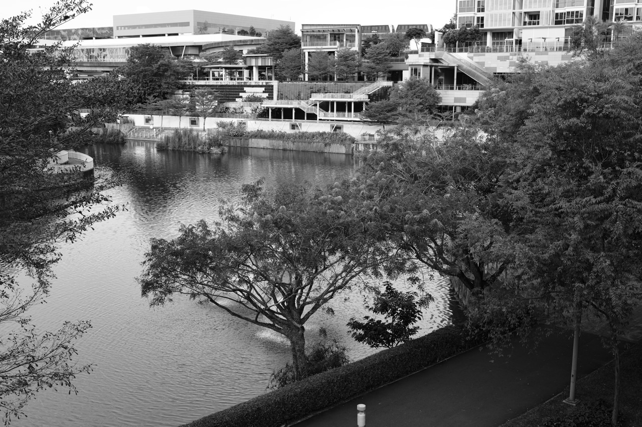
This article’s feature image shows present-day Punggol Waterway Park near Waterway Point. It is not presented as a 1995 photograph or as an original drawing of the 110-hectare proposal. The Punggol Discovery Cube’s model provides another useful way to study the finished town’s general geography.
Further reading in the Punggol history series
For the earlier shoreline, read land reclamation and Punggol’s changing coastline. For the later policy vision, see Punggol 21 and Punggol 21 Plus and the 1998 planning report. The separate March 1995 housing-queue account shows why land preparation had real effects on applicants.
Frequently asked questions
Were 8,000 houses built at Punggol in November 1995?
No. The figure appears in a report about a proposal to build homes on reclaimed land. It must not be presented as a completed housing inventory for that month.
Did the proposal cover the whole modern Punggol town?
The report specified 110 hectares between Coney Island and the mainland. That is a particular proposed area, not a proven boundary for all of today’s Punggol.
Was Punggol 21 announced in 1995 or 1996?
A specific waterfront housing proposal was reported in November 1995. HDB dates the unveiling of the broader Punggol 21 blueprint to 1996. These are distinct milestones.
Can the same 8,000-home design be located precisely on a 2026 map?
Not reliably from the newspaper headline alone. A careful comparison needs the newspaper graphic, dated surveys, subsequent planning reports and as-built records.
Does the 110-hectare number describe all Punggol reclamation?
No. It describes the area attached to this 1995 proposal. Other reclamation figures can apply to wider projects, different dates and different boundaries.
Primary sources and official context
- The Straits Times: Weekly Overseas Edition, 11 November 1995 — Ann Williams’s report “Waterfront town at Ponggol with 8,000 houses on reclaimed land”, reporting 110 hectares.
- The Straits Times, 8 November 1995 — original issue cited by later heritage research.
- HDB’s Punggol town history — date of the 1996 blueprint and subsequent development.
- National Heritage Board, History of Punggol — longer reclamation and development chronology.
- PMO, 2011 Punggol Waterway opening speech — later scheme and how its waterway evolved.
What makes November 1995 memorable is not merely a big housing number. It was the moment readers could see a startling possibility: a place known for old coastal businesses, farms and quiet shorelines might become a major new waterfront neighbourhood. The outcome changed through several later plans, but the ambition had already become visible.


