
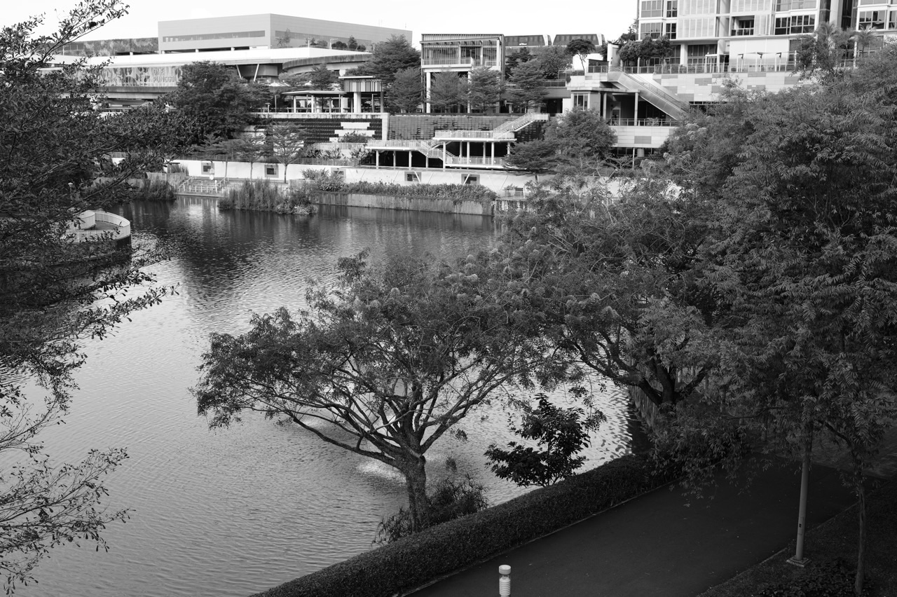
The top 10 things to do in Punggol for Geography students are to map the planned waterway corridor, compare the four Waterway Park zones, investigate Lorong Halus Wetland’s environmental management, observe coastal habitats at Coney Island, study the Punggol Point coastline, compare Punggol and Punggol Coast rail nodes, learn about HDB’s Treelodge Eco-Town, interpret myENV environmental data, examine services at One Punggol, and study the opened Punggol Heritage Trail. Each stop answers a different geographic question instead of simply naming ten scenic places.
Best first Geography field trip: choose a safe and accessible stretch of Punggol Waterway Park and investigate how water, greenery, housing and movement fit together. If you want to study environmental systems, PUB’s Lorong Halus learning material provides a clear researched case. For human geography, compare One Punggol’s co-located services with the newer Punggol Coast transport district. Use official public information, your own clearly dated observations and explicit limitations.
This October 2026 guide treats geographical fieldwork as evidence gathering, not souvenir photography. It separates official facts, observed features, model data, planned developments and questions that require professional measurements. Outdoor investigations should use current NEA advisories and site rules. The activities can be adapted to Primary learners, Secondary Geography students, family study groups or university-bound fieldwork beginners.
Choose a Punggol Geography focus
- Physical and environmental geography: waterway landscaping, Coney Island coastal vegetation, Lorong Halus water management or myENV weather data.
- Human geography: rail accessibility, One Punggol services, HDB eco-design and land-use transitions.
- Maps and geospatial thinking: compare park zones, transport networks and heritage routes at different scales.
- Geographical inquiry: frame a question, distinguish observed versus secondary information, gather ethical data and report uncertainty.
- Short family visit: one waterway viewpoint and a simple land-use sketch.
- Desktop-only study: use current NParks, PUB, HDB, JTC and NEA resources and do not claim observations were made on-site.
The fieldwork method: question, evidence, pattern, interpretation, limit
Start with a specific geographical question. ‘Is Punggol beautiful?’ is difficult to evaluate because the criterion is subjective and the location vague. ‘What land uses can be observed from one public stretch of Punggol Waterway Park?’ is a clear observational question. A broader environmental study might ask which purpose PUB documents for Lorong Halus Wetland and what published evidence describes its treatment design. State your question first, then choose the source that can answer it.
A useful geographic notebook has six columns: date and time; location or map scale; source or observation type; feature or value; interpretation; and limitation. A published park description is secondary information. A visitor’s sketch is a dated personal observation. An official current environmental reading is a time-sensitive dataset. Mixing them without labels creates misleading confidence. Every table and map should have a title, units where applicable and a source note.
Geographical reasoning also asks why a pattern may exist. A busier path could reflect transport connectivity, shade or proximity to homes, but a single observation cannot establish causality. A coastal habitat may look different from a landscaped park because of salinity, management, exposure or many other factors; do not claim the reason without evidence. When an inference is plausible but unverified, call it a hypothesis rather than a fact.
Ten Punggol geography fieldwork activities
1. Map the waterway as a designed geographical corridor
Location: Punggol Waterway Park public areas along Sentul Crescent.
Geographical importance
HDB’s Punggol Eco-Town Explorer Trail identifies My Waterway@Punggol as a 4.2km man-made waterway with landscaping and housing frontage. NParks separately describes Waterway Park and its recreational zones. This is a strong lesson in human-environment interaction because the water, planting, public paths and adjacent homes were designed together. A geographical inquiry must distinguish the function of a planned waterway from an assumption that it is a wholly natural river.
Safe method and observations
Read HDB’s Explorer Trail and NParks’ current visitor page. On a simple outline map, distinguish water, housing, public greenery, pedestrian movement and major bridges using a legend. At a safe public viewpoint, observe which land uses are actually visible in the selected segment; do not treat the whole 4.2km as though it has identical surroundings. A child can label the nearer and farther bank, while an older student can note where building density changes and how the public path relates to the water.
Worked Punggol example
An illustrative map of one visible stretch shows the waterway, a planted edge, a footpath and a residential backdrop. The student labels only those features directly visible, then separately cites HDB for the route’s planned role in the town. They do not claim their single viewpoint proves that every bank of the waterway has the same width, slope or planting.
Higher-level inquiry question
Write a geographical question such as ‘How does the arrangement of public greenery influence use of the waterway edge at my chosen viewpoint?’ Suggest two non-intrusive observation variables: approximate shade cover visible from the path and number of available rest points within a short public segment. Describe what the study cannot establish: shade at another time of day or the reasons a particular resident chooses that route.
Evidence and safety limits
Do not take samples from water, climb banks or try to map private HDB courtyards as public attractions. The physical waterway, its nature-walk route and the named 8.4km park connector are different geographical objects, even when their paths overlap.
Official source: Map the waterway as a designed geographical corridor. Check updated site access and conditions.
2. Compare the four Waterway Park zones as differently designed landscapes
Location: Punggol Waterway Park’s Nature Cove, Recreation Zone, Heritage Zone and Green Gallery.
Geographical importance
NParks identifies four themed zones in Punggol Waterway Park. Those themes reflect different visitor and landscape purposes, creating opportunities to discuss land-use planning at the scale of a public park. A nature area can support quieter observation while a recreation area may contain family play; a heritage setting uses design to communicate older history. Geography is not just describing ‘lots of green space’ but explaining the different uses people assign to space.
Safe method and observations
Start with the official park page or map. Choose two zones that can be compared safely on separate visits or through current official information. Record which visitor activities the park authority associates with each and what a learner actually observes. Describe the difference between an intended function and a measured behaviour. If you cannot visit both, write ‘desktop comparison’ rather than inventing field observations.
Worked Punggol example
A student compares the Recreation Zone and Nature Cove in a table with rows for stated purpose, visible features, route constraints and unanswered questions. They conclude that park design can accommodate more than one user experience. The analysis stops short of asserting visitor numbers because no systematic count was conducted.
Higher-level inquiry question
Design a small hypothetical survey asking which type of park space a family would choose for a picnic, quiet walk or bird observation. Explain why the survey would need consent, fair question wording and an appropriate sample before drawing conclusions about the entire town. For younger learners, replace surveying strangers with comparing choices within their own family.
Evidence and safety limits
Do not confuse NParks’ four park zones with the Urban, Undulating and Rustic themes used in HDB’s wider waterway urban-design guidance. Different classifications have different planning purposes.
Official source: Compare the four Waterway Park zones as differently designed landscapes. Check updated site access and conditions.
3. Investigate how Lorong Halus Wetland treats a former landfill’s water
Location: Lorong Halus Wetland beside Serangoon Reservoir, using public learning facilities only.
Geographical importance
PUB states that Lorong Halus Wetland collects and treats water associated with the former landfill before it can enter Serangoon Reservoir. This is a specific case of environmental management following an earlier land use. It connects hydrology, water quality, sustainability and urban development without turning the site into a simplistic myth about a ‘natural pond that cleans itself’. The engineered system is the actual fact that makes the place valuable for geographical inquiry.
Safe method and observations
Study PUB’s official site overview and its ABC Waters Learning Trail material. Draw a flow sequence showing the former landfill drainage context, the wetland treatment system and the reservoir. Identify which arrows represent an agency-described process, not water movement you directly observed. If a supervised school study is planned, follow PUB’s organiser and safety requirements. Ordinary family visitors should stay on open paths and use learning signs without handling water.
Worked Punggol example
A learner writes ‘The water looks clear, so treatment is complete.’ Their teacher asks what measurements would support that claim. The revised note explains that PUB documents the site’s treatment purpose, while the student’s photograph only establishes a visible wetland view at that moment. The distinction between site function and performance measurement becomes central to the case study.
Higher-level inquiry question
List four types of data that might help engineers evaluate a treatment system: inflow, outflow, relevant pollutant concentrations and time period. Explain in plain language why a one-time visual observation lacks that information. Then propose a desk-only evidence table using published PUB material rather than invented laboratory readings.
Evidence and safety limits
PUB field-study safety guidance prohibits entering reed beds and requires participants to respond to lightning alerts. Do not collect samples, touch treatment installations or enter reservoir water without the specific authorisation and safety arrangements.
Official source: Investigate how Lorong Halus Wetland treats a former landfill’s water. Check updated site access and conditions.
4. Describe coastal forest and mangrove habitats at Coney Island
Location: Coney Island Park, West entrance near Punggol Point or East entrance near Lorong Halus.
Geographical importance
NParks describes the 81-hectare Coney Island Park as a rustic habitat-rich area with coastal forest and mangroves. It has a different ecological role from heavily landscaped Waterway Park. Students can compare designed recreational greenery with a managed natural area, exploring biodiversity, coastal conditions and visitor impacts. The comparison is useful only if they respect what cannot be seen: an attractive leaf is not proof of a specific species or its ecological abundance.
Safe method and observations
Check NParks’ current map, trail conditions and 7am–7pm opening. Choose a short accessible public trail section with enough time for a safe exit. Record differences between visible coastal vegetation and inland park landscaping: canopy density, presence of roots near tidal areas or the shelter provided by paths. Write an observation only if the feature is actually visible. Make no collection of insects, seeds or water, and avoid sensitive or closed habitats.
Worked Punggol example
A child sees tangled coastal roots and writes ‘all these trees are mangroves’. The revised field note records the root shape and nearby habitat, says ‘possible mangrove setting’, and checks the NParks description for contextual evidence. The child learns that habitat labels and species identification require appropriate field marks.
Higher-level inquiry question
Create a two-column comparison of ‘Punggol Waterway Park’ and ‘Coney Island Park’ using official site purposes, public access and observed vegetation type. Discuss why two green places can serve different ecological and social functions. Explain why the study cannot calculate biodiversity merely by counting photographs taken during a short walk.
Evidence and safety limits
Coney Island opens from 7am to 7pm and has rustic paths, no on-island carpark and separate entrances. Do not interpret the park’s ecological value as permission for unrestricted entry, or recommend it as guaranteed accessible for every mobility need.
Official source: Describe coastal forest and mangrove habitats at Coney Island. Check updated site access and conditions.
5. Observe coastal geography and human use at Punggol Point Park
Location: Punggol Point Park and public promenade viewpoints at the northern end of Punggol Road.
Geographical importance
Punggol Point Park is a small coastal park facing the sea, distinct from the internal waterway. It provides a starting point for learning about coastline, tidal influence, shoreline management and views toward the wider region. A geographical field note can explain what is visible and what needs reference data, rather than guessing sea depth, tidal height or currents from a short observation.
Safe method and observations
Check NParks’ park guidance and a safe public coastal viewpoint. Record the time of observation, apparent direction of the horizon, features visible at the shore and the presence of built elements such as a path or railing. If discussing tides, use an authoritative tide table and do not infer exact tidal stage simply by looking at one wave. Create a simple annotated sketch showing land, water, public path and distant features with no invented coordinates.
Worked Punggol example
A pupil draws the coast and labels ‘water level rising’ after watching three waves. Their teacher explains that individual waves are not the same as the tidal trend. The revised drawing uses ‘wave movement observed’ and lists ‘tide direction unverified without timed measurements or published data’. The note becomes more accurate while remaining based on the child’s experience.
Higher-level inquiry question
Ask how a public seaside park balances ecological features, visitor access and safety barriers. Compare a photograph taken from the coast with an aerial map of the area and identify which viewpoint reveals each relationship best. Explain that an aerial map can show a regional relationship but does not tell you the state of the path after heavy rain.
Evidence and safety limits
Stay away from sea walls, unsafe edges and restricted jetties. The park’s 24-hour opening does not mean every connected business or promenade facility shares that schedule, nor that outdoor conditions are safe in lightning.
Official source: Observe coastal geography and human use at Punggol Point Park. Check updated site access and conditions.
6. Compare Punggol MRT and Punggol Coast as transport-access nodes
Location: Punggol MRT/LRT interchange and Punggol Coast MRT near Punggol Digital District.
Geographical importance
LTA opened Punggol Coast MRT for passenger service in December 2024, extending North East Line access toward Punggol Digital District. The older Punggol interchange links the MRT with two LRT loops serving residential precincts. This is a good example of transport geography: a hub and a newer terminal perform different functions, and the usefulness of a station depends on nearby land uses as much as on the rail alignment.
Safe method and observations
Use a current LTA rail map and choose one actual trip that fits your purpose. Mark Punggol as an interchange, the LRT loops separately and Punggol Coast as a North East Line station. At a safe public area near each station, identify the kind of destinations the station connects to: community hub, housing, offices, learning facilities or food. Use official wayfinding, not private campus access, to understand the pedestrian network.
Worked Punggol example
A geography student draws two simple station catchment sketches. The first is centred on Punggol MRT, highlighting its transfer role. The second is centred on Punggol Coast and its link to the newer district. They write that the maps illustrate different access purposes, but do not claim actual passenger volumes because they have no published station-level ridership figures.
Higher-level inquiry question
Ask whether a destination that is ‘one station away’ is automatically a short door-to-door trip. The answer depends on waiting, transfers, exits and walking. Use a hypothetical journey with labelled assumptions and identify which values would need live operator data. This can introduce accessibility and transport equity without treating every user’s travel priorities as identical.
Evidence and safety limits
Do not confuse Punggol Point LRT with Punggol Coast MRT. Future Cross Island Line connections are not current 2026 passenger services. Campus and business areas can have restricted entry independently of rail station opening.
Official source: Compare Punggol MRT and Punggol Coast as transport-access nodes. Check updated site access and conditions.
7. Use HDB’s Treelodge@Punggol Eco-Town trail for urban climate study
Location: Treelodge@Punggol and HDB’s published Eco-Town Explorer Trail, with observations from open public areas only.
Geographical importance
HDB identifies Treelodge@Punggol as an eco-precinct incorporating a landscaped Eco-Deck and Green Spine, rainwater harvesting and design intended to support ventilation. These provide a practical introduction to urban heat, building form and water conservation. A visitor can study an open, public design feature and use HDB’s documented aims, but cannot independently calculate energy savings or air temperatures simply by looking at the block arrangement.
Safe method and observations
Read HDB’s Explorer Trail beforehand. Identify one stated design feature and ask what geography topic it relates to: airflow, vegetation, surface cover or water use. If visiting a genuinely public path, sketch the arrangement of paths and greenery from a lawful point, recording time and weather. Create a concept diagram separately from your observations. Do not enter residential blocks or communal facilities that are not open for your purpose.
Worked Punggol example
A student sees a landscaped elevated area and writes that it must reduce all nearby temperatures by a certain number of degrees. HDB documents the intended benefits, but the student has no measured comparison. Their revised statement identifies the landscaping and explains the claimed design purpose without inventing a quantified result. They add a future data question about comparable shaded and unshaded measurements.
Higher-level inquiry question
Design a non-intrusive desk study using satellite or published photographs of two hypothetical precinct layouts. Identify the land cover represented by tree canopy, building roofs and roads. Explain why daytime temperature also depends on wind, humidity, time and materials. The learner discovers that urban climate questions require carefully defined variables, not just green colouring on a map.
Evidence and safety limits
HDB estates are lived-in neighbourhoods. Do not block entrances, enter private space, photograph residents without care or mistake a description of a green feature for unrestricted visitor access. Actual maintenance can change visible details.
Official source: Use HDB’s Treelodge@Punggol Eco-Town trail for urban climate study. Check updated site access and conditions.
8. Use myENV to interpret regional weather, haze and dengue information
Location: At home, One Punggol’s public reading spaces where permitted, or before an outdoor Punggol field visit.
Geographical importance
NEA’s myENV provides weather forecasts, rain and lightning alerts, PSI, hourly PM2.5 information and dengue monitoring. Geography students need to identify each dataset’s time window and geographic scope. A reading for a reporting region is not the same as a measurement at the student’s exact street, and a weather forecast is not proof that a future event will occur at a specific minute.
Safe method and observations
Open the official myENV service and write a small metadata card: value or alert, source, time, time window, unit and geographic level. Compare the 24-hour PSI with one-hour PM2.5 without treating them as interchangeable. For heavy rain or lightning, use current advisories when deciding whether to postpone a field visit. A student can create a fictional data-chart exercise at home, but must never label invented values as actual NEA readings.
Worked Punggol example
A learner downloads a screenshot one day and tries to use it as a live environmental condition the next. Their revised case note records the date, time and source separately, then checks the current update before travel. The lesson is that geographical data is perishable: even an authentic value can become irrelevant if used outside its time period.
Higher-level inquiry question
Compare two hypothetical readings from distinct time windows and ask why they cannot be averaged as if they measure the same quantity. Discuss the problem of microclimate variation in a town with open water, tree cover and high-density housing. State what direct instrument measurements would be needed before asserting a quantified local temperature difference.
Evidence and safety limits
Do not use a child’s self-report of haze symptoms as a substitute for medical advice. Follow NEA and relevant authorities’ current environmental advisories. Fieldwork is optional when weather is unsafe.
Official source: Use myENV to interpret regional weather, haze and dengue information. Check updated site access and conditions.
9. Investigate service accessibility around the integrated One Punggol hub
Location: One Punggol, 1 Punggol Drive, including public library and hawker centre spaces.
Geographical importance
The People’s Association documents One Punggol as an integrated community hub with library, food and other public services. This is a strong location for human geography because it illustrates service co-location: multiple everyday purposes can be reached within a common development. Students should distinguish the existence of a facility from how equitably or frequently it is used by all residents. A short visit alone cannot establish the whole town’s satisfaction or access.
Safe method and observations
Choose two publicly open services identified in the hub directory, such as Punggol Regional Library and the Level 2 hawker centre. Sketch the route between them, noting the lifts, entrances and wayfinding signs you can lawfully observe. Ask what kind of trip might combine both tasks. Record only the route you took and published facility functions. If interested in resident preferences, use documented survey results or a properly designed consenting study rather than intrusive questions to passers-by.
Worked Punggol example
A child maps the library and food-centre levels, then explains why a parent who visits the library might also choose lunch there. This is a plausible use case, not measured evidence that all parents do so. An older student could write: ‘Co-location may shorten some multi-purpose trips, but benefits vary with origins, service availability and individual needs.’
Higher-level inquiry question
Compare One Punggol with a separate neighbourhood centre such as Oasis Terraces using HDB and PA public information. Design a matrix of daily functions—reading, eating, community services, retail—rather than arguing from building appearance. Ask whether geography at building, neighbourhood and town scale answers different questions.
Evidence and safety limits
Public buildings contain private healthcare, childcare and other facilities with specific rules. Do not conduct unauthorised interviews, take photographs of clients in sensitive settings or assume every programme is freely bookable.
Official source: Investigate service accessibility around the integrated One Punggol hub. Check updated site access and conditions.
10. Examine how Punggol Heritage Trail preserves land-use memory
Location: Punggol Digital District’s publicly opened Heritage Trail section near Punggol Coast MRT.
Geographical importance
NParks and JTC document the opened first 400 metres of Punggol Heritage Trail, retaining aspects of Old Punggol Road, older terrain and mature vegetation within a rapidly developing district. The planned full alignment is about 1.3km, but its additional sections should not be treated as open solely because plans show them. This makes the trail a human-geography case about heritage, changing land use and the tension between new construction and ecological continuity.
Safe method and observations
Read the current JTC community page and the NParks trail description before travel. Record which section is explicitly open, and follow only signed public routes. From safe viewpoints, look for interpretive material, retained vegetation and the relationship between older road features and new streets. Note what appears to be preserved and what is recreated, using site captions to avoid guessing. If additional segments are fenced, do not enter them.
Worked Punggol example
A school group first plans a 1.3km continuous heritage walk because a masterplan depicts that alignment. The latest agency information confirms only the first 400m as open. They revise the activity into a short evidence-based field survey. The geographical learning becomes stronger because the group can explain project phasing and the difference between planned and actual public access.
Higher-level inquiry question
Build a then-now-future table with sources for each stage: old road landscape, currently visible heritage interpretation, and future development proposals. Discuss how a district can use heritage for identity without preserving every original structure. Avoid placing an invented old village boundary directly onto a new tower unless archival evidence supports the location.
Evidence and safety limits
Do not enter construction areas or fragile planting. Planned future openings can be delayed, and current site signs override an old planning document. A self-directed walk does not amount to archaeological investigation.
Official source: Examine how Punggol Heritage Trail preserves land-use memory. Check updated site access and conditions.
An evidence-quality checklist for geographical investigations
- Record the date, time and exact public part of the location actually visited.
- Keep current observations separate from archived maps, masterplans and authority descriptions.
- Do not use a regional haze value as an exact personal address measurement.
- Avoid assigning scientific species names when distinctive field marks cannot be seen.
- Use consistent units and choose a map scale that matches the question.
- Explain why a chosen site or sample may not represent all of Punggol.
- Treat interviews and photographs ethically; get appropriate consent and respect privacy.
- For planned infrastructure, check whether it is announced, under construction or actually open.
- Identify at least one uncertainty or missing measurement in the final conclusion.
- Make the cited government document or official page easy for another reader to retrieve.
Three realistic Punggol Geography itineraries
One-hour town-centre geography
Choose a publicly accessible Waterway Park viewpoint near town-centre transport. Spend part of the visit identifying water, greenery, housing and a public connection. Record a land-use sketch rather than trying to visit all four park zones. Then use One Punggol’s public directory to note how the nearby library and hawker centre provide shared services. The field report can compare one open landscape with one service hub while clearly stating that it is a short-area sample.
Half-day environmental systems learning
Use PUB’s Lorong Halus Wetland learning material and current public route information. Study the former landfill context and the treatment wetland from approved paths, if weather and access allow. Keep children and equipment out of the water. A second stop at a fully different coastal habitat such as Coney Island should be considered only with sufficient daylight, proper footwear and adequate exit time. One careful wetland study may be more educational than two rushed sites.
Two-stage urban change and transport project
First use HDB and LTA information to understand Punggol 21, the Eco-Town context and the North East Line’s Punggol Coast extension. Then travel to publicly open district areas near Punggol Coast MRT and the officially opened Heritage Trail section. Observe pedestrian links and interpretive features but avoid private university and office space. Compare planned elements with actual site access and finish by writing one unverified question for later research.
How to avoid a misleading Geography conclusion
Consider the statement, ‘Punggol Digital District’s shaded walkways reduce energy use by 30 per cent.’ A student may have seen a shaded walkway, but that observation contains no building energy data. JTC’s design intentions may include documented energy estimates, yet the student must attribute those figures to their actual source and distinguish expectations from measured performance. An honest conclusion would describe the observed shade and separately cite the design purpose, without inventing a number.
A second example is, ‘Coney Island has more biodiversity than Waterway Park because I saw three types of birds there.’ This compares sites using a tiny, uncontrolled personal sample. Detection depends on visit time, observer skill, access and weather. The correct observation is simply that three kinds of birds were seen at one site during one session. A fairer study would need a common method, repeated observations and possibly official biodiversity records.
Finally, a town-service map showing a library at One Punggol does not prove that every resident can reach it equally easily. It does show that a public library is located there. Understanding transport barriers, trip timing, individual needs and demographics requires additional evidence. The first statement is a correct map fact; the second is a larger social geographical question.
Frequently asked questions
What is geographical inquiry?
It means posing a geographical question, gathering appropriate evidence, identifying patterns, reasoning about them and assessing the limitations of the conclusion.
Is Punggol Waterway a natural river?
HDB describes My Waterway@Punggol as a planned man-made waterway with landscaping through the Eco-Town. Do not describe it as an entirely natural river.
How long is Punggol Waterway?
HDB describes 4.2km for the waterway. NParks separately lists an 8.4km waterway park connector route.
What are Waterway Park’s four zones?
NParks names Nature Cove, Recreation Zone, Heritage Zone and Green Gallery.
Why is Lorong Halus a useful Geography site?
PUB documents an engineered wetland treating water related to a former landfill before discharge toward Serangoon Reservoir.
May students collect wetland water themselves?
Not without the appropriate organiser permission and safety measures. Ordinary public visitors should use the learning resources and remain on legal paths.
What is special about Coney Island Park?
NParks describes a rustic 81-hectare coastal park with habitat diversity and entry times of 7am to 7pm.
Is Coney Island part of Punggol Waterway Park?
No. They are distinct NParks-managed places with different environments and access arrangements.
What can pupils study at Punggol Point?
Coastal scenery, human use, shore design and the difference between waves, tides and published marine conditions, from safe public viewpoints.
When did Punggol Coast MRT open?
LTA opened it for passenger service on 10 December 2024 as a North East Line extension.
What is Treelodge@Punggol?
HDB identifies it as an eco-precinct with features such as an Eco-Deck, Green Spine and rainwater-harvesting system.
Can a photograph prove a building’s energy savings?
No. Quantified energy performance requires relevant measurements or attributable official data.
Which app helps with Punggol haze and weather fieldwork?
NEA’s myENV provides regional air-quality and weather information, including current alerts that must be interpreted by time frame.
What is the difference between one-hour PM2.5 and 24-hour PSI?
They are different measures or time windows. Use the appropriate NEA advisories rather than treating numbers as interchangeable.
Why study One Punggol as a human geography site?
The hub co-locates a library, food and community services, making it useful for examining public service accessibility and daily trips.
Is the full Punggol Heritage Trail open?
JTC’s current information identifies a first 400m section as open. Additional planned alignment requires separate confirmation.
What is the difference between Punggol Park and Punggol Waterway Park?
Punggol Park is at Hougang Avenue 8 and 10; Punggol Waterway Park is the planned waterway landscape in Punggol.
How many places must I visit for a school report?
Follow the teacher’s method and sampling requirements. One carefully studied public site can be more useful than many superficial stops.
How do I write fieldwork limitations?
Name the sampling period, site access, variable, measurement uncertainty and conclusions your evidence cannot justify.
Can Geography fieldwork be done from home?
Yes, as a desktop investigation using attributable published datasets and maps. Clearly label it as secondary-source study rather than invented first-hand observation.
Primary sources and related Punggol guides
- Map the waterway as a designed geographical corridor
- Compare the four Waterway Park zones as differently designed landscapes
- Investigate how Lorong Halus Wetland treats a former landfill’s water
- Describe coastal forest and mangrove habitats at Coney Island
- Observe coastal geography and human use at Punggol Point Park
- Compare Punggol MRT and Punggol Coast as transport-access nodes
- Use HDB’s Treelodge@Punggol Eco-Town trail for urban climate study
- Use myENV to interpret regional weather, haze and dengue information
- Investigate service accessibility around the integrated One Punggol hub
- Examine how Punggol Heritage Trail preserves land-use memory
- NParks Waterway Park nature walk and bridges
- NParks 8.4km park connector
- PUB geographical investigation field-study resources
- Punggol urban planning fieldwork guide
- Punggol local history and evidence guide
- Punggol mathematics field problems
A useful map includes the limits of what it shows
Choose one geographical question about Punggol, identify the official and first-hand evidence that can answer it, and report the pattern without overstating what you know. The town’s water, coast, housing, transport and public services are interconnected, but each scale needs its own observation. Careful fieldwork makes a reader more capable of understanding not only Punggol, but any changing urban landscape.


