
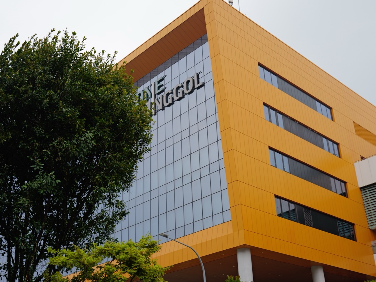
The top 10 things to do in Punggol for local history detectives are to build a source ledger at NLB’s Punggol Stories exhibition, compare Curiocity’s historical geography with today’s streets, investigate the variations in Kampong Wak Sumang’s traditions, search Awang Osman’s oral-history interviews, compare old maps, read historical newspaper reports carefully, trace the 1996 and 2007 town-planning stages, study the preserved Old Punggol Road bus shelter, understand Lorong Halus’s landfill-to-wetland transformation, and examine the opened stretch of Punggol Heritage Trail. Each activity is a research method, not a ranking of tourist sights.
Best first outing: visit Punggol Regional Library at One Punggol and spend one hour with Punggol Stories on Level 4. Record three source labels and one unanswered question, then use NLB’s Curiocity and National Archives portals to check the evidence at home. For outdoor fieldwork, choose one signed public heritage location rather than assuming that old maps or future masterplans give access to a present-day site.
This October 2026 guide is written for readers who want to know how a historian reaches a conclusion. Punggol’s past includes fishing villages, plantations, farms, roads, coastal recreation, changes to the waterfront and a contemporary digital district. We use primary institutional references and distinguish oral traditions, photographic records, contemporary reports, maps, planning announcements and observed public features. The most valuable result is an accurate claim whose source can be found again.
Choose your Punggol history investigation
- Want a short family introduction? Punggol Stories at the regional library; choose one documented decade and discuss its evidence.
- Curious about village origins? Read NLB on Kampong Wak Sumang and compare traditions with map references.
- Interested in people’s voices? Search the National Archives for identified oral histories, preserving speaker and recording dates.
- Like maps? Compare historical cartography carefully with current roads, marking approximate rather than invented exact locations.
- Want modern planning history? Trace HDB’s 1996 Punggol 21 blueprint and 2007 Remaking Our Heartland revision.
- Want to go outdoors? Consider a confirmed public heritage stop, a short Waterway Park walk or the opened Heritage Trail stretch, not closed future alignments.
The evidence ladder: what different sources can really tell you
Physical observations establish what a visitor can see at a particular place and time, but not necessarily why it was built. Maps document how a survey or cartographer represented space on a given date, with their own scale and purpose. Contemporary newspapers can show what was reported at the time, but a reported proposal is not proof it was completed. Oral histories preserve memories, experiences and perspectives, but a recollection does not automatically describe every resident. Official plans explain stated intentions; opening notices and current site signs explain operational access.
Keep a source ledger with title, creator, original date, holding institution, source type and exact claim supported. For a screenshot or photograph, preserve the original caption and collection credit. For an oral interview, record the speaker, interviewer, accession number and reel. When you cannot locate an item, do not cite it as though you have inspected it. You may cite an established summary that discusses it, clearly attributing the interpretation to that summary.
A strong short historical article also acknowledges uncertainty. Punggol can be spelled differently on maps; named places can shift through administrative changes and reclamation; personal recollections can contradict one another. Those are reasons to improve the question, not to choose the most dramatic answer. A responsible local historian can say what is known, what is plausible, what is contested and what remains unverified.
Ten research experiences to try
Read the source labels at Punggol Stories instead of relying on memory
Where: Punggol Regional Library’s Singaporium at Level 4, One Punggol.
Why this is worth investigating
NLB’s Punggol Stories permanent exhibition divides its history into Punggol Pioneers, Seaside Solace, Farm to Fable and Winding Waterways. These are useful historical themes, not a claim that every exhibit item was created at the same time. An effective detective begins with a source label, date and context, rather than declaring an evocative old photograph to be proof of any convenient story. The exhibition’s Memory Map adds residents’ recollections, which must be read as personal accounts rather than exact universal records.
A practical source-checking exercise
Arrive during current library hours and use the correct exhibition floor. Choose one caption about a person, one object or photograph and one change in the landscape. In a notebook create columns labelled ‘Claim’, ‘Evidence type’, ‘Date represented’, ‘Date produced’, ‘What remains uncertain’. An old map may represent a period far earlier than its digital publication date. A resident’s remembered childhood might be recorded decades later. Write down the exhibit or catalogue reference so that a reader can return to it.
Worked Punggol example
A family sees a description of pig farms and an image of the waterfront. Their child initially writes that the pig farm photograph explains every building’s construction date. The revised note names agriculture and waterfront change as separate subjects and gives each item its own caption. The family can now ask whether a specific farm appears on a historical map instead of making the exhibition tell a story it did not assert.
Take the investigation one step further
Compare two pieces of evidence about the same decade: an exhibit caption and a publication accessible through OneSearch. Identify one thing both confirm and one detail only one source supports. Use a deliberately modest conclusion: ‘These sources document part of the change’ rather than ‘This is everything Punggol residents experienced’. A good investigation is small enough for another person to check and detailed enough that its uncertainty is visible.
Accuracy, safety and access limits
NLB lists the general exhibition from 10am–9pm, but individual installations differ; Words That Move is listed 5pm–7pm. Verify current notices and treat displays as public cultural resources, not an invitation to handle originals. Never reproduce full copyrighted texts or claim to have interviewed a resident merely because you read their memory.
Primary reference: Read the source labels at Punggol Stories instead of relying on memory. Keep the source title and access date in your research notes.
Compare NLB’s Punggol historical story map with today’s streets
Where: NLB Curiocity Punggol story map, viewed online or at home.
Why this is worth investigating
Curiocity’s Punggol story map gives a researched introduction to how the place was described before today’s boundaries. The page notes that parts of Sengkang and Hougang were formerly considered within Punggol, and that Hougang Avenues 8 and 10 were once connected with the historical Punggol Road context. That does not mean those neighbourhoods should be marketed today as a single walkable Punggol attraction. The historical name and the present administrative area answer different questions.
A practical source-checking exercise
Open the official story map, identify its historical references and look at the current base map. Write three location labels: historical place name, present name and evidence of the relationship between them. If a location appears to have moved, ask whether the name moved, the boundary changed, the road alignment changed or the landscape was reclaimed. Do not copy a current map pin into a nineteenth-century event without checking whether the site existed then.
Worked Punggol example
A pupil sees an old reference to Punggol Road and assumes it has always ended where a modern road ends. After examining the story map, they recognise that road geography and place boundaries have evolved. Their finished sketch uses a solid line for current roads and dashed annotations for historical interpretation, so a parent can immediately tell which parts are verified today.
Take the investigation one step further
Recreate a short walking-distance question entirely on paper. Mark the historical item with an approximate area rather than a false GPS coordinate, and label the uncertainty ‘not enough evidence to pinpoint’. Compare this to the precision of a present-day MRT station address. Discuss why a story map helps with interpretation but is not a replacement for an archival survey plan, a licensed legal land record or on-site access checks.
Accuracy, safety and access limits
NLB states its map does not comprehensively cover every building or landmark. Treat the map’s base geography, historical sources and modern travel directions separately. Never enter private buildings because a historical point seems to align with a current parcel.
Primary reference: Compare NLB’s Punggol historical story map with today’s streets. Keep the source title and access date in your research notes.
Investigate Kampong Wak Sumang without turning oral tradition into certainty
Where: NLB BiblioAsia’s Kampong Wak Sumang research and its cited archival material.
Why this is worth investigating
BiblioAsia traces how Wak Sumang’s story is preserved in oral traditions, maps and later writing. A nineteenth-century community, a 1957 literary account called Tok Sumang, old place names and family recollections do not all have the same evidentiary status. The article notes that the village founder’s origins and even some identifying descriptions differ among accounts. A careful local-history detective can value those traditions while explaining exactly what is documented and what remains debated.
A practical source-checking exercise
Read the source article and make separate index cards for ‘Tradition’, ‘Printed narrative’, ‘Historic map’, ‘Oral interview’ and ‘Modern interpretation’. On one card record the article’s discussion of the 1844 map and on another note the 1957 book by Muhammad Ariff Ahmad under the pen name Mastomo. Ask what each source can establish: a map can show named geography, a printed story can show what an author recorded, and an interview can show what an individual recalled.
Worked Punggol example
A student wants a poster headed ‘The exact person who named Punggol’. Their sources instead contain several naming traditions and explanations. They change the heading to ‘Stories about Punggol’s name’ and add two columns: traditions and evidence. This does not diminish the community’s history; it keeps the poster honest and prevents readers mistaking a memorable account for an agreed linguistic fact.
Take the investigation one step further
Write a 150-word interpretation explaining why a descendant’s family history is valuable even when it cannot verify every event described. Distinguish a claim about cultural memory from a claim about a precise founding year. Include a reference to NLB’s page so a reader can examine the variations. A respectful researcher neither mocks oral tradition nor upgrades it silently into a proven event.
Accuracy, safety and access limits
Do not invent the thoughts or dialogue of named historical individuals. The versions of a personal name or place spelling may vary across sources. Keep those variations visible, and do not reproduce long passages from copyrighted material without permission.
Primary reference: Investigate Kampong Wak Sumang without turning oral tradition into certainty. Keep the source title and access date in your research notes.
Find Awang Osman’s oral-history interview through Archives Online
Where: National Archives of Singapore’s online portal, with Punggol historical interviews.
Why this is worth investigating
NLB documents approximately 800 minutes of Awang Osman’s interviews across thirty reels recorded in 1984–1985. Awang Osman was associated with Kampong Wak Sumang, and the record allows later readers to encounter a particular person’s recollections rather than a generic summary of the village. The date of an interview, the decades remembered and the archivist’s transcription are distinct layers of evidence. Oral histories can be rich in first-person experience but should not be forced to represent everyone in a community.
A practical source-checking exercise
Begin at the National Archives official access-to-records page. Search the named person’s variants and the accession number cited by NLB, 000319, in the appropriate oral-history database. Record the exact interview reel, recording date, speaker, interviewer and available transcript or audio reference. If a file is not accessible online, use Archives Online’s permitted request-to-view process rather than inventing a transcript. Build a timeline of the events discussed and separately label the later interview date.
Worked Punggol example
A learner reads an account recorded in 1984 about a much earlier Punggol experience. They had initially written ‘1984: this event happened’. After checking the metadata, they revise it to ‘1984: the resident recalled an earlier event’. That single correction avoids a common error in local-history presentations, where a digital catalogue date is mistaken for an event date.
Take the investigation one step further
Compare the interview with another source dealing with a similar subject, such as the BiblioAsia synthesis or a newspaper report from the relevant decade. If the sources differ, record the difference and consider why: memory, translation, reporting angle or changed geography. You do not need to force agreement. A history report can properly end with two possible interpretations and a specific unresolved question.
Accuracy, safety and access limits
Archival material may have access and reproduction restrictions. Some recordings contain sensitive personal or traumatic experiences. Treat wartime accounts with respect, preserve attribution and avoid posting identifiable family details without appropriate permissions.
Primary reference: Find Awang Osman’s oral-history interview through Archives Online. Keep the source title and access date in your research notes.
Compare the 1844, 1939 and 1985 Punggol maps as different snapshots
Where: Map references and image credits identified in NLB’s Wak Sumang research; National Archives map holdings.
Why this is worth investigating
NLB’s Wak Sumang research shows an 1844 map associated with J.T. Thomson, a 1939 topographic map and an 1985 survey map. The maps describe different purposes, scales and periods. They are valuable not because one is the ultimate answer, but because the researcher can examine how a place name, shoreline or settlement appears across sources. Land reclamation and changed road networks complicate attempts to put an old village on a current map pin.
A practical source-checking exercise
Read the map credits and dates first. Record which survey agency or collection is attributed, the broad area covered, how the title spells Punggol or Ponggol, and which natural features are visible. Compare only comparable things—for example a river mouth or named village—rather than pretending every old symbol is measured to the same accuracy as a modern digital map. If the image is cropped, say so before drawing boundaries from it.
Worked Punggol example
An enthusiastic pupil places a pin on a modern road to show where every house in Kampong Wak Sumang once stood. The 1985 map and older maps do not justify that level of certainty from the cropped view. Their revised drawing instead shades an approximate historic area, lists the source map references and labels the modern roads separately.
Take the investigation one step further
Create a ‘map provenance table’ containing date, collection, scale if shown, maker or surveying body, and what the map can answer. Write one paragraph on why the coastline may look different in an old image, carefully distinguishing actual land changes from changed map depiction. Treat map rights separately: publication of a digitised historical map may require permission from the owning institution.
Accuracy, safety and access limits
Do not interpret old coordinates as modern GPS certainty or imply a historic shoreline is legally accessible today. The raw map may need a larger archival view for detailed analysis, and a screenshot of the NLB article is not a substitute for checking its credits.
Primary reference: Compare the 1844, 1939 and 1985 Punggol maps as different snapshots. Keep the source title and access date in your research notes.
Learn how to test a newspaper headline against its full article
Where: NLB newspaper holdings and OneSearch discovery, using topics from its Punggol research.
Why this is worth investigating
Historical newspapers can document what an issue looked like at the time, but one report may reflect a single reporter’s angle, the newspaper’s audience or an incomplete stage of planning. BiblioAsia cites articles on the last days of Punggol’s fishing village, land reclamation and community concerns. These reports are useful for reconstructing a sequence, but a headline by itself is an inadequate basis for saying what all Punggol residents believed.
A practical source-checking exercise
Start with a specific title, newspaper name and date cited in the NLB research. Use OneSearch or the appropriate digitised newspaper service to locate the item lawfully, including any access restrictions. Read the body and caption, not merely a short headline snippet. Ask who made each quoted statement, whether a figure is an estimate, and what later material could confirm an announced plan actually happened. Keep a concise citation with date, newspaper and page where possible.
Worked Punggol example
An old report says a park or housing feature was planned. A student initially writes that it opened in the report’s publication year. After checking the wording, they change the claim to ‘the plan was announced at that time’ and look for a later opening notice. The gap between announcement and completion becomes a research finding rather than an embarrassing error.
Take the investigation one step further
Make a three-entry timeline: announcement, any interim reporting, and completion or revised plan. If you cannot find completion evidence, write ‘status not confirmed by these sources’. Comparing the same issue in English and Malay newspapers may also reveal different community emphases, but do not pretend a language you cannot read has been accurately translated.
Accuracy, safety and access limits
Do not bypass paywalls or reproduce whole copyrighted newspaper pages. Older spellings, typographic recognition errors and retrospective headlines require careful reading. A newspaper’s publication date proves the date of the report, not always the date of the underlying event.
Primary reference: Learn how to test a newspaper headline against its full article. Keep the source title and access date in your research notes.
Check the 1996 Punggol 21 vision against the 2007 remaking plan
Where: HDB’s official Punggol town history.
Why this is worth investigating
HDB places the announcement of Punggol 21 in 1996 and a new Remaking Our Heartland phase in September 2007. The distinction is important because a town vision, a later revision and an individual completed facility are three different things. Calling all waterfront features the original 1996 plan ignores subsequent decisions. Treating the 2007 plan as the birth of Punggol also erases the town’s much older communities.
A practical source-checking exercise
Read HDB’s chronology and write three columns: ‘Vision announced’, ‘Later planning update’, and ‘Visible completed example’. Populate the first two with accurately sourced dates, then choose an example you can observe on a safe public visit such as Waterway Park or a station. Ask whether your current image proves only the existence of a feature or also its official opening date. Use HDB or the relevant agency for the second claim.
Worked Punggol example
A pupil writes ‘Punggol Waterway was built when Punggol 21 started in 1996’. Their evidence supports only the original vision date, not the precise construction date. The corrected explanation says the town’s waterfront direction evolved through later planning and delivery stages, then attaches separate official references for any specific completed attraction.
Take the investigation one step further
Create a short question-and-answer card for parents: ‘Does a masterplan guarantee a facility is open?’ Explain that schedules, budgets and design choices can change, so researchers should keep current operational facts alongside past plans. This reasoning applies to contemporary Punggol Digital District phases just as much as to older visions.
Accuracy, safety and access limits
Do not treat planning imagery as permission to use a site under construction. Place your conclusions at the correct scale: a town blueprint does not establish the opening status of every playground, road, library or business.
Primary reference: Check the 1996 Punggol 21 vision against the 2007 remaking plan. Keep the source title and access date in your research notes.
Investigate transport memory through a preserved bus-stop shelter
Where: NParks’ historic Waterway Park guide and public routes showing old-road heritage.
Why this is worth investigating
NParks describes a preserved Old Punggol Road section and an old bus-stop shelter as part of the park’s interpretation. A remnant can reveal how older residents experienced movement before the present MRT, LRT and park crossings. The object is a physical clue, not a working timetable. The presence of a bus shelter in a heritage guide does not tell us which numbered service called there in a particular year or how many people used it.
A practical source-checking exercise
Study the NParks guide and find a currently open public approach if you decide to visit. Observe from a lawful path without climbing onto the shelter or blocking cyclists. Sketch the form, describe any explanatory sign and note which statements the guide supports. Then use an archival newspaper, timetable or map only if you can find one that directly addresses your chosen question. If the exact former service is not documented, leave it unknown.
Worked Punggol example
A visitor labels their photo ‘Old bus stop, where Punggol LRT ran in the 1970s’. That confuses distinct periods and modes. They replace it with ‘Preserved historic bus-stop shelter associated with Old Punggol Road’ and research the later LRT independently. The new caption makes an interesting historical connection without fusing two unrelated timelines.
Take the investigation one step further
Compare a preserved bus-stop form with modern wayfinding in the Punggol MRT/LRT interchange. Record who can use each type of infrastructure, the information provided and which user needs it addresses. Make clear that one is heritage and one is currently operational. This is an opportunity to connect history with the practical evolution of transport rather than treating architecture as a nostalgic decoration.
Accuracy, safety and access limits
Historic objects must not be touched, modified or used as props for staged activity. Current path closures take precedence over archival directions; a guide from an earlier year may not reflect maintenance changes.
Primary reference: Investigate transport memory through a preserved bus-stop shelter. Keep the source title and access date in your research notes.
Read Lorong Halus Wetland as a change in land use, not an old park legend
Where: PUB’s official Lorong Halus Wetland public learning materials.
Why this is worth investigating
PUB documents an engineered wetland treating water associated with the former Lorong Halus landfill before it reaches Serangoon Reservoir. For local history, this is an unusually clear example of why physical landscapes have multiple chapters. The site is not simply a pretty plant trail, nor does a former waste-related land use mean all current water quality can be guessed by sight. Its present engineered purpose is a documented response to a longer land-use story.
A practical source-checking exercise
Read PUB’s official explanation and prepare a two-part field note: the former use and the present water-treatment system. If you visit an open public route, observe the landscape from signed paths. Do not collect water or approach treatment structures. Draw a three-box process sketch and label which part of the diagram comes from PUB’s explanation. Ask what measurements would be necessary to confirm treatment results rather than inventing a performance figure.
Worked Punggol example
A child writes that the wetland is a natural pond that has always been here. The official source shows a more complex story linked to a former landfill and an engineered treatment role. Their revised description separates the historical land use from present-day ecological appearance. The learning outcome is understanding change, not declaring that the water must now be safe for swimming.
Take the investigation one step further
Add this site to your Punggol timeline beside the town’s housing and transport phases. A useful history report considers infrastructure that is less visible than a station or shopping mall. Ask which professions contribute to such a transformation: environmental engineers, planners, ecologists and operators. The answer connects historical interpretation with a modern public service.
Accuracy, safety and access limits
Treat water and the old landfill as controlled areas. No water-quality sampling, entry to ponds or unsupervised handling is justified by a family history project. Check current weather and PUB notices before travelling.
Primary reference: Read Lorong Halus Wetland as a change in land use, not an old park legend. Keep the source title and access date in your research notes.
Examine the opened Punggol Heritage Trail and distinguish phases
Where: Punggol Digital District, first officially opened Heritage Trail section near Punggol North Avenue and Campus Boulevard.
Why this is worth investigating
NParks and JTC state that the first 400-metre stretch of the Heritage Trail opened in August 2025, retaining features of Old Punggol Road and some mature vegetation. JTC’s current community page identifies that first section as open and describes a larger 1.3-kilometre route when fully finished. An estimated end-2026 completion date for another phase is not proof of current access. That distinction is a valuable lesson in reading historical announcements about projects still evolving.
A practical source-checking exercise
Begin by reading JTC’s current community page and the NParks opening release. Record the precise length described as open, the planned full alignment and the announcement date. If travelling, use Punggol Coast MRT and only signed public trail entrances that are available. Read interpretive signs about Old Punggol Road; distinguish preserved authentic features from recreated elements. A recreated stop is useful historical interpretation but not identical to an original object.
Worked Punggol example
A history-club organiser plans a 1.3-kilometre continuous walk from an old masterplan diagram. The latest operating information confirms only the first 400 metres. The organiser revises the visit to that open stretch and labels the longer alignment as future or subject to confirmation. This corrects a logistical error and prevents a group from approaching worksites.
Take the investigation one step further
Make a table labelled ‘Documented original feature’, ‘Interpretive recreation’, ‘Opened now’, ‘Planned or not yet verified’. Use it as your closing heritage field report. Note that a modern trail can honour a historic road while providing new habitat, leisure access and pedestrian routes. A responsible visitor can appreciate that design without claiming an exact historical reconstruction of every metre.
Accuracy, safety and access limits
Do not enter closed works or rely on a planned phase date to override fences. Respect ecological planting and site rules. The announced longer trail can connect multiple destinations in the future, but future connectivity must not be sold as currently accessible.
Primary reference: Examine the opened Punggol Heritage Trail and distinguish phases. Keep the source title and access date in your research notes.
Build one complete Punggol historical case file
A case file should answer a narrow question and make the route back to evidence obvious. Consider ‘What can we establish about a particular village, road or planning change from named public sources?’ Divide a sheet into four parts: a one-sentence question, the evidence consulted, a short interpretation and an explicit remaining doubt. Add one lawful photograph or original sketch only if it helps. This format is useful for schools, parents and interested adults because another person can judge the support for each statement.
Case-file example: a Punggol village name
Question: what does the name Wak Sumang tell us about the historical village? Sources: NLB’s BiblioAsia study, the Punggol Stories exhibition and an identifiable oral-history accession. The confident claim is that multiple forms of the Wak Sumang name occur in the historical record and the associated kampong has a documented local history. The unresolved issue is which specific origin story is most reliable. Avoid the stronger claim that all accounts agree on an exact founding event. This version respects both historical records and the role of memory.
Case-file example: a changed road
Question: how is an older road represented in today’s landscape? Sources: NParks’ historical interpretation, JTC’s Heritage Trail information and current public trail signage. The secure observation is that an opened stretch preserves selected aspects of Old Punggol Road. A recreated bus-stop element may help interpret the former transport landscape, but it must not be described as an operating historic service. The remaining question might be how later phases will handle additional features. Answer it only after checking an official update.
Case-file example: waterfront development
Question: when did Punggol become a planned waterfront town? HDB documents the announcement of the Punggol 21 vision in 1996 and later Remaking Our Heartland plans in 2007. Those are planning dates. If your report discusses when an individual waterway section or public facility opened, find a second specific agency source. Do not turn a high-level masterplan into an invented construction calendar. The lesson transfers to any rapidly developing Singapore estate.
Three itineraries for different history readers
An hour at the regional library
Plan one visit to Punggol Stories during NLB’s current exhibition hours. Spend the first fifteen minutes on Punggol Pioneers, the next on Farm to Fable or Seaside Solace, then choose one dated caption and find its holding institution. Finish with a short paragraph separating the printed claim, the evidence credited and an unanswered question. Leave any sensitive or interactive access to library staff rules. This is a complete learning outing even without leaving the building.
An at-home map and archive afternoon
Use Curiocity’s Punggol story map, then consult the BiblioAsia study’s cited maps and the National Archives access guide. Build a timeline only from identifiable sources. Separate a map’s survey date from its publication or digitisation date. If a database offers only a description rather than the original item, cite what you have actually seen and use the permitted request process if necessary. End by labelling one location approximate instead of assigning a false modern GPS coordinate.
A short, safe outdoor heritage observation
Start with current NParks or JTC public access information, not a decades-old map. Choose one open route at Waterway Park or the confirmed first Heritage Trail section. Take a lawful photograph of an interpretive feature, record its caption and compare it with an official document at home. Do not treat the full future trail as complete merely because 2026 was a projected completion period. Respect closures, wildlife areas, heat, lightning and other path users.
Ten errors that weaken local history writing
- Using a digital upload date as the date when an historic event occurred.
- Copying a headline as though it establishes every detail in the underlying newspaper article.
- Presenting oral traditions or legends as universally verified facts.
- Using a present-day street address for an old village without assessing reclamation and changed boundaries.
- Treating a plan’s unveiling as proof that every proposed structure opened then.
- Assuming an old bus shelter remains a present-day bus boarding point.
- Copying a cropped map without collection credits or scale limitations.
- Claiming to have consulted an oral-history recording when you have read only a later summary.
- Entering restricted land because an archival map shows a historic route.
- Repeating details from an earlier guide without checking newer operating notices or original sources.
Frequently asked questions about Punggol history
Where can I research old Punggol without paying for a tour?
Begin with NLB’s free Punggol Stories exhibition, Curiocity story map, BiblioAsia history articles and the National Archives online discovery portal. Some specific items may have access restrictions.
Where is Punggol Stories?
It is a permanent NLB exhibition across selected areas on Levels 1, 3 and 4 of Punggol Regional Library at One Punggol.
What are the Punggol Stories themes?
The Level 4 Singaporium sections include Punggol Pioneers, Seaside Solace, Farm to Fable and Winding Waterways, along with an interactive Memory Map.
Is a resident’s memory a primary historical source?
It can be a primary source for the person’s experience or recollection. Verify the recording date and remember that memory is not an automatic universal account of every event.
Who was Wak Sumang?
BiblioAsia discusses Wak Sumang as a figure associated with the origins of Kampong Wak Sumang. Details of background and naming traditions vary; research should acknowledge the different accounts.
What is Tok Sumang?
It is a work written by Muhammad Ariff Ahmad, published under the pen name Mastomo in 1957, drawing on narratives associated with Wak Sumang.
What was Awang Osman’s connection with Punggol?
NLB identifies Awang Osman as a headman associated with Kampong Wak Sumang whose oral-history interviews were recorded in the mid-1980s.
Does a 1984 interview mean the events discussed happened in 1984?
No. The interview recording date and the dates of remembered events must be recorded separately.
Can I find old Punggol maps online?
NLB references maps from different dates and NAS provides discovery of maps and building plans. Availability and reproduction rights depend on the holding collection.
When was Punggol 21 first announced?
HDB documents its initial blueprint in 1996 and later major waterfront-focused updates in 2007 under Remaking Our Heartland.
Is the preserved old bus shelter still a normal bus stop?
It should be treated as heritage until a current transport operator independently confirms a passenger service. A heritage guide alone is not proof of live bus boarding.
What was Lorong Halus before its engineered wetland?
PUB documents a former landfill whose related waters are addressed by an engineered wetland treatment system before reaching the reservoir.
Can I collect water samples at Lorong Halus to prove its history?
Not without the appropriate permission and safety arrangements. Use PUB’s documented treatment function and public interpretation.
Is all of the Punggol Heritage Trail open in October 2026?
JTC’s current community page identifies the first 400 metres as open and separately describes the planned 1.3-kilometre route. Check later phase announcements and on-site signs before assuming more.
How can children use an oral history responsibly?
Record the speaker, date and source, separate the person’s experience from interpretation, quote briefly only when permitted and do not invent dialogue.
What should I write when two sources disagree?
Identify the conflict, compare their dates and purposes, and state what remains uncertain. A documented disagreement is not a failure of research.
Can I reuse archival photographs in a school article?
Check the holding institution’s rights and conditions. Credit the creator and collection; a publicly visible preview is not automatically licensed for unrestricted republication.
What is the best length for a first history case file?
A focused 200–400-word evidence-led explanation with a precise question, source references, interpretation and uncertainty can be more useful than a long unverified story.
How to conduct a ten-minute archival source-return test
A source-return test begins with a single sentence you intend to publish. Underline its date, named place and action, then look at the original source rather than an author’s summary of it. Write down the archive reference or the official document title. Next, check whether the original wording is direct evidence for the whole sentence or only one clause. A map can establish that a label was used on a particular map; it does not by itself prove every resident used that label in daily speech. A speaker may remember a school journey, but the memory alone does not establish a precise bus timetable. When the source supports only part of your sentence, divide the sentence rather than stretching the source. Keep a short line in your notebook for ‘claim not yet verified’ and return to it later. This small discipline makes historical writing substantially more reliable without making the article dull or difficult to read.
When two Punggol history sources appear to disagree
The first question is whether the sources are describing the same event. A road might be laid out in one period, altered in another and later preserved as part of a new public trail. A photograph labelled with its digitisation year may show a scene captured decades earlier. A Punggol 21 blueprint records the announcement of a vision, while a separate announcement establishes when a public facility opened. Those are different dates rather than necessarily contradictory ones. Create a two-line comparison containing each source’s author, date and exact proposition. Check whether the geographical boundaries also differ: a source about the larger historical Ponggol area may not refer to precisely the same administrative or planning boundary as a contemporary map of Punggol town. If genuine disagreement remains, report both attributed accounts and explain the uncertainty. Do not quietly select whichever one makes a more dramatic story.
Names deserve similar care. Punggol and Ponggol appear in materials from different periods; people, roads and kampong names can also have variants. A search should include likely alternative spellings, but the researcher must preserve the form printed in the record when presenting an exact quotation or title. Do not change a spelling inside a photograph’s official title and then claim the new word was the original. When identifying older roads on contemporary maps, consider land reclamation, changed alignments and different map scales before asserting an exact location. If the match is approximate, say approximately where the features relate instead of pinning a specific modern block number to an unsupported historical point.
Document what is absent without treating absence as proof
An unsuccessful archive search tells you only that your chosen terms, collection and access level did not reveal a matching record. It does not prove the event never happened. Try alternative spellings, a different date range or another source type before writing a conclusion. Photograph catalogues, oral histories, newspaper archives and government records were created for different purposes; some important community experiences may be poorly represented in a particular collection. Keep a dated search log identifying the database, terms and filters so that another person can reproduce the unsuccessful search. If records are closed, missing or not yet digitised, note the limitation rather than inventing a replacement account. Good history includes these research boundaries because they explain why a conclusion should remain provisional and where further work might become possible.
A publication-ready historical caption checklist
Before publishing a Punggol photograph or historical claim, confirm five things: the institution holding the source, its record or article title, the date actually established, the specific place established, and the reproduction conditions. If an image shows unidentified people, do not attach names based on appearance. If the scene is a historical family gathering, think about the privacy of people still living before uploading it. A photograph from today’s Heritage Trail may illustrate the present-day conservation environment, but it cannot serve as direct visual proof of what the road looked like fifty years earlier. Likewise, an NLB exhibition statement may introduce a topic without giving the details required for a precise family biography. Revise a caption until a reader can recognise what is documented and what is interpretation. This extra attention helps prevent mistaken labels from circulating through many later websites.
If an article includes a historical map, put its reference directly beside the explanation of the map instead of burying every source at the end. State whether the image is reproduced, cropped, traced or compared with a newer base map. Keep a copy of the permission or licence information relevant to any reuse. When making a side-by-side comparison, use consistent labels and explicitly mark uncertain alignments. The reader should not need to guess which image is from an archive and which photograph you took last weekend. A well designed caption is a tiny research report: it tells the truth about the evidence, gives enough context to prevent an obvious misreading, and offers a credible return path for the next curious reader.
Primary historical resources and related Punggol guides
- Read the source labels at Punggol Stories instead of relying on memory
- Compare NLB’s Punggol historical story map with today’s streets
- Investigate Kampong Wak Sumang without turning oral tradition into certainty
- Find Awang Osman’s oral-history interview through Archives Online
- Compare the 1844, 1939 and 1985 Punggol maps as different snapshots
- Learn how to test a newspaper headline against its full article
- Check the 1996 Punggol 21 vision against the 2007 remaking plan
- Investigate transport memory through a preserved bus-stop shelter
- Read Lorong Halus Wetland as a change in land use, not an old park legend
- Examine the opened Punggol Heritage Trail and distinguish phases
- NLB BiblioAsia: Tok Sumang translation and provenance
- NParks/JTC August 2025 Heritage Trail opening announcement
- Related Punggol oral history records guide
- Related Punggol heritage walks for history lovers
- Related Punggol planning and land-use fieldwork
- Detailed education and worked-example reference
A good historical question has a return path
Pick one Punggol claim, name the source that supports it, explain what that source can and cannot prove, and preserve a way for the next reader to check your work. A verified caption, small timeline or carefully qualified map can be more valuable than a dramatic history article filled with invented certainty. The town’s past is compelling enough without improving the facts.


