
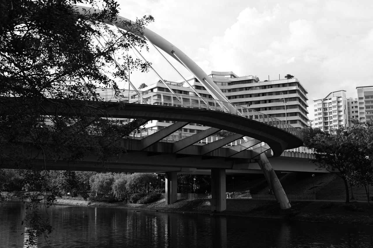
The top 10 things to do in Punggol for urban planning enthusiasts are to follow the town’s Punggol 21–Eco-Town timeline, compare Punggol and Punggol Coast rail access, study HDB’s three waterway urban-design themes, observe floating wetlands, explore the integrated One Punggol hub, compare Oasis Terraces and Northshore Plaza, walk publicly accessible Punggol Digital District areas, examine the opened Heritage Trail and learn how Lorong Halus Wetland handles an old landfill’s environmental legacy. These places explain how Punggol works, not merely how its buildings look.
Best first field trip: start at Punggol MRT, observe a short section of the Waterway Park corridor and finish at One Punggol’s public hub. For a second visit, choose Punggol Coast MRT, the operating amenities of Punggol Digital District and the first opened 400 metres of the Heritage Trail. HDB’s town-design information and JTC’s current amenities provide the background you need to make the trip informative.
This October 2026 guide treats three kinds of evidence separately: government plans and design intentions, public amenities officially identified as operating, and features a visitor can actually observe. A future masterplan is not proof of current physical access, and a visual impression cannot measure a smart grid’s energy performance. Each stop offers a focused planning question, a practical observation and a limit on what can safely be concluded.
Punggol urban planning in one glance
- Timeline: Punggol 21 in 1996, Remaking Our Heartland plans in 2007, and Eco-Town selection in 2010, according to HDB.
- Rail: Punggol MRT/LRT interchange serves the town centre; Punggol Coast opened in December 2024 for the newer district.
- Water: HDB’s urban-design themes along the corridor are Urban, Undulating and Rustic; NParks’ four Waterway Park zones are a different classification.
- Everyday facilities: One Punggol combines public services; HDB’s neighbourhood centres connect retail with community life.
- New economy: JTC’s 50-hectare Punggol Digital District links industry, higher education and public amenities.
- Heritage: the first 400 metres of Punggol Heritage Trail are confirmed open; do not assume the entire planned route is accessible.
- Environment: Lorong Halus Wetland links the former landfill with engineered water treatment.
Five questions make a useful urban-planning field notebook
First, who is the space designed to serve—residents, students, workers, families or all of them? Second, how do people reach it without unnecessary difficult crossings? Third, what environmental or social function does it perform? Fourth, what features exist now, and what remains planned? Fifth, what can you verify from an official reference instead of guessing from appearance? These questions turn a photograph walk into an honest study of a working district.
A simple notebook needs five columns: location, observed feature, documented claim, user benefit, unresolved question. For example, the existence of a shaded public corridor is directly observable; an official explanation of the design objective is a cited statement; an estimated carbon saving is not a number a passer-by can confirm. Carry water, plan a short legal route and use NEA myENV before exposed outdoor work.
Ten Punggol urban-planning experiences
1. Trace Punggol’s transformation from waterfront vision to Eco-Town
Where: Public Punggol town-centre streets and official HDB historical information.
Why this stop matters
HDB records the 1996 Punggol 21 vision, the 2007 Remaking Our Heartland plans, and Punggol’s 2010 selection as Singapore’s first Eco-Town. The town’s rural origins, later waterfront housing and smart housing experiments belong to different stages. Understanding that sequence prevents the common mistake of treating every building, park and railway as part of one event or one masterplan.
What to investigate
Before walking, read HDB’s town history and mark three phases on a simple timeline. In a currently accessible public part of the town centre, identify one visible example of planned high-density housing, one landscaped public space and a piece of everyday infrastructure. Explain which facts about those sites are documented and which you are simply observing. Visit only one small cluster; the town cannot be understood responsibly by rushing through every district.
Worked Punggol fieldwork example
A student writes: ‘Punggol 21 was first announced in 1996; later ROH planning helped shape the waterfront vision; by 2010 the town had been selected as an Eco-Town.’ They then take a photograph from a lawful public path. The dates and site observation are recorded separately, so a photo is not being used as proof of a decades-old planning decision.
Planning evidence and access limits
Do not imply every current block was constructed in 1996 or that the entire town has been fully rebuilt at once. Respect housing estates as places where people live. Never wander into schools, construction compounds or residents’ private areas for an urban survey.
Official reference: Trace Punggol’s transformation from waterfront vision to Eco-Town. Check current public access before travelling.
2. Compare transport networks at Punggol and Punggol Coast stations
Where: Punggol MRT/LRT interchange, Punggol Coast MRT and their public access connections.
Why this stop matters
Public transport tells an urban-planning story because station coverage shapes where people can live, study, work and shop. Punggol MRT connects to two LRT loops, while Punggol Coast MRT opened in December 2024 to improve North East Line access to the new district. Rail access is about more than a station on a map: walkability and destination services determine how well the network functions.
What to investigate
Start with an official current rail map. Draw the existing Punggol interchange with East and West loops; add Punggol Coast as a North East Line extension, not as an LRT stop. If travelling, compare the public wayfinding from each station to one currently open community or retail destination. Record the availability of a clear pedestrian crossing, weather shelter and suitable lift, while avoiding assumptions about accessibility from maps alone.
Worked Punggol fieldwork example
A student sees that Punggol is a transfer hub and Punggol Coast directly serves the SIT and business-park district. They ask whether a shorter rail journey always produces a shorter door-to-door trip. The honest answer depends on the final walking link and the actual destination.
Planning evidence and access limits
Do not represent the future Cross Island Line at Riviera as an operating 2026 interchange. Follow current service notices and do not enter maintenance zones or private campus areas. Bus and LRT directions may change.
Official reference: Compare transport networks at Punggol and Punggol Coast stations. Check current public access before travelling.
3. Read the waterway corridor as an urban design system
Where: Punggol Waterway public paths and bridges, with HDB’s Punggol Town Design Guide.
Why this stop matters
HDB’s town-scale design guide divides the Punggol Waterway corridor into Urban, Undulating and Rustic urban-design themes. It calls for landscaped promenades and building forms that step down toward the waterway to create changes in scale. These three urban-design themes are not the same classification as NParks’ four park zones, so careful observers should keep the two planning frameworks separate.
What to investigate
Download or study the HDB guide before a short walk. At a legal public viewpoint, describe the relationship among waterside landscaping, nearby housing and crossings. Ask which observed feature seems to help pedestrians enjoy the water while keeping circulation possible. Make a sketch that uses labels such as promenade, residential frontage and bridge rather than inventing exact dimensions of structures you cannot measure.
Worked Punggol fieldwork example
A learner compares an HDB diagram of an urban corridor with a photograph of a particular Waterway Park view. They write, ‘The guide describes a desired transition in built scale; this photo shows one actual perspective.’ That distinction makes their analysis more rigorous.
Planning evidence and access limits
A planning drawing is not a construction certificate for every feature in 2026. Do not treat a corridor diagram as proof of public access through fenced works, or claim that every section already has the intended layout.
Official reference: Read the waterway corridor as an urban design system. Check current public access before travelling.
4. Examine the floating wetlands and water-sensitive landscaping
Where: Public Punggol Waterway viewpoints where planted landscape features may be visible.
Why this stop matters
HDB’s Green Innovations material describes floating wetlands made from interlinked hexagonal modules. It says they add greenery and help clean the waterway. Together with the terraced planting and landscaped banks described by NParks, these illustrate how ecological functions can be considered during waterfront design. The visible plants are evidence of a landscape feature, but visitors cannot calculate treatment performance by looking at the water.
What to investigate
Choose one safe public position where water plants or bank landscaping are visible. Record the plant arrangement, the edge between land and water and the location of nearby paths. Then compare observations with HDB’s description of floating wetlands, leaving the plant identification provisional if necessary. Sketch a design question: how might a planted edge affect the appearance and experience of the public realm?
Worked Punggol fieldwork example
A family observes that a planted section appears to soften the edge of a straight path. Their report describes that visible effect and cites HDB for the stated design function. It deliberately avoids saying that a particular kilogram amount of pollution was removed during their visit.
Planning evidence and access limits
Do not remove plants, collect samples or enter water. Species and exact module locations may change with maintenance. Neither attractive greenery nor clear water is proof of safety for swimming or drinking.
Official reference: Examine the floating wetlands and water-sensitive landscaping. Check current public access before travelling.
5. Explore how One Punggol combines public services under one roof
Where: One Punggol integrated community hub, 1 Punggol Drive.
Why this stop matters
The People’s Association describes One Punggol as an integrated lifestyle hub with nine co-location partners. Its facilities include Punggol Regional Library, a hawker centre, community-club amenities and service or care facilities. The planning lesson is the co-location of daily needs, especially for families and residents who benefit from making fewer separate journeys. A library is not interchangeable with a healthcare facility, but their proximity can matter.
What to investigate
Begin with the public directory and select only open common areas or services you genuinely have a reason to use. Mark where the library, hawker centre and public community areas sit in the building. Consider how lifts, plazas and sheltered connections affect movement among facilities. Ask which services require appointments and which can be browsed or accessed without one. Finish with a short rest rather than trying to enter every partner organisation.
Worked Punggol fieldwork example
An urban-planning learner draws a simple three-layer diagram: ground-level public circulation, library learning areas and a food-centre stop. They note that the concept aims for proximity and shared public space, without claiming private clinical services are available for sightseeing.
Planning evidence and access limits
Healthcare, childcare and other sensitive facilities have restricted functions and separate opening requirements. Do not photograph patients, children or staff intrusively; observe only lawful public areas.
Official reference: Explore how One Punggol combines public services under one roof. Check current public access before travelling.
6. Study Oasis Terraces as a new-generation neighbourhood centre
Where: Oasis Terraces by Oasis LRT PE6, Punggol Drive.
Why this stop matters
HDB identifies Oasis Terraces as the first new-generation Neighbourhood Centre introduced in 2019, designed with plazas, play areas and community spaces. HDB notes that its tenant mix and design responded to residents’ feedback, and that it integrated services such as a polyclinic and childcare centre. The place provides a clear alternative to thinking of retail only as a row of shops: neighbourhood centres can be planned as social infrastructure.
What to investigate
Take the East Loop to Oasis if that suits your journey and use the current public directory. Compare how shopping, public meeting spaces and access to community services fit together. Identify which spaces invite casual social use and which exist for essential appointments. On a small sketch, show one pedestrian entrance, a public open area and a connection to the LRT.
Worked Punggol fieldwork example
A Secondary student argues that a useful neighbourhood centre is not measured only by its number of shops. They point to documented public plazas and links to healthcare while noting that patient waiting areas cannot be treated as public leisure space.
Planning evidence and access limits
An announced play facility may not be operating on your visit date. Do not enter the polyclinic, childcare centre or restricted rooms for a planning tour, and check shop or event hours independently.
Official reference: Study Oasis Terraces as a new-generation neighbourhood centre. Check current public access before travelling.
7. Compare Northshore Plaza’s community spine with nearby housing
Where: Northshore Plaza I and II near Samudera LRT, Punggol Northshore.
Why this stop matters
HDB describes Northshore Plaza as the first seafront New Generation Neighbourhood Centre in an HDB estate, with shops and a community spine linking residential blocks and Samudera LRT. It also highlights a naturally ventilated corridor extending toward Punggol Promenade. For planners, that makes Northshore useful for asking how daily shopping can support connections between public transport, housing and a waterfront landscape.
What to investigate
Choose a short public route from Samudera LRT or a confirmed transport approach, then use signed paths between the retail centre and permitted public connections. Note the differences among a sheltered passage, an open plaza, a residential entrance and a promenade link. Record what helps a pedestrian navigate from transit to food and onward to the public waterfront, and whether your particular route is step-free.
Worked Punggol fieldwork example
Two friends compare Northshore Plaza with Oasis Terraces. One has a seafront community-spine emphasis, while the other illustrates an integrated neighbourhood-centre approach with community plazas and healthcare. Rather than award a winner, they explain what each design is intended to serve.
Planning evidence and access limits
The community spine is public circulation, not an invitation to enter residents’ private blocks. Retail tenants and food venues change, and an HDB webpage does not confirm every individual pedestrian link is always open.
Official reference: Compare Northshore Plaza’s community spine with nearby housing. Check current public access before travelling.
8. Investigate the public realm of Punggol Digital District
Where: Public spaces around Punggol Coast Mall, Punggol Coast Hawker Centre and nearby Punggol Coast MRT.
Why this stop matters
JTC describes Punggol Digital District as a 50-hectare business park that integrates employment, innovation and the SIT campus. JTC’s community page confirms currently open public amenities, while its sustainability page documents passive environmental design, solar generation and an integrated smart grid. A careful visitor can distinguish an attractive public realm from the more technical infrastructure that is not directly visible.
What to investigate
Travel to Punggol Coast, choose publicly open areas and note how the MRT, hawker centre, shops and district walkways connect. Identify one shading or landscape feature you can actually see and one sustainability claim you can only learn from official documentation. If discussing JTC’s projected solar output, label it as an official expectation, not an independent on-site measurement.
Worked Punggol fieldwork example
A student drafts two paragraphs: the first describes the pedestrian experience from station to open retail; the second explains JTC’s planned energy systems using cited project material. Keeping observation and documented project objectives separate avoids exaggeration.
Planning evidence and access limits
The district develops in phases. Do not present planned childcare centres, the complete Heritage Trail, commercial offices or SIT classrooms as unrestricted walk-in destinations. Worksite fences and current signs override a masterplan illustration.
Official reference: Investigate the public realm of Punggol Digital District. Check current public access before travelling.
9. Walk the opened Heritage Trail section to see conservation within development
Where: First 400 metres of Punggol Heritage Trail from Punggol North Avenue toward Campus Boulevard.
Why this stop matters
NParks records that the first 400-metre stretch of Punggol Heritage Trail opened on 23 August 2025 and retained elements of the character of Old Punggol Road, including undulating terrain and mature vegetation. JTC’s current community page still identifies that first stretch as open. The planned trail is longer, but recognising the difference between partial and complete delivery is essential for an accurate planning case study.
What to investigate
Check current public signage near Punggol Digital District, locate an authorised trail entrance and walk only the open section. Observe the relationship between retained trees, historic alignment and new district routes. Ask how designers can balance heritage value, biodiversity, safety and public circulation when a district is redeveloped.
Worked Punggol fieldwork example
A young planner writes, ‘The opened portion preserves certain physical characteristics of the old road, while newer buildings and paths are being added nearby.’ They cite NParks for the opening and avoid claiming that the full 1.3 kilometres can already be walked end to end.
Planning evidence and access limits
No amount of interest in urban heritage gives permission to enter construction zones or fragile vegetation. Future opening dates and alignments should be checked on official pages; fences and closures take priority.
Official reference: Walk the opened Heritage Trail section to see conservation within development. Check current public access before travelling.
10. Learn how Lorong Halus Wetland links land use and water management
Where: Lorong Halus Wetland by Serangoon Reservoir, eastern edge of Punggol.
Why this stop matters
PUB explains that the engineered wetland treats water passing through a former landfill before it can reach Serangoon Reservoir. This is a remarkable land-use lesson: a place once associated with waste disposal has a present role within a larger water-management and educational landscape. It also explains why planning cannot be reduced to housing and transport alone—environmental infrastructure has lasting consequences.
What to investigate
Use PUB’s self-guided learning information and permitted public routes. Draw a simple diagram showing a former landfill area, the engineered wetland and the receiving reservoir. Add a note about the distinction between a designed environmental function and evidence of actual water quality. If a visit is unsuitable, the publicly available learning material can still support a careful study at home.
Worked Punggol fieldwork example
A geography student asks how former land uses constrain what can happen next. They write about the treatment wetland’s documented purpose and identify which questions require specialist water-quality data. They do not invent a percentage reduction in pollutants or assume the public can enter treatment ponds.
Planning evidence and access limits
Do not enter the water, collect samples without permission or present clear-looking water as safe for direct contact. Weather and operational restrictions may alter access. Use published PUB learning trails responsibly.
Official reference: Learn how Lorong Halus Wetland links land use and water management. Check current public access before travelling.
Three half-day itineraries for urban-planning curiosity
The established town-centre and waterway route
Begin at Punggol MRT and inspect the public wayfinding between the interchange and One Punggol. Continue to a manageable Waterway Park public path. Read HDB’s waterway design guidance, then compare it with the actual view of a bridge, promenade and neighbouring homes. Finish at One Punggol’s regional library or hawker centre. This short route connects mobility, green space and social infrastructure without requiring the whole waterway to be walked.
The Punggol Coast and heritage route
Take the North East Line to Punggol Coast. Study how the station connects to operating public amenities at Punggol Digital District, then walk only the clearly opened Heritage Trail section if access and weather suit. The two questions are how new jobs and learning destinations can be connected by rail, and how a new district can retain something recognisable from an older landscape.
The neighbourhood-centre comparison
On separate short trips if necessary, compare Oasis Terraces with Northshore Plaza. HDB describes their planning intentions differently: Oasis as a new-generation neighbourhood centre with integrated community and care features, Northshore as a seafront centre with a spine linking housing, LRT and promenade. Compare walking links, seating, mixed uses and opportunities for casual social life. Do not try to turn healthcare rooms or residential entrances into places for a tour.
Do not confuse the three scales of planning
Building scale: how a hub, mall or tower organises entrances, services, shading and vertical movement. Neighbourhood scale: how homes, schools, services and LRT stops sit within a manageable daily walk. Town scale: how the 4.2-kilometre waterway, reservoirs, major rail corridors and ecological infrastructure shape the whole area. Good fieldwork says which scale a conclusion belongs to.
Common Punggol planning mistakes
- Confusing NParks’ four themed Waterway Park zones with HDB’s three urban-design themes for the waterway corridor.
- Claiming the full planned Punggol Heritage Trail has opened when only its first 400 metres are confirmed.
- Assuming all sustainability targets described by JTC have already been achieved and independently measured.
- Calling private universities, childcare rooms, medical facilities or workplaces public attractions.
- Using one photograph to infer engineering performance, water quality or full wheelchair access.
- Ignoring the last-mile route between a train station and the actual public destination.
- Describing Punggol Park in Hougang as though it were Punggol Waterway Park in Punggol town.
- Treating retail centres as interchangeable without considering neighbourhood services, public space and transport connections.
Frequently asked questions
When did the Punggol 21 vision begin?
HDB states that the Punggol 21 blueprint was unveiled in 1996.
When was Punggol selected as an Eco-Town?
HDB identifies 2010 as the year Punggol was selected for Singapore’s first Eco-Town development.
What are the three urban-design themes along Punggol Waterway?
HDB’s town-scale design guide names Urban, Undulating and Rustic themes. These are not the same as NParks’ four park zones.
How long is Punggol Waterway?
HDB describes a 4.2-kilometre waterway through the town. That is distinct from the 8.4-kilometre named park connector route.
What is a floating wetland?
HDB describes stable floating plant modules within Punggol Waterway that contribute to greenery and water improvement. Their function cannot be measured merely by looking.
What makes One Punggol an integrated hub?
PA identifies multiple co-located organisations and facilities including community services, Punggol Regional Library, dining and care functions.
What is special about Oasis Terraces?
HDB calls Oasis Terraces its first new-generation Neighbourhood Centre, incorporating public plazas and community uses with services such as a polyclinic.
What is special about Northshore Plaza?
HDB identifies Northshore Plaza as its first seafront New Generation Neighbourhood Centre, with connections to housing, Samudera LRT and Punggol Promenade.
How large is Punggol Digital District?
JTC describes a 50-hectare district integrating business activity, technology, SIT and public community amenities.
Does Punggol Digital District have a smart grid?
JTC describes a district-level smart grid integrated with solar and battery technology. Published expected benefits should be distinguished from verified measured results.
When did Punggol Coast MRT open?
LTA opened the station for passenger service on 10 December 2024.
Can I walk the entire Punggol Heritage Trail?
Current JTC community information confirms the first 400 metres as open. Do not assume every planned stretch is accessible.
What was Lorong Halus before the wetland?
PUB documents a former landfill and a present engineered wetland that treats water passing through that area before it reaches Serangoon Reservoir.
Is Punggol Park the same as Punggol Waterway Park?
No. NParks places Punggol Park at Hougang Avenue 8/10; Punggol Waterway Park is the landscaped waterway park in Punggol town.
Can school pupils do this fieldwork?
Yes, with suitable supervision, public access and age-appropriate observation. Focus on comparing a documented planning claim with what can be seen safely.
Do planners only design buildings?
No. The examples here involve transport access, social services, land use, heritage, green networks, public space and environmental infrastructure.
Can I photograph public buildings for a project?
Use lawful public viewpoints, follow venue rules and respect people’s privacy. Do not enter restricted sites or block circulation.
Where can I read official Punggol planning documents?
Start with HDB’s Punggol town history and town design guide, JTC’s district information, NParks’ heritage information and PUB’s wetland explanation.
Primary sources and related Punggol guides
- Trace Punggol’s transformation from waterfront vision to Eco-Town
- Compare transport networks at Punggol and Punggol Coast stations
- Read the waterway corridor as an urban design system
- Examine the floating wetlands and water-sensitive landscaping
- Explore how One Punggol combines public services under one roof
- Study Oasis Terraces as a new-generation neighbourhood centre
- Compare Northshore Plaza’s community spine with nearby housing
- Investigate the public realm of Punggol Digital District
- Walk the opened Heritage Trail section to see conservation within development
- Learn how Lorong Halus Wetland links land use and water management
- HDB Punggol Eco-Town explorer trail
- NParks Punggol Waterway Park Connector
- JTC Punggol Digital District sustainability features
- Related Punggol architecture and design guide
- Punggol rail and transit enthusiast guide
- Punggol sustainable family activities
- eduKateSG learning structure and guided inquiry
The best town is one people can actually use
A good Punggol field trip ends with a clearer explanation of how rail, housing, public services, green space and environmental infrastructure fit together. Plans matter, but so do everyday users and real operating conditions. Choose one system, find credible evidence, look closely and ask a better question about the town you share.


