
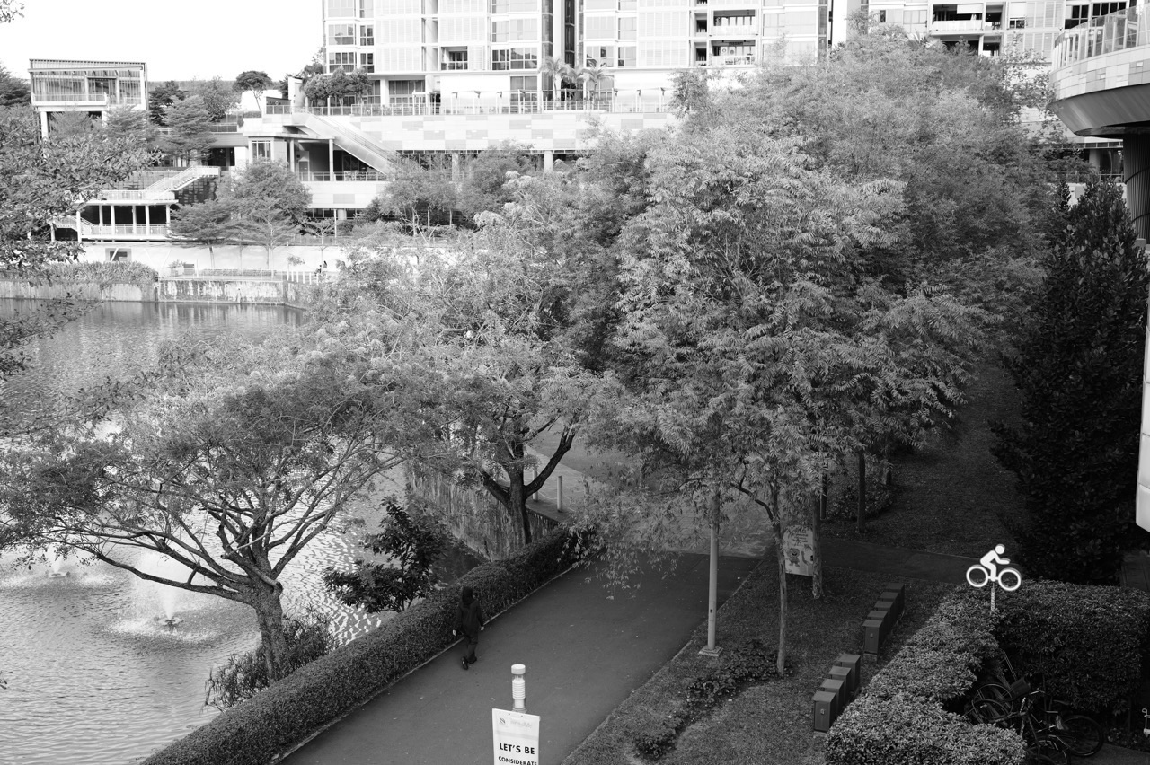
A one-day Punggol itinerary should show why the town is more than a housing estate without turning the day into a race. The best first visit moves through four versions of Punggol: the Town Centre, the Waterway, the nature/coast edge, and the new Punggol Coast / Digital District. You can do the whole day by MRT, LRT, walking and cycling.
Important 2026–2027 note: Punggol Point Park is currently closed for upgrading from 11 August 2026, with completion expected by 31 December 2027. Coney Island remains open from 7am to 7pm, and Punggol Waterway Park is open 24 hours. Follow current NParks closure signs and access instructions on the day you visit.
This itinerary is deliberately flexible. If you have young children, shorten the cycling/walking portions. If it rains, spend longer at Punggol Regional Library, One Punggol, Waterway Point or Punggol Coast. If you are a resident rather than a visitor, use it as a reminder of how many different landscapes fit into one town.
The route at a glance
| Time | Stop | Why it belongs |
|---|---|---|
| 8:30am | Punggol MRT / Waterway Point | Begin at the transport and retail centre of the original new town |
| 9:15am | One Punggol / Regional Library | See the civic and community layer |
| 10:00am | Punggol Waterway Park | Walk or cycle the landscape that defines the town |
| 11:30am | Coney Island / north-east nature edge | See the rustic ecological side of Punggol |
| 1:30pm | Lunch / rest around the northern waterfront area | Slow down before the afternoon |
| 3:30pm | Punggol Coast MRT / SIT / Punggol Digital District | See what the next version of Punggol looks like |
| 5:30pm | Punggol Coast / Northshore waterfront | End with the coast, retail or an easy evening walk |
8:30am — Start at Punggol MRT and Waterway Point
Punggol MRT/LRT is the best first-time starting point because it shows the town’s original transport logic immediately. The North-East Line arrives below the Town Centre, the LRT radiates into the residential districts, and Waterway Point sits above the interchange.
Have breakfast here or nearby rather than spending the first hour searching for a famous café. The point of the morning is orientation. Walk outside and notice the relationship between:
- Punggol MRT/LRT;
- Waterway Point;
- Punggol Waterway;
- One Punggol;
- the surrounding residential blocks.
For the deeper transport map, use the Punggol LRT Guide.
9:15am — Walk to One Punggol
One Punggol is useful because it shows how a mature new town begins consolidating services. The integrated hub contains community and public-service functions as well as the Punggol Regional Library, Singapore’s first fully inclusive regional library.
If the weather is already hot or wet, the library can become a longer stop. Families with children can use it as the indoor anchor of the day rather than trying to complete every outdoor segment.
Hawker-centre operations have undergone a 2026 operator transition, so check the current food situation on the day rather than treating an old operator listing as permanent.
10:00am — Enter the Waterway
Punggol Waterway is the town’s strongest visual explanation. HDB’s waterfront plan turned a man-made waterway into a continuous public landscape through the housing town. NParks’ park connector runs 8.4km along both sides of the Waterway.
You do not need to walk the whole loop. A first-time visitor should simply spend enough time to see:
- the bridges;
- housing facing water rather than a highway;
- joggers, cyclists and everyday users;
- birdlife and planted edges;
- how the Waterway connects Town Centre to the wider park network.
NParks’ own nature-walk guide suggests roughly one to two hours for a 4.2km Waterway Park walk. For a full-day itinerary, do a shorter section and save energy for the north.
Walking or cycling?
Walking gives you more time to notice the town. Cycling lets you cover the Waterway and coast without turning the day into an endurance walk. If you cycle, ride defensively around families and shared paths and follow current park-connector rules.
11:30am — Coney Island
Coney Island is the deliberate contrast in the itinerary. After the engineered Waterway and high-density town, you enter an 81-hectare nature park with boardwalks, cycling paths and more rustic habitats.
NParks currently lists Coney Island’s opening hours as 7am to 7pm, with entrances at the west near Punggol Point/Punggol Promenade and at the east near Lorong Halus Wetland. There are no carparks on the island itself.
Because Punggol Point Park is under upgrading, check the current approach to the west entrance and follow NParks detours. The east entrance is another option if you are already comfortable cycling farther.
How long should you spend on Coney Island?
For a first visit, 45–90 minutes is enough unless nature is the main reason for the day. The goal is not to complete every path. It is to experience the change in texture between urban Punggol and the island.
- Bring water.
- Keep to designated paths.
- Do not feed wildlife.
- Do not remove plants or marine life.
- Leave enough time to exit before 7pm.
1:30pm — Lunch and a slower hour
After the Waterway and Coney Island, stop. A good itinerary needs recovery time. The Punggol Settlement / northern waterfront area has dining, while the Town Centre and Punggol Coast clusters offer other options depending on where you exit.
Do not schedule lunch around Punggol Point Park itself—the park is closed for upgrading. Use the surrounding accessible commercial/waterfront areas and current maps.
3:30pm — Take the new Punggol Coast route
The afternoon should jump forward in time. Head to Punggol Coast MRT and the Punggol Digital District.
JTC describes PDD as a 50-hectare business district integrated with Singapore Institute of Technology. The district includes technology and innovation businesses, SIT, retail, dining, community space and a car-lite pedestrian environment. It is served directly by Punggol Coast MRT and Teck Lee LRT.
Walk slowly through the district. Notice the difference from a conventional suburban business park: university buildings, workplace towers, pedestrian streets and retail are designed to overlap.
What to see around Punggol Digital District
- Punggol Coast MRT architecture and entrances;
- SIT’s integrated campus;
- Campus Boulevard and pedestrian spaces;
- Punggol Coast Mall;
- dining areas (JTC still lists Market Village as coming soon);
- the open section of the Punggol Heritage Trail where accessible;
- connections toward Northshore and the coast.
JTC says the first 400m of the Punggol Heritage Trail is currently open, with the full trail planned to connect Waterway Park to Punggol Point Park through the new district. Because construction and park upgrading continue, treat the exact walkable route as live information.
5:30pm — End at Punggol Coast or Northshore
The final hour should be easy. Stay around Punggol Coast for food and retail, or head toward the Northshore waterfront if the weather is good and current pedestrian routes are open.
Northshore shows another version of Punggol planning: newer seafront housing, Northshore Plaza and a sheltered community spine connecting homes toward Samudera LRT and the waterfront.
You can then leave through Punggol Coast MRT, Teck Lee/Samudera LRT connections, or return toward Town Centre depending on your route.
If you only have half a day
Choose one of these:
- Classic Punggol: Punggol MRT → Waterway → One Punggol → easy lunch.
- Nature Punggol: Waterway → Coney Island → northern waterfront.
- New Punggol: Punggol Coast MRT → SIT → Digital District → Coast Mall → Northshore.
If you are visiting with young children
- Shorten Coney Island.
- Use the library as a midday indoor stop.
- Do not over-plan the cycling.
- Carry water and sun/rain protection.
- Keep one easy food fallback at a mall.
If you are visiting with teenagers
Let the day include more independent movement. The Waterway, PDD, library, food stops and cycling routes are more interesting when teenagers can make some route decisions themselves.
See Things to Do in Punggol for Teenagers.
Rain plan
- Waterway Point;
- One Punggol and Punggol Regional Library;
- Punggol Coast Mall / sheltered PDD spaces;
- short LRT ride to understand the town from the transport network.
What not to do
- Do not treat Punggol Point Park as open during the 2026–2027 upgrading closure.
- Do not try to walk the full Waterway, full Coney Island and every northern district in one day unless distance is the point.
- Do not rely on a 2024 restaurant list in a fast-changing retail district.
- Do not spend the entire visit inside Waterway Point and conclude you have seen Punggol.
Why this route works
The itinerary tells Punggol’s story in sequence:
- Town Centre: the original transport and retail core.
- Waterway: the waterfront-planning idea that made Punggol distinctive.
- Coney Island: the ecological edge that prevents the town from feeling purely built.
- Punggol Coast / PDD: the work-university-digital layer now changing what the town can contain.
Official/current sources
- NParks — Punggol Waterway
- NParks — Coney Island Park
- NParks — Park Connector Notices
- One Punggol
- JTC — Punggol Digital District
Last checked: 26 September 2026.
Continue exploring Punggol
Do not try to collect Punggol in a checklist. Start at the centre, follow the water, touch the nature edge, then finish where the town is becoming something new.
One Day in Punggol: Route-Verified Itinerary System
This Future Build section deepens the existing canonical owner rather than creating a competing URL. The reader job is a first-timer day itinerary. current access, opening hours, transport and venue availability should be checked with the relevant current providers before travel.
Reader job
Treat reader job as a changing or contextual variable, not a permanent slogan about Punggol. First identify whether the claim is geographic and stable, operational and provider-dependent, statistical and definition-dependent, or experiential and household-specific.
Use the source appropriate to that claim. State the date or context where freshness matters. Do not turn one resident’s experience, one busy weekend, one construction phase or one historical statistic into a timeless description of the whole town.
Then convert the information into a practical household action: change the route, add a buffer, choose another stop, compare the correct denominator, schedule recovery, verify current access, or leave the plan unchanged because the evidence does not justify intervention.
Current-source boundary
Treat current-source boundary as a changing or contextual variable, not a permanent slogan about Punggol. First identify whether the claim is geographic and stable, operational and provider-dependent, statistical and definition-dependent, or experiential and household-specific.
Use the source appropriate to that claim. State the date or context where freshness matters. Do not turn one resident’s experience, one busy weekend, one construction phase or one historical statistic into a timeless description of the whole town.
Then convert the information into a practical household action: change the route, add a buffer, choose another stop, compare the correct denominator, schedule recovery, verify current access, or leave the plan unchanged because the evidence does not justify intervention.
Morning start
Treat morning start as a changing or contextual variable, not a permanent slogan about Punggol. First identify whether the claim is geographic and stable, operational and provider-dependent, statistical and definition-dependent, or experiential and household-specific.
Use the source appropriate to that claim. State the date or context where freshness matters. Do not turn one resident’s experience, one busy weekend, one construction phase or one historical statistic into a timeless description of the whole town.
Then convert the information into a practical household action: change the route, add a buffer, choose another stop, compare the correct denominator, schedule recovery, verify current access, or leave the plan unchanged because the evidence does not justify intervention.
Breakfast
Treat breakfast as a changing or contextual variable, not a permanent slogan about Punggol. First identify whether the claim is geographic and stable, operational and provider-dependent, statistical and definition-dependent, or experiential and household-specific.
Use the source appropriate to that claim. State the date or context where freshness matters. Do not turn one resident’s experience, one busy weekend, one construction phase or one historical statistic into a timeless description of the whole town.
Then convert the information into a practical household action: change the route, add a buffer, choose another stop, compare the correct denominator, schedule recovery, verify current access, or leave the plan unchanged because the evidence does not justify intervention.
Town Centre
Treat town centre as a changing or contextual variable, not a permanent slogan about Punggol. First identify whether the claim is geographic and stable, operational and provider-dependent, statistical and definition-dependent, or experiential and household-specific.
Use the source appropriate to that claim. State the date or context where freshness matters. Do not turn one resident’s experience, one busy weekend, one construction phase or one historical statistic into a timeless description of the whole town.
Then convert the information into a practical household action: change the route, add a buffer, choose another stop, compare the correct denominator, schedule recovery, verify current access, or leave the plan unchanged because the evidence does not justify intervention.
Waterway
Treat waterway as a changing or contextual variable, not a permanent slogan about Punggol. First identify whether the claim is geographic and stable, operational and provider-dependent, statistical and definition-dependent, or experiential and household-specific.
Use the source appropriate to that claim. State the date or context where freshness matters. Do not turn one resident’s experience, one busy weekend, one construction phase or one historical statistic into a timeless description of the whole town.
Then convert the information into a practical household action: change the route, add a buffer, choose another stop, compare the correct denominator, schedule recovery, verify current access, or leave the plan unchanged because the evidence does not justify intervention.
Library
Treat library as a changing or contextual variable, not a permanent slogan about Punggol. First identify whether the claim is geographic and stable, operational and provider-dependent, statistical and definition-dependent, or experiential and household-specific.
Use the source appropriate to that claim. State the date or context where freshness matters. Do not turn one resident’s experience, one busy weekend, one construction phase or one historical statistic into a timeless description of the whole town.
Then convert the information into a practical household action: change the route, add a buffer, choose another stop, compare the correct denominator, schedule recovery, verify current access, or leave the plan unchanged because the evidence does not justify intervention.
Parks
Treat parks as a changing or contextual variable, not a permanent slogan about Punggol. First identify whether the claim is geographic and stable, operational and provider-dependent, statistical and definition-dependent, or experiential and household-specific.
Use the source appropriate to that claim. State the date or context where freshness matters. Do not turn one resident’s experience, one busy weekend, one construction phase or one historical statistic into a timeless description of the whole town.
Then convert the information into a practical household action: change the route, add a buffer, choose another stop, compare the correct denominator, schedule recovery, verify current access, or leave the plan unchanged because the evidence does not justify intervention.
Coney Island access
Treat coney island access as a changing or contextual variable, not a permanent slogan about Punggol. First identify whether the claim is geographic and stable, operational and provider-dependent, statistical and definition-dependent, or experiential and household-specific.
Use the source appropriate to that claim. State the date or context where freshness matters. Do not turn one resident’s experience, one busy weekend, one construction phase or one historical statistic into a timeless description of the whole town.
Then convert the information into a practical household action: change the route, add a buffer, choose another stop, compare the correct denominator, schedule recovery, verify current access, or leave the plan unchanged because the evidence does not justify intervention.
Punggol Coast
Treat punggol coast as a changing or contextual variable, not a permanent slogan about Punggol. First identify whether the claim is geographic and stable, operational and provider-dependent, statistical and definition-dependent, or experiential and household-specific.
Use the source appropriate to that claim. State the date or context where freshness matters. Do not turn one resident’s experience, one busy weekend, one construction phase or one historical statistic into a timeless description of the whole town.
Then convert the information into a practical household action: change the route, add a buffer, choose another stop, compare the correct denominator, schedule recovery, verify current access, or leave the plan unchanged because the evidence does not justify intervention.
Northshore
Treat northshore as a changing or contextual variable, not a permanent slogan about Punggol. First identify whether the claim is geographic and stable, operational and provider-dependent, statistical and definition-dependent, or experiential and household-specific.
Use the source appropriate to that claim. State the date or context where freshness matters. Do not turn one resident’s experience, one busy weekend, one construction phase or one historical statistic into a timeless description of the whole town.
Then convert the information into a practical household action: change the route, add a buffer, choose another stop, compare the correct denominator, schedule recovery, verify current access, or leave the plan unchanged because the evidence does not justify intervention.
Food stop
Treat food stop as a changing or contextual variable, not a permanent slogan about Punggol. First identify whether the claim is geographic and stable, operational and provider-dependent, statistical and definition-dependent, or experiential and household-specific.
Use the source appropriate to that claim. State the date or context where freshness matters. Do not turn one resident’s experience, one busy weekend, one construction phase or one historical statistic into a timeless description of the whole town.
Then convert the information into a practical household action: change the route, add a buffer, choose another stop, compare the correct denominator, schedule recovery, verify current access, or leave the plan unchanged because the evidence does not justify intervention.
Afternoon heat
Treat afternoon heat as a changing or contextual variable, not a permanent slogan about Punggol. First identify whether the claim is geographic and stable, operational and provider-dependent, statistical and definition-dependent, or experiential and household-specific.
Use the source appropriate to that claim. State the date or context where freshness matters. Do not turn one resident’s experience, one busy weekend, one construction phase or one historical statistic into a timeless description of the whole town.
Then convert the information into a practical household action: change the route, add a buffer, choose another stop, compare the correct denominator, schedule recovery, verify current access, or leave the plan unchanged because the evidence does not justify intervention.
Rain plan
Treat rain plan as a changing or contextual variable, not a permanent slogan about Punggol. First identify whether the claim is geographic and stable, operational and provider-dependent, statistical and definition-dependent, or experiential and household-specific.
Use the source appropriate to that claim. State the date or context where freshness matters. Do not turn one resident’s experience, one busy weekend, one construction phase or one historical statistic into a timeless description of the whole town.
Then convert the information into a practical household action: change the route, add a buffer, choose another stop, compare the correct denominator, schedule recovery, verify current access, or leave the plan unchanged because the evidence does not justify intervention.
Evening return
Treat evening return as a changing or contextual variable, not a permanent slogan about Punggol. First identify whether the claim is geographic and stable, operational and provider-dependent, statistical and definition-dependent, or experiential and household-specific.
Use the source appropriate to that claim. State the date or context where freshness matters. Do not turn one resident’s experience, one busy weekend, one construction phase or one historical statistic into a timeless description of the whole town.
Then convert the information into a practical household action: change the route, add a buffer, choose another stop, compare the correct denominator, schedule recovery, verify current access, or leave the plan unchanged because the evidence does not justify intervention.
LRT transfers
Treat lrt transfers as a changing or contextual variable, not a permanent slogan about Punggol. First identify whether the claim is geographic and stable, operational and provider-dependent, statistical and definition-dependent, or experiential and household-specific.
Use the source appropriate to that claim. State the date or context where freshness matters. Do not turn one resident’s experience, one busy weekend, one construction phase or one historical statistic into a timeless description of the whole town.
Then convert the information into a practical household action: change the route, add a buffer, choose another stop, compare the correct denominator, schedule recovery, verify current access, or leave the plan unchanged because the evidence does not justify intervention.
Bus transfers
Treat bus transfers as a changing or contextual variable, not a permanent slogan about Punggol. First identify whether the claim is geographic and stable, operational and provider-dependent, statistical and definition-dependent, or experiential and household-specific.
Use the source appropriate to that claim. State the date or context where freshness matters. Do not turn one resident’s experience, one busy weekend, one construction phase or one historical statistic into a timeless description of the whole town.
Then convert the information into a practical household action: change the route, add a buffer, choose another stop, compare the correct denominator, schedule recovery, verify current access, or leave the plan unchanged because the evidence does not justify intervention.
Walking distance
Treat walking distance as a changing or contextual variable, not a permanent slogan about Punggol. First identify whether the claim is geographic and stable, operational and provider-dependent, statistical and definition-dependent, or experiential and household-specific.
Use the source appropriate to that claim. State the date or context where freshness matters. Do not turn one resident’s experience, one busy weekend, one construction phase or one historical statistic into a timeless description of the whole town.
Then convert the information into a practical household action: change the route, add a buffer, choose another stop, compare the correct denominator, schedule recovery, verify current access, or leave the plan unchanged because the evidence does not justify intervention.
Cycling option
Treat cycling option as a changing or contextual variable, not a permanent slogan about Punggol. First identify whether the claim is geographic and stable, operational and provider-dependent, statistical and definition-dependent, or experiential and household-specific.
Use the source appropriate to that claim. State the date or context where freshness matters. Do not turn one resident’s experience, one busy weekend, one construction phase or one historical statistic into a timeless description of the whole town.
Then convert the information into a practical household action: change the route, add a buffer, choose another stop, compare the correct denominator, schedule recovery, verify current access, or leave the plan unchanged because the evidence does not justify intervention.
Children
Treat children as a changing or contextual variable, not a permanent slogan about Punggol. First identify whether the claim is geographic and stable, operational and provider-dependent, statistical and definition-dependent, or experiential and household-specific.
Use the source appropriate to that claim. State the date or context where freshness matters. Do not turn one resident’s experience, one busy weekend, one construction phase or one historical statistic into a timeless description of the whole town.
Then convert the information into a practical household action: change the route, add a buffer, choose another stop, compare the correct denominator, schedule recovery, verify current access, or leave the plan unchanged because the evidence does not justify intervention.
Teenagers
Treat teenagers as a changing or contextual variable, not a permanent slogan about Punggol. First identify whether the claim is geographic and stable, operational and provider-dependent, statistical and definition-dependent, or experiential and household-specific.
Use the source appropriate to that claim. State the date or context where freshness matters. Do not turn one resident’s experience, one busy weekend, one construction phase or one historical statistic into a timeless description of the whole town.
Then convert the information into a practical household action: change the route, add a buffer, choose another stop, compare the correct denominator, schedule recovery, verify current access, or leave the plan unchanged because the evidence does not justify intervention.
Older family members
Treat older family members as a changing or contextual variable, not a permanent slogan about Punggol. First identify whether the claim is geographic and stable, operational and provider-dependent, statistical and definition-dependent, or experiential and household-specific.
Use the source appropriate to that claim. State the date or context where freshness matters. Do not turn one resident’s experience, one busy weekend, one construction phase or one historical statistic into a timeless description of the whole town.
Then convert the information into a practical household action: change the route, add a buffer, choose another stop, compare the correct denominator, schedule recovery, verify current access, or leave the plan unchanged because the evidence does not justify intervention.
Wheelchair and mobility questions
Treat wheelchair and mobility questions as a changing or contextual variable, not a permanent slogan about Punggol. First identify whether the claim is geographic and stable, operational and provider-dependent, statistical and definition-dependent, or experiential and household-specific.
Use the source appropriate to that claim. State the date or context where freshness matters. Do not turn one resident’s experience, one busy weekend, one construction phase or one historical statistic into a timeless description of the whole town.
Then convert the information into a practical household action: change the route, add a buffer, choose another stop, compare the correct denominator, schedule recovery, verify current access, or leave the plan unchanged because the evidence does not justify intervention.
Toilets and rest stops
Treat toilets and rest stops as a changing or contextual variable, not a permanent slogan about Punggol. First identify whether the claim is geographic and stable, operational and provider-dependent, statistical and definition-dependent, or experiential and household-specific.
Use the source appropriate to that claim. State the date or context where freshness matters. Do not turn one resident’s experience, one busy weekend, one construction phase or one historical statistic into a timeless description of the whole town.
Then convert the information into a practical household action: change the route, add a buffer, choose another stop, compare the correct denominator, schedule recovery, verify current access, or leave the plan unchanged because the evidence does not justify intervention.
Crowds
Treat crowds as a changing or contextual variable, not a permanent slogan about Punggol. First identify whether the claim is geographic and stable, operational and provider-dependent, statistical and definition-dependent, or experiential and household-specific.
Use the source appropriate to that claim. State the date or context where freshness matters. Do not turn one resident’s experience, one busy weekend, one construction phase or one historical statistic into a timeless description of the whole town.
Then convert the information into a practical household action: change the route, add a buffer, choose another stop, compare the correct denominator, schedule recovery, verify current access, or leave the plan unchanged because the evidence does not justify intervention.
Construction
Treat construction as a changing or contextual variable, not a permanent slogan about Punggol. First identify whether the claim is geographic and stable, operational and provider-dependent, statistical and definition-dependent, or experiential and household-specific.
Use the source appropriate to that claim. State the date or context where freshness matters. Do not turn one resident’s experience, one busy weekend, one construction phase or one historical statistic into a timeless description of the whole town.
Then convert the information into a practical household action: change the route, add a buffer, choose another stop, compare the correct denominator, schedule recovery, verify current access, or leave the plan unchanged because the evidence does not justify intervention.
Noise
Treat noise as a changing or contextual variable, not a permanent slogan about Punggol. First identify whether the claim is geographic and stable, operational and provider-dependent, statistical and definition-dependent, or experiential and household-specific.
Use the source appropriate to that claim. State the date or context where freshness matters. Do not turn one resident’s experience, one busy weekend, one construction phase or one historical statistic into a timeless description of the whole town.
Then convert the information into a practical household action: change the route, add a buffer, choose another stop, compare the correct denominator, schedule recovery, verify current access, or leave the plan unchanged because the evidence does not justify intervention.
Aircraft noise
Treat aircraft noise as a changing or contextual variable, not a permanent slogan about Punggol. First identify whether the claim is geographic and stable, operational and provider-dependent, statistical and definition-dependent, or experiential and household-specific.
Use the source appropriate to that claim. State the date or context where freshness matters. Do not turn one resident’s experience, one busy weekend, one construction phase or one historical statistic into a timeless description of the whole town.
Then convert the information into a practical household action: change the route, add a buffer, choose another stop, compare the correct denominator, schedule recovery, verify current access, or leave the plan unchanged because the evidence does not justify intervention.
LRT reliability concerns
Treat lrt reliability concerns as a changing or contextual variable, not a permanent slogan about Punggol. First identify whether the claim is geographic and stable, operational and provider-dependent, statistical and definition-dependent, or experiential and household-specific.
Use the source appropriate to that claim. State the date or context where freshness matters. Do not turn one resident’s experience, one busy weekend, one construction phase or one historical statistic into a timeless description of the whole town.
Then convert the information into a practical household action: change the route, add a buffer, choose another stop, compare the correct denominator, schedule recovery, verify current access, or leave the plan unchanged because the evidence does not justify intervention.
Lift concerns
Treat lift concerns as a changing or contextual variable, not a permanent slogan about Punggol. First identify whether the claim is geographic and stable, operational and provider-dependent, statistical and definition-dependent, or experiential and household-specific.
Use the source appropriate to that claim. State the date or context where freshness matters. Do not turn one resident’s experience, one busy weekend, one construction phase or one historical statistic into a timeless description of the whole town.
Then convert the information into a practical household action: change the route, add a buffer, choose another stop, compare the correct denominator, schedule recovery, verify current access, or leave the plan unchanged because the evidence does not justify intervention.
Peak-hour load
Treat peak-hour load as a changing or contextual variable, not a permanent slogan about Punggol. First identify whether the claim is geographic and stable, operational and provider-dependent, statistical and definition-dependent, or experiential and household-specific.
Use the source appropriate to that claim. State the date or context where freshness matters. Do not turn one resident’s experience, one busy weekend, one construction phase or one historical statistic into a timeless description of the whole town.
Then convert the information into a practical household action: change the route, add a buffer, choose another stop, compare the correct denominator, schedule recovery, verify current access, or leave the plan unchanged because the evidence does not justify intervention.
New-development change
Treat new-development change as a changing or contextual variable, not a permanent slogan about Punggol. First identify whether the claim is geographic and stable, operational and provider-dependent, statistical and definition-dependent, or experiential and household-specific.
Use the source appropriate to that claim. State the date or context where freshness matters. Do not turn one resident’s experience, one busy weekend, one construction phase or one historical statistic into a timeless description of the whole town.
Then convert the information into a practical household action: change the route, add a buffer, choose another stop, compare the correct denominator, schedule recovery, verify current access, or leave the plan unchanged because the evidence does not justify intervention.
Resident anecdote boundary
Treat resident anecdote boundary as a changing or contextual variable, not a permanent slogan about Punggol. First identify whether the claim is geographic and stable, operational and provider-dependent, statistical and definition-dependent, or experiential and household-specific.
Use the source appropriate to that claim. State the date or context where freshness matters. Do not turn one resident’s experience, one busy weekend, one construction phase or one historical statistic into a timeless description of the whole town.
Then convert the information into a practical household action: change the route, add a buffer, choose another stop, compare the correct denominator, schedule recovery, verify current access, or leave the plan unchanged because the evidence does not justify intervention.
Official evidence
Treat official evidence as a changing or contextual variable, not a permanent slogan about Punggol. First identify whether the claim is geographic and stable, operational and provider-dependent, statistical and definition-dependent, or experiential and household-specific.
Use the source appropriate to that claim. State the date or context where freshness matters. Do not turn one resident’s experience, one busy weekend, one construction phase or one historical statistic into a timeless description of the whole town.
Then convert the information into a practical household action: change the route, add a buffer, choose another stop, compare the correct denominator, schedule recovery, verify current access, or leave the plan unchanged because the evidence does not justify intervention.
Provider evidence
Treat provider evidence as a changing or contextual variable, not a permanent slogan about Punggol. First identify whether the claim is geographic and stable, operational and provider-dependent, statistical and definition-dependent, or experiential and household-specific.
Use the source appropriate to that claim. State the date or context where freshness matters. Do not turn one resident’s experience, one busy weekend, one construction phase or one historical statistic into a timeless description of the whole town.
Then convert the information into a practical household action: change the route, add a buffer, choose another stop, compare the correct denominator, schedule recovery, verify current access, or leave the plan unchanged because the evidence does not justify intervention.
Date stamp
Treat date stamp as a changing or contextual variable, not a permanent slogan about Punggol. First identify whether the claim is geographic and stable, operational and provider-dependent, statistical and definition-dependent, or experiential and household-specific.
Use the source appropriate to that claim. State the date or context where freshness matters. Do not turn one resident’s experience, one busy weekend, one construction phase or one historical statistic into a timeless description of the whole town.
Then convert the information into a practical household action: change the route, add a buffer, choose another stop, compare the correct denominator, schedule recovery, verify current access, or leave the plan unchanged because the evidence does not justify intervention.
Population definition
Treat population definition as a changing or contextual variable, not a permanent slogan about Punggol. First identify whether the claim is geographic and stable, operational and provider-dependent, statistical and definition-dependent, or experiential and household-specific.
Use the source appropriate to that claim. State the date or context where freshness matters. Do not turn one resident’s experience, one busy weekend, one construction phase or one historical statistic into a timeless description of the whole town.
Then convert the information into a practical household action: change the route, add a buffer, choose another stop, compare the correct denominator, schedule recovery, verify current access, or leave the plan unchanged because the evidence does not justify intervention.
Planning-area boundary
Treat planning-area boundary as a changing or contextual variable, not a permanent slogan about Punggol. First identify whether the claim is geographic and stable, operational and provider-dependent, statistical and definition-dependent, or experiential and household-specific.
Use the source appropriate to that claim. State the date or context where freshness matters. Do not turn one resident’s experience, one busy weekend, one construction phase or one historical statistic into a timeless description of the whole town.
Then convert the information into a practical household action: change the route, add a buffer, choose another stop, compare the correct denominator, schedule recovery, verify current access, or leave the plan unchanged because the evidence does not justify intervention.
Household definition
Treat household definition as a changing or contextual variable, not a permanent slogan about Punggol. First identify whether the claim is geographic and stable, operational and provider-dependent, statistical and definition-dependent, or experiential and household-specific.
Use the source appropriate to that claim. State the date or context where freshness matters. Do not turn one resident’s experience, one busy weekend, one construction phase or one historical statistic into a timeless description of the whole town.
Then convert the information into a practical household action: change the route, add a buffer, choose another stop, compare the correct denominator, schedule recovery, verify current access, or leave the plan unchanged because the evidence does not justify intervention.
Housing denominator
Treat housing denominator as a changing or contextual variable, not a permanent slogan about Punggol. First identify whether the claim is geographic and stable, operational and provider-dependent, statistical and definition-dependent, or experiential and household-specific.
Use the source appropriate to that claim. State the date or context where freshness matters. Do not turn one resident’s experience, one busy weekend, one construction phase or one historical statistic into a timeless description of the whole town.
Then convert the information into a practical household action: change the route, add a buffer, choose another stop, compare the correct denominator, schedule recovery, verify current access, or leave the plan unchanged because the evidence does not justify intervention.
Age profile
Treat age profile as a changing or contextual variable, not a permanent slogan about Punggol. First identify whether the claim is geographic and stable, operational and provider-dependent, statistical and definition-dependent, or experiential and household-specific.
Use the source appropriate to that claim. State the date or context where freshness matters. Do not turn one resident’s experience, one busy weekend, one construction phase or one historical statistic into a timeless description of the whole town.
Then convert the information into a practical household action: change the route, add a buffer, choose another stop, compare the correct denominator, schedule recovery, verify current access, or leave the plan unchanged because the evidence does not justify intervention.
Family profile
Treat family profile as a changing or contextual variable, not a permanent slogan about Punggol. First identify whether the claim is geographic and stable, operational and provider-dependent, statistical and definition-dependent, or experiential and household-specific.
Use the source appropriate to that claim. State the date or context where freshness matters. Do not turn one resident’s experience, one busy weekend, one construction phase or one historical statistic into a timeless description of the whole town.
Then convert the information into a practical household action: change the route, add a buffer, choose another stop, compare the correct denominator, schedule recovery, verify current access, or leave the plan unchanged because the evidence does not justify intervention.
Trend versus snapshot
Treat trend versus snapshot as a changing or contextual variable, not a permanent slogan about Punggol. First identify whether the claim is geographic and stable, operational and provider-dependent, statistical and definition-dependent, or experiential and household-specific.
Use the source appropriate to that claim. State the date or context where freshness matters. Do not turn one resident’s experience, one busy weekend, one construction phase or one historical statistic into a timeless description of the whole town.
Then convert the information into a practical household action: change the route, add a buffer, choose another stop, compare the correct denominator, schedule recovery, verify current access, or leave the plan unchanged because the evidence does not justify intervention.
Historical comparison
Treat historical comparison as a changing or contextual variable, not a permanent slogan about Punggol. First identify whether the claim is geographic and stable, operational and provider-dependent, statistical and definition-dependent, or experiential and household-specific.
Use the source appropriate to that claim. State the date or context where freshness matters. Do not turn one resident’s experience, one busy weekend, one construction phase or one historical statistic into a timeless description of the whole town.
Then convert the information into a practical household action: change the route, add a buffer, choose another stop, compare the correct denominator, schedule recovery, verify current access, or leave the plan unchanged because the evidence does not justify intervention.
School holiday dates
Treat school holiday dates as a changing or contextual variable, not a permanent slogan about Punggol. First identify whether the claim is geographic and stable, operational and provider-dependent, statistical and definition-dependent, or experiential and household-specific.
Use the source appropriate to that claim. State the date or context where freshness matters. Do not turn one resident’s experience, one busy weekend, one construction phase or one historical statistic into a timeless description of the whole town.
Then convert the information into a practical household action: change the route, add a buffer, choose another stop, compare the correct denominator, schedule recovery, verify current access, or leave the plan unchanged because the evidence does not justify intervention.
Holiday childcare
Treat holiday childcare as a changing or contextual variable, not a permanent slogan about Punggol. First identify whether the claim is geographic and stable, operational and provider-dependent, statistical and definition-dependent, or experiential and household-specific.
Use the source appropriate to that claim. State the date or context where freshness matters. Do not turn one resident’s experience, one busy weekend, one construction phase or one historical statistic into a timeless description of the whole town.
Then convert the information into a practical household action: change the route, add a buffer, choose another stop, compare the correct denominator, schedule recovery, verify current access, or leave the plan unchanged because the evidence does not justify intervention.
Grandparents
Treat grandparents as a changing or contextual variable, not a permanent slogan about Punggol. First identify whether the claim is geographic and stable, operational and provider-dependent, statistical and definition-dependent, or experiential and household-specific.
Use the source appropriate to that claim. State the date or context where freshness matters. Do not turn one resident’s experience, one busy weekend, one construction phase or one historical statistic into a timeless description of the whole town.
Then convert the information into a practical household action: change the route, add a buffer, choose another stop, compare the correct denominator, schedule recovery, verify current access, or leave the plan unchanged because the evidence does not justify intervention.
Parent work shifts
Treat parent work shifts as a changing or contextual variable, not a permanent slogan about Punggol. First identify whether the claim is geographic and stable, operational and provider-dependent, statistical and definition-dependent, or experiential and household-specific.
Use the source appropriate to that claim. State the date or context where freshness matters. Do not turn one resident’s experience, one busy weekend, one construction phase or one historical statistic into a timeless description of the whole town.
Then convert the information into a practical household action: change the route, add a buffer, choose another stop, compare the correct denominator, schedule recovery, verify current access, or leave the plan unchanged because the evidence does not justify intervention.
Holiday tuition
Treat holiday tuition as a changing or contextual variable, not a permanent slogan about Punggol. First identify whether the claim is geographic and stable, operational and provider-dependent, statistical and definition-dependent, or experiential and household-specific.
Use the source appropriate to that claim. State the date or context where freshness matters. Do not turn one resident’s experience, one busy weekend, one construction phase or one historical statistic into a timeless description of the whole town.
Then convert the information into a practical household action: change the route, add a buffer, choose another stop, compare the correct denominator, schedule recovery, verify current access, or leave the plan unchanged because the evidence does not justify intervention.
Reading
Treat reading as a changing or contextual variable, not a permanent slogan about Punggol. First identify whether the claim is geographic and stable, operational and provider-dependent, statistical and definition-dependent, or experiential and household-specific.
Use the source appropriate to that claim. State the date or context where freshness matters. Do not turn one resident’s experience, one busy weekend, one construction phase or one historical statistic into a timeless description of the whole town.
Then convert the information into a practical household action: change the route, add a buffer, choose another stop, compare the correct denominator, schedule recovery, verify current access, or leave the plan unchanged because the evidence does not justify intervention.
Library use
Treat library use as a changing or contextual variable, not a permanent slogan about Punggol. First identify whether the claim is geographic and stable, operational and provider-dependent, statistical and definition-dependent, or experiential and household-specific.
Use the source appropriate to that claim. State the date or context where freshness matters. Do not turn one resident’s experience, one busy weekend, one construction phase or one historical statistic into a timeless description of the whole town.
Then convert the information into a practical household action: change the route, add a buffer, choose another stop, compare the correct denominator, schedule recovery, verify current access, or leave the plan unchanged because the evidence does not justify intervention.
Outdoor learning
Treat outdoor learning as a changing or contextual variable, not a permanent slogan about Punggol. First identify whether the claim is geographic and stable, operational and provider-dependent, statistical and definition-dependent, or experiential and household-specific.
Use the source appropriate to that claim. State the date or context where freshness matters. Do not turn one resident’s experience, one busy weekend, one construction phase or one historical statistic into a timeless description of the whole town.
Then convert the information into a practical household action: change the route, add a buffer, choose another stop, compare the correct denominator, schedule recovery, verify current access, or leave the plan unchanged because the evidence does not justify intervention.
Free activities
Treat free activities as a changing or contextual variable, not a permanent slogan about Punggol. First identify whether the claim is geographic and stable, operational and provider-dependent, statistical and definition-dependent, or experiential and household-specific.
Use the source appropriate to that claim. State the date or context where freshness matters. Do not turn one resident’s experience, one busy weekend, one construction phase or one historical statistic into a timeless description of the whole town.
Then convert the information into a practical household action: change the route, add a buffer, choose another stop, compare the correct denominator, schedule recovery, verify current access, or leave the plan unchanged because the evidence does not justify intervention.
Paid activities
Treat paid activities as a changing or contextual variable, not a permanent slogan about Punggol. First identify whether the claim is geographic and stable, operational and provider-dependent, statistical and definition-dependent, or experiential and household-specific.
Use the source appropriate to that claim. State the date or context where freshness matters. Do not turn one resident’s experience, one busy weekend, one construction phase or one historical statistic into a timeless description of the whole town.
Then convert the information into a practical household action: change the route, add a buffer, choose another stop, compare the correct denominator, schedule recovery, verify current access, or leave the plan unchanged because the evidence does not justify intervention.
Hot-weather plan
Treat hot-weather plan as a changing or contextual variable, not a permanent slogan about Punggol. First identify whether the claim is geographic and stable, operational and provider-dependent, statistical and definition-dependent, or experiential and household-specific.
Use the source appropriate to that claim. State the date or context where freshness matters. Do not turn one resident’s experience, one busy weekend, one construction phase or one historical statistic into a timeless description of the whole town.
Then convert the information into a practical household action: change the route, add a buffer, choose another stop, compare the correct denominator, schedule recovery, verify current access, or leave the plan unchanged because the evidence does not justify intervention.
Wet-weather plan
Treat wet-weather plan as a changing or contextual variable, not a permanent slogan about Punggol. First identify whether the claim is geographic and stable, operational and provider-dependent, statistical and definition-dependent, or experiential and household-specific.
Use the source appropriate to that claim. State the date or context where freshness matters. Do not turn one resident’s experience, one busy weekend, one construction phase or one historical statistic into a timeless description of the whole town.
Then convert the information into a practical household action: change the route, add a buffer, choose another stop, compare the correct denominator, schedule recovery, verify current access, or leave the plan unchanged because the evidence does not justify intervention.
Sleep reset
Treat sleep reset as a changing or contextual variable, not a permanent slogan about Punggol. First identify whether the claim is geographic and stable, operational and provider-dependent, statistical and definition-dependent, or experiential and household-specific.
Use the source appropriate to that claim. State the date or context where freshness matters. Do not turn one resident’s experience, one busy weekend, one construction phase or one historical statistic into a timeless description of the whole town.
Then convert the information into a practical household action: change the route, add a buffer, choose another stop, compare the correct denominator, schedule recovery, verify current access, or leave the plan unchanged because the evidence does not justify intervention.
School reopening
Treat school reopening as a changing or contextual variable, not a permanent slogan about Punggol. First identify whether the claim is geographic and stable, operational and provider-dependent, statistical and definition-dependent, or experiential and household-specific.
Use the source appropriate to that claim. State the date or context where freshness matters. Do not turn one resident’s experience, one busy weekend, one construction phase or one historical statistic into a timeless description of the whole town.
Then convert the information into a practical household action: change the route, add a buffer, choose another stop, compare the correct denominator, schedule recovery, verify current access, or leave the plan unchanged because the evidence does not justify intervention.
Budget
Treat budget as a changing or contextual variable, not a permanent slogan about Punggol. First identify whether the claim is geographic and stable, operational and provider-dependent, statistical and definition-dependent, or experiential and household-specific.
Use the source appropriate to that claim. State the date or context where freshness matters. Do not turn one resident’s experience, one busy weekend, one construction phase or one historical statistic into a timeless description of the whole town.
Then convert the information into a practical household action: change the route, add a buffer, choose another stop, compare the correct denominator, schedule recovery, verify current access, or leave the plan unchanged because the evidence does not justify intervention.
Transport cost
Treat transport cost as a changing or contextual variable, not a permanent slogan about Punggol. First identify whether the claim is geographic and stable, operational and provider-dependent, statistical and definition-dependent, or experiential and household-specific.
Use the source appropriate to that claim. State the date or context where freshness matters. Do not turn one resident’s experience, one busy weekend, one construction phase or one historical statistic into a timeless description of the whole town.
Then convert the information into a practical household action: change the route, add a buffer, choose another stop, compare the correct denominator, schedule recovery, verify current access, or leave the plan unchanged because the evidence does not justify intervention.
Normal day
Treat normal day as a changing or contextual variable, not a permanent slogan about Punggol. First identify whether the claim is geographic and stable, operational and provider-dependent, statistical and definition-dependent, or experiential and household-specific.
Use the source appropriate to that claim. State the date or context where freshness matters. Do not turn one resident’s experience, one busy weekend, one construction phase or one historical statistic into a timeless description of the whole town.
Then convert the information into a practical household action: change the route, add a buffer, choose another stop, compare the correct denominator, schedule recovery, verify current access, or leave the plan unchanged because the evidence does not justify intervention.
Disrupted day
Treat disrupted day as a changing or contextual variable, not a permanent slogan about Punggol. First identify whether the claim is geographic and stable, operational and provider-dependent, statistical and definition-dependent, or experiential and household-specific.
Use the source appropriate to that claim. State the date or context where freshness matters. Do not turn one resident’s experience, one busy weekend, one construction phase or one historical statistic into a timeless description of the whole town.
Then convert the information into a practical household action: change the route, add a buffer, choose another stop, compare the correct denominator, schedule recovery, verify current access, or leave the plan unchanged because the evidence does not justify intervention.
Editorial review
Treat editorial review as a changing or contextual variable, not a permanent slogan about Punggol. First identify whether the claim is geographic and stable, operational and provider-dependent, statistical and definition-dependent, or experiential and household-specific.
Use the source appropriate to that claim. State the date or context where freshness matters. Do not turn one resident’s experience, one busy weekend, one construction phase or one historical statistic into a timeless description of the whole town.
Then convert the information into a practical household action: change the route, add a buffer, choose another stop, compare the correct denominator, schedule recovery, verify current access, or leave the plan unchanged because the evidence does not justify intervention.
Evidence review
Treat evidence review as a changing or contextual variable, not a permanent slogan about Punggol. First identify whether the claim is geographic and stable, operational and provider-dependent, statistical and definition-dependent, or experiential and household-specific.
Use the source appropriate to that claim. State the date or context where freshness matters. Do not turn one resident’s experience, one busy weekend, one construction phase or one historical statistic into a timeless description of the whole town.
Then convert the information into a practical household action: change the route, add a buffer, choose another stop, compare the correct denominator, schedule recovery, verify current access, or leave the plan unchanged because the evidence does not justify intervention.
Source routing
Treat source routing as a changing or contextual variable, not a permanent slogan about Punggol. First identify whether the claim is geographic and stable, operational and provider-dependent, statistical and definition-dependent, or experiential and household-specific.
Use the source appropriate to that claim. State the date or context where freshness matters. Do not turn one resident’s experience, one busy weekend, one construction phase or one historical statistic into a timeless description of the whole town.
Then convert the information into a practical household action: change the route, add a buffer, choose another stop, compare the correct denominator, schedule recovery, verify current access, or leave the plan unchanged because the evidence does not justify intervention.
Review and refresh
Treat review and refresh as a changing or contextual variable, not a permanent slogan about Punggol. First identify whether the claim is geographic and stable, operational and provider-dependent, statistical and definition-dependent, or experiential and household-specific.
Use the source appropriate to that claim. State the date or context where freshness matters. Do not turn one resident’s experience, one busy weekend, one construction phase or one historical statistic into a timeless description of the whole town.
Then convert the information into a practical household action: change the route, add a buffer, choose another stop, compare the correct denominator, schedule recovery, verify current access, or leave the plan unchanged because the evidence does not justify intervention.
The Final Place Principle
The intended return is a flexible day route with sensible transfers and wet-weather substitutions. Keep current facts with their current owners, label history as history, use household experience for household fit, and refresh the page when a changing dependency actually changes.


