
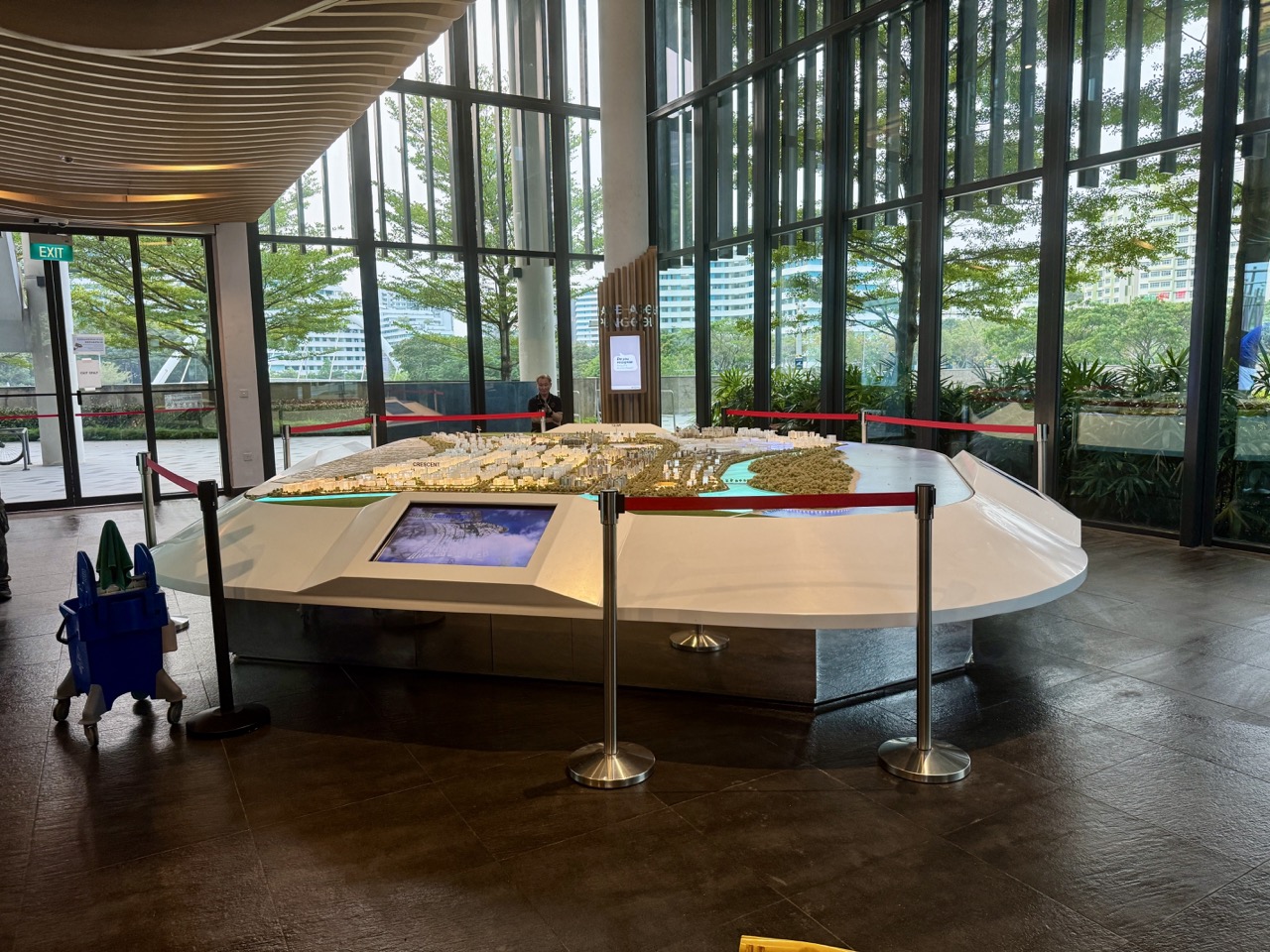

Singapore Education 2027: Urban planning and geospatial analysis are about understanding how places work and how decisions about land, transport, housing, services and the environment affect people. A student may be interested in designing useful neighbourhoods, interpreting maps, analysing transport accessibility or working with Geographic Information Systems (GIS). These are different but related careers. Singapore offers relevant undergraduate study such as NUS Geography, professional education through the NUS Master of Urban Planning, and a Graduate Diploma in Applied GIS for eligible graduates and working professionals. The Urban Redevelopment Authority (URA) also provides information on planning careers and opportunities for students.
Quick answer: URA’s Master Plan 2025 was formally gazetted on 1 December 2025 and guides Singapore’s land use and physical development for the following 10 to 15 years. NUS’s Master of Urban Planning has an official August 2027 intake application window from 1 October 2026 to 28 February 2027, with an early-consideration target of 30 November 2026. NUS’s Graduate Diploma in Applied Geographic Information Systems offers an additional technical route with full-time and part-time options for qualifying degree holders. A Secondary 4 student does not apply directly for these postgraduate qualifications without first satisfying their academic prerequisites.
- What planners do: study land use, housing, transport, accessibility, environmental systems and the needs of different people.
- What GIS does: combine location-linked information with spatial analysis to answer questions about patterns, distance, access and change.
- Undergraduate foundation: Geography and other accepted disciplines may lead towards urban planning or geospatial specialisation.
- NUS postgraduate: Master of Urban Planning (August 2027 intake) and Graduate Diploma in Applied GIS are different qualifications.
- Latest Singapore context: Master Plan 2025 is now the statutory plan, not a future draft awaiting adoption.
- Career possibilities: planning research, transport analysis, GIS, land-use assessment, environmental planning and related public- or private-sector work.
- Important caution: analysing a public map is not permission to approve a development or practise a regulated architect’s role.
What urban planning really decides
A neighbourhood must provide more than homes. Residents need transport, schools, healthcare, food, public spaces, employment access, utilities and safe routes through the area. Land is limited, so different uses compete for space. Urban planning examines how those needs can be balanced over time and how one decision affects another.
Consider a new school near a busy road. The school may serve a real educational need, but planners must examine how students can reach it safely, whether bus services and walking routes are suitable, how traffic works during peak hours and how the site fits with nearby housing. A plan that appears attractive on paper may be difficult in daily use.
Urban planning therefore requires more than artistic drawing. A planner must understand technical information, the relevant legal framework, evidence about community needs, land constraints, cost, transport, environmental issues and the practical limits of a project. Some questions have several defensible answers rather than one perfect solution.
Urban planning versus architecture: why the distinction matters
Architects often focus on buildings and the design of specific spaces, with regulated professional responsibilities for architectural practice. Urban planners work more broadly on how land, infrastructure, development and communities relate across districts and cities. Landscape designers, civil engineers, transport planners and GIS analysts contribute different specialist knowledge.
A person who wants to design a building may study Architecture and eventually follow the Board of Architects professional route. A person who wants to analyse housing distribution, transport access or land-use plans may prefer Planning, Geography or GIS. The fields overlap but have distinct education and professional pathways.
A school project involving a sketch of a new town cannot substitute for real statutory planning approval. Planning proposals are governed by public authorities and technical processes that require the appropriate expertise and responsibilities.
Master Plan 2025 is already gazetted
URA’s official circular of 1 December 2025 states that Master Plan 2025 became Singapore’s statutory land-use plan on that date. It guides physical development for approximately the next 10 to 15 years and is reviewed at five-year intervals. The plan is based on longer-term strategies but sets out more detailed permissible land uses and development densities.
For readers planning education or careers in 2027, this is an important update. An article should not call Master Plan 2025 a future proposal awaiting approval. URA’s current site describes the plan and provides links to URA SPACE, where users can examine the applicable statutory plans and relevant amendments.
The plan still requires interpretation: a map may indicate a permissible use or density, but specific development permissions, design requirements and implementation timelines depend on the relevant regulations and approval processes. A student should never infer from a coloured map that construction on a particular site is certain to begin in 2027.
What is GIS, in simple terms?
A Geographic Information System (GIS) helps people organise, display and analyse data linked to geographic locations. The underlying information can include roads, neighbourhood boundaries, transport stops, elevation, land use, population or environmental conditions. The value is not the map alone; it is what the data allow people to investigate.
For instance, if a public library is a short straight-line distance from an estate, that does not necessarily mean the journey is easy. A GIS analyst may need to examine actual roads, crossings, walkways, barriers and public transport routes. A resident may be separated from the library by a canal or expressway that makes the practical journey longer than the direct distance suggests.
This shows why spatial reasoning is useful. Location, connectivity, time and the needs of different users all influence how accessible a place really is. A digital map can display data beautifully while remaining misleading if it uses the wrong assumptions or outdated information.
Difference between GIS, geospatial analytics and land surveying
GIS is a set of systems and methods for working with geographically referenced data. Geospatial analytics uses spatial relationships, measurements and statistical or computational techniques to answer questions. Land surveying involves professionally precise measurement of positions and boundaries under its own technical and, where applicable, regulatory requirements.
A GIS student who measures distance using public map data should not claim that this determines an official property boundary. A certified professional land survey has stricter evidence and legal implications. An aspiring student should learn which precision is appropriate for an education exercise and when a qualified surveyor or planning authority must be involved.
NUS Geography as an undergraduate starting point
NUS offers Geography study within the College of Humanities and Sciences, including physical, human and environmental topics. Students interested in cities, transport, landscapes and GIS can develop relevant research methods, quantitative analysis and understanding of how societies use space. A Geography degree is one possible foundation, not the only acceptable pathway towards later planning work.
Planning teams also include graduates from Architecture, Environmental Studies, Engineering, Economics, Sociology and related fields, depending on role and qualification. A student should check the exact modules and degree prerequisites rather than assume that only one major can lead to a planning career.
At undergraduate level, students should build writing and evidence evaluation alongside mapping skills. A good location analysis needs a defensible explanation, not just a sophisticated graphic. An applicant who enjoys both Geography and data may find GIS and spatial analysis especially interesting.
NUS Graduate Diploma in Applied GIS
NUS’s Department of Geography publishes a Graduate Diploma in Applied Geographic Information Systems designed for graduates and working professionals who want applied GIS skills in fields such as urban planning, environmental management, transport, public health and business analytics.
The programme can be undertaken on a full-time or part-time basis. The published normal duration is 12 months full-time or 24 months part-time, subject to the university’s maximum candidature rules. Admission normally requires an appropriate bachelor’s degree or other qualifying academic background; NUS describes case-by-case consideration for some applicants with different qualifications and relevant professional experience.
Applicants who did not study at an English-speaking university may need to provide accepted evidence of English proficiency. These are programme-specific postgraduate requirements. A Secondary 4 student should not confuse a ‘Graduate Diploma’ with an ordinary polytechnic diploma available immediately after secondary school.
Who benefits from Applied GIS training?
A transport analyst could use GIS to investigate access to bus stops. An environmental practitioner could analyse how vegetation and land cover change in an area. A public-health researcher might study geographic distribution of services or outcomes, with strong privacy protections. A business may examine locations of stores and transport routes. The techniques overlap, but the questions and constraints differ.
Someone already working in Engineering, local government, real estate research or environmental services may find a Graduate Diploma useful for adding spatial analysis to existing expertise. A student without a bachelor’s degree should instead look at undergraduate education and earlier technical foundations.
NUS Master of Urban Planning: August 2027 application
The NUS Department of Architecture publishes an August 2027 intake for its Master of Urban Planning, with applications currently open from 1 October 2026 to 28 February 2027. The department asks candidates seeking early consideration to submit by 30 November 2026 and describes the possibility of some early admission offers. These are official published dates, not a promise that every early applicant will receive a place.
The degree is a postgraduate programme. Applicants must hold a qualifying prior degree or other accepted university-level qualification and meet the department’s specific conditions. Students aiming for this long-term route should check which undergraduate degrees, design experience, portfolio or other evidence are appropriate for their future application.
Applicants should compare the Master of Urban Planning’s professional and analytical emphasis with the GIS Graduate Diploma. A Planning programme may focus on policy, spatial development, design, implementation and urban systems. A GIS programme concentrates more on geospatial data and technical spatial analysis. Either may complement an existing qualification, but they are not identical.
URA: what the agency does and career opportunities
The Urban Redevelopment Authority (URA) describes work involving land-use planning, urban design, advanced planning tools and implementation. Its official careers portal also includes student scholarships and internships and explains the different roles supporting Singapore’s urban development.
A planning team may analyse land-use options, public input, accessibility, planning guidelines and future infrastructure. Some roles require substantial technical or professional education; others focus on research, policy, technology or communications. Entry requirements depend on the actual position and recruitment exercise, not on the student declaring that they ‘love maps’.
Working for URA is not automatic after graduating in Geography or Urban Planning. Candidates must meet the published job requirements and compete for available positions. Internships and scholarships have their own selection and award conditions.
How urban planning combines Science, Mathematics and Humanities
The quantitative side may include land area, population, travel time, density, geographic distance and analysis of infrastructure. The qualitative side may involve public needs, social interaction, cultural heritage and the experience of living in a particular neighbourhood. A planner needs both because numerical efficiency can fail to describe how comfortable or inclusive a space feels.
A proposed walking route might be short but lack shade or safe crossings. A new community facility might be centrally located but inaccessible to someone with limited mobility. An analysis that only measures the straight-line distance can conceal those differences. Effective planning considers who benefits and under what conditions.
Students should learn to recognise trade-offs. Adding green space can improve amenities but consumes land that might otherwise serve housing or facilities. Higher density can support transport access but may require careful planning for services and public space. Strong analysis considers more than one dimension.
What a geospatial analyst actually needs to know
- Coordinate and reference systems: know how locations and spatial measurements are represented.
- Data quality: check who collected the data, when and under what method.
- Spatial relationships: distinguish proximity from practical accessibility and identify boundaries or barriers.
- Statistics: understand averages, distributions, sampling and the limits of conclusions.
- Communication: make maps and explanations that accurately describe what was measured.
- Ethics: protect individual location histories and avoid identifying people through supposedly anonymised spatial records.
- Policy context: understand which official plans and planning approvals govern the intended land use.
What to learn during Secondary 1–4
- Mathematics: develop geometry, scale, ratios, statistics, graphs and proportional reasoning.
- Geography: investigate landscapes, human settlements, environment, spatial relationships and resource use.
- Science: understand rainfall, heat, energy, ecology and environmental measurements relevant to cities.
- English: interpret planning conditions and communicate conclusions precisely.
- Computing: learn spreadsheets, basic data visualisation and geospatial concepts through approved learning resources.
- Humanities: explore how planning choices affect groups with different needs and constraints.
- Safety and privacy: use lawful public information and avoid sharing private addresses or individual travel data.
A simple Punggol GIS learning example
Using a publicly available map and fictional walking times, a student can compare which of three imagined study spaces is most accessible from several approximate estate locations. First, draw the straight-line distances. Then consider actual pedestrian routes and any major crossing or barrier. Finally, ask how the result changes for a resident using a wheelchair or travelling during heavy rain.
This illustrates why location analysis depends on more than a pin on a map. A route that seems shortest on paper may not be practical for all users. The student should explain the data and assumptions and identify where official accessibility or transport information would be needed for a real recommendation.
The project should not publish the exact homes, personal routes or travel histories of classmates. Use publicly available facilities and approximate or fictional residential starting points. The goal is to learn responsible spatial reasoning.
How to build a credible planning or GIS portfolio
A planning portfolio can include a clearly stated problem, site understanding, evidence, options, trade-offs, maps, diagrams and an explanation of how the proposal changed after feedback. A technically impressive GIS map can also be valuable if the student documents the data source, method, limitations and insight gained.
Avoid pretending that an attractive rendered city image proves feasibility. Buildings, roads and services must satisfy legal and engineering requirements. The portfolio should distinguish a conceptual student project from an officially approved plan. It should also acknowledge what additional information would be needed before a real intervention could occur.
2027 planning: how to decide which course is appropriate
- Choose whether your interest is in urban planning, environmental planning, transport, GIS analysis, surveying or professional Architecture.
- Identify your current education stage; a postgraduate master’s or graduate diploma is not a direct substitute for a polytechnic course.
- For an undergraduate route, compare Geography, Engineering, Architecture and related majors by their actual modules.
- For NUS Master of Urban Planning, note the published 2027 application and early consideration dates and check prior-degree requirements.
- For Applied GIS, check academic eligibility, mode, duration, English proficiency and the next actual intake.
- Explore URA careers and student programmes without assuming a specific job or scholarship will be available.
- Compare tuition, technology needs, commuting, fieldwork and relevant financial aid.
What not to do
- Do not describe Master Plan 2025 as a future proposal awaiting formal adoption; it was gazetted on 1 December 2025.
- Do not assume a student map indicates actual planning permission for a building or housing development.
- Do not confuse GIS analysis with professional land surveying or regulated architectural practice.
- Do not treat NUS’s Master of Urban Planning as direct admission for someone who has not met its prior university qualification requirements.
- Do not assume that being close to a location on a map means the pedestrian journey is easy or accessible.
- Do not publish identifying spatial data about classmates or residents without appropriate permission.
- Do not promise that an urban planning or Geography degree guarantees a job with URA.
Frequently asked questions
Is Singapore’s Master Plan 2025 already official?
Yes. URA gazetted it on 1 December 2025. It is the statutory plan guiding the country’s physical development for approximately the next ten to fifteen years, subject to relevant amendments and approval processes.
Does NUS offer an Urban Planning master’s for 2027?
Yes. NUS has published an August 2027 intake with applications open from 1 October 2026 to 28 February 2027, with 30 November 2026 identified for early consideration.
Can an adult learn GIS through a graduate diploma?
NUS has a Graduate Diploma in Applied GIS with full-time and part-time structures for applicants who meet its degree or other recognised admission conditions.
Can a Geography graduate work in urban planning?
Geography can provide useful spatial and analytical foundations, but the actual postgraduate education and professional job requirements depend on the role and employer. The degree does not automatically grant planning authority.
Official urban planning and geospatial sources
- URA — Master Plan 2025 and current land-use guidance
- URA — Official Master Plan 2025 gazette notice
- URA — Master Plan and medium-term development
- URA — Planning careers, student internships and scholarships
- NUS — Master of Urban Planning, August 2027 intake
- NUS — Graduate Diploma in Applied GIS
- NUS — Geography Department and undergraduate pathways
- NUS — 2027 postgraduate coursework application dates
- eduKate Punggol — Architecture and professional qualifications
- eduKate Punggol — Sustainable built environment study
- eduKate Punggol — University and degree prerequisites
Updated 13 November 2026. URA’s Master Plan 2025 is in force; local development proposals and course admissions remain subject to the relevant statutory and institutional processes. Confirm each 2027 programme’s current application and eligibility directly.


