
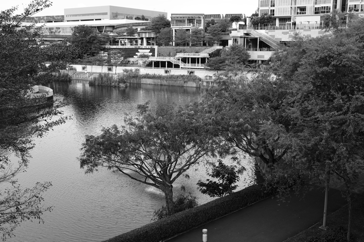
Why did HDB plant freshwater-tolerant mangrove and riverine vegetation along My Waterway@Punggol, even though mangroves are commonly associated with salty tidal coasts? The 4.2-kilometre Waterway is a managed freshwater link between Punggol and Serangoon reservoirs, not an ordinary tidal estuary. To create a living waterfront, its designers selected appropriate water-tolerant species and arranged planting in layers: vegetation nearest the water, shade trees beside the promenade, and greenery extending into the housing estates.
HDB’s Punggol Town Design Guide (updated 2024) describes the town’s landscape theme as “Fresh Water Mangrove and Riverine Zone” and explicitly sets out these three tiers. Its original Discovering Punggol Waterway educational tour kit reported more than 22 species of freshwater-tolerant mangrove plants in the Waterway at the time of that guide, along with bank stabilisation through riprap and marginal planting. That figure is a historical project description, not a newly audited species count for November 2026. The design aims to make ecological planting, water management, public shade and neighbourhood identity work together, without pretending that an engineered freshwater channel is identical to a natural coastal mangrove forest.
- Location: the 4.2 km My Waterway@Punggol and adjacent landscaped promenades and HDB estates.
- Water setting: freshwater connection between Punggol and Serangoon reservoirs, not an open tidal seawater channel.
- First tier: water-tolerant vegetation near the Waterway banks.
- Second tier: broad-canopy trees along the pedestrian promenade to provide shade and an inviting public route.
- Third tier: neighbourhood HDB planting extending the overall green canopy inland.
- Historical HDB figure: the original eco-learning guide described more than 22 freshwater-tolerant mangrove species at the site.
- Other engineering: appropriate marginal planting and riprap help manage some embankment and runoff concerns.
- Not the same: floating wetland modules, rain gardens and coastal tidal mangroves are separate features.
- Practical rule: learn from public paths; do not collect roots, seedlings or water samples from managed planting areas.
Why a waterfront needs an ecological plan
A man-made waterway must carry water and fit within a working town, but it can also support vegetation and public activity. A continuous hard-edged canal might provide the hydraulic route without the same experience of a planted river landscape.
HDB chose to combine water management, riverine planting and public promenades instead of treating the banks only as engineering surfaces.
This creates opportunities for habitat and comfort while still relying on professional drainage and reservoir operations.
Why the Waterway is different from an estuary
Punggol Waterway joins two reservoirs. Its water is managed as part of Singapore’s freshwater environment, so the conditions differ from a shore regularly flooded by seawater tides.
Mangrove species are not all interchangeable in their salt and freshwater tolerances. A typical intertidal mangrove planting recipe cannot simply be applied to every artificial freshwater channel.
The design had to select plants suited to the intended water conditions rather than rely on the broad word mangrove alone.
Why HDB used the phrase freshwater-tolerant
HDB’s historical eco-learning material describes planting a variety of mangroves able to tolerate freshwater conditions. Its 2024 town guide also refers to additional mangrove plants adapted to freshwater.
This matters because some classic mangrove habitats are associated with changing salinity and tidal inundation.
A species should be discussed with its actual ecological requirements rather than assume that every mangrove thrives equally well in pure freshwater.
Why more than 22 species is a historical number
HDB’s original Waterway tour kit states that visitors could see more than 22 freshwater-tolerant mangrove species in the scheme. The figure records how the project was presented at that time.
The present species composition may differ as plants mature, are replaced or change through environmental conditions.
For a 2026 article, the number should remain attached to the original HDB guide rather than be presented as a new field survey completed this morning.
Why a natural mangrove and a planted riverine edge differ
A natural mangrove forest includes relationships among tidal water, sediments, roots, animals and changing salinity. A landscaped freshwater waterway has different operating conditions and constraints.
Planting suitable mangrove-associated species can offer ecological and visual benefits without recreating every physical process of a coastal forest.
The correct claim is habitat enhancement within an engineered waterway, not that Punggol built a complete natural tidal mangrove ecosystem from nothing.
Why HDB planned three vegetation tiers
The 2024 Town Design Guide explains a deliberate relationship between the water’s edge, promenade and nearby homes. Each tier addresses a different position in the town.
Water-tolerant plants are placed near the water; broad-canopy trees contribute shade along the promenade; estate greenery extends the wider visual canopy.
The three tiers turn separate planting zones into one coherent waterfront landscape without requiring all species to be planted in the same place.
What the first planting tier does
The first tier lies closest to the bank, where water-tolerant plants can be selected for local wetness and environmental conditions.
This is the location where vegetation may interact most directly with the Waterway edge and its ecological setting.
The planting must also be compatible with bank stability, maintenance and water-management requirements. A child should not enter the bank to investigate roots.
Why the promenade needs a second tier
Residents use the promenade for walking and recreation. A broad-canopy tree can shade portions of the route and help shape an inviting public space.
HDB identifies this as the second tier of planting, which complements the more water-oriented vegetation nearer the bank.
Its purpose is not necessarily to remove all sunlight everywhere. Shade and views have to be balanced according to route geometry and actual environmental conditions.
Why housing precincts form the third tier
HDB blocks along the Waterway have their own landscape areas. If these were planned completely separately, the green route could feel discontinuous.
The town guide describes precinct planting as the third layer, extending the riverine landscape into the residential environment.
This connects ecological identity with everyday public housing spaces rather than confining greenery to a narrow line at the bank.
Why the first tier is not always tall trees
Vegetation at the immediate bank may include species with different heights and growth forms, selected for wetness and stability conditions.
A uniform row of very tall trees directly beside the water could create other maintenance, access or view considerations.
Using several kinds of plants creates an opportunity for habitat and bank-edge diversity rather than one repeated street-tree solution.
Why a broad canopy can matter to people
Walking beside water in Singapore’s heat can expose visitors to direct sun. Large suitable tree canopies can reduce some solar exposure at certain positions.
HDB’s second-tier promenade planting is intended partly to support shaded pedestrian experiences.
The actual shade depends on time, season, tree growth and route orientation. No one should assume the entire 4.2 km trail remains shaded throughout every afternoon.
Why the third tier is part of urban identity
From a nearby HDB estate, residents may see the tree-lined Waterway in relation to greener communal spaces and courtyards.
The overlapping canopies can help the waterfront feel like part of the neighbourhood rather than a separate attraction disconnected from the flats.
This is an urban-design intention; the actual sense of belonging people experience depends on more than landscape alone.
Why riverine means more than mangroves
Riverine refers to environments associated with rivers or their banks. A riverine planting concept may include broad-canopy trees, shrubs and other suitable vegetation alongside freshwater-tolerant mangrove-associated species.
HDB’s guide names species such as Paperbark and Chengal Pasir in its broader planting palette.
The theme therefore should not be described as one enormous single-species mangrove plantation.
Why Paperbark is a useful example
The Town Design Guide lists Melaleuca cajuputi, commonly called Paperbark, among the proposed landscape datum trees for the Waterway theme.
Paperbark can be associated with wet landscapes, giving the designers a way to reinforce the riverine character.
Its inclusion in a planning palette does not prove every individual Paperbark shown in an old photo remains at exactly the same location today.
Why Chengal Pasir appears in the palette
HDB also identifies Hopea odorata, Chengal Pasir, among the Waterway planting references. Different canopy forms can complement vegetation closer to water.
The guide’s botanical names matter because common labels may vary between people or refer to unrelated trees.
A family can compare verified images without breaking branches or collecting seeds from managed public landscapes.
Why Weeping Tea-Tree contributes a different form
The design guide includes Leptospermum brachyandrum, or Weeping Tea-Tree, with slender cascading growth. Such a form creates a different visual texture from a broad, upright tree.
A planted waterfront becomes more legible and varied when species are selected for ecology and the visual relationship among different heights.
The species name in the guide is evidence of a design reference, not a guarantee that any tree with drooping branches is that exact species.
Why plants have different freshwater tolerance
Plant physiology varies among species. Waterlogging, dissolved salts, oxygen at roots and soil characteristics can all influence survival.
A freshwater-tolerant plant is useful only if the actual riverine conditions match its ecological needs. Some organisms require different environments even when they share the same broad habitat label.
This is why HDB used species selection and research rather than telling contractors to plant whichever mangrove seedlings were easiest to obtain.
Why roots can affect sediments
Plant roots can influence soil structure and help hold material in suitable conditions. Vegetation along an edge may also change how runoff and particles move.
HDB’s Waterway material associates marginal planting with embankment treatment and with managing silt and debris.
The effect depends on the actual site and engineering design; roots alone do not replace every required bank-stability structure.
Why riprap is part of the same story
Riprap refers to suitably arranged rock used to protect an embankment from certain erosion forces. HDB’s Waterway educational material explicitly pairs marginal planting with riprap in parts of the bank.
The rocks and vegetation have different functions but can be designed to work together within one water-edge treatment.
A visible pile of stones should not automatically be treated as decorative landscaping or removed by visitors.
Why a planted bank still needs engineering
The Waterway has varying widths, edges and adjacent public routes. Its bank must remain suitable for managed water levels and other operating conditions.
Vegetation can complement appropriate embankment measures, but its presence does not certify structural stability on its own.
Qualified assessment is needed for design and maintenance. A public educational guide should not offer DIY instructions for changing a managed reservoir-linked channel.
Why silt matters for water quality
Silt consists of fine particles that can be transported in runoff. Excess sediment can affect clarity and environmental conditions in receiving waterbodies.
HDB’s learning guide describes marginal planting and riprap as part of an approach to reducing silt and other unsuitable material entering the Waterway.
That is a design benefit, not proof that every water sample is free of all suspended solids or dissolved pollutants.
Why clearer-looking water is not necessarily safe to drink
Plants and physical treatment measures may improve aspects of stormwater quality. But colour and visible particles reveal only part of a waterbody’s condition.
A managed reservoir-linked Waterway remains different from a treated drinking-water supply.
Families should never taste water or infer that a natural-looking planted bank certifies potable water quality.
Why aquatic life may benefit from diverse edges
Different vegetation and root structures can offer shelter, feeding opportunities or habitat for organisms, depending on species and water conditions.
The Waterway’s planting programme aims to support biodiversity as well as its landscape appearance.
A student should describe the habitat opportunity without claiming that each species of fish or insect will appear during a short visit.
Why all waterways do not need identical plants
The local slope, substrate, sunlight, water level and land uses can vary. An arrangement suitable near one Punggol Waterway segment may require changes elsewhere.
HDB’s three-tier concept is a planning framework rather than a fixed formula prescribing the same tree at every five-metre interval.
Good design adapts species and implementation to actual site conditions under professional oversight.
Why a planted edge is not a public garden bed
Water-edge planting is managed for ecological, water and urban-design functions. It is not a freely available source of seedlings or decorative branches.
Removing material can harm plants, disturb habitat or create instability near a bank.
The appropriate family learning activity is to observe from the designated promenade, take photographs without disturbance and use official species descriptions.
Why the historical 2011 opening provides context
HDB officially opened My Waterway@Punggol in October 2011 as a 4.2-kilometre landscaped waterway connecting the rivers and reservoirs on either side of the town.
The planting programme belongs to a broader eco-town vision rather than an isolated horticultural experiment.
A source dated near opening can explain design intention, while current maintenance and survival of individual plants require newer observations.
Why the waterway width varies
HDB’s original education kit describes varying widths along the 4.2 km route. These changes help create different landscape and public-space conditions.
Some places may allow wider planting and public areas, while other sections have more constrained embankments.
The varied geometry is another reason the habitat and promenade planting cannot be perfectly uniform throughout the project.
Why the Waterway’s green edges can attract different wildlife
A layered landscape may provide food, shelter or movement opportunities for birds, insects and other organisms, depending on planted species and surrounding conditions.
The Waterway is part of a broader network of park connectors and habitats in Punggol. This connectivity can be useful without guaranteeing every animal crosses every link.
The correct ecological statement concerns opportunities for biodiversity, not an invented present-day population count.
Why a riverine landscape is not a single forest
Trees along the promenade experience different conditions from vegetation beside the water. Housing precinct planters differ again in sunlight, soil and maintenance arrangements.
HDB’s three-tier concept reflects these variations instead of treating the waterfront as one uniform plot.
Students can learn that ecological design works across different physical settings, even when the visual result is one coherent green corridor.
Why mangroves are not a magic water filter
Appropriate plants and their root environments may contribute to sediment management and some biological processes. They cannot remove every pollutant or make reservoir water safe for immediate consumption.
HDB’s early guide describes water-quality improvement as a goal of the scheme. A real assessment of current water quality would require professional sampling.
A green bank is valuable without being described as a replacement for PUB’s water treatment facilities.
Why non-tidal plantings require careful terminology
Many natural mangrove forests are intertidal, where water moves with tides. My Waterway@Punggol is a managed freshwater environment, so its selected mangrove-tolerant and riverine species face different conditions.
The phrase freshwater-tolerant is essential. It prevents a student from concluding that all saltwater mangroves naturally live in inland freshwater canals.
A comparison with Coney Island’s tidal mangrove habitat can make the distinction more concrete.
Why Coney Island mangroves are different
The mangrove forest on Coney Island is connected to a coastal tidal environment, where seawater and freshwater can mix to form brackish conditions.
Punggol Waterway’s freshwater-tolerant planted landscape serves a reservoir-linked urban setting. Both involve appropriate coastal or riverine vegetation but have different hydrological circumstances.
The earlier Coney Island’s five beach habitats guide explains distinct coastal restoration zones.
Why water plants need more than water
A plant requires light, nutrients, suitable root conditions and oxygen in its environment, not simply a constant supply of liquid.
A species capable of tolerating wet soil may still struggle under unsuitable shade, salinity or maintenance practices.
Choosing appropriate species therefore requires evidence about the whole local environment rather than reliance on one label such as water-loving.
Why landscape quality changes with time
Young plantings grow and change their shape. Some individuals may be replaced and maintenance can adjust the layout.
The original 2011-era images and HDB guide capture the design at a particular stage, while the 2024 Town Design Guide explains the continuing intended character.
A credible 2026 article should distinguish those documents from a new field survey and avoid claiming an exact current count of every species.
Why tree canopies can frame views of the water
HDB’s guide aims to maintain visual relationships between housing and the Waterway through appropriately selected planting forms and canopy layers.
That design can create places where visitors see water below branches and greenery extends back towards the housing precincts.
It does not guarantee a particular view from every unit, because building position, tree growth and other obstructions differ.
Why some trees are intended to have open canopies
The town design guidance refers to tall trees with open canopies along relevant development edges. Their form can provide a landscape transition without creating the same solid visual barrier as a dense continuous wall.
This is a species and spatial composition choice, not a declaration that trees with denser crowns are always undesirable.
The ideal form depends on the planting zone’s intended ecological and public-space function.
Why the third tier may look more regular
HDB’s guide describes the housing-precinct greenery as forming a comparatively uniform canopy against more varied vegetation nearer the water.
The difference creates a visual transition between residential blocks and the riverine edge.
This demonstrates why a plan may intentionally vary planting diversity and appearance across spaces rather than require every tier to have the same ornamental pattern.
Why street furniture cannot replace a planted landscape
Seats, shelters and themed public features make the Waterway useful for people. Plants serve different ecological, shade and aesthetic functions.
HDB’s Explorer Trail identifies both environmental planting and street furniture made using suitable recycled materials as part of the eco-town concept.
The public experience depends on multiple features working together. A beautifully designed bench does not perform the same function as a living water-tolerant plant.
Why bank maintenance must consider roots
Roots can be important to a plant’s survival and to aspects of soil stability. Maintenance works near the bank therefore need to consider the living vegetation and engineering surfaces together.
Unauthorised digging or removal can damage both ecological and physical functions.
Residents should report concerns to the responsible operator rather than attempt to replant or reinforce an embankment independently.
Why riprap is not proof of uncontrolled erosion
Rock protection at a river edge may be part of the original preventive design, not evidence that a major failure has already occurred.
HDB deliberately identifies riprap in its original Waterway educational explanation as an embankment treatment.
A useful field observation can record the presence of stones while leaving the actual engineering purpose and condition to authoritative records and qualified assessment.
Why sediment is not the only water-quality issue
Runoff can contain suspended particles as well as dissolved substances. Measures that reduce visible sediment do not necessarily control every chemical or biological condition.
The Waterway’s planted banks and other eco-features are parts of a broader water-management design.
Actual safe recreational use or drinking-water supply remains subject to the appropriate agency’s standards, not a visitor’s visual impression.
Why floating wetland modules are another system
HDB also developed buoyant hexagonal modules carrying aquatic plants within Punggol Waterway. These sit on the water rather than being rooted directly in the designed bank.
The system uses different engineering, including buoyancy and interlocking connections. Its water-quality and biodiversity goals can complement bank planting without making the systems identical.
The floating hexagonal wetlands explanation covers that separate mechanism.
Why rain gardens differ from freshwater mangrove planting
Rain gardens commonly receive and detain runoff at source, using suitable filter media, planting and designed outlets.
Freshwater-tolerant bank vegetation is part of a broader riverine edge, with ecological and landscape functions adjacent to the waterway.
The Waterway Ridges rain gardens article addresses a specific housing-precinct stormwater system, not the same physical planting strip.
Why aerators serve a different water-quality function
Waterway aerators, described in HDB’s eco-learning guide, introduce movement and help oxygen exchange with the water.
Plants, by contrast, support their own biological processes and influence habitat and water conditions through different mechanisms.
A sound systems explanation distinguishes mechanical aeration from bank planting and does not assume one eliminates the need for the other.
A fictional three-tier drawing
Draw a waterway with a narrow bank, a promenade and an HDB estate behind it. Label water-tolerant vegetation at the bank, broad-canopy shade trees near the path and planted residential spaces farther inland.
The exercise reproduces HDB’s general three-tier concept, not the exact geometry of any development.
Students explain why one plant species or tree height cannot serve every function in all three positions.
A fictional salinity comparison
Imagine two otherwise similar plants, one adapted to brackish conditions and another capable of growing in the Waterway’s freshwater setting.
Ask students why a coastal plant’s name alone cannot determine its survival in the other environment.
The exercise introduces salinity and species tolerance without encouraging anyone to transplant protected seedlings or change water conditions in a public space.
A fictional riprap-and-root diagram
Sketch a bank with stones and suitable plants, then label the rock protection and living roots as different components.
Students distinguish physical embankment treatment from biological planting and discuss why both might be useful under the site-specific design.
The model is not a technical specification. Actual slope works require appropriate engineering and approval.
A fictional water-quality claim to repair
A child sees a lush riverbank and declares that every drop of Waterway water is safe to drink. A teacher asks which observation establishes potable quality.
The answer is none. Appearance and planted filtering measures cannot replace certified water treatment and testing.
The corrected statement describes the intended environmental benefit without making a dangerous health claim.
A fictional view-corridor question
A resident sees the HDB design objective of creating views through tree canopies and assumes every nearby flat receives an unobstructed reservoir view.
Students explain why an overall spatial goal cannot establish the exact view from a particular window.
The exercise separates urban design intent from individual property characteristics.
A fictional historical-count exercise
HDB’s original education kit describes more than twenty-two freshwater-tolerant mangrove species. Students are asked whether this is a measured count in November 2026.
The correct answer is no: the figure belongs to a historical HDB project account.
A present-day count would need an appropriately defined and completed survey. Reading the source date prevents outdated numbers from becoming falsely current.
Teaching Guide: three layers of green beside a freshwater route
Learning goal: explain how HDB’s Fresh Water Mangrove and Riverine landscape theme combines ecological and pedestrian functions across three planting zones.
Activity one: identify the managed freshwater setting and contrast it with an intertidal mangrove. Activity two: draw the first, second and third vegetation tiers.
Activity three: describe the distinct roles of water-tolerant banks, promenade shade and housing greenery. Activity four: compare riprap and marginal planting as components of an engineered edge.
Activity five: interpret HDB’s historical species figure carefully. Activity six: differentiate rooted bank planting, floating wetland modules and rain gardens.
Transfer test: design a conceptual planted edge for another public waterbody, listing the environmental evidence that would be necessary before species selection.
Frequently asked questions
Is Punggol Waterway seawater? It is a managed freshwater link between Punggol and Serangoon reservoirs.
Why plant mangrove-associated species there? HDB selected vegetation that can tolerate the intended freshwater conditions and support ecological and landscape objectives.
What are the three tiers? Water-tolerant banks, broad-canopy promenade trees and greenery in housing precincts.
How many species were originally described? HDB’s historical tour kit reported more than 22 freshwater-tolerant mangrove species.
Does this mean all mangroves grow in freshwater? No. Species have different environmental requirements.
Does the planting make Waterway water drinkable? No. Water quality and potable treatment are separate matters.
Why are there rocks along some banks? Riprap is an engineered embankment treatment used alongside suitable planting.
Are floating wetlands the same planting? No. Floating modules have separate structures and locations.
May visitors collect seedlings? No. Respect park and landscape rules.
Where can I verify the plan? HDB’s Punggol Town Design Guide and HDB Explorer Trail.
Your next step
Read HDB’s Punggol Town Design Guide, updated 2024, especially printed pages 38–39 on the freshwater mangrove and riverine landscape, and the HDB Explorer Trail.
For the historical figure and bank treatment, use HDB’s Discovering Punggol Waterway tour kit. For the natural coastal contrast, see NParks’ Recognising Trees of the Mangroves.
The essential idea is to match plants to the water and arrange greenery for several different jobs. Punggol’s riverine planting is an engineered, living urban landscape, not a claim that every bank reproduces a natural tidal forest.


