
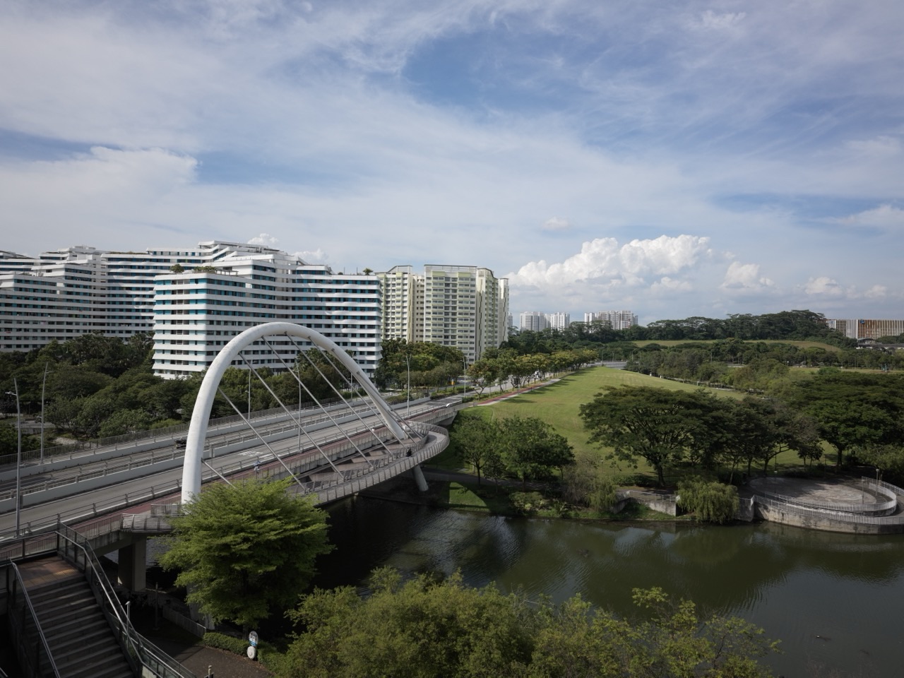
Why do some landscaped lawns at Waterway Ridges in Punggol temporarily hold rain after a storm, instead of draining every drop immediately away? At this HDB precinct, rain gardens and planted channels are more than decorative greenery. They form part of an engineered Active, Beautiful, Clean Waters (ABC Waters) drainage system that collects, slows and treats stormwater before it reaches public drains and nearby waterbodies.
PUB’s Managing Urban Runoff, Drainage Handbook (Second Edition, 21 June 2024) documents Waterway Ridges as a 3.98-hectare case study. About 70% of site runoff was to be channelled through rain gardens and vegetated swales. Its bioretention basins were designed with up to 200 millimetres of temporary surface detention, with additional 400–850-millimetre gravel storage layers underground. PUB’s comparison indicates how the design addresses the rise in peak flows caused by building on previously greener land: an illustrative 1.85 m³/s peak with conventional development drainage compared with 1.16 m³/s with the on-site stormwater measures. The pre-development comparison was 1.04 m³/s. These are design-model values, not today’s live measurements.
- Precinct: Waterway Ridges, a Punggol HDB development and documented ABC Waters testbed.
- Problem: roofs and hard paving can send runoff faster towards public drains during rainstorms.
- Method: bioretention rain gardens, vegetated swales, filter layers, gravel detention and controlled outlets.
- PUB case study: 3.98 hectares, about 70% of runoff routed through these features.
- Multi-use design: some basins function as lawns or common spaces when dry and store stormwater temporarily during rain.
- Not potable: runoff is not automatically safe to drink or play in even after passing through planted features.
- Design limits: a ten-year return-period storm is a statistical basis, not a promise that rain beyond the design never occurs.
- Best reference: PUB’s 2024 drainage handbook, printed pages 31–34, and HDB’s Punggol town development history.
Why an HDB precinct needs its own stormwater plan
When rainfall hits roofs, paths and roads, a significant share may flow across their surfaces rather than soak into the ground. The quantity and timing of water entering the public drainage network are therefore influenced by how a development is built.
Waterway Ridges demonstrates an approach in which the development manages some runoff at its source before it leaves the site. This reduces reliance on sending everything immediately into roadside drains and gives designers opportunities to integrate greenery.
The environmental lesson is not that paving is always wrong. Homes and accessible paths are necessary. It is that the change in water movement created by those surfaces must be understood and responsibly managed.
Why Waterway Ridges is a real Punggol case
PUB’s 2024 drainage handbook identifies Waterway Ridges as a 3.98-hectare public-housing development incorporating rain gardens, swales, underground storage and controlled outlets. HDB’s historical material identifies it as a water-sensitive design pilot launched in 2011 and completed in 2016.
Those dates and dimensions create a specific local example rather than a hypothetical description of what a raingarden could do.
However, a design-era case study cannot certify every outlet’s live condition in November 2026. Understanding what was built and auditing its current performance are different questions requiring different records.
What ABC Waters means
PUB’s Active, Beautiful, Clean Waters programme brings water-sensitive features into developments so stormwater management can coexist with attractive landscapes. Its approach can combine planted swales, detention and treatment rather than relying solely on conventional hard drainage.
The word beautiful does not mean the system is merely decorative. At Waterway Ridges, filter media, gravel and overflow structures are engineering components.
Students should ask about the feature’s function: which surface supplies water, how the water moves, how long it may be held and where it goes afterward. An attractive garden photograph is only part of that explanation.
Why a raingarden differs from an ordinary flower bed
A normal garden is primarily designed to grow plants. A rain garden is engineered to receive runoff under suitable conditions, with soil or filter media, planting, storage depth and an appropriate outlet.
Waterway Ridges’ typical section includes a surface basin, a 400-millimetre filter layer, a 100-millimetre transition layer and gravel below. This layering gives the garden a hydraulic role that ordinary planted soil may not perform.
A resident should not dig out or replace these layers to plant something new. The landscape can be beautiful because it was engineered, and altering it casually may damage the function.
Why vegetated swales are useful
A vegetated swale is a shallow channel covered in suitable planting and designed to move runoff along a defined route. It can slow flow compared with some steep hard-surfaced alternatives while also supporting appropriate filtering.
PUB’s Waterway Ridges plan shows swales connecting sub-catchments and bioretention features as water moves towards designated outlets.
A swale is therefore not an unplanned puddle or simply a strip of landscaping that happened to be lower than its surroundings. Its slope, planting and connection to downstream features are part of the drainage arrangement.
Why the system is called a treatment train
PUB describes a treatment train as a series of stormwater features working together to slow runoff and improve water quality. One stage can manage what arrives before passing water to another stage.
At Waterway Ridges, a network of swales and rain gardens performs this linked function across the development.
The lesson is a general one in engineering: the value of one component depends partly on what receives its output. A single rain garden cannot explain the system without its inlets, storage and eventual discharge route.
What the 70 percent number actually tells us
PUB says runoff from about 70% of the total site was designed to pass through the linked rain gardens and swales. This concerns the portion of site runoff directed through particular infrastructure.
It is not a claimed 70% reduction in pollution, 70% less rainfall, 70% of all Punggol land or a guarantee of a 70% reduction in peak flow. Those would be different measurements.
A strong public explanation must preserve the source’s denominator and meaning. A useful engineering statistic can become false as soon as it is stripped of the thing it measures.
Why dry lawns can hold stormwater
Some Waterway Ridges detention areas are designed as public lawns during dry weather. When rain comes, the ground-level depression can temporarily store water.
PUB’s case study explicitly presents photographs of these spaces in dry and wet conditions. They demonstrate that the same land can perform different functions over time.
The sensible limit is that a lawn being usable in dry weather does not make it a safe play pool during rain. Water quality, slipperiness and changing flow must be respected.
Why a lawn and a drain are not always separate
People commonly imagine recreation as occurring on one plot and stormwater engineering as hidden inside another. Waterway Ridges deliberately combines the two on some surfaces.
That can preserve neighbourhood amenities while meeting engineering needs under space constraints. A small development cannot dedicate unlimited land to separate ponds and lawns.
This approach requires careful maintenance and user understanding. A temporarily flooded lawn may be working as intended, even though its present appearance differs from the dry-weather purpose residents know.
Why the project needed underground gravel storage
PUB explains that much of the ground level needed to remain available for public amenities such as playgrounds and lawns. Surface detention alone offered limited space.
The design therefore used 400–850-millimetre-deep gravel storage layers below or within selected bioretention basins. Water can occupy void spaces among the properly arranged gravel.
This is a layered land-use decision. Residents see a garden above while additional detention volume sits below. The gravel is an engineered component and should not be assumed to be an empty tank or ordinary fill.
Why porosity matters
A gravel layer includes both solid particles and void spaces. The total volume of the layer is not the same as the volume available to hold water.
Engineers use appropriate materials and calculations to determine the storage and flow characteristics. A classroom model might fill a transparent container with clean gravel and compare the displaced space, but it cannot reproduce the actual hydraulic design.
The key concept is that spaces within granular material can be useful infrastructure even when no large hollow chamber is visible.
Why filter media differs from gravel
The typical Waterway Ridges cross-section identifies a 400-millimetre filter media layer above a 100-millimetre transition layer and underlying gravel.
The filter and transition materials help manage the passage of water through the basin, while lower layers contribute to storage and drainage. They are not random ingredients that can be mixed without affecting the design.
A reader should understand each layer by function, not label everything underneath the grass simply as soil. That distinction is essential to explaining how the system works.
Why a transition layer is included
Water moving between materials with different particle sizes can carry fine particles unless the arrangement is designed appropriately.
A transition layer helps manage that interface within the engineered filter-and-drainage structure. Its exact properties depend on the technical specification, not a generic household gardening recipe.
For students, it illustrates why a functioning system sometimes needs a component whose role is less obvious than the plants or storage space: the materials must interact correctly.
Why the basin was designed for temporary ponding
The PUB case study describes up to 200 millimetres of temporary detention depth for the relevant basin. This means a limited surface volume can hold water while the outlet regulates its release.
That is an engineering depth, not a promise that the entire estate can never experience water above that height. Different locations and storms have different conditions.
It also does not authorise children to wade there. Storm runoff may contain debris, pollutants or slippery surfaces even when water appears shallow.
Why the overflow structure is not a mistake
Every detention system has finite capacity. PUB’s typical Waterway Ridges section includes overflow and drainage components that manage excess water.
When water reaches the designed overflow level, it can continue along an appropriate route rather than relying on a basin that holds unlimited rainfall.
An operating overflow is not automatically evidence of a defective scheme. Its purpose is to handle conditions beyond particular storage levels in the way the system was designed to manage.
Why a smaller outlet can reduce peak runoff
An outlet limits how quickly stored water can leave a basin under specified conditions. PUB’s description explains that a reduced opening was calculated to help maintain appropriate downstream peak flow.
If water entered a large open drain immediately, the downstream network might receive more runoff during a short period. Holding and releasing some of it gradually changes the flow profile.
But an outlet cannot be chosen simply by making a hole as small as possible. It must be sized for the full safety and drainage requirements, including overflow.
What the ten-year storm basis means
PUB’s design describes stormwater performance with reference to a ten-year return-period event. In hydrology, a return period expresses a statistical frequency under stated conditions.
It does not mean exactly one large rainstorm will happen every ten years, or that a second similar event cannot occur soon after the first.
A design standard helps engineers choose an appropriate level of protection. It does not make storms outside the design assumptions physically impossible.
Why the pre-development peak was recorded
The case study compares runoff before major development with scenarios for a completed housing precinct. That provides a baseline for seeing how urbanisation can change the water flow.
PUB illustrates a pre-development peak of 1.04 cubic metres per second for the relevant model.
This is a modelling reference, not a measurement residents can reproduce from the present-day Waterway. It helps explain what the drainage system was trying to manage.
Why conventional development can increase peak flow
PUB’s illustrative conventional-drainage scenario gives 1.85 m³/s for the developed site. More hard surfaces can send stormwater towards drains faster than under the original greener conditions.
The figure represents the scenario in the handbook, not a claim that the estate actually experienced this peak with no mitigation.
When interpreting results, it matters whether the number describes a hypothetical comparison or measured operating behaviour. This is why careful source language is as important as calculation.
Why the source-controlled case is different
PUB’s illustrated source-controlled Waterway Ridges scenario gives 1.16 m³/s, after including detention and retention features in addition to conventional drainage.
That is materially lower than 1.85 m³/s in the comparison, showing the purpose of the source controls. It is also slightly above the 1.04 m³/s pre-development reference.
The responsible explanation preserves all three values instead of saying the system magically restored identical pre-development runoff or made flooding impossible.
Why percentages need care
The difference between the conventional 1.85 and managed 1.16 m³/s scenarios is 0.69 m³/s. Relative to the conventional value, that is roughly 37%.
This arithmetic describes one model comparison. It is not a measured reduction for every actual storm, every drain or all of Punggol.
A student should always state the compared scenarios and the denominator. A correct percentage becomes misleading if it is presented without the conditions attached to it.
Why water quality is another objective
Rainwater passing over paved areas can carry fine particles and other substances. Source-control features may reduce some of this material through appropriately designed media and vegetation.
PUB’s Waterway Ridges case lists treatment objectives for suspended solids, total phosphorus and total nitrogen.
The water may look clearer after passing through features, but appearance is not proof that it is safe to drink. Stormwater treatment and potable water treatment are separate requirements.
What total suspended solids means
Total suspended solids describes particles present in water. Some can be trapped or settled through suitable stormwater treatment.
PUB’s case-study objectives include 80% suspended-solids removal or less than 10 parts per million for the relevant treated runoff.
These are design goals, not audited outcomes for every rain event in November 2026. A learner should distinguish the measured parameter and its target from actual performance records.
Why phosphorus and nitrogen are monitored
Phosphorus and nitrogen compounds can enter stormwater from different sources and influence the environment when concentrations become excessive.
PUB includes total phosphorus and total nitrogen treatment objectives in the Waterway Ridges case. The stated design thresholds and removal rates refer to specific water-quality indicators.
A photograph of green plants cannot show the exact concentration of a dissolved nutrient. Professional sampling and analysis would be needed to make those claims.
Why the plants cannot be random choices
Plants in a bioretention feature may face dry periods followed by temporary wet conditions. Their suitability depends on the actual habitat and system design.
PUB describes selecting attractive species that also encourage biodiversity in the Waterway Ridges landscape.
Good planting must serve the public space and the water-management arrangement. A flower that looks attractive elsewhere is not automatically appropriate in a constructed stormwater basin.
Why a bioretention basin differs from a pond
A conventional permanent pond holds visible water for much of the time. Some Waterway Ridges basins are designed to be normally dry and fill only temporarily during suitable rain events.
Their primary water-management roles include detention, filtration and controlled discharge.
A resident should therefore not call every depression a lake or expect a permanent water surface. The difference in operating behaviour is a key part of the design.
Why the feature is not a sewer
The rain gardens manage rainwater runoff from the development. They do not receive household toilet sewage as an ordinary permitted input.
Singapore uses a separate used-water sewerage network for sanitary wastewater.
The Punggol rain drains and sewers guide explains that division. Waterway Ridges is a local stormwater example, not a sewage treatment installation.
Why this is not the same as rainwater harvesting
A harvesting tank collects rainwater for later appropriate use, perhaps in common-area washing or irrigation.
A detention basin stores stormwater mainly to control the speed and rate of discharge and, in suitable designs, improve runoff quality.
The Treelodge rainwater harvesting article describes the different building-scale use. Similar water-storage language does not make the systems identical.
Why the downstream Waterway remains important
Waterway Ridges is one part of a larger catchment, and the water leaving its internal drainage system connects to public routes and receiving environments.
Managing runoff before discharge can help reduce demands on the wider network under designed conditions.
The local measures do not replace Punggol Waterway, reservoirs or every public drain. They perform a source-level function within a larger urban water system.
Why public amenities needed to remain available
Housing estates need practical spaces for play, relaxation and walking. Dedicating every part of the development to fenced technical works would reduce everyday community use.
PUB explains that design space at Waterway Ridges was limited by the need for playgrounds and lawns, helping motivate combined surface and underground detention.
This is an urban planning trade-off: technical infrastructure can share space with suitable public amenities while retaining its engineered function.
Why the common green adds social value
A shared landscaped area offers places for neighbours to pass, meet or spend time outdoors in ordinary dry conditions.
At Waterway Ridges, the multi-purpose rain gardens demonstrate that an environmental feature can also be part of daily residential life.
But weather changes its suitable use. A rain garden should be understood as a public space with a specific hydraulic responsibility, not as an ordinary permanent sports field regardless of conditions.
Why maintenance must respect the hidden layers
Landscaped stormwater features need care for plants, filter material, inlets and outlets. A blocked inlet or damaged layer can affect function.
The service provider should follow appropriate inspection and maintenance procedures rather than assume that the garden is healthy solely because it remains green.
Residents can help by avoiding litter and reporting hazards, but should not remove manhole covers, dig up filter media or modify drainage outlets themselves.
Why the garden may change appearance after rain
A basin designed for temporary detention can look different during or shortly after a heavy storm. There may be ponded water, wet vegetation and a less usable path.
That difference does not necessarily indicate poor maintenance. A system intended to hold rain briefly may be doing its job.
If a condition seems dangerous or persists unexpectedly, the useful report records its exact location and timing for professional assessment rather than guessing the cause.
Why storms can exceed the design assumptions
Rainfall intensity and duration vary. Infrastructure is designed around engineering standards and specified assumptions rather than an unlimited amount of water.
Waterway Ridges’ ten-year design comparison should not be treated as a universal flood-proof guarantee.
A mature explanation acknowledges that even useful detention systems require downstream drains, overflow arrangements, maintenance and appropriate safety measures in exceptional conditions.
Why excess water needs an appropriate exit
After the temporary storage fills, the system needs to convey water to a controlled outlet without creating unreasonable hazards.
PUB’s section shows overflow and perforated drainage features for this purpose.
Students should notice that the goal is not to stop all water from leaving the site. It is to change the flow timing and quality while allowing safe drainage under the design.
Why gravel voids need to empty again
When water temporarily occupies the storage spaces in gravel, those spaces are less available until the water moves onward.
A detention system must therefore be able to release water so it has room for a later event, within the applicable operating requirements.
Holding water permanently in every storage void would not achieve the same function during subsequent rainfall. This is why an outlet is essential even when storage is the main feature.
Why a drawing can be more accurate than a site photograph
A photograph shows the surface appearance of a basin but not the layered gravel, filter media and perforated drains hidden below.
PUB’s technical section gives a conceptual explanation of those components. A plan diagram also shows the connected swales and outlets across the development.
Both are useful for different questions. A photo documents appearance, while a section explains internal design. Neither should be used to invent the current operating condition of a specific component.
Why the Waterway Ridges example should not be generalised too widely
Other Punggol developments have different site areas, soil conditions, infrastructure and building layouts.
A rain garden arrangement effective under the Waterway Ridges design may not be copied without changes to a different estate.
Engineering depends on local conditions. The transferable principle is managing runoff near its source through appropriate features, not assuming every site must have the same 200-millimetre surface depth or identical gravel layers.
Why the floating wetlands are a different innovation
Punggol Waterway also contains floating planted systems built on buoyant supports. Their vegetation is positioned on the water rather than inside land-based rain-garden basins.
Both features can improve public landscapes and support environmental objectives, but the source and route of water differ.
The floating-wetland article explains modules and water-based ecological functions, while this article explains storm runoff passing through planted land-side drainage elements.
Why a former landfill wetland is also different
Lorong Halus Wetland involves contaminated leachate from a former landfill, underground containment, collection and managed treatment.
That is not the same input as rain falling on Waterway Ridges’ built surfaces.
The distinct source of the water changes the technical controls required. An environmental article should explain which water is being managed rather than call all planted treatment features simply wetlands.
A hypothetical roof-runoff calculation
Imagine a fictional 1,500-square-metre catchment receiving 20 millimetres of rain. In an idealised calculation, the volume falling on it is 30 cubic metres.
Not all of that necessarily enters a particular rain garden; actual runoff depends on infiltration, storage and the designed drainage routes.
The exercise shows why rain depth and catchment area are needed before calculating volume, and why engineering still needs other information.
A hypothetical gravel-storage calculation
Suppose a classroom gravel layer has a total geometric volume of ten cubic metres, with an invented void fraction of thirty per cent.
Its idealised void space would contain three cubic metres, not the full ten.
That is a teaching model only. Real materials have different porosity and hydraulic characteristics. The point is that the solid gravel and empty spaces both affect the system.
A hypothetical basin-depth question
Draw a fictional level basin of fifty square metres with water 0.2 metre deep. Multiplying area and depth gives ten cubic metres under the simplified geometry.
Real basins have sloped edges, planting and outlet structures, so their actual storage cannot be inferred from the classroom rectangle.
This helps learners identify what a calculation assumes, rather than treat a plausible answer as a certified technical figure.
A hypothetical design-comparison chart
Plot three bars labelled pre-development 1.04, conventional-developed 1.85 and source-controlled 1.16 cubic metres per second.
Students can observe that the source-controlled value is lower than the conventional scenario but slightly above the earlier greenfield value.
The chart is a teaching representation of the PUB comparison, not an observation of today’s rainfall. Keeping the labels correct is part of the mathematics.
A hypothetical overflow observation
A resident notices a drainage outlet carrying water during rain and concludes the rain garden has failed.
The student explains that a controlled outlet is part of the system and may operate during ordinary design conditions.
The correct response to a genuine hazard is reporting the actual symptom, not modifying the outlet. Flow does not need to be zero for a detention system to work.
A hypothetical blocked-inlet problem
Children see leaves accumulating near a rain-garden inlet. They want to lift a cover to clear the entire underground system.
The adult explains that public drainage equipment should be left to authorised maintenance workers, especially during or after heavy rain.
The children can record the safe observation and identify the right reporting channel. Curiosity and responsible behaviour can coexist without hands-on interference.
Teaching Guide: a lawn that stores water when it rains
Learning goal: explain how a planted public space can slow, hold and filter runoff under suitable conditions.
Activity one: draw a roof, pathway and road draining into a planted swale. Activity two: add a surface detention basin with filter and gravel layers below.
Activity three: label PUB’s 70% routed-runoff statement correctly. Activity four: compare the three published peak-flow design scenarios and state their units.
Activity five: discuss why the lawn can be a public amenity when dry and a detention feature during rain. Activity six: compare the system with Treelodge rainwater harvesting and a floating wetland.
Transfer test: consider an imaginary school site with a smaller garden and ask which information an engineer would need before installing a similar feature.
Frequently asked questions
Is Waterway Ridges a real Punggol project? Yes. PUB and HDB identify it as a water-sensitive public-housing development.
How big is the case-study site? PUB describes 3.98 hectares.
What does 70% refer to? Approximately 70% of total site runoff was designed to pass through the specified rain gardens and swales.
Why is there gravel beneath the planting? Its void spaces provide additional temporary stormwater storage.
What is the surface detention depth? The typical design allows temporary ponding up to 200 millimetres in the relevant basin.
Does it collect drinking water? No. The system is for stormwater runoff, not potable supply.
Is the rain garden also a playground pool? No. Ponded runoff can be hazardous.
Does a 10-year storm occur exactly once a decade? No. It is a statistical design concept, not a timetable.
What do the three peak-flow numbers represent? Alternative model scenarios in PUB’s handbook, not live measurements.
Where can I read the technical case? Printed pages 31–34 of PUB’s 2024 Managing Urban Runoff Drainage Handbook.
Your next step
Read PUB’s Managing Urban Runoff Drainage Handbook, second edition, especially the Waterway Ridges case study and the cross-section of its rain gardens.
For local background, see HDB’s Punggol award and water-sensitive design account and the earlier Waterway Ridges ABC Waters history.
This article owns the site-specific mechanism and numbers, rather than repeating the broad Why Punggol Stormwater Must Slow Down Before Reaching Drains. The one idea to remember: an engineered rain garden can serve the neighbourhood between storms while slowing and filtering water when rainfall arrives.


