
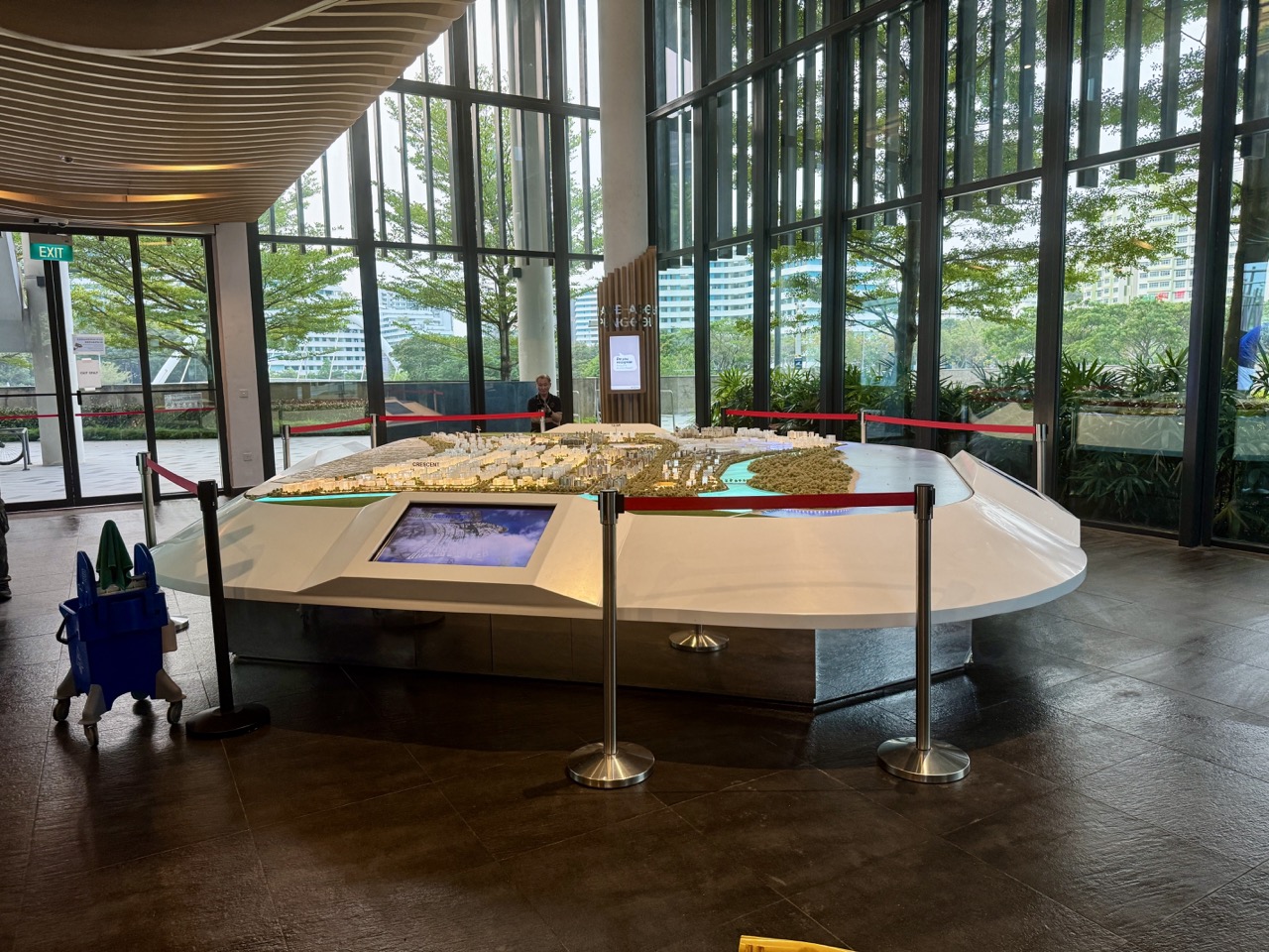
What to do in Punggol when a family notices an interpretive sign along a heritage route and wants to explain the area’s earlier life to a child? Read the sign as a source rather than treating the entire landscape as proof of everything it describes. The Punggol Heritage Trail follows parts of the former Old Punggol Road corridor near Punggol Digital District and Singapore Institute of Technology. Its official interpretation addresses Punggol’s kampung history, private zoos and the pig-farming district, while the present trail landscape reflects later conservation and redevelopment choices.
The National Parks Board opened the first 400-metre stretch of Punggol Heritage Trail on 23 August 2025 between Punggol North Avenue and Campus Boulevard, with over one kilometre of meandering paths in that initial area. NParks says interpretive signs were placed at a recreated old-style bus stop near Campus Boulevard and elsewhere along the trail, supported by the National Heritage Board. The remaining 900 metres were planned for completion by the end of 2026; that earlier target is not proof that every planned section is already accessible today.
At a glance: six checks for reading a Punggol heritage sign
- Choose one accessible, currently open public sign or a verified official interpretation page.
- Record the panel’s exact topic, issuing organisation and date where shown.
- Separate what the sign states from what a modern structure merely resembles.
- Check the same claim against NParks, NHB Roots or another relevant official historical source.
- Identify whether the source describes an event, proposal, reconstruction or disputed recollection.
- Write a short accurate family explanation and one uncertainty, without entering prohibited trail sections.
This is a practical family history-reading activity, not a live confirmation of construction completion, guided tour booking or permission to enter closed areas. You can use the official NParks announcement and NHB history pages even without visiting. If you do attend, check current access, public paths, weather and the actual wording on site; quote accurately, distinguish artwork from archival evidence and leave protected habitats and infrastructure undisturbed.
Start with one panel rather than the whole trail
A family might be interested in Punggol’s past fishing communities, its old zoological attractions or the farming landscape. Choosing one sign keeps the activity manageable and makes it possible to examine the wording rather than rushing through a long route.
Ask the child what question the panel appears to answer. A place name, picture or historical object can lead to a useful question, but it should not become a complete explanation before the text is read. Begin with the source, not the story you expected to find.
Where the documented first segment is
NParks’ 23 August 2025 announcement identifies the first 400 metres of Punggol Heritage Trail between Punggol North Avenue and Punggol Digital District’s Campus Boulevard. It describes over one kilometre of meandering trails available within that opened stretch.
Do not confuse the 400-metre main segment with the aggregate length of every smaller path in the initial area. Both measurements can be correct because they describe different things. State which one the official announcement used rather than turn them into competing figures.
The trail is a redevelopment of Old Punggol Road
The documented project preserves aspects of the former road corridor, including its undulating terrain, mature greenery and coastal-forest character. It introduces planting and public recreational features within a modern development framework.
The presence of an old road alignment does not mean every present path surface, shelter or tree is unchanged from the kampung era. A family should distinguish retained features, reconstructed references and new design elements. The exact wording of NParks and the sign supports that distinction.
The recreated old-style bus stop is interpretive
NParks says a former bus stop has been recreated along the trail near Campus Boulevard, with a shelter recalling earlier Singapore bus-stop design. Interpretive signage there explains chapters of Punggol’s history.
Recreated does not mean the present shelter is literally the original untouched object or that every past bus route can be inferred from it. A child can compare its design with modern bus stops and discuss why a contemporary public space might choose to preserve a memory through reconstruction.
Who supports the historical interpretation
NParks’ opening release says the signs were supported by the National Heritage Board. That institutional attribution matters when a reader wants to know whether a story is an official interpretive project or a personal speculation shared online.
Nevertheless, a sign is a concise curated explanation rather than the complete archive. It can be a strong starting source while leaving historical disagreements or details for further research. A family should be able to identify the organisation and limits of the material.
The rest of the trail was a future stage
The 2025 NParks statement said a further 900 metres of trail were expected to be completed by the end of 2026, forming the planned 1.3-kilometre route. JTC’s current Punggol Digital District community page discusses the project and the first opened stretch.
As of a particular day, a previous completion target should not be rephrased as confirmed present access. Check the newest opening notice and actual signs before planning a family walk along the full proposed alignment. Construction boundaries must be respected even when a masterplan shows a continuous future trail.
A completion target is not an access licence
A project can have a publicly announced target while final opening depends on safety, construction, landscaping or operational requirements. The public should not interpret a date printed on a promotional board as permission to enter a site on the morning after that date.
Use current NParks, JTC or authorised site information. If a section is fenced, diverted or signed closed, choose another permitted route. Family history learning does not require testing barriers or reconstructing an older road from a plan.
The planned 1.3 kilometres must be labelled
NParks and JTC describe the full Punggol Heritage Trail as a planned 1.3-kilometre pedestrianised corridor connecting green and community spaces around Punggol Digital District. A plan can help visualise the intended connection while remaining different from a verified open route.
A school worksheet should state whether the number represents a planned full length or an already opened section. This is a useful lesson about how descriptive verbs—planned, expected, opened and operating—change what a statement asserts.
The historical name Punggol was geographically broader
The NHB Roots history of Punggol explains that the older use of Punggol included places now associated with Sengkang and Hougang, including former parts of Punggol Road.
This matters when a sign mentions a location that does not fit a present planning-area map. Do not assume the historical source is wrong merely because today’s Punggol boundary differs. Ask what the name meant during the period described.
Road names are clues, not exact survey evidence
Old Punggol Road, Punggol Road and modern street names can lead families to historical records. But a name remaining recognisable does not prove that every metre of current path follows the original alignment or that a building stood at a precise present-day address.
Use dated maps and official records for exact location questions. The present sign can introduce the story, while a properly identified archival map may provide spatial context. Do not invent former house locations from a modern road label.
Kampong Punggol was a lived community
The NHB history describes Kampung Wak Sumang, also called Kampung Punggol, near Punggol Point. The narrative includes fishing communities, village leadership and Malay families who lived in the area before later redevelopment.
A family should not describe the earlier landscape as empty land waiting for apartments. Historical interpretation has a human dimension, and a brief sign may be an invitation to learn about people rather than merely admire an old-looking structure.
Wak Sumang’s chronology is contested
NHB documents differing accounts of when Kampung Wak Sumang began. Some family testimony places it well before 1819, while other narratives suggest an origin in the nineteenth century; an 1852 map based on 1840s surveys shows a Malay community around Punggol Point.
Do not choose the oldest or newest date simply because it produces the strongest dramatic claim. The family can write that Punggol’s earlier settlement history has multiple documented interpretations. Recognising disagreement is not a weakness of historical learning.
Oral history and a map answer different questions
A descendant’s recollection can preserve community life, relationships and traditions. A historical map may show an area, road or settlement label. Neither automatically proves everything the other describes, and their dates and purposes may differ.
Ask the student which source supports a particular claim. Personal memory can be valuable without becoming a cadastral survey, while a map can establish a geographical representation without listing every resident who lived there.
A zoo mentioned on a sign needs a source
NParks specifically says Punggol Heritage Trail signage covers the area’s private zoos. NHB’s local history identifies William Lawrence Soma Basapa and his Punggol Zoo, established in 1928 along Punggol Road.
A current animal-themed drawing or sign does not prove the location or species of every historical enclosure. If a student wants the exact zoo site or history, use the attributed NHB account and relevant archives rather than a guess from an illustration.
A reconstructed feature is not an original artefact
A shelter, playground or graphic can draw on history without being a preserved object from the period it evokes. Designers may create a modern representation using materials and safety standards suitable for today’s public visitors.
Read labels such as recreated, inspired by or retained carefully. These words distinguish reconstruction, interpretation and physical conservation. A family that notices this difference has already learnt something important about heritage communication.
Pig farming shaped parts of older Punggol
The NHB Roots history records commercial pig-farming development in Punggol during the 1970s and later changes to the area. NParks identifies the former pig-farming district among subjects of interpretive signage along the Punggol Heritage Trail.
Do not infer that every current residential block stands directly on a specific former farm. The district history is broader than an exact building footprint. More detailed land-use maps and records would be needed to make a location-specific claim.
A farming photograph is not an invitation to invent a biography
An archival photograph may show animals, buildings or people associated with agricultural activity. It cannot identify every individual or the circumstances of the day unless suitable context accompanies it.
Read the official caption and repository record. Do not assign names, family relationships or feelings to unidentified people because they look familiar. A strong description tells the reader what is seen and which parts come from historical documentation.
Coastal forest planting is part of the design
NParks describes a planting palette reflecting Punggol’s coastal forest and kampung heritage, including Sea Almond, Common Pulai, Pianggu and Small-leafed Oil-fruit among the species used or retained in the area.
That does not establish that every plant visible today is an original remnant of the village period. Some species have been newly planted to support ecological connectivity. A child should distinguish native species, existing trees and new planting using reliable evidence.
Do not identify a tree from one leaf alone
A heritage sign may name species, while a visitor sees leaves nearby and assumes they belong to the indicated plant. Correct identification can require several features: leaf arrangement, bark, flowers, fruit and other context.
Use the existing Punggol leaf-sketch guide for a separate low-impact observation activity. Do not pick or damage plants to obtain evidence for a history worksheet.
The landscape has ecological functions today
The historical corridor now supports public recreation, shade and ecological connectivity. NParks explains that native plantings can attract wildlife and strengthen habitat relationships within the broader City in Nature planning approach.
Do not treat environmental planting as evidence that the past ecology has been perfectly restored. A carefully designed contemporary habitat and an earlier natural landscape are not identical. The family can appreciate both the historical reference and the modern conservation objective.
A sign is a secondary interpretation of multiple sources
An official sign often condenses research, archival photographs and oral accounts into a few paragraphs. The visitor sees the final interpretation, not every historical document used to prepare it.
Write the sign’s main claim accurately and note its issuer. If an exact date, name or location is important, seek the underlying NHB or NAS material. Concise public interpretation is valuable but should not be mistaken for a complete archival file.
Read the source label before the story
Some panels identify contributors, partner organisations, photographs or collection owners. These are clues to where information originated and how it may be checked. A small credit line can be as useful as a dramatic historical headline.
Do not remove credits when sharing a short paraphrase. If the sign reproduces a photograph, distinguish the original photographer or archive from the present trail operator where the information is available.
A QR code, when present, is not automatically trustworthy
Not every heritage panel necessarily includes a QR code, and a QR sticker can be added or replaced by an unrelated person. If a visitor encounters a code, inspect its destination before entering personal details or payment information.
The ScamShield check-for-scams guidance explains ways to verify suspicious links. A genuine historical information page should not require a stranger’s bank password or OTP to reveal a public heritage story.
A panel can remain useful without a smartphone
A family can read the visible text and draw an original summary without scanning anything. Public heritage learning should not depend on installing an unknown app or granting location permissions simply because a sign invites digital exploration.
If additional resources are useful, open official NParks or NHB addresses independently. Do not claim that a particular application is mandatory for entry to an ordinary public path unless current site rules genuinely require it.
Photography should not damage the space
Taking a photograph of a public sign may help a family remember the wording, subject to venue and rights conditions. The visitor should not climb a rail, obstruct cyclists, trample planting or block a narrow path just to obtain a perfect image.
Keep the public route accessible and use a safe standing position. Do not photograph unrelated visitors or children unnecessarily. A short handwritten source note can be adequate when taking a picture would create inconvenience.
A public sign can contain copyrighted material
Interpretive panels may include protected photographs, artwork and text. Public display does not automatically give visitors permission to reproduce entire panels for commercial publication.
Where a family wants to publish its learning, use a short independently written explanation with a link to official sources and check reproduction permissions for any substantial image or text. The original author’s and archive’s rights still matter.
The old bus stop and a current public bus stop differ
A reconstructed heritage shelter may resemble a bus stop from an earlier era, but it is not necessarily a current operating place where a passenger can board an ordinary service. The location’s historic design cannot replace live LTA or operator route information.
Use present bus stop codes and actual service signs for travel. The companion five-digit bus-stop-code guide explains that separate transport task. A historical shelter can teach history without serving as a timetable.
The first trail stretch is a public learning resource
NParks opened the initial stretch for public enjoyment and interpretation. A family can choose a short permitted visit to read one or two signs without aiming to complete every planned route or attraction.
Check current path accessibility and weather. A visit with a child, stroller or older adult should fit the group, not the ambition to cover all 1.3 kilometres. One thoughtful stop can produce a stronger learning result than rushing across a complex construction landscape.
Do not interpret an artist’s impression as a photograph
Planning websites can show renderings of trail connections, greenery and future facilities. These images help communicate a design intention but do not establish exactly what was built or open on the date the image was made.
Read captions carefully. A family article should not use a rendering as a present-day site photograph without labelling it. A current visit can verify access only to the area actually observed, not unseen future sections.
The 2025 release contains both opened and proposed features
The NParks release described features newly available on 23 August 2025 alongside additional attractions targeted for later completion, including playground elements and the remainder of the corridor. These are different categories of claim inside a single official statement.
A student should underline the relevant verbs before making a timeline. The same credible source can contain verified opening information and forward-looking plans. Source credibility does not remove the need to understand tense and scope.
The 2026 update must be checked separately
An announcement from 2025 cannot tell a resident definitively whether all construction targets were met by November 2026. The correct next step is to consult a current opening notice from NParks, JTC or the operator.
Do not publish a full route map with an unverified ‘open now’ claim just because the earlier schedule said end-2026. If a section’s availability is uncertain, state that and recommend only the documented accessible portion subject to onsite signs.
NHB Heritage Activation Node and the physical trail differ
The National Heritage Board launched a Heritage Activation Node at Punggol in partnership with OH! Open House in 2025, emphasising art and community heritage activities. That initiative is related to heritage awareness but distinct from the NParks-managed physical trail construction.
Do not merge every programme under the title ‘Punggol Heritage Trail’ or assume a three-year art partnership proves a particular walkway is complete. Different agencies and projects may contribute complementary experiences without sharing identical dates or operations.
The source institution helps explain the evidence
NParks is an authority on its park project openings and ecological features. NHB and Roots.sg provide detailed heritage research and community histories. JTC describes the surrounding Punggol Digital District development.
Ask which question each institution is best placed to answer. A historical figure’s biography needs a heritage source, while a present temporary path closure needs a site or operating authority. A well-written guide does not force one document to answer everything.
Use NHB’s full Punggol account for context
The History of Punggol on Roots.sg documents the settlement, private zoo, pig farming, reclamation and modern Punggol 21 plans.
Read it as a contextual companion to the sign. Do not copy the whole text or attribute every sentence to a specific on-site panel. The public webpage can contain more information than the shorter inscription seen during a walk.
National Archives can support a precise check
The National Archives of Singapore provides records including maps, photographs and oral histories, with access conditions varying by item. An individual historical statement may be clarified through an actual archival record rather than a modern rendering.
Do not claim you examined an archival source when you only read another person’s summary. Name what was consulted and note any restricted or unavailable material. An honest limited bibliography is better than a list of sources the family never opened.
Historical research should protect residents’ privacy
Old photographs and community records may mention living relatives, addresses or personal experiences. A family should avoid using heritage research to publicise private details about people who have not agreed to participate.
Focus the public explanation on appropriately sourced geographical and historical information. Where oral history is involved, ask for consent and preserve the speaker’s wording and limits. A local story can be meaningful without identifying current private households.
Avoid treating disputed memory as a fabricated story
Different accounts of Punggol’s early settlement may disagree because records, oral recollections and later retellings cover different periods or traditions. A child should not assume that any disagreement proves deliberate deception.
Label each account by source and identify what it claims. A historian may explain why a date remains uncertain or why a place name has several proposed origins. The family can preserve that uncertainty rather than force a single dramatic ending.
A simple five-sentence caption
Sentence one identifies the sign or panel topic. Sentence two accurately paraphrases its central claim. Sentence three identifies the issuing institution or source. Sentence four explains what a related authoritative source confirms. Sentence five says what remains unknown or which present access issue still needs checking.
That structure is a practical original teaching method, not an official NHB examination rubric. It allows students to report one genuine learning point without inventing biographies, route openings or archaeological certainty.
A Primary English exercise
Ask a child to find an important noun, a date and a verb on a panel. Explain whether the verb describes something that happened, something recreated or something planned. The distinction helps the learner understand how public information works.
Do not ask younger children to memorise every historical event. One clear sentence with the correct source and period is enough. A child who says ‘the present bus shelter was recreated to recall an older design’ has understood a useful distinction.
A Primary Geography exercise
A pupil can locate Punggol North Avenue and Campus Boulevard on a current official map, then identify the documented first opened trail segment from the NParks release.
Do not draw an uninterrupted walking route across a planned or closed section. The exercise should distinguish map representation from actual current pedestrian access. A general corridor shape is not a guarantee that every gate and path is available.
A Secondary History exercise
An older student can classify three claims: a reported earlier settlement, a reconstructed modern shelter and a future completion target. These require different types of evidence and verb tense. The student can compare an NParks opening release with a Roots.sg historical account.
A strong answer gives the actual source and acknowledges what remains uncertain. History learning improves when the writer distinguishes evidence of the past from modern acts of remembering it.
A Secondary design-thinking extension
Ask why planners would retain undulating terrain and mature trees while designing new access paths and interpretive signs. Students can discuss trade-offs among ecology, safety, community identity and urban connectivity based on the documented project features.
Do not attribute a specific motivation to unnamed engineers without evidence. A design discussion can make hypotheses while labelling them as such. The official opening release supports what was built or planned, not every private conversation involved in design.
A science extension around native planting
NParks identifies coastal-forest species and habitat connectivity as important aspects of the heritage landscape. A student may notice how planting influences shade, habitat and the character of the trail.
Do not pick leaves, damage roots or chase wildlife to complete the worksheet. Use observations from permitted paths and the agency’s published species information. A source-based discussion can teach ecology without disturbing the space.
Worked example: the reconstructed shelter
Imagine a family reading a sign near the recreated old-style bus stop. A child says, ‘This must be the exact bus stop where every village family waited a century ago.’ The adult returns to the NParks text, which describes the shelter as recreated.
A better conclusion is: ‘The modern shelter was created to recall earlier Punggol bus-stop design and to present interpretive history.’ It leaves the precise history of a particular original stop to further evidence. The example is about interpreting documentation, not inventing a personal memory.
Worked example: the private zoo topic
A trail sign discusses private zoos in older Punggol. A teenager wants to claim that animals once occupied the exact modern playground. The family consults NHB’s history for the documented zoo and recognises that a general local topic does not establish that precise present location.
The correct note names the zoo and period only to the extent supported by the source. Any house-by-house historical reconstruction would require additional records. A modest claim is still interesting when it is genuinely supported.
Worked example: a construction target
A relative reads a 2025 release saying the remaining 900 metres were expected to open by end-2026. On 1 November 2026, they want to announce that the entire route is open. The family points out the difference between a future target and confirmed operational access.
They look for a current official opening notice or obey the signs on a permitted visit. Until verified, the correct statement is that the earlier document gave a target. This preserves both the announcement’s historical truth and the uncertainty about current completion.
Worked example: a QR code beside a panel
A visitor notices a QR sticker next to historical information but cannot confirm its destination. Rather than enter identity or payment details, they independently visit NParks or NHB’s public website and look up the topic.
This is hypothetical; not every panel is asserted to contain such a code. The purpose is safe online verification. A public heritage fact does not normally require bank credentials to become visible.
Worked example: the disputed origin date
A child finds several dates mentioned in accounts of Kampung Wak Sumang. Instead of selecting the earliest and stating it as certain, they write that NHB presents multiple interpretations and a nineteenth-century mapped settlement reference.
That is an excellent result because it names evidence and uncertainty. It also respects local families’ traditions without erasing the distinction between recollection, historical writing and map records.
The quick one-page visit note
Write the panel subject, issuing organisation, location, date visited, actual wording checked, one related official source, one supported statement and one unresolved question. Keep photos and personal information only as necessary.
Do not invent exact signage locations if you did not visit. A family using only an official release can state that clearly instead of pretending to have read a sign onsite. The note is a learning tool, not a certified archaeological record.
When the trail is busy or weather changes
An outdoor heritage walk shares space with other visitors and the surrounding transport network. Choose safe public paths, allow others to pass and follow current weather warnings. The activity should not require standing in a cycle lane to read a sign.
If heavy rain, lightning, heat or crowding makes the visit unsuitable, stop and continue with the official online sources at home. A respectful short outing is more valuable than finishing a historical route at any cost.
The enduring Punggol history skill
Punggol’s heritage trail shows how contemporary public spaces can preserve parts of a landscape while adding interpretation about earlier community life. The reconstructed shelter, native planting and signs can be meaningful without being treated as unchanged physical remains of every event they describe.
A family leaves with a better habit: read the words, identify the source, distinguish evidence and reconstruction, check current access and allow uncertainty. That method makes local history more truthful and more interesting than a confident story assembled from one photograph.
Continue exploring Punggol
Explore three other practical Punggol activities from this batch. Follow the actual responsible provider, official information and current site conditions before acting.
- Use a Five-Digit Bus Stop Code to Choose the Correct Pickup Side
- Verify a Singapore Green Label on a Household Cleaner
- Plan a Safe Reunion Point Before a Crowded Community Event
Frequently asked questions
When did the first Punggol Heritage Trail segment open?
NParks states 23 August 2025 for the first 400-metre stretch between Punggol North Avenue and Campus Boulevard.
Does the first 400 metres mean only 400 metres of all paths?
No. NParks describes more than one kilometre of meandering paths within the initial opened area.
Is the whole 1.3-kilometre trail confirmed open?
Do not assume so from an older plan. NParks projected later completion by end-2026; check current official opening and onsite access.
What does the recreated bus stop represent?
NParks says it recalls former bus-stop designs and contains heritage interpretation, not necessarily an untouched original shelter.
Who supports the signs’ historical information?
NParks identifies National Heritage Board support for the interpretive signage.
What historical subjects do the signs address?
NParks mentions Kampong Punggol, private zoos and the area’s former pig-farming district.
Does a heritage sign prove the exact former location of a home?
Not automatically. Historical geography needs appropriately dated maps and other evidence.
Where can I learn more about the zoo?
NHB’s History of Punggol discusses William Lawrence Soma Basapa and Punggol Zoo, founded in 1928.
Is the founding year of Kampung Wak Sumang settled?
NHB documents different accounts and mapped evidence; preserve the uncertainty.
Is every present tree an original kampung-era tree?
No. The project retains some existing greenery and includes newly planted native species.
Can we pick leaves for a school project?
Do not damage plants. Use photographs, sketches and appropriate NParks source information from permitted paths.
Are planning renderings proof a path is open?
No. Renderings show intended designs; use present official opening notices and onsite signs.
Is HAN@Punggol the same as trail construction?
No. NHB’s Heritage Activation Node is a related community arts and heritage initiative with a separate programme.
Must a heritage panel have a QR code?
No. Do not assume every sign includes one. If present, inspect the destination before using it.
Can I copy a whole panel into a commercial blog?
Check copyright and reuse permissions; a link and short properly sourced paraphrase may be more appropriate.
Should I use an old map to navigate closed paths?
No. Current access, closures and safety rules take priority over historic road alignments.
Can the trail be enjoyed in a short visit?
Yes, choose a currently permitted and manageable section or use official source material at home.
Is the historic shelter a boarding stop for present buses?
Do not assume so. Use live LTA and operator signs for current boarding locations.
How should a child summarise one sign?
Identify the topic, accurately paraphrase a claim, name its source and state an uncertainty.
What is the main learning outcome?
Distinguish original evidence, public interpretation, reconstruction and future planning before retelling local history.
Official heritage sources and connected Punggol reading
- NParks: 23 August 2025 first stretch opening and interpretive signage
- NParks: Punggol Heritage Trail planning and community engagement
- JTC Punggol Digital District: community and Punggol Heritage Trail
- NHB Roots: History of Punggol, Wak Sumang, zoo and farming
- NHB Roots: Waterfront Living at Punggol
- NHB: Heritage Activation Nodes in Punggol
- National Archives Singapore: historical public records
- ScamShield: verify a suspicious QR destination or link
- eduKate Punggol: compare historical and present maps
- eduKate Punggol: verify historical newspaper dates
- eduKate Punggol: exact current bus stop codes
Editorial verification: 1 November 2026. The first 400-metre trail stretch opened on 23 August 2025 according to NParks. The subsequent 900-metre completion was an earlier projection, not a guarantee that every path was open on this writing date. This article has not inspected an individual panel onsite; follow current NParks or JTC opening notices, signs, public-route safety and copyright. Historical examples follow official NParks and NHB accounts and preserve known disputes.


