
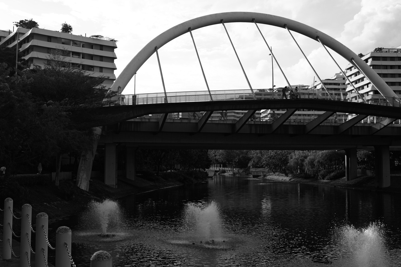
Why would a new town create a winding 4.2-kilometre waterway through the middle of its housing estates? A straight pedestrian route might have been easier to understand. A collection of separate parks might have provided greenery. And the surrounding reservoirs already existed as water resources. Yet Punggol’s planners chose a continuous water corridor linking two reservoirs and shaping the town around it.
The answer is that Punggol Waterway was designed to do more than carry water. HDB says the 4.2-kilometre man-made waterway connects Punggol Reservoir and Serangoon Reservoir, meandering through the residential heart of Punggol. Its creation helped support a new waterfront town identity, public walking and cycling corridors, housing design, ecological features and places where residents could experience water close to home.
The distinction is important. Punggol Reservoir and Serangoon Reservoir are water-storage infrastructure within Singapore’s catchment system. Punggol Waterway is a connecting water corridor running through the town. Punggol Waterway Park is the managed public park alongside much of that corridor. These are related features, but they are not three different names for the same place.
This article explains why Punggol Waterway connects two reservoirs instead of remaining an isolated park feature. It explores the physical connection, its effect on town planning, the role of the green corridor, the meaning of the park’s four themed zones and the practical safety responsibilities that come with a public water landscape. It is not an operational explanation of reservoir gates or a promise that every activity is permitted along the water.
The answer in 50 seconds
HDB’s refreshed Punggol masterplan introduced a 4.2-kilometre man-made waterway linking the impounded Sungei Punggol and Sungei Serangoon, now managed as freshwater reservoirs. HDB designed and built the waterway as part of the vision of a waterfront town with greenery, walking routes and homes close to the water.
The waterway opened in October 2011, after years of planning and construction. HDB’s historical records identify the water corridor as a defining feature of the town’s transformation. It is not merely an ornamental canal added after the surrounding buildings were finished.
NParks manages the adjacent Punggol Waterway Park, a 25.79-hectare park with four themed areas: Nature Cove, Recreation Zone, Heritage Zone and Green Gallery. These give different parts of the corridor their own public functions.
The big idea is that one continuous waterway can organise a town, joining different destinations and landscapes while making the reservoirs part of residents’ everyday experience.
Why the reservoir connection matters
Imagine two large waterbodies near different sides of a growing town. They are important independently, but the land between them might otherwise develop as ordinary housing streets and separate parks.
Creating a connecting water corridor changes the geometry of that land. The waterway establishes a recognisable line running through the development. Nearby buildings, bridges, paths and open spaces can be organised in relation to it.
HDB explains that the Punggol Waterway Corridor runs from Punggol Reservoir towards Serangoon Reservoir. This is a town-planning statement as well as a geographical one. The corridor creates a continuous reference point that residents can use to understand where different parts of the town sit.
The value is not simply that water can move between two endpoints. It is also that a once-less-connected stretch of land becomes an identifiable public landscape.
What a man-made waterway means
A man-made waterway is a water channel created or substantially formed through deliberate engineering rather than a purely untouched natural river.
HDB describes My Waterway@Punggol as Singapore’s first man-made waterway running through a residential town. It stretches 4.2 kilometres and was introduced as part of Punggol’s waterfront masterplan.
The phrase does not imply that the water within it is artificial or that the surrounding ecology is fake. The water is real, its movement depends on physical processes and its planted surroundings can support living organisms. What is engineered is the channel and its relationship to the town.
This is an important distinction for children. A constructed environment can still contain authentic natural processes. A reservoir can be created by engineering, and wildlife may still use its banks.
Why the channel meanders instead of acting like a ruler line
HDB describes the waterway as meandering through Punggol. A winding corridor can create varied waterfront edges, views, public spaces and places where routes meet the water.
A curved channel may offer planning flexibility, but it would be wrong to claim that every bend was included for one specific scientific reason without the design records. Engineers must consider land, hydrology, public access and construction constraints.
The important point is that a meandering corridor produces a different urban experience from a perfectly straight line. Different stretches can relate to different housing blocks, park zones and pedestrian crossings.
A student can see that geometry is not merely decoration. The shape of a large public feature influences how people move through and recognise the town.
Why this was not just a landscaping project
A small decorative pond might be added in front of an office for visual effect. Punggol Waterway operates at a different scale. At 4.2 kilometres, it is long enough to shape the organisation of much of the town.
HDB’s waterfront plan involved the reservoirs, waterway, housing along the banks, bridges and landscaped promenades. The scheme therefore combines infrastructure and urban design.
This is a meaningful difference. A neighbourhood can gain a new park without reorganising its housing plan. A continuous waterway corridor can influence the layout of roads, blocks and public spaces across multiple precincts.
For residents, this helps explain why the water appears in so many views and place names around Punggol rather than being a single destination at the edge of the town.
Why a waterway can become a town’s spine
Urban planners sometimes describe an important continuous feature as a spine. It is a structure around which other elements can be arranged.
A transport corridor may connect stations. A shopping street may link services. A waterway can become a green and blue spine, joining parks, housing, crossing points and recreation routes.
HDB’s Punggol Town Design Guide identifies the Waterway Corridor as one of several key town corridors, alongside the Heritage Trail and coastal promenade. These corridors help people navigate and form a sense of the town’s character.
A spine is not valuable merely because it looks impressive on a map. It becomes useful through the smaller paths and destinations connected to it.
Why continuity changes the visitor experience
Imagine three small landscaped ponds separated by roads and buildings. Each might be attractive, but a visitor would need to leave one area and travel separately to another.
Now imagine a continuous public water corridor. A person can follow the landscape through different parts of the town, choosing a short segment or a longer journey.
That continuity provides options for walking and cycling, subject to path rules. A family might enter near the town centre and enjoy a short stretch, while a longer-distance user may connect with park connectors and nearby destinations.
The result is not that everybody must complete the whole 4.2 kilometres. The network’s usefulness lies in its multiple entry points and the ability to choose a suitable route.
Why waterfront housing follows the corridor
HDB’s waterfront vision created opportunities for residential developments along the banks. Its official town information identifies projects such as Waterway Terraces and Waterway Ridges as part of the vision.
Locating homes near a public water landscape can give residents views, paths and recreational opportunities. But building near water also requires careful design for access, maintenance and environmental conditions.
The mere presence of a water view does not make every flat better for every household or guarantee a particular resale value. Residents still consider transport, schools, affordability, space and daily needs.
The planning mechanism is that a public corridor can shape how adjacent developments engage with the wider town. The water becomes part of the neighbourhood layout rather than only a distant landmark.
Why the bridges are essential
A continuous waterway is an attractive route but also a physical barrier. Homes on opposite sides need ways to connect. Bridges provide crossing points, allowing people and appropriate traffic to travel between the banks.
This means the value of the waterway depends partly on the bridges and paths designed alongside it. Without suitable crossings, a person may face long detours to reach a destination that looks close across the water.
NParks identifies several memorable bridges, including Jewel Bridge, Kelong Bridge and Sunrise Bridge. Their styles also contribute to the park’s identity and history.
The exact best crossing depends on the intended route, accessibility and current conditions. A bridge photograph alone cannot tell a family the fastest or safest complete journey.
Why Kelong Bridge refers to history
NParks describes Kelong Bridge as drawing inspiration from a kelong, a traditional offshore fishing platform built on wooden stilts. The form is a reminder of Punggol’s earlier coastal and fishing activities.
A modern bridge can therefore carry pedestrians while also communicating a historical idea. It has an infrastructure function and an interpretive function.
This does not make it an original historic fishing platform. The design refers to the past; it should not be confused with a preserved working kelong.
The lesson is that urban design can include cultural meaning without claiming that every historically inspired structure is an antique.
Why the park has four themed areas
NParks identifies Nature Cove, Recreation Zone, Heritage Zone and Green Gallery at Punggol Waterway Park. Each reflects a different type of public experience.
Nature-oriented areas direct attention towards planting and habitat. Recreation space supports suitable leisure activities. Heritage features help visitors recognise earlier Punggol history. A green gallery invites appreciation of the landscape and its visual character.
A family does not need to memorise the boundaries of every zone before visiting. The categories explain why one stretch may feel different from another, even though both belong to the same water corridor.
The broader planning lesson is that a long park does not need to offer an identical experience at every metre. Variety can make different stretches useful for different activities.
Why Nature Cove is different from a playground
A nature-themed area is intended to help people experience plants, water and habitats rather than concentrate only on play equipment.
That does not mean it is untouched wilderness or safe for visitors to enter every patch of vegetation. Managed landscapes can include deliberately planted species and areas that should remain undisturbed.
NParks’s information about Waterway Park identifies aquatic plants and birds as features of the wider environment. Families can observe responsibly from public paths without collecting plants or approaching wildlife.
The lesson is that recreation can include careful observation and quiet discovery, not only organised sport.
Why Recreation Zone is a different kind of space
A recreation-oriented area may support play, movement and public leisure, subject to the actual facilities and current rules.
Children may value playground activities; adults may enjoy walks or fitness. But suitability differs by age, weather and personal ability. The existence of a recreation zone does not make all activities permissible.
NParks’s park page lists rules, including the prohibition of fishing in Punggol Waterway Park. A family should follow those rules rather than assume that any waterbody in a public park is a free fishing or swimming venue.
The educational point is that a public park must balance multiple users and activities, not simply maximise excitement.
Why the Heritage Zone matters
The Waterway Park’s heritage features include a preserved old Punggol Road bus-stop shelter and a 160-metre stretch of old road. They remind visitors that the area had roads and settlements before the present waterfront town was built.
Kelong Bridge adds another historical reference. These features connect the modern waterway to earlier fishing, farming and transport activity.
A short preserved road segment is not the full history of Punggol, but it provides something tangible to investigate. Families can compare the surviving feature with archive material and official interpretation.
This shows how a town’s design can include memory as well as new amenities.
Why the Green Gallery is not simply an extra lawn
A green gallery emphasises the experience of landscape along the corridor. Planting, open views and suitable paths can allow people to observe the changing relationship between water, greenery and housing.
A gallery is usually a place where someone looks carefully at something. Here, the subject can be the living landscape rather than framed paintings.
The experience still depends on time, weather and access. A mature tree may cast useful shade, while an exposed section may be uncomfortable at midday. Not every stretch has identical seating or accessibility features.
The broader idea is that the town’s greenery can be appreciated as part of an everyday route instead of being confined to isolated garden beds.
Why aquatic plants belong beside an engineered waterway
NParks describes planting such as Red Thalia, Bulrush and Swamp Cabbage along Punggol Waterway Park. It explains that suitable aquatic plants can contribute to removal of certain pollutants from soil and water.
That does not mean every plant makes water safe to drink or that the waterway has no need for proper water-quality management. Biological processes can contribute to an environmental system but have limits.
Plants also provide visual interest and may support some organisms. Their placement must consider maintenance and the waterway’s design.
For a child, the useful question is why a particular plant can grow in wet conditions where an ordinary land plant might struggle. That connects environmental design with plant adaptation.
Why the waterway is not a drinking-water tap
The surrounding reservoir system contributes to Singapore’s water-supply strategy. However, a public waterway does not provide finished drinking water directly to visitors.
PUB’s local catchment water system collects raw water and sends suitable supplies to waterworks for treatment and quality control. Water seen from a park path should not be assumed safe to drink, wash food with or swim in.
This is an important distinction between water infrastructure and potable water. A reservoir can be part of a national water supply while still requiring treatment before consumption.
Children should never be asked to taste or collect waterway water for an unsupervised experiment.
Why a water connection still needs water management
Connecting two waterbodies through a designed corridor involves water levels, flow, quality and operational requirements. Those cannot be understood solely from a photograph of the canal.
PUB manages relevant reservoir and water infrastructure. Historical engineering information may explain the scheme, but live operations can differ with weather and other conditions.
A resident should not guess when gates are operated or claim a particular section is safe because the water looks calm. Technical systems have rules and operating limits.
This article concentrates on why the corridor exists and how it shapes the town. For details about gates, water levels and tides, use the separate technical guide and current official information.
Why connecting reservoirs is different from storing rain
The reservoir’s water-supply function concerns capturing and storing appropriate catchment water. The Waterway’s town-planning function includes linking the reservoirs and providing a continuous public corridor.
These jobs interact but are not identical. A waterway can move or connect water without itself performing every task of a waterworks. A reservoir can store raw water without being designed primarily as a public promenade.
Understanding the distinction helps prevent a vague explanation in which “water” is treated as one universal infrastructure type.
For students, the right question is to name the component and its role: storage, connection, treatment, drainage or recreation.
Why a corridor can support active mobility
A landscaped promenade beside water can provide a recognisable route for people walking, running or cycling where permitted. It may connect residential areas with other parts of town or with park connectors.
HDB’s planning material identifies the Waterway Corridor as a walkable and active-mobility feature. NParks identifies Punggol Waterway Park within the North Eastern Riverine Loop.
But public path design differs by segment. Some paths are shared, others are separated, and rules can change. A family should follow current signage rather than assume every waterfront path permits every mobility device.
The benefit is having another route option through the town, not permission to ignore speed limits or pedestrian priority.
Why walking along water can feel different from walking beside roads
A water-edge route may have different scenery, sound and visual openness from a busy road. Some visitors value that experience for recreation or a slower journey.
However, a waterfront path can also be exposed to sun, heat or rain. The closest route to the water is not always the most comfortable or accessible one for every person.
A good family choice compares the complete journey, including crossings, shade, rest points and current conditions.
The lesson is that route quality is more than distance. A corridor’s landscape character can influence whether people choose to use it, even when it is not the shortest route.
Why the waterway can support social spaces
A long corridor creates opportunities for people to pause, meet and enjoy public views. Seats, bridges and adjacent amenities can become familiar meeting points.
This does not guarantee that every bench is a good gathering place or that every public area can be reserved for an event. Different spaces have rules, capacities and practical conditions.
A town gains social value when its public spaces are useful without requiring people to make purchases or enrol in a programme. A family can share a simple walk along the waterway without treating the outing as a commercial attraction.
The value lies in regular, accessible public life as well as occasional special events.
Why flood and stormwater design still matters
A continuous waterway exists within a wider catchment and drainage system. Heavy rainfall can change runoff conditions, and engineers must manage the water environment within appropriate infrastructure limits.
HDB has documented rain gardens and bioswales in developments near the Waterway, such as Waterway Ridges. These features help handle some surface runoff at the source, complementing the wider network.
No individual rain garden or waterway can guarantee the absence of flooding during every extreme event. PUB’s flood resilience approach involves multiple measures.
Residents should keep to designated paths, follow alerts and avoid flooded or hazardous areas rather than assume a familiar waterfront route is always safe.
Why Punggol’s eco-town identity is connected with the Waterway
HDB selected Punggol for Singapore’s first Eco-Town development in 2010. Its sustainable-development approach incorporated environmental planning, public space and technologies tested in the growing town.
The Waterway was part of a larger transformation rather than the sole reason for the eco-town designation. Housing projects, greenery, transport, rainwater management and energy technologies all contributed to the planning story.
The corridor made a green-and-blue town identity visible to residents. People could encounter water, planting and paths during ordinary journeys, not only by travelling to a distant nature reserve.
This demonstrates how a sustainability strategy can influence the form of an entire neighbourhood rather than remain a hidden technical target.
Why waterfront development requires restraint
A popular water landscape attracts activity. But more visitors and construction also create pressures: noise, litter, possible disturbance of wildlife and demand for maintenance.
Good management has to protect the public environment while allowing appropriate enjoyment. NParks’s park rules, path guidance and maintenance arrangements help regulate uses.
People should not feed wildlife, enter planted areas to obtain photographs or discard litter in the water. Scenic surroundings do not make a public resource disposable.
This is a civic lesson: the shared attractiveness of a place depends partly on residents using it responsibly.
Why the 2011 opening date matters
HDB records the official opening of My Waterway@Punggol on 23 October 2011. It was a milestone in the realisation of the waterfront-town vision.
The date does not mean every surrounding housing block, bridge or future amenity opened at exactly the same time. Towns grow in phases, and different facilities are completed as development progresses.
An old article or photograph may show an earlier stage of the Waterway. That is not necessarily inaccurate; it represents the condition at the time.
Students learn an important historical principle here: the opening of a major corridor is not the completion of an entire town.
Why the Waterway and Waterway Park are not interchangeable
People use the terms casually, but they refer to different aspects of the place. The Waterway is the 4.2-kilometre connecting water corridor. Waterway Park is the adjoining managed recreational and green space, identified by NParks as 25.79 hectares.
A bridge spans the Waterway. A walking path may be inside the park or form part of a wider park-connector system. A housing block may face the water without being part of the park.
The distinction matters for enquiries and planning. Rules for a park activity differ from the operational responsibilities of the water infrastructure.
For a family, it helps to ask whether the goal concerns the waterbody, a specific park zone, a bridge or a path to another destination.
Why a park can be open while an activity is prohibited
NParks lists Punggol Waterway Park as open 24 hours. That does not mean every activity is allowed at every hour.
NParks specifically states that fishing is not allowed in the park. Other activities may be governed by path rules, safety notices and facility-specific restrictions.
The distinction is between general public access and permission for a particular use. A public place can be open to visitors while certain actions remain prohibited for safety, environmental or operational reasons.
This is a useful concept for children: access to shared space does not mean unrestricted use of everything within it.
Why birds and otters are not the primary purpose of the Waterway
Wildlife may use planted and aquatic habitats along the corridor. NParks describes several bird species that visitors might encounter, and otters have been observed in Punggol’s wider water landscape.
However, the waterway was planned as a multi-purpose town corridor, not as a wildlife enclosure. Its habitat value interacts with housing, recreation and water management.
A visitor should not assume a wildlife sighting is guaranteed or that a particular species will appear at the same bridge every day. Wildlife needs space and should not be approached for entertainment.
The educational benefit is noticing how animals may share a managed urban environment with people, not claiming the entire system was built solely for them.
Why the Waterway can make local history visible
NParks’s old-road bus-stop feature and the Kelong Bridge draw attention to earlier Punggol life. They create opportunities to compare the past with the present town.
A child might ask why a modern bridge resembles a fishing platform or why a fragment of old road remains inside the park. Such questions connect the landscape to history.
But an interpretive bridge is not a genuine historic kelong, and a preserved road fragment does not tell the full story of the settlement. Use National Heritage Board and NParks sources to add context.
The lesson is to distinguish physical heritage evidence from modern designs inspired by history.
Why the route should be considered door to door
Suppose a resident wants to reach a friend on the opposite bank. The waterway may provide a scenic path, but the actual route depends on the nearest safe bridge and the walking connections on both sides.
The person should compare the full route, not only the distance between two points across the water. A straight-line measurement can be misleading when a waterbody creates a barrier.
For a family with a stroller or a person using a mobility aid, accessible bridge approaches and other connections may be essential. A waterway view does not guarantee a step-free journey.
This shows how a planning feature can simultaneously create an attractive route and a need for carefully placed crossings.
Three worked family examples
Example one: a child asks where the Waterway ends
A parent opens an official HDB town map and helps the child identify Punggol Reservoir and Serangoon Reservoir. They then trace the Waterway between them.
The child notices that the waterway is a connector, while the reservoirs are larger water-storage features. The family discusses why the town grew around the connecting corridor.
The lesson is to distinguish a linked system from its individual components.
Example two: a family chooses a short park visit
A household wants a gentle outing rather than a complete 4.2-kilometre walk. It identifies a suitable entrance, bridge, rest area and return route.
The family checks current NParks information, weather and accessibility. It does not assume that completing every themed zone is necessary.
The lesson is that a long public corridor offers choices; success is not measured by walking its entire length.
Example three: two photographs show different uses of water
One image shows a planted water-edge landscape, and another shows the reservoir with public infrastructure. A student says both are “just a park.”
The teacher asks what each feature actually does. The student learns to separate water storage, waterway connection, landscaped recreation and treatment-related features.
The lesson is that similar-looking water scenes can perform different functions.
A mathematical model of a connecting corridor
Draw two circles labelled Reservoir A and Reservoir B. Place a curved 4.2-kilometre line between them. Add five housing clusters and three bridges at fictional positions.
Ask which cluster can reach each side of the corridor conveniently. Then remove one bridge in the hypothetical model and examine how some routes change.
This is a simple graph-theory lesson. The reservoirs are important nodes in the water system, while pedestrian bridges are links across the corridor in the human movement system.
The exercise uses invented positions for teaching. It does not reproduce actual distances or bridge locations in Punggol.
What students should know about water quality
Water in the Waterway may look clear after a sunny day. That appearance is not a complete water-quality test.
Dissolved substances and microorganisms cannot necessarily be detected by sight. Professional monitoring uses defined parameters and methods suited to the water system’s purpose.
A student should learn to distinguish observation from inference. “The water looked clear” is a valid observation. “The water is safe to drink” is an unsupported inference.
This is particularly important because the connected reservoirs contribute to a water-supply system that includes professional treatment and quality control.
What the Waterway teaches about integrated planning
A transport planner may focus on paths and crossings. A water engineer may focus on levels and hydraulic connections. A landscape architect may focus on public spaces and planting. A historian may value heritage references.
Punggol Waterway brings those viewpoints together. No single discipline fully explains why it is useful.
That is the deeper meaning of integrated planning. One major corridor can provide several coordinated services while requiring trade-offs and ongoing management.
The project also demonstrates why a good outcome cannot be inferred from a single attractive feature. The waterway’s value comes from the complete arrangement of infrastructure, housing and public life.
Common misunderstandings
One mistake is saying Punggol Waterway and Punggol Reservoir are the same place. Another is describing the Waterway as purely decorative or as a complete drinking-water treatment plant.
A third is assuming all public waterfront paths permit fishing or swimming. A fourth is believing that every view along the corridor is equally shaded or accessible.
Another error is treating the park’s four themed areas as four separate independent parks. They belong to one connected park environment.
Finally, do not infer live water-level or gate operations from a static landscape article. Those require current technical information.
Frequently asked questions
How long is Punggol Waterway?
HDB says it is a 4.2-kilometre man-made waterway running through Punggol town.
Which reservoirs does it connect?
HDB identifies Punggol Reservoir and Serangoon Reservoir.
When did it open?
HDB’s historical documentation identifies 23 October 2011 as the official opening date.
Who designed and built it?
HDB describes My Waterway@Punggol as a waterway designed and built as part of the town’s waterfront transformation.
Is Punggol Waterway Park the same thing?
No. The park is the managed public landscape alongside the waterway, with its own facilities and rules.
What are the four themed areas?
NParks lists Nature Cove, Recreation Zone, Heritage Zone and Green Gallery.
Why are there several bridges?
They allow people to move between the two banks and provide crossings within the larger pedestrian and road network.
Is the waterway water drinkable?
Do not assume so. The wider reservoir system handles raw water that requires appropriate treatment and monitoring before distribution.
Is fishing allowed in Punggol Waterway Park?
NParks says fishing is not permitted in the park. Follow current rules at each specific location.
Do residents need to complete the whole route?
No. A suitable short segment is a perfectly valid outing.
A practical Punggol Waterway checklist
- Identify whether you want the Waterway, Waterway Park or one of the two reservoirs.
- Use HDB and NParks maps for the actual route and park features.
- Choose a realistic segment based on time and ability.
- Check safe bridge approaches and accessibility.
- Follow cycling and pedestrian path rules.
- Avoid unsafe water edges and restricted infrastructure.
- Do not fish or assume swimming is permitted in the park.
- Keep litter out of drains and waterbodies.
- Observe wildlife from a respectful distance.
- Recheck weather and current notices before a longer outing.
- Use authoritative evidence for technical water-quality claims.
Teaching Guide: two reservoirs, one town corridor
Learning goal. Students should explain why a continuous waterway can shape a town and distinguish its function from the reservoirs, parks and bridges around it.
Activity one: identify the endpoints. Draw two circles for the reservoirs and a connecting line for the Waterway. Ask what each component does.
Activity two: add housing. Place fictional housing clusters near the corridor. Ask how a waterfront spine can influence views, public access and the relationship between precincts.
Activity three: add bridges. Put crossing points at different positions. Ask how they affect the distances people must walk between opposite banks.
Activity four: add four park functions. Assign one part of the corridor to nature, one to recreation, one to heritage and one to landscape appreciation. Discuss why variety may be useful within a long public space.
Activity five: introduce water safety. A child suggests collecting water from the canal to drink. Ask why that is unsafe and what must happen before raw water can become safe tap water.
Activity six: compare planning disciplines. Give students the roles of engineer, landscape designer, transport planner and historian. Ask what each would need to consider.
Activity seven: test evidence. Show the statement “Punggol Waterway opened in October 2011” and a photograph taken several years later. Ask why the photo does not prove the date, even though both sources are useful.
Transfer test. Present another imaginary town with a river corridor. Ask what changes if planners add continuous public paths and crossings rather than isolated parks.
Parent checkpoint. A good answer is: “Punggol Waterway joins two reservoirs and also joins different parts of the town. The water, park, bridges and homes are connected but do different jobs.”
How this article fits the existing Punggol library
The Why Punggol article on reservoirs storing rainwater explains the water-supply function. Why Bridges Matter for Walking Across the Waterway explains pedestrian crossing geometry. The Punggol Waterway Park, Jewel Bridge, Kelong Bridge and Sunrise Bridge article describes the individual park features.
This explanation asks a different question: why does the town have a continuous man-made channel connecting the two reservoirs, and what did that connection make possible? It is about the corridor’s organising role rather than a reservoir primer or walking itinerary.
Official sources and further reading
- HDB: Punggol Town and the 4.2-kilometre Waterway
- HDB: Town Design Guide and the Waterway Corridor
- HDB: Waterway Design, Sustainability and Heritage Explorer Trail
- NParks: Punggol Waterway Park
- NParks: Waterway Park Nature Walk
- eduKatePunggol: Why Reservoirs Store Rainwater
The one idea to remember
Punggol Waterway is both a physical connection between two reservoirs and a public corridor that shapes the town. Its banks organise housing, parks, bridges and daily routes. The important achievement is not only placing water beside homes, but making the waterway a continuous part of how Punggol works.


