
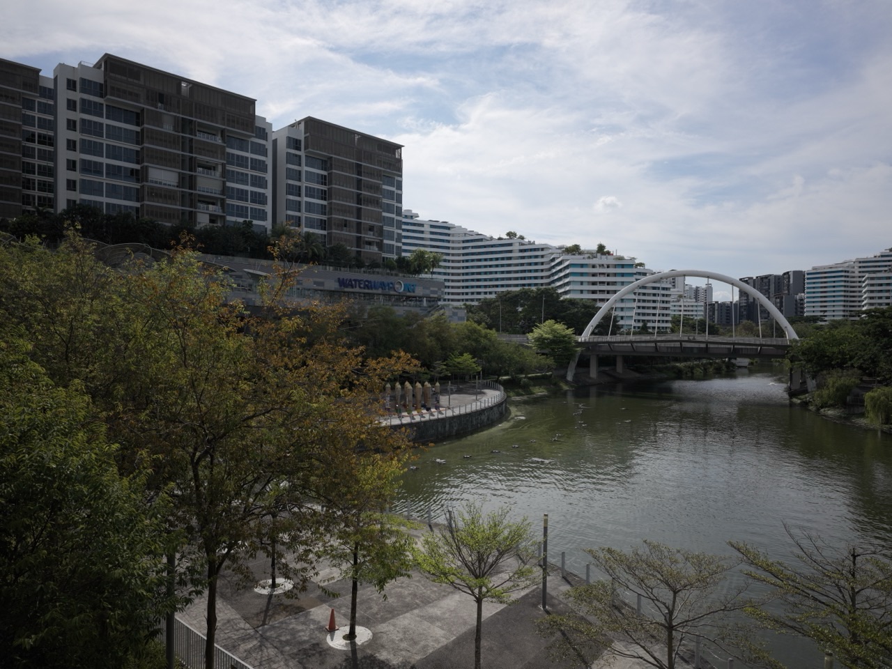
Why do several bridges cross Punggol Waterway when a person could simply walk along the bank? The answer explains more about Punggol than a photograph of a beautiful bridge ever could. A bridge changes which homes, schools, shops and recreational spaces belong to a convenient walking journey. It is a small-looking piece of infrastructure with a surprisingly large effect on daily life.
If you live in Punggol, you may know the feeling. A destination appears almost directly opposite you, but the water lies between. The difference between being able to cross now and having to continue to another crossing can decide whether you walk, cycle, use public transport or postpone the errand. Punggol’s bridges are therefore useful lessons in how a waterfront town works.
This guide explains why Punggol Waterway has multiple crossings, what they do for families, how to choose an appropriate route and how children can use the bridges to understand maps, distance and town planning. It does not replace the existing park-route guides or the detailed history of the Waterway. Its particular question is simple: why does a crossing change the usefulness of the entire neighbourhood?
The answer in 50 seconds
Punggol Waterway is a planned, approximately 4.2-kilometre water corridor connecting the town’s reservoir landscapes. The Housing & Development Board describes it as central to Punggol’s waterfront-town vision. NParks describes an 8.4-kilometre park-connector route along both sides, with opportunities for walking, running and cycling.
A path on each bank creates enjoyable space. Crossings make those banks work together. A well-placed bridge can shorten everyday journeys, connect destinations, provide alternative ways home and make the Waterway feel like a shared town centre rather than a dividing line. Some crossings also become recognizable landmarks, but their practical value is bigger than their appearance.
The useful question is not ‘Which bridge is prettiest?’ It is ‘Which crossing gets this person safely from where they are to where they need to be?’
First understand the shape of the problem
Imagine drawing a long blue line across a piece of paper. Put homes, a school, a supermarket, a park and an LRT stop on the two sides. Now draw walking paths beside the line, but no bridge across it.
Everyone can travel parallel to the water. Yet two destinations that look close in a straight line may be far apart by an actual walking route. A parent may see the other bank from a window and still need a substantial detour to reach it. A wheelchair user may have fewer suitable alternatives than a fit adult willing to take stairs. A child travelling with an adult needs a predictable, legible route rather than the shortest line on a map.
Add one bridge and the network changes. Add a second crossing farther along the corridor and more journeys become practical. What matters is not the raw number of bridges alone. Their positions in relation to people’s daily origins and destinations determine their value.
This is why water and movement must be planned together. A landscaped corridor can be delightful as scenery while still being inconvenient if its crossing points are poorly distributed. The town becomes more useful when paths along water and paths across it form one connected system.
Why Punggol Waterway creates a special design challenge
Punggol did not simply inherit a natural river unchanged. HDB explains that its modern waterfront vision involved damming Sungei Punggol and Sungei Serangoon, creating reservoirs and introducing a man-made waterway through the town. This change brought a long, visible water feature through the residential landscape.
That decision produced several benefits. More residents could experience water near home. Landscaped edges created space for recreation. Housing and public places gained a shared visual identity. The Waterway could become a familiar route rather than an occasional destination.
But every linear feature also introduces an organising problem. A railway, expressway, valley or waterway can connect places along its length while separating the places directly opposite one another. Its crossings determine where people move from one side to the other.
In a carefully planned waterfront town, a bridge is not an afterthought fitted into a photograph. It is part of the original question of how residents will actually use the town. That does not mean every bridge performs the same job. Some are especially useful for particular walking routes, while others help connect recreational spaces or make the corridor easier to navigate.
A bridge solves two different problems
The first problem is physical access. Can someone get across the water without going a long way around? The second problem is mental access. Does that person understand where the crossing is, which path reaches it and whether the route beyond it continues to the intended destination?
Both matter. A beautifully accessible bridge may be underused by someone who cannot find a clear approach to it. A crossing may appear convenient on a small-scale map but feel confusing where several paths, landscaped levels and road crossings meet. Direction signs, visibility, lighting, nearby landmarks and the condition of connecting paths all influence the experience.
For young children, the mental problem often comes before the physical one. They may recognize a familiar bridge by its distinctive shape, but not understand how it relates to a destination beyond the bend. Adults can teach this gently: look at the starting bank, identify the intended bank, find a suitable crossing and then trace the continuation.
A good route is a sequence of correct choices, not a single decision to ‘go towards the bridge’.
Why the nearest bridge is not always the right bridge
The simplest route rule is ‘cross at the closest bridge’. It is not always correct. The shortest approach to one crossing may lead away from the final destination. Another bridge slightly farther along the bank may line up with a more direct continuation, an accessible path, a sheltered section or a place where someone can rest.
Consider an example using invented distances, not measurements of an actual Punggol route. A walker travels 300 metres to Bridge A, crosses, then walks 900 metres to a shop. Another crossing, Bridge B, is 600 metres away on the original bank but leaves only 250 metres on the opposite bank. Ignoring the crossing lengths for a moment, the route via A is 1,200 metres and the route via B is 850 metres. The bridge that initially seemed farther away can produce the shorter journey.
The everyday lesson is to consider the whole route. Do not judge convenience from the distance to the bridge alone. Check where you come out, how you proceed and whether the path suits the traveller.
This matters especially when moving with small children, an older relative or somebody using a wheelchair or mobility aid. Suitability, safety, lifts where needed, gradient and rest opportunities matter more than winning an imaginary race.
Seven everyday journeys, seven reasons to care
Think of seven different people crossing the same waterway. A student wants to reach school without arriving exhausted. A parent pushes a stroller toward a nearby facility. An older resident walks slowly and needs predictable places to rest. A cyclist travels through the area rather than making a recreational loop. A wheelchair user needs a continuous accessible route. A visitor is navigating from an MRT or LRT station for the first time. A runner wants a loop that does not require retracing every step.
Their destinations and preferences differ. The crossing that feels most convenient to one person may not suit another. In each case, the bridge is part of a longer journey, and its value depends on what comes before and after it.
This is why an urban designer should not ask only whether a bridge has been built. The more revealing questions are who can use it, where its approaches lead, how people find it and how it behaves during ordinary busy periods.
For residents, this is also a useful way to assess claims about neighbourhood convenience. A place may have many attractive amenities on a map, but the quality of connections determines how readily those amenities become part of daily life.
The difference between a scenic path and a useful network
NParks describes the Punggol Waterway Park Connector as an 8.4-kilometre track along the promenade at both sides of the Waterway. It is a place to walk, jog, cycle and observe the environment. Yet an enjoyable corridor is not automatically an efficient everyday transport network.
A scenic path is often evaluated by the experience it provides along the way: greenery, views, seating, air movement, access to the water and the pleasure of passing through. A useful transport network is also evaluated by whether it reaches important destinations, how direct its routes are and whether the journey works repeatedly, in different weather and at different times.
Punggol’s waterway paths can serve both purposes. Crossings help turn parallel promenades into loops and connections. That increases the choices available to residents, whether they want exercise or an ordinary practical trip.
The distinction is especially useful for parents. A pleasant weekend walk is not necessarily the best route for a child going to class on a weekday. Weekday routing adds the constraint of arrival time. Weekend recreation can favour discovery and longer detours. There is no contradiction: the same infrastructure supports different uses.
Why bridges can make an area feel smaller
A neighbourhood’s size is not only its land area. People also experience distance through the time, effort and difficulty required to reach useful places. A connected district can feel compact even when individual streets and paths are fairly long. A poorly connected district can feel fragmented when destinations visible across water require inconvenient detours.
A bridge reduces what planners sometimes call the cost of separation. The cost can be literal, such as transport fare, but for walkers it is often measured in minutes, exertion, uncertainty and comfort. Lowering that cost gives residents more realistic choices.
Suppose two small public spaces face one another across the Waterway. Without a crossing nearby, each may function mainly for people on its own bank. With a convenient crossing, users can move between them during the same outing. A child can visit one place, then another; a parent can combine errands; a jogger can form a loop.
More connections are not automatically better in every situation. Bridges require maintenance, suitable approaches and attention to their environment. The right planning question is where a crossing provides enough public value to justify its construction and upkeep.
What bridge design can tell a child about engineering
Children often notice the shape first. One bridge looks different from another. That curiosity is a good opening for engineering questions, provided we do not guess at a specific bridge’s structural type or material from a photograph alone.
Ask the child what loads a bridge must accommodate. People walk across it. Some may push strollers or use wheelchairs. The bridge itself has weight. Rain and wind affect the structure and its surfaces. The approach has to meet the paths at each end. Drainage must keep surfaces usable. Railings help define safe edges.
Then ask what the design needs to balance. A bridge should be strong enough for its intended use and should fit the surroundings. It needs safe approaches and inspection access. A crossing built solely to look striking could fail its everyday purpose if people cannot move easily onto and off it.
This is a useful introduction to the idea of constraints. Real engineering is not simply making the strongest possible thing or the most attractive possible thing. It is designing something that meets several requirements together, reliably and within available resources.
The names make the route easier to remember
NParks identifies recognizable crossings at Punggol Waterway Park, including Jewel Bridge, Wave Bridge, Sunrise Bridge and Kelong Bridge. Their names can help people remember distinct points along the corridor.
A name is more than a decorative label. In an unfamiliar landscape, a clear landmark reduces the number of decisions a person must hold in memory. Rather than saying ‘turn at the third bridge after the bend’, a family can refer to a named crossing once they have verified where it is on their route.
That said, do not substitute memory for directions when a journey matters. Names are useful orientation cues, but the intended route may change with access arrangements, works or the exact location of the destination. Check current route information and site signage when travelling, especially if accessibility is important.
A practical exercise for children is to match a bridge name to a location on a simple route sketch. They should then explain what the crossing connects. The answer ‘a bridge goes across water’ is true but incomplete. The more useful answer names the two route segments that become connected.
A simple way to compare two possible routes
Make a four-column comparison on paper. In the first column, write the crossing considered. In the second, write the expected route distance from starting point to destination. In the third, record practical constraints such as shade, stairs, gradient, busy intersections or rest stops. In the fourth, write the reason for choosing or rejecting the route.
Do not try to invent exact times from distance alone. A person walking with a child may take longer than the same person walking alone. Waiting at signals, photographs, rest breaks, path conditions and weather can all change the result. A navigation estimate is a starting point, not a promise.
For a school activity, children can compare two hypothetical routes using a simple scale. Draw each path as connected segments, add the lengths and explain which route is shorter. Then introduce a new constraint: one route has stairs, while the traveller needs a step-free path. The shortest mathematical path may now be unsuitable. What happens to the answer?
This is a powerful lesson in applied reasoning. Numbers matter, but the correct decision depends on the actual problem being solved.
Safety near water is a separate decision
A convenient crossing is not an invitation to approach the water’s edge carelessly. Singapore’s landscaped urban waterways remain managed environments. They may look calm, but water safety and weather conditions are independent of whether a path is pleasant or a bridge is accessible.
Stay on designated paths, observe barriers and signs, and supervise children appropriately. Do not climb railings for photographs or attempt to shorten a walk through undesignated edges. If lightning or a thunderstorm is approaching, move to proper shelter rather than lingering in exposed waterside areas.
A child may confuse ‘I can see a safe bridge’ with ‘everything near this bridge is safe’. Explain the difference. The crossing provides a designed route over the water; it does not change the hazards at the bank or make the surrounding water suitable for swimming.
For detailed waterway management and safety questions, the existing eduKatePunggol waterway guide offers a fuller account. This article focuses on the purpose of bridges and how to make good route choices.
Why different people notice different problems
A student may notice that the route is direct but exposed to afternoon sun. A person using a mobility aid may notice the slope or condition of the approach first. A cyclist may worry about predictability around pedestrians. A parent supervising toddlers may notice stopping places and railings. A first-time visitor may care most about signs.
None of these observations makes the others irrelevant. They describe different parts of the same experience. Good public-space evaluation tries to hear them together.
For families, one helpful habit is to let a child explain the route from another person’s point of view. ‘What would change if Grandma came with us?’ ‘What if we were pushing a stroller?’ ‘What if it rained on the way?’ The exercise builds empathy without turning accessibility into an abstract slogan.
The family can then check one claim in real life. A path appearing flat in a photograph does not guarantee that every connecting segment is accessible. A shaded part of a route at 8am may be exposed at another time. Checking beats assuming.
Can bridges reduce pressure on roads?
A well-connected walking network may make some short trips more attractive on foot, and it may support journeys to public transport. But it would be misleading to claim that a particular Punggol bridge has reduced car traffic by a specific amount without traffic counts or a credible evaluation.
The sound argument is conditional. If a crossing makes a destination meaningfully easier to reach, and if other parts of the journey are safe and comfortable, more people may find walking practical for that trip. Whether they actually change their travel behaviour depends on destination, weather, schedules, personal needs and available alternatives.
This is one reason planners connect stations, bus stops, housing, parks and commercial uses rather than treating every element separately. A bridge’s impact extends beyond the structure itself because it can change how people reach all the other pieces.
For residents, the important question is concrete. Which trips can you now accomplish conveniently without a vehicle? If a journey still requires a long detour, a difficult crossing or an exposed segment, what would make it more practical?
Where this explanation belongs in the Punggol library
Punggol already has dedicated guides on its waterfront history, reservoir functions and park activities. Those articles answer different questions. The history guide explains how the planning vision evolved. The technical waterway guide explains the larger water and town system. Activity guides help people choose things to do.
This article owns a smaller but important question: why do crossings matter in the everyday geometry of a residential town?
Keeping that distinction is useful to a reader. You do not need a full history of Punggol to choose a bridge on your next walk. You do need to understand that a crossing’s value comes from the entire route, not just the visible structure.
For deeper background, read How Punggol Waterway Works and How Punggol Became a Waterfront Town. For water management and safety questions, see Understanding Punggol Waterway.
Three worked examples for families and students
Example one: the supermarket across the water
A family sees a supermarket on the other bank. On their sketch, crossing A is closer to the starting point, but crossing B is nearer the shop. They measure the full route via each crossing. Route A measures 1.6 kilometres; Route B measures 1.2 kilometres. Both are invented examples, not measured Punggol walking directions.
Route B is 400 metres shorter. At a hypothetical walking speed of 4 kilometres per hour, that difference would equal six minutes of uninterrupted walking. Real travel times will vary. The child should state the calculation and its assumptions, not report it as an exact journey time.
Now add a toddler in a stroller. Route B has an inaccessible segment on the hypothetical map. The correct route is no longer simply the shorter one. Choose a continuous suitable path, or reconsider the trip. That is the difference between solving an arithmetic problem and solving a real-world movement problem.
Example two: making an afternoon exercise loop
Two friends plan an evening walk along one bank and a return along the opposite bank. They need crossing points at the ends of the intended loop. If their route is too long, they can shorten it by choosing a closer suitable crossing, rather than walking to the far end and retracing the same bank.
They also need to check whether the selected route is open, suitable for their fitness and practical in the day’s weather. The fact that NParks lists an 8.4-kilometre park-connector track does not mean every person should attempt the entire length.
For a younger child, the learning task can be to draw a loop on paper and explain why two crossings permit a circular route. For an older student, the task can include comparing route lengths and making a reasoned choice from constraints.
Example three: explaining directions to a visitor
A visitor asks how to reach a public facility after arriving by rail. A helpful explanation should identify the correct station exit or approach, where the path begins, which crossing to use if needed and what landmark confirms the route afterward.
‘Just cross the bridge’ is insufficient if several crossings exist. The resident should ask for the exact destination and check an up-to-date map or official sign where necessary.
The child listening to this exchange learns that good communication includes enough information for another person to act. The most useful directions are those the visitor can follow without needing to guess what the speaker meant.
Frequently asked questions
Why does Punggol Waterway need more than one bridge?
Because different homes, facilities and paths lie along a long corridor. Multiple crossing opportunities can connect different pairs of routes and shorten different journeys. The usefulness of each depends on where it joins the wider network.
Are the bridges mainly tourist attractions?
No. They can be recognizable and pleasant to visit, but crossings also support everyday walking, route choices, access between banks and recreational loops. A bridge’s appearance is only one part of its function.
Is the Punggol Waterway a natural river?
HDB describes it as a man-made waterway introduced as part of the town’s waterfront plan and linked to the reservoir landscape. Do not confuse it with an untouched natural river.
What is the difference between the 4.2-kilometre waterway and the 8.4-kilometre park connector?
HDB gives the waterway length as approximately 4.2 kilometres. NParks describes an 8.4-kilometre track along the promenade at both sides. Those figures refer to different things, so they should not be presented as competing measurements of the same route.
Which is the best bridge for children?
The one whose entire approach, crossing and continuation suit the child’s age, supervision, weather and destination. A bridge’s recognizable name is not enough to establish that a particular route is appropriate.
Can I assume a bridge is wheelchair accessible?
No. The full journey matters, including gradients, connecting paths and any temporary works. NParks identifies the Punggol Waterway park connector as wheelchair friendly, but a specific end-to-end trip should still be checked.
Should I cycle across every pedestrian bridge?
Follow the signs and applicable path rules at the actual location. Slow down around pedestrians and dismount where required. The presence of a bridge does not give cyclists priority over people walking.
Can a bridge increase the value of public spaces?
It can make spaces easier to reach and combine in one trip. That is a planning mechanism, not proof of a measurable property-price effect. Price claims would require separate evidence.
How can a family learn about bridges without a long outing?
Look at a map, choose a short route and compare two hypothetical crossings. If an outing is appropriate, observe one crossing from designated public paths. The central learning task is to connect paths and destinations, not to cover every bridge in a day.
Where should I check current routes?
Use current official NParks park and park-connector pages, on-site signage and reliable journey planning. The site may change temporarily due to maintenance, weather or works.
A practical Punggol route-check checklist
- Name the exact destination, not just the general neighbourhood.
- Mark the start and destination on opposite or same sides of the Waterway.
- Compare the entire routes, including what happens after crossing.
- Check accessibility, stairs, gradients, surfaces and rest options for the people travelling.
- Check current signage, closures and local weather where relevant.
- For children, explain water safety and supervision before beginning.
- For cyclists, allow for shared-space etiquette and posted rules.
- Choose a route because it fits the journey, not because it looks shortest in a photograph.
Teaching Guide: use a Punggol bridge to explain networks
Learning aim. A learner should understand that two places can be geographically close but far apart along a usable path, and that adding a crossing changes the network of possible journeys. This is a Geography, Mathematics and civic-design lesson, not an instruction to make an unsupervised site visit.
Materials. Use paper, coloured pencils and either a simple fictional map or a publicly available map of part of Punggol. Begin with fictional distances so the child can focus on reasoning rather than the accuracy of a live route.
Teach. Draw a blue waterway. Draw paths and four destinations on each bank. Ask the learner to trace a journey before a bridge is added. Then add a crossing and compare. Repeat with a second crossing. Ask not just ‘What became shorter?’ but ‘For whom did it become shorter?’
Practise. Give two complete routes measured in invented metres. Have the child add the segments correctly, state the shorter route and explain what information is missing. Then introduce one constraint, such as the need for a step-free path, and invite a new answer.
Check transfer. Present a different scenario involving a road or railway instead of water. Ask why an underpass, crossing or bridge could change the usefulness of nearby facilities. If the learner applies the same principle without being prompted, the underlying idea has transferred.
Answer principle. The correct conclusion is not ‘the shortest line always wins’. It is ‘choose a continuous, safe, suitable route that connects the real starting point to the real destination’. The learner should distinguish known measurements from assumptions and estimates.
For parents. Keep the task conversational. Ask what the child noticed. A good response may be only two or three sentences. Do not turn a relaxed family walk into a test. The objective is to see the town more clearly.
A five-minute neighbourhood investigation. A bridge lesson can become an exercise in ordinary decision-making without requiring anyone to travel far. Start by asking the child to choose a familiar destination on a map of Punggol. The child should identify whether the destination is on the same side of the Waterway, where a crossing would be necessary, and which connecting paths would complete the trip. Next, ask the child to draw an alternative that uses a different crossing. What changes: total walking distance, the number of turns, access to public transport, or the suitability of the route for a person with limited mobility? In a second round, remove one crossing from the fictional map. The learner should describe which journeys become less convenient and which remain unaffected. This reveals an important distinction: a network can lose one link without every journey becoming impossible, but some journeys may require much longer detours. Now introduce a practical constraint such as a temporarily closed path or a family member needing a step-free connection. The answer may change again. These exercises are deliberately hypothetical; they do not certify live accessibility or closures in Punggol. For a real journey, check current signage and route information. The most revealing final question is: what new information would make you revise your chosen route? A learner who can answer that has understood a bridge as more than an object to photograph. They have learned to make a decision, explain its assumptions and update it when conditions change.
Official sources and further reading
- HDB: Punggol town history and waterfront planning
- NParks: Punggol Waterway Park Connector
- NParks: Nature walk at Punggol Waterway Park
- eduKatePunggol: How Punggol Waterway Works
- eduKatePunggol: Complete Contents and Learning Routes
The one idea to remember
A bridge is not simply an object over water. It is a decision about connection. Punggol’s Waterway is beautiful partly because it is public landscape, but it works as a neighbourhood when residents can use its crossings to reach meaningful places on both banks. Once you begin seeing bridges as links in a network, the town becomes easier to understand—and easier to navigate.


