
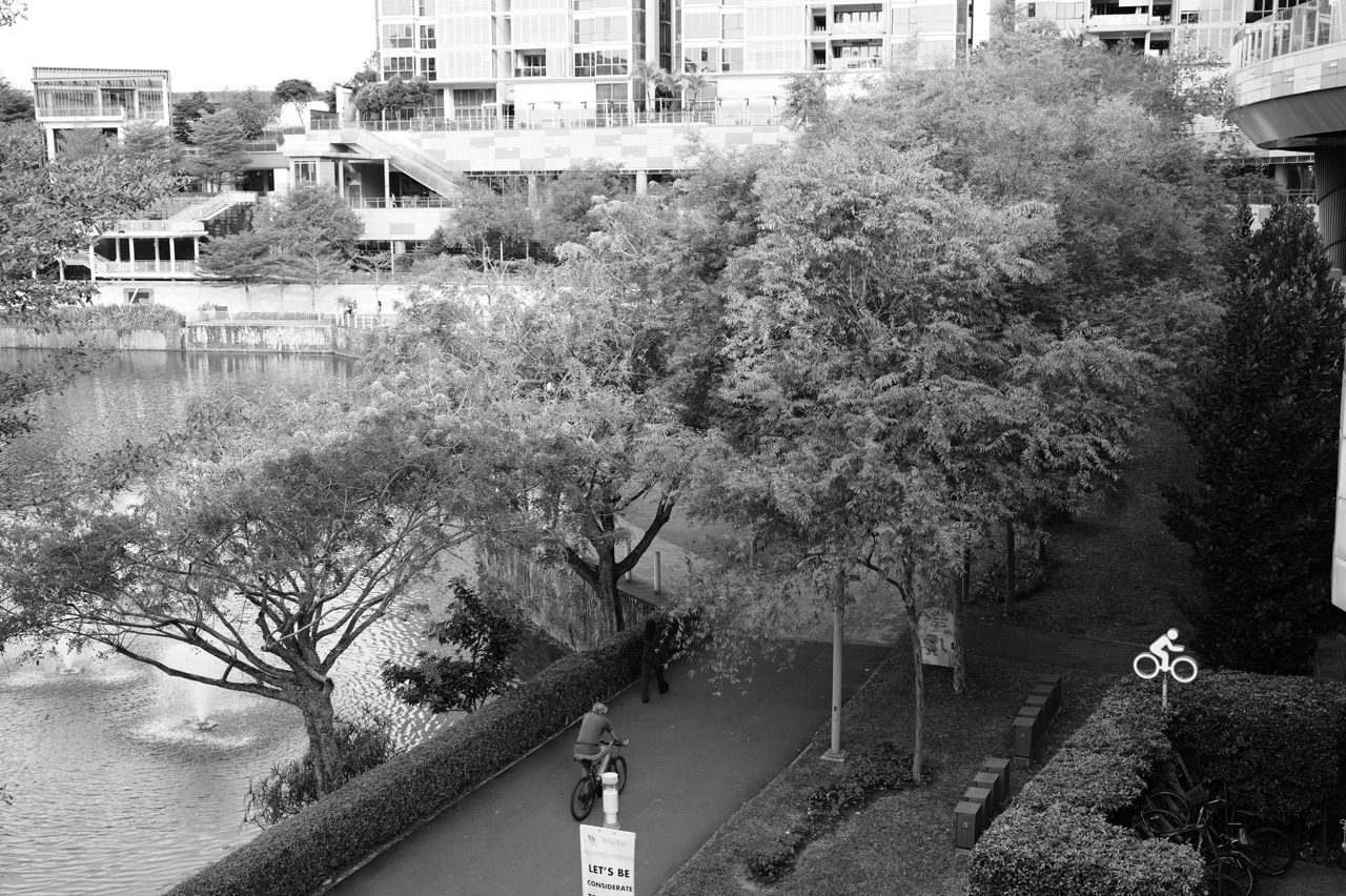
What should Punggol residents expect from Punggol Waterway Park in 2027? Jewel Bridge, Kelong Bridge, Sunrise Bridge, the themed park zones and a therapeutic garden already exist. NParks lists the park as generally open 24 hours, while particular paths and features can still be affected by maintenance or safety notices. This is an existing public asset, not a new 2027 park announcement.
The Punggol Waterway nature walk is approximately 4.2 kilometres, while the park connector covering both banks is about 8.4 kilometres. The distinctive bridges make it possible to plan shorter outings between homes, green areas and the town centre. Understanding these choices is more helpful than claiming every resident must walk the whole route.
This 2027 Punggol neighbourhood guide explains what is already there, the bridges’ history and design, the four park areas, official no-fishing rules, accessibility and how families can verify genuine future changes.

Punggol Waterway Park 2027: at a glance
| Location or feature | What is established for 2027 |
|---|---|
| Already operating | Punggol Waterway Park with four thematic zones and existing bridges. |
| Named bridges | Jewel Bridge, Kelong Bridge, Sunrise Bridge, Wave Bridge and other park crossings. |
| Walking distances | 4.2 km nature-walk route; separate 8.4 km park connector spanning the two banks. |
| Existing therapeutic garden | 900 sqm near Carpark A, opened in 2020, with programme access subject to actual arrangements. |
| What to verify in 2027 | Current path maintenance, bridge access, weather safety and park notices; no invented grand opening. |
Checked against current NParks resources on 27 October 2026. Published hours do not override temporary closures, and photography does not establish a site’s operating condition on a later visit.
Why the bridges give Punggol a distinctive identity
Did you know that the bridges of Punggol Waterway Park are not simply different versions of the same crossing? NParks names Jewel Bridge, Kelong Bridge and Sunrise Bridge, and its nature-walk guide also identifies Wave Bridge. Their shapes and locations connect different parts of the waterway while giving the town a series of recognisable landmarks.
The 2027 question is not when these bridges will first open. They are already part of the existing park system. Residents instead need to know which bridge connects their actual destinations, whether its approaching paths are accessible, and what temporary signs or weather conditions might affect a journey.
Bridges also teach children that urban infrastructure has two jobs. It can move people efficiently, and it can express an idea about place. Punggol’s fishing-village history appears in the kelong-inspired bridge, while more sculptural forms create distinct landmarks that people recognise in a long green corridor.
What is open now in Punggol Waterway Park?
NParks describes Punggol Waterway Park along Sentul Crescent as a 25.79-hectare park with four thematic areas—Nature Cove, Recreation Zone, Heritage Zone and Green Gallery. Its general opening hours are 24 hours. The park is described as wheelchair accessible and elderly-friendly.
Those park-level descriptions do not certify the access to every bridge or play feature on a specific 2027 day. Paths can be affected by maintenance, works, storm damage or temporary closures. Current signs take priority over a map or an older photograph.
NParks expressly prohibits fishing in the park. The presence of a bridge that resembles a historic fishing platform does not override the park rules. Always check the managed site’s actual permitted activities before planning an outing.
Jewel Bridge is a real landmark, not a promised 2027 construction
NParks explains that Jewel Bridge takes its name from its dome-shaped design. It can provide a viewpoint for sunset and, when conditions allow, observation of birds or otters. Neither a sunset nor an animal sighting is guaranteed for a particular visit.
Residents choosing a walking route can use the bridge as an agreed meeting or turning point. Specify which bank or approach because a bridge connects two sides. Avoid blocking accessible circulation or stopping in the path of cyclists.
Children can compare the visible structure with the practical task of spanning water. The lesson is not to calculate advanced engineering forces without evidence, but to see how the design creates a recognisable form while serving pedestrians.
Kelong Bridge preserves an idea from the fishing era
Kelong Bridge was designed to recall a kelong, a traditional fishing platform on stilts. This makes it a place where the town’s earlier coastal economy is reflected through modern public architecture.
An adult can explain that an architectural reference is not the same as an original preserved kelong. The bridge is part of a modern park route, while the historic fishing settlement belongs to Punggol’s past. A child can compare images of traditional structures with today’s bridge and identify what design features have been reinterpreted.
The distinction also prevents confusion about permission to fish. NParks’ no-fishing rule still applies. Public heritage should encourage understanding, not unsafe use of the water.
Sunrise Bridge and the importance of choosing the time of day
NParks identifies Sunrise Bridge on the eastern side of the park and associates it with views of the rising sun. It is already there, though the actual light and visibility vary with cloud cover, rain and other environmental conditions.
A family making an early-morning visit should leave enough time for breakfast, school or work and the return journey. The best photo location is not worth approaching an unsafe edge or ignoring any closure barrier.
Visitors who are unfamiliar with the park should locate the bridge using current official directions rather than invent an exact station-to-bridge travel time. Walk-time estimates depend on the actual block and access point.
Wave Bridge and Adventure Bridge in the wider network
NParks’ walk material identifies Wave Bridge among the bridges crossing the waterway. HDB’s Punggol Town Design Guide maps Adventure Bridge and other pedestrian crossings, showing how the network helps people move between housing and public space.
Different maps serve different purposes. A design guide explains an intended physical structure, while a current park directory helps someone plan a lawful visitor route. Neither should be read as proof that a short private-estate shortcut is public access.
Choose the crossing that joins two useful destinations rather than trying to visit every bridge in one outing. The least mobile person in the household should set the sensible distance.
Old Punggol Road bus stop and the Heritage Zone
NParks identifies the preserved Old Punggol Road bus stop and a 160-metre portion of the former road as historical features within Punggol Waterway Park. They recall a time before the present HDB residential town and modern rail network.
The historic bus stop is not a current operating bus interchange. Residents seeking buses should use present stop codes and LTA services. The old structure is a reminder of the town’s transformation and a useful setting for history education.
Punggol Heritage Trail through the Digital District is another separate site with its own phased access. Although both commemorate Old Punggol Road, their paths and opening notices are not interchangeable.
The established therapeutic garden near Carpark A
NParks says the park’s 900-square-metre therapeutic garden opened on 4 May 2020. Located near Carpark A, it includes sensory planting, a communal planter and a fitness area, together with an elevated view of the waterway.
Some organised therapeutic horticulture sessions are conducted by trained facilitators for groups including older adults and people with particular support needs. The garden’s presence is not a guarantee that a suitable guided session is available immediately.
For a resident seeking a calm outing, a short walk and a rest may be preferable to completing the entire waterway. This is a practical wellbeing setting, not a substitute for medical assessment or treatment.
The four park zones serve different interests
Nature Cove, Recreation Zone, Heritage Zone and Green Gallery divide the park into areas with different purposes. One family may prefer a short quiet observation walk, while another wants a recreational route and a child may enjoy identifying historical objects.
There is no requirement to see all four zones in one day. The value lies in choosing an outing appropriate to the participants, the weather and available time.
Because the waterway cuts through a residential town, access from each block differs. Always check the correct entrance, barrier-free path, safe crossing and return option.
Planting is environmental infrastructure
NParks draws attention to aquatic plants such as Red Thalia, Bulrush and Swamp Cabbage, which contribute to environmental management around the waterway. Vegetation can support habitats, filtering and resilient landscapes, not merely provide decoration.
Children can observe where aquatic plants are placed and ask why some plants grow beside water while others are in higher planted areas. Such observations encourage science reasoning without needing to collect samples or enter the water.
Do not remove plants, release animals, feed wildlife or attempt unofficial water testing. A public park is an environment to share and care for, not a site where every scientific activity is permitted.
What does 4.2 km versus 8.4 km actually mean?
NParks presents a 4.2-kilometre nature walk along Punggol Waterway Park and an 8.4-kilometre park connector along both sides of the waterway. A resident should not assume an outing has to cover either distance in full.
A short route may use one bridge, a few benches and the same path home. That can be especially appropriate for small children, older relatives or people who need predictable step-free access.
When planning from the MRT, LRT or a home, account for the walk to the park itself and the return. Actual travel depends on crossings and current path access, not the headline length on the NParks website.
What residents should watch in 2027
No official evidence used for this guide supports a brand-new opening of Punggol Waterway Park or its existing bridges in 2027. The relevant updates will concern temporary maintenance, accessibility, event programming and other public-space operations.
Punggol Point Park on the northern coast has a separate upgrading closure, with works expected to finish around the end of 2027. That coastal park should not be confused with Punggol Waterway Park in the town centre.
The best neighbourhood outlook helps residents decide what they can actually use now and explains how to verify later changes rather than presenting every familiar landmark as a future attraction.
A responsible park-visit checklist
- Choose one appropriate bridge and turning point, not an unnecessarily long route.
- Distinguish the 4.2 km waterway walk from the 8.4 km two-bank park connector.
- Check actual park access, any works and the weather before leaving.
- Respect the no-fishing rule, wildlife, aquatic plants and shared cycling paths.
- Plan seating, shade and safe crossings for children and older relatives.
- Use current NParks notices rather than assuming the entire park is unchanged in 2027.
Frequently asked questions
Is Punggol Waterway Park opening in 2027?
No. It already exists and NParks lists it as generally open 24 hours.
What are the four themed areas?
Nature Cove, Recreation Zone, Heritage Zone and Green Gallery.
Are Jewel, Kelong and Sunrise Bridges already present?
Yes. They are existing named park bridges described by NParks.
Why is Kelong Bridge named that?
Its structure recalls Punggol’s past as a fishing settlement with stilted offshore fishing platforms.
Can I fish from Kelong Bridge?
No. NParks prohibits fishing within Punggol Waterway Park.
Is the Waterway route 4.2 km or 8.4 km?
They measure different things: the nature-walk route along the waterway and the two-bank park connector.
Where is the therapeutic garden?
Near Punggol Waterway Park Carpark A. NParks says it opened in 2020.
Can I book therapeutic horticulture automatically?
No. Individual programme schedules and eligibility need confirmation.
Is every park path barrier-free?
The park is broadly accessible, but the full chosen route and any temporary works should be checked.
Does Punggol Point Park upgrading close central Waterway Park?
No. They are different sites with separate access notices.
Official sources
- NParks: Punggol Waterway Park, bridges, zones, hours and no-fishing rule
- NParks: nature-walk route and Wave, Jewel, Sunrise, Kelong bridges
- NParks: therapeutic garden and horticulture programmes
- NParks: two-bank 8.4 km Punggol Waterway connector
- HDB: eco-learning Voyager Trail around the waterway
More Punggol local guides
- Where to rest on a short Waterway Park walk
- 2027 Town Square and Discovery Cube community guide
- 2027 Central and Waterway: everyday services and transport
- Punggol Waterway Park in a slower Sunday outing
- Complete Punggol resident guide
Editorial status: 27 October 2026. Existing bridges and park facilities are not described as future construction. Project dates, park maintenance and programme participation require separate confirmation.


