
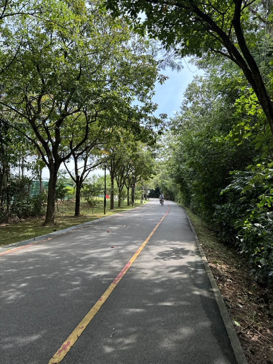
An upcoming connection along the Tampines Expressway could make the northeast’s recreational routes more continuous. For Punggol residents, the new section has meaning because existing park connectors already reach Sengkang and the coast. Here is how the future TPE link fits into the Round Island Route and what families can do safely before its opening is confirmed.

The answer: a new TPE-side connection is in the recreation plan
Updated 23 October 2026. URA’s 2026 Recreation Master Plan highlights an upcoming section of Singapore’s Round Island Route along the Tampines Expressway intended to provide a more seamless connection between Sengkang Riverside Park and Seletar Aerospace Park. For Punggol residents, that development matters because the town is already part of a much larger network of waterways, park connectors and coastal paths. The source identifies the planned connection but does not provide a verified public opening day for the new TPE-side section.
The National Parks Board describes the completed first phase of the Round Island Route as a 75-kilometre route launched on 22 January 2022, while the full long-term route is planned to span around 150 kilometres. Those two numbers describe different stages. It would be wrong to claim that a brand-new 150km loop is already open or that the entire upcoming TPE-side route has been completed just because parts of the wider network are available.
This guide explains the future network’s usefulness for walkers, cyclists, families, nature enthusiasts and students without presenting an imagined uninterrupted path as a current itinerary. The most important distinction is between an official planned link, an existing legal route, and the personal journey that becomes possible only after any missing section is commissioned.
Where the TPE fits into the northeast
The Tampines Expressway cuts across the northern and eastern transport geography of Singapore. Its name appears in the Recreation Master Plan not because cyclists will ride on the expressway, but because a recreational connection is planned along the road corridor. The precise alignment, crossing arrangement and available entrances must be confirmed through official route maps when the relevant section opens.
Sengkang Riverside Park and Seletar Aerospace Park are distinct destinations. Sengkang Riverside Park sits near Sungei Punggol and existing green routes used by residents of Sengkang and Punggol. Seletar Aerospace Park has its own business and heritage landscape, including routes toward Rower’s Bay. Linking these places more seamlessly has a potential recreational value beyond either park in isolation.
The planned connector should not be equated with the separate road infrastructure that serves private cars between Punggol and Seletar. A cycle path is not a vehicle carriageway, and a new road bridge does not automatically mean every cyclist may use the same carriageway. Read the particular project’s posted access rules.
Round Island Route, North Eastern Riverine Loop and local PCNs are not the same
Several route names coexist in the northeast. The Round Island Route is NParks’ long-distance recreational network, planned at approximately 150km when fully completed. The North Eastern Riverine Loop is an approximately 26km park-connector loop linking places such as Punggol Park, Punggol Point Park, Punggol Waterway Park and Sengkang Riverside Park. Specific park connectors, such as Punggol Park Connector, have their own lengths and access points.
These networks can overlap and connect. A family can use part of one route without completing the named loop, and a longer recreational journey may cross more than one connector. Treat the route names as different planning scales rather than interchangeable descriptions of the same path.
This matters for safety and expectations. A short family stroll along Punggol Waterway is not a commitment to a 26km loop, much less a 150km ride. The future TPE segment is one potential addition to a network; it does not change the physical capabilities or interests of every user.
What is already available on the Round Island Route?
NParks states that Phase 1 launched in January 2022 and covers the eastern portion of Singapore, linking Rower’s Bay toward Berlayer Creek and passing major parks including Sengkang Riverside Park, Pasir Ris Park, Changi Beach Park and East Coast Park. It offers existing walking and cycling experiences. The network includes rest nodes, signage and a variety of coastal and urban landscapes.
Rower’s Bay and Seletar West Park Connector are examples of current facilities. The Seletar West Park Connector runs about 4.6km from Rower’s Bay toward Piccadilly Circus, with rest points related to heritage trees and the old Jalan Kayu Guardhouse. This is evidence of an existing northeast connection, not evidence that the future TPE-side section has finished.
Because the network is large, users should check the exact route and current notices instead of relying on a promotional summary. A section near another park may be under maintenance even though the overall first phase is open. Dates and local notices always matter more than an older infographic.
Why the coming link could matter to Punggol
Punggol residents already enjoy local waterways and green links, but a more continuous regional route could allow longer recreational trips with fewer awkward gaps. A person comfortable cycling moderate distances may be able to plan a ride that connects local paths to Sengkang and Seletar destinations in a more legible way once the specific link is officially open.
The potential benefit is not just distance covered. Route continuity affects confidence. A cyclist who knows how to navigate well-marked crossings and public paths is less likely to improvise on unfamiliar roads. A person walking with a child or older relative benefits when exit options and rest points are clear rather than depending on local knowledge.
However, no completed path can be guaranteed from a line in the Recreation Master Plan. The final route’s surface, crossings, shade, slope and permitted users will determine whom it really serves. A well-designed section could expand choices without requiring anyone to undertake an endurance challenge.
What the 150km goal really signifies
A 150km continuous recreational connection is a long-term vision for Singapore’s network, not a suggestion that every family should cycle that distance. NParks positions the Round Island Route as a way to experience varied nature, habitats and coastal environments while strengthening ecological connectivity.
The ecological goal matters alongside recreation. A landscape connection can help link habitat areas, although habitat quality depends on planting, maintenance, human disturbance and the surrounding land. It would be simplistic to claim that laying a path alone restores biodiversity. The best route design supports people while respecting the living systems around it.
For schools, this distinction produces a useful lesson: infrastructure can have several objectives. A park connector may make transport more comfortable, provide recreation and contribute to a broader green network. Judging it well means asking how those goals interact, rather than counting kilometres as the sole measure of success.
Punggol Waterway: the local starting point
NParks identifies Punggol Waterway Park Connector as an approximately 8.4km route along both sides of the waterway. It is an approachable setting for families who want to build confidence before considering longer rides. The path already offers benches, water views and a variety of everyday recreational users.
A household should first decide the appropriate distance for the least experienced member. A child learning to cycle may need a short familiar section with breaks and adult supervision. A family seeking a gentle walk could remain within one comfortable part of the waterway. The existence of a longer network does not impose a longer itinerary.
From a future-planning perspective, local confidence matters. People who learn to read path signs, yield appropriately and recognise when to turn back will be better prepared to use a new regional link after commissioning.
Punggol Park Connector and links toward Sengkang
The existing Punggol Park Connector is approximately 6.1km, according to NParks. It connects Punggol Promenade with Gerald Drive, follows water-themed landscapes and links toward Sengkang’s existing routes. This is a useful piece of the wider geography for residents exploring journeys beyond their immediate block.
A map may appear to show multiple routes converging, but the user must still check exact entrance locations, crossing rules and temporary notices. A bridge or waterfront section that looks connected in a diagram may have a diversion or closure affecting a practical journey. Avoid cycling through restricted work sites to force an imagined shortcut.
For someone preparing a future TPE ride, learning the existing Sengkang approach is sensible. It can be explored in short sections before the additional connection is ready, without pretending that the full planned itinerary is already continuous.
Sengkang Riverside Park as a route node
Sengkang Riverside Park is a named access point for the existing Round Island Route. Its wetlands, river setting and connections to neighbouring paths make it more than a transit point. It is also a destination where a household can stop, observe wildlife and decide whether to continue or return.
For new cyclists, a route node is valuable because it can provide a clear start or turnaround point. A trip that ends at a planned destination can be easier to manage than an open-ended ride. The right itinerary allows time for rest and the unexpected, rather than pushing everyone to complete a target distance regardless of conditions.
When the new TPE-side link is officially opened, Sengkang Riverside Park may become a useful anchor for a longer route toward Seletar. Until then, the safe plan remains the existing signed network.
Seletar Aerospace Park is not simply a picnic ground
Seletar Aerospace Park combines aviation-related businesses, heritage features and recreational destinations. JTC promotes the area’s historical character and access to spaces such as Hampstead Wetlands Park. The Seletar West Park Connector is an established way to experience part of that landscape.
An aerospace district also has working roads, commercial facilities and access restrictions. A leisure visitor should use designated public paths and avoid entering controlled aviation or industrial areas. The presence of a park connector does not turn the entire business estate into a recreational precinct where every road is suitable for an inexperienced cyclist.
A future connector can broaden leisure choices, but respectful route use will remain essential. Families should plan a destination and a return method rather than assume that every point near the aerospace park has a public exit or transport stop.
Rower’s Bay and the existing Seletar connection
Rower’s Bay is a known Round Island Route stop with a boardwalk, lookout pavilion and wetland planting. NParks describes it as a gathering and rest point for recreational users. It is already part of the route network and should not be presented as a new facility awaiting the future TPE connector.
Seletar West Park Connector extends from the Rower’s Bay area toward Piccadilly Circus, with interpretive material about Seletar’s history and notable mature trees. For students, this provides examples of how transport routes can double as lessons in culture, ecology and design. For adult walkers, it offers a bounded existing outing to study before attempting a longer trip.
A new connection along the TPE could make it easier to connect the established Seletar side with Sengkang, but its precise continuity must be checked when the authority publishes an as-built map.
The new TPE section: what is missing from the public description
The URA recreation page identifies the upcoming TPE-side link and the places it will connect. It does not, in that statement, provide a detailed set of junction-by-junction directions, specific opening date, universal width, all surface materials or guaranteed rest stops. Those details should not be filled with confident guesses.
A good future-development guide can still be useful despite missing particulars. It can explain the intended network function, identify which existing routes already operate and show readers where to look for formal updates. That is preferable to publishing a fictional 12km ‘complete trail’ that a cyclist later finds obstructed.
Readers can monitor NParks’ Round Island Route page, park-connector maps and local notices. Where a route touches an expressway corridor, the public should use only designated separated paths and legal crossings. No cyclist or pedestrian should enter an expressway to bridge a missing link.
How to plan a first ride after the link opens
Begin with the official route map and identify a short section that has clear entry and exit points. Select a turnaround based on the least experienced rider’s ability, the weather and available water or toilet facilities. A new route is best learned gradually, not first attempted as an all-day challenge.
Before departure, check bicycle brakes, tyres, lights where applicable and whether the rider has a properly fitted helmet. Carry drinking water and a way to communicate. Leave enough daylight for the return; do not rely on unknown lighting arrangements along an unopened stretch.
If the path is busy, ride at a speed appropriate to the conditions, slow near pedestrians and follow all signs. Good cycling is cooperative. The newest infrastructure works well only when people use it thoughtfully.
Walking rather than cycling: a different experience
A long network may be described through cycling maps, but parts of it can also be attractive to walkers where permitted. A family that enjoys observing plants and birds might prefer a small section with frequent stops. The appropriate route should be chosen based on comfort, accessibility and the purpose of the outing.
Walking along an expressway-adjacent corridor may offer a different sensory experience from a waterfront park. Traffic noise and heat can affect enjoyment even if a path is safely separated. Readers should not assume that every new connector feels like the tree-lined Punggol Waterway.
A practical outing measures satisfaction, not kilometres. A parent with a toddler may be happier with a shaded fifteen-minute walk than a much longer journey undertaken to tick a new route off a list.
Safety near expressways: clear boundaries
A path described as being along the TPE is not a permission to walk on the expressway shoulder, cross an entrance ramp or cycle among expressway traffic. Expressways operate under different safety rules from park connectors. The future recreational link must have its own authorised alignment and connection points.
When local works are under way, barriers and diversions exist for a reason. Never climb over a work-zone fence to reach a path that appears on a planning map. If an access point seems missing, turn back or use an established legal alternative. An ambitious exercise plan is not worth a serious collision or fall.
Parents should explain these boundaries to children early. A map may use a coloured line close to a road without depicting every protective barrier. Recognising the difference between symbolic maps and real infrastructure is part of safe navigation.
Shared-path etiquette matters more as the network expands
Longer continuous routes can attract users travelling at very different speeds. A person on a leisurely walk may share space with a confident recreational cyclist, a runner or a family teaching a child to ride. The wider network’s quality therefore depends on predictable interactions.
Cyclists should slow near pedestrians, give room and avoid sudden overtaking. Walkers should keep to appropriate paths and avoid obstructing the full width of a shared corridor. Where signs designate particular lanes or prohibited devices, those local rules control behaviour. A broad description of ‘cycling access’ does not override restrictions on a specific path.
If the route becomes congested, choose a quieter time or shorter section. Public green space works best when everyone accepts a reasonable limit on their own convenience to protect others.
Heat, rain and air-quality planning
Singapore’s weather changes the practical difficulty of a route. A flat path can become uncomfortable under strong sun, and a long return journey is challenging if heavy rain or lightning develops. Riders and walkers should check forecasts and official lightning or weather guidance before committing to a long journey.
Appropriate clothing, water, sun protection and realistic breaks are simple safeguards. During episodes of poor air quality, people with additional health risks may need to adjust outdoor exertion according to official advice. The opening of a new path is not a reason to disregard personal limitations or environmental conditions.
A family should have an exit plan. Identify where the existing permitted route returns toward public transport or a safe gathering point, and do not rely on an unnamed shortcut across restricted property.
Nature observation without disturbing habitats
NParks connects the Round Island Route with ecological connectivity and opportunities to encounter nature. The route passes environments with wetlands, reservoirs, coasts and planted habitat. Those places are living systems, not merely backgrounds for exercise photographs.
Visitors should stay on designated trails, avoid feeding wildlife and refrain from collecting plants or animals. A bird seen near a path does not mean it is safe to approach or photograph at close range. Quiet observation usually provides better results and causes less disturbance.
Students can record common names of species only when confident, and label uncertainty honestly. A nature journal is more useful when it records what was actually observed than when it invents rare sightings to make an outing sound exciting.
Why ecological connectivity requires more than asphalt
A connected recreational network can contribute to broader environmental goals by integrating planting and habitat along its length. Yet an ecological corridor must provide suitable conditions for the species it is intended to support. Heavy disturbance, litter, artificial lighting and poorly chosen planting can reduce habitat quality even where a new path looks green.
This creates a design challenge: the route should be pleasant and safe for people while allowing nature to thrive. That may mean setbacks, planting buffers, managed access or clear instructions around sensitive areas. The exact ecological design of the TPE section cannot be inferred from the URA summary alone.
A thoughtful visitor respects those limits. Not every attractive patch of vegetation should become an unofficial trail. Sometimes the most meaningful environmental contribution is staying out of a habitat while enjoying a nearby permitted path.
A Mathematics project: routes as a network
Students can draw a simple network with nodes for Punggol Waterway, Sengkang Riverside Park, Rower’s Bay and Seletar Aerospace Park. Label existing links with solid lines and planned links with dotted lines. Then choose a start and destination and consider which proposed link might reduce the number of transfers between routes.
An important lesson is that a connection can be valuable even if its exact distance is unknown. It may eliminate a discontinuity or reduce a complicated crossing. But the students should not claim a kilometre saving without measured route data. A network diagram is an abstraction, not a GPS track.
The exercise develops graph reasoning, spatial literacy and careful labelling. It can also explain why a future transport project matters to residents who will never cycle around Singapore: an extra usable connection can change their local options.
A Science project: fair comparisons between paths
Imagine a student wants to know whether a new green corridor feels cooler than a nearby paved street. A weak experiment measures one location in the morning and another at noon, then attributes the difference to trees. A better approach records measurements at comparable times, uses suitable safe equipment and notes weather and surface conditions.
The student could also ask about noise, shade or how a planted buffer affects the experience of a pedestrian. Those are observations, not proof of an officially intended performance target. A school report should state which variables were measured and acknowledge the limits of a small sample.
This sort of fieldwork connects the future route to scientific thinking without needing privileged access to construction sites or restricted environmental records.
A Geography project: who benefits from an extra link?
A new route may serve recreational cyclists, residents who walk for exercise, families exploring another park or commuters seeking an active transport alternative. These users have different needs. A fast cyclist might value continuous movement, while a person using a mobility aid needs appropriate gradients and surfaces. The most inclusive plan asks about both rather than assuming one ideal user.
Students can interview willing family members about why they choose a path, then compare the answers to mapped services and rest points. Responses should be summarised respectfully without storing personal data unnecessarily. A small interview sample should not be presented as the opinion of the entire Punggol town.
The question of who benefits also includes people who may be affected by construction, land-use changes or increased path traffic. Good public policy considers both access and external effects.
An example: a Punggol family building stamina
Imagine a family with two children who enjoy cycling but rarely ride beyond the waterway. The parents want to explore the future Seletar link after it opens. They first choose familiar rides with turnaround points and record how everyone feels afterward. Their initial success criterion is a pleasant, safe outing, not a particular speed or distance.
Over several weekends, they practise checking bicycles, sharing a path and planning a rest stop. They also learn what to do when someone is tired or the weather changes. By the time the new link is officially ready, the family may be able to choose a suitable portion with confidence.
This is a fictional planning example, not an advertised official route or itinerary. The advantage of a gradual approach is that it remains useful even if the new section opens later than expected.
An example: an older adult exploring parks
An older resident may be interested in the improved network but prefer walking shorter distances. The correct choice depends on mobility, rest needs and transport access. An official path described as accessible may still contain surfaces, crossings or open stretches that need individual evaluation.
A companion could begin with an existing park connection, noting seating and the return journey. When a new section is open, they can assess a small portion without committing to a long one-way walk. Accessibility is personal and practical, not a label that eliminates every difficulty.
Punggol’s future green network should offer options for these users as well as enthusiastic cyclists. A good connection is one people can approach at their own pace.
An example: a student studying Seletar’s history
Seletar West Park Connector contains interpretation of the area’s past and connects to features such as heritage trees and the Jalan Kayu Guardhouse node. A student interested in history can use the existing route to explore how a former airbase environment became a modern aerospace district.
They might compare old photographs with current public spaces, citing dates and sources rather than inventing stories. The future TPE link could make this kind of learning journey more convenient for some northeast residents, but any school trip should remain within a confirmed permitted route and follow supervision policies.
The activity shows how a recreation network can connect two kinds of learning: ecological observation at a park and historical interpretation in a working industrial district.
The future link and the car-light town idea
More continuous walking and cycling connections can offer alternatives to short vehicle trips, but the effect depends on how usable the network is for real destinations. A scenic route may be excellent for weekends yet too indirect for a weekday workplace commute. A car-light ambition therefore requires attention to directness, safety, storage and connections with public transport.
Residents who cycle for errands need lawful bicycle parking at destinations and a route suitable for carrying bags or riding at practical times. A future path announcement does not establish new parking racks at every endpoint. Those details should be confirmed before assuming it will replace a particular car journey.
The network’s value may be chiefly recreational for many families, and that is worthwhile. Health, social time and access to nature are substantial benefits even without a measurable reduction in road traffic.
Avoid mixing this project with other Punggol announcements
Several transport and recreation changes are happening in Punggol and the northeast. The upcoming Round Island Route TPE-side section is distinct from the Cross Island Line Punggol Extension, Punggol Shore Friendly Streets and Punggol Heritage Trail Phase 2. A project can share part of the geography without sharing the same timeline or purpose.
It is also distinct from the existing Punggol Park Connector and Seletar West Park Connector, which already have published descriptions and access arrangements. A new link may strengthen the network, but it should not be marketed as the opening of every connected trail.
Punggol Point Park has a specific upgrading closure notice extending toward the end of 2027. That restriction must be respected even if a broader cycling map continues to show connections through the Punggol coast. Current closure notices override generic route descriptions.
How to read maps without inventing a new route
An official master-plan illustration communicates a development idea. It may not show every kerb, path width, access point or temporary construction barrier. A route map for current public use serves a different purpose: it describes where a person can travel now. Confusing the two is a common source of unsafe instructions.
When an upcoming section appears on a planning page, write down the source, publication date and status. Do not treat a drawn line as evidence of a commissioned route. When an operator later publishes an updated map, compare it with the older proposal and note what changed.
This method helps local readers avoid stale navigation information, particularly during construction. It also supports responsible content publishing: a future article can explain the plan without pretending to be a turn-by-turn cycling guide.
What local clubs and community groups can prepare
A walking or cycling club can use the future connection as a reason to strengthen its safety routines, even before the route is open. Leaders should be clear about participant ability, rest stops, group size, weather decisions and what happens if someone falls behind. A group itinerary should be based on the current operating network.
Once a new section is officially accessible, organisers can do a separate route inspection before advertising a group outing. Check crossings, the availability of toilets and water, surface conditions and whether beginners can exit early. Do not recruit riders for an unverified ‘opening ride’ with a made-up date.
Community groups can also encourage respectful nature behaviour. An organised outing should not block shared paths or overwhelm sensitive habitats. The goal is to enjoy better connectivity while protecting the quality of the space for everyone else.
What to monitor in 2027 and beyond
The URA recreation plan establishes the intention of a TPE-side connection between Sengkang Riverside Park and Seletar Aerospace Park. As of this article’s review, its public summary does not establish a specific opening day. The appropriate next step is to watch NParks and relevant authority updates for the alignment, project completion and any changes to public access.
A responsible tracker records the exact section that has opened rather than declaring the full Round Island Route completed. Where different agencies handle nearby roads and park connectors, use the announcement that corresponds to the actual facility. A press photo of another phase should not be mistaken for proof of a local route.
Once the link is commissioned, the most useful follow-up is an on-the-ground route guide with verified start points, legal crossings, rest facilities, restrictions and alternatives. Until then, readers should continue to use currently signed routes.
Frequently asked questions
What future connection has URA described? An upcoming section of the Round Island Route along the TPE intended to link Sengkang Riverside Park and Seletar Aerospace Park more seamlessly. What is the opening date? No exact public opening date is established by the URA summary. Is the entire Round Island Route open? No; NParks describes Phase 1 as an existing 75km section within a longer planned 150km route.
Is the North Eastern Riverine Loop the same project? No. It is a distinct roughly 26km existing loop with connections through Punggol and Sengkang. Can I cycle on the TPE itself? No; use only designated lawful cycling paths. Is Rower’s Bay open? It is an existing RIR node; check current local notices before visiting.
Will the new link be suitable for children? That depends on the completed route and the child’s ability. Can wheelchair users use it? The final route’s actual accessibility needs verification. Will it shorten my daily commute? No universal time saving is established. Can I already plan a continuous ride using the proposed line? Not until the particular link’s access is confirmed.
What will count as a verified TPE-side link opening?
An upcoming path should be treated as publicly usable only when the responsible authority confirms access and the route on the ground is signed and safe to follow. A contractor’s finished pavement, an artist’s impression or a photograph of a new structure is not enough. Physical construction can precede commissioning, opening of connections at both ends and removal of temporary barriers.
When an announcement finally names the opened section, check what length and connection points it actually covers. A new link between existing park connectors does not mean the entire planned 150km Round Island Route has opened. A responsible family guide should identify current entrances, restrictions and diversions, along with the date those details were verified.
How to prepare before the link opens without taking risks
Families can explore short stretches of confirmed existing routes near Punggol Waterway and Sengkang Riverside Park, building familiarity with wayfinding and shared-path courtesy. Students can draw planned connections as dotted lines and existing connections as solid ones. That simple distinction helps them understand a changing transport network without turning a future proposal into dangerous turn-by-turn instructions.
Once an as-built map appears, comparing it with the earlier proposal will reveal what changed during implementation. The exercise can include observations about shade, crossings, accessibility and rest facilities. Until then, no one should enter the TPE, cross an expressway ramp or bypass a work barrier in an attempt to complete the planned route.
Official sources and existing Punggol routes
Read URA’s 2026 Recreation Master Plan for the proposed TPE-side connection. The operational baseline is NParks’ Round Island Route overview, updated October 2026, with Seletar West Park Connector and Punggol Park Connector as published existing segments.
For shorter local journeys consult Punggol Waterway Park Connector and North Eastern Riverine Loop. The latter is different from the future TPE proposal. For neighbourhood cycling etiquette and local context, see eduKatePunggol’s active mobility rules guide.
Editorial boundary: The featured photo is an existing Punggol park connector, not an image of the proposed TPE-side section. All suggested exercises and example journeys are illustrative until the route is officially opened.
| Route component | Current status or plan |
| New TPE-side section | Upcoming connection identified by URA, opening date not specified |
| Intended regional link | Sengkang Riverside Park to Seletar Aerospace Park |
| RIR Phase 1 | 75km launched 22 January 2022, per NParks |
| RIR full ambition | Approximately 150km when completed |
| North Eastern Riverine Loop | Separate existing 26km network |
| Punggol PC | Separate existing 6.1km connector |
| Featured photo | Existing Punggol connector, not proposed works |


