
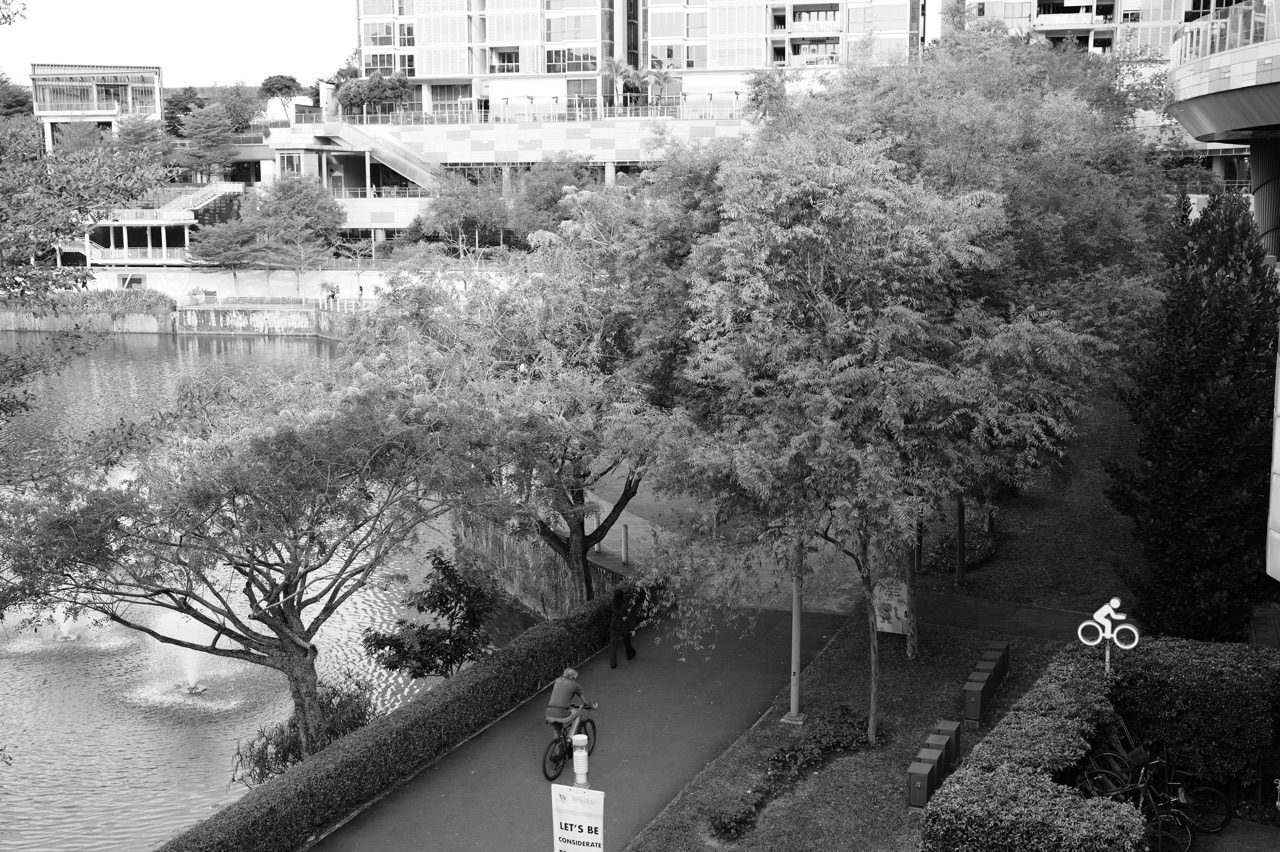
Quick answer, updated 23 October 2026: Punggol Heritage Trail is planned as a roughly 1.3-kilometre pedestrianised route along Old Punggol Road, linking the Punggol Waterway area and Punggol Point. The first 400 metres opened on 23 August 2025, between Punggol North Avenue and Campus Boulevard at Punggol Digital District. The remaining 900 metres are expected to be completed by the end of 2026, according to NParks. Planned features include the conservation of Api Api Ludat mangrove trees and a connection toward Punggol Jetty. The end-2026 date is a target, not a verified opening-day invitation.
The future of Punggol can sometimes be described as a list of newer buildings. This project tells a different story. One of its older roads is becoming a green public corridor that residents can use without a car, while preserving part of the landscape that existed before the town grew around it. It is worth understanding both the history that remains visible and the practical limits of today’s walking route.
What has opened and what is still planned?
| Item | Position as at 23 October 2026 |
| Overall plan | About 1.3 km of Old Punggol Road transformed into Punggol Heritage Trail |
| First section | 400 m between Punggol North Avenue and Campus Boulevard; opened 23 August 2025 |
| Walking within first section | More than 1 km of meandering paths and connected trails were described at first opening; this is not the length of the main completed corridor |
| Further section | Remaining 900 m expected by end 2026 |
| Coastal heritage | Conserved Api Api Ludat (Avicennia officinalis) mangrove trees featured in the planned expansion |
| Future connection | A route toward Punggol Jetty, as described in NParks’ plans |
| Access today | Use designated open sections and current NParks maps; do not cross work-site barriers |
| Relevant operators | NParks oversees park information; JTC provides Punggol Digital District context |
The distinction between a 400 m opened corridor and more than 1 km of walking paths matters. The longer number refers to the meandering trail network available within the landscaped first section, not proof that the entire Old Punggol Road corridor was already completed in 2025. The NParks park page still describes Phase 2 as expected by end 2026, and a site visit should follow the latest trail map.
Why keep Old Punggol Road at all?
Before the high-rise housing estates, Punggol Road provided a route through a much less built-up northeastern landscape. Parts of the old alignment carried memories of villages, farming, coastal leisure and journeys to Punggol Point. As modern transport and development arrived, preserving the exact historic road as a general traffic corridor was not necessarily the best use of the land. Turning much of it into a walking trail creates a different kind of continuity: people can still experience the alignment without bringing through-traffic into a public green space.
This is not a reconstruction of a historic kampung. The surroundings have changed and many visible features are new. Heritage is preserved partly through the route and retained landscape: the road’s original undulating ground, existing greenery and the ecological character recalled through planting. That is more meaningful when visitors recognise which parts are retained and which parts are interpretation, rather than calling everything along the route “original”.
For historical background, read History of Punggol: Old Punggol Road, village tracks and the Heritage Trail. Our focus here is narrower: what the second section might change for everyday travel and family outings after 2026.
Where will the full corridor connect?
Urban Redevelopment Authority guidance describes a continuous green walking and cycling corridor between Punggol Waterway Park and Punggol Point Park, with the trail running through Punggol Digital District. In practice, the experience will comprise different segments: everyday paths used by residents, planted stretches near SIT, local crossings and links onward toward the coast. The projected northward route should not be treated as one completely open path until the authorities confirm each segment is accessible.

The southern end: Waterway, homes and daily errands
A person starting near Punggol MRT or Waterway Point already has access to well-used paths by the Waterway. The Heritage Trail concept extends the idea of a green journey northwards instead of treating parks as isolated destinations requiring a separate car trip. Once completed, it could make weekend movement between the town centre and the coast feel more like one connected excursion. The actual journey will still depend on safe crossings, heat, rain, mobility and whether the relevant segments are open.
The middle: SIT and Punggol Digital District
The university and business park are not disconnected enclaves. Campus Boulevard, planted corridors and public areas are designed to bring students, workers, visitors and residents through shared parts of the precinct. Punggol Heritage Trail offers a quieter contrast to the large buildings: a place for a short walking break, observing local plants or using a green route between destinations. Any link passing near university or company facilities must still respect posted public-access boundaries.

The northern end: mangroves and a coastal connection
NParks’ 2025 announcement specifically names conserved Api Api Ludat (Avicennia officinalis) mangrove trees in the later section and a new connection to Punggol Jetty. The trees are a reminder of the coastal habitat associated with the area long before much of Punggol was urbanised. They are living ecological features, not decorative props. Visitors should stay on designated paths, avoid breaking branches or trampling exposed soil and observe any site-specific protection signs.
The future jetty connection may make the northern walk more convenient, but the trail and nearby parks need to be understood separately. In particular, Punggol Point Park has had an upgrading-closure programme extending toward end 2027. A completion notice for Heritage Trail Phase 2 will not automatically mean every coastal attraction beside it has reopened. Always check both sites before planning an outing.
What is special about the planting?
The trail does not simply line a road with generic shrubs. NParks has described a planting palette that reflects the original coastal forest and kampung setting. Preserving mature vegetation and retaining the shape of the terrain helps the route keep some individuality: one part may feel more enclosed, another more open, while the rise and fall of the path makes the walking experience recognisable. These are qualities often lost when every footpath is flattened into an identical straight corridor.
Mangrove trees add a different ecological lesson. They are adapted to coastal conditions, with roots and structures that help them tolerate challenging waterlogged or saline environments. A child who notices their form can ask questions about plant survival, salinity and the way roots support trees. The useful educational habit is to observe, sketch and describe without disturbing the habitat. Do not assume all mangroves are identical, and avoid describing the entire trail as a mangrove forest.
Conservation also carries practical constraints. During maintenance or construction, a path may be diverted to protect roots or prevent unsafe access. A healthy green corridor is not necessarily a corridor where every tree can be approached. Safety barriers and temporary closures can be part of environmental stewardship rather than evidence that a park is failing.
A future walking day for three generations
Picture a Punggol family planning a slow outing with a grandparent, a parent and a primary-school child after authorities confirm the full corridor is open. A sensible trip might begin in the Waterway area, pause near the district’s public spaces, continue along designated green paths and return by transit rather than insisting on covering every metre. This is an example of a possible outing after completion, not a verified walking itinerary for October 2026.
The first decision is not distance. It is who in the family sets the pace. A route of 1.3 km may sound short, but the total outing includes connections from home, detours, rest stops and perhaps a return journey. Singapore’s humidity can make even an easy walk uncomfortable. For a grandparent, the location of seating, shade, toilets and a place to exit early may matter more than a photograph at the far endpoint.
For a child, the story can be more compelling than the distance. Ask them to imagine how people travelled when Old Punggol Road carried vehicles and village traffic, then compare it with a future walking landscape. Which changes make the route safer for recreation? What has been gained and what might be difficult to preserve? These are meaningful questions about town planning and heritage, not a compulsory nature quiz.
A five-step plan for checking the trail before leaving home
- Check the current NParks trail map. A projected phase-completion date is not an open-path guarantee.
- Check the northern park separately. Punggol Point Park upgrading restrictions may differ from Heritage Trail access.
- Select a start and finish you can actually reach. Public MRT, LRT and bus services make a one-way walk easier than a forced return trek.
- Consider accessibility. NParks lists wheelchair accessibility, but slopes, crossings and temporary diversions still require route-specific attention.
- Plan for conditions. Take drinking water, use sun protection and follow NEA guidance when lightning, heavy rain or poor air quality make outdoor activities unsuitable.
What does the trail teach children about urban design?
A trail between a residential neighbourhood, a university and a coastal park is a practical lesson in public space. An urban designer must balance movement, drainage, nature, heritage and daily use. A perfectly straight route might be fast, but it could remove valuable old trees. A winding path might preserve more green space, but it may be harder for someone trying to reach an appointment. A helpful discussion asks who benefits from a design choice and who faces a trade-off.
For primary-school children, make it a simple observation exercise. Identify three places where the route changes direction. Look for sheltered and unsheltered areas. Ask where rainwater might flow. A Primary Science discussion could focus on roots, shade and habitats; a Mathematics exercise could estimate walking duration using a realistic pace and explain why a number taken from a map differs from total walking distance.
For secondary students, the questions can become more analytical. Compare current photographs with older road maps, then separate directly observed evidence from inference. Test the claim that a new path always improves accessibility: it may improve connectivity for some walkers yet remain challenging at particular crossings. Consider the costs of maintenance and how a landscape changes as trees grow. Such reasoning is valuable in Geography, History, Science and Social Studies.
How to avoid damaging the very heritage you came to see
One threat to a new trail is treating everything visible as something to collect. Historical features and plants should be left in place. Do not remove loose building fragments as souvenirs, break branches, feed wildlife or step into protected vegetation to recreate a photograph. If you observe damage or a hazardous obstruction, report it through the appropriate agency channel rather than attempting repair yourself. A photograph with a note about the location is often more useful than an object taken away.
The second threat is treating a public trail like a high-speed cycle corridor. Where walking and cycling are both permitted, follow current active-mobility laws, on-site separation markings and speed restrictions. Slowing near children, seniors and blind corners matters even when a path appears wide. Riders should not assume that a green link in a master plan is immediately an unrestricted cycling route.
What businesses and university users may notice
Green space is part of how a district functions. A worker may need a short change of environment after a long meeting; a student may use a planted route to reach lunch; a nearby resident may use the same path on weekends. Mixed use can make parks lively throughout the day, but it also creates crowding at certain entrances and a greater need for clear wayfinding. Good signage is not decorative: it helps people distinguish a through-route from a campus gate or a service driveway.
Small businesses may notice a different pattern of visitors once the trail is fully connected, especially people combining a walk with food or a retail stop. This is possible, not a guarantee of commercial success. A café planning for more weekend walkers should observe real footfall, weather and opening hours before making decisions. Meanwhile, a school running an outdoor learning visit should request any necessary permissions and match group size to the safe capacity of the walking paths.
What the heritage corridor cannot tell us by itself
The trail does not prove that every other part of Punggol will be car-free, or that wildlife biodiversity will recover to its pre-development state. It is one element in a town that also needs housing, transport, drainage, commerce and public services. Green space can reduce some forms of urban stress and offer contact with nature, but specific environmental outcomes need proper evidence. A tree visible beside a new office does not mean construction had no ecological impact.
Similarly, the name “Heritage Trail” does not establish every roadside memory as an official protected monument. The project retains an old route and certain landscape features, and it offers interpretation of past life. For claims about a specific historical event, use archival records or museum research, not photographs alone. Our existing Heritage Trail visitor guide provides practical background; this future-focused article explains the second-phase milestone and its implications.
Questions residents should ask when Phase 2 is announced
- Is the full remaining 900-metre section open, or only selected segments?
- Has NParks issued an updated map showing the actual path into Punggol Point?
- Are the mangrove conservation areas viewable from formal paths, and which sections remain protected?
- Do any crossing points have temporary traffic management or pedestrian diversions?
- Are cycles permitted throughout the connection, and do local signs distinguish walking-only stretches?
- Is the adjoining jetty or park separately accessible, or subject to upgrading closures?
- Where are the nearest exits, toilets and shaded rest stops for families and older visitors?
Frequently asked questions
Is Punggol Heritage Trail fully open in October 2026?
The first 400-metre section opened in August 2025. NParks identifies the second 900-metre section as expected by the end of 2026. Without a confirmed completion announcement, do not describe the entire 1.3 km as already open.
Is the heritage trail the same as Old Punggol Road?
It follows the historic road alignment and deliberately retains important terrain and landscape features, but the route is being adapted into a pedestrianised green corridor. It is not identical to the former road traffic arrangement.
How long will the complete trail be?
The planned main corridor is approximately 1.3 km. Side paths, access links and detours can increase the total distance someone walks. The “over one kilometre of walking trails” described at the 2025 opening refers to the meandering paths of the initial landscaped section.
Will it connect to Punggol Jetty?
NParks describes a planned new connection to Punggol Jetty as part of the remaining works. That is a plan, not evidence that the entire jetty and adjacent Punggol Point Park area is presently open.
Why are mangroves important here?
The planned later section highlights conserved Api Api Ludat mangrove trees. They provide a tangible link to the area’s coastal ecology and a chance for visitors to learn how plants adapt to coastal environments without entering sensitive habitat.
Can children cycle on the entire route?
Do not assume so before checking the completed route markings and current regulations. Shared paths, pedestrian-only stretches and work-site diversions can have different rules.
Is the route wheelchair accessible?
NParks lists wheelchair accessibility for the park, but suitability for a particular user depends on the open section, slope, surface, crossings and any temporary diversions. Confirm the live map and conditions before visiting.
Can we see the old Punggol landscape exactly as it once was?
No. The development retains selected terrain and greenery and uses heritage-inspired planting, but surrounding structures and the use of the road have changed. Treat it as a present-day park that preserves some evidence of a past landscape.
Official sources and related reading
- NParks: Punggol Heritage Trail park details — visitor information, park size, access, map and second-phase target.
- JTC carrying NParks’ 23 August 2025 opening announcement — original 400 m, preserved features, 900 m expansion and mangroves.
- NParks Friends of the Parks: Heritage Trail public engagement — links to Waterway and Punggol Point and the green-corridor intention.
- URA Punggol Digital District urban-design guidelines — planned 1.3 km heritage corridor and integration with surrounding routes.
- JTC Punggol Digital District community page — context for the trail in the surrounding district.
- eduKatePunggol: Old Punggol Road, village tracks and history — historic context for the route.
- eduKatePunggol: Punggol Point Park upgrading and closures — separate northern-end access checks.
Editorial status, 23 October 2026: The end-2026 completion date remains a stated expectation, not a confirmed public opening day. Photographs used in this article document nearby existing Punggol spaces, not inaccessible construction areas. Consult live NParks notices before planning a continuous walk.


