
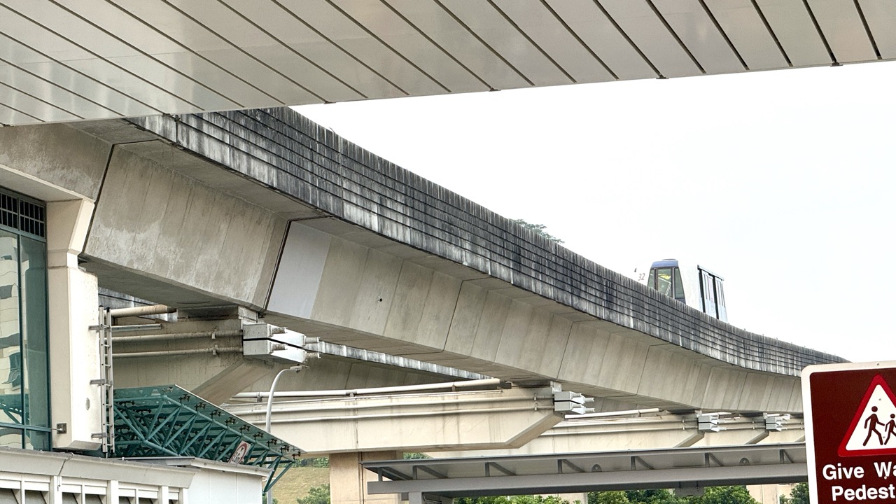
The top 10 things to do in Punggol for transit enthusiasts are to study Punggol MRT–LRT interchange, explore both LRT loops, follow Sam Kee’s first-and-last-mile connections, understand Teck Lee’s opening, take the LRT to Punggol Point, study Riviera’s planned Cross Island Line, ride to Punggol Coast MRT, examine the bus interchange and look at bridges and transport heritage beside the waterway. These are ten ways to understand a working town, not ten stations that must be visited on the same day.
Best first transport outing: begin at Punggol MRT, select one East or West Loop stop with a genuine reason to visit, and make a planned return. For a new-district contrast, take the North East Line to Punggol Coast. For the coast, use Punggol Point LRT and verify the pedestrian path. Every rail and bus journey requires valid travel and respect for the operator’s safety rules.
This October 2026 guide uses current operating services rather than treating planned rail connections as finished. Teck Lee LRT began service on 15 August 2024 and Punggol Coast MRT on 10 December 2024; Riviera’s future Cross Island Line interchange is not an operating passenger connection. Always check live displays, announcements and access arrangements before leaving.
Punggol transport at a glance
- North East Line: Punggol (NE17) is the interchange; Punggol Coast (NE18) is the newer terminal.
- East Loop: PE1 Cove, PE2 Meridian, PE3 Coral Edge, PE4 Riviera, PE5 Kadaloor, PE6 Oasis, PE7 Damai.
- West Loop: PW1 Sam Kee, PW2 Teck Lee, PW3 Punggol Point, PW4 Samudera, PW5 Nibong, PW6 Sumang, PW7 Soo Teck.
- Other movement: bus services, sidewalks, covered links, bridges and park connectors complete journeys beyond the rails.
- Responsible rail enthusiasm: learn from public maps and safe passenger areas; do not enter restricted infrastructure.
How to enjoy transit without turning a day out into a station race
Choose a question before choosing a route. Why does a residential stop need a loop service? How is a business district served differently from a housing neighbourhood? How does a waterside bridge change a walk? The most useful outing answers one question using a real observation and an official source, then stops. More station names do not automatically produce more understanding.
Check live LTA or SBS Transit directions, current fares, the location of lifts and any rail works. A service announced years ago may now run differently. Do not use travel photographs as justification to obstruct passenger flow, and keep all photography in permitted public areas. Weather can also change the right choice for a waterway or coastal walk; use NEA’s myENV guidance.
Ten Punggol transit experiences
1. Study the Punggol MRT–LRT interchange
Where: Punggol MRT (NE17) and LRT concourse.
What makes it interesting
The town-centre station combines an MRT line serving cross-town travel with two smaller loops serving neighbourhoods. It is a good place to see how a regional rail corridor and local last-mile transport work together. Understanding a transfer can be more useful than memorising every stop.
What to do on the outing
On the public concourse, locate the North East Line map and the LRT signs, explain the difference between line and loop, and identify the correct platform for a proposed journey. Use a current operator map. Then take a short valid paid ride to a purposeful destination, rather than circling for no reason.
A worked Punggol example
Two students sketch Punggol MRT as a transfer node and add the East and West loops as separate branches. They write a sentence explaining why a resident at Oasis needs to understand the LRT direction before boarding the North East Line.
Safety and accuracy
Do not obstruct gates, escalators, lifts or platforms while studying maps. Restricted rail offices and tracks are not public attractions, and photography must respect other passengers and operator rules.
Primary or local route reference: Study the Punggol MRT–LRT interchange. Check current service information separately.
2. Ride part of the Punggol LRT East Loop
Where: Cove PE1, Meridian PE2, Coral Edge PE3, Riviera PE4, Kadaloor PE5, Oasis PE6 and Damai PE7.
What makes it interesting
The seven stations show how automated local rail serves housing estates and neighbourhood centres. Coral Edge offers a connection toward Punggol Plaza; Oasis is linked to Oasis Terraces. Other stops are more about public paths and everyday residents’ journeys than commercial tourist attractions.
What to do on the outing
Choose one or two stops for a clear purpose, confirm the live direction on the platform, and compare what a residential station looks like with a station near shops. Stay on public paths if disembarking. Check fare and travel time using current rail information, rather than assuming one rotation takes a fixed number of minutes.
A worked Punggol example
A parent and child travel to Oasis and observe how shops, community space and public transport fit together. They draw an annotated map identifying the station, a safe crossing and a publicly open neighbourhood facility.
Safety and accuracy
Do not enter school premises, private buildings or residential areas for sightseeing. Riviera’s future Cross Island Line interchange is not an operating 2026 rail connection.
Primary or local route reference: Ride part of the Punggol LRT East Loop. Check current service information separately.
3. Explore the logic of the Punggol LRT West Loop
Where: Sam Kee PW1, Teck Lee PW2, Punggol Point PW3, Samudera PW4, Nibong PW5, Sumang PW6 and Soo Teck PW7.
What makes it interesting
The West Loop serves another set of neighbourhoods, including areas toward Punggol Point and the new district. Comparing both loops is a practical exercise in land use and mobility: the same light-rail technology helps reach coastal settings, public amenities, housing and growing educational or employment destinations.
What to do on the outing
Read a current map and choose one stop with a clear public destination. Identify how far the final walk appears, then verify route signage on the ground. A short observation from a lawful station area is useful, but the better goal is to understand what the rail journey lets people do.
A worked Punggol example
One teenager compares Sam Kee’s community connections with Teck Lee’s links toward Punggol Digital District. The conclusion is not which stop is ‘best’, but that transport value depends on the places and people a stop serves.
Safety and accuracy
Service direction and train patterns can change during works. Historical announcements explain opening dates, not today’s platform guidance. Never enter elevated track structures or fenced rail facilities.
Primary or local route reference: Explore the logic of the Punggol LRT West Loop. Check current service information separately.
4. Make a first-and-last-mile study around Sam Kee
Where: Sam Kee LRT PW1 and public routes near SAFRA Punggol and One Punggol.
What makes it interesting
A local train trip only succeeds when passengers can reach their destination after leaving the platform. Sam Kee is a useful start for looking at public linkways, walking time, crossings and the distinction between a station and nearby community facilities. The public hub and SAFRA have their own opening and access arrangements.
What to do on the outing
Pick a confirmed public destination, such as One Punggol’s community areas or an operating SAFRA public facility. Follow signed paths, mark the location of any covered walkway or crossing, and return the same way if the weather changes. Distinguish your observed journey time from the map’s approximate route.
A worked Punggol example
A child learns the phrase ‘last mile’ by measuring how many safe crossings lie between the station and a public place they want to visit. The exercise is more concrete than guessing a distance from an aerial map.
Safety and accuracy
Do not promise that a play facility is free or open because the LRT is operating. Validate particular pedestrian and wheelchair access points, and avoid blocking local residents.
Primary or local route reference: Make a first-and-last-mile study around Sam Kee. Check current service information separately.
5. Learn why Teck Lee LRT opened in 2024
Where: Teck Lee LRT PW2, Sentul Walk, approaches to SIT Punggol and Punggol Digital District.
What makes it interesting
LTA announced that Teck Lee would start carrying passengers on 15 August 2024 to improve access toward Singapore Institute of Technology and the business park. This history shows how a transport investment can be matched to an area as the surrounding community changes. A station that existed earlier was not necessarily open for passenger use earlier.
What to do on the outing
Ride to Teck Lee, stay in publicly accessible areas and look for signed transport links to the surrounding district. Compare LTA’s dated announcement with what is currently operating outside. Discuss why transport use is affected by university, workplace and neighbourhood demand, then return without entering restricted buildings.
A worked Punggol example
A Secondary student makes a three-point timeline: older infrastructure, the 2024 station opening, and newer public amenities emerging around Punggol Digital District. Each point is grounded in official descriptions rather than assumptions about unseen workplaces.
Safety and accuracy
SIT classrooms, offices and active construction sites are not open sightseeing spaces. LTA’s opening notice is historical context; current station facilities and access must be checked separately.
Primary or local route reference: Learn why Teck Lee LRT opened in 2024. Check current service information separately.
6. Use Punggol Point LRT to compare rail and coastal landscapes
Where: Punggol Point LRT PW3 and public walking routes to Punggol Point Park.
What makes it interesting
A rail trip ending near the coast feels very different from a dense interchange. NParks lists Punggol Point Park as a small public coastal park with views across the sea. This is an accessible introduction to why transit matters: it lets people reach different landscapes without assuming a private car is essential.
What to do on the outing
Use the correct West Loop direction, identify the station exit and follow a verified public route to the park if conditions suit. At a lawful viewpoint, compare an elevated transport corridor with the open horizon and note how long the last walking section takes. Return by the same safe public route.
A worked Punggol example
A rail enthusiast creates an original two-panel sketch: the station and its pedestrian exit in one panel, then a coastal viewpoint in the second. The caption explains that an LRT station provides access, not a guaranteed sea view from the platform.
Safety and accuracy
Do not climb coastal barriers, enter restricted jetty areas or continue in lightning. The station, park and any restaurant near the coast have separate operating conditions.
Primary or local route reference: Use Punggol Point LRT to compare rail and coastal landscapes. Check current service information separately.
7. Understand the future Cross Island Line at Riviera without inventing a ride
Where: Riviera LRT PE4, East Loop.
What makes it interesting
Riviera illustrates how maps evolve. Its current role is an East Loop LRT stop, while the future Cross Island Line connection is separate infrastructure. A good transit fan distinguishes an operational line from one still being built, and understands why a future interchange may reshape accessibility in a district.
What to do on the outing
Compare LTA’s published Cross Island Line plans with an operating rail map. Mark current LRT tracks with a solid line and planned rail links with a different convention. If visiting, observe only public footpaths and permanent wayfinding, leaving the worksites entirely alone.
A worked Punggol example
A young reader sees a future interchange symbol and initially thinks they can transfer today. Their corrected map notes that the planned connection is not the same as a working 2026 CRL service. They learn to use dates and map legends before travelling.
Safety and accuracy
Do not enter construction sites or assume proposed completion timing remains fixed. Current LTA service alerts and on-site barriers take precedence over illustrations of a future network.
Primary or local route reference: Understand the future Cross Island Line at Riviera without inventing a ride. Check current service information separately.
8. Take the North East Line to Punggol Coast MRT
Where: Punggol Coast MRT NE18, beyond Punggol on the North East Line.
What makes it interesting
LTA opened Punggol Coast for passenger service on 10 December 2024. The new terminal serves Punggol Digital District and makes it easier to reach a concentration of higher education, workplaces and public amenities. It is a powerful contrast with the LRT loops because it adds rapid-transit coverage rather than feeding into the older town-centre interchange.
What to do on the outing
Take a paid North East Line journey from Punggol to Punggol Coast, check the current exit signs and visit a genuinely open public part of the district. JTC identifies Punggol Coast Mall and the hawker centre as community amenities. Compare the two stations’ functions and make a short wayfinding note.
A worked Punggol example
A visitor explains why Punggol station is a transfer hub and Punggol Coast is a new district-serving terminal. They record how the rail exit connects to public destinations without claiming that private workplaces provide walk-in tours.
Safety and accuracy
Punggol Coast MRT is not Punggol Point LRT. Tenant hours, construction phases and campus access differ from the station opening, and any public tour requires explicit arrangements.
Primary or local route reference: Take the North East Line to Punggol Coast MRT. Check current service information separately.
9. Observe Punggol Bus Interchange as part of an integrated network
Where: Public boarding and alighting areas at Punggol Bus Interchange.
What makes it interesting
Buses serve routes and road corridors that rail alone cannot cover. LTA’s 2024 Teck Lee release also discussed circular Service 84G/W as part of improving connectivity in northern Punggol at that time. A bus interchange helps explain how fixed rail stations, road services and pedestrian connections complement one another.
What to do on the outing
Look at the current public berth signs and route displays, select a bus service whose destination is meaningful, and explain which places it reaches that are not directly on a particular rail loop. Avoid waiting in a boarding queue unless actually travelling. Use updated operator journey planning rather than a photocopied historic berth directory.
A worked Punggol example
A pupil draws a line for the MRT, a loop for LRT and a curving street for a bus route. They can explain that different systems solve different travel problems and must meet at useful transfer points.
Safety and accuracy
Routes, berths and frequencies can change. Keep clear of bus movements and accessible boarding zones, and do not photograph drivers or passengers intrusively.
Primary or local route reference: Observe Punggol Bus Interchange as part of an integrated network. Check current service information separately.
10. Compare modern waterway bridges with old transport heritage
Where: Punggol Waterway Park public bridges and the preserved Old Punggol Road bus-stop shelter.
What makes it interesting
NParks’ Waterway Park nature-walk information names the Jewel, Wave, Sunrise and Kelong bridges and a preserved Old Punggol Road bus-stop shelter. This creates a rich outdoor finale for anyone interested in transport design. The bridges show how a landscaped waterway is crossed; the vintage shelter shows that the district had earlier transport infrastructure worth remembering.
What to do on the outing
Choose a short public park section and identify one named bridge or heritage feature from NParks information. Observe whether it mainly serves walking, cycling or another movement. Compare the apparent age and design of the structures, recording uncertainties rather than guessing engineering dimensions.
A worked Punggol example
A student draws one bridge with a caption about today’s pedestrian network and sketches the preserved bus shelter with a caption about earlier Punggol Road. Their work shows that places can retain heritage while changing how people travel.
Safety and accuracy
The preserved shelter is not proof of a bus currently serving that location. Follow path signage, do not climb structures and leave room for cyclists and other park users.
Primary or local route reference: Compare modern waterway bridges with old transport heritage. Check current service information separately.
Three transit itineraries that work
A short East Loop learning trip
Meet at Punggol MRT, read the live LRT direction, ride to a single neighbourhood stop such as Oasis or Coral Edge and take a short public walk. Discuss why the stop serves daily errands, housing and community facilities. Return without crossing into an unfamiliar longer route. It is enough to finish with a clear explanation of how the interchange connects to the chosen neighbourhood.
A growing-district journey
Use the West Loop to understand Teck Lee, or travel directly on the North East Line to Punggol Coast. Compare station wayfinding with JTC’s currently open public district amenities. LTA’s official opening dates provide historical context; JTC’s public community page shows current accessible amenities. Do not treat an illustration of a future district as proof that every building or route has opened.
A rail-and-waterway afternoon
Choose one Punggol LRT ride followed by a manageable Punggol Waterway Park path. Identify a bridge named by NParks and observe one public transport heritage feature if it is reachable. The exercise connects mechanical movement with pedestrian infrastructure. Return before fatigue and bad weather become problems.
Common mistakes transport enthusiasts can avoid
- Confusing Punggol Point LRT and Punggol Coast MRT because their names sound similar.
- Assuming an LRT loop has only one direction or a fixed public timetable from an old article.
- Believing that a future Cross Island Line interchange is already operating at Riviera.
- Treating a station opening notice as permission to enter a university campus, workplace or construction site.
- Mistaking a heritage bus-stop shelter for a current bus boarding point.
- Photographing rail infrastructure in ways that block other passengers or create safety hazards.
- Attempting every stop without planning real walking routes, fares, food, rest and return travel.
Frequently asked questions
What is the difference between Punggol and Punggol Coast MRT?
Punggol (NE17) connects to the Punggol LRT. Punggol Coast (NE18) opened in December 2024 as the North East Line’s newer terminal for Punggol Digital District.
How many stations are on Punggol LRT’s East Loop?
Seven: Cove, Meridian, Coral Edge, Riviera, Kadaloor, Oasis and Damai.
How many stations are on Punggol LRT’s West Loop?
Seven: Sam Kee, Teck Lee, Punggol Point, Samudera, Nibong, Sumang and Soo Teck.
When did Teck Lee LRT open?
LTA announced passenger service would start on 15 August 2024.
When did Punggol Coast MRT open?
LTA scheduled its passenger opening for 10 December 2024; the station is part of the North East Line.
Is Riviera on the Cross Island Line in 2026?
Its current Punggol LRT service is operational; the future Cross Island Line connection is separate and must not be presented as an open passenger line.
Which LRT station gets me near the coast?
Punggol Point PW3 offers a route toward Punggol Point Park, subject to a verified onward public walk.
Can I visit the railway control room?
No public walk-in permission should be assumed. Keep all visits to passenger and publicly accessible areas.
What are the easiest stations for neighbourhood shopping?
Coral Edge is useful for Punggol Plaza and Oasis for Oasis Terraces. Shop opening hours are independent of LRT service hours.
Is a complete LRT loop ride free?
Do not assume so. Apply current fare rules to the actual journey and valid fare medium.
Can I photograph a train safely?
Follow station rules and keep platforms, access points and other passengers clear. Avoid intrusive filming and restricted areas.
How do I find the correct LRT direction?
Follow current platform signs and operator service displays, not only an old schematic of the loop.
What can children learn from a transit outing?
Route reading, place names, safe pedestrian access, journey planning and the difference between a current service and future project.
How should mobility-aid users plan?
Check current LTA rail access guidance and the specific station lifts and onward footpaths.
Why include Waterway Park in a rail article?
Its public crossings and preserved Old Punggol Road bus-stop shelter provide evidence of how everyday mobility and place history are connected.
Sources and related guides
- Study the Punggol MRT–LRT interchange
- Ride part of the Punggol LRT East Loop
- Explore the logic of the Punggol LRT West Loop
- Make a first-and-last-mile study around Sam Kee
- Learn why Teck Lee LRT opened in 2024
- Use Punggol Point LRT to compare rail and coastal landscapes
- Understand the future Cross Island Line at Riviera without inventing a ride
- Take the North East Line to Punggol Coast MRT
- Observe Punggol Bus Interchange as part of an integrated network
- Compare modern waterway bridges with old transport heritage
- LTA October 2026 LRT service adjustment update
- First-time Punggol guide
- East Loop station guide
- West Loop station guide
The next useful connection
Punggol’s rail and bus network makes more sense when you choose one destination, examine the connection and then verify how people actually use it. That is the most satisfying form of transit exploration: it helps you read the town better every time you travel.


