
Top 10 things to do in Punggol for history lovers: walk the officially opened section of Punggol Heritage Trail; read its recreated bus-stop interpretation; trace the town’s kampung and agricultural stories; investigate the former Punggol Zoo; study Matilda House from lawful public space; explore the fishing and seafood history; learn about the Punggol Beach Massacre through a respectful, access-aware approach; compare Kelong Bridge with its historic inspiration; research Coney Island’s Haw Par era; and create an old-and-new Punggol photo record. These are ten distinct ways of engaging with the same layered town, not ten preserved monuments with ticket booths.
Start at Punggol Coast MRT if you want one compact history walk. NParks announced the first 400-metre stretch of Punggol Heritage Trail opened on 23 August 2025, between Punggol North Avenue and Punggol Digital District’s Campus Boulevard, with more than a kilometre of meandering paths in the opened landscape. JTC continues to identify the first 400 metres as open. Later parts of the planned 1.3-kilometre main trail were announced for phased development; a future length must never be treated as unconditional public access. If you have less time, a heritage observation at Waterway Park’s Kelong Bridge and old bus-stop references can be made a separate central-Punggol outing.
The crucial 2026 distinction is history versus current access. Matilda House is a conserved building used as a private condominium clubhouse, not a walk-in museum. The former Punggol Zoo is not operating. The Punggol Beach Massacre Site is an important historical marker at Punggol Point Park, but the park has upgrading closure restrictions in 2026. Coney Island Park is open only 7am–7pm and its historically associated villa is not an attraction to enter. Good history writing does not turn a past event into a present-day facility or use a tragic site as a recreational photo backdrop.
This guide is written for readers who want useful facts immediately. It distinguishes what is known from archives and official accounts, what can be seen today, and where an interpretation or memory remains uncertain. The easiest outing is a short, legal public path with a few verified stories; the most thoughtful one may be a library-and-archive session that does not require visiting the original physical site.
Quick reference: which history activity is worth your time?
- 1. Best first-time heritage walk: Punggol Heritage Trail first opened section. Punggol Coast; check current works.
- 2. Visible interpretation stop: Recreated Old Punggol Road bus shelter. Campus Boulevard vicinity; signage.
- 3. Name and rural identity: Kampung Punggol place-name research. Official NHB account, then map.
- 4. Lost attraction research: Former Punggol Zoo. Historical learning; no surviving zoo visit.
- 5. Conserved house study: Matilda House. Private condominium; exterior only if public.
- 6. Coastal industry history: Mussel farming and Seafood Village. Archive research plus lawful coast access.
- 7. Difficult WWII history: Punggol Beach Massacre Site. Respectful research; closure check.
- 8. Old fishing design: Kelong Bridge. Waterway Park public section.
- 9. Island history: Coney Island / Haw Par Island. 7am–7pm; no villa entry.
- 10. Changing landscapes: 1990s reclamation to the 2020s district. Before-after map and photo exercise.
Use the table as a decision tool rather than a promise of ten geographically adjoining historic monuments. Some are physical field visits; others are responsible archive-led studies of places that have disappeared, become private or are affected by park works. Those distinctions matter more than trying to claim every activity is free to enter.
How we check local heritage claims
Use different kinds of evidence correctly
Separate evidence types. An official heritage article, oral-history interview, place marker, current park map and family photograph each tell you different things. A memory can establish how a person experienced a place, but may not determine an exact date. A current map can locate a path but not prove what stood there in 1930. State which type of evidence supports each claim rather than flattening them into one unquestioned story.
Start with a defensible timeline
Use an official chronology before improvising. NHB’s *Punggol: Waves of Recreation* outlines the district’s rural and recreational past, the Japanese Occupation, later coastal industries and the 1980s–1990s redevelopment. NParks and JTC describe what the new heritage trail physically retains. Read the chronology first, then let today’s surroundings illustrate it. Do not invent surviving artefacts simply to make the walk more dramatic.
Respect today’s private and closed spaces
Choose a legal access point. Punggol has public parks, working businesses, private condominiums and construction land. The fact that a heritage story concerns a location does not create visitor access. Matilda House’s conservation does not make it a museum, and the Punggol Beach Massacre marker’s official status does not override a park closure. If the actual site cannot be reached lawfully, use official photographs and accounts instead.
Treat remembrance as remembrance
Treat tragic history differently from leisure. The 1942 Sook Ching killings at Punggol Beach demand respectful wording, historical accuracy and a sober tone. Avoid describing a massacre site as a quirky hidden attraction or using it for playful photo challenges. Family groups can discuss the event in age-appropriate terms without forcing young children into graphic descriptions.
Separate projected from completed public works
Distinguish proposals from finished infrastructure. NParks stated in August 2025 that further heritage-trail works were scheduled for completion phases; check present openings rather than extrapolating an announced date. JTC currently marks the first 400 metres as open. In a district with active redevelopment, a path map, a rendering and an operational route are not interchangeable.
Build one geographic cluster at a time
Keep the itinerary compact. Punggol Coast, the central waterway, the historic Matilda House area and the island entrances are separate clusters. It is rarely sensible to combine them all on a short afternoon. Choose one story and its public setting, then follow up with reading or mapping. A well-understood single stop is better history than a series of hurried photographs.
Ten history activities in Punggol
1. Walk the first publicly opened Punggol Heritage Trail section
Where: Punggol North Avenue to Campus Boulevard, near Punggol Coast MRT.
What history is documented?
NParks announced the first 400-metre section opened on 23 August 2025 and explained that retained features include Old Punggol Road’s undulating terrain, existing vegetation and coastal-forest character. It describes more than one kilometre of meandering walking paths within the opened landscape. The larger 1.3-kilometre trail is a phased project. JTC’s current community page still explicitly labels the first 400 metres as open. This is today’s clearest place to read the old town against its changing landscape.
How to do the activity
Begin from an official public entrance near Campus Boulevard. Read signs before walking and follow the opened path rather than attempting to join a planned future section. Look for retained landform, mature greenery and newer native planting. Stop at interpretive information and ask which features genuinely predate the digital district, and which were introduced during redevelopment. Give the route thirty to sixty minutes with a comfortable return through the station area.
Worked local example
Two friends compare a current JTC district map with the route on the ground. One points out the changing slope, while the other notices that the planting mixes retained trees with newer species. They label the slope as a preserved physical feature and the younger plantings as deliberate contemporary conservation design, rather than calling every tree a surviving kampung tree.
Limits, access and common mistakes
Do not extend the walk through a fence just because a brochure depicts the full planned route. Some neighbouring university or business spaces have separate access rules. Current NParks notices, JTC updates and physical signs outrank old social-media trails. Wear shoes appropriate for an outdoor walk and check rain, lightning and heat.
What to record or learn
Draw a simple two-colour map: ‘retained’ for documented old features and ‘new’ for clearly modern paths, plantings or buildings. It will help you understand how heritage landscapes can be constructed and preserved at the same time.
Historical basis or official visitor status: nparks.gov.sg/news/news-detail/nparks-opens-first-stretch-of-punggol-heritage-trail-with-features-of-old-punggol-road-retained. A source that verifies the history does not itself grant permission to enter a closed park, private property or future development site.
2. Read the recreated Old Punggol Road bus stop as a transport-history exhibit
Where: Punggol Heritage Trail near Campus Boulevard.
What history is documented?
The NParks opening announcement says a former bus-stop shelter was recreated near Campus Boulevard, using a design reminiscent of older Singapore bus stops. The accompanying interpretive material was supported by the National Heritage Board. The distinction ‘recreated’ is important: the shelter recalls public transport history but should not be described as the untouched original structure. NHB’s wider Punggol account also discusses how limited transport once shaped the area’s remoteness.
How to do the activity
Locate the interpretation stop on the official trail map and read what the sign actually says. Compare the waiting shelter with modern station, bus and pedestrian infrastructure visible from public areas nearby. Note one change in transport comfort, one change in route coverage and one unchanged human need: waiting, meeting or travelling between home and work.
Worked local example
A parent asks a teenager why a bus stop is worth keeping in a heritage trail. The teenager first calls it ordinary. After learning that transport scarcity shaped access to old Punggol, they realise a shelter can represent a whole daily-life system rather than only a piece of roadside furniture. They sketch the difference between old and new transit.
Limits, access and common mistakes
Do not assume that a bus service operating on an old map still exists or that the reconstructed shelter is an active boarding point. Check current LTA information for real travel. Avoid blocking people using the trail while taking pictures of the interpretation board. A reconstruction is evidence of contemporary remembrance, not physical proof of every detail of the original bus stop.
What to record or learn
Write a ‘then/now’ card: how long might a visitor once have waited or travelled, and what can be confirmed today? Leave historical journey times unspecified if the archive does not support a particular number.
Historical basis or official visitor status: nparks.gov.sg/news/news-detail/nparks-opens-first-stretch-of-punggol-heritage-trail-with-features-of-old-punggol-road-retained. A source that verifies the history does not itself grant permission to enter a closed park, private property or future development site.
3. Investigate Kampung Wak Sumang and the different explanations of Punggol’s name
Where: Heritage Trail interpretation and NHB Roots historical resources.
What history is documented?
NHB’s Punggol history material records several explanations for the name and explicitly cautions against assuming that Wak Sumang alone named Punggol. One family tradition concerns a falling branch or ‘punggur’, while other linguistic and rural interpretations concern fruit gathering or trade. The town’s older rural identity and the shifting historical boundaries of Punggol explain why today’s compact HDB town cannot be projected backward without careful maps.
How to do the activity
Read the official NHB history page before visiting a public trail sign about Kampung Punggol. Note each explanation of the place name as a separate attributed account. Then look at a historic versus current map and ask where early settlement, agricultural land and access roads would lie relative to modern MRT and residential blocks. Use the public trail only as a prompt, not as a guarantee that every historical feature is still visible.
Worked local example
A student writes ‘Punggol was named because Wak Sumang’s tree fell’ but discovers at least two other explanations in NHB materials. The student revises the statement to ‘one oral tradition links the name with a fallen branch, while other interpretations exist’. That tiny correction is precisely what historical literacy requires: distinguishing a remembered origin story from an uncontested etymology.
Limits, access and common mistakes
Do not turn contested naming explanations into settled facts. Early maps sometimes use ‘Ponggol’, and the geographic boundaries differ from modern planning areas. The original kampung is not a staged living-history attraction, and residents’ private spaces should not be entered to seek traces.
What to record or learn
Create a three-column evidence chart: proposed name origin, source or narrator, and degree of certainty. Repeat the method for other local place names; it trains careful reading and respects oral tradition without overclaiming.
Historical basis or official visitor status: roots.gov.sg/han/Neighborhoods/Punggol/HAN-Resources-Folder/History-of-Punggol. A source that verifies the history does not itself grant permission to enter a closed park, private property or future development site.
4. Research the lost Basapa Punggol Zoo instead of looking for a zoo entrance
Where: Heritage Trail interpretation plus Roots and Indian Heritage Centre archives.
What history is documented?
NHB identifies William Lawrence Soma Basapa as the founder of Punggol Zoo in 1928 on seafront land. It developed a substantial collection of animals and birds, and the official history explains how the approaching Japanese invasion in 1942 led to its destruction and closure. The Punggol Zoo was a real pre-war attraction, but it is not an operating facility or zoo enclosure one can tour in 2026.
How to do the activity
Begin with NHB’s account of the Punggol Zoo and the agriculture-and-wildlife material. At the opened Heritage Trail section, look for interpretive signage mentioning the private zoos once associated with Punggol. Compare the documented location and old transport route with a modern map, but do not assume the precise site remains publicly visitable. Treat the field visit as a discussion linked to archival images rather than a search for cages.
Worked local example
A group looks at an old photograph of animal enclosures and compares it to a present-day green district. The children ask whether any animals survived the war and whether a current building occupies the zoo’s exact position. The adult distinguishes what NHB documents from what would require additional historical survey work. A difficult answer is better than an invented dramatic story.
Limits, access and common mistakes
Historic animal-handling practices can be uncomfortable by modern standards. Describe them accurately without glamorising exotic-animal captivity or fabricating an ‘abandoned zoo’ expedition. The original land may have been altered radically through reclamation and redevelopment. Do not access private parcels or active construction zones.
What to record or learn
Make a short source card with year 1928, founder’s full name, the pre-war period and the zoo’s wartime end. Compare the purpose and ethics of historic private zoos with contemporary biodiversity conservation, keeping those as two distinct historical contexts.
Historical basis or official visitor status: roots.gov.sg/stories-landing/stories/finding-basapa-in-search-of-a-pioneer-and-his-story/story. A source that verifies the history does not itself grant permission to enter a closed park, private property or future development site.
5. Study conserved Matilda House without treating it as a public museum
Where: Matilda House in the Treasure Trove condominium area, viewed only from lawful public space.
What history is documented?
NHB’s Punggol history resource dates Matilda House to 1902 and links it to the Cashin family. It was conserved by URA in 2000 and incorporated into the private Treasure Trove condominium development as a clubhouse in 2015. Its role has changed from family seaside home to conserved private amenity. The building illustrates how heritage protection can coexist with residential redevelopment, but conservation is not equivalent to public access.
How to do the activity
Read the NHB account and study official photographs before deciding whether a lawful public exterior viewpoint exists. If the building is not clearly visible from a public street, do not try to pass security or enter the condominium. Instead, use a map-based study comparing the former relationship to Punggol’s rivers and coast with today’s built environment. A reader can understand the house without touching its walls.
Worked local example
A history enthusiast considers asking a guard to let them enter for photographs. After checking the property’s current use, they choose a non-intrusive public viewpoint or archival photographs. They write a short timeline showing 1902 construction, 2000 conservation and 2015 repurposing, noting that the current use serves residents rather than museum visitors.
Limits, access and common mistakes
Do not publish access instructions that encourage trespass, photographing residents in private common areas or treating a clubhouse as open heritage attraction. Older features such as gardens or a river vista may no longer look as described in colonial-era recollections. Be explicit when an imagined historical view differs from the current site.
What to record or learn
Use Matilda House to ask a conservation question: when a building’s function changes, which aspects can remain and which are inevitably transformed? Support the answer with official conservation or NHB material instead of nostalgic speculation.
Historical basis or official visitor status: roots.gov.sg/han/Neighborhoods/Punggol/HAN-Resources-Folder/History-of-Punggol. A source that verifies the history does not itself grant permission to enter a closed park, private property or future development site.
6. Follow the fishing, mussel trade and Seafood Village history through archival research
Where: Roots Punggol recreation resources; optional public Punggol coast visit where access is confirmed.
What history is documented?
NHB’s *Punggol: Waves of Recreation* traces fishing ponds, kelongs, post-war water sports and later waterfront seafood dining. Its agricultural account also describes Johor fishermen who helped develop a mussel trade in Kampung Punggol. Punggol Point’s Seafood Village became famous as a dining destination, but historic restaurants and boatels should not be presented as if they still operate under the same names. Reclamation and relocation changed the coastline itself.
How to do the activity
Choose two dates from the historical account—one before major reclamation and one after. Compare a historic seafood-dining image with a modern official map. If you wish to visit a current restaurant in the northern district, independently verify the venue, legal public access, business hours and the status of adjacent park works. The historic coast is best understood through both the archive and the transformed landscape.
Worked local example
Two generations compare what ‘going to Punggol for seafood’ meant to them. A grandparent remembers one restaurant era while a teenager knows current mall or hawker food. Rather than claiming that the same establishment has continuously operated, they construct a timeline of changing forms of dining and identify the shared waterfront tradition.
Limits, access and common mistakes
The 2026 Punggol Point Park closure means historic associations with the park cannot be turned into instructions to enter it. Punggol Settlement venues are distinct businesses with separate access. Do not quote a 1990 menu price as a current deal. Memories are not necessarily precise addresses.
What to record or learn
Make a four-period food map: colonial fishing, post-war leisure, Seafood Village boom, and today’s dispersed dining. Label each layer as historical or current. It demonstrates how recreation and livelihoods can remain culturally linked even when the physical venue changes.
Historical basis or official visitor status: roots.gov.sg/stories-landing/stories/punggol-waves-of-recreation/story. A source that verifies the history does not itself grant permission to enter a closed park, private property or future development site.
7. Learn about the Punggol Beach Massacre with a solemn, access-aware history study
Where: NHB Punggol Beach Massacre historical marker resource; Punggol Point Park only if officially reopened.
What history is documented?
NHB records that approximately 400 Chinese civilians were killed at Punggol Beach on 28 February 1942 during the Sook Ching purge. The event is one of Singapore’s serious Japanese Occupation tragedies. Its official historic-site marker is associated with Punggol Point Park. In 2026 the park is affected by upgrading closure restrictions, so a physical memorial visit must not be promised without current confirmation. Historical learning can and should proceed through NHB’s marker page and WWII trail materials.
How to do the activity
Read the National Heritage Board’s marker account and, if appropriate, the wider World War II trail material. Keep a respectful setting: a library or quiet home reading space may be better than attempting an inaccessible coast. Use the date, victim group and nature of the violence carefully, distinguish documented facts from rumours, and reflect on how remembrance protects human dignity. A future visit can be planned only after the operator confirms safe public access.
Worked local example
An adult researcher initially writes ‘Hundreds were killed at Punggol in 1942’ and then checks NHB’s more specific date and approximate figure. They add an explicit source and avoid sensational details. When explaining the event to a younger learner, they centre remembrance, the seriousness of violence and why historical evidence matters rather than graphic images.
Limits, access and common mistakes
This is not a cheerful scavenger-hunt stop or a selfie attraction. Treat victims and descendants with respect. Do not explore closed shoreline, search for relics, disturb ground or present uncertain wartime anecdotes as proof. The research activity is fully worthwhile without physical entry to a closed park.
What to record or learn
Write a sourced two-paragraph remembrance note separating what happened, what NHB documents and why the place matters to Singapore’s history. Leave space for further inquiry while resisting sensational storytelling.
Historical basis or official visitor status: roots.gov.sg/places/places-landing/Places/historic-sites/punggol-beach-massacre. A source that verifies the history does not itself grant permission to enter a closed park, private property or future development site.
8. Read Kelong Bridge as a modern reference to an older fishing world
Where: Kelong Bridge, Punggol Waterway Park public paths.
What history is documented?
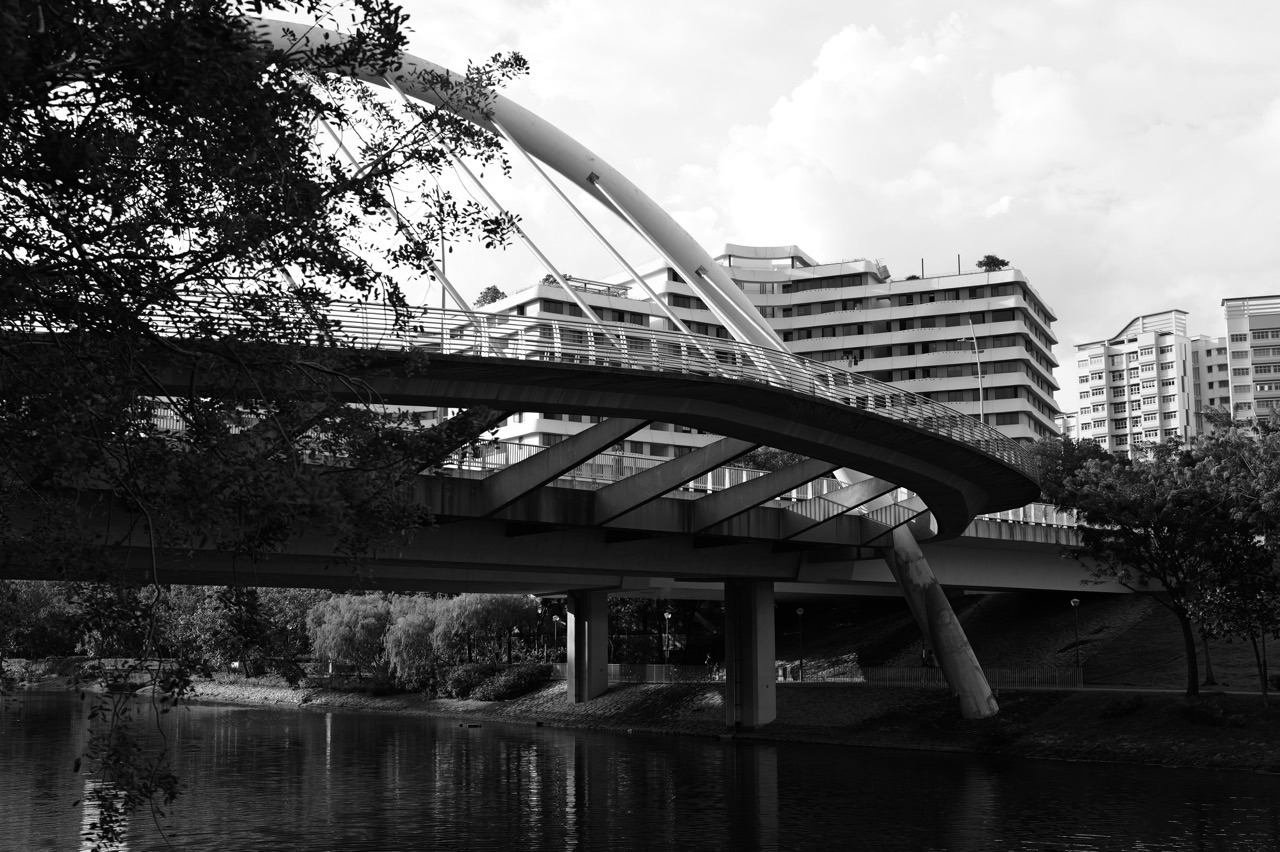
NParks lists Kelong Bridge and the preserved old bus stop among Waterway Park’s heritage appreciation landmarks. The bridge’s design refers to a kelong, an offshore fishing structure used in earlier coastal livelihoods. It is a contemporary interpretive piece rather than an untouched historic fishing platform. The value lies in asking why a new-town park includes a recognisable visual reference to the earlier community.
How to do the activity
Visit a publicly accessible waterway path and locate the bridge using NParks information. Notice the form, supports and relationship to the water; read any on-site interpretation before making historical claims. Compare the architecture with legitimate archival kelong photographs from the National Museum or NHB. Allow time to stop without blocking pedestrians and cyclists.
Worked local example
A student photographs the modern bridge and captions it ‘old Punggol kelong’. A teacher prompts a revision: the bridge evokes older kelongs but was built as part of a contemporary park. The corrected caption makes the image more historically interesting because it identifies how design commemorates an activity that was part of everyday work.
Limits, access and common mistakes
The existence of a bridge does not establish a working fishing or boating facility below it. NParks’ park rules, water-edge restrictions and shared-path rules continue to apply. Do not lean over barriers for a photograph or describe designed elements as archaeological remains.
What to record or learn
Make a side-by-side annotation: kelong as historic structure, Kelong Bridge as modern interpretation. Explain what the design evokes and what it cannot tell us about the details of a past fishing operation.
Historical basis or official visitor status: nparks.gov.sg/visit/parks/park-detail/punggol-waterway-park/. A source that verifies the history does not itself grant permission to enter a closed park, private property or future development site.
9. Research Coney Island’s Haw Par period while exploring public nature routes
Where: Coney Island Park, permitted public trails between its West and East entrances.
What history is documented?
NHB’s Punggol history resource describes the island’s ownership by Aw Boon Haw and Aw Boon Par during the 1930s and 1940s, when it was known as Haw Par Island, and notes the historic Haw Par Beach Villa. Today’s NParks park emphasises biodiversity and rustic recreation. The private former villa is not an invitation for visitors to climb fences or enter buildings; the legitimate experience is a public nature visit accompanied by a documented story about changing ownership and use.
How to do the activity
Read the Roots timeline before travelling, then choose a short NParks-approved island route that opens between 7am and 7pm. Compare the island’s contemporary visitor map with historic references, taking notes from public paths. Look at natural features and ask how an island’s role shifts between private retreat, later modification and protected public recreation. Leave well before the gates close.
Worked local example
A couple wants to find the ‘Tiger Balm brothers’ house’ after seeing a social-media post. They check NHB’s material and NParks’ access map, then decide to walk a normal public island route rather than searching for unofficial entry points. They photograph vegetation, reflect on the changed use of the island and research the villa at home.
Limits, access and common mistakes
Do not treat Haw Par Beach Villa as an operating tourist attraction or guarantee its visibility. Avoid dense vegetation, wildlife disturbance and unapproved shortcuts. The park’s rustic surface can be unsuitable for some mobility needs. A historical place can be understood without invading an inaccessible building.
What to record or learn
Create a three-stage timeline for the island: named ownership in the 1930s–40s, later alterations to land use, and the modern public ecological park. Mark any gaps instead of inventing continuous events.
Historical basis or official visitor status: roots.gov.sg/han/Neighborhoods/Punggol/HAN-Resources-Folder/History-of-Punggol. A source that verifies the history does not itself grant permission to enter a closed park, private property or future development site.
10. Create an old-and-new Punggol map and photo essay
Where: Public Punggol Digital District and Waterway Park viewpoints, supported by library and archive research.
What history is documented?
NHB’s historic account explains Punggol’s recreation and agricultural character before major late twentieth-century reclamation, while URA and HDB planned a new waterfront residential town. JTC’s Punggol Digital District and NParks’ landscape projects show a further layer of twenty-first-century development. A before-and-after photo essay is a valid history activity even when old structures have disappeared, because the comparison makes land-use change visible.
How to do the activity
Select one historical map or copyright-cleared archive image, determine its approximate location and date, then visit a lawful current public viewpoint. If an exact viewpoint no longer exists because land was reclaimed or access changed, say so instead of manufacturing a perfectly matched shot. Make three pairs: coast and reclamation, agricultural land and housing, old road and digital district. Cite each archival source and use your own current images.
Worked local example
A learner sees a 1970s farming image and assumes it was taken beside today’s Waterway Point. Research shows that historical Punggol boundaries and road tracks were different, so they label the image only to the extent supported by the archive. They pair it with a current town-centre view but explicitly state that it is an illustrative contrast, not an exact spot reproduction.
Limits, access and common mistakes
Do not copy copyrighted photos without permission or present a historical picture as an original. Avoid private premises, drone operations without approvals and restricted campus spaces. Modern renovations and construction mean a 2026 view may change quickly; state the photo date.
What to record or learn
Write an evidence caption for each pair: what the old source shows, where it was approximately taken, what today’s image shows, and which part of the comparison remains uncertain. The completed essay can support a family history discussion or school project without pretending that every claim is settled.
Historical basis or official visitor status: roots.gov.sg/stories-landing/stories/punggol-waves-of-recreation/story. A source that verifies the history does not itself grant permission to enter a closed park, private property or future development site.
Three self-guided heritage itineraries
1. One hour: Punggol Coast trail and interpretation
Arrive at Punggol Coast MRT, follow the presently opened heritage trail section and focus on the recreated bus shelter, documented road terrain and interpretive signboards. Take two evidence-backed photographs and return using the same safe public route. Do not assume future trail phases are open.
2. Two hours: central waterway heritage
Choose a convenient entry to Punggol Waterway Park, identify Kelong Bridge and heritage interpretation, compare them with NHB’s fishing-village and seafood history, and finish at a nearby accessible food stop. This route is separate from Punggol Coast and should not force a cross-town extension.
3. At home plus one field visit: deeper research
Read the Roots accounts of the Punggol Zoo, Matilda House and the Sook Ching massacre; choose one public trail or waterway stop afterward to compare old and new land use. Keep closed parks and private properties out of the itinerary and record uncertainty in a short source-based journal.
An evidence-led Punggol history worksheet
For any one chosen stop, write four columns: claim, source, what is visible now, and what remains uncertain. A strong entry might say ‘Matilda House dates to 1902’ under claim, give the relevant Roots page, note today’s private clubhouse use, and explicitly state that exterior viewing does not establish access inside. A weak entry would claim the house is an abandoned tourist attraction because an old blog used that language. The worksheet protects readers from inaccurate itinerary advice.
For oral histories, record the interviewee’s wording and the approximate date of the recollection separately from the date of the event described. If an elder remembers an old restaurant along Punggol Road, do not invent a precise GPS location from memory alone. Compare with maps, directories or newspaper records. An account can remain valuable even when its exact address is unknown. Obtain consent before publishing identifiable family stories.
For photographs, note the photographer or archive, approximate date, rights status and what can be safely inferred from the image. A photograph of an old road proves that the road looked a certain way at the time and angle shown, but it may not prove that a remembered incident occurred there. Modern matched views should have their own dates, with changes in reclaimed coastline, road alignment and private access acknowledged.
For official announcements, preserve the words ‘opened’, ‘planned’ and ‘expected’. NParks’ 2025 heritage release states which first segment was opened and what later phases were expected to add; JTC’s current community page is a further check. An expected completion date is not a licence to enter a section before the operator declares it open. Likewise, a conservation record indicates historic significance but not that a building is a public museum.
Checklist for a safe and accurate heritage walk
- Check today’s public path entrance and current NParks/JTC restrictions.
- Decide which historical period the outing will study.
- Download an official map instead of relying on a screenshot of proposed routes.
- Bring a primary or reliable secondary source for every key claim.
- Respect private buildings, active construction and residential entrances.
- Allow a weather fallback near Punggol Coast or the central town.
- Use solemn and accurate language for WWII violence and remembrance.
- Photograph only from lawful public viewpoints and respect other users.
- Label personal memories as recollections rather than undisputed chronology.
- Finish with one evidence-backed caption or question to research.
Frequently asked questions
Where should a Punggol history lover go first?
The opened section of Punggol Heritage Trail near Punggol Coast MRT is the easiest compact starting point for publicly interpreted local history. Confirm the current open entrance with NParks or JTC; the future full alignment is a separate development.
Is all 1.3 kilometres of Punggol Heritage Trail open?
JTC identifies the first 400 metres as currently open, with the larger 1.3-kilometre alignment planned in phases. NParks describes more than a kilometre of meandering paths within the opened landscape, which is not equivalent to the whole proposed main trail.
Can we visit the old Punggol Zoo?
No. The historic zoo founded by William Lawrence Soma Basapa in 1928 ceased in the wartime era. You can explore NHB’s history and relevant interpretive signage; do not search for a functioning zoo.
Can tourists enter Matilda House?
It is a conserved building serving as a private condominium clubhouse, not a walk-in museum. Use lawful public viewpoints if they exist or consult official photographs and heritage material instead.
What happened at Punggol Beach in 1942?
NHB documents the killing of approximately 400 Chinese civilians on 28 February 1942 during the Sook Ching purge. It is a serious remembrance subject requiring respectful presentation.
Can I see the WWII marker in October 2026?
The marker is associated with Punggol Point Park, which is affected by upgrading restrictions. Do not assume physical access; consult the current official park notice before planning a visit and use NHB’s online marker page for history in the meantime.
Was Punggol always the same size?
No. NHB explains that the older geographic use of Punggol included areas such as Sengkang and Buangkok before later planning boundaries changed. Compare the dates and source maps before claiming that a historical site lies in today’s town.
How did Punggol get its name?
Official sources describe more than one explanation, including fruit-gathering or market interpretations and traditions associated with Wak Sumang. Avoid claiming one story is indisputably established.
Is Kelong Bridge an original fishing platform?
No. The modern bridge evokes kelong fishing heritage; it is an interpreted design feature within Punggol Waterway Park, not a preserved working kelong.
Was Coney Island once called Haw Par Island?
NHB records ownership by the Aw brothers in the 1930s and 1940s and describes the island as Haw Par Island. Today’s park is open 7am–7pm, but this does not confer access to its historic villa.
Is Punggol’s old seafood industry still operating as before?
The historic Seafood Village, boatels and coastal industries changed substantially through reclamation and redevelopment. Today’s restaurants are individual current businesses; do not equate an old name with a present operating venue.
What sources should a history writer trust?
Start with NHB Roots, the National Archives of Singapore, NParks, JTC and relevant URA conservation records. Distinguish oral memories, historical images, official markers, current maps and announcements about future projects.
Official primary references and next reading
The historical chronology and visitor status in this article are supported by official National Heritage Board, NParks and JTC materials checked in October 2026. Where public facilities have been developed in phases, recheck the actual operator notice before travelling. Some archive-led activities are intentionally not promoted as physical attractions, because private access or closure makes that misleading.
- NParks 2025 Heritage Trail opening
- JTC current Punggol Heritage Trail status
- NHB Punggol Waves of Recreation
- NHB History of Punggol
- NHB Punggol agriculture and wildlife
- NHB Punggol Zoo research
- NHB Punggol Beach Massacre marker
- NParks Waterway Park
- NParks Coney Island
- Punggol historic events and research companion
- Nature lovers companion
A first heritage outing that actually works
Begin with the open trail near Punggol Coast and one question: how has Old Punggol Road been remembered within a modern district? Read a sign, observe a retained landscape feature and make an accurate note. If you want more, use the official sources to research the zoo, farming, Matilda House or the old waterfront on a later day. Good local history accumulates through evidence and reflection, not the number of places photographed.


