
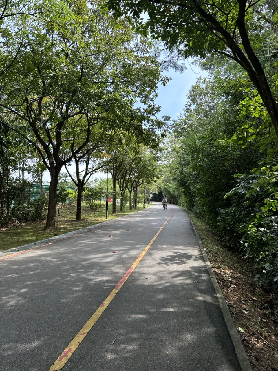
The top 10 things to do in Punggol for cyclists start with the 8.4-kilometre Punggol Waterway Park Connector, but there is no rule that every cyclist should cover the full route. Beginners can practise starts and stops on a short lawful section. Confident riders can visit the coastal Punggol Promenade, plan a daylight Coney Island loop or explore the 3-kilometre Lorong Halus Park Connector. Stronger cyclists can work toward the 26-kilometre North Eastern Riverine Loop, provided they understand the current path map and the ride back.
This 2026 guide ranks ten cycling experiences by what the rider wants to achieve: an easy first ride, a scenic waterway circuit, a coast-focused short ride, a rustic park ride, birdwatching from safe stops, a fitness challenge, a cafe-or-hawker meetup and one purposeful route-planning exercise. It separates cycling-permitted paths from pedestrian-only sections, explains the difference between published route lengths and a personal ride, and treats bike parking and return logistics as part of the outing.
Important 2026 updates: NParks’ September park connector pages describe Punggol Waterway as 8.4 kilometres, Punggol Park Connector as 6.1 kilometres, Lorong Halus Park Connector as 3 kilometres, and the North Eastern Riverine Loop as a 26-kilometre network. These lengths are official descriptions of routes, not guarantees that every section is open or suitable for every rider today. LTA’s Pedestrian-Only Path initiative also means cyclists should not assume a pedestrian route is available to bikes.
Before leaving, check NParks park connector notices, LTA’s current path rules, the NEA weather outlook and any entrance-specific restrictions. Punggol Point Park has been closed for upgrading since 11 August 2026, expected through late 2027, and connected cycling routes may require a lawful alternative. No scenic photograph is a reason to ride past a closure barrier. Treat the ten ideas as a choice of one well-planned experience, not a ten-stop endurance requirement.
Quick selection: ten ways to cycle Punggol
- 1. New or returning cyclists — Easy Waterway practice section; Check path type; stay near start.
- 2. Scenic ride with clear turnaround — Punggol Waterway bridge circuit; 8.4 km PCN exists; short route is fine.
- 3. Coastal short ride — Punggol Promenade Riverside Walk approach; 1.2 km PCN, follow current cycling signs.
- 4. Greenery and shelter breaks — Punggol Promenade Nature Walk approach; 2.4 km connector, check diversions.
- 5. Rustic nature — Coney Island cycling; 7am–7pm park opening.
- 6. Wetland views — Lorong Halus Park Connector; 3 km; watch for birds at rest points.
- 7. Longer water-themed connector — Punggol Park Connector; 6.1 km, links wider network.
- 8. Endurance training day — North Eastern Riverine Loop; 26 km network, advanced planning.
- 9. Bike-and-food social — Punggol Coast or Waterway Point stop; Choose lawful bike parking first.
- 10. Skills-first group ride — Shared-path courtesy and navigation session; LTA and NParks signs govern.
The ten choices differ in purpose as well as location. Some are routes, some are planned safe stops, and some are exercises in skills and group judgement. A published connector length describes an official section, while your actual ride includes approach, return, stops and possible closures. Always estimate the total journey, not just a headline distance.
How to choose a ride without getting into difficulty
Choose a sensible total distance
Ride to your current ability, not to the most impressive distance on a route map. A good cycling itinerary should make the return easier than the outward journey. Pick a fixed turn-back point, bring enough water and allow a margin for unplanned pauses. If an inexperienced friend is riding, do not choose a lengthy multi-connector route and promise it is ‘flat and easy’ without checking crossings, exposure and bike suitability.
Understand current path permissions
Understand path categories before deciding where to ride. LTA explains the difference between pedestrian-only paths, standalone footpaths, shared paths and cycling paths, and the permitted devices can differ. NParks’ park connector guidance also highlights path markings, segregated sections and attention zones. A maximum speed on a shared path is not a target speed; slowing near pedestrians is essential even when the legal ceiling is higher.
Start with reliable bicycle equipment
Make a bicycle check part of the outing. Verify tyres, brakes, steering, chain and safe lighting as relevant, and wear an appropriately fitting helmet. Riders using a rental bicycle should test their fit and brake response before entering crowded shared space. Do not assume a rental listing on an older travel blog means the operator still has the right bike, child seat or return station available. Every cyclist needs a safe way to turn back.
Treat stopping and parking as part of cycling
Do not confuse three activities: riding on a connector, walking with a parked bicycle in a nature space, and entering a mall to eat. They may occur in the same afternoon but follow different permissions. Dismount and secure bikes where cycling is not permitted. Use legitimate bicycle parking and never chain equipment where it obstructs accessible routes, fire exits or private operations.
Make weather an explicit go/no-go decision
Plan the weather decision before the group gathers. NEA’s myENV gives heavy rain, lightning and environmental alerts. Exposed waterfront stretches can become difficult during thunderstorms, while high heat may make sustained riding uncomfortable. Use a sheltered location to pause and reassess, and postpone rather than ride through unsafe conditions. A planned shortcut or station exit is a sign of preparedness, not weakness.
Share space with people and wildlife
Respect wildlife, residents and other road users. The corridor is a transport and recreation asset shared with walkers, children, older people and people using wheelchairs or mobility aids. Maintain appropriate passing space and keep speeds conservative near them. Stop completely off a path when photographing birds or checking navigation. Nature parks have special rules, so follow site signage and do not assume every path is an unrestricted cycling trail.
The top 10 cycling activities and routes in detail
1. Practise a short beginner ride on Punggol Waterway Park Connector
Location: A clearly permitted, quieter section of the Punggol Waterway Park Connector. Important: Follow current official path classifications and notices, not old route screenshots.
What makes this cycling experience worthwhile
An 8.4-kilometre official connector can sound intimidating, but the beginner experience should be built on a few hundred metres of smooth, predictable riding at a time. The setting provides a pleasant reason to leave home while still offering bridges and waterway scenery. The goal is consistent steering and braking, not total mileage. Riders who have only recently resumed cycling may value a simple, repeatable route much more than a complex loop.
A good recreational route gives the rider a reason to move, an achievable end point and a way to recover. Scenic views are useful, but they should never distract from the fact that public paths are shared with people moving at different speeds. The best route is not automatically the longest one; it is the one whose surface, crossings, exposure and return fit the actual rider’s preparation.
Route-planning steps
Choose a low-crowd time and a section where cycling is explicitly allowed. Check the bicycle before starting, practise a controlled launch and full stop, then repeat until both feel comfortable. Identify a safe turnaround with no sharp surprise crossing. If pedestrians, fast riders or congestion make the section unsuitable, dismount and move to a better permitted place rather than trying to practise among people at risk.
Write down the start point, the planned turnaround and the nearest sensible exit before moving. Mark a break point where stopping is permitted and will not obstruct pedestrians or cyclists. If the route appears different from the map, stop safely, read the latest signage and revise the journey. When using a cycling computer or navigation app, do not stare at it while moving through a busy shared zone.
Worked local ride
A returning adult cyclist rides alongside a confident friend who agrees not to set the pace. The rider practises safe starts, follows marked directions, and completes a short loop without abrupt braking. They return home while the experience is positive. On the next visit, they add one extra safe section but keep the same start and stop checks.
What makes this example work is the rider’s choice to adapt before trouble develops. A route is a plan rather than a promise. Shortening an outing because of heat, fatigue, weather or unfamiliar signage is an ordinary part of sound cycling. It is not a failed attempt to prove fitness or an embarrassing concession to another rider.
Risks and legal limits
The park connector’s overall designation does not mean every nearby footpath permits cycling. LTA’s pedestrian-only conversions must be respected, as must actual on-site NParks markings. Wear suitable protection and avoid practising near water edges or stairs. Anyone uncomfortable with balance may need supervised instruction or a different training location rather than an unsupervised public path.
LTA and NParks publish the current path and device rules. Those rules are more authoritative than a casual comment suggesting that ‘everybody rides here’. A cycle path, shared path and pedestrian-only path are not interchangeable. Check any special park operating hours and pay attention to signs at real junctions. Courtesy is needed even when riding within a posted maximum speed.
When to choose another ride
Choose this over Coney Island when someone is still learning confidence and a quick return is important. A rustic nature route should come later, not be the first challenge. The best beginner activity is a repeatable one where the rider can stop safely and feel in control.
A useful skill or observation to take home
Record three skills rather than speed: straight-line control, smooth stopping and predictable yielding. Improvement is more meaningful than a fitness-app ranking. Repeat the same short practice route until these are consistent before extending distance.
Official check for this outing: route, park or safety authority. Use it with current NParks notices, local signs and a weather check. Routes and commercial services can change after a guide has been published, so avoid assuming a named place guarantees present-day unrestricted cycling access.
2. Explore Punggol Waterway’s bridges as a scenic cycling circuit
Location: Punggol Waterway Park Connector and designated cycling paths near public waterway bridges. Important: Follow current official path classifications and notices, not old route screenshots.
What makes this cycling experience worthwhile
The waterway’s architecture turns an ordinary ride into a landscape experience. NParks describes four park zones, and the connector runs along the waterway beside a mix of bridges, planted areas and public spaces. Riders who already have basic control can choose a modest out-and-back circuit, pause at an appropriate rest area and appreciate different viewpoints without promising to travel the whole town.
A good recreational route gives the rider a reason to move, an achievable end point and a way to recover. Scenic views are useful, but they should never distract from the fact that public paths are shared with people moving at different speeds. The best route is not automatically the longest one; it is the one whose surface, crossings, exposure and return fit the actual rider’s preparation.
Route-planning steps
Open NParks’ current route map and pick one or two bridges as checkpoints. Choose a lawful cycling path and mark one designated place to stop fully off the traffic line. Allow time to dismount for photographs, then resume only when the shared path is clear. Plan the return toward a known MRT-area anchor rather than improvising ever farther from the starting point.
Write down the start point, the planned turnaround and the nearest sensible exit before moving. Mark a break point where stopping is permitted and will not obstruct pedestrians or cyclists. If the route appears different from the map, stop safely, read the latest signage and revise the journey. When using a cycling computer or navigation app, do not stare at it while moving through a busy shared zone.
Worked local ride
Two friends begin with a waterway-view goal rather than a target speed. At the first bridge they stop, move to a public standing area and take photographs of different arch shapes. They then ride to the second planned turning point and return. The ride remains conversational and calm because there is no pressure to complete a long distance.
What makes this example work is the rider’s choice to adapt before trouble develops. A route is a plan rather than a promise. Shortening an outing because of heat, fatigue, weather or unfamiliar signage is an ordinary part of sound cycling. It is not a failed attempt to prove fitness or an embarrassing concession to another rider.
Risks and legal limits
Busy weekends can bring pedestrians, strollers and slower recreational riders onto shared sections. Slow well before blind bends, give sufficient room and do not ride across busy pedestrian zones. Stopping abruptly for an unexpected good photograph can endanger someone behind you. Use the planned break point instead.
LTA and NParks publish the current path and device rules. Those rules are more authoritative than a casual comment suggesting that ‘everybody rides here’. A cycle path, shared path and pedestrian-only path are not interchangeable. Check any special park operating hours and pay attention to signs at real junctions. Courtesy is needed even when riding within a posted maximum speed.
When to choose another ride
Choose the bridge circuit when scenic variety is the main reward. Choose a skills-only session when somebody cannot yet brake predictably. An endurance rider seeking a longer training block may prefer the connected North Eastern Riverine Loop after checking current diversions.
A useful skill or observation to take home
Make a bridge-design comparison from parked positions. Notice which structures shade the path or direct pedestrians and cyclists. The exercise adds interest to a familiar ride without creating competition for narrow space.
Official check for this outing: route, park or safety authority. Use it with current NParks notices, local signs and a weather check. Routes and commercial services can change after a guide has been published, so avoid assuming a named place guarantees present-day unrestricted cycling access.
3. Enjoy the Punggol Promenade Riverside Walk cycling approach
Location: Public cycling-permitted approach to Punggol Promenade Riverside Walk near the Serangoon Reservoir. Important: Follow current official path classifications and notices, not old route screenshots.
What makes this cycling experience worthwhile
NParks’ park connector directory lists Riverside Walk as a 1.2-kilometre wheelchair-friendly waterside route with nearby Tebing Lane food options. It is a useful short-coast or reservoir objective because cyclists can plan a brief scenic stop rather than a large training session. The path’s accessibility description does not itself confirm that every metre or adjoining pedestrian segment permits cycling, so the on-site route classification matters.
A good recreational route gives the rider a reason to move, an achievable end point and a way to recover. Scenic views are useful, but they should never distract from the fact that public paths are shared with people moving at different speeds. The best route is not automatically the longest one; it is the one whose surface, crossings, exposure and return fit the actual rider’s preparation.
Route-planning steps
Find the present legal cycling approach using the NParks map and follow signs near shared or segregated paths. Choose a calm stopping area away from the flow and decide whether to dismount for the riverside view. If a section is marked pedestrian-only, walk the bicycle or use another cycling-permitted route. Confirm which access remains open near any separate upgrading works.
Write down the start point, the planned turnaround and the nearest sensible exit before moving. Mark a break point where stopping is permitted and will not obstruct pedestrians or cyclists. If the route appears different from the map, stop safely, read the latest signage and revise the journey. When using a cycling computer or navigation app, do not stare at it while moving through a busy shared zone.
Worked local ride
A rider wants a waterfront change after commuting around central Punggol all week. They take a short lawful approach, park safely where permitted, drink water and watch activity on the reservoir. They turn home before the warmest part of the afternoon rather than adding a long northern coast extension by habit.
What makes this example work is the rider’s choice to adapt before trouble develops. A route is a plan rather than a promise. Shortening an outing because of heat, fatigue, weather or unfamiliar signage is an ordinary part of sound cycling. It is not a failed attempt to prove fitness or an embarrassing concession to another rider.
Risks and legal limits
Do not treat the word ‘promenade’ as a blanket cycling permission. Outdoor routes can intersect pedestrian-only stretches, narrow approach ramps and spaces used by families. Riding through crowds at speed is inappropriate even if the rider is technically on a shared portion. Restaurants and parking arrangements also change; do not rely on an old listing for bike security.
LTA and NParks publish the current path and device rules. Those rules are more authoritative than a casual comment suggesting that ‘everybody rides here’. A cycle path, shared path and pedestrian-only path are not interchangeable. Check any special park operating hours and pay attention to signs at real junctions. Courtesy is needed even when riding within a posted maximum speed.
When to choose another ride
Choose this when a short reservoir-focused stop sounds appealing. Choose Waterway Park for more central transport access or Lorong Halus for a distinct wetland and biodiversity setting. If the latest closure map shows a diversion, follow it even when the attractive route seems shorter.
A useful skill or observation to take home
Write down how long the return actually took, including crossing and stopping time. A simple real-world time estimate makes future rides safer and less stressful than relying on cycling-app predictions alone.
Official check for this outing: route, park or safety authority. Use it with current NParks notices, local signs and a weather check. Routes and commercial services can change after a guide has been published, so avoid assuming a named place guarantees present-day unrestricted cycling access.
4. Follow an appropriate section near Punggol Promenade Nature Walk
Location: Punggol Promenade Nature Walk, linking northern promenade segments. Important: Follow current official path classifications and notices, not old route screenshots.
What makes this cycling experience worthwhile
The NParks listing describes a 2.4-kilometre waterfront nature-walk section with rest shelters and scenic views. It gives cyclists an appealing destination for a bicycle-and-walk outing, especially when the ride itself is meant to connect public spaces rather than cover the longest distance possible. The route also connects distinct thematic promenade sections, so a rider should treat access, path designation and closure status as separate things to check.
A good recreational route gives the rider a reason to move, an achievable end point and a way to recover. Scenic views are useful, but they should never distract from the fact that public paths are shared with people moving at different speeds. The best route is not automatically the longest one; it is the one whose surface, crossings, exposure and return fit the actual rider’s preparation.
Route-planning steps
Plan cycling on the sections that permit it and be prepared to dismount for clearly pedestrian-only stretches. Use the current park connector map and on-site signs, not the label ‘Nature Walk’ as cycling authorisation. Pick one shelter or legal bicycle-parking point as the break. Since northern Punggol Point Park is under upgrading, check that the chosen approach does not depend on closed park land.
Write down the start point, the planned turnaround and the nearest sensible exit before moving. Mark a break point where stopping is permitted and will not obstruct pedestrians or cyclists. If the route appears different from the map, stop safely, read the latest signage and revise the journey. When using a cycling computer or navigation app, do not stare at it while moving through a busy shared zone.
Worked local ride
Two cyclists visit the nature-walk area to look at the coastal scenery. When they reach a narrow pedestrian-focused section, they walk their bicycles and share the view. They stop near a legal rest point rather than forcing a ride through people. The trip is satisfying because moving with courtesy was part of the plan.
What makes this example work is the rider’s choice to adapt before trouble develops. A route is a plan rather than a promise. Shortening an outing because of heat, fatigue, weather or unfamiliar signage is an ordinary part of sound cycling. It is not a failed attempt to prove fitness or an embarrassing concession to another rider.
Risks and legal limits
Some coastal surfaces and approach paths can be more exposed or less familiar than central park-connector sections. Wind, sudden rain, high sun and crowds alter the experience. Do not stop a bike across a ramp or block a sheltered rest area. If notices restrict access, ride another connected section instead of looking for an informal shortcut.
LTA and NParks publish the current path and device rules. Those rules are more authoritative than a casual comment suggesting that ‘everybody rides here’. A cycle path, shared path and pedestrian-only path are not interchangeable. Check any special park operating hours and pay attention to signs at real junctions. Courtesy is needed even when riding within a posted maximum speed.
When to choose another ride
Choose this for a mix of riding and walking, not for uninterrupted high-speed cycling. Choose the Waterway PCN for a more direct ride, and Coney Island if the group explicitly wants a rustic island experience with time to exit before closure.
A useful skill or observation to take home
Observe where the experience changes from transport corridor to nature appreciation. Riders learn to slow or dismount according to context, a skill more useful for safe urban cycling than memorising one preferred speed.
Official check for this outing: route, park or safety authority. Use it with current NParks notices, local signs and a weather check. Routes and commercial services can change after a guide has been published, so avoid assuming a named place guarantees present-day unrestricted cycling access.
5. Ride the cycling-permitted paths of Coney Island Park by daylight
Location: Coney Island Park via the West or East entrance. Important: Follow current official path classifications and notices, not old route screenshots.
What makes this cycling experience worthwhile
NParks describes Coney Island as an ecologically sustainable, biodiversity-rich park with scenic cycling paths, boardwalks and rustic habitats. Cycling here can feel more adventurous than a town-centre loop while remaining a planned daytime activity. The park’s 7am–7pm operating hours are a real boundary, and some surfaces require riders to be more careful about traction, obstacles and the needs of walkers.
A good recreational route gives the rider a reason to move, an achievable end point and a way to recover. Scenic views are useful, but they should never distract from the fact that public paths are shared with people moving at different speeds. The best route is not automatically the longest one; it is the one whose surface, crossings, exposure and return fit the actual rider’s preparation.
Route-planning steps
Check the official park map, opening and current notices, then arrive early enough to complete a modest route and exit comfortably before 7pm. Use cycling-permitted paths only; dismount where signs require it or pedestrian density makes riding inappropriate. Carry water, maintain a steady moderate pace and identify which entrance the group will use to return. Some park sections may be rugged, so match tyres and experience to the route.
Write down the start point, the planned turnaround and the nearest sensible exit before moving. Mark a break point where stopping is permitted and will not obstruct pedestrians or cyclists. If the route appears different from the map, stop safely, read the latest signage and revise the journey. When using a cycling computer or navigation app, do not stare at it while moving through a busy shared zone.
Worked local ride
Three confident cyclists plan a late-morning island visit. They ride gently through designated routes, pause only in suitable rest areas and spot tree changes without following wildlife. After a little more than an hour, they use the same entrance to return. They then eat in a nearby suitable venue, keeping the island ride separate from the meal.
What makes this example work is the rider’s choice to adapt before trouble develops. A route is a plan rather than a promise. Shortening an outing because of heat, fatigue, weather or unfamiliar signage is an ordinary part of sound cycling. It is not a failed attempt to prove fitness or an embarrassing concession to another rider.
Risks and legal limits
Do not enter the park for an evening-after-sunset ride; closing hours and natural habitat protection matter. Avoid chasing animals, creating shortcuts through vegetation or pretending every rustic stretch is suitable for a novice on a road-oriented bicycle. Lightning and strong rain are reasons to defer the island trip, not to seek shelter under isolated trees.
LTA and NParks publish the current path and device rules. Those rules are more authoritative than a casual comment suggesting that ‘everybody rides here’. A cycle path, shared path and pedestrian-only path are not interchangeable. Check any special park operating hours and pay attention to signs at real junctions. Courtesy is needed even when riding within a posted maximum speed.
When to choose another ride
Choose Coney Island if the natural habitat is the goal and everyone is an able cyclist. Choose the main waterway connector for more predictable town-centre access or when someone has limited time. An island ride is also a poor plan if your return schedule is uncertain near closing.
A useful skill or observation to take home
Use a slow biodiversity observation approach: identify two habitats from a suitable stopping point and note how the cycling surface changes between them. The observation can add meaning without disturbing the ecological setting.
Official check for this outing: route, park or safety authority. Use it with current NParks notices, local signs and a weather check. Routes and commercial services can change after a guide has been published, so avoid assuming a named place guarantees present-day unrestricted cycling access.
6. Ride the three-kilometre Lorong Halus Park Connector
Location: Lorong Halus Park Connector near Pasir Ris Farmway and Lorong Halus Wetland. Important: Follow current official path classifications and notices, not old route screenshots.
What makes this cycling experience worthwhile
NParks describes Lorong Halus Park Connector as a three-kilometre link between Pasir Ris and Punggol, running along the corridor near Serangoon Reservoir and Lorong Halus Wetland. Its distinct appeal is combining cycling with views of an engineered wetland and bird habitats. Birdwatching enthusiasts can pause to look for species such as Chestnut Munia and Little Grebe, mentioned in the official connector description, without needing to enter wildlife habitat.
A good recreational route gives the rider a reason to move, an achievable end point and a way to recover. Scenic views are useful, but they should never distract from the fact that public paths are shared with people moving at different speeds. The best route is not automatically the longest one; it is the one whose surface, crossings, exposure and return fit the actual rider’s preparation.
Route-planning steps
Check the published connector map and the exact approach from your starting point. Ride at a comfortable pace, plan a safe and lawful place to dismount, and take a short birdwatching break if conditions allow. Keep bicycles out of wetland vegetation, water-treatment infrastructure and pedestrian-focused areas. A rest stop should protect the cyclist’s bike and leave public paths unobstructed.
Write down the start point, the planned turnaround and the nearest sensible exit before moving. Mark a break point where stopping is permitted and will not obstruct pedestrians or cyclists. If the route appears different from the map, stop safely, read the latest signage and revise the journey. When using a cycling computer or navigation app, do not stare at it while moving through a busy shared zone.
Worked local ride
A cyclist starting from Punggol wants a new route without committing to a 26-kilometre loop. They follow the mapped connector, stop at a suitable viewpoint and spend ten minutes using binoculars rather than forcing a close bird photograph. They then return along the known legal path. The outing has a clear theme and a practical endpoint.
What makes this example work is the rider’s choice to adapt before trouble develops. A route is a plan rather than a promise. Shortening an outing because of heat, fatigue, weather or unfamiliar signage is an ordinary part of sound cycling. It is not a failed attempt to prove fitness or an embarrassing concession to another rider.
Risks and legal limits
A three-kilometre connector’s published length does not count travel from every rider’s home or the way back. Check total door-to-door distance before leaving. The wetland environment can be hot and open, while feeding wildlife, disturbing birds or entering treatment areas is inappropriate. Avoid hard acceleration near pedestrian crossings.
LTA and NParks publish the current path and device rules. Those rules are more authoritative than a casual comment suggesting that ‘everybody rides here’. A cycle path, shared path and pedestrian-only path are not interchangeable. Check any special park operating hours and pay attention to signs at real junctions. Courtesy is needed even when riding within a posted maximum speed.
When to choose another ride
Choose Lorong Halus for wetland scenery and a shorter named connector. Choose Coney Island for rustic forest/coastal habitat or Punggol Waterway for familiar urban waterside views. Riders who want an environmental learning trail may prefer to park lawfully and walk the wetland section.
A useful skill or observation to take home
Keep a route note that separates cycling kilometres from time spent observing nature. This helps future rides stay realistic and prevents an outdoor hobby from becoming only a count of speed and distance.
Official check for this outing: route, park or safety authority. Use it with current NParks notices, local signs and a weather check. Routes and commercial services can change after a guide has been published, so avoid assuming a named place guarantees present-day unrestricted cycling access.
7. Explore the six-point-one-kilometre Punggol Park Connector
Location: Punggol Park Connector linking Punggol Promenade, reservoir edges and Gerald Drive. Important: Follow current official path classifications and notices, not old route screenshots.
What makes this cycling experience worthwhile
NParks lists Punggol Park Connector as 6.1 kilometres, a water-themed route that passes reservoir and Straits of Johor environments while linking toward Gerald Drive and other connections. The official description mentions birdlife such as Grey Heron, Little Egret and Collared Kingfisher. For cyclists, this is a useful intermediate step beyond a single small waterway segment because it introduces more route-planning and return decisions.
A good recreational route gives the rider a reason to move, an achievable end point and a way to recover. Scenic views are useful, but they should never distract from the fact that public paths are shared with people moving at different speeds. The best route is not automatically the longest one; it is the one whose surface, crossings, exposure and return fit the actual rider’s preparation.
Route-planning steps
Check the current PCN map, public approach and return connections. Choose a segment suitable for your skill, not necessarily the entire published corridor. Use marked paths and manage crossings carefully. Decide whether the rider will return along the same section or use a confirmed connected route, and calculate the combined distance instead of reading the connector length as the whole ride.
Write down the start point, the planned turnaround and the nearest sensible exit before moving. Mark a break point where stopping is permitted and will not obstruct pedestrians or cyclists. If the route appears different from the map, stop safely, read the latest signage and revise the journey. When using a cycling computer or navigation app, do not stare at it while moving through a busy shared zone.
Worked local ride
Two experienced recreational cyclists complete a morning out-and-back along an appropriate stretch and stop briefly to observe reservoir birds. Their companion has an afternoon obligation, so they leave a large buffer for the return. They learn the difference between a named connector and a full outing, and can plan a longer extension next time.
What makes this example work is the rider’s choice to adapt before trouble develops. A route is a plan rather than a promise. Shortening an outing because of heat, fatigue, weather or unfamiliar signage is an ordinary part of sound cycling. It is not a failed attempt to prove fitness or an embarrassing concession to another rider.
Risks and legal limits
Do not confuse Punggol Park Connector with Punggol Park itself, which NParks places near Hougang Avenue 8 and 10. The names refer to different geographical objects. Cycling under time pressure can make unfamiliar junctions more hazardous; if there is any uncertainty, stop off the path and confirm the route instead of navigating from a moving bicycle.
LTA and NParks publish the current path and device rules. Those rules are more authoritative than a casual comment suggesting that ‘everybody rides here’. A cycle path, shared path and pedestrian-only path are not interchangeable. Check any special park operating hours and pay attention to signs at real junctions. Courtesy is needed even when riding within a posted maximum speed.
When to choose another ride
Choose this for an intermediate or exploratory connector ride. Choose a short waterway section for beginners; choose the full North Eastern Riverine Loop only when fitness, time and navigation confidence are sufficient. The right route should be chosen before leaving, not during a moment of fatigue.
A useful skill or observation to take home
Create a simple route card listing the start, two memorable landmarks, a water stop and a confirmed return. Share that card with the group so everybody understands the plan without depending on one rider’s phone battery.
Official check for this outing: route, park or safety authority. Use it with current NParks notices, local signs and a weather check. Routes and commercial services can change after a guide has been published, so avoid assuming a named place guarantees present-day unrestricted cycling access.
8. Plan an advanced ride on the 26-kilometre North Eastern Riverine Loop
Location: The North Eastern Riverine Loop through Punggol, Sengkang and Buangkok. Important: Follow current official path classifications and notices, not old route screenshots.
What makes this cycling experience worthwhile
NParks describes the North Eastern Riverine Loop as a scenic 26-kilometre network connecting four parks across Punggol, Sengkang and Buangkok. It is attractive to riders who want a longer continuous recreational session through varied urban, riverine and coastal landscapes. However, 26 kilometres is a network description, not a promise that every connected section is free from a diversion or that the chosen start and return cover exactly that distance.
A good recreational route gives the rider a reason to move, an achievable end point and a way to recover. Scenic views are useful, but they should never distract from the fact that public paths are shared with people moving at different speeds. The best route is not automatically the longest one; it is the one whose surface, crossings, exposure and return fit the actual rider’s preparation.
Route-planning steps
Treat this as an intermediate-to-advanced planning exercise. Download the current official brochure or map, check PCN closure notices, identify food and water stops, and calculate the total mileage from the actual start and back. Agree on a no-shame early-exit procedure for a group. Carry adequate supplies and allow a realistic riding duration that includes crossings and breaks.
Write down the start point, the planned turnaround and the nearest sensible exit before moving. Mark a break point where stopping is permitted and will not obstruct pedestrians or cyclists. If the route appears different from the map, stop safely, read the latest signage and revise the journey. When using a cycling computer or navigation app, do not stare at it while moving through a busy shared zone.
Worked local ride
A small group is comfortable with regular ten-kilometre rides and wants to explore more. They study the loop beforehand, discover a closure notice affects a desired northern section and adjust the official alternative before setting off. They use a planned midway checkpoint to assess energy and choose to complete only their safe portion rather than chase a full-loop badge.
What makes this example work is the rider’s choice to adapt before trouble develops. A route is a plan rather than a promise. Shortening an outing because of heat, fatigue, weather or unfamiliar signage is an ordinary part of sound cycling. It is not a failed attempt to prove fitness or an embarrassing concession to another rider.
Risks and legal limits
Longer distance increases consequences of mechanical trouble, navigation error, heat and fatigue. Do not attempt a first 26-kilometre ride as an informal family outing without conditioning or a clear fallback. A driver or rider who misunderstands segregated paths may put pedestrians at risk. Maintain conservative speed and know whom to contact if equipment fails.
LTA and NParks publish the current path and device rules. Those rules are more authoritative than a casual comment suggesting that ‘everybody rides here’. A cycle path, shared path and pedestrian-only path are not interchangeable. Check any special park operating hours and pay attention to signs at real junctions. Courtesy is needed even when riding within a posted maximum speed.
When to choose another ride
Choose the loop when the primary goal is a prepared long recreational ride. Choose Coney Island for habitat and shorter experience, or the 6.1-kilometre Punggol Park Connector for a more limited route. Distance alone is not a reason to rank a route as better.
A useful skill or observation to take home
Compare moving time, stopped time and comfort rather than only average speed. That distinction helps cyclists understand the true duration of a route and plan more realistic group outings without racing or disregarding pedestrian safety.
Official check for this outing: route, park or safety authority. Use it with current NParks notices, local signs and a weather check. Routes and commercial services can change after a guide has been published, so avoid assuming a named place guarantees present-day unrestricted cycling access.
9. Build a bike-and-food route with lawful parking
Location: A selected cycle route terminating near Punggol Coast Mall or Waterway Point. Important: Follow current official path classifications and notices, not old route screenshots.
What makes this cycling experience worthwhile
Food can make a short cycling outing social and help encourage regular riding, but the destination must have a sensible bicycle approach and lawful parking. Punggol Coast and the central Waterway Point area have different transport and pedestrian environments. The best ride does not end with a cyclist blocking a mall entrance or carrying a muddy bicycle through a busy shared corridor.
A good recreational route gives the rider a reason to move, an achievable end point and a way to recover. Scenic views are useful, but they should never distract from the fact that public paths are shared with people moving at different speeds. The best route is not automatically the longest one; it is the one whose surface, crossings, exposure and return fit the actual rider’s preparation.
Route-planning steps
Choose the food venue first, then find a legal cycling approach and bicycle parking on current site or map information. Consider locking equipment appropriately and bringing only what can be carried off the bike. Check the current dining tenant and operating hours; restaurant schedules can change independently of mall hours. Allocate time for the final ride home and avoid eating too heavily just before a demanding return.
Write down the start point, the planned turnaround and the nearest sensible exit before moving. Mark a break point where stopping is permitted and will not obstruct pedestrians or cyclists. If the route appears different from the map, stop safely, read the latest signage and revise the journey. When using a cycling computer or navigation app, do not stare at it while moving through a busy shared zone.
Worked local ride
Two cyclists want coffee and a relaxed conversation after a short morning route. They select a venue near an approved bike parking area, finish the ride, secure their bicycles and enter on foot. A favourite restaurant is unexpectedly closed, but nearby food options let them keep the social purpose without riding to three more locations.
What makes this example work is the rider’s choice to adapt before trouble develops. A route is a plan rather than a promise. Shortening an outing because of heat, fatigue, weather or unfamiliar signage is an ordinary part of sound cycling. It is not a failed attempt to prove fitness or an embarrassing concession to another rider.
Risks and legal limits
Do not invent bike parking locations or treat informal railings as appropriate locking places. Cyclists should dismount before entering pedestrian or private areas that prohibit cycling. Rain may affect bike security and riders’ ability to return. A food stop is a planned break, not a reason to compromise the return ride with poor hydration or fatigue.
LTA and NParks publish the current path and device rules. Those rules are more authoritative than a casual comment suggesting that ‘everybody rides here’. A cycle path, shared path and pedestrian-only path are not interchangeable. Check any special park operating hours and pay attention to signs at real junctions. Courtesy is needed even when riding within a posted maximum speed.
When to choose another ride
Choose this for social riders who want a shorter ride and relaxed finish. Choose a pure waterway circuit when time is limited, or a longer loop when an uninterrupted training goal matters more than dining. The route should allow everyone to arrive and leave in a predictable manner.
A useful skill or observation to take home
Use this experience to test a genuine ‘car-lite’ local routine: can the bike replace a short leisure trip comfortably without breaking path rules? Recording what worked—parking, crossings and sheltered pedestrian access—is useful for everyday travel.
Official check for this outing: route, park or safety authority. Use it with current NParks notices, local signs and a weather check. Routes and commercial services can change after a guide has been published, so avoid assuming a named place guarantees present-day unrestricted cycling access.
10. Turn a group ride into a shared-path safety and navigation challenge
Location: Suitable permitted Punggol Waterway Park Connector sections with clear markings. Important: Follow current official path classifications and notices, not old route screenshots.
What makes this cycling experience worthwhile
Experienced recreational riders sometimes focus exclusively on distance and speed. A skills-focused outing can be more beneficial, especially for a group with different cycling backgrounds. Punggol’s mix of shared spaces, attention zones and separated paths makes it a practical setting to practise giving way, spotting legal route changes, communicating stops and navigating without abrupt manoeuvres.
A good recreational route gives the rider a reason to move, an achievable end point and a way to recover. Scenic views are useful, but they should never distract from the fact that public paths are shared with people moving at different speeds. The best route is not automatically the longest one; it is the one whose surface, crossings, exposure and return fit the actual rider’s preparation.
Route-planning steps
Before departing, review LTA and NParks’ current definitions of paths. Assign a lead rider and a rear rider and choose three planned observation points where everyone can stop off the path. At each point, identify markings, pedestrian priority and the safest next movement. Practise hand signals and predictable slowing in an appropriate area without turning the outing into a hazardous improvised training course.
Write down the start point, the planned turnaround and the nearest sensible exit before moving. Mark a break point where stopping is permitted and will not obstruct pedestrians or cyclists. If the route appears different from the map, stop safely, read the latest signage and revise the journey. When using a cycling computer or navigation app, do not stare at it while moving through a busy shared zone.
Worked local ride
A group notices a path transition where a pedestrian-only route begins beside a permitted cycling section. Instead of following another rider blindly, they stop safely, read the signs and choose the lawful way forward. The experience makes them more confident and courteous for future rides. They finish with a short water break and return as a group.
What makes this example work is the rider’s choice to adapt before trouble develops. A route is a plan rather than a promise. Shortening an outing because of heat, fatigue, weather or unfamiliar signage is an ordinary part of sound cycling. It is not a failed attempt to prove fitness or an embarrassing concession to another rider.
Risks and legal limits
Never stop across a busy connector to explain rules. A training group still owes other visitors safe passage and should not use a public path to test maximum speeds or risky manoeuvres. New rules can take effect after an old cycling video is filmed. If uncertain about a device category or legal restriction, consult current LTA information rather than a stranger’s assumption.
LTA and NParks publish the current path and device rules. Those rules are more authoritative than a casual comment suggesting that ‘everybody rides here’. A cycle path, shared path and pedestrian-only path are not interchangeable. Check any special park operating hours and pay attention to signs at real junctions. Courtesy is needed even when riding within a posted maximum speed.
When to choose another ride
Choose this over a longer ride when safety habits, new members or navigation confidence need attention. It also suits experienced riders who want to model considerate behaviour. Choose an indoor bicycle-maintenance lesson or a quieter familiar short ride if the paths are busy or weather makes training impractical.
A useful skill or observation to take home
After the outing, write one group rule that made everybody safer. For example, stop fully off the path before checking a map. A single well-practised rule can prevent more problems than memorising a complicated route with no attention to other users.
Official check for this outing: route, park or safety authority. Use it with current NParks notices, local signs and a weather check. Routes and commercial services can change after a guide has been published, so avoid assuming a named place guarantees present-day unrestricted cycling access.
Three ready-to-use routes at different levels
1. Beginner confidence, around 45–60 minutes
Pick one permitted quieter waterway section and spend most of the time on controlled starts, stops, steady pace and courteous yielding. Choose a nearby rest spot and turn back early. Never assume that the published 8.4-kilometre connector must be completed.
For each plan, identify one absolute stop condition: unsafe lightning, a major mechanical fault, a confusing diversion, unexpected discomfort or insufficient time to return before a park closes. A clear early-exit rule is part of being a capable rider. It also prevents a group from making poor decisions because it already travelled a long distance to meet.
2. Scenic intermediate half-day
Start on an appropriate Punggol Waterway connection, ride at an easy pace toward a chosen lawful promenade or nature viewpoint, pause fully off the cycling route and return with enough daylight. Check current diversions before departure and keep a sheltered fallback.
For each plan, identify one absolute stop condition: unsafe lightning, a major mechanical fault, a confusing diversion, unexpected discomfort or insufficient time to return before a park closes. A clear early-exit rule is part of being a capable rider. It also prevents a group from making poor decisions because it already travelled a long distance to meet.
3. Longer experienced-rider plan
Use the latest NParks North Eastern Riverine Loop map to choose a legal connected route with a clear midpoint decision and water breaks. If closures or weather make completion inappropriate, use an agreed shorter segment without treating it as a failed ride.
For each plan, identify one absolute stop condition: unsafe lightning, a major mechanical fault, a confusing diversion, unexpected discomfort or insufficient time to return before a park closes. A clear early-exit rule is part of being a capable rider. It also prevents a group from making poor decisions because it already travelled a long distance to meet.
Cycling costs and equipment without false assumptions
Many public connector rides require no park admission ticket, but this is not the same as free cycling. Bicycles cost money to own or rent, and riders may pay for maintenance, transport, food, locks and safety equipment. A short outing with a well-maintained owned bicycle can be cheaper and safer than an unplanned rental expedition. If using commercial rentals, verify operator availability, price, booking and return requirements directly.
A helmet should fit and remain fastened properly. Brakes should respond consistently, tyres should be appropriate for the chosen terrain, and lights are needed when visibility or applicable rules require them. Gear does not compensate for poor judgement. A rider who cannot stop smoothly in a clear space should not be pressed into a busy waterfront path because friends are eager to reach a photo location.
Cycling groups should also choose one person to handle route information, while everyone remains responsible for noticing signs and others using the paths. Keep group communication simple: agreed pace, rest point, turnaround and response to separation. Do not stop across narrow shared paths to hold a discussion. Move to a suitable safe place and then work out the next section.
Ten-point riding checklist
- Check the correct official NParks connector map and any temporary closure notices.
- Check which parts of the chosen route allow bicycle riding.
- Inspect brakes, tyres, steering, lights and helmet fit.
- Choose a total distance that includes the return, not just the outbound connector.
- Locate one lawful stopping point and an alternative turn-back point.
- Carry adequate drinking water and necessary personal items.
- Check current rain, lightning, heat and haze information.
- Make a safe passing and pedestrian-yield plan on shared paths.
- Verify opening hours for Coney Island or other gated parks.
- Finish with enough energy and time to return rather than chasing a route badge.
Five common Punggol cycling mistakes
Mistake one is turning route descriptions into speed challenges. NParks’ 8.4-kilometre waterway and 26-kilometre loop figures are helpful for orientation, but they do not decide how far an individual should ride. Choose a realistic segment, and count return and approach kilometres. Resist comparing a beginner’s quiet outing with a training rider’s metrics.
Mistake two is failing to distinguish cycling paths from footpaths. Following an older route video can lead riders into a newly converted pedestrian-only section. Read the signs before entry and follow current LTA rules. If a path is not permitted or its status is unclear, dismount or find another legal way rather than relying on informal habit.
Mistake three is treating a nature reserve or park as a free-for-all. Coney Island has a closing time, habitats that should not be disturbed and paths of differing ruggedness. The wetland around Lorong Halus includes environmental infrastructure and bird habitat. Cyclists should use permitted routes and enjoy the scenery from appropriate stopping points.
Mistake four is not planning for rain and heat. Waterfront rides can be exposed, and a short route may feel substantially harder in the afternoon sun. Review NEA conditions, allow water breaks and do not continue through lightning. If the weather is clearly unsuitable before departure, an indoor activity or postponed ride is the more competent choice.
Mistake five is ending a ride in the wrong place. A destination may lack convenient legal bike parking or involve an awkward return, and a mall entrance is not automatically somewhere to ride or secure a bicycle. Decide where the bicycle will go before committing to a meal or errand.
Frequently asked questions
How long is Punggol Waterway Park Connector?
NParks’ September 2026 listing describes an 8.4-kilometre park connector. A cyclist’s total ride depends on the start, return and any detours, so it may be shorter or longer than that figure.
How long is the North Eastern Riverine Loop?
NParks describes a 26-kilometre loop across Punggol, Sengkang and Buangkok. It is not a beginner requirement, and current diversions may alter an individual journey.
Can I cycle on every Punggol footpath?
No. LTA distinguishes pedestrian-only paths, standalone footpaths, shared paths and cycling paths. From July 2025, selected converted pedestrian-only paths prohibit active mobility devices. Follow current signs and the applicable rules.
What speed is allowed on shared park connector paths?
NParks and LTA describe shared-path limits, including up to 25 km/h for applicable devices, but riders must slow appropriately around pedestrians and obey local signs. A legal maximum is not a safe default speed.
Is Coney Island open at night for cycling?
No. NParks lists Coney Island Park opening from 7am to 7pm. Plan to leave well before closing and keep to cycling-permitted routes.
Can we cycle at Lorong Halus Wetland?
The Lorong Halus Park Connector supports a cycling approach, but the wetland has its own designated visitor areas and infrastructure. Follow the specific signs and dismount or park where required; do not enter sensitive habitat.
Is Punggol Point Park open for a cycling stop?
Upgrading closure affects the park from 11 August 2026 into an expected late-2027 completion. Check official connector diversions and do not ride through closed sections.
Do we need to own bikes?
Not necessarily, but current rental availability, bike size, return location and fees must be verified directly. A suitable bicycle and confident handling matter more than the decision to rent.
What if it rains while cycling?
Stop in an appropriate safe location, check NEA rain and lightning information and avoid exposed paths during thunderstorms. It may be safer to end or postpone rather than ride on when traction and visibility deteriorate.
Can I take photographs while riding?
No photograph is worth riding distracted. Stop completely in an appropriate area away from the path, secure the bicycle and photograph without blocking others or disturbing wildlife.
How do groups decide distance?
Let the least confident rider help set the distance, pace and turnaround, not only the strongest cyclist. Account for everybody’s return and recovery. Agree in advance how to shorten or cancel the ride.
How can we fact-check a cycling map?
Start with the current NParks connector page and notices, then compare on-site signs with LTA rules. A commercial cycling blog may show an attractive route but be out of date about construction, rental operators and legal path changes.
Official sources, maps and related guides
Route lengths and names were checked against NParks park connector pages updated in September and October 2026. Cycling rules were checked with LTA and the NParks PCN safety guidance. Before riding, use the latest on-site signs and current weather/closure notices for the actual date; the information below should not be treated as an all-clear for a particular segment.
- NParks Punggol Waterway PCN 8.4 km
- NParks Punggol Waterway Park
- NParks Punggol Park Connector 6.1 km
- NParks Lorong Halus PCN 3 km
- NParks Punggol Promenade Nature Walk
- NParks Coney Island Park
- NParks North Eastern Riverine Loop 26 km
- NParks PCN safety rules
- LTA active mobility code
- NEA myENV
- Punggol cycling companion
- Family cycling companion
Plan the next ride in one minute
Pick a legitimate route, choose a return point and a safe stopping place, inspect the bike and check weather and closures. Leave when the plan makes sense for the rider’s actual ability. Punggol’s different connectors will still be there for another day; protecting the shared space and arriving home comfortably is the real success.


