
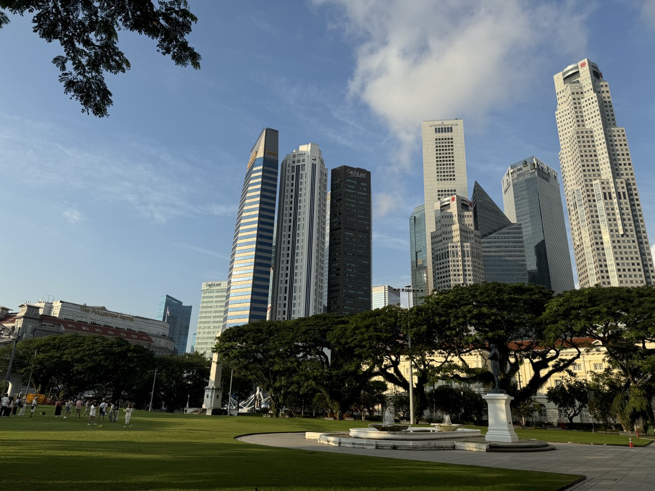
For a free Boat Quay walk in Singapore, start at Raffles Place MRT and head towards UOB Plaza and the river. Walk upstream along the conserved shophouse frontage towards Elgin Bridge. Turn back along the same bank for the shortest version, or use an open public crossing to see the row from across the river.
Allow around 30 to 45 minutes for the core walk at an easy pace, with longer for photographs, a bridge crossing or a meal. Boat Quay is most interesting when you look above the restaurant signs. The narrow fronts, upper floors and roofline show how the historic trading district fits against the high-rise financial centre behind it.
- Start at Raffles Place MRT on the East West or North South Line and follow signs towards UOB Plaza and the river.
- Walk the Boat Quay riverfront from the Raffles Place side towards Elgin Bridge.
- Use a public route on the opposite bank for a wider view when it is open.
- Read the upper floors before choosing a restaurant. Compare the total meal cost if you plan to stay.
- Leave a river cruise, a long bridge walk or Merlion Park as an optional extension.
1. Get from Raffles Place to the river
Use Raffles Place MRT and follow station signs towards UOB Plaza and the Singapore River. Exit G is one approach used for the UOB Plaza side. Follow the current signs if your route requires a lift or if an exit is diverted. If you are meeting friends, name both the station and the landmark on the river side so nobody waits in the middle of the square while the others are at the water.
At the river, take a moment to work out the two directions. The short shophouse route leads upstream towards Elgin Bridge. The Civic District and the approach to Marina Bay offer separate extensions. Knowing which way you intend to go helps when a map labels a broad part of the river as Boat Quay. Use the name of the crossing or a particular meeting point for a more exact instruction.
Start the walk on the shophouse side if you want to look up at facades and compare building widths. Start on the opposite side if the broad view and skyline are your priorities. It takes longer to use both sides than to do an out-and-back on one bank. You can make either version the entire outing.
Set a turnaround point
Choose Elgin Bridge or an earlier public point depending on your time. If you turn around before the bridge, use a safe place to stop and look back. The line of shophouses and changes in the background can be clearer from a new position even after only a short walk. A small group with children can make a game of choosing a landmark they will recognise on the return.
If you have a booking, plan the walking part separately. Identify the restaurant or meeting point before extending the route. Circular Road, the riverfront and the station approach are close enough to combine but can take you in different directions. A full name and a specific public entrance make the next part of the day easier to find.
2. Why the riverfront has rows of narrow buildings
The Urban Redevelopment Authority describes Boat Quay as a historic centre of trade. Its conservation area includes shophouses and former warehouses. Many nineteenth-century shophouses were built as continuous rows of narrow, two-storey buildings. The ground floor was used for business, while upper rooms could house merchants or workers. That arrangement helped fit many premises close to the river.
Read the terrace one bay at a time
Stand where you can see several fronts together. Look for the divisions between buildings. The terrace reads as one row from a distance, but the shop units can vary in width and detail. Compare which windows belong together. If a modern sign makes the division hard to see at ground level, look at the columns or upper floors instead.
A child can pick two adjacent fronts and describe one difference. They might notice different window shapes, the height of a floor or how the front meets the roof. Ask them to point to the exact detail. This is easier to remember than a general statement that all old shophouses look alike.
Notice the role of the river
The value of a riverfront location was different when boats carried goods to the quay. Warehouses, or godowns, needed space for cargo and access to boats. The buildings and river edge formed part of the same working area. Stand at an open public point and look from the water to the row. Think about how workers would need to move goods between a boat, the quay and a store.
The modern use is different. People now walk along the bank for meals, leisure or a route through the city. Boat traffic that visitors see today has a different relationship with the shore. The historic fabric still offers clues to how the place once worked. The contrast helps explain why conservation can preserve a building while allowing its everyday use to change.
Contents · Previous section · Next section
3. See the same row from both riverbanks

On the shophouse side, look for close details
From the riverfront, look up to see the upper windows and roofline. Some details are visible only from a little way back, so do not feel you have to stand right beside a frontage. Keep the public walking line clear and respect restaurant seating and other private areas. A photograph taken from farther away can be easier to understand because it shows how the selected building sits beside its neighbours.
Notice where the frontage curves with the river. A section that seems straight when viewed from directly in front can become part of a much longer sweep when you look along the bank. That curve is one reason a short walk gives more information than a single fixed view. You can choose a close view first and save the skyline for the crossing.
Across the river, compare the row with the towers behind it
Use an open public bridge and look back from a place where you can pause. The opposite bank offers a wider view of the old and newer buildings together. Look for the scale difference between a row of shophouses and the towers of the financial district. From one position you can see both the historic riverfront and part of the modern city that grew around it.
A wide photograph works well when the shophouse row, the river and the towers each have space in the frame. If a child is sketching, ask them to draw the tops of the low buildings first, then add the high-rise background. The two lines show the relationship clearly. You do not have to identify every tower to explain what makes the view distinctive.
If a bridge or path is busy, complete the crossing before stopping. An unobstructed place on the bank is often better for a group photograph anyway. Pick two useful views rather than stopping everyone at every opening. That leaves time to watch the river and enjoy the walk between them.
Contents · Previous section · Next section
4. What to look for above restaurant signs
Windows, shutters and the size of each opening
Choose one upper storey and count the openings that belong to the unit. Compare them with the unit next door. The shape or rhythm of openings can help you read the width of the frontage. Ground-floor shop displays can make the units look more uniform than they are. The upper floors often give you another way to work out where one unit stops and the next begins.
The roofline and the change in building height
Look along the row and see which units are two storeys and where taller buildings interrupt the rhythm. URA describes varied architectural styles and some taller shophouses with upper verandahs. A visitor can notice differences without naming a style on the spot. Write down the building or stretch you looked at, then compare its details with the conservation material later.
The river edge and the walkway
URA describes surviving historic granite steps and later changes to raise the promenade. The relationship between the present public walking level and the water is part of the story. Look from a safe place and think about what access the earlier trading quay would have needed. Do not assume every visible step is original. Use the conservation record to learn which elements it identifies and how the riverbank changed.
These three observations work well with students. One person can describe the windows, another the roofline and another the river edge. At the end, put them together in a short explanation of how people used and changed the place. The walk can give a student a specific example of conservation instead of a general account of historic buildings.
Contents · Previous section · Next section
5. Choose lunch, dinner or a walk without a meal
Lunch for a clearer look at the facades
A daytime visit makes it easier to see small differences between the buildings. If you want to stop for food, compare places before the group sits down. A riverfront table can give you a view of the opposite bank, while a side street might suit a group with different tastes or a shorter schedule. Check the opening time for your date.
Dinner when you want to see the area change after work
Arrive early enough to make the shophouses the first stop if you want to see their details in daylight. Then let dinner be a separate part of the outing. If the table is outdoors, check what the venue does if conditions change. For a group with children or a companion who prefers conversation in a quieter space, ask about table location before making a booking.
Compare the total cost for your group. Read menu prices, portion details and any charges shown. For items sold by weight or marked at a market price, ask for the expected amount before ordering if it matters to your budget. A river view and a meal can be the whole evening, but a reservation should still fit what the group wants to spend.
A no-purchase walk
The public route does not require a restaurant booking or a cruise ticket. You can come for the buildings and the river and leave by MRT after a short walk. Plan a separate place to eat if your group prefers. This is an especially simple option when people have different schedules. Agree where to meet, see the row and use the next transport stop that makes sense.
Contents · Previous section · Next section
6. Three routes for different lengths of visit
About half an hour from Raffles Place
Head to UOB Plaza and the river. Walk along the row until you have one clear view along the curve and one building you want to look at more closely. Turn back on the same bank. If you want a straightforward return to the MRT or you are meeting someone afterwards, this version gives you the main subject with less wayfinding.
A two-bank walk
Start on the shophouse side and choose an open public crossing. Return along the opposite bank for part of the distance, then use a suitable crossing or continue to your next stop. The closer bank shows building detail. The opposite bank puts the whole row into context. Use the current map and signage to decide which crossings and paths are available.
Add a Civic District or Marina Bay landmark
Choose one extension. A nearby bridge and the Civic District make sense if you want more heritage buildings. An onward route towards Merlion Park makes sense if you want the bay. Clarke Quay is farther upstream and has a different atmosphere and set of attractions. Keep the Boat Quay visit distinct so the group can decide whether it has time and energy for the extra route.
If you want to add a river cruise, look up its operator and actual boarding point rather than assuming a boat visible at Boat Quay takes passengers there. A cruise works as another timed activity. The shore walk can fit before or after it, but allow time to reach the right landing. That matters more than whether the two activities appear close on a city map.
Contents · Previous section · Next section
7. A short heritage timeline you can see in the street
URA’s account describes Boat Quay as a working trading area, a later decline in river trade and a period of cleaning up and conserving the river. By 1983 the last boats involved in the older trade had been moved away as part of the changes. Boat Quay was designated for conservation in 1989. The public experience today is linked to those decisions, even though a visitor now mainly sees people walking, dining or looking at the skyline.
Try to find one visible clue for each part of the timeline. The rows and the quay edge help explain the trading area. Modern uses of the buildings show adaptation. The contrast between restored fronts and newer towers gives a larger view of how the city developed. One photograph can show more than one era at once.
Be precise about what an image proves. A picture of an old building with a restaurant sign shows the current use and the exterior visible today. It does not establish who owned it or what was sold there in the past. Use URA’s description for the wider history and individual building references if you want to make a more specific claim.
If you bring someone who knows the modern business district but has never walked the river, begin with the question of why goods used to come to this edge. Then show them the widths of the units and the scale of the buildings behind them. The walk links the river with the downtown skyline without needing a long historical lecture.
Contents · Previous section · Next section
8. Make the walk comfortable for the whole group
Use the public path and check the route if anyone needs to avoid steps. The paths are connected through bridges and underpasses, but a particular route can have grades, stairs, crowds or diversions. Check the exact crossing before committing to a loop. A same-bank return is easy to shorten if the group needs more time or a rest.
For a visit after dark, agree where everyone will meet before taking photographs or going for food. Some stretches feel busier than others depending on the time and activity. If a path narrows around a queue or table area, move through first and look back from a clearer spot. People can see much of the riverfront without gathering in a single place.
Weather may shorten the walk. Decide on one view you want to see before changing plans. A meal or an indoor stop can be a separate choice if the group wants to continue. If your main reason for coming was the shophouses, an early return on another day can offer different light and a quieter chance to read details.
Send directions as three pieces of information. Name Raffles Place MRT, the riverside landmark and the agreed turnaround or meeting point. A visitor seeing the route for the first time can then adapt it without losing track of the group.
Contents · Previous section · Next section
9. Add two public sculptures to make the history visible
The River Merchants near Maybank Tower
NHB’s Roots directory locates The River Merchants in front of Maybank Tower. Aw Tee hong’s bronze work shows two sets of figures, one engaged in trading and another moving goods. Roots links its location to a former warehouse associated with Alexander Laurie Johnston. Look at what the figures are doing before reading the account. A child can identify what someone is holding or moving and ask how it reached the quay.
Use the sculpture to begin a conversation about work on the river. A merchant and a person loading cargo had different roles. The building that stored the goods needed a way for both the cargo and people to reach it. Look towards the river and then towards the built frontage. The walk gives you real distances and directions to add to what you see in the sculpture.
The artwork is a modern interpretation. A visitor can describe what the artist chose to depict while using the conservation material to check details about the earlier trade. If you photograph the work, frame the figures in a way that shows their action or relation to the waterfront. Leave the main public path clear.
First Generation near The Fullerton Hotel
If you are extending the walk towards the lower river, look for Chong Fah Cheong’s First Generation near The Fullerton Hotel. Roots describes five boys leaping towards the river. This work gives you a different angle on the same place. Where The River Merchants shows work, First Generation evokes an everyday experience of children who lived by the river.
Ask why it matters that both artworks use the same river setting. The water was part of different people’s lives. A visitor who sees only the riverfront shops today may associate the area with a meal or an evening stroll. The works help people imagine what else brought others to the same banks.
Use one or both depending on your route
The River Merchants is a natural short addition near the shophouse walk. First Generation can fit if you continue towards the Fullerton area. Check the route and any temporary arrangements before making both sculptures part of a group plan. If you choose only one, use the time to look closely. A single work that someone can describe afterwards makes a useful addition to a short walk.
Contents · Previous section · Next section
10. Compare Boat Quay and Circular Road before choosing where to stop
Stay on the water for a continuous view
The shophouse frontage makes the river easy to follow. Choose this route when the people you are bringing want to see the bank and the skyline. If you are deciding where to eat, look at whether everyone wants to remain outside, how much room they need and whether they would rather visit a place without a river view. A good stop fits your group’s budget and pace.
Use Circular Road as a nearby side trip
URA includes Circular Road in its description of the historic district’s boundaries. A short detour onto the street side can help you understand how a narrow river-facing building sits in a larger block. Keep to available public routes and check the direction back towards Raffles Place. A meal on the street side and a walk along the river can fit the same visit without having to treat the table as your viewing point.
Give someone joining late the street address as well as the restaurant name. The word ‘quay’ can be used broadly, and a person following the river may be looking at a different entrance from the one you sent. If the group is meeting after work, a precise address saves more time than a general suggestion to meet by the water.
Save a question for another walk
Take one question from the visit and use it next time you pass a row of shophouses elsewhere in Singapore. Compare the width of the fronts, the kinds of upper windows and the role of the street or river outside. A similar form may serve a different part of the city. If you remember the evidence for one Boat Quay observation, you will have a better comparison than a general memory that the buildings looked old.
Contents · Previous section · Next section
Frequently asked questions
Which MRT station should I use for Boat Quay?
Raffles Place on the East West and North South lines is a useful start. Follow signs towards UOB Plaza and the river.
Is the walk free?
Yes. This route uses public riverfront paths. Meals and cruise tickets are separate.
Can I walk to Clarke Quay?
Yes, using available public routes upstream. Allow more time and check any diversions.
Where can I photograph the whole row?
Try an available public position on the opposite bank. The shophouse side is better for reading close details.
What are godowns?
They were warehouses. URA identifies godowns and shophouses as two important building types in Boat Quay’s trading landscape.
How much time should I allow?
Plan about 30 to 45 minutes for a compact walk. Add time for a crossing, meal or visit farther along the river.
Is Boat Quay a good dinner stop?
It can be if you want a riverside setting. Check menus, prices, table arrangements and opening hours for your group.
Are Boat Quay and Clarke Quay the same place?
They are separate areas along the Singapore River. Boat Quay is the conserved riverfront near Raffles Place.


