
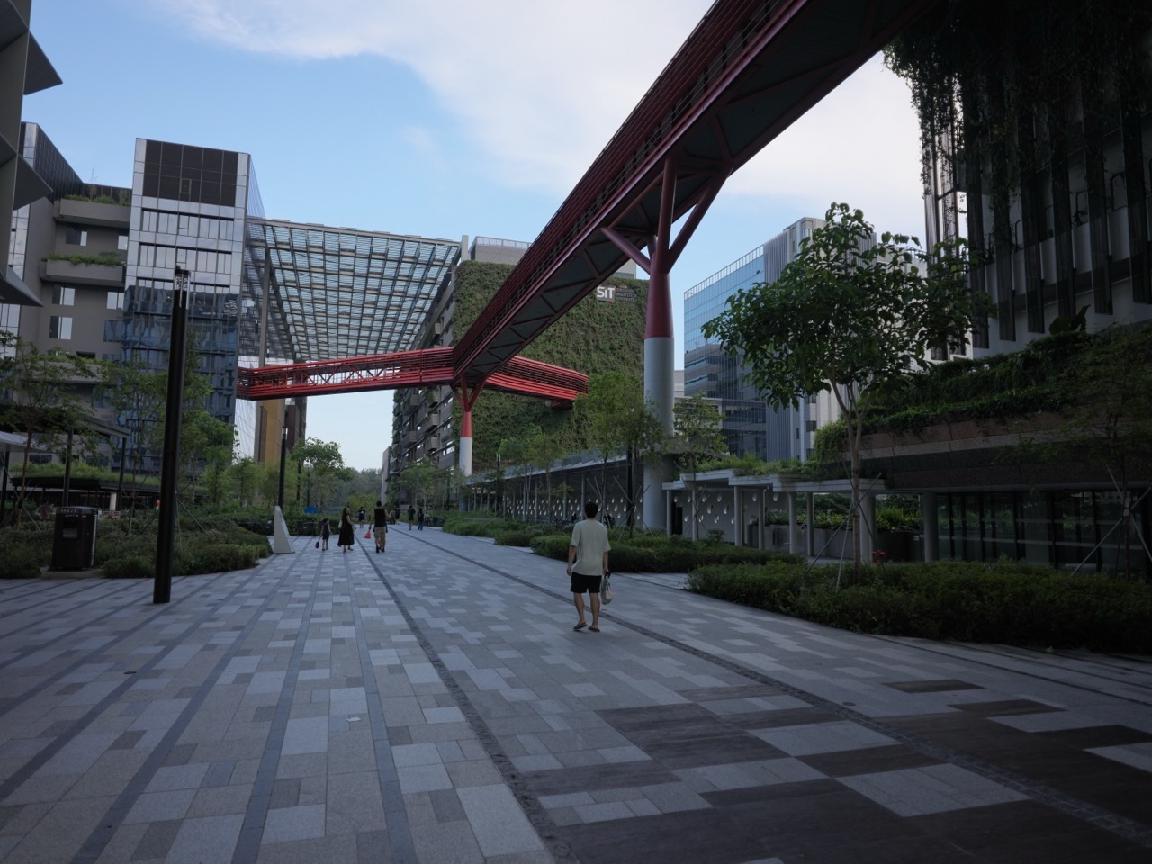
For a short walk on Punggol Heritage Trail, start at Punggol Coast MRT (NE18), follow signs towards SIT’s Punggol Campus and use the official trail map to find the Campus Boulevard end. The first 400-metre section opened between Campus Boulevard and Punggol North Avenue. Walk the open section and return the same way if you want to finish near the station.
Allow for the walk from the fare gates to the trail as well as the walk itself. The 400 metres refers to the first trail section in the opening announcement. If you want to continue towards Punggol Point Park, check the latest NParks map and signs before relying on a through route.
- Start at Punggol Coast MRT (NE18). SIT directs visitors to Exit 1 for campus access.
- Find the trail connection at Campus Boulevard using the NParks map and local signs.
- Use Punggol North Avenue as the named end of the first opened stretch.
- Check terrain and closures before taking a wheelchair, stroller or group of young children.
EDUKATE PUNGGOL · PUNGGOL COAST AND SIT
Find the part you need

Use the campus side for orientation
SIT directs visitors to Exit 1 at Punggol Coast MRT for direct campus access. From there, use the district signs and NParks’ map to locate the Campus Boulevard end of the trail. The station, mall, campus and trail are distinct destinations. If you have only saved the map pin for the mall, open the trail map before leaving the fare gates.
If friends are coming separately, meet at the MRT or an agreed public landmark in the district before setting out. A message with “Punggol Coast MRT, NE18” helps avoid a mix-up with Punggol MRT, which serves Waterway Point. From the mall or campus, choose a meeting point everyone can find, then walk to the trail together.
The SIT directions cover the station exit. The NParks trail page has the trail map and visitor details. The photographs here show the approach through the district rather than the surface of the trail.

Separate the trail distance from the outing distance
JTC and NParks announced the first 400 metres between Punggol North Avenue and Campus Boulevard in August 2025. Walking that whole stretch out and back is about 800 metres on the trail, plus the approach from the MRT and any detours. For a short outing, use the station as your return point and turn before the far end if the group has had enough.
NParks lists Phase 2 separately and gives an expected completion by the end of 2026. Plans and openings can change. Use the open paths shown on current signs. A map that shows how the finished trail will connect can be useful for understanding the district, while the latest notices are the guide to what you can walk that day. Read JTC’s opening announcement.
Allow for slopes and the return journey
NParks describes the trail as wheelchair accessible and recommends assistance because the terrain is undulating. It identifies grass mounds and stepping stones as unsuitable for wheelchairs. Check the official map and decide how much of the route suits your group. If someone finds slopes tiring, give them time to try the first part before committing to an out-and-back walk.
A family with a stroller can choose a shorter version and stay on the appropriate paved route. Give children a simple rule for turning back, such as finishing after one interesting sign and one photograph. Use the pace of the slowest walker when planning the return.
Contents · Previous section · Next section
Notice where the old road and the new district meet
The trail retains features linked to Old Punggol Road. NParks describes interpretive signs and a recreated bus stop among the trail’s heritage features. Use the signs on the open stretch to see what you can identify. A child can compare what a sign says about the earlier landscape with what they can see towards the new campus today.
Try asking each person to notice something different. One person might pick a tree or slope, another a road feature, and another something about the new buildings. Ask what helped them recognise it. That keeps the walk grounded in what is actually visible. If a child wants to record a fact, use the wording on the sign or check the official trail page when you get home.
Add one optional stop in the district
If everyone still has time, return through the public district paths and stop at Punggol Coast Mall or Punggol Coast Hawker Centre. Both are listed separately by JTC. Agree where to meet before anyone walks ahead. If someone needs to take the train home, it is easy to make the rail station the final meeting point.
For meal planning, see where to eat near SIT Punggol. For a different visit focused on a university appointment, see how to get to SIT Punggol Campus.
Contents · Previous section · Next section
Which MRT station is nearest?
NParks identifies Punggol Coast MRT. Use SIT’s campus directions and the NParks trail map for the approach via Campus Boulevard.
Can I follow it all the way to Punggol Point Park?
Check the current NParks notices and signs. The first opened section ran between Campus Boulevard and Punggol North Avenue. Plan a turnaround there unless you have confirmed an open route onward.
Is it suitable for wheelchairs?
NParks lists it as wheelchair accessible and recommends assistance on the undulating terrain. Use the official map and avoid stepping stones and grass mounds when travelling by wheelchair.
Is the walk exactly 400 metres from the MRT?
The 400 metres is the length of the first opened trail section. Your full trip includes the approach from the station and your return route.


