
PG3 is Posting Group 3, a Secondary 1 admission route under Full Subject-Based Banding, not a separate course in water management. Lower-secondary G3 Geography includes the sustainable management of natural resources, with water and its spatial distribution as important learning areas. For Punggol students, the key ideas are how water moves through the hydrological cycle, why its availability varies among places, how human activities affect quantity and quality, and how societies plan reliable supplies rather than assume water will always be available at the tap.
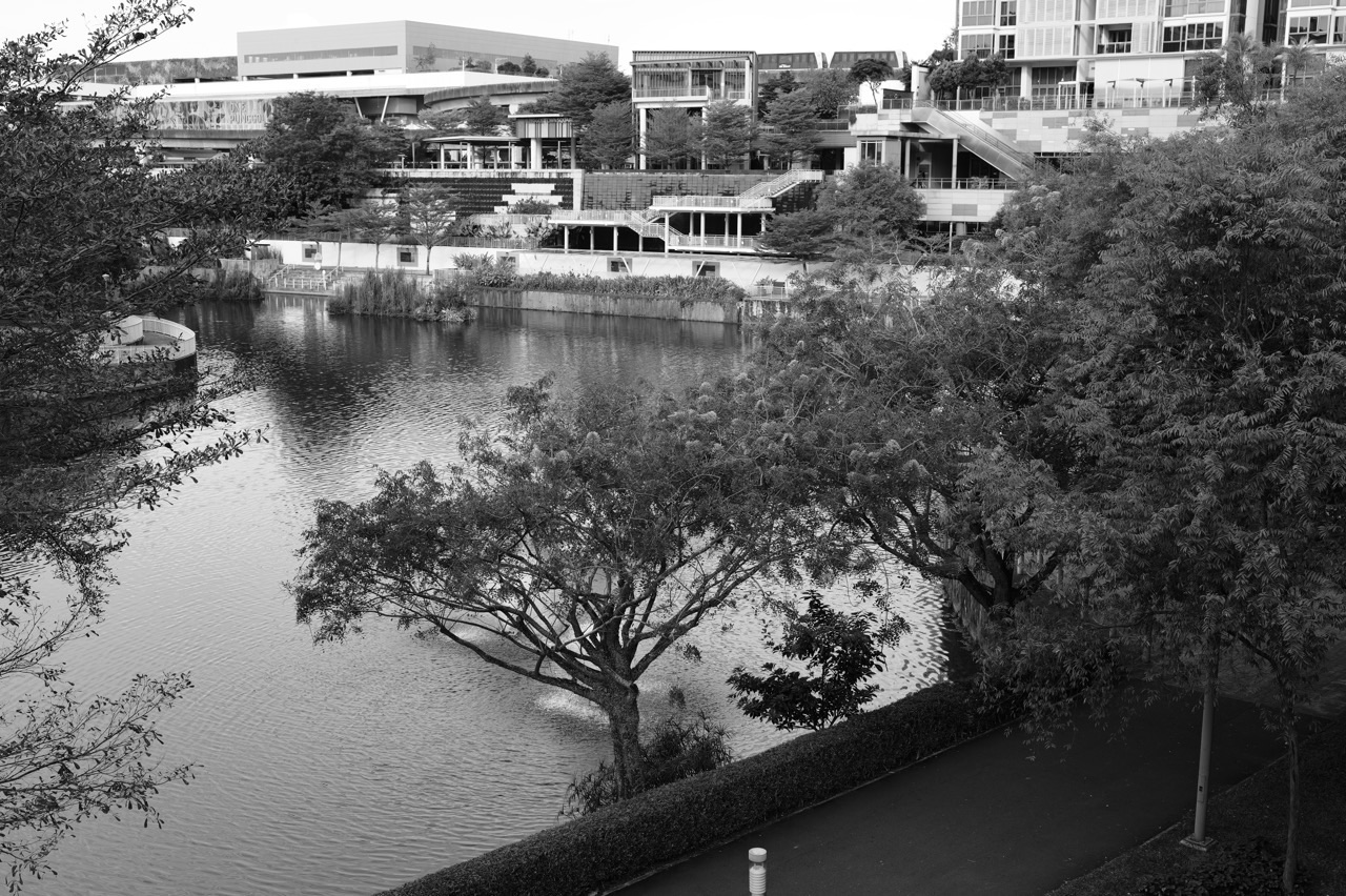
Singapore’s national water agency PUB identifies four National Taps: local catchment water, imported water, NEWater and desalinated water. Each has different origins, technologies and considerations, so a student should not call all four simply ‘rainwater’. Punggol Waterway Park offers a familiar visible landscape for discussing runoff, vegetation and built environments, but a photograph of its canal does not establish that the water is drinking water or reveal its precise treatment process. Parents should teach the difference between an observation, an official PUB statement and an unsupported inference.
- PG3 is the admission group; Geography content and subject levels follow the school’s lower-secondary programme.
- The hydrological cycle includes evaporation, transpiration, condensation, precipitation, infiltration, percolation, runoff and groundwater movement.
- Water is renewed through global processes but is not equally available or accessible at every place and time.
- A catchment’s water budget distinguishes inputs, outputs and storage under a defined boundary.
- Singapore’s Four National Taps are local catchment water, imported water, NEWater and desalinated water.
- NEWater is high-grade reclaimed water further treated through advanced processes; desalination removes salts from seawater.
- Water quantity, quality, reliability, energy demand and economic trade-offs all matter for water sustainability.
- Use dated PUB sources for actual facilities and policy; illustrative Punggol examples are not water-quality tests.
- Follow school fieldwork and public-space safety rules rather than independently collecting unknown water samples.
Definition lock: the Four National Taps
| National Tap | Water source | Useful Geography question |
|---|---|---|
| Local catchment | Rain collected in managed catchments and reservoirs | How can a city collect and protect rainwater? |
| Imported water | Water drawn from Johor, Malaysia | How does regional supply contribute to diversification? |
| NEWater | High-grade reclaimed water purified after used-water treatment | What technologies and monitoring make reuse possible? |
| Desalinated water | Freshwater produced from treated seawater | What energy and infrastructure trade-offs arise? |

Guide chapters
- Why water is a geographical resource rather than merely a liquid
- Definition lock: water cycle, catchment and water supply
- Solar energy helps drive evaporation
- Transpiration connects plants with the atmosphere
- Condensation and cloud formation
- Precipitation returns water toward the surface
- Infiltration and surface runoff have different paths
- Percolation and groundwater flow
- A drainage basin or catchment needs a defined boundary
- A water budget is an accounting model
- Water abundance and water access are not identical
- Singapore’s Four National Taps are a supply strategy
- Local catchment water begins with captured rain
- Imported water is a distinct supply source
- NEWater is high-grade reclaimed water
- Desalination removes salts from seawater
- Water treatment and water purification are not magic words
- Water quality and water quantity are different problems
- Water demand depends on people and activity
- Water conservation starts with a defined action
- Punggol Waterway is a landscape, not a water-quality certificate
- Waterways, runoff and urban drainage
- Climate change creates a reason to plan for uncertainty
- Comparing the Four National Taps fairly
- How to build an evidence-based Geography answer
- A four-week Water Geography practice plan
- What to verify with Punggol schools and PUB
Why water is a geographical resource rather than merely a liquid
Water is a chemical substance, but Geography asks where it occurs, who can access it, how it moves and how societies manage it. An understanding of evaporation and condensation alone does not explain why two places experience different water shortages or how a city invests in supply systems. Geographical thinking connects physical processes to economic, environmental and social questions.
A Punggol family may see rainfall, drains, waterways and drinking taps during one ordinary day. These are related to water, but they do not necessarily form one simple direct pipeline from the pavement to the kitchen. Each component has a particular function that must be established through evidence. The student should not infer a technical process purely from visual proximity.
Parents can begin by asking where the household’s water comes from and which official source would answer. That opens the door to PUB’s Water Story and the distinction between visible infrastructure and managed supply.
Definition lock: water cycle, catchment and water supply
The hydrological or water cycle describes continuous movement of water among the atmosphere, surface, organisms and underground stores. A catchment is an area from which water drains to an identified outlet or receiving system. A water-supply system involves infrastructure and management that make water available for use under appropriate standards. These ideas overlap but answer different questions.
Rain falling in an area does not automatically become safe drinking water. Some water infiltrates into soil, some evaporates, some is taken up by vegetation and some runs across the surface. Water collected for supply requires the relevant management and treatment before distribution. The exact route differs by location and system.
Ask the pupil to draw separate diagrams of the natural cycle and a managed supply process. Linking them should come after each is understood, not by assuming that every water body has the same purpose.
Solar energy helps drive evaporation
Evaporation is the change of liquid water into water vapour at a surface under suitable conditions. Energy from the sun contributes to this process on Earth, although the detailed rate depends on temperature, exposure, humidity, air movement and other circumstances. A student should not claim that evaporation occurs only when water boils or that it stops whenever the sky is cloudy.
Imagine a hypothetical puddle gradually becoming smaller during several observation periods. The change may be consistent with evaporation, but infiltration, drainage or other movement might also contribute. A photograph before and after does not identify the exact quantities involved. Good Geography uses an understanding of processes while recognising the need for additional evidence.
Parents can discuss the process without instructing children to heat large containers of water or perform unsafe experiments. The explanatory question is what happens to the water and under which conditions.
Transpiration connects plants with the atmosphere
Transpiration is water movement from plants to the atmosphere, commonly involving water vapour leaving leaves. In the hydrological cycle, it forms part of the transfer of water from land and vegetation into the air. Students may encounter the broader term evapotranspiration when evaporation and transpiration are considered together.
A pupil should not assume that visible droplets on a leaf prove transpiration in every instance. They might reflect dew, rainfall or another process. The distinction between direct observation and explanation matters. Appropriate evidence, timing and context are needed before assigning a cause.
At a green public space, the family can discuss the role of vegetation conceptually while respecting plants and public rules. No specimen collection or bagging experiments are necessary to understand the idea.
Condensation and cloud formation
Condensation changes water vapour into liquid water when conditions support the transition. In the atmosphere, condensation plays an important role in cloud formation, though detailed cloud processes involve particles and complex physical conditions. Students should connect the process to temperature and moisture without treating every white shape in the sky as identical.
A pupil might recognise condensation on a cold window and then ask how droplets form in clouds. The similarity is the phase change, but the scale and conditions differ. Good explanations identify the relevant common concept while recognising that a classroom model is simplified.
Parents can ask the child what was present before condensation and what changed. The water does not appear from nowhere; it moves between states and locations.
Precipitation returns water toward the surface
Precipitation includes water falling from the atmosphere in forms such as rain. Singapore’s tropical climate means rain is a familiar example, but the global hydrological cycle includes different types under other climates. Students should not assume rainfall is spatially uniform or identical in intensity and duration across a city, country or region.
A family may experience heavy rain at one Punggol location and hear a different report from another part of Singapore. That contrast suggests the importance of spatial variation, but a personal anecdote cannot establish long-term climate patterns. Those require appropriate meteorological datasets and a clearly defined period.
Ask what the actual geographic question is: a short-lived shower, seasonal rainfall or long-term water availability? Each needs a different timescale and type of evidence.
Infiltration and surface runoff have different paths
Infiltration is water entering the soil from the surface, whereas surface runoff occurs when water flows across land rather than immediately infiltrating. Both can operate during a rainfall event, with the balance depending on soil, land cover, slope, rainfall and other conditions. A paved area may behave differently from a vegetated area, but students should not treat every surface as having one fixed infiltration rate.
Imagine two fictional diagrams showing the same rainfall input on a patch of permeable ground and a sealed paved surface. The child can explain why different amounts of infiltration and runoff might occur under the stated assumptions. The model helps connect physical geography to urban design and drainage.
Do not conclude that a particular Punggol estate floods or drains poorly from one visual impression. Such claims require appropriate current data.
Percolation and groundwater flow
Once water enters the soil, it may move downward through pores and materials in a process commonly described as percolation. Groundwater can move through suitable subsurface structures under physical gradients. These processes often occur out of sight, so students rely on diagrams and evidence rather than direct surface observation.
A simplified cross-section can depict rain, soil, bedrock, groundwater and movement routes. The diagram needs a legend and a clear statement of what each arrow represents. The pupil should not assume every underground layer has identical permeability or that all infiltrated water immediately reaches a reservoir.
Parents can ask which part of the process can be observed directly and which is an explanatory model. This develops the evidence awareness needed for later investigations.
A drainage basin or catchment needs a defined boundary
A catchment gathers water that drains toward a particular system or outlet. Its boundaries are relevant because water inputs and outputs can be described for that area. Students should not treat an entire country or town as one catchment without referring to the actual hydrological and infrastructure context. Maps help define what is included.
Suppose a fictional diagram shows rainfall feeding a stream within a marked basin boundary. Ask whether a road or building outside the boundary should be counted in that basin’s area simply because it is nearby. The question requires reading the map rather than relying on the place’s common name.
Understanding boundaries is the basis for water budgets and for fair comparison of different sites or management strategies.
A water budget is an accounting model
A water budget compares inputs, outputs and changes in storage within a defined system. Rainfall and other inflows may add water; evaporation, discharge and withdrawals may remove it. The balance is not an account of household spending. It is a physical accounting framework, and the quantities must use compatible units and time periods.
Imagine a hypothetical catchment that receives 100 units of water in a period and has 70 units leaving through all defined outputs. Under those simplified assumptions, storage increases by 30 units. If outputs exceed inputs, storage decreases. The result depends on the completeness of the defined flows.
The student should state that these numbers are fictional and identify the system boundary. A valid subtraction cannot rescue a budget that omits a major water movement.
Water abundance and water access are not identical
A location may receive substantial rainfall yet face difficulties storing, treating or distributing freshwater reliably. Other places may have water sources but experience pollution, uneven distribution or seasonal challenges. Geographical sustainability asks about infrastructure, management and human needs, not just the amount of rain falling from the sky.
Singapore’s national Water Story describes the country’s limited land for collecting and storing rainfall, along with historical challenges such as drought, floods and pollution. Those constraints help explain why policy emphasises a diversified water supply. The official source should be read in context rather than condensed into a claim that Singapore receives no rain.
Parents can ask the pupil how a wet climate could coexist with water-security concerns. The answer should distinguish natural availability from a reliable treated supply.
Singapore’s Four National Taps are a supply strategy
PUB identifies four National Taps: water from local catchments, imported water, NEWater and desalinated water. Diversification means Singapore is not dependent on a single source under every condition. Each tap has different characteristics, infrastructure and long-term considerations. The four names should be learnt accurately before comparing benefits or challenges.
A pupil who simply says ‘Singapore recycles all its drinking water’ has misrepresented the strategy. NEWater is one component, while rainfall catchments, imports and desalination play separate roles. Likewise, desalination should not be confused with purification of used water because the input water and treatment requirements differ.
A useful table compares the source, the relevant processing and a genuine policy question for each tap. This builds understanding beyond memorising four labels.
Local catchment water begins with captured rain
PUB explains that local catchment water comes from rain collected through waterways and reservoirs. The collection system supports supply but does not mean untreated water found in any public canal or park is automatically safe to drink. Treatment and managed distribution are separate essential steps. Parents should discourage children from drinking or sampling unknown surface water.
Singapore’s urban environment shapes how rainwater can be captured. Land use, drainage, reservoir management and water quality all matter. A student can discuss catchment management using official PUB documents without speculating about the technical role of every waterway visible during a neighbourhood walk.
The key distinction is between water entering a managed catchment and potable water delivered to consumers. Geography asks how human systems connect these stages responsibly.
Imported water is a distinct supply source
Imported water is one of Singapore’s Four National Taps. PUB identifies water drawn from Johor, Malaysia, as part of its supply arrangement. Its presence in the national strategy illustrates that water management can involve regional infrastructure and agreements as well as local physical geography. The policy should be described using current official documents.
Students should avoid reducing international water arrangements to rumours about prices, political intentions or delivery conditions. Those are specialised factual claims requiring reliable sources and dates. A lower-secondary task can focus on why diversification and cross-border supply involve different risks and management considerations.
Ask what evidence would be needed to assess reliability over time. A sensible answer might refer to official agreements, supply capacity and infrastructure, not an invented anecdote.
NEWater is high-grade reclaimed water
PUB describes NEWater as high-grade reclaimed water produced from treated used water that undergoes further purification, including advanced membrane technologies and ultraviolet disinfection. The goal is stringent water quality appropriate to its intended uses. A student should not describe NEWater as untreated sewage or confuse its treatment pathway with simply filtering rain.
PUB’s current materials explain the role of NEWater in Singapore’s diversified water supply. Industrial and other applications are part of the broader water strategy, and specific use arrangements should be described accurately from official sources. A public description of the technology does not authorise students to recreate any treatment process at home.
Ask the pupil to distinguish the input, the additional treatment and the output. This makes the process easier to explain while avoiding misleading labels.
Desalination removes salts from seawater
Desalination turns seawater into freshwater through suitable treatment, with reverse osmosis among the methods used by PUB. The process requires energy, pressure and specialised infrastructure, so its environmental and economic considerations differ from collecting local rainwater. A student should not state that desalination is free merely because the sea is abundant.
PUB’s current desalination information describes operational plants and ongoing work to reduce energy requirements. Those facts can support a discussion of supply resilience and resource cost. The precise number of plants or future facilities should be checked against PUB’s current pages before publication or school submission because infrastructure can change.
Parents can help by asking what problem desalination solves and which trade-off remains. A robust answer recognises both the benefit of an additional source and the energy needs of the process.
Water treatment and water purification are not magic words
Water treatment involves physical, chemical and biological processes selected for the quality of the incoming water and the desired output. There is no universal household demonstration that proves drinking-water safety. A clear-looking sample can still contain unsafe substances or microorganisms, and an unusual colour does not identify its exact composition.
Teach students to rely on official PUB water-quality monitoring rather than claims inferred from a photograph or taste. School learning can use conceptual process diagrams and published water-quality standards, while actual testing requires suitable methods and qualified supervision.
No pupil should attempt to purify unknown park water for consumption. The educational goal is understanding the managed system, not performing an unsafe experiment.
Water quality and water quantity are different problems
A community may have an adequate volume of water but face pollution concerns, or it may have high-quality sources that are insufficient in a dry period. Water-security planning must consider both dimensions. Students should not assume that more visible water automatically means more usable drinking water. Quality assessment requires relevant indicators and appropriate monitoring.
Suppose a fictional reservoir’s volume increases after a rainstorm. That observation alone does not establish whether treatment needs changed, whether pollution entered the catchment or how supply reliability will evolve across the year. Each claim requires further data. A stronger geographical response identifies those questions.
Parents can encourage children to specify whether they are talking about availability, quality, infrastructure or demand before choosing evidence.
Water demand depends on people and activity
Households, industry and commercial facilities use water for different purposes, and the total demand changes with population, economic activity and efficiency measures. A pupil should distinguish absolute consumption from per-person or per-unit consumption. An increase in total water use does not automatically imply that every household is becoming less efficient.
Imagine a fictional neighbourhood with more homes than a previous year but lower average water use per resident. Total demand could still increase because the population is larger. To evaluate the situation fairly, the student needs both the number of users and the relevant per-person data.
This connects Geography to rate, ratio and percentage skills in Mathematics. Good interpretation protects against broad claims based on one isolated figure.
Water conservation starts with a defined action
Water conservation can involve reducing unnecessary use, improving efficiency and avoiding pollution. A responsible household action should be practical and appropriate rather than based on fear or an invented numerical promise. PUB publishes water-saving advice and public education resources that families can use. A small regular habit may be more sustainable than a dramatic one-day challenge.
Ask the child to identify which action changes demand and how any claimed saving would be measured. A leaking tap and a shorter unnecessary flow represent different situations, but precise savings depend on flow rate and duration. Without measurements, it is better to describe the likely direction of improvement than declare an exact number of litres saved.
Education should lead to informed decisions, not guilt or unrealistic expectations that children can solve national water challenges alone.
Punggol Waterway is a landscape, not a water-quality certificate
NParks describes Punggol Waterway Park as a managed public park with paths, vegetation and water frontage. Families can use the setting to observe how water and built environments interact. But the visible canal is not evidence that its water is potable or that it feeds a particular reservoir without an official source establishing the connection.
A photo may show a high water level, aquatic plants or a bridge. It cannot establish dissolved pollutant levels, long-term water availability or the full drainage catchment. Those are different kinds of information requiring appropriate measurement or documentation. Students who make that distinction are practising proper geographical inquiry.
Any family visit should stay on permitted public routes. Do not collect water samples, enter restricted banks or encourage contact with unknown surface water for schoolwork.
Waterways, runoff and urban drainage
Urban drainage systems help manage rainfall runoff in developed environments, but a specific water feature’s function should be checked with the responsible authority. A local park may combine recreation, landscape design and hydrological infrastructure in ways that are not obvious from appearance. Students should not assume all canals, ponds and reservoirs have identical roles.
An original paper-based exercise might compare a fictional catchment with 40 percent impermeable cover against one with 20 percent under stated assumptions. Ask what effect might occur on runoff while noting that slope, soil, vegetation and drainage design also matter. The numbers are teaching inputs, not measured figures for Punggol.
This encourages systems thinking: water management results from several interacting conditions rather than one visually dramatic factor.
Climate change creates a reason to plan for uncertainty
Changing climate conditions can influence precipitation patterns, sea levels and the stresses placed on infrastructure, although exact local impacts require scientifically grounded projections. A school task may explore why water planning must account for variability rather than rely on one past year’s weather. The student should distinguish observed changes from modelled scenarios and unsupported predictions.
Singapore’s water-security strategy is designed to increase resilience through diversified sources, infrastructure and innovation. This is a useful policy example for Geography, but a pupil should not claim that one technology eliminates every future risk. Each option involves cost, energy, land and management.
Ask the child how uncertainty affects long-term planning and what evidence would be needed before predicting a specific shortage year. Responsible answers remain within the data.
Comparing the Four National Taps fairly
One source can be useful because of local availability, another because it reduces dependence on rainfall, and another because it provides supply diversity. A good comparison should explain the criterion rather than rank the taps using a universal label such as ‘best’. Cost, reliability, quality, energy requirements and infrastructure are relevant, and each requires suitable evidence.
For example, desalination is weather-resilient relative to rainfall-dependent catchments, but it is energy-intensive. NEWater demonstrates advanced reuse, while imported water involves a different geographic relationship. The system’s resilience arises partly from their complementary roles, not from treating every source as identical.
A strong student response can identify one benefit, one limitation and a question needing updated PUB information for each tap.
How to build an evidence-based Geography answer
A good paragraph states a relevant claim, supports it with accurate information and explains why that information matters. If the question asks why Singapore diversifies supply, the pupil can identify constraints on land for rainfall capture and describe how different sources help reduce dependence on a single condition. The answer should not invent a particular drought or claim precise resilience gains without a source.
Another paragraph may consider trade-offs. Desalination provides a source less dependent on rainfall but uses energy and specialised infrastructure. The explanation should connect those characteristics to long-term resource management. It should not present a technology as free of environmental impacts.
Ask the student which sentence answers the question and which establishes the evidence. This prevents a long list of four names from masquerading as an explanation.
A four-week Water Geography practice plan
Week one focuses on the water cycle: the pupil draws and labels processes and explains what each arrow means. Week two uses a catchment diagram and a simple fictional water budget to distinguish inputs and outputs. Week three studies PUB’s Four National Taps and builds a table of sources, methods and considerations. Week four asks for an evidence-based paragraph evaluating one water-management trade-off.
Keep sessions short and aligned with the teacher’s actual topics. A student who confuses infiltration and runoff needs to repair those definitions before tackling a lengthy policy essay. A pupil who remembers the taps but cannot explain desalination should focus on the process rather than memorise more examples.
Return to a new scenario after several days to check whether understanding transfers. Better reasoning and more accurate qualifications matter more than the length of the notes.
What to verify with Punggol schools and PUB
Ask the receiving secondary school when the lower-secondary Geography syllabus introduces water resources, which maps or investigation formats are used and whether school fieldwork is planned. A 2026 school example shows that water and the hydrological cycle can be included in Secondary 1 teaching, but one school’s sequence cannot be applied automatically to another.
Use PUB’s latest Water Story, NEWater and desalination pages for actual national-supply information. Avoid repeating old facility counts or presenting a proposal as a completed installation. Current policy and infrastructure data should carry the date and source used in the school answer.
PG3 marks an entry route, not a final geographical identity. A capable student learns to trace water processes, connect human needs to resource choices and make evidence-based judgements about sustainability.
Frequently asked questions
Is water-resource Geography exclusive to PG3 pupils?
No. PG3 is school posting; G3 Geography is a subject level under Full SBB.
What is the hydrological cycle?
The ongoing movement of water among atmosphere, land, organisms and water stores through processes such as evaporation and precipitation.
What is the difference between infiltration and runoff?
Infiltration enters the soil; surface runoff moves across the land surface.
What does a water budget compare?
Inputs, outputs and change in storage within a defined catchment and time period.
Are Singapore’s Four National Taps all rainfall?
No. They are local catchment water, imported water, NEWater and desalinated water.
Is NEWater simply untreated wastewater?
No. PUB describes extensive treatment and further advanced purification of used water.
What does desalination remove?
Dissolved salts and minerals from seawater through suitable processes, including reverse osmosis.
Can children drink water from Punggol Waterway?
Do not assume surface water is potable. Follow official safety guidance and use approved drinking-water supplies.
Does more visible water mean water supply is secure?
No. Quality, storage, treatment, demand, infrastructure and reliability are separate considerations.
Can a park photograph reveal pollutant concentrations?
No. Water quality requires appropriate monitoring and analysis.
Does the water-management topic always appear in Sec 1?
MOE’s lower-secondary curriculum includes it, but actual sequence and assessment should be checked with the school.
Where can families verify facts?
Use PUB’s current Four National Taps pages, MOE Geography guidance and the receiving school’s programme.
Continue the Punggol PG3 subject guides: PG3 G3 Mathematics ratios and percentages | PG3 G3 Science forces and energy | PG3 G3 English functional and situational writing
Official MOE, PUB and Punggol references
- MOE lower-secondary Geography teaching and learning syllabus (2021 version, archived)
- River Valley High School Geography: Secondary 1 Water and Natural Resources
- PUB: Singapore Water Story and the Four National Taps
- PUB: NEWater quality, treatment and monitoring
- PUB: Desalinated Water technology and supply considerations
- PUB: 2025 study of a possible new desalination plant
- NParks: Punggol Waterway Park public features and rules
- What is PG3: Geography Fieldwork and Punggol Waterway Maps
- What is PG3: Geography Sustainable Cities, Housing and Transport
Your next step
Ask the pupil to draw a labelled water-cycle diagram, explain how one catchment receives and loses water, then create a fact-checked table of Singapore’s Four National Taps using current PUB information. Separate planning or technical statements from what can be observed at Punggol Waterway Park. Follow the receiving school’s actual Geography task and never collect unknown water for drinking or unsupervised testing.


