
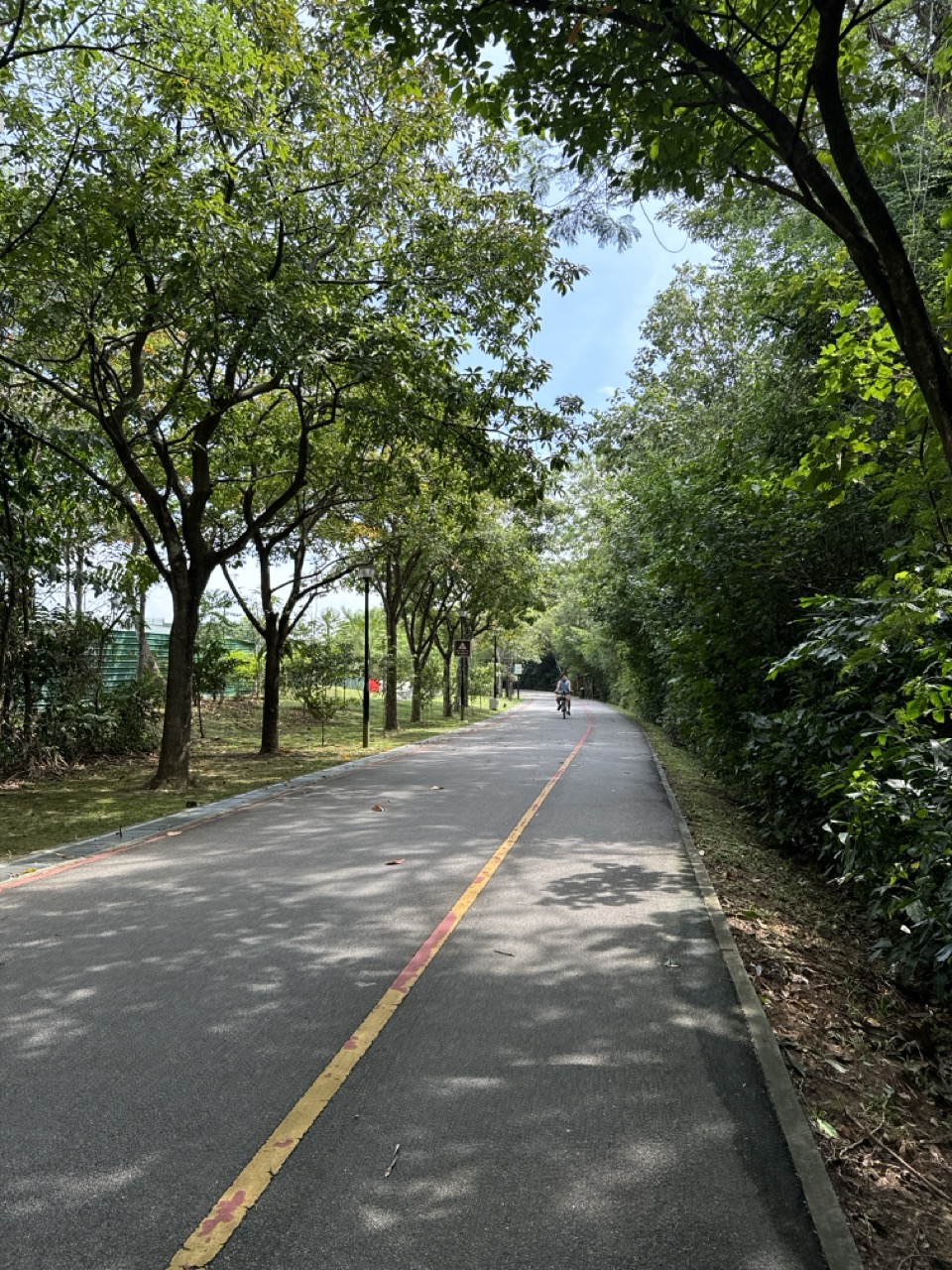
Why would a park path continue long after you have passed the playground, trees and benches that first attracted you to it? A normal park can be a destination. You enter, enjoy its facilities and return home. A park connector has another job: it must link places that would otherwise feel separate.
Punggol gives residents a strong example of this network idea. The National Parks Board describes the North Eastern Riverine Loop as a roughly 26-kilometre route through Punggol, Sengkang and Buangkok, connecting four parks and extending into waterfront, reservoir and wetland landscapes. Within that wider network, the Punggol Park Connector is a distinct 6.1-kilometre route linking Gerald Drive to Punggol Promenade along the reservoir and waterfront. The paths are not all one type or one continuous scenic photograph.
This article explains why Punggol needs park connectors rather than only isolated parks. It explores the difference between a park and a connector, how green routes influence everyday movement, why paths must be shared responsibly and how families can use the network to teach Geography and systems thinking. It is not a recommended 26-kilometre family itinerary, a live closure notice or permission to cycle on every visible footpath.
The answer in 50 seconds
A park provides a place for recreation, nature and public activities. A park connector provides a route linking parks, neighbourhoods and other destinations. Singapore’s Park Connector Network is designed to improve access to green spaces and support activities such as walking and cycling, subject to the path type and applicable rules.
The North Eastern Riverine Loop brings several landscapes together. NParks’s official page identifies a 26-kilometre route connecting four parks through Punggol, Sengkang and Buangkok, including access to the wider waterfront and wetlands. Residents do not need to complete the entire loop to benefit from it.
The main idea is that a useful green network does two jobs: it gives people enjoyable places to travel through, and it helps them reach other places. The value is in the connections between destinations, not only what can be found at one park entrance.
Why an isolated park has a limit
Imagine a small neighbourhood park surrounded by busy roads and buildings. It may be beautiful, with seats, exercise equipment and plants. But residents living several blocks away still need a practical route to reach it.
If the approach is uncomfortable, circuitous or inaccessible, the park’s benefits may be limited for some households. A facility can be excellent inside its boundary while remaining difficult to use from outside.
A park connector addresses part of that access problem by creating a recognised pathway between green spaces and surrounding neighbourhoods. It may make an ordinary walk to another destination more pleasant and provide opportunities for longer recreational journeys.
It does not eliminate all barriers. Road crossings, uneven paths, construction works and weather still matter. The benefit of a connector depends on the route as a whole.
For children, the distinction is simple: a park is often a place to go; a connector is also a way to get somewhere.
Why a path can be infrastructure, not just leisure
People often describe park connectors as places for jogging or cycling. Those are important uses, but the route can also be part of everyday mobility. A resident may walk along it to reach a community facility, transport stop or another neighbourhood.
A practical travel route needs continuity, clear signs and safe transitions. An enjoyable recreational path also benefits from greenery, interesting scenery and appropriate places to pause. A well-planned connector can serve both purposes.
However, a beautiful route is not automatically the fastest commuter route. Someone travelling to school at a fixed time may prefer a shorter sheltered street connection, while a weekend walker may choose the longer green path.
The important lesson is to identify the traveller’s purpose. A network that serves many possible journeys can be valuable without being the best option for every journey.
Why the North Eastern Riverine Loop is bigger than Punggol
The name includes Punggol’s identity, but the route extends through multiple north-eastern neighbourhoods. NParks explicitly describes Buangkok, Sengkang and Punggol along the 26-kilometre loop.
This matters because people’s lives do not stop at the boundary of a town. Someone living in Sengkang might want to reach a Punggol waterfront area. A Punggol resident may visit a park farther south. Green routes can create continuity between these destinations.
An administrative map divides areas into towns, but a walking or cycling network connects them. That difference helps explain why the route should not be viewed as belonging to only one estate.
For school Geography, it demonstrates the difference between boundaries and flows. Boundaries help describe where areas are; flows show how people and resources move between them.
What the ‘riverine’ part of the name tells us
The term *riverine* relates to rivers or river environments. The North Eastern Riverine Loop draws much of its character from water landscapes, including reservoirs, canals, coastal stretches and wetlands.
NParks describes the route as passing through places with varied birdlife and plant communities. The water shapes the scenery, but different segments can look very different. One may run beside a landscaped canal, another near housing, and another closer to a more naturalistic waterfront.
The name is therefore a useful geographical clue, not a guarantee that every metre of path is immediately beside a river. A path network includes connectors needed to join the major scenic areas.
Students can use the name to form a hypothesis about the route and then check an official map to see where the water-related sections actually occur.
Why the exact number of kilometres requires care
NParks calls the North Eastern Riverine Loop a 26-kilometre route. It also describes individual park connectors by their own lengths, including the 6.1-kilometre Punggol Park Connector and the 8.4-kilometre Punggol Waterway Park Connector track along both sides of the Waterway.
These figures refer to different route definitions. They should not be added automatically as though every named path is an independent section of one single journey. Network loops may incorporate or overlap existing paths.
A traveller should use an official current route map and plan the specific section they intend to use. Exact journey length depends on where they start, finish, detour and return.
For a child, this is a lesson in measurement: the length of a named network is not necessarily the distance from your doorstep to your destination.
Why the Punggol Park Connector is not Punggol Waterway Park
The names sound similar, but they refer to different things. NParks’s Punggol Park Connector runs about 6.1 kilometres from Gerald Drive towards Punggol Promenade and links water-related destinations in the north-east. Punggol Waterway Park is a specific park through the residential town. The Waterway Park Connector follows the promenade paths along both sides of the Waterway.
Another confusing name is Punggol Park, the public park located near Hougang Avenue 8 and Hougang Avenue 10. Despite its name, it is not the same place as Punggol Waterway Park in the Punggol town centre.
These distinctions matter for an actual family outing. A person searching for a park name should check the address and route, not assume every place containing “Punggol” lies beside the same MRT exit.
Names organise the map, but they are not substitutes for geographical verification.
Why connecting four parks changes the possibilities
Imagine four separate parks with no connecting green route. A resident might travel to each as an independent outing. The surrounding streets may still work, but the journey between parks could be less legible or less attractive.
A connected system offers more options. A person may enter at one point, travel through a park and continue to another. Someone else may use only a short segment. A runner may form a loop; a family may choose a short return walk.
The effect is not simply a greater number of parks. It is the creation of routes between parks. Those routes can make facilities and landscapes more accessible as a network.
The value depends on safe links. A disconnected final 200 metres can matter greatly to a person with limited mobility or someone travelling with children. Continuity must be understood in real life, not only on a simplified diagram.
Why a loop and a connector are different ideas
A connector is a link between places. A loop is a route that returns towards its starting point or forms a circuit. A larger named recreational loop may be made up of several individual park connectors and other paths.
This matters because residents sometimes assume that the entire North Eastern Riverine Loop is one specially built path with identical width, surface and permitted uses throughout. NParks’s information instead describes a route assembled through varied places and facilities.
The correct route plan identifies the constituent segments and the conditions of each. A shared path on one stretch may meet a segregated footpath and cycling path elsewhere. Road crossings may interrupt the journey.
A network gains flexibility from combining links, but those links may not all support the same activity at the same speed.
Why park connectors can support walking as well as cycling
A park connector can attract cyclists because it offers a recognised route beyond one park. But walking remains an equally important part of its public purpose.
NParks’s current guidance explains shared and segregated paths, including when cyclists and pedestrians use different designated spaces. The rules depend on the type of path and signage.
A family walking slowly should not be treated as an obstacle that must clear the route for faster users. Conversely, walkers should avoid sudden unpredictable movements where bicycles are permitted and follow any marked separation.
The broad principle is that different modes can share a network only when users respect the rules and one another.
Why a shared path is not a private cycle track
A cyclist may see a long smooth path and imagine it is designed mainly for speed. A pedestrian may see the same path as a peaceful walking route. If both assume priority without checking, conflict can result.
NParks identifies shared paths and reminds cyclists to slow down, maintain a safe distance and give way to pedestrians. It also instructs users to remain on designated paths and obey relevant active-mobility rules.
The specific speed limit and device permissions can differ across path types and may change with regulation. Follow current on-site signs and official guidance rather than a figure copied from an old brochure.
The most useful rule for a child is to be predictable and considerate. A place can be safe for multiple users when everyone understands the shared purpose.
Why separated paths may be introduced
On some stretches, walking and cycling can be separated to reduce interaction between people moving at very different speeds. NParks describes segregated arrangements with different paths for pedestrians and for relevant cycling or active-mobility users.
Separation can make movements clearer, but it requires enough space and clear markings. At intersections, stops or amenity nodes, paths may come together again.
This is why a separated layout cannot eliminate every conflict. Users still need to pay attention at points where routes cross or merge.
For students, this illustrates a design trade-off. A shared path is compact but requires consideration among mixed users. A separated arrangement may reduce some conflicts while requiring more space and careful transitions.
Why attention zones exist
NParks identifies attention zones at locations such as bus stops, crossings, playgrounds, toilets and other places where people may enter or leave the main path unexpectedly.
These are not merely decorative markings. They indicate a need for particular care as the predictable flow of a route meets the less predictable movement around facilities.
Cyclists and other permitted riders should slow down and give way appropriately, while pedestrians should also remain alert to their surroundings.
The lesson is that where two activities meet, risk and uncertainty may rise. Good design highlights the transition; responsible behaviour makes it work.
Why a path may change rules along the way
A 26-kilometre route can pass through different jurisdictions, design types and land uses. Its surface markings, allowable devices, crossing rules and temporary access conditions may not remain identical from beginning to end.
A rider should therefore keep reading signs rather than relying on the rules from the first kilometre. A footpath is not automatically a cycling path, and a park connector is not an exemption from traffic laws at a road crossing.
For a family, this means a route should be evaluated segment by segment if a particular mobility device or access need is important. A single “wheelchair accessible” description for one connector does not certify every segment of a larger route.
A good path plan is a chain of valid links, not a single title on a map.
Why the Punggol waterfront makes the network attractive
Punggol’s reservoirs, Waterway and coastal landscapes create variety along the route. A person can experience a different setting from a typical urban street while still travelling through residential and connected public spaces.
NParks identifies bird species along the Punggol Park Connector and describes scenic opportunities through the larger loop. These observations support the route’s recreational and nature-learning value.
But the route’s attractiveness should not be confused with a promise of wildlife sightings, continuous shade or cool conditions. Nature and weather vary, and some sections may be exposed.
The public benefit is having the opportunity to experience varied landscapes responsibly, rather than treating animals and views as scheduled attractions.
Why a green route can encourage interest in nature
A child who walks along a planted corridor may notice trees, birds, insects or changing water conditions. These observations can lead to questions about habitats and ecosystems.
An isolated park can also support nature learning. The added value of a connector is that learners may see how environmental conditions change across a longer route—between urban edges, waterbodies and planted areas.
For example, a bird observed near a reservoir may be associated with different habitat resources from a small garden bird in a residential courtyard. The correct conclusion depends on species and evidence, not merely location.
Parents should keep the activity safe and undisturbing. Wildlife should never be chased or fed to make the outing more exciting.
Why ecological connectivity is not identical to a human path
A planted corridor may also contribute to the movement or habitat opportunities of particular organisms. Yet animals do not necessarily follow the paved path that humans use.
A bird may fly between trees. An insect may depend on suitable host plants. A ground-dwelling species may be affected by roads, fencing or gaps in vegetation. The ecology of connectivity differs by species.
This is why a public park connector’s existence does not prove that every organism can move safely along its length. Wildlife connectivity requires species-specific study and habitat considerations.
The human network and ecological network can overlap and support related goals, but they should not be described as the same mechanism.
Why the North Eastern Riverine Loop crosses different environments
The wider route passes through towns and landscapes that are not uniform. Buangkok and Sengkang have residential and park settings, while parts of Punggol lead towards coastlines, reservoirs and wetlands.
That variety is an asset for recreation and learning, but it also creates different practical conditions. One section may be a convenient short local route, another a more exposed waterfront passage, and another near a busy road crossing.
A child should not assume that completing an easy 500-metre stretch means they are prepared for an entire 26-kilometre circuit. Distance, weather, equipment, physical ability and access all change the demands.
The sensible goal is to choose a section matched to the traveller rather than making the network’s full length a challenge every family must complete.
Why local access points matter more than a famous starting point
A named recreational loop may have well-known landmarks, but its everyday usefulness comes from multiple places where residents can enter and leave.
A Punggol household should identify the nearest appropriate access point and the destination or section it wants. Travelling across town just to begin at a brochure’s suggested start can be unnecessary if the actual goal is a short walk.
Similarly, a cyclist commuting to a particular facility needs to know where the connector joins ordinary roads or approved cycling paths. The final link matters.
This reflects a general network principle: a path’s benefit is distributed through the access points that connect it with real origins and destinations.
Why family outings should be shorter than the full loop when appropriate
A 26-kilometre route is a substantial distance for many people. A younger child, older relative or beginner may prefer a short segment with convenient rest opportunities.
The presence of a long signed route is not a requirement to complete it. A good outing has a realistic start, a suitable turnaround point and a plan for weather or fatigue.
A parent may choose a 20-minute walk rather than a multi-hour circuit. That can be entirely successful if the family enjoys the experience and remains comfortable.
The objective is access to green space, not proving endurance. The network’s size creates options; it should not create pressure.
Why heat and lightning change the journey
Punggol’s water-related paths can be exposed to strong sun. A breeze may make a walk pleasant on one day, while another day may be humid and uncomfortable. Thunderstorms can also develop quickly.
A family should check current weather and relevant advisories before a long outdoor activity. Seek appropriate shelter during lightning conditions and avoid exposed waterfront areas, isolated trees and other unsafe positions.
A park connector is not an emergency shelter. Benches, gazebos and planted areas should not be assumed suitable for every severe-weather situation.
The reliable habit is to plan a journey that can be shortened, delayed or cancelled when the environment changes.
Why maintenance matters across an entire network
A long network has many surfaces, signs, crossings and landscape elements. Wear, weather damage, temporary works or fallen branches can affect a segment.
The appropriate managing party depends on the exact asset and location. NParks oversees park-connector facilities within its responsibility, while some connecting paths and roads involve other agencies or estate managers.
Residents can report concerns with precise locations through official channels, including OneService where appropriate. Do not enter a damaged area or attempt an unqualified repair.
A network is only as usable as the links currently available. Maintenance is therefore part of providing connectivity, not a separate afterthought.
Why a closure can affect more than one destination
Suppose a fictional connector joins a residential estate to two parks and a transport stop. If a section closes, the consequences can extend beyond one recreational outing.
Residents may need an alternative route to their intended destination. A runner may change the length of a loop. A family with mobility requirements may have fewer suitable choices.
That is why current closure notices and signs matter. A route map tells us where links normally exist, but it may not describe a temporary obstruction.
The lesson for students is that a network’s resilience depends partly on whether alternative connections exist. One path can be very useful and still require a backup plan.
Why park connectors do not eliminate the need for roads and public transport
A walking or cycling network can improve local access, but it does not replace every transport mode. Some people travel long distances, carry equipment or need accessible alternatives unsuitable for a particular path.
Punggol’s MRT, LRT and bus system perform functions different from a green recreational connector. The systems can complement one another when their access points join conveniently.
A resident might take public transport to a park and then walk a short section. Another might use a bicycle for a local trip where the permitted route is suitable.
The correct planning approach offers practical choices rather than claiming that everyone should use the same mode.
Why continuous paths can change the feel of a town
A neighbourhood with parks separated by difficult road crossings can feel fragmented. Adding well-connected routes may make places feel closer and easier to discover, even when their physical distance has not changed.
People experience distance through effort, time, uncertainty and the need for transfers or detours. A continuous legible path can reduce some of that burden.
This does not mean a connector makes every route shorter. A green path may be longer than a direct street route. The advantage can lie in comfort, scenery or the ability to combine several destinations.
A good explanation therefore distinguishes geographical distance from experienced accessibility.
An example: two parks and one connecting path
Draw two fictional parks separated by a kilometre of housing and roads. Before a connector is introduced, visitors must use several turns and crossings. After a suitable path is constructed, there is a clearer route between the parks.
Ask which journeys become easier. A visitor who wants to use both parks may benefit; someone whose destination is elsewhere may not.
Now add a road crossing in the middle. The student should recognise that the network still needs a safe crossing. A green line drawn on a map is not enough to ensure real-world usability.
This is why the design of the transitions matters as much as the scenic sections.
An example: a path changes from shared to separated
A family rides on a suitable permitted shared path. Further along, signs show separate areas for walking and cycling. The child wants to remain on whichever part feels more spacious.
The adult explains that path markings determine where different users should move. They adjust to the actual signs and slow down near a busy attention zone.
The lesson is that a continuous journey can contain changing rules. Responsible travel requires ongoing observation rather than a single decision made at the starting point.
An example: an older resident prefers a short loop
An older resident would like a gentle walk near the Waterway but is not interested in a long cycling or hiking route. A family member chooses a short suitable section with a clear return route.
They check accessible connections and rest opportunities, rather than assuming every segment is appropriate because it belongs to a park-connector network.
The outing succeeds when it meets the person’s needs. Completing the full named loop has no special value if it would create unnecessary difficulty.
The lesson is that a large network should increase personal choice, not reduce it.
Why signage is a form of public knowledge
A route sign communicates where a person is and which direction a destination lies. Clear path markings can also communicate who should use which part of the route and what behaviour is expected.
Without signage, a long network can become confusing, particularly near junctions where several paths connect. A first-time visitor may not know whether a route continues across a road or turns into another park.
Good wayfinding reduces the amount of information a person must memorise. A child can learn to read the current sign, identify the next decision and confirm the route rather than guessing.
This is an example of information design in physical space: knowledge is embedded in signs so that people can act more confidently.
Why map reading is still useful even with a phone
Navigation apps provide convenient routes, but they may not capture every temporary closure, current path restriction or accessibility detail. A person should still be able to interpret basic maps and signs.
For Punggol’s park connectors, learning the difference between an individual connector, a wider loop and a park entrance can prevent confusion. A map also helps identify alternatives if the original route becomes unsuitable.
Children can start with simple directions and landmarks. Older students can compare route lengths, estimated times and access constraints, stating assumptions.
The purpose is not to reject digital maps. It is to use them with enough understanding to recognise when the route on the screen no longer matches the conditions ahead.
Why a long green route needs responsible cycling
Cycling can extend the distance a person can cover during an outing, but greater speed can increase the seriousness of conflicts with pedestrians and other users.
NParks guidance tells cyclists to maintain safe distances, signal when changing direction, slow in crowded or narrow areas and give way appropriately. Device-specific permissions and regulations must be followed.
A cyclist should not assume that a child, older walker or person using a mobility aid will move predictably. A large speed difference requires extra care.
Good shared-path behaviour is not merely politeness. It supports the practical operation of a facility used by many people with different travel purposes.
Why a path’s scenic value and commuting value differ
A commuter often prioritises reliability and arrival time. A leisure walker may value varied scenery, rest points and an interesting route. Both can use the same connector differently.
If a path becomes crowded at weekends, the commuter may prefer an alternative. If a direct street route is exposed to strong sun, a slightly longer park connector may feel more comfortable on a suitable day.
There is no universal best route independent of time, person and purpose. The same infrastructure creates different value in different situations.
This is a useful lesson for children: a design can be multifunctional, yet each function needs its own measures of success.
Why biodiversity observation should be cautious
NParks mentions birds such as herons and kingfishers along the Punggol Park Connector. A family might hope to see them during a nature outing.
But an official record of species in an area does not guarantee a sighting, nor does it prove every segment offers the same habitat. Wildlife movement depends on many ecological and environmental factors.
A child should describe what was actually observed and verify identification later. Avoid chasing animals, feeding birds or stepping into restricted vegetation for a better photograph.
The best educational benefit is developing attention and evidence, not producing the most impressive wildlife checklist.
Why the term ‘green corridor’ needs precision
People often use “green corridor” to describe any planted path. In planning and ecology, the term can refer to different functions, including human access, landscape continuity and potential wildlife movement.
A park connector certainly links public places, but it is not automatically a formally designated nature corridor with identical ecological performance along its entire length.
If an article claims a specific wildlife benefit, it should cite relevant evidence rather than infer it from trees beside a path. The presence of vegetation can create opportunities for some species without guaranteeing an effective ecological connection for all.
This keeps the explanation honest while still recognising the public value of a greener route.
How Punggol residents can use the network sensibly
Start with an actual purpose: a short walk, a family cycling session, a nature observation or a journey to another destination. Identify the route segment that fits the goal.
Check current NParks information and the relevant path rules. Consider physical ability, weather, water, toilets and accessible exit points. Do not select a distance based solely on a social-media challenge.
If the route involves a child, maintain appropriate supervision. If it involves a person with particular accessibility needs, evaluate the complete journey. If cycling, obey the current designated paths and signs.
The practical benefit of a large network is that families can adapt its many possible routes to their needs.
Common misunderstandings
The first is treating the North Eastern Riverine Loop as the same thing as the Punggol Park Connector. They have different route definitions and lengths.
A second is confusing Punggol Park in Hougang with Punggol Waterway Park in Punggol. A third is assuming every park connector permits every kind of bicycle or motorised device.
A fourth is believing the official 26-kilometre label means every visitor must complete the entire circuit. A fifth is assuming all sections are shaded or equally accessible.
Other mistakes include using old path rules as current law, treating a wildlife sighting as guaranteed and assuming a green human path is automatically a safe animal corridor.
The correction is to distinguish the network, the individual segment, the traveller’s needs and the applicable rules.
Frequently asked questions
What is the North Eastern Riverine Loop?
NParks describes it as a 26-kilometre park-connector route through Punggol, Sengkang and Buangkok, linking four parks and varied water-related landscapes.
Is the whole 26 kilometres one park?
No. It is a network route linking multiple parks, park connectors and surrounding spaces.
How long is the Punggol Park Connector?
NParks lists it as 6.1 kilometres from Gerald Drive to Punggol Promenade.
Is Punggol Waterway Park the same as Punggol Park?
No. Punggol Waterway Park lies in the Punggol town setting, while Punggol Park is near Hougang Avenue 8 and 10.
Can I cycle on every path?
No. Device permissions depend on path type and current regulations. Follow the actual signs.
Why are there attention zones?
They identify places where routes mix or intersect with facilities and where users should slow down and pay attention.
Is the loop wheelchair accessible throughout?
Do not assume blanket accessibility. Check the particular segments, their connecting paths and any current works.
Do I need to complete the whole loop?
No. Residents can choose shorter suitable sections and return routes.
Will I definitely see kingfishers or herons?
No. Wildlife records indicate what may be present, not what appears at a particular time.
Where should I check live path conditions?
Use current NParks information and on-site signage; report issues through appropriate official channels.
A Punggol park-connector checklist
- Identify the specific segment rather than only the broad loop name.
- Choose a realistic distance and return plan.
- Check path type, device permissions and current signs.
- Give way and slow down where rules and conditions require.
- Observe road crossings and traffic signals.
- Allow extra care in attention zones and near pedestrians.
- Check accessibility, resting places and weather.
- Do not enter closed or restricted areas.
- Keep dogs under control and clean up after pets.
- Observe plants and wildlife without feeding or disturbing them.
- Use current official routes instead of relying only on old brochures.
- Treat a short comfortable outing as a valid use of the network.
Teaching Guide: build a green network instead of four isolated parks
Learning goal. Students should explain why linking parks changes access across a town and distinguish a named loop from its individual connecting segments.
Activity one: draw four parks. Place four fictional parks on a sheet of paper with homes and schools between them. Ask how residents would travel from one to another before a connector is added.
Activity two: add green links. Draw suitable paths between the parks. Ask which new journeys are possible, then include access points from surrounding housing.
Activity three: add one barrier. Place a major road across a connector. Ask why the path needs a properly designed safe crossing rather than simply a continuous green line on paper.
Activity four: add two types of user. One resident wants a quiet walk, while another wants to cycle. The learner must explain where shared or separated paths might be useful and why actual rules matter.
Activity five: calculate distances. Give fictional link lengths and ask the learner to compare two routes. Explain that the shortest distance may not be the most accessible or suitable.
Activity six: remove a link. Close one fictional section for maintenance. Ask how alternative routes affect the network’s usefulness.
Activity seven: consider ecology. Add birds, insects and habitat patches. Ask why a human path does not necessarily create a continuous wildlife corridor for every species.
Transfer test. Give the student a different town with several libraries or sports centres. Ask why connecting facilities can matter as much as building them.
Parent checkpoint. A strong explanation is: “A park is a destination, but a park connector also helps people reach other places. The network becomes useful when the paths are continuous, safe and suitable for the people using them.”
Where this article fits in eduKatePunggol
The existing North Eastern Riverine Loop, Cycling and Green Connections guide provides route context. The Cycling, Pedestrian-only Paths and Safe Park Connectors guide deals with specific path-use rules. Why Punggol | Bridges Matter for Walking Across the Waterway explains the role of crossings.
This article answers a different question: why does Punggol benefit from a network that links green spaces rather than a collection of parks with no clear connections? It explores network geometry, access and shared use instead of serving as a step-by-step cycling itinerary.
Official sources and further reading
- NParks: North Eastern Riverine Loop
- NParks: Punggol Park Connector
- NParks: Punggol Waterway Park Connector
- NParks: Types of Park Connector Paths
- NParks: Using Routes and Trails Safely
- eduKatePunggol: North Eastern Riverine Loop and Green Connections
The one idea to remember
Punggol’s park connectors matter because a town’s green spaces become more useful when people can travel between them. A 26-kilometre loop offers many possibilities, but its real value is found in the smaller everyday links that suit different residents. The network succeeds when scenery, accessibility, safe path rules and proper connections work together.


