
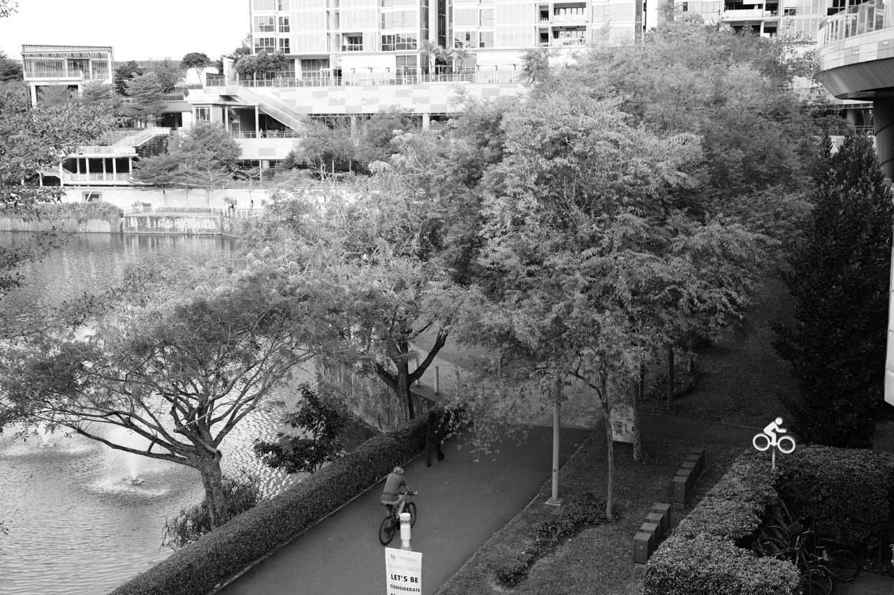
What should Punggol residents expect from the North Eastern Riverine Loop in 2027? NParks’ existing 26-kilometre green route connects Punggol, Sengkang, Buangkok and Hougang through four parks and adjoining riverfront connectors. The network is real today, but individual parks have different operating conditions, and a temporary closure may affect part of a planned outing.
For 2027 families, the useful question is not whether an entirely new 26km loop opens. It is how to use the established network safely, what the published distances mean, where the route crosses neighbourhood boundaries and how to distinguish a planned cycling link from a route a person can already use.

26km riverine loop: the verified picture
| Route or plan | What it means in 2027 |
|---|---|
| The existing loop | 26km linking Punggol Park, Punggol Point Park, Punggol Waterway Park and Sengkang Riverside Park. |
| Existing smaller components | 6.1km Punggol Park Connector and 8.4km Punggol Waterway Park Connector (both waterway banks). |
| 2027 access caveat | Individual park closures and works must be checked; Punggol Point Park has a separate upgrading restriction. |
| Future connections | URA planning documents contain additional walking/cycling links; not every conceptual link is confirmed as open for public use. |
Updated 27 October 2026 from NParks and URA. Route maps describe the network; the latest dated closures and physical signage determine day-of-visit access.
A 26-kilometre network, not one single new park
Did you know that Punggol forms part of a 26-kilometre green circuit reaching beyond the estate into Sengkang, Buangkok and Hougang? NParks calls it the North Eastern Riverine Loop. It follows waterways and stretches of coastline, linking four important parks: Punggol Park, Punggol Point Park, Punggol Waterway Park and Sengkang Riverside Park.
That name is easy to misunderstand. Punggol Park itself is located at the junction of Hougang Avenues 8 and 10; it is not another name for Punggol Waterway Park. The riverine loop is an interconnected route across several neighbourhoods and not a single venue with one entrance, one closing time or one manager of every activity along it.
For 2027, the loop is already established. A resident can use its real paths for short walks and cycling, but should not infer that all 26 kilometres will be free of temporary diversions simply because a brochure depicts a complete circle.
What the four parks contribute
Punggol Waterway Park runs through the residential heart of Punggol and is described by NParks as a 25.79-hectare landscape open 24 hours in general. It has Nature Cove, Recreation Zone, Heritage Zone and Green Gallery, with different activities around the water and surrounding homes.
Punggol Point Park sits at the coastal end of Punggol Road and has historically included a viewing deck, paths and waterfront recreation. Its general NParks park directory still carries ordinary details, but the separate upgrading closure affecting it from August 2026 with works targeted to finish at the end of 2027 takes precedence. A route brochure should never be used to enter a park that is fenced for works.
Sengkang Riverside Park provides a different park landscape beside Sungei Punggol and the Sengkang Floating Wetland. For a Punggol resident who has never explored outside the estate, the park illustrates why the 26km circuit is a cross-town network rather than a loop contained in one HDB planning district.
Punggol Park is a family leisure park in Hougang, despite its name, and NParks places it on the same green network. Its position is a good lesson in checking exact addresses before setting out to meet friends.
The different distance figures actually refer to different things
The complete North Eastern Riverine Loop is 26 kilometres according to NParks and URA. Punggol Park Connector itself is a 6.1-kilometre route from Gerald Drive to Punggol Promenade, passing along water and linking green destinations. The Punggol Waterway Park Connector is separately listed at 8.4 kilometres along both banks of the roughly 4.2-kilometre central waterway.
These lengths are not conflicting estimates of one route. They describe a loop, a named connector and two sides of a waterway. A family that reads ‘8.4 km waterway’ should not assume that the actual waterway is eight kilometres long in a straight line.
The entire round trip from your flat may be longer still. Add the journey to the trailhead, any return to a different public transport point, detours and the distance between rest stops. Use the official NParks route details for the exact segment chosen.
A resident looking to exercise does not need to complete the entire 26km circuit to make use of it. Selecting a manageable five- or twenty-minute stretch is often more practical than an impressive all-day goal.
Why the links matter to the everyday neighbourhood
A green network can help someone walk between residential areas, parks and community facilities without travelling every part of the trip by car. It also provides leisure alternatives for children, older adults and families whose free time may not match a paid attraction’s opening hours.
In Punggol, established waterway routes lead towards LRT and MRT connections, shops and gathering places. The public transport portion still needs separate planning, particularly when the return point is not near the home. A pleasant walk should not end with a family stranded without a realistic route back.
Some people will cycle rather than walk. A connected park route can reduce reliance on short vehicle trips when the actual road crossings, path design and parking options are suitable. This is a potential everyday benefit, not a guarantee of a specific commute time for every household.
URA’s Master Plan 2025 North-East regional material identifies the North Eastern Riverine Loop as a significant recreation resource and discusses further green and cycling connectivity. These regional plans guide longer-term development; they are not evidence that every future link is already built in 2027.
How to choose a safe family route
Start with people rather than kilometres. A younger child may want a short stop to look at water or birds, while a grandparent may prefer a shaded path with seating. An older student may be ready for a longer cycle but needs to understand crossings, navigation and an agreed return point.
For a family starting at Punggol Waterway Park, a simple plan is to choose an existing open path, walk to a known bridge or seating area, and return by the same route. Record the time taken so the next outing has a realistic duration.
Residents travelling towards Sengkang Riverside Park can plan a longer route along Sungei Punggol. Check the actual connector and any route notices; the scenic name does not remove the need to pass junctions safely or respect cyclists using the shared path.
Some visitors prefer the coast and Coney Island. Remember that Coney Island has a separate 7am–7pm park-opening regime, while Punggol Point Park’s upgrading closure is separate again. The green network has multiple access regimes, not one universal gate.
A 2027 closure notice can override a historic route map
NParks maintains a live Park Connector Network notices page. Its October 2026 updates include wildlife advisories for Punggol Promenade Nature Walk and reminders about fragile intertidal areas near Punggol Point Walk. There are also older entries for past temporary track closures; a reader must check each entry’s dates.
A notice about wild boars means observe from a distance and remain on designated paths; it is not permission to pursue animals for photographs. A notice about coastal intertidal access means a beach or stretch may have controlled entry even where an older recreational map shows the shoreline.
Similarly, Punggol Point Park’s separate upgrading closure affects the old coastal park and associated carpark. It must not be presented as closing every kilometre of the North Eastern Riverine Loop. Equally, a route labelled open elsewhere in town does not make a blocked local crossing legal to enter.
The correct 2027 procedure is to compare NParks’ current loop and park-specific information, then inspect any physical signs on the day. A dated closure or diversion notice is more authoritative for access than an undated scenic photograph.
Shared-path etiquette for cyclists and walkers
On a shared connector, pedestrians and cyclists have different speeds and needs. Cyclists should slow near crossings, children, animals and blind corners, signal appropriately and give sufficient space. Walkers should remain aware of others and avoid spreading across the entire path when it is busy.
Do not assume every park connector is a segregated cycleway. Some parts may be designated shared paths, others connect to footpaths or road crossings. Follow the signs and prevailing active-mobility rules for the actual path category.
A child learning to cycle should practise where the adult can supervise and the risk of conflicts is limited. Helmets, lights and a working bicycle matter, but route selection and judgement are equally important. A long ride is not proof of competence if the child does not know when to stop.
Rentals and shared bicycles add another layer: check legitimate parking locations and never leave a bicycle blocking a path, tactile paving or a ramp. Good access should work for wheelchair users and people pushing prams as well as cyclists.
Wildlife and the riverine landscape
The loop passes waterways, wetlands and coastal environments that support birds and plants. NParks identifies species such as herons, egrets and kingfishers along the Punggol Park Connector. Seeing a bird is never guaranteed, but observing without interference is a good learning activity.
Children can use a walk as a simple science field experience: record the habitat, sketch a bird’s silhouette, compare the view at different times of day and ask why water, trees and shared paths have been designed together.
An accurate field journal distinguishes what a child observed from what they infer. A bird seen near the waterway does not establish its exact species, and murky water after rain is not by itself evidence of pollution. Learning to ask good questions is more useful than inventing certainty.
Residents should not feed wild animals, remove plants, disturb intertidal habitats or enter the reservoir. An accessible public path does not make the adjacent ecosystem an unrestricted playground.
What future connectivity claims should Punggol residents check?
One likely theme of future planning is improving connections among neighbourhood facilities, green corridors and public transport. URA’s Master Plan 2025 and Punggol Digital District guidelines discuss links for pedestrians and cyclists. Those guidelines establish design intentions and requirements, not an opening schedule for every missing path.
For a supposed new connector, ask whether the responsible authority has announced a site, approved the link, begun works, or formally opened it. The four statuses are different. A line on a conceptual plan does not demonstrate that a family can ride across it in 2027.
Do not transplant announcements about a road bridge or LRT depot onto a park connector. Road infrastructure, rail capacity and NParks recreational facilities have different agencies and project timelines.
The practical success of a 2027 green-network plan lies in safe, continuous, lawful access that residents can actually use, not only an impressive map of possible future links.
Neighbourhood route checklist
- Select the route for the people going, not just the largest distance on a map.
- Check park-specific entry hours, closure and maintenance notices before travel.
- Use authorised crossings and follow shared-path cycling and walking rules.
- Include a real return route or public transport stop in the plan.
- Distinguish the 26km network, 6.1km Punggol connector and 8.4km Waterway connector.
- Never assume an URA proposed link is already open; inspect official announcements.
Frequently asked questions
How long is the North Eastern Riverine Loop?
NParks and URA identify it as a 26km recreational network.
Which parks does it link?
Punggol Park, Punggol Point Park, Punggol Waterway Park and Sengkang Riverside Park.
Is Punggol Park inside Punggol town?
No. Despite its name, NParks locates Punggol Park at Hougang Avenues 8 and 10.
Is the whole 26km route brand-new in 2027?
No. It is an established network; individual closures or new links require separate notices.
How long is Punggol Park Connector?
NParks lists a 6.1km segment from Gerald Drive to Punggol Promenade.
Why is the Waterway route described as 8.4km?
The park connector covers promenades on both banks of the approximately 4.2km waterway.
Does Punggol Point Park remain affected in 2027?
A separate upgrading closure has an expected works-completion target at end-2027. Follow the current park-specific notice before visiting.
Can families use part of the loop rather than completing it?
Yes. Choose a lawful, suitable segment and a manageable return route.
Is the full loop wheelchair-friendly from every HDB block?
No universal door-to-door guarantee follows from a park connector’s accessibility description; inspect the precise route.
Where should I verify closures?
Use NParks Park Connector Network notices, the park-specific directory and on-site signage.
Official NParks, URA and LTA sources
- NParks: North Eastern Riverine Loop 26km overview
- URA Master Plan 2025: Fun by the Water, Play Near Home
- NParks: Punggol Park Connector, 6.1km
- NParks: Punggol Waterway Park Connector, 8.4km
- NParks: live PCN safety and closure notices
- LTA: cycling infrastructure and active mobility
Continue reading on eduKatePunggol
- History of the North Eastern Riverine Loop: Punggol’s 2012 opening
- Punggol Waterway Park versus Riverside Walk: correct routes
- What to Expect for Punggol 2027: Coney Island and Nature Walk
- Punggol Point Park 2027 closure and heritage outlook
- Punggol resident guide: transport, parks and amenities
Editorial note: 27 October 2026. This is a local planning and route guide, not a real-time statement of uninterrupted access to all 26km. Check current authority notices before a planned ride or long walk.


