
Did you know that Punggol’s LRT is not one straight railway with a station at each end? It is a neighbourhood rail network organised around two loops, with Punggol MRT as the important connection to the wider North East Line. That shape looks almost obvious on a transit map. It becomes much more interesting when you ask why the town was given that arrangement.
A loop is a way of linking several residential areas to a central interchange without requiring a full-sized MRT line through every housing precinct. But it creates practical questions for commuters. Which direction is the train travelling? Where does a particular service go next? Why might one journey feel longer than another even though the two stations look close? Why should someone check the train information rather than assume that every arriving vehicle serves every stop?
This guide is a plain-English explanation of why Punggol has two LRT loops. It concentrates on the network logic, everyday journey choices, and the way young people can learn to read transport maps. For exact operating directions, train frequency, temporary service arrangements and lift access, use current information from LTA and the operator. Those details can change; the reasoning behind the network is the more lasting lesson.
The answer in 50 seconds
The Land Transport Authority describes the Punggol LRT as a fully driverless light-rail system that opened in 2005. It links residential neighbourhoods with Punggol MRT station on the North East Line and Punggol bus interchange. LTA identifies two loops serving 14 stations. The loops are a way of distributing access across the town while using the central interchange as a common connection point.
A loop connects several stops in a circuit. Having two loops allows different sets of neighbourhood stations to be served around Punggol rather than requiring every passenger to travel along one long straight corridor. But a loop network also requires passengers to pay attention to station names, direction and service information. The correct train is the one whose actual journey takes you to your destination, not merely the next train that arrives.
The fundamental idea: Punggol’s LRT is a neighbourhood connector; the MRT is the regional link. Different transport layers do different jobs.
Why a town needs more than a single railway line
Imagine designing a town with homes spread over several neighbourhoods. You want residents to reach a central shopping area, a transport interchange, services and schools without every trip requiring a private vehicle. One option would be a single rail line running along one corridor. That would serve people near the stations but leave others with long approaches.
Another option is a bus network that follows multiple roads. Buses are flexible and remain essential. A third option is to create a light-rail network reaching several precincts and connecting back to a major MRT station. The planning question is not which mode looks most impressive. It is which combination provides useful access within the available land, engineering, cost and operating constraints.
Punggol’s LRT fits into this wider multi-mode system. LTA says it connects residential areas to Punggol MRT and the bus interchange. In everyday terms, it helps people complete the neighbourhood portion of a longer journey. The main MRT line carries them beyond Punggol; the LRT makes the origin or destination more accessible inside the town.
That division of labour matters. A short local trip and a long cross-island journey are not the same transport problem. They do not necessarily require identical trains, station spacing or alignments.
What a loop actually does
A railway loop is a route that turns back towards its starting area rather than finishing at a distant terminal. Draw a circle on paper and place several stops around it. Put a central interchange at the beginning of the circuit. A passenger can board at the interchange, travel around the circuit and return towards the interchange.
Real transport networks are more complicated than a perfect geometric circle. Tracks follow available corridors, stations sit where useful destinations exist, and operating directions depend on the actual infrastructure and service plan. The Punggol system therefore should not be explained by drawing a generic circle and claiming every train completes it in every operating period.
Nevertheless, the circuit gives children a useful mental model: there is a central transfer point, several neighbourhood stops, and a way for trains to serve those stops in an organised repeating pattern. Understanding the pattern is much more valuable than memorising a list of station codes without knowing where they fit.
A loop also makes a distinction between physical closeness and journey convenience. Two stations can be geographically close but sit at points on a route that make their actual travel pattern less direct. That is why a transport map should be read as a network, not as an ordinary street map.
Why Punggol has two loops rather than one enormous circuit
Two circuits can distribute stops over different parts of a growing town while allowing both to connect with the same major interchange. This is a reasonable network design response when residential precincts spread over multiple corridors. It can also help separate the way each part of the town is served rather than forcing every journey onto one very long neighbourhood circuit.
This is a planning explanation, not a claim that a single factor caused every historical engineering decision. The detailed construction, alignment and operating choices depend on studies that include land use, constraints, expected demand and cost. Without those design records, it would be misleading to say that one particular road or block was the sole reason for the two-loop pattern.
What residents need to know is simpler. The East Loop and West Loop are different sets of neighbourhood stations. Commuters should identify their stop and the corresponding current service arrangement. Checking the platform’s displayed route remains essential, particularly during service changes.
The two-loop concept also explains why Punggol MRT is more than just another stop on the local network. It is the common connection between local movement and wider rail journeys.
Why the interchange matters more than the shape of the map
Punggol MRT connects the LRT with the North East Line. A household may use the LRT only for a few stops, but the interchange makes those few stops useful as the beginning of a much longer trip.
Consider a student who needs to travel from a Punggol neighbourhood to a secondary school elsewhere in Singapore. The student’s journey can have several legs: a walk to a neighbourhood station, the LRT ride, the MRT ride, perhaps another train or bus, and a final walk. The entire commute succeeds only if these pieces connect sensibly.
A map of the LRT alone cannot reveal whether the full school journey is convenient. The child needs to know where transfers occur, what time to leave and what alternatives exist if a service is disrupted. The quickest journey is not always the one with the fewest stations if a transfer takes time or a walking route is difficult.
This is the meaning of an interchange. It joins different networks. The LRT loops would still be routes if no MRT connection existed, but their usefulness for longer journeys would be significantly different.
A model town exercise: one line versus two loops
Suppose a fictional town contains eight housing precincts grouped on either side of a central interchange. A straight line goes through four of them. The others need long walks or buses. A second design introduces two small circuits, one serving the eastern group and one the western group.
Ask the learner which homes now gain nearby access. Then ask the more difficult question: what have we not measured? The answer includes waiting time, rail operating cost, accessible station approaches, total travel time, crowding and whether the routes actually follow useful destinations.
The purpose of the exercise is not to prove that a two-loop design is universally superior. It is to show that network shapes create trade-offs. A straight line can be excellent where destinations lie along a corridor. A loop can be useful where neighbourhoods surround a central node. A bus may be the better solution for some trips.
Children learn an important planning principle here: choose the structure to fit the problem. Do not choose the problem after falling in love with a particular structure.
Why train direction changes the answer
If a service follows a circuit, a passenger must know which way the train is travelling. A simple classroom demonstration makes this obvious. Draw six stops around a circle. From Stop A, the destination Stop B is one segment clockwise but five segments anticlockwise. Both directions eventually reach the destination in the imaginary exercise, but one is shorter.
Real Punggol services have their own advertised directions and operating arrangements, so do not carry the classroom rule over as a claim about every train or every time of day. Instead, use the current station diagrams, electronic signs and announcements to confirm the actual service.
This point is especially important for visitors and younger commuters. A station name on the map does not guarantee that every approaching train travels toward it next. Taking the wrong direction can turn a simple trip into a frustrating one.
If uncertain, stop before boarding. Read the display, check the destination sequence and ask station staff where appropriate. A minute spent understanding the route can prevent a longer detour.
Why loops can be confusing even when they are convenient
People are usually comfortable with a linear idea: board at the start, move towards the end, get off at the named stop. A circular network demands a different mental picture. The line may return to the same area. Direction and loop identification become important.
This is a wayfinding problem. It can be reduced through clear station diagrams, distinctive labels, digital announcements, accessible information and repetition. The best wayfinding does not expect passengers to memorise the complete system before making one trip. It gives them enough correct information at the moment of decision.
For a child, use three simple questions: Which stop am I at? Which stop do I need? What does the next train actually serve? For an older resident or visitor, a clear printed or digital reference can be more useful than an explanation filled with abbreviations.
Public transport is effective only when people can understand how to use it. An elegant track layout without good wayfinding would be an incomplete public service.
What an automated train changes—and what it does not
LTA describes the Sengkang-Punggol LRT as fully driverless. That means the train service uses automated rail technology rather than relying on a driver in the conventional cabin role. It does not mean that no people are needed to run the transport system.
Rail operations still involve control, supervision, maintenance, safety systems, station management, incident response and passenger communication. The fact that a train travels without a driver does not make track inspection, reliable equipment or clear procedures unimportant.
Students sometimes equate automation with a machine making every decision independently. A more accurate picture is that automation operates inside a designed set of systems, rules and safeguards. Engineers must still plan for failures, unusual conditions and human needs.
The educational connection is valuable. Understanding an LRT can open conversations about sensors, control systems, communication networks and maintenance. But a child does not need specialist software knowledge to use the train responsibly. The first skill is reading the current service information accurately.
Why the trains are elevated
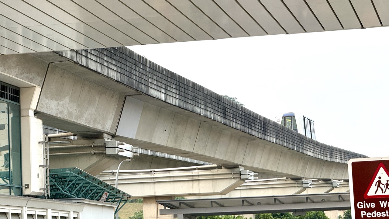
Residents can see Punggol LRT vehicles travelling above street level. An elevated guideway separates the rail vehicle’s movement from many road-level conflicts. It also creates a distinctive urban landscape, with stations connected to the surrounding paths and housing areas.
The advantages come with trade-offs. Elevated structures require columns, foundations, access infrastructure and maintenance. Stations must connect vertically and horizontally to pedestrian routes. Stairs and lifts become important accessibility features. Construction and long-term operation must take account of surrounding land use and safety.
It would be oversimplified to say elevated rail is always cheaper, quieter or better than an underground line. Different settings produce different cost and environmental outcomes. The important point is that the chosen rail level affects how the entire neighbourhood functions.
A child looking up at an LRT guideway can be asked a useful question: what can move underneath, and what must be provided to let passengers reach the platform? That shifts attention from the train alone to the town around it.
Why the surrounding streets still matter
Even if the train is reliable, a passenger must reach the station safely. That means a useful LRT network depends on walkways, safe crossings, step-free access where required, signs, lighting and surrounding destinations.
Imagine two neighbourhoods with identical travel time on the LRT. In one, the station approach is direct and well connected. In the other, residents must take a long detour around a barrier. The railway journey is the same length, but the complete journey is not.
This is why transport planning cannot stop at the platform edge. The station’s usefulness includes the experience before and after boarding. People pushing strollers or using mobility aids may face different challenges from commuters who can manage stairs and long walks.
For Punggol families, the correct route plan is door to door. Do not use the published train ride alone as the estimate of the entire commute.
Why the LRT is not the same as a neighbourhood bus
Light rail and buses can both serve local journeys. They differ in alignment, infrastructure, stopping patterns, operational flexibility and capacity characteristics. A bus route can be changed more readily than rail infrastructure, but it also interacts with roads and traffic conditions.
A fixed rail line provides a clear permanent corridor but cannot be diverted like a road vehicle to serve a newly opened street. Local buses and walking links remain important alongside it. The two systems are not enemies competing for the right to exist; they solve related but distinct transport problems.
If a child asks, “Why not use the LRT for everything?”, point to destinations that are not next to a station, to the need for cross-town travel, and to situations in which a bus may provide a more suitable connection. If they ask, “Why have the LRT at all?”, explain the value of a regular rail connector integrated with the MRT interchange.
Both questions help the child move beyond a simplistic belief that one transport mode is universally best.
Why future housing affects a rail network
Punggol has developed over time. Transport infrastructure must cope with changes in neighbourhood populations, travel patterns and the attractiveness of different destinations. A station serving one pattern of homes and jobs may face different demand years later.
LTA reports that both Sengkang and Punggol LRT systems introduced two-car operations in 2016 and that the Sengkang-Punggol LRT depot is being expanded to accommodate more two-car trains by 2027. Treat the 2027 statement as an infrastructure plan or target reported by LTA, not an assurance of a particular future train frequency.
The reason for adding capacity is understandable: more passengers need room, and operators must have enough trains and supporting facilities to serve demand. But a larger depot does not tell us the exact timetable for a particular school commute.
For decisions that depend on next week’s travel, check live or current operator information. For understanding why transport upgrades occur, look at the relationship between demand, fleet size, maintenance and operating capacity.
What capacity means in ordinary language
A vehicle’s capacity is not the number of people one passenger happens to see on one trip. It is about how many passengers can be accommodated within operating and safety constraints. Crowding depends on the time of day, service pattern, direction and demand.
Imagine a hypothetical route where one vehicle comfortably carries 50 passengers in a simplified classroom model. If 90 people want to board during the same period, the system must find a way to provide sufficient capacity through vehicle size, service frequency or other operational measures. The figures are fictional and do not describe any Punggol train.
Now add another constraint. Additional vehicles require space for maintenance and storage and suitable infrastructure to operate them. The learner discovers that ‘just add trains’ is a real engineering and scheduling task rather than a button anyone can press without consequences.
This example helps explain why a depot upgrade can matter, even though the depot itself is not a place a passenger normally visits.
Why a neighbourhood loop is useful to families
A local rail connection can influence the feasibility of ordinary routines. A parent may combine a school journey and shopping trip. A student may travel to tuition. An older resident may use a combination of walking and public transport for a medical appointment. The relevant destinations are personal; they vary from household to household.
The LRT is not guaranteed to be the correct option for every one of those trips. Some may be easier on foot or by bus. Others require an MRT transfer. The useful decision is to compare the complete routes rather than automatically selecting the nearest rail station.
For small children, the LRT can be a learning opportunity when accompanied by an adult. They can practise recognising station names, reading line diagrams and noticing how a neighbourhood changes as the train moves. They should not be instructed to travel independently merely because they can identify a station on a map.
Family travel is also about practical details: weather, station lifts, crowding, carrying groceries and keeping a safe distance from platform edges. Good planning respects those details without turning every journey into an elaborate project.
A short lesson in network mathematics
A network can be represented by nodes and links. A node might be a station. A link might be a train segment or a walking connection. An interchange is an especially important node because it joins different networks.
Draw two small circles touching at one point. Label the shared point “Punggol interchange” for the purpose of the model. Place fictional neighbourhood stations on each circle. Add a third line leaving the interchange, representing the wider MRT network.
Ask the learner to trace a journey from a stop on one circle to a stop on the other. They will discover that the shared node matters. Now ask them to reach a distant station outside Punggol. The regional line becomes necessary.
For older learners, add costs: each link can have a hypothetical travel time, waiting time or walking distance. A route with fewer links may not have the lowest total cost. This is the basis of many journey-planning problems, but the family exercise requires nothing more than paper and clear reasoning.
Why the shortest map path may not be the fastest trip
A transit diagram is designed to show connections clearly. It is not always drawn to geographic scale. Even an accurate geographic map cannot tell you every waiting time from a glance.
Suppose hypothetical Route A has two stops and ten minutes of waiting. Route B has four stops but a train is about to depart. Which is faster? We need travel times for each link, not just the stop count.
For Punggol, the correct response is to use current timetable and service information, particularly when a journey matters. An article explaining loop geometry should not fabricate a universal “fastest direction” rule based on an invented schedule.
This is also a good lesson in data literacy. A route planner gives an estimate based on available information and assumptions. The actual trip can differ if service conditions change. The most responsible traveller knows the difference between a useful estimate and a guaranteed arrival.
Three real-life style scenarios, without made-up timetables
Scenario one: a child needs to reach school
A family identifies the exact school and the station closest to home. Instead of simply counting LRT stops, they work backwards from the school arrival time. They check the neighbourhood walking route, the train service, transfers and the final approach to school.
The adult asks whether a reliable bus or walk could be simpler for part of the route. They also plan an alternative if the usual path is temporarily unavailable. The child is taught the correct station name and what to do if confused: remain in a safe staffed/public area and seek authorised help rather than guessing.
The lesson is that a commute is a complete chain of decisions, not just a ride on a loop.
Scenario two: a visitor is going to a friend’s flat
A visitor receives directions that say, “Take the LRT.” That is not enough. The friend should provide the specific destination station and confirm the current loop and service direction. A landmark or nearby road may help identify the correct exit and subsequent walking route.
If a particular station has access changes, the visitor must follow current signs or official announcements. The friend should avoid making claims about which train is “always” running unless that has been verified.
The lesson is precise communication. Saying “Punggol LRT” is like saying “take a road” without identifying the route.
Scenario three: an older resident has an appointment
An older resident prefers a step-free journey and needs sufficient time for lifts and transfers. A family member checks the actual station facilities and full path, not simply the existence of rail service. They allow comfortable time and consider another transport mode if the usual access is unavailable.
The resident’s preference matters. Accessibility decisions should be made with the person, not from assumptions about age. A trip that involves fewer train stops may still be less suitable if its walking and transfer components are more difficult.
The lesson is that the best public transport network is the one people can use in practice.
How the LRT helps students understand geography
A town is not just a collection of buildings. Its functions depend on relationships between places: housing, shops, jobs, schools, green spaces and transport. LRT stations are useful reference points because they make those relationships visible.
Use a current public transport map of Punggol and mark three categories of destination: daily needs, learning and community activities. Ask where people might need to transfer between rail, bus and walking. Then ask why a trip between two close-looking destinations may still require careful planning.
The exercise introduces accessibility, which means more than whether a place exists. A facility has limited practical value to someone who cannot reasonably reach it. The LRT is one part of solving that access problem.
This is especially important for children learning map skills. A map becomes useful when they can explain how to get from one place to another, identify assumptions and notice when they need more information.
What not to assume from a station name
A station name is a label, not a complete description of the surrounding neighbourhood. It does not certify the distance to every nearby home, the availability of a particular shop or the accessibility of a specific route. It also does not guarantee that trains are operating normally at the moment someone arrives.
For a family planning a one-off visit, it is sensible to cross-check the intended destination and current walking directions. For a daily commuter, remember that transport patterns can change as developments open and service arrangements are updated.
Parents can use this as a literacy lesson: names help organise information, but a name alone does not answer every practical question. A confident learner checks the evidence needed for the action they are taking.
The goal is not excessive caution. It is the habit of using the right information for the right decision.
How to read a loop map correctly
Start with your origin, not your destination. Locate the current station and identify which circuit it belongs to. Next, locate the destination station. Then trace the actual route shown by the current service map and identify any required transfer.
Check whether you are reading a diagram showing infrastructure or a diagram showing services currently in operation. Those are related but different. A track can exist even if a service pattern changes temporarily. Station signs and operator updates are authoritative for present-day travel.
Before boarding, compare what you expected with the platform display and announcements. If the information conflicts, do not rely on your memory of an old screenshot. Seek a current answer.
This is a repeatable procedure a child can learn with supervision. It is more robust than memorising a single route and assuming it will never change.
Mistakes residents should avoid
One mistake is treating all Punggol LRT trains as interchangeable because the vehicles look similar. Another is believing that a loop means direction is irrelevant. A third is counting only stops and ignoring waiting, walking and transfers.
A fourth mistake is using a map image from an old article as if it were a live timetable. A fifth is assuming the LRT’s two-car capacity upgrades immediately imply a new frequency. Another is overlooking the accessibility of the path between home and the platform.
There is also a conceptual mistake: assuming the LRT is designed to compete with the MRT or bus network. In fact, each mode belongs to a larger system of local and regional connections. The decision for any person is about the whole journey.
Finally, avoid using the word “automated” to mean “requires no human oversight”. Safe public transport includes complex human and technical responsibilities beyond the passenger’s view.
Frequently asked questions
How many loops does the Punggol LRT have?
LTA describes two loops serving 14 stations. Refer to current route information for the stops and services operating on the day of travel.
When did the Punggol LRT open?
LTA states that it opened in 2005. The system has subsequently evolved and had capacity upgrades.
Why not build one straight line instead?
A straight line primarily serves a corridor; loops can distribute access around separate neighbourhood areas and bring riders back toward a shared interchange. Detailed alignment choices also depend on engineering, land and operating constraints.
Does every train call at every station?
Do not assume so. Consult current service diagrams, platform indicators and announcements. Service patterns can change.
Why does Punggol MRT matter so much?
It connects the neighbourhood LRT system with the North East Line and the wider rail network, making local access useful for longer journeys.
Are the trains driverless?
LTA describes the system as fully driverless. It still needs supervision, maintenance, safety management and other human roles.
Did two-car trains arrive recently?
LTA reports two-car operations began in 2016 for the Sengkang and Punggol LRT systems. Further capacity work, including depot expansion, is planned.
Are trains faster than buses for every Punggol trip?
No. Compare the exact origin, destination, walking distance, transfers and live conditions. Different modes serve different journeys.
What should I do when the displayed route differs from an old map?
Use current operator information and station guidance. Do not board based on an old diagram alone.
Can children learn the loop system?
Yes. With appropriate adult supervision, drawing the circuits and tracing a route is an excellent map-reading exercise. Learning the diagram is not permission for unsupervised travel.
A commuter’s practical route-check checklist
- Identify the exact station near your starting point and the actual destination.
- Check whether your destination is on the East or West Loop.
- Read the current service map rather than an old screenshot.
- Check the train’s direction and displayed service before boarding.
- Include walking, waiting and transfers in your journey plan.
- For a trip outside Punggol, identify the connection at Punggol MRT.
- Confirm accessibility where lifts or step-free approaches matter.
- Pay attention to temporary works and operator announcements.
- Make a backup plan when punctual arrival is essential.
- Help young travellers practise the route safely with a responsible adult.
Teaching Guide: build a two-loop network on paper
Goal. The learner explains why local transport routes connect neighbourhoods to a central interchange, why direction matters, and why a full journey includes more than train time.
Materials. A sheet of paper, coloured pencils and a current official LTA map for reference. For calculation exercises, use invented stop names and distances so there is no confusion between a model and the live Punggol timetable.
Stage 1: identify the structure. Draw a central dot labelled Interchange. Draw two circuits meeting it, then place fictional stations around the circuits. Ask what a person on one circuit must do to reach the other. The learner should notice the shared interchange.
Stage 2: compare directions. Draw four hypothetical stations on a small circle. Assign one minute to each segment. Compare the number of segments travelled in two directions. Remind the child that the calculation describes the fictional model, not today’s operating services.
Stage 3: add a regional route. Draw a third line from the interchange to a distant city destination. Ask why the local train alone is not the correct system for the whole journey. Introduce the idea of transport layers with different functions.
Stage 4: add real-world constraints. Introduce a three-minute walk to the station, a variable wait and a five-minute walk after the final train. Ask how these influence total travel time. Do not let the child quote the numbers as actual Punggol journey times.
Stage 5: test transfer. Present an unfamiliar imaginary town with a bus hub and two feeder lines. Ask the learner to explain how the same network logic applies even though the transport mode changes.
Checkpoint. The child should be able to say, “I know my destination, I know which route reaches it, and I check current signs before boarding.” That is better than memorising station names without understanding the system.
Where this fits in the Punggol guide library
This explanation is intentionally different from the detailed Punggol LRT depot and two-car train update, which addresses capacity and the 2027 infrastructure pipeline. For broader planning and routes, see the Punggol MRT versus Punggol Coast MRT guide and the Punggol bus interchange guide.
Here the question is more fundamental: why is Punggol connected by two neighbourhood rail loops at all? The answer introduces the ideas of network shape, local accessibility, interchange function and journey choice without pretending that a static explanation is a live timetable.
Official sources
- Land Transport Authority: Sengkang-Punggol LRT
- LTA: Rail network and travel information
- SBS Transit: Transport service information
- eduKatePunggol: LRT capacity and depot guide
The one idea to remember
Punggol’s two LRT loops make sense when you stop seeing them as two train rides and start seeing them as a neighbourhood access network. The loops connect different residential areas to a common interchange. The MRT connects that interchange to a wider region. Understanding those layers—and checking which service actually operates—turns a complicated-looking map into an everyday tool.


