
Quick answer — 27 October 2026: Punggol residents exploring geospatial, GIS and mapping careers for 2027–2028 have a verified national pathway to investigate. Singapore’s Geospatial Master Plan 2024–2033, led jointly by the Singapore Land Authority (SLA) and Maritime and Port Authority (MPA), aims to develop geospatial talent, infrastructure and broader adoption. Public-sector careers guidance lists mapping, remote sensing, GIS engineering and geospatial analysis as different technical specialisations. This does not mean that a particular number of GIS jobs will open at Punggol Digital District.
Did you know that a map can answer a question without telling a user what decision to make? It can show a public library, an MRT entrance, a cycling path or a flood-related asset. But a professional must still decide whether data are current, whether walking access is actually available, which measurements are comparable, and whether publishing information would reveal private movements. In geospatial work, the difficult part is frequently making the location-based conclusion reliable, not simply placing colourful pins.
Punggol is a useful place to understand this industry because the neighbourhood contains LRT loops, bridges, paths, water, schools, housing precincts and a new university/business district. This guide explains what is publicly established, which actual roles to investigate, how students and mid-career workers can build safe evidence, and what to watch for in 2027 and 2028.
A forecast must begin with confirmed evidence
| What is known by October 2026 | What it actually means | What it does not mean |
| Singapore Geospatial Master Plan 2024–2033 | A national strategy for mainstreaming geospatial use, deepening capability and global partnerships | Ten-year guaranteed annual hiring numbers |
| SLA is the national geospatial and mapping agency | Official expertise and maintained national digital maps exist | That all relevant job vacancies are based at SLA’s offices |
| OneMap is an authoritative Singapore map | Street-level locations, routing and selected thematic information can support analysis | That each dataset is suitable for every safety-critical decision |
| Singapore Government Tech Careers names geospatial role tracks | Mapping, remote sensing, GIS systems, geodata and analysis are recognised functions | That every map user is automatically a certified surveyor |
| Punggol Digital District and town planning | An actual location with varied planning, accessibility and infrastructure questions | That JTC has promised a 2027 geospatial graduate intake |
The source documents are SLA’s Geospatial Master Plan explanation, updated March 2026, SLA’s official OneMap information and Singapore Government Tech Careers: Geospatial. They describe national capability and occupational roles, not Punggol-only vacancies.

What geospatial technology is, in ordinary English
Geospatial information connects a fact to a location or area. A recorded bus stop has coordinates. A public path has a route. A building may have shape, floors and entry points. A school or community service may be described by an address, coverage zone or catchment. A map is one way of displaying those relationships; spatial analysis asks what they mean.
For example, two addresses might be 500 metres apart in a straight line but require a much longer walking route because a canal, rail track or road separates them. A good GIS analysis considers the actual route network, safe crossings and assumptions. Someone who reports only the straight-line distance can mislead families about a journey.
This is why the careers touch engineering, science, healthcare access, transport, environmental management and business operations. Location alone is not an industry: it is information used across industries.
The five geospatial career families
1. GIS analyst and geospatial data specialist
An analyst gathers appropriate spatial datasets, checks coordinate references, resolves inconsistent fields and asks practical questions. How many facilities are accessible within a specified route network? Are the relevant timestamps compatible? Is a cluster visible because of real conditions or incomplete data?
A school project might use public, permitted datasets to compare walking access to services. A professional analysis needs more: data provenance, accuracy, refresh schedules, licensing and a stated limitation. Charts and maps without these are difficult to trust.
2. Surveying and geomatics
Surveying establishes precise positions, dimensions and boundaries for physical work. Geomatics combines measurement technologies with digital spatial information. An engineer or surveyor working on construction, infrastructure or land may use specialised instruments and recognised procedures.
The crucial caution is that reading coordinates from a phone does not authorise someone to certify legal land boundaries, construction positions or safety-critical measurements. Those functions can require prescribed qualifications and professional responsibility.
3. Remote sensing and imagery interpretation
Remote sensing uses information captured by satellites, aircraft or other sensors rather than direct contact with an object. Applications can include land-cover analysis, vegetation change, surface conditions and planning. The analyst must consider sensor resolution, date, atmospheric conditions, viewing angle and how observations are classified.
A satellite image that appears to show a changed building roof may result from lighting or acquisition geometry, not necessarily construction activity. Learning to question the evidence is central to this career.
4. Geospatial engineering and software
An engineer may design geodata pipelines, build geospatial databases, manage APIs, optimise map queries or integrate location information into digital services. This work joins software fundamentals, database design, security and spatial logic.
For example, a service that recommends the nearest facility must define ‘nearest’: by straight line, wheelchair-accessible route, public transport travel time or opening hours? The program’s result is only as useful as that decision definition.
5. Urban analytics and digital twins
A city-scale model can support scenarios for crowds, shade, drainage, access, building operations or maintenance. Public bodies and businesses use models to test possibilities before carrying out costly physical changes. A digital twin is not necessarily a fully real-time replica; its value depends on data quality, update cycles and explicit limitations.
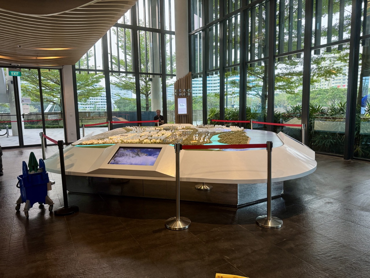
For Punggol, a model of an LRT interchange or mixed-use area may raise interesting planning questions. This is a learning example, not a claim that residents can access a secure district-wide operational model or alter private systems.
What the Geospatial Master Plan 2024–2033 actually commits to
The master plan has three strategic directions: mainstreaming geospatial use, deepening capabilities and international collaboration. Its remit spans government, businesses and society; SLA and MPA co-drive the latest iteration, linking land and maritime applications.
For 2027–2028, that supports a scenario in which organisations continue building relevant technical capability. But the plan is not an authorised yearly vacancies ledger. The questions residents should monitor are whether programmes expand, employers recruit, education institutions offer recognised pathways and actual products solve practical needs.
A government Careers@Gov posting for a Geomatics/Geospatial Manager/Principal Engineer illustrates this distinction: it describes work in technology roadmapping, capability building, industry engagement and emerging themes such as GeoAI and 3D mapping. Its listed reporting location is SLA Revenue House, not Punggol. The existence of a related career nationally does not make it a local district job.
Learn with OneMap, but do not pretend to be a surveyor
SLA describes OneMap as Singapore’s authoritative national digital map. It includes routing and amenities, bus stop information, selected school and land information and other official layers. OneMap is a powerful resource for learning about geographical relationships when used under its terms and with proper interpretation.
A responsible student can compare two permitted, publicly accessible routes through Punggol using published walking directions. Record the date the information was checked. Walk only on open public paths and follow normal pedestrian safety rules. Note where accessibility information is missing, and explain why on-screen routes require real-world verification.
Do not map the home addresses or daily routines of identifiable children, use screenshots to track individuals, trespass on a construction site or treat OneMap boundaries as sufficient for regulated engineering decisions.
A worked neighbourhood problem: straight line versus usable route
Hypothetical exercise: Imagine two public facilities separated by 300 metres in straight-line distance, but the only authorised crossing makes the accessible walking route 700 metres. The walking-route distance is 400 metres longer, or about 2.33 times the straight-line distance.
That does not tell us the walk time without speed, terrain, signals and mobility conditions. A GIS analyst would ask which network was used, whether accessible entrances were identified, whether temporary diversions apply, and whether the data are current.
The exercise teaches Mathematics, Geography and careful writing. It is also a lesson in ethics: a simple number on a map should not be presented as reliable travel advice for somebody whose mobility needs the analyst has not considered.
Skills roadmap for different students
| Learner | Foundation to build | Next experience to seek |
| Primary/Lower Secondary | Map-reading, scale, units, direction, clear language and observation | Draw a safe family route diagram with symbols and explanations |
| Upper Secondary G1/G2/G3 | Mathematics, geography, scientific enquiry, computing and communication | Compare public datasets and write their limitations |
| ITE | Geospatial-enabled technical skills, field safety, software or instrument basics | Supervised practical exposure to applicable tools |
| Polytechnic | GIS, geomatics, computer science, environmental analysis or built environment modules | Project using authorised data and a documented method |
| University/SIT | Data modelling, spatial statistics, software, geography, urban studies or engineering | Applied research, digital-twin or infrastructure study under qualified supervision |
| Mid-career worker | Existing facilities, logistics, mapping, analytics, planning or field-service expertise | Targeted upskilling grounded in actual job requirements |
What a useful GIS portfolio should show
- Question: Define the real user problem; do not start by selecting a fashionable map style.
- Sources: Identify each dataset, time period, licence and geographic coverage.
- Method: Explain geocoding, projections, joins, filters and assumptions at the level you genuinely understand.
- Checks: Compare several observations with trusted sources and identify missing or uncertain values.
- Privacy: Aggregate responsibly; do not expose private locations or infer identities.
- Interpretation: Explain what the result supports and what it cannot establish.
- Revision: Record feedback and show how the analysis improved.
Forecast scenarios for 2027 and 2028
| Scenario | What could happen | What would support the claim | What remains uncertain |
| Public-sector spatial capability expands | More GIS-oriented projects or skills partnerships | SLA or agency programme announcements, verified vacancies | Annual staff numbers and work locations |
| Private organisations use spatial analysis more widely | Retail, logistics, healthcare or built environment employers adopt location insights | Repeated job postings and tested services | Which roles become dedicated GIS positions |
| Digital twins mature | Some teams integrate asset records, modelling and sensors | Published deployments and evaluation results | Whether benefits persist outside pilots |
| Hiring stays selective | Employers expect stronger software, statistics and domain understanding | Live advertisements showing explicit competencies | Whether a short GIS certificate is sufficient |
What not to do
- Do not equate a national ten-year master plan with a guaranteed Punggol recruitment target.
- Do not make highly precise claims using an inaccurate or outdated phone GPS location.
- Do not publish children’s home or school travel patterns as a mapping exercise.
- Do not treat a model as ground truth without physical verification where necessary.
- Do not assume a specialist engineering, land survey or drone task is legal without the appropriate authorisations.
- Do not buy a course until its content matches real role requirements and your level of mathematical or computing knowledge.
Frequently asked questions
Will there be GIS jobs in Punggol Digital District in 2027?
There may be opportunities with organisations operating in and around the district, but the sources cited here do not announce an exact local vacancy count. Search verified employer listings.
Is Geographic Information Systems only for Geography students?
No. Computing, engineering, environmental science, urban planning, logistics and data analysis can all use spatial reasoning. Specific roles still have prerequisites.
Can I work in GIS without becoming a licensed land surveyor?
Yes. GIS analysis and regulated surveying are different occupational functions. Do not conflate a general map analyst with someone who certifies boundaries.
Will AI automatically make traditional geospatial skills unnecessary?
AI tools can help process or classify information, but they can also propagate spatial errors. Reference systems, quality checking, professional accountability and the real physical environment remain important.
Official references and related local guides
- SLA/MPA: Singapore Geospatial Master Plan 2024–2033
- SLA: authoritative OneMap and its features
- Government Tech Careers: geospatial occupational pathways
- SLA: Geospatial Centre of Excellence and careers
- SLA: MOE Map Our World and MOE-EduGIS learning initiative
- eduKatePunggol: OneMap, coordinates and ethical GIS
- eduKatePunggol: remote sensing science pathways
- Punggol Career: construction, research and built environment
The useful career conclusion
Geospatial careers are built around a powerful question: how does location change a real decision? The public national plan creates a strong reason to learn, and Punggol offers familiar examples. Yet a career takes actual job requirements, reliable analysis, safe professional conduct and proof of skill. The map is a tool. The thinking behind it is the profession.


