
To understand what Punggol may look like in the future, start with Singapore’s gazetted URA Master Plan—not a developer’s artist’s impression or a map that labels every empty plot “coming soon”. The Urban Redevelopment Authority (URA) Master Plan 2025, formally gazetted on 1 December 2025, is Singapore’s statutory land-use plan guiding development over roughly 10 to 15 years. It shows intended land uses and development intensity. It does not promise that every planned road, park, school, commercial building or community facility will open on a particular date.
The fastest useful method is to check the exact site on URA SPACE, read its zoning and any plot-ratio or control information, then distinguish what is allowed from what is actually approved, under construction or already operating. A plot labelled Residential is not necessarily an HDB BTO launch. A potential business-park zone is not proof of a signed tenant. A mapped road may depend on detailed implementation and funding. A proposal to change zoning is also not necessarily a gazetted approved change.
This Understanding Punggol | Things to Know guide explains how land-use planning affects housing, transport, business, nature and everyday life. It uses URA Master Plan 2025 publications and 2026 planning-permission guidance, with HDB and JTC’s Punggol development information, checked on 21 October 2026. It is intended for residents, homebuyers, students, community groups, business owners and anyone evaluating a future-development claim. It does not provide site-specific planning approval or legal advice; actual decisions are governed by the current official maps, written statement and authorised agency notices.
The Punggol planning system at a glance
- Current statutory plan: URA Master Plan 2025, gazetted 1 December 2025.
- Time horizon: development guidance for 10–15 years, generally reviewed every five years.
- Long-Term Plan: a broader strategic framework looking further ahead than the Master Plan.
- URA SPACE: digital platform for inspecting land-use zoning and planning information for a specific site.
- Master Plan zoning: the broad permissible land-use category; not a guaranteed opening date.
- Plot ratio: an intensity control involving gross floor area relative to site area, subject to technical and urban-design requirements.
- Development application: a formal request for planning permission, not proof that construction is complete.
- Outline application: can test a proposed use, building height or intensity before a formal project application.
- Proposed amendment: publicly exhibited planning change that may be subject to comments and approval.
- Approved gazetted amendment: a formal change to the statutory Master Plan, effective according to its notice.
- HDB: responsible for planning and developing public housing projects under the broader planning framework.
- JTC Punggol Digital District: a 50-hectare district integrating business park functions and SIT, with phased delivery.
- Critical caution: a map’s future designation is not an instruction to buy property, assume school admission or promise employment.
1. Why Punggol’s future cannot be read from a single photograph
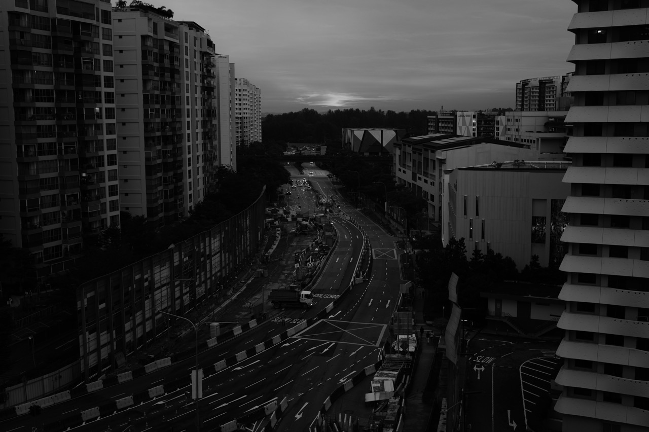
Punggol grew through several phases, from early Punggol 21 planning to waterfront development, the Waterway, Northshore and the emerging Digital District. A photograph taken from an existing bridge captures only what was visible at that moment. It cannot show statutory plans, pending projects or administrative status for another site.
Similarly, a glossy rendering can depict an intended building surrounded by trees, visitors and completed shops. The image may be a useful vision but cannot establish whether the facilities exist, whether a contractor has been appointed or whether the final form will match the illustration. Planning and execution are distinct stages.
A sound future-development guide therefore identifies a site, source, publication date, planning status and responsible agency. That approach remains useful even as Punggol continues to evolve.
2. What the statutory Master Plan actually is
URA describes the Master Plan as the statutory land-use plan guiding Singapore’s medium-term physical development over 10 to 15 years. It is reviewed periodically, generally every five years, and translates the broader Long-Term Plan’s strategies into more detailed land-use proposals.
The Master Plan identifies permissible land uses and development intensity. It provides a planning framework for decisions by agencies, developers and landowners. It is not a schedule of which business opens on the ground floor of a particular mixed-use building next month.
The key word statutory means the plan has a legal planning role. A prospective developer still must comply with the applicable development controls and obtain permissions where required. A resident should avoid converting the plan’s authority into an imaginary construction timetable.
3. Master Plan 2025 is already approved, not merely a draft
URA’s Draft Master Plan 2025 went through public engagement and exhibition. URA announced the gazette of Master Plan 2025 on 1 December 2025, making it the current official land-use blueprint. A source from June 2025 describing a draft should not be used in October 2026 as if the final plan had not been adopted.
That matters when comparing online maps. A blog may refer to Draft Master Plan 2019 or a long-term concept document, while the statutory Master Plan 2025 is now the relevant base. Some earlier features remain informative as history but do not automatically represent the current legal planning position.
Start at URA’s Master Plan page and the current viewer rather than relying on an undated reproduction.
4. The Long-Term Plan works at a different timescale
Singapore’s Long-Term Plan explores strategic directions over a longer horizon, often described as fifty years or more, whereas the Master Plan is the medium-term statutory translation. This distinction prevents a long-range possibility from being misrepresented as a committed 2027 project.
For example, a strategy to decentralise employment and improve regional connectivity can guide many subsequent choices. Individual station entrances, tender dates and new building launches require separate decisions by the responsible bodies. A strategic arrow on a national planning graphic is not a construction contract.
Readers should treat Long-Term Plan material as context and the current Master Plan as the statutory starting point, then move to project-level evidence for operational questions.
5. URA SPACE is the right map for land-use claims
URA SPACE allows people to inspect the Master Plan and related spatial planning information. A buyer or resident should locate the exact plot rather than search only for a broad neighbourhood name. Singapore’s planning boundaries, land parcel limits and road alignments can be much more precise than an estate agent’s marketing description.
The map may provide zoning and intensity information, with overlays or legends identifying different planning controls. Do not assume a colour alone explains all permitted activity; read the label and the applicable Written Statement or special controls. Map scales and viewing layers also matter.
An effective first exercise is to find your actual block, then identify nearby major residential, commercial, park, institution and road parcels and their current designation.
6. Zoning is permission for a class of use, not a tenant list
A land-use zone describes the types of development that may be permitted under the statutory framework. It does not identify the future business occupant of every unit or the person who will receive a particular school place. A plot marked for commercial use is not necessarily a supermarket, café or clinic.
That distinction is important in a fast-developing district. A resident may see commercial zoning near Punggol Coast and assume a particular retail brand is opening. Such a claim requires verified operator or developer evidence, not just a map colour. The same applies to hotel, office or community uses.
A zoning description should be paired with a current statement of whether the site has a confirmed project, approved plan and operational announcement.
7. Residential zoning does not guarantee an HDB BTO launch
Singapore has public and private housing within its planning system. A land parcel with a residential designation could be developed through different housing models under the relevant agency and ownership arrangements. A resident should not equate “Residential” with “BTO launching this year”.
HDB announces actual new-flat exercises, project availability, eligibility and sales conditions through its official channels. URA zoning provides broader planning context, while HDB identifies the real product and application pathway.
For a family choosing between Punggol BTO and resale housing, the future map can be helpful but cannot substitute for a specific HDB flat launch or HFE eligibility check.
8. What does plot ratio mean?
Plot ratio is broadly a measure of permitted gross floor area relative to a site’s land area, within the planning framework. A theoretical plot ratio of 2.8 on a 10,000-square-metre site could correspond to 28,000 square metres of gross floor area under a simple ratio calculation. That arithmetic illustrates the concept, not a site-specific entitlement.
Actual permissible development depends on definitions of floor area, site boundaries, height and technical controls. A map may show a ratio that is only part of the approval conditions. Some development permissions are constrained by urban design, transport or other agency requirements.
A reader should never use a single plot-ratio number to guarantee the height or exact number of residential units that will be built.
9. Worked plot-ratio arithmetic
Assume a hypothetical Punggol site has area 8,000 m² and a permissible plot ratio of 2.5. The simplified potential gross floor area is 8,000 × 2.5 = 20,000 m². If a design allocates half that gross floor area to one use under suitable approvals, the arithmetic half would be 10,000 m².
These are educational calculations only. They do not address actual gross floor area definitions, exclusions, road reservations or mixed-use permissions. Nor do they determine whether the site’s owner has submitted a planning application.
The useful lesson is that density control is a *ratio over an identified land parcel*, not a promise that a building will have a corresponding number of storeys.
10. Plot ratio is not the same as building height
A site with a particular gross plot ratio may be designed with different building footprints and heights, subject to height and other controls. Two developments can have similar overall gross floor area but different building forms. Building height also depends on aviation, urban design, infrastructure and planning constraints.
URA’s amendment notices explicitly warn that actual development parameters such as building height are subject to other considerations. A reader should not treat the plot-ratio figure as a direct multiplication rule for floors.
This matters when someone asks whether a new building will block a particular view. A general map cannot confidently predict the finished building profile from a single number.
11. Building a school requires more than an institutional zone
A plot intended for an educational institution does not establish which school will be constructed or when admissions begin. MOE determines its actual school programme, enrolment arrangements and opening announcements. Likewise, a civic and community zone can permit different institutions rather than guaranteeing one named clinic.
Families selecting a home because they anticipate a nearby school should separate the statutory land use from the concrete MOE project. Primary 1 admission also has separate registration rules even where a school already operates.
The right commitment requires three verified facts: the actual school, the official operational date and the child’s applicable admission procedure. A planning label alone supplies none of these guarantees.
12. Parks and green spaces are managed through multiple agencies
URA may designate open space or other relevant land uses, but individual park implementation and operation involve agencies such as NParks and other landowners. A green shape on a planning map should not be interpreted as a presently open playground with toilets, lighting and walking paths.
Punggol contains established facilities such as Punggol Waterway Park and Coney Island Park, with different access conditions. Future open-space plans may involve staged landscape works and connectivity that cannot be assumed complete immediately.
Check the park operator’s current page before planning a family outing. A statutory park reservation and a maintained public park are different stages.
13. Roads and transport links need more than mapped alignments
A road reservation on a plan can signal an intended transport function without confirming that traffic can use it today. Road construction requires engineering, approvals, funding and completion. Public bus service changes and new rail operations are separately announced by LTA and the respective operators.
For Punggol, residents may see future links near developing precincts and assume they shorten today’s journey. That is a mistake if the connection is still fenced, incomplete or restricted to construction traffic.
Use current route-planning and LTA information for an actual commute. Use the Master Plan for medium-term context, not real-time directions.
14. The existing MRT and LRT network is operational evidence
Punggol MRT, the neighbourhood Punggol LRT, and Punggol Coast MRT are actual transport facilities. Punggol Coast station began operating in December 2024, providing a real access point for the northern district. Their operating status is supported by transport-agency announcements, not merely planning graphics.
However, a development next to a station does not guarantee every entrance, shop or pedestrian link has the same opening date. Construction may proceed in phases while the railway continues operating. A user still needs the exact building entrance and accessibility route.
See our Understanding Punggol transport network guide for actual journey decisions.
15. What is a Development Application?
URA says certain development and building works, including changes in land use, require planning permission through an appropriate Development Application or other permitted process. The proposal is assessed against the Master Plan and development-control requirements. A submitted application does not mean it has been approved.
A developer can have an attractive design and financing strategy without permission to construct that particular form. The competent authority may request revisions or apply conditions. Other technical and building approvals can be necessary even after planning permission.
A resident who wants to know whether a future project is confirmed should look for actual agency notices rather than infer approval from a sign announcing a “proposed development”.
16. What is an Outline Application?
URA’s updated Outline Application guidance allows applicants to test whether a proposed land use, plot ratio or building height may be acceptable before a formal development application. It is useful particularly where the proposal differs from approved planning parameters or intended land use.
An Outline Application is a preliminary planning assessment, not a building permit and not a guarantee that a contractor may begin work. URA says the assessment generally takes about 20 working days, subject to the application circumstances.
The important status label is outline. Someone should not describe it as a full approval or infer that all subsequent building and safety requirements have disappeared.
17. Who can submit an Outline Application?
URA identifies eligible applicants such as property owners, prospective buyers with the owner’s consent and developers. The application requires appropriate site information and evidence of the necessary authority to submit. It also has fees, which are generally 50% of the formal Development Application fee under the applicable calculation and are not necessarily credited against the later formal fee.
This is not a routine application every HDB resident needs when repainting a bedroom. It concerns development control at the relevant site and proposal level. Ordinary HDB internal renovation has its own HDB technical and permit framework.
A property investor or commercial user considering a major change should consult appropriate planning professionals rather than attempt to treat an informal internet question as an official outline determination.
18. Changing use can require planning permission
A unit approved for one use may not lawfully be operated as an entirely different type of establishment without relevant approvals. URA’s Planning Permission guidance covers changing the use of property, alongside development applications and authorised exemptions.
A business owner considering a tuition studio, restaurant, medical practice or workshop in an existing space should confirm the permitted use rather than trust the previous tenant’s business name. Fire safety, building management and other sector licences can apply separately.
The rule is the same for Punggol and elsewhere in Singapore. A popular commercial location is not a general waiver from planning control.
19. HDB home businesses have a different pathway
Certain low-impact home-based activities can be conducted under Singapore’s specified home business schemes, subject to conditions. That does not authorise a Punggol flat to be converted into a full public commercial premises with uncontrolled visitors, industrial equipment or permanent signage.
The HDB Home-Based Business Scheme and related home office arrangements have defined permissible operations, scale and restrictions. A family starting a small enterprise must distinguish these from a URA change-of-use application for commercial premises.
Our Working in Punggol: Starting a home-based business explains the proper entrepreneurial entry point. A planning map’s residential designation alone cannot answer every business licensing question.
20. Planning approval is not the final building safety approval
A development may require review by different authorities for building safety, fire requirements, roads, drainage, environment and utilities. URA planning permission addresses development-control matters within its authority, while technical requirements can involve other agencies. One approval should not be displayed as proof that all safety inspections are complete.
For a homeowner, this also explains why planning, HDB renovation permissions and licensed electrical or plumbing work are distinct. A contractor who says “URA allows this land use” has not thereby proved a proposed window alteration or gas fitting is lawful.
Read the actual approval scope and the responsibilities of each relevant authority. Avoid blanket claims that one stamp covers the entire project.
21. CORENET X introduced another 2026 application change
URA’s Development Application guidance updated in September 2026 says that, from 1 October 2026, new development projects with Gross Floor Area of 5,000 m² and above must be submitted through CORENET X, with the specified IFC+SG format. Smaller projects have different allowed submission arrangements.
This is a professional regulatory process rather than something an ordinary purchaser must handle to apply for a Punggol BTO flat. It matters for architects, developers and technically complex development proposals.
For readers interested in how Singapore works, the example shows that urban development involves formal digital submission and cross-agency review, not only a decision drawn onto a physical map.
22. Proposed amendments are not approved amendments
The Master Plan can be amended through a statutory procedure. URA publishes proposed amendments for inspection and comments, and separately lists gazetted approved amendments after the relevant approval process. A person reading a proposed change must not claim it has already become an effective statutory designation.
URA’s October 2026 lists illustrate the distinction. One page carries proposals with their respective public consultation windows; another records approved changes taking effect on stated dates. The existence of an item on either list should be read with its specific site and decision status.
For Punggol, check the exact location rather than assume a Singapore-wide amendment notice concerns the town.
23. October 2026 amendment lists can be checked directly
As of 21 October 2026, URA’s current Master Plan 2025 pages list approved and proposed amendments with notices updated in October. These reflect ongoing adjustments to zoning, plot ratios or other planning parameters. An amendment can be very local, affecting only identified lots and not the whole district.
A resident should first check the Master Plan layer, then consult the applicable amendment list if a current issue is important. The official notice date and legal effect help determine whether an older map reproduction has become outdated.
Use approved amendments and proposed amendments rather than relying on a social-media image of a marked-up plot.
24. Public consultation does not equal a guaranteed objection outcome
The planning framework allows public inspection and representations on proposed amendments under stated conditions. A resident may submit relevant factual concerns within the official window where the notice provides that opportunity. But submitting comments does not automatically cause a plan to be rejected or changed.
Useful feedback focuses on concrete issues: pedestrian accessibility, local transport, biodiversity, public-space usability or other relevant planning consequences. A message saying “we dislike all future development” is less informative than evidence of how a specific proposal may affect a crossing or public function.
People should follow the actual notice’s submission method and deadline. An opinion posted in a neighbourhood group is not necessarily a formal statutory representation.
25. Punggol Digital District is a phased development, not one building
JTC’s Punggol Digital District is a 50-hectare business and education district integrating Singapore Institute of Technology’s campus with business park functions. JTC’s published district overview identifies sectors such as cybersecurity, artificial intelligence, robotics and financial technology, with long-term capacity figures including approximately 28,000 jobs and 12,000 students.
Those numbers describe the intended or planned ecosystem, not a live count of job vacancies or employees already at their desks on a given date. Different buildings and facilities open in phases. A business park can be partly operational while another section remains under construction.
Use JTC’s Punggol Digital District page and current employer or SIT publications for the specific function you need, such as hiring, learning or visiting.
26. Why university integration matters to planning
SIT’s campus alongside business park spaces creates opportunities for industry-academia collaboration and shared public life. This is not merely placing lecture halls next to offices. The planned district includes public spaces and movement connections that can bring students, workers and residents into the same broader neighbourhood.
For a Punggol resident, the practical question is what can be used now. A planned restaurant and a currently operating campus service are different stages. A student can enrol only through SIT’s actual admissions rules, while a job candidate needs an employer’s live vacancy and selection process.
The Understanding Punggol Digital District guide provides the detailed employment and education context.
27. Campus Boulevard and the Nexus are design concepts with real spatial purpose
URA’s 2025 recreation material describes an 800-metre tree-lined Campus Boulevard, the Nexus as a sheltered community plaza connecting with Punggol Coast MRT, and Market Village for leisure and dining as part of the Punggol Digital District vision. These elements are designed to connect buildings and bring everyday activity into the area.
However, design descriptions can predate full operation of every component. Do not promise that all spaces, shops and amenities are open simply because URA has published a vision. Opening notices, site management and access rules remain relevant.
A visitor should identify a confirmed public entrance and opening status before planning a long outing around one named location.
28. Public spaces are part of the economic ecosystem
An office district needs more than workstations. Workers, students and residents use transit, food, shade, rest and appropriate public access. Urban design therefore considers the links between employment, learning, retail and green spaces. Punggol’s northern development illustrates these interdependent planning goals.
A pleasant walk can support a lunch break or a social meeting, while an accessible sheltered route can enable someone with mobility needs to reach a lecture hall. The planning success depends on how the complete public journey functions.
The most helpful resident observation is not whether a rendering looks exciting; it is whether real routes, seats, crossings and facilities work after opening.
29. Land-use plans should not be confused with school catchments
A property advertisement may highlight planned educational facilities or proximity to a campus. That does not establish priority admission for a primary school or acceptance into a university. MOE registration rules, school enrolment and tertiary admission are independent systems.
In Singapore’s Primary 1 registration, school distance and phase rules can affect the process, but an unbuilt school cannot be treated as an operating choice merely because planning material reserves an institutional site. A university’s physical presence does not make its programmes open admission to local residents.
Parents should verify actual school names, operational status and year-specific admissions criteria with MOE or the institution.
30. Planning does not guarantee higher resale values
Future amenities may influence a purchaser’s opinion about a neighbourhood, but a statutory plan cannot promise how property prices or rents will move. Interest rates, housing supply, individual unit condition and the broader economy all matter. A planned transport link may also take longer than buyers expect.
A home purchase should be affordable and suitable under today’s actual conditions, with any future improvement treated as potential upside rather than a guaranteed contractual benefit. The user should separately inspect title, financing, HDB conditions and exact daily travel.
Do not multiply an artist’s impression by an arbitrary percentage to “forecast” a Punggol flat price. That is speculation, not evidence-based planning analysis.
31. A worked land-use interpretation exercise
Imagine a resident locates an 8,000 m² hypothetical parcel and sees a commercial designation and permitted intensity marker. They first read the legend and applicable controls; next, they look for any formal planning application or amendment notice. They do not immediately announce that a mall is opening next year.
If there is a project-level notice, the resident checks whether it states a proposal, approval, commencement of construction or actual opening. These are four separate statements. A formal site plan might also limit building height or require road and drainage infrastructure.
The correct public summary might be: “This plot has a commercial land-use designation; I have not found a confirmed operator or opening date.” That is more useful than an invented announcement.
32. A worked example: promised commute improvement
A Punggol homeowner sees an online drawing of a future road connection and assumes their school journey will be ten minutes faster. A credible analysis first checks whether the drawing belongs to the current statutory plan and then whether the road has construction approval and a publicly confirmed operating date.
Even after opening, journey times depend on traffic controls, crossings, peak demand and how the actual route works. A new link can change movement patterns in both directions. It cannot guarantee an exact travel-time saving for every address.
The resident should use existing transport for current decisions and avoid making an irreversible commitment based on one projected minute figure.
33. Construction noise is not a planning permit dispute by itself
Residents may experience noise, dust, diversions or temporary inconvenience from a lawful construction project. Planning permission answers one set of questions; environmental, workplace safety and public road management address others. A person who dislikes noise should identify the actual issue before deciding which agency to contact.
For a Punggol public-space obstruction, OneService or the relevant project operator may help route non-emergency feedback. For ordinary HDB renovation noise, HDB’s separate guidelines apply. Immediate danger requires an appropriate emergency response.
The right complaint identifies location, dates, observable effects and responsible assets, rather than asserting that all construction is illegal because it is disruptive.
34. Who owns and manages a planned facility after completion?
URA guides land use, but the eventual operator may be HDB, JTC, LTA, NParks, PA, a private developer or another entity. The owner and operator affect what users can book, how maintenance is funded, who responds to complaints and whether entry fees apply.
For example, a public park may be managed by NParks, while a private office plaza can have its own management. A town council may maintain common property but not a commercial mall. Planning’s role does not erase operational boundaries.
Our Understanding Punggol community-services guide explains how to identify the correct real-world operator.
35. A plot’s present use can differ from its planned use
Land can be in transition. A parcel may currently be vacant, used temporarily or occupied by a structure that predates the new plan. The statutory designation expresses planning intent and permissible development, while current occupation can reflect existing approved arrangements or transitional use.
A photo of empty land therefore does not prove government neglect; it may have a future role whose implementation is not immediate. Conversely, a vibrant temporary community space does not mean that use has permanent statutory entitlement.
A careful local-history or planning article gives the date of the observation and identifies current versus future land status.
36. Punggol’s coastal character creates environmental trade-offs
The town’s waterway, reservoirs, coast, island habitats and planted corridors have ecological and recreational value. Development planning needs to balance housing, economic activity, mobility and environmental resilience. The presence of natural features also creates practical constraints around access, conservation and water safety.
A new route that looks attractive on a map may need special design around waterways or sensitive habitats. A family should not expect every coastline segment to become an unrestricted commercial promenade. NParks, PUB and relevant agencies have specific roles.
The correct approach is to understand trade-offs and evaluate real environmental measures, not assume that either every new project is harmful or every landscaped building is automatically sustainable.
37. Flood risk is not determined by the colour of the zoning map
Punggol’s freshwater Waterway and reservoirs are managed infrastructure, but zoning categories do not themselves identify every short-term flood hazard. Stormwater management requires PUB’s separate drainage and flood-resilience framework. A property or road can have a designated land use while still requiring appropriate flood-mitigation measures.
Residents should use actual PUB flood alerts and available risk information for specific journeys, not infer “flood-proof” from a modern-looking land-use plan. Likewise, one historical flood at a road segment does not establish the whole town’s status.
Our Understanding Punggol Waterway and flood guide gives the proper operational distinction.
38. The concept of car-lite planning is broader than fewer parking lots
Singapore’s urban planning encourages public transport, walking, cycling and reduced dependence on private vehicles where feasible. In Punggol, LRT, MRT, pedestrian routes and local shopping nodes help residents combine work, school and household activities without requiring a car for every trip.
Car-lite planning does not mean no person in Punggol may own a vehicle or that every part of the town is equally accessible today. Individual mobility, caregiving and business needs still matter. Road design, parking, safe crossings and real service frequency affect the outcome.
A good household compares actual routes. A policy direction is most meaningful when it improves daily opportunities, not merely because it sounds modern.
39. Accessibility should be designed across boundaries
A future library, community hub or office can include lifts and accessible entrances, yet its connection from the nearest transit station may involve a longer exposed or diverted path. True usability depends on the whole sequence of movement: home, station, crossing, public walkway, building entrance and destination level.
Residents with disabilities and older people can provide valuable feedback about such chains. A planning consultation that counts only theoretical map distances may miss real barriers such as missing seating or poorly placed crossings.
A Punggol resident evaluating a new project should ask about accessible access and public space, not only retail floor area and building height.
40. Community engagement can improve the evidence base
URA’s Draft Master Plan 2025 engagement involved almost 220,000 participants over a major consultation exercise. Public feedback can reveal needs that technical maps do not fully express, including local routes, community facilities and the experience of particular age groups. The approved plan does not mean public engagement ends forever.
Residents can participate through relevant future consultations, project-specific notices and official agency feedback. Useful contributions include clear examples and alternative ideas where possible. A resident does not need to be an architect to explain why a busy school crossing is difficult for children.
The strongest feedback distinguishes an observed current issue from a prediction about future development. That makes the concern easier for authorities to assess.
41. Student geography and mathematics projects can use the Master Plan
Punggol offers a practical learning context for geography, social studies and applied mathematics. Students can compare past and current land-use plans, examine the relationship between transport and housing, or calculate a simplified gross floor area from plot ratio with clearly stated assumptions.
A good project should cite URA’s official map and date, note changes and avoid reproducing images without respecting use rights. It should also be honest about what is not yet known. A student can analyse a proposed business area without inventing a list of future employers.
These projects teach research habits: distinguish fact from inference, read the source’s purpose and test claims against official records.
42. Worked example: explaining a proposed zoning change
Suppose a planning notice describes a hypothetical parcel moving from one land-use zone to another. A reader should identify the lot, previous zoning, proposed new zoning, relevant plot ratio, notice date, public comment period and approval status. These fields matter far more than a social-media headline saying “new town centre confirmed.”
If the change is only proposed, the proper description remains conditional. If later formally gazetted, the statutory status may change while the project still needs development approval and construction.
This method creates an accurate short summary that can be shared with neighbours without generating false expectations.
43. A Punggol homebuyer should do a three-layer check
Layer one is today’s reality: walk to the actual transport stop, grocery destination, school route and care services. Layer two is current statutory planning: use URA SPACE to inspect land use and associated control information. Layer three is project delivery: look for HDB, JTC, LTA, NParks or developer notices showing concrete approvals, construction and opening.
No single layer replaces the others. An impressive plan cannot make today’s long walk shorter, and a current empty lot does not mean nothing will be built there. The combination supports a more balanced property decision.
Make notes with publication dates rather than rely on memory. When the family revisits the decision six months later, check for updates to each layer.
44. A business owner should not confuse zoning with a licence to trade
Someone wanting to open a café, tuition centre or fitness facility near Punggol Digital District must check the premises’ permitted use, actual lease, planning permissions and relevant sector licences. A future retail parcel’s zoning does not entitle anyone to occupy it immediately.
A properly registered business may still need landlord consent, food licensing, fire safety compliance or other approvals. A signed commercial lease does not necessarily waive planning-control obligations. Verify the specific premise’s authorised use before expensive fit-out work.
This reduces the risk of spending money on a shop that cannot lawfully operate as proposed. The right order is site suitability, permissions and contract before irreversible expenditure.
45. Misconceptions to avoid when reading Punggol plans
Myth one: a Master Plan map is a fixed construction schedule. It is a statutory land-use plan, not a list of guaranteed opening dates. Myth two: a Residential zone guarantees a BTO launch. HDB sales are separate. Myth three: a plot ratio tells you exactly how many floors will be built. Other controls apply.
Myth four: a proposed amendment is already approved. Gazetted proposed and approved changes have different legal status. Myth five: a development application means construction is complete. It is a planning approval process. Myth six: a public amenity shown on a rendering can be booked now. Only actual operator information confirms operational availability.
Myth seven: a new station makes every nearby building open. Project phases differ. Myth eight: future developments guarantee higher resale prices or shorter commutes. Such claims require far more evidence and are never assured by zoning alone.
46. Punggol planning information checklist
- Identify the exact land parcel, development address or relevant block.
- Use the gazetted URA Master Plan 2025, not an outdated draft.
- Open URA SPACE and read the site’s full zoning label and control information.
- Treat plot ratio as a density parameter, not a building-height guarantee.
- Consult the Master Plan Written Statement and special controls where relevant.
- Check recent approved and proposed amendment notices for the specific site.
- Distinguish proposed, approved, construction and operating stages.
- Confirm actual school announcements through MOE or institution operators.
- Confirm actual housing launches through HDB.
- Confirm transport opening and route changes through LTA and operators.
- Use JTC or SIT for Punggol Digital District functions and public access.
- Verify parks, flood conditions and access rules with the relevant agencies.
- For commercial use changes, check URA planning permission and other licences.
- Ask whether project statistics describe targets or current operating counts.
- Do not base a home purchase on an unverified future amenity or property price.
- Record the source, date and location when sharing information with neighbours.
- Recheck status before an actual visit, purchase, lease or business launch.
Frequently asked questions
Is the current Punggol planning map still a draft?
No. URA Master Plan 2025 was gazetted on 1 December 2025 and is the current statutory land-use plan. Check later approved amendments that may affect individual sites.
How far into the future does the URA Master Plan guide development?
URA describes a 10–15-year medium-term horizon, with reviews generally every five years. That does not give a confirmed opening date for each project.
Does commercial zoning mean a supermarket will open there?
Not necessarily. Zoning indicates a category of permissible use. The precise development, tenant and date require separate approved project and operator evidence.
Does a residential plot mean a new Punggol BTO launch?
No. HDB announces real new-flat projects and sales exercises separately. A residential designation cannot guarantee BTO allocation, launch date or eligibility.
What is plot ratio?
Broadly, the ratio of permissible gross floor area to the site’s land area under applicable definitions and controls. It does not, by itself, state the number of building storeys.
Can a proposed Master Plan amendment be treated as law immediately?
No. A proposed amendment and a gazetted approved amendment are distinct statuses. Use URA’s official listings and effective notices.
Is Punggol Digital District already completely finished?
It is a phased development. JTC and individual building operators provide project-specific opening and operational information; the 50-hectare district plan is not proof every facility has opened.
Does an Outline Application let construction begin?
No. It is a preliminary planning test for proposed use, intensity or height, not an unrestricted construction approval. Other formal permissions may be needed.
Can an HDB owner rely on URA zoning to hack a wall?
No. HDB renovations have separate technical and permit rules; structural works require appropriate approval and qualified professionals.
How can residents comment on a proposed planning change?
Follow the current URA statutory amendment notice’s stated inspection, comment or representation process and deadline for the specific site. General online discussion is not automatically a formal submission.
Official sources and eduKate Punggol follow-up routes
- URA: Master Plan statutory framework and URA SPACE viewer.
- URA: Master Plan 2025 overview.
- URA: Gazette of Master Plan 2025, 1 December 2025.
- URA: Master Plan 2025 planning circular.
- URA: List of approved Master Plan 2025 amendments.
- URA: List of proposed amendments open to appropriate comment.
- URA: Planning Permission, changes of use and exemptions.
- URA: Development Application and CORENET X 2026 rules.
- URA: Outline Application, eligibility and timing.
- URA: North-East recreation and Punggol Digital District design.
- JTC: Punggol Digital District official overview.
- HDB: Punggol town development and waterfront evolution.
- Understanding Punggol: Location, Waterway and neighbourhood system.
- Understanding Punggol: Digital District, SIT and jobs.
- Understanding Punggol: MRT, LRT and route choices.
- Understanding Punggol: HDB housing choices.
- Understanding Punggol: Community services and public facilities.
- Understanding Punggol: Waterway and flood risks.
- Working in Punggol: Home-Based Business Rules.
The practical principle: Punggol’s future is understandable when each claim is placed at the correct stage: statutory land use, approved development, construction or operation. URA shows the framework; HDB, JTC, LTA, NParks and actual operators establish what is being delivered and when. Check the exact site and the date before relying on a promised facility.


