
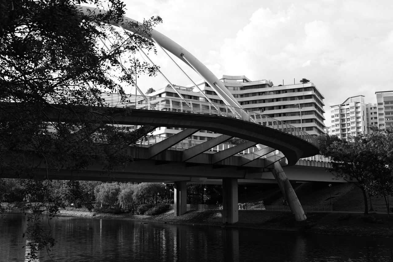
Understanding Punggol is easier when you stop treating it as a single destination and start reading it as a living town. Punggol is a north-eastern Singapore planning area, bounded in broad terms by the Tampines Expressway, Sungei Punggol, the waters to its north and east, and Sungei Serangoon. It includes Coney Island. The HDB town grew through planned housing districts, transport links, community facilities and a 4.2-kilometre waterway; its northern edge is also becoming a substantial university-and-industry district. Someone who says “I live in Punggol” may be describing very different routines depending on whether their nearest everyday anchor is Punggol MRT, an LRT neighbourhood station, Northshore, the Waterway or Punggol Coast.
For a newcomer, three questions explain most practical decisions: Which neighbourhood is my address actually in? Which transport node will I use most often? Which public services and amenities are convenient from that node? A nearby waterfront may make a place attractive without being the most useful route for a daily school run. A station on a map may be one direct walk from a block but require a different transfer when bringing a stroller or luggage. A development marketed as part of Punggol may be inside a distinct cluster of housing, schools, shops and open spaces. This guide teaches a way to verify the answer instead of promising that every facility is close to every home.
This is a town orientation and systems guide, not a list of top attractions, a property-price forecast or a substitute for an official entitlement check. It separates established facts from personal decisions. In particular, the HDB overview of Punggol, URA Master Plan and National Heritage Board history provide better starting points than an old promotional map.
Punggol at a glance: the facts worth keeping
- Position: north-eastern Singapore; a planning area distinct from neighbouring Sengkang and Hougang.
- Waterfront: a town shaped by Sungei Punggol, Sungei Serangoon, its man-made Waterway and the nearby coast.
- Important transport anchors: Punggol MRT, Punggol LRT and Punggol Coast MRT, supported by bus services, pedestrian routes and cycling links.
- Everyday civic anchor: One Punggol, with community services and Punggol Regional Library, is more useful for many practical errands than a scenic landmark.
- Northern development: Punggol Digital District and the Singapore Institute of Technology campus add a major learning and employment function to the town.
- Planning rule: the journey between a particular home and a particular destination matters more than a town-wide distance claim.
- Source rule: opening dates, bus routes, school vacancies and public-service eligibility are dynamic; check the relevant agency before acting.
1. Know the actual boundary before interpreting a place name
There are several meanings of “Punggol”. A planning area has mapped boundaries used by URA and for public statistics. An HDB town refers to a public-housing development and administration context. A historical area may have had a wider or different meaning; the National Heritage Board notes that parts of today’s Sengkang and Hougang were formerly associated with Punggol Road. A property listing, school notice or commercial business may use “Punggol” colloquially because people recognise the name. None of these interpretations automatically proves that an address falls within a particular official area.
A useful map check begins with an exact address or postal code in an official mapping service. Identify the nearest north–south and east–west connections, the water bodies, the MRT or LRT access and the name of the development itself. Then check whether a promised amenity is already operating. The common mistake is to infer a short real-world journey from a point-to-point map distance. Roads, water crossings, station entrances, lifts, weather protection and traffic signals create the journey that a resident actually makes.
This distinction is particularly important when a resident compares Punggol with Sengkang. A block near the boundary can have convenient links to facilities in both towns. That is an advantage, but the address remains whatever the official location record says. Do not use a school name, estate agent’s headline or social-media location tag as a substitute for the map. A precise place name is not pedantry; it is the first step in getting transport, schooling, household administration and delivery directions correct.
2. Understand how the old Punggol became the planned town
Punggol is not simply a recent waterfront estate. The area’s earlier landscapes included fishing communities, plantations and agricultural activity. The HDB town history records the 1996 Punggol 21 blueprint, which set out the ambition for a waterfront town, and the renewed plans announced in 2007 under Remaking Our Heartland. Punggol’s development as Singapore’s first Eco-Town was identified in 2010. These dates describe distinct phases, not a single moment when the whole town suddenly appeared.
History has an everyday consequence: different districts were conceived, constructed and occupied at different stages. Their paths, public spaces, ground-floor retail patterns and transport relationships reflect the planning concerns and available technology of their time. A mature part of town may have an established walking rhythm, while a newly completed precinct may still be accumulating shops and social infrastructure. A resident should therefore compare the specific neighbourhood at the present date rather than imagine the entire town is equally old or equally new.
The HDB Punggol town page mentions Treelodge@Punggol, Waterway Terraces, Waterway Ridges, Northshore and Punggol Point developments as examples of phases in the town’s evolution. They are examples of how the vision materialised, not a complete list of blocks. When writing a school project or explaining your address to a visitor, this phased-development account is more accurate than “Punggol used to be a village and now it has tall buildings.”
3. Read the waterway as infrastructure and public space
The 4.2-kilometre Punggol Waterway is a defining feature of modern Punggol. HDB explains that the town was redesigned around a man-made waterway connecting the dammed Sungei Punggol and Sungei Serangoon reservoirs. It contributes to the waterfront setting, landscape connections and public recreational experience. However, its significance is larger than a picture of a bridge beside an apartment block: it shapes where public routes are pleasant, where people encounter one another and how neighbouring precincts connect.
For a family, the relevant question is not “Is there a waterway?” but “What part of the waterway is reasonably reachable from our block, at the hour we would use it?” A ten-minute stroll in mild conditions is different from a pushchair journey in heavy rain. Sections vary in shade, bridge placement, seating, rest facilities and connections to services. A picturesque detour is excellent during leisure time and unhelpful if it makes someone late for a clinic appointment.
Treat water beside paths as a real physical environment. Stay on designated routes, supervise young children, never assume an informal waterside shortcut is safe, and obey signs governing access. Water levels and surrounding conditions may change in rain. Do not infer that a well-landscaped water edge is a designated swimming or boating location. These simple distinctions allow residents to enjoy the place while leaving specialist water activity to authorised operators and facilities.
4. The town is a network of neighbourhoods, not one giant town centre
Punggol’s local identity includes places around Punggol Central, Matilda, Waterway, Sumang, Punggol Point and Northshore. These labels are helpful for describing clusters, but the precise limits and marketing usage may vary. The quickest useful orientation is to pair a neighbourhood with an everyday landmark: a station, neighbourhood shopping node, school, community facility or public-transport connection. This creates a map you can actually use.
Consider two imagined households. Household A lives near a town-centre route and can combine a train connection with food shopping on the same outing. Household B lives farther north, closer to a waterfront stretch and perhaps a different station entrance, so daily travel has a different first leg. Neither household is automatically better located; the answer depends on work destination, caregiving obligations, preferred walking tolerance, household mobility and how often they need a particular service.
Avoid describing a neighbourhood entirely by the most famous place near it. A visitor looking for Coney Island may need only the coastal access route. A parent deciding on a home needs school links, lifts, wet-weather alternatives, late return journeys, quiet spaces, accessibility and actual household costs. The same broad geographical area must be read at different scales for different decisions.
5. Distinguish a transport interchange from a nearby station
Punggol MRT is a central transport point on the North East Line and connects with the Punggol LRT network. Punggol Coast MRT became the northern terminal on 10 December 2024, with better access to Punggol North and the developing digital district. These are not interchangeable station names. A train journey to the coast must not be confused with an LRT ride around residential precincts; the correct first and final leg matters.
Likewise, the original Punggol bus interchange and Punggol Coast Bus Interchange are different facilities. LTA’s 2025 release says Punggol Coast Bus Interchange opened on 29 June 2025, integrating with Punggol Coast MRT and the retail development. Bus arrangements can be amended, so never turn a date-specific list of service numbers into a permanent promise. A reader should check LTA, the operator and the travel-planning app on the day of the journey.
For an immediate journey, use this sequence: identify the exact destination entrance; find the closest suitable station or stop; check any interchange; estimate an accessible walking leg; leave extra time for an unfamiliar transfer. A wheelchair user, older adult or caregiver carrying a sleeping child may prefer a route with lifts and predictable shelter rather than the shortest line on a map. The full guide to transport choices appears separately in this series.
6. Learn what an integrated community hub actually does
One Punggol is a useful example of a building designed for multiple everyday purposes. The People’s Association identifies community-club facilities, Punggol Regional Library, a hawker centre, ServiceSG assistance and other co-located public or community services. Its role is not merely to give residents another shopping destination; it reduces the need to travel to several unrelated addresses for learning, exercise, assistance and community activity.
One Punggol is a helpful first answer when someone asks where they might combine a library visit with an errand or where a resident unfamiliar with digital transactions might seek supported access to certain government services. Yet it would be inaccurate to promise that every government transaction can be completed there, that any room is always free, or that every facility operates on the same hours. The operator of each service decides its availability, booking rules and scope.
The official One Punggol facilities page and hub overview should be your current starting points. If your real objective is to borrow a book, reserve a court, ask about a household matter or attend a programme, confirm the particular facility’s current terms before travelling. That habit is one of the most useful ways of understanding any multi-use civic hub.
7. Recognise why the north has a different role
Punggol’s northern developments are not simply more housing beside the water. JTC’s Punggol Digital District integrates business-park functions and the Singapore Institute of Technology campus, with technology-related work and learning as part of its planned role. JTC describes the district as 50 hectares and identifies intended opportunities around cybersecurity, artificial intelligence, robotics and financial technology. URA’s urban-design rules emphasise walkability, cycling, public transport connections and links to public spaces.
This matters for residents who have known Punggol mainly as a place to sleep before travelling elsewhere to work. The growth of a significant employment-and-study district creates the possibility of shorter commutes for some people, more daytime activity, new demand for amenities and a different daily rhythm near the coast. It does not guarantee that any particular resident will find a job there or that all projects are complete on the same day.
When using statistics about jobs and student capacity, read them as figures stated in the district’s official description, not a count of people present on a particular Tuesday. For someone considering study or employment, the test is concrete: which programme or employer, which eligibility conditions, which specific building and which current opening status? The separate digital-district guide explores these decisions in detail.
8. Why one neighbourhood can feel cooler, greener or noisier than another
Punggol’s environmentally oriented design is deliberate, but the outcome must be assessed locally. HDB’s Biophilic Town Framework considers soil, water, plants and wildlife, outdoor comfort and people. The framework was first applied in Punggol Northshore in 2015. HDB describes modelling wind flows, reducing sun exposure, designing landscape and providing habitats that support biodiversity. These are planning features, not a claim that every street enjoys identical temperatures or breezes.
A sea view from one building can be attractive while an exposed approach to that building feels hot in the afternoon. Dense foliage may provide comfort in one stretch and a less direct route in another. Vehicular roads, deliveries, construction, school dismissal and recreation also change sound levels through the day. A prospective resident should visit at meaningful times rather than rely only on a developer’s daytime photograph.
To compare two locations, walk the actual path you would use for a station, supermarket and clinic. Note shade, steps, crossings, seating, drainage points and places to wait during thunderstorms. Do this within safe weather conditions. Write down observations instead of converting impressions into unsupported claims such as “Northshore is always cooler” or “the Waterway is never noisy.” Good place decisions are observational and verifiable.
9. The coast and the island require a different kind of planning
Coney Island Park is part of Punggol’s distinctive landscape and falls within its geographical story, but it is not a conventional indoor attraction. NParks lists its hours as 7am to 7pm, identifies west and east access points and notes that some terrain is rugged despite more accessible areas near the ends. It also gives specific guidance about wildlife, trails, footwear and restrictions such as no camping or fishing within the park.
That means a family visit needs a clear return plan. Check the current park notice and closing time, have water and appropriate footwear, allow enough daylight and make no assumption that there will be food, shade or toilets wherever you turn. A route that looks simple in a promotional photograph can become demanding for someone with limited mobility or a very young child. Respect restricted areas and wildlife; the place is an ecosystem rather than a theme park.
The term “Punggol waterfront” also covers multiple experiences. The Waterway, Northshore coastal front, Punggol Point and Coney Island are not one continuous indoor-accessible attraction. They have different entrances and different practical demands. Identifying the exact place first prevents the common error of travelling to the wrong station and expecting a short, universal walk.
10. Make a daily-life map before making a lifestyle claim
A useful daily-life map has five layers. First is home-to-transport: the actual walk, lift access, crossings and transfers. Second is home-to-care: the clinic, pharmacy, childcare, eldercare or other service relevant to your household. Third is home-to-provisions: reliable food, groceries and routine purchases. Fourth is home-to-learning: schools, libraries, homework space, study and sports provision. Fifth is home-to-rest: spaces that are safe and practical for relaxation without adding a tiring journey.
The layers change with a person’s life stage. A student may value a library, school route and after-school programme. A parent of toddlers may prioritise sheltered paths, childcare and a safe place to pause. A caregiver for an older adult may need kerb-free crossings, seating, accessible toilets and transport interchange lifts. An employee may care most about a predictable departure route and an easy return after work. There is no universal best block that answers all five layers equally well.
Map services and official pages can help, but the final audit is human: make the journey once if practical. A place that looks close may be awkward when carrying groceries. A slightly longer route might be much less stressful if it has an obvious sheltered connection. Understanding Punggol therefore means understanding your own recurring movements within Punggol.
11. Housing labels do not tell you the whole story of a home
The phrase “Punggol HDB” covers different flat developments and different ages of housing. It does not specify the flat’s layout, lease commencement, maintenance condition, resale eligibility or financing. New-flat launches, resale transactions and rental arrangements have separate rules. A buyer also needs to distinguish a flat from HDB from a resale purchase and understand the minimum occupation period and any flat classification conditions.
When comparing homes, begin with your household’s verified eligibility and financial position rather than what a neighbour says they paid. Use HDB’s HFE letter process where it applies; review grants, financing, transaction costs and continuing monthly expenses independently. The official resale and new-flat processes are updated by HDB. No generic Punggol article can promise that you qualify for a scheme or that a particular transaction is available.
A complete location review checks daily travel, facilities at the specific block, maintenance signs, accessibility and the actual terms of the unit. The separate housing guide in this series goes deeper into new-flat, resale, renting and estate-care questions. This overview’s job is to stop the housing decision from being collapsed into one attractive view or one optimistic price comparison.
12. Learn which authority to ask, rather than guessing who is responsible
Singapore’s towns involve several public bodies with different responsibilities. HDB supplies information about public housing and related transactions. URA publishes land-use and planning guidance. LTA addresses public-transport systems and roads within its remit. NParks manages parks within its jurisdiction. The People’s Association runs relevant community spaces and programmes. Education providers, their regulators and social-service operators each publish their own admission or service rules.
A resident with a concern should first identify the asset or service, not just the nearest government logo. Is the problem inside your flat, in an HDB common area, on a public road, at a bus stop, within a park, or at a privately operated development? Those distinctions determine the useful reporting channel. Town councils, managing agents, agencies and building operators have different roles; reporting to the wrong one can delay resolution.
Keep location evidence simple: the block number or address, exact spot, date, time and a clear description. Avoid publishing photographs that expose neighbours’ private information. For hazards requiring urgent assistance, use the relevant emergency services instead of treating an administrative feedback form as an emergency response system. This habit matters far more than memorising every agency acronym.
13. Schools are local institutions, but proximity is not admission
Punggol has schools and learning facilities used by many families. A school being located near a new housing precinct does not mean every family is entitled to a place there. Singapore’s Ministry of Education publishes official SchoolFinder information, Primary 1 registration rules and relevant admissions processes. Availability and balloting outcomes can change across years, and the details differ by education stage.
A family’s school-location analysis should ask four questions: Is the school’s current address correct? Which admission or transfer rules apply to this child? What are the actual morning and afternoon travel routes? What educational support does the child need beyond location? The answer depends on the child’s age, school level, learning needs and the most recent official policy. Property marketing cannot settle any of these questions.
Punggol Regional Library and community study spaces extend learning outside school. They can be valuable for reading, inquiry, family learning and independent work, subject to their current rules and capacity. That is part of the neighbourhood education ecosystem, but not a replacement for classroom teaching or individual learning support. Do not assume that any named school or study room is available to any visitor.
14. Reading a development plan without confusing it for a promise
URA’s Master Plan guides land use over a medium-term horizon of roughly 10 to 15 years. It is a statutory framework, but a map does not mean every intended development is already built or has a fixed opening date. Some elements are completed, some are underway and others require later detailed plans, funding and implementation. The distinction matters in fast-evolving places such as Punggol North.
When you encounter a headline saying “coming soon”, ask who issued it, when it was published and whether it describes a policy objective, approved project, contractor milestone, announced opening or operating service. Those are five different stages. A proposed road connection may alter future accessibility, but it does not help today’s commute. A projected employment total is not proof of current hiring volume. A planned amenity is not a basis for promising immediate convenience.
For a property purchase or long-term relocation, read the current URA Master Plan alongside field observations and the agency’s latest project information. The point is not to distrust official plans. It is to use them for the right question: what is planned versus what can be relied upon now?
15. Build a realistic first-day route for a visitor
A visitor who has never been to Punggol can start with one central anchor, not a marathon itinerary. Arrive by the appropriate MRT route, confirm the intended exit, choose one main activity and identify a meal or rest opportunity near it. If the objective is to understand neighbourhood life, a civic hub and a short public walkway can tell a more useful story than racing between distant Instagram locations.
For a first example, suppose someone wants a public-service errand and a little exploration. The sequence is service opening-hours check, station-to-building route, the errand itself, a meal or library stop if practical, then return. For a second example, suppose an outdoor walk is the objective. Choose a specific Waterway section, check weather and accessibility, take water, decide how to return and leave the itinerary flexible.
Do not quietly add Coney Island, Northshore, a distant school and the Digital District merely because each is “in Punggol”. That would be an impressive-looking list and a poorly designed day. A good local guide measures success by the visitor reaching the intended place comfortably and understanding where they are.
16. Use an accessibility-first route, not an accessibility assumption
Singapore’s newer transport and civic developments often incorporate barrier-free design, but a route is only as accessible as its least usable segment. An MRT station may have a lift, yet a traveller may still face an exposed crossing, a diversion, construction work or a path too rough for their needs. NParks explicitly notes that some parts of Coney Island Park have rugged terrain despite accessibility at its ends.
For a wheelchair user or someone moving with a stroller, work backwards from the exact entrance. Locate the station lift and the destination entrance, then review the pavement between them. Check for grade changes, shelter, rest opportunities and alternative return routes. A map’s shortest distance is not a substitute for this chain. When uncertain, call the relevant venue, operator or agency rather than relying on a generic claim that “Punggol is accessible.”
This approach benefits many residents who do not identify as disabled: older adults, people recovering from injuries, parents with several children, delivery workers and anyone moving during heavy rain. The better public route is the one that works in the actual conditions of the journey.
17. Weather, haze and crowds can change the right decision
Punggol’s outdoor amenities encourage exercise and exploration, yet Singapore’s tropical weather requires active planning. Heavy rain and lightning can make an outdoor detour unwise. Heat can make an unshaded route exhausting. Haze may change whether prolonged outdoor exercise is appropriate. Information about air quality, storms and closures should come from the relevant official service on the actual day, not a forecast pasted permanently into an evergreen article.
A useful pre-departure decision has three branches: go as planned if conditions are suitable; shorten and move closer to sheltered amenities if conditions are marginal; postpone the outdoor activity if warnings or personal safety needs make it unsuitable. Avoid the sunk-cost error of continuing a long waterfront route merely because you have travelled there. There is no prize for finishing an itinerary that no longer makes sense.
For households with small children or mobility needs, plan an indoor return option before leaving. Know where a normal transport link is located and carry water and contact details as appropriate. Keep the plan simple. Local knowledge is less about memorising everything than about making sensible changes when conditions change.
18. Understand the place without romanticising the past
Punggol’s history includes working landscapes, village life and coastal leisure. That makes it a rich place for local-history learning, but it is a mistake to narrate the whole area as an uncomplicated lost paradise. The history of land use also involved change, labour, relocation and the evolving needs of different communities. Official heritage materials document names and images that can be checked; personal recollections can add detail but should be identified as recollections.
A strong history question is specific: what stood on this location in a particular decade, who used it, what was it connected to and how did the site change? National Library Board and National Heritage Board collections can help, along with contemporaneous maps and newspapers. A map from one decade should not be used as a factual representation of another. If a site is not publicly accessible, do not trespass in order to make the story more vivid.
A town becomes more understandable when its old and new layers are read together. A contemporary digital district and a heritage walking trail can occupy the same regional story without implying that either cancels the other. That is a more useful lens for students, newcomers and long-time residents alike.
19. Four mistakes that produce bad Punggol advice
Mistake one: “Everything is near the waterfront.” Some blocks are closely connected to the Waterway or coast, while others require a specific transfer or longer walk. Verify a destination from the address.
Mistake two: “Punggol Coast is another name for Punggol MRT.” They are separate stations on the same North East Line. The distinction changes the best meeting point, bus interchange and walking leg.
Mistake three: “New development equals existing service.” A plan, rendering, projected opening and confirmed operating facility describe different things. Check dates and service pages.
Mistake four: “One attractive statistic proves the whole town’s quality.” The town contains districts at different stages, and personal experiences vary. Look at commute, accessibility, school needs, housing rules, expenses and meaningful amenities together before drawing conclusions.
20. An evidence-first checklist for someone moving to Punggol
- Verify the exact address, block and neighbourhood using official maps.
- Test your most frequent morning journey, not only a weekend outing.
- Check the real walking route to the first MRT, LRT or bus connection.
- Check groceries, medical care, everyday meals, household services and sheltered waiting points.
- Confirm school or childcare eligibility using the responsible provider’s rules.
- Understand the particular home’s tenancy, tenure, HDB restrictions and recurring expenses.
- Observe afternoon sun, rain routes, crossings and accessibility.
- Separate established facilities from proposals and developments still opening in phases.
- Review civic spaces as practical service destinations, not only weekend attractions.
- Keep an alternative route for severe weather, transit disruptions or mobility changes.
- Recheck current official pages shortly before making commitments.
- Save the names and locations of the agencies or operators that actually manage essential services.
The checklist intentionally includes no unverified price or commute promise. Instead it converts an attractive idea — “living in Punggol” — into a household-specific set of questions that can be checked. Its biggest advantage is that it remains useful when new shops open, bus routes change or a planned development becomes operational.
Frequently asked questions
Is Punggol the same as Sengkang?
No. They are neighbouring parts of north-eastern Singapore with different planning identities. Historical usage of the name Punggol covered a wider area, which is one reason older references can be confusing. For present-day administrative, property or route decisions, identify the current precise address and official map boundary.
Is Punggol Coast MRT already open?
Yes. LTA announced the opening of Punggol Coast MRT on the North East Line on 10 December 2024. The station serves the Punggol North and Punggol Digital District area. That does not mean every destination there has the same walking time or entrance; check the particular building.
What is the most useful single fact about Punggol?
Punggol has several distinct neighbourhood clusters. Most practical questions begin by locating the exact block and its daily transport, school, shopping or civic-service links. A town-wide headline such as “waterfront living” cannot tell a resident whether their personal route is convenient.
Does Punggol have a real town history before HDB development?
Yes. Official heritage and HDB material document its fishing and agricultural past and successive phases of planning. The 1996 Punggol 21 blueprint, 2007 revised waterfront vision and 2010 Eco-Town direction are milestones in modern development, not the beginning of Punggol’s history.
Is Coney Island just another Waterway Park path?
No. Coney Island Park has its own access points, park rules, opening hours and more rugged areas. NParks asks visitors to remain on designated trails and take precautions around nature. Do not transfer assumptions about a paved town walkway to an island nature park.
Where can residents combine everyday civic services?
One Punggol is a major integrated community hub. Its facilities include the community club, library and several co-located services, but each service has its own scope, rules and operating details. Use the People’s Association and individual operators for current information.
Does the Punggol Digital District guarantee technology jobs?
No. JTC presents the district as an innovation, education and business cluster and publishes a jobs figure in its district overview. That describes the planned ecosystem, not an individual employment offer. Check employers’ current roles and eligibility directly.
Is Punggol a good place for a family?
It can be, but the useful answer is household-specific. Compare the exact home’s routes to school, care, transport, groceries and public spaces with your costs and schedule. Any blanket verdict ignores variation across neighbourhoods and personal needs.
Are property prices and flat rules the same throughout Punggol?
No. Particular units and transactions differ. HDB’s rules distinguish new, resale and other flat types; eligibility and occupation conditions must be verified. This guide intentionally avoids treating one quoted price or one listing as a town-wide market fact.
How should I check a claim about a future amenity?
Find the original agency publication, note its date and identify whether it describes a vision, a planned facility, an approved construction project or an already operating service. Then check for a later update. URA planning documents, HDB town pages, LTA notices and individual operators are appropriate starting points.
Official sources and further reading
- HDB: Punggol town history, waterfront plans and housing districts.
- National Heritage Board: History of Punggol and geographical context.
- URA: Master Plan and statutory land-use interpretation.
- URA: 2025 North-East region plans and future development context.
- HDB: Biophilic Town Framework and Punggol Northshore.
- LTA: Punggol Coast MRT opening.
- LTA: Punggol Coast Bus Interchange.
- People’s Association: One Punggol hub facilities.
- JTC: Punggol Digital District overview.
- NParks: Coney Island Park visitor guidance.
Continue with a specific decision
For route planning, read Punggol without a car: MRT, LRT and walking. For family route comfort, use Punggol toilets, rest stops and nursing-room planning. For responsible shared use, see Punggol public-space etiquette. This series continues with a dedicated transport system, housing decisions and the Digital District.


