
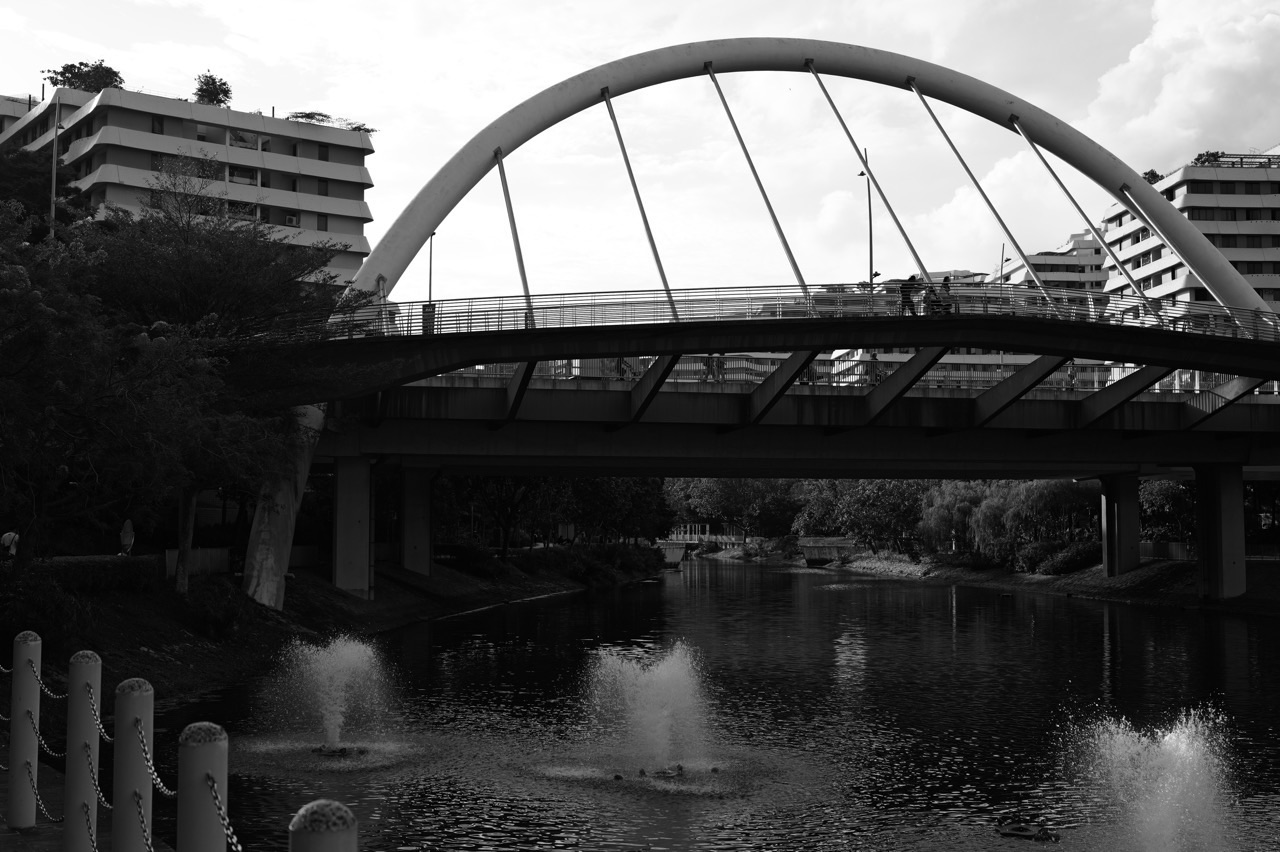
The Punggol Waterway is part of a planned freshwater landscape, not just an ornamental canal. HDB’s account of Punggol’s development explains that Sungei Punggol and Sungei Serangoon were dammed to form reservoirs, then connected by a 4.2-kilometre man-made waterway through the town. The waterfront is also a public corridor for walking, cycling, ecological landscaping and learning. Understanding how those roles fit together makes residents better able to enjoy it without confusing a reservoir, a drain, a public park and a designated recreation facility.
The practical answer for a resident is threefold. First, identify the *exact stretch* you plan to visit; the whole Waterway is not one identical walkway. Second, use official weather, flood and park information before outdoor activity, especially during heavy rain or lightning. Third, treat the water’s edge, nearby drains and waterside plants as managed infrastructure: observe, enjoy and report problems, but do not enter closed areas or assume the water is suitable for swimming. PUB leads national water and flood-management work; NParks operates Punggol Waterway Park; HDB planned the town; local estate managers look after their own common property.
This seventh Understanding Punggol | Things to Know article was prepared with official HDB, NParks, PUB and NEA material available on 18 October 2026. It focuses on mechanisms, responsibilities, household decisions and clear verification steps rather than selling a “best view.” Exact flood conditions and construction arrangements can change within hours or across dates.
Waterway essentials in 60 seconds
- Length: HDB describes My Waterway@Punggol as a 4.2 km man-made waterway connecting the two dammed rivers.
- Two named rivers: Sungei Punggol to the west and Sungei Serangoon to the east; both were dammed into reservoirs.
- Punggol Waterway Park: NParks identifies a 25.79-hectare park, generally open 24 hours and organised into Nature Cove, Recreation Zone, Heritage Zone and Green Gallery.
- Different places: the park, HDB waterfront promenade, reservoir shorelines, Punggol Promenade and Coney Island do not automatically have the same rules.
- Four realities: a water feature may be scenic, ecological, recreational and part of a managed water system at once.
- Flood safety: use PUB’s Flood Alerts and myENV when heavy rain is possible; an alert is location- and time-specific.
- Do not conclude: no alert on your chosen path does not prove that every bridge, slip road or walkway is safe in severe weather.
- Best approach: verify your destination entrance and return path before taking children, a mobility aid or a group outdoors.
1. How Punggol acquired its modern waterway
Early Punggol’s coastal and riverine landscape was not a single planned waterfront experience. The modern waterway belongs to successive phases of new-town development. HDB describes the 1996 Punggol 21 blueprint, the 2007 refresh of the waterfront vision and the 2010 designation of Punggol as Singapore’s first Eco-Town. The waterway project transformed connections through the town and provided a landscaped activity corridor along the water.
An HDB historical account records the decision to dam the existing Sungei Punggol and Sungei Serangoon and connect their reservoirs by a man-made channel. That makes the system different from a small decorative pool inside a shopping centre. Its scale affects neighbourhood planning, walking routes, public spaces and environmental features. When a resident talks about “the Waterway,” they are using a convenient label for a system rather than a single destination.
The distinction helps answer why some HDB precincts face water while others do not, why crossing points matter and why a route that looks very close on a map may involve a longer journey around a bank or toward a designated bridge. A good place description names the nearest access route, not just the water body.
2. The two reservoirs are not the same as the sea
Singapore’s water system includes freshwater catchments and reservoirs, seawater and treated domestic supply, each with different management and uses. A reservoir behind a dam is not simply “sea water” because it is near the coast. HDB’s account of the Punggol plan specifically identifies the two dammed rivers as reservoirs connected by the waterway.
PUB manages Singapore’s national water supply and water resources through a range of systems. The fact that water is part of a reservoir does not mean a person can drink it directly from the bank. Raw water requires treatment and oversight. Nor does a calm surface prove that entering the water is permitted or safe. Visibility, depth, underwater structures, algae and weather are not assessed by eye from an attractive promenade.
The useful public-facing principle is to distinguish water in a managed landscape from water delivered as safe tap water and from water specifically made available for an authorised recreation activity. They involve different treatment, regulations and safety conditions. A school fieldwork report should label them correctly rather than describe all visible water as a beach.
3. What exactly the 4.2 kilometres measure
HDB and NParks use 4.2 km to describe the Punggol Waterway and its nature-walk context. NParks’ nature-walk guide also estimates an easy 4.2-km route at approximately one to two hours. That is a useful planning reference but not a personal guarantee of travel time. A walk with a toddler, photography stops or a mobility aid may take substantially longer.
Do not use 4.2 km as the distance between your flat and your destination. A resident approaching from one precinct may only walk a small section; a visitor may cover a longer route when they add transport transfers or a detour for food. Bridge choices also alter the actual course. A map’s straight line across water is not a pedestrian crossing.
For a realistic plan, select a start and finish point and map the exact paths. Note the nearest stations, toilets and return route before deciding on distance. When the day is hot, wet or hazy, a shorter loop near a convenient exit may deliver a much better experience than attempting the full length.
4. The four parts of Punggol Waterway Park
NParks describes four themed areas: Nature Cove, Recreation Zone, Heritage Zone and Green Gallery. These are helpful planning and educational labels, not separate ticketed parks that function identically. Their names signal different emphases, from observing planting and habitats to public activity and historical interpretation. The park itself sits along Sentul Crescent and the North Eastern Riverine Loop of the Park Connector Network.
A family interested in history might pay particular attention to the Heritage Zone and the preserved elements associated with old Punggol Road. Someone interested in ecological landscaping may find plant-lined water edges and naturalised surroundings more compelling. A child wanting to move freely may need an appropriate recreation area rather than a narrow waterside viewpoint.
Always check the live NParks park information and local signs. A themed label does not guarantee that particular play equipment or water access is operational on the date you arrive. The public park may be open 24 hours even though a specific activity, path segment, restroom or operator has its own restrictions.
5. Bridges are real transport links, not only photo subjects
Punggol Waterway Park features bridges with names including Jewel Bridge, Wave Bridge, Sunrise Bridge and Kelong Bridge, cited by NParks’ nature-walk guide. Their design adds identity to the landscape, but their most useful everyday function is to connect opposite banks or nearby streets. That can change the route to an HDB precinct, transport node or community facility.
When comparing two routes, check where a bridge actually connects and whether both approaches are suitable for your group. A bridge may appear visually close while its access paths loop around planting or road infrastructure. Photo locations are not necessarily the nearest practical crossing. Weather exposure can matter when transporting a small child or an older relative.
Treat ramps, railings and path markings as part of the route, not decorations. Never climb barriers for a better angle, stop suddenly where cycling traffic may pass or lean equipment over a waterside railing. The safest bridge photograph is one that does not obstruct other users or require stepping outside the designed public path.
6. Ecology at the water’s edge
The NParks nature-walk page notes aquatic vegetation such as Red Thalia, Bulrush and Swamp Cabbage along the Waterway. HDB also describes freshwater mangroves and ecological landscaping in its sustainability trail. Such plants help create habitat and can contribute to water-quality management, but an individual plant’s presence is not a substitute for official water-testing data.
Ecological design has several benefits that are easy to miss when looking only at apartment views. Vegetated edges can support birds and other wildlife, create spatial separation from intensive human activity and make the public walkway feel more varied. People also learn to recognise differences between an ornamental planted area and a functioning, semi-natural wetland habitat.
Avoid pulling up plants, feeding wildlife or entering the water to retrieve something. Disturbing plantings can harm the very habitat visitors came to see. For children, a field notebook and a photo from the path are more appropriate tools than touching an unfamiliar animal or collecting samples without permission.
7. Why a large waterway does not eliminate flash floods
Singapore’s drainage and flood-management system is extensive, but intense rain can temporarily overwhelm local capacity. PUB explains that climate change increases weather extremes and that it manages flood risks through a holistic strategy rather than promising zero floods everywhere. The presence of a reservoir, waterway or canal does not mean every road junction, underpass or low-lying path nearby is immune from temporary flooding.
A powerful misconception is that “the waterway takes away all the rain, so every Punggol route is safe.” Local surface drainage follows specific topography, drains, crossings and engineered pathways. A storm may affect one junction while another remains passable. A developed waterfront may also have adjacent roads and public spaces governed by different operational constraints.
Residents should use location-specific official information instead of a blanket assurance. Even a route with a good drainage record can be unsuitable during a lightning storm. Flood resilience is infrastructure plus forecasting, maintenance, community preparation and sensible personal decisions.
8. PUB’s Source–Pathway–Receptor framework in plain language
PUB’s flood-resilience strategy is often described as a Source–Pathway–Receptor approach. It addresses runoff where rainfall lands, the drains and channels through which water moves, and the assets or places that may experience flooding. In everyday language: reduce or delay runoff where possible, convey it through suitable infrastructure and protect vulnerable locations.
This framework explains why drainage work is not always just a matter of making one canal wider. The size of the upstream catchment, the ability of a pathway to carry water, local ground levels and the use of vulnerable land can all matter. Green features, drainage upgrades and flood barriers may perform different roles. Their effectiveness depends on design and circumstances.
The public should not attempt to diagnose drainage capacity by looking at one uncovered drain. Instead, take notice of official hazard alerts, road closures and the state of the public path. If you see a blocked drain or unusual water accumulation, report the exact location through the appropriate official channel instead of attempting unsafe clearance yourself.
9. What Punggol Way’s flood history actually tells us
PUB’s December 2022 statement notes that it completed road-raising works in August 2022 at Punggol Way’s slip road to the Tampines Expressway, an area previously affected by intense-rain flooding. This is a verified example of a specific flood-mitigation intervention. It does not prove the rest of Punggol was historically flooded, nor does it guarantee that the road will never experience difficult conditions again.
The lesson is geographical precision. A statement about one slip road cannot be extended to a residential precinct, Coney Island or the entire Waterway. Conversely, a photograph of water on one road should not become a town-wide scare headline. The location, date, time, rainfall context and official report are essential.
When comparing two homes or commutes, review current flood information for the exact route. Do not use a single old news item as a proxy for every possible future event. Infrastructure is improved, weather varies and actual movement decisions need current evidence.
10. Flood alerts are temporary instructions, not a permanent map
PUB operates official flood-risk and flood-response information channels. The myENV app provides updated warnings about heavy rain and locations with flood risks. PUB also has flood alerts through its official channels, including a public Telegram feed linked from the agency’s flood information. Alerts can identify a particular junction or road segment and may include a time interval for avoidance.
If a message advises avoiding a road for the next hour, treat the place and time as part of the information. An undated screenshot circulated days later is not current evidence. An alert about another district is not a confirmed incident in Punggol. Equally, the absence of a displayed alert does not authorise entering a path already visibly flooded.
For a real journey, look up the latest information, confirm the precise location, choose a safe alternative and obey on-site instructions. The PUB Get Flood-Wise resource is designed to help the public understand the alert workflow.
11. Weather warnings, lightning and flood messages answer different questions
A heavy rain warning indicates expected or ongoing conditions, while a flood alert can concern an identified local risk or observed water accumulation. A lightning warning identifies a separate immediate danger, especially in open waterfront spaces. Treat these as different risk signals. A safe-looking sky above your home does not invalidate an official lightning advisory for your destination.
The myENV app combines weather, air quality, flood, water-service and other environmental information. Its value is being able to review relevant live signals before an activity. A school outing coordinator, adult cyclist or parent planning a park visit should check the expected weather window and any warnings rather than only the temperature.
If thunder is heard or lightning risk is indicated, stop outdoor activities and find proper shelter. Do not use open pavilions, exposed bridges, isolated trees or waterside shelters as assumed lightning protection. Follow government guidance for the conditions and postpone rather than trying to beat a storm along an exposed path.
12. A route can be dry while its exits are disrupted
Imagine a person standing on a dry section of a raised Waterway path while heavy rain affects a nearby road approach. Looking at the path alone cannot reveal whether the bus connection, underpass or final crossing is accessible. A safe route is only as useful as its entrance and exit. This matters especially for group walks, school activities and residents moving with mobility devices.
Before an excursion, identify at least one alternative exit and the nearest practical transport link. If a route depends on a single narrow crossing, consider whether the group can turn back before severe weather develops. Always obey temporary fencing and agency instructions. Do not use a path that is cordoned off merely because it looks dry from a distance.
In difficult conditions, simplify the plan to a shorter outing or postpone it. A later walk is better than a forced return through standing water or a dark path after closing conditions. The ability to abandon an itinerary is a core safety skill.
13. Do not walk, ride or drive through floodwater
Floodwater conceals depth, surface damage, open drainage structures and contamination. Even shallow-looking water can obscure hazards or a dangerous change in footing. Cyclists can lose control, and vehicle movement can worsen risks for people nearby. The safest advice is not to enter floodwater to test its depth.
If water appears across a path, turn around or find a clearly safe alternative route according to official advice. Keep children and pets away from the edge. A person with mobility limitations may need assistance rather than an improvised diversion. Do not lift a bicycle onto a ledge or climb railings to bypass a barrier.
For someone already in difficulty, follow emergency guidance and seek help as appropriate. Do not make a risky rescue attempt without suitable training and conditions. A flood photograph is never worth entering danger, and publishing a dramatic image should not take priority over safety.
14. Who maintains the drains and who manages the park
Several authorities can meet along a single walking route. PUB is responsible for the national drainage and water-management framework; NParks manages its designated parks and the Park Connector Network; HDB and Town Councils have roles in the public-housing estate environment; LTA handles road and transport assets within its jurisdiction. Private developments may maintain their own connected spaces.
This is why a complaint needs a precise location. A broken park railing is not the same as an HDB corridor light. A blocked drain on a road can have a different agency workflow from rubbish in a condominium common area. The responsible body should be identified using on-site signs or official asset information wherever possible.
For non-emergency neighbourhood issues, the OneService platform may route reports to the correct party. Use an accurate map pin, nearby block or path marker and a description of what is observable. Do not enter restricted maintenance areas to prove who owns the problem.
15. Stagnant water is not the same as a managed reservoir
Mosquito prevention advice commonly focuses on *small stagnant-water breeding sites*, such as flowerpot trays, discarded containers and water trapped in household receptacles. NEA warns about Aedes breeding in such places. It is not accurate to treat every visible reservoir surface as automatically an untreated mosquito-breeding emergency.
A planned water body has a different scale and maintenance framework. Nevertheless, small isolated puddles, blocked drains and containers around nearby residential or park areas can require attention. The distinction is important: the appropriate household action is to remove avoidable stagnant water, maintain receptacles and report concerns about public areas, not to condemn an entire river.
Residents should follow the current NEA anti-dengue guidance and check live dengue information when relevant. If an actual small stagnant-water problem is on common property, give the manager its precise location. Never put chemicals into a waterway or alter public drainage to attempt mosquito control yourself.
16. Water quality is monitored; ordinary visitors do not certify it
Water appearance is an unreliable safety test. Clear water can still be unsuitable for drinking or direct contact; turbid water after rain does not, by itself, establish pollution from a particular source. PUB and relevant operators manage water quality within their authority. A passer-by should not claim that a water body is “chemically safe” or “contaminated” solely from colour, smell or a social-media photo.
If a visitor notices unusual odour, foam, dead fish or visible discharge, make a careful observation from a safe distance and use official feedback channels. Record a location, time and what can be seen without assigning a cause. The responsible agency can investigate with the correct methods.
This is a useful classroom lesson in evidence. An observation is a starting point. A measurement requires a suitable instrument and protocol. A conclusion requires interpretation and, often, repeated data. Well-intentioned anecdotes should not become water-quality assurances.
17. Does the Waterway supply drinking water directly?
The reservoirs form part of Singapore’s managed water landscape, but it would be false to imply that a family can collect unprocessed water from the promenade and drink it. Singapore’s water supply has treatment, monitoring and distribution systems. PUB describes its national water strategy as a combination of local catchment water, imported water, NEWater and desalinated water.
A visitor may learn about catchment water and conservation through the Waterway, but that is a conceptual relationship, not a personal drinking-water access point. The household tap delivers treated water under a separate service framework. The rain that enters a drain, the water in the reservoir and the water coming out of a domestic tap occupy different stages and uses.
For an educational activity, ask students to trace the stages: rainfall, collection, storage, treatment, distribution, use and wastewater management. The route is not necessarily one continuous visible channel from the park to a particular home. That distinction prevents a simplistic diagram from becoming a wrong factual claim.
18. Swimming, paddling and fishing require permission, not enthusiasm
A landscaped public route beside a reservoir is not automatically an approved swim zone. Activity permissions and operator arrangements vary by water body and location. It is not responsible to tell readers to swim, kayak, paddle or fish at any attractive bank without checking the relevant authorised recreation arrangements and safety rules.
When researching water sports, verify the named operator, the specific launch point, supervision, equipment, conditions and restrictions. A family should ask about age limits and whether an organised activity has trained personnel. For an independently planned activity, check that it is actually permitted where intended, not merely that somebody once posted a picture of a boat nearby.
Never climb a railing or enter water to recover a dropped item. Ask an authorised operator or park manager for guidance. The water’s visual accessibility should not be confused with physical permission to enter it.
19. Cycling paths around the Waterway are shared public routes
The Waterway’s routes form part of wider walking and cycling connections, but the presence of cyclists does not make every segment a high-speed cycling lane. NParks’ October 2026 guidance stresses keeping left where appropriate, yielding to slower users, observing signs and slowing down in Attention Zones. Dedicated cycling tracks, shared paths and pedestrian paths have different rules.
For a cyclist, approach curves, bridges, crossings, school groups and other crowded points cautiously. Announce a pass appropriately and do not weave between walkers. For pedestrians, remain predictable and use the designated footpath where one is available. With children, teach them to stop before crossing a cycling route rather than dart across.
Path rules should be verified on-site because surface markings and permitted devices can vary. This matters for scooters and motorised devices in particular. A park connector’s visual width is not enough to tell you what is legally allowed on it.
20. Compare a waterfront workout with a daily commute
A person may enjoy a thirty-minute riverside run on weekends but find the same path impractical for a weekday school run. Recreational routes reward scenery and flexibility. Commuting routes prioritise reliability, shelter and access to the right transport link. Water crossings and shared-path congestion have different effects depending on the purpose.
Suppose a resident wants to cycle to a town-centre errand. The decision should include whether bicycles can be safely parked at the destination, the permitted path type, the number of crossings and the chance of having to travel during a storm. Someone walking to a clinic may put lift access and a short sheltered link ahead of a waterside detour.
There is no universally correct “best Waterway path.” A realistic guide gives readers criteria to choose a route suitable for their own needs. That is more useful than publishing a single itinerary and implying it works equally well for everyone.
21. Accessibility must cover the complete chain of movement
An attractive broad walkway may still require steps, a ramp, a road crossing or a diversion to reach a particular facility. A person who uses a wheelchair, walker or stroller should assess the entire route from the original entrance to the final exit. Nearby public transport accessibility, toilets, seating and weather protection matter as much as the central scenery.
Look for usable bridges, lift routes, kerb changes and places to rest. Do not assume an online route line reflects temporary works or day-specific obstructions. If the journey involves a group with different mobility needs, plan around the least accessible segment, not the fastest participant.
In poor weather, changing plans is reasonable. Some routes may become slippery or exposed. For a senior with a walking aid, a shorter visit near a known return point may be more enjoyable than attempting the longest possible promenade walk simply to reach a named landmark.
22. Wildlife and plants are residents of the ecosystem too
NParks’ Waterway nature-walk guide highlights birds including Black-naped Orioles, Yellow-vented Bulbuls and Long-tailed Parakeets. Green edges also support other wildlife. Birds may be easier to observe during quieter periods, though sightings are never guaranteed. A photograph online cannot promise the same species will be visible on a particular morning.
Carry binoculars or use a phone camera from a respectful distance. Never feed wild animals to attract them closer; it changes behaviour and can harm them. Avoid loud approaches to nesting areas and do not leave food waste. Children can learn to recognise birds by shape, calls and habitat without catching or touching them.
The wider conservation lesson is that urban nature is designed and maintained, yet not completely controlled. Trees grow, wildlife moves and habitats change. A good educational guide respects this uncertainty instead of presenting animals as booked attractions.
23. Rain, runoff and rubbish connect home habits to the water system
Litter left on streets and paths can move through drainage networks when rain is heavy. Blocked grates and improperly disposed waste create public hygiene and maintenance problems. Residents can reduce these risks through ordinary behaviour: dispose of rubbish properly, secure loose items near balconies and avoid dumping oils, chemicals or bulky waste into drains.
It is tempting to believe that a single household has too small an impact to matter. In a dense new town, however, repeated small actions across many units contribute to the conditions maintenance teams must manage. Keeping drains clear is not an invitation for members of the public to enter them; it is a reason not to create obstructions in the first place.
For a blocked public drain, use official reporting with a location and photo from a safe distance. For drainage or leaks within a residence, obtain appropriate professional assistance. This distinction keeps environmental responsibility practical rather than asking residents to perform unsafe infrastructure work.
24. A simple science worked example: rainfall volume
Consider a hypothetical school worksheet, not a measurement of Punggol’s actual waterway. A flat paved area covers 800 square metres. During a storm, 25 millimetres of rain falls uniformly. If no water evaporates or infiltrates and we ignore losses for the calculation, what rainwater volume falls on this area?
Convert depth to metres: 25 mm = 0.025 m. Volume = area × depth = 800 m² × 0.025 m = 20 m³. Because one cubic metre equals 1,000 litres, the result is 20,000 litres. If the rainfall intensity were unchanged but the paved area doubled, the collected volume would also double under the same simplified assumptions.
The teaching point is scale, not prediction. Real catchments have runoff coefficients, storage, infiltration, drainage gradients and varying rainfall. This toy example cannot calculate flood probability, canal level or pump performance. A credible applied-mathematics article states its assumptions before giving the answer.
25. A practical worked example: a school nature walk
A teacher proposes a 4.2-km Waterway learning excursion. The NParks guide gives a one- to two-hour estimate for a typical easy walk. But a class needs time for assembling, safety briefing, observing vegetation, discussing heritage features, water breaks, toilets and return transfers. Therefore the walk estimate is a planning baseline, not a complete excursion timetable.
The teacher first verifies the chosen start and finish points, students’ mobility needs and official weather forecast. The route should identify places where the class can regroup without obstructing cyclists. Observation tasks must remain on public paths. Students should not enter the water to collect specimens or leave rubbish. The responsible adult also establishes what happens if lightning or heavy rain develops.
The educational task can be small but substantive: describe one ecological plant adaptation, identify a bridge that serves a real transport function and sketch the difference between a reservoir and a household water-supply process. This integrates geography, science, history and civic responsibility without overclaiming what a casual visit can prove.
26. A practical worked example: the unexpected storm
Imagine two friends cycling along a dry section of Waterway Park as dark clouds gather. A new heavy-rain alert arrives, and thunder is audible. Their priority shifts from finishing the planned loop to getting to safe shelter. They slow down, avoid exposure, check official advice from a safe location and do not attempt to cross pooled water or a closed path.
A social-media post saying “Punggol looks fine” would be poor evidence because the sender may be at another block or using an old photo. The relevant questions are where the warning applies, whether there is a safe return and whether conditions are deteriorating. The pair should leave the outing unfinished if necessary.
After conditions improve, they can check whether the route has reopened before continuing. This is an example of information-driven behaviour, not a claim that any particular part of Punggol flooded on a specific date.
27. A practical worked example: reporting a damaged water-edge feature
A resident spots a loose railing near a bridge and a pile of litter collecting in adjacent planting. It is unclear whether the site belongs to a park, HDB precinct or private development. The resident should not shake the railing to test its strength, step over a barrier or lean down to remove rubbish beside deep water.
Instead, record the closest bridge name, path side, a recognisable landmark and time. Take a photograph only from a safe location. Check any managing-authority sign and submit non-emergency feedback through the appropriate operator or OneService. If a person is at immediate risk, seek urgent help instead of waiting for a case number.
The report should describe what is seen, not assume the cause. “Railing appears detached at the base beside the eastern bridge approach” is more useful than “the entire Waterway is unsafe.” Accurate reports improve the chance that the right maintenance team inspects the right asset.
28. A flood alert is not a property-price indicator
Property advertisements can highlight waterfront proximity, but an attractive view is not a hydrological risk assessment. Equally, seeing a flash-flood notice in the wider town does not automatically establish that a particular flat is unsafe. Risk involves the specific road, site elevation, design, historical events and current mitigation.
If evaluating a home, test the daily paths to transport and essential services. Use official maps and current infrastructure notices, and examine the exact unit and building conditions. The buyer should not turn an educational article into a professional building survey or rely on social-media speculation about one neighbour’s experience.
The right question is not “Is Punggol flood-proof?” but “What do current official resources and the actual location tell me about this route or property?” A credible guide provides methods and sources for checking rather than a blanket verdict.
29. Five common misconceptions to avoid
Misconception one: the Waterway is just decoration. It is embedded in Punggol’s freshwater landscape, ecological public spaces and walking network.
Misconception two: Waterway Park and Coney Island have the same opening hours. NParks lists Waterway Park as generally open 24 hours and Coney Island Park as 7am–7pm.
Misconception three: a reservoir is a swimming pool. Swimming and other water activities require the correct permitted location and conditions; attractive waterside access is not authorisation.
Misconception four: no flood alert means no weather danger. Lightning, slippery paths and unforeseen local flooding can still require immediate caution.
Misconception five: one flooded road means the entire town is flooded. Reports must retain the exact road segment, time and official evidence.
30. A resident’s quick waterway decision checklist
- Confirm the exact waterfront stretch, not only the town name.
- Check NParks park detail, current closure notices and route permissions.
- Identify the starting entrance, nearest return station and suitable bridge.
- Distinguish a public park route from a reservoir activity site.
- Before going outside, review myENV weather and PUB flood information.
- Never use old screenshots as proof of current conditions.
- During thunder or lightning risk, prioritise safe shelter.
- Avoid walking, cycling or driving into standing floodwater.
- Supervise children and pets near the water; remain behind safety barriers.
- Give way appropriately on shared park-connector paths.
- Check accessible ramps, crossings and rest points for your group.
- Leave plants, nesting animals and water habitats undisturbed.
- If reporting a hazard, send exact location evidence to the responsible operator.
- Keep one simpler indoor or shorter-route alternative.
- Separate planned future facilities from places already open for use.
Frequently asked questions
Is Punggol Waterway natural or man-made?
The connecting Waterway itself was constructed as part of Punggol’s new-town plan. It connects the freshwater reservoirs formed by damming Sungei Punggol and Sungei Serangoon. The existing rivers and the engineered connecting landscape should not be described as identical.
Is Punggol Waterway Park open at night?
NParks lists the park as generally open 24 hours. Individual facilities, construction zones and adjoining parks can have different conditions, so check current notices. Darkness and weather affect safety even when the park is officially open.
Is Coney Island also open 24 hours?
No. NParks lists Coney Island Park opening hours as 7am to 7pm. The Waterway Park entry must not be used to infer island access rules.
Can people swim in the Waterway?
Do not assume swimming is authorised. A landscaped promenade is not a designated swimming venue. Check the responsible authority and specific activity permissions rather than interpreting open water as permission to enter.
Does Punggol never flood because it has reservoirs?
No. PUB has recorded and addressed specific flood-prone road sections, including completed road-raising works at the Punggol Way slip road to TPE in 2022. Singapore’s flood strategy manages risk; it is not a guarantee that every location can never flood.
Where do I check live flood information?
Use PUB’s official Flood Alerts and the myENV app, which includes heavy-rain, flood and other environmental notices. Read the alert’s exact place and time and obey barriers and on-site advice.
What are the four themed areas of Waterway Park?
Nature Cove, Recreation Zone, Heritage Zone and Green Gallery, as identified by NParks. Their purpose is to organise activities and interpretation within the larger park.
What should I do about a loose waterside railing?
Do not test it or climb around it. Record the precise location from a safe place and report it to the park manager, responsible authority or OneService as appropriate. Get immediate help if someone is in danger.
How long does the entire Waterway walk take?
NParks’ nature-walk guide gives 4.2 km and approximately one to two hours for an easy walk. Families and groups should budget extra time for stops, accessibility and weather; routes to transport add distance.
Can I feed birds or fish at the Waterway?
Do not feed wildlife or disturb habitats. NParks’ park rules and good ecological practice discourage interfering with wild animals. Observe them at a respectful distance instead.
Official reference desk and series links
- HDB: Punggol town history, reservoirs and 4.2-km waterway.
- HDB: Explorer Trail and Waterway sustainability features.
- NParks: Punggol Waterway Park, four themed areas and hours.
- NParks: 4.2-km nature walk, bridges, plants and birds.
- PUB: Flood resilience and stormwater management.
- PUB: Get Flood-Wise and live alerts.
- PUB: Road-raising works at Punggol Way slip road, 2022.
- NEA: myENV environmental alerts and services.
- NParks PCN: Sharing routes and trails safely.
- NParks: Park dos and don’ts, bad-weather precautions.
- Understanding Punggol: The neighbourhoods, map and town plan.
- Understanding Punggol: MRT, LRT, buses and everyday travel.
- Understanding Punggol: Town Council, OneService and community maintenance.
Bottom line: Punggol’s Waterway links reservoirs, public space, habitat and day-to-day movement. Residents should use the exact route, the correct managing authority and current official warnings rather than making broad claims about water safety or flooding. Enjoying the waterfront responsibly is a matter of knowing what the system is designed to do—and what it does not guarantee.


