
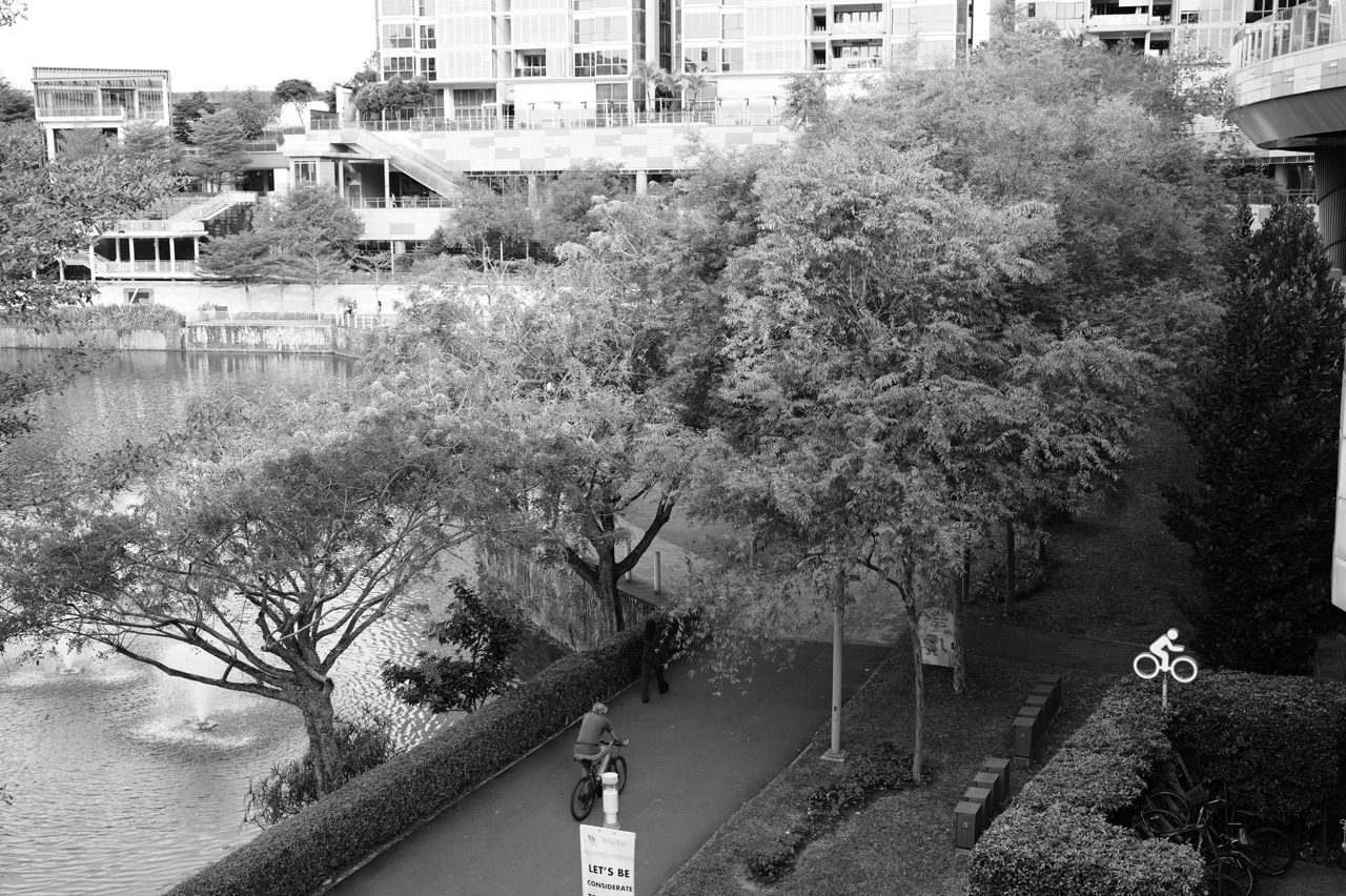
- NParks – Punggol Waterway Park
- NParks – Punggol Waterway Connector 8.4 km
- NParks – Punggol Park Connector 6.1 km
- NParks – Coney Island Park
- NEA – 17 October 2026 haze update and 18 October forecast
- Ministry of Health – Haze advisory framework
- SportSG – Haze management measures for sport
- SAFRA – EnergyOne gym locations and facilities
- SAFRA – EnergyOne operation and contact
- Waterway Point – official visit information
- PA – One Punggol civic facilities
- Punggol first 5K walk-run programme
A better way to run in Punggol
Choose a route you can describe clearly from entrance to exit, and use it only when environmental conditions and your own circumstances are appropriate. Scenic Punggol offers many possibilities, but the most useful habit is knowing when to run, when to slow down and when to leave the running for another day.
- Check NEA’s current one-hour PM2.5 and 24-hour PSI guidance before outdoor exertion.
- Check weather and lightning alerts; do not run on exposed paths in thunderstorms.
- Choose the actual start point and return, not only a park’s general name.
- Understand that 8.4 km and 6.1 km are official connector lengths, not your personal run distances.
- Carry appropriate water and plan rest without assuming every section has services.
- Respect walkers, cyclists, wildlife and all local path directions.
- For Coney Island, observe the 7am–7pm opening and variable terrain.
- Confirm gym admission, availability and fees before relying on an indoor option.
- Do not treat announced future sports facilities as available until officially opened.
- When uncertain about injury or medical limits, seek appropriate qualified guidance.
Mistakes in Punggol running advice
An easy mistake is mixing up Punggol Park Connector and Punggol Park. NParks lists the connector as a 6.1-kilometre route along Punggol Reservoir and toward the promenade; Punggol Park itself is in Hougang, not the central Punggol waterway. Search carefully using the full official place name.
Another is confusing open park hours with safety. Waterway Park’s 24-hour access listing does not mean every section is well-lit, dry or safe for a solo night run. Coney Island’s 7am–7pm hours explicitly preclude late-night visits. Do not import sunset-date itineraries into a training guide without checking whether the runner can return in daylight.
A third is ignoring haze because it is not raining. NEA issued serious October 2026 advisories, and the pollution situation can change rapidly. Read current forecasts and adjust exertion accordingly. A good guide states when not to use its own outdoor recommendations.
A fourth is treating runners as sole owners of park connectors. Shared urban recreation routes are not race tracks. Do not organise intervals, sprint finishes or photo stops in crowded pedestrian sections. Singapore’s public space is for people moving at very different speeds.
Frequently asked questions
How long is the Punggol Waterway running route?
NParks lists the Punggol Waterway Park Connector as 8.4 km. Your actual distance depends on where you start, which portion you run, how you turn and where you finish.
Is there another Punggol connector?
Yes. NParks lists the separate 6.1 km Punggol Park Connector, linking Gerald Drive to Punggol Promenade. Do not confuse it with Punggol Park in Hougang.
Can I run in Punggol today, 18 October 2026?
NEA’s 17 October advisory forecast unhealthy-to-very-unhealthy air quality for 18 October and recommended avoiding prolonged or strenuous outdoor exertion. Check current hourly PM2.5 and the latest official guidance; an indoor or rest alternative may be more appropriate.
Where is an indoor running alternative in Punggol?
SAFRA’s EnergyOne Gym at SAFRA Punggol lists cardio equipment and operating hours. Check fees, eligibility and current availability before going; membership and equipment use are not automatically free.
Can I run in Coney Island after sunset?
No. NParks lists Coney Island Park’s opening hours as 7am to 7pm. Natural terrain is more suitable for careful daylight visits than after-dark speed training.
Is Punggol Waterway Park open 24 hours?
NParks lists the park as open 24 hours, subject to specific closure notices. Opening hours do not establish good lighting or safe conditions for a particular run.
Are the paths dedicated to running only?
No. Park connectors and bridge approaches can be shared with walkers and cyclists. Follow posted rules and adapt speed to crowding.
Is Jewel Bridge a good interval-running location?
It is a scenic landmark, not a dedicated track. The approach can be a gentle route marker, but sprinting through a crowded bridge is discourteous and unsafe.
How do I find a Punggol running club?
Search current official community or sports listings and confirm organisers, eligibility and actual meeting times. A general CC interest-group directory does not prove a named running club is currently operating.
What is a sensible first Punggol run?
A short out-and-back on a familiar public path when conditions are suitable, with an easy return and adequate rest. For a structured beginner plan, use the separately linked Punggol first-5K guide.
Official reference links and deeper Punggol running guidance
NParks, NEA, Sport Singapore, the Ministry of Health, SAFRA and the People’s Association are the main authority or operator sources for the factual claims here. Refer to their current notices before making an outdoor or gym decision. No article can verify a live air-quality reading or unexpected closure for every future visit.
- NParks – Punggol Waterway Park
- NParks – Punggol Waterway Connector 8.4 km
- NParks – Punggol Park Connector 6.1 km
- NParks – Coney Island Park
- NEA – 17 October 2026 haze update and 18 October forecast
- Ministry of Health – Haze advisory framework
- SportSG – Haze management measures for sport
- SAFRA – EnergyOne gym locations and facilities
- SAFRA – EnergyOne operation and contact
- Waterway Point – official visit information
- PA – One Punggol civic facilities
- Punggol first 5K walk-run programme
A better way to run in Punggol
Choose a route you can describe clearly from entrance to exit, and use it only when environmental conditions and your own circumstances are appropriate. Scenic Punggol offers many possibilities, but the most useful habit is knowing when to run, when to slow down and when to leave the running for another day.
- Check NEA’s current one-hour PM2.5 and 24-hour PSI guidance before outdoor exertion.
- Check weather and lightning alerts; do not run on exposed paths in thunderstorms.
- Choose the actual start point and return, not only a park’s general name.
- Understand that 8.4 km and 6.1 km are official connector lengths, not your personal run distances.
- Carry appropriate water and plan rest without assuming every section has services.
- Respect walkers, cyclists, wildlife and all local path directions.
- For Coney Island, observe the 7am–7pm opening and variable terrain.
- Confirm gym admission, availability and fees before relying on an indoor option.
- Do not treat announced future sports facilities as available until officially opened.
- When uncertain about injury or medical limits, seek appropriate qualified guidance.
Mistakes in Punggol running advice
An easy mistake is mixing up Punggol Park Connector and Punggol Park. NParks lists the connector as a 6.1-kilometre route along Punggol Reservoir and toward the promenade; Punggol Park itself is in Hougang, not the central Punggol waterway. Search carefully using the full official place name.
Another is confusing open park hours with safety. Waterway Park’s 24-hour access listing does not mean every section is well-lit, dry or safe for a solo night run. Coney Island’s 7am–7pm hours explicitly preclude late-night visits. Do not import sunset-date itineraries into a training guide without checking whether the runner can return in daylight.
A third is ignoring haze because it is not raining. NEA issued serious October 2026 advisories, and the pollution situation can change rapidly. Read current forecasts and adjust exertion accordingly. A good guide states when not to use its own outdoor recommendations.
A fourth is treating runners as sole owners of park connectors. Shared urban recreation routes are not race tracks. Do not organise intervals, sprint finishes or photo stops in crowded pedestrian sections. Singapore’s public space is for people moving at very different speeds.
Frequently asked questions
How long is the Punggol Waterway running route?
NParks lists the Punggol Waterway Park Connector as 8.4 km. Your actual distance depends on where you start, which portion you run, how you turn and where you finish.
Is there another Punggol connector?
Yes. NParks lists the separate 6.1 km Punggol Park Connector, linking Gerald Drive to Punggol Promenade. Do not confuse it with Punggol Park in Hougang.
Can I run in Punggol today, 18 October 2026?
NEA’s 17 October advisory forecast unhealthy-to-very-unhealthy air quality for 18 October and recommended avoiding prolonged or strenuous outdoor exertion. Check current hourly PM2.5 and the latest official guidance; an indoor or rest alternative may be more appropriate.
Where is an indoor running alternative in Punggol?
SAFRA’s EnergyOne Gym at SAFRA Punggol lists cardio equipment and operating hours. Check fees, eligibility and current availability before going; membership and equipment use are not automatically free.
Can I run in Coney Island after sunset?
No. NParks lists Coney Island Park’s opening hours as 7am to 7pm. Natural terrain is more suitable for careful daylight visits than after-dark speed training.
Is Punggol Waterway Park open 24 hours?
NParks lists the park as open 24 hours, subject to specific closure notices. Opening hours do not establish good lighting or safe conditions for a particular run.
Are the paths dedicated to running only?
No. Park connectors and bridge approaches can be shared with walkers and cyclists. Follow posted rules and adapt speed to crowding.
Is Jewel Bridge a good interval-running location?
It is a scenic landmark, not a dedicated track. The approach can be a gentle route marker, but sprinting through a crowded bridge is discourteous and unsafe.
How do I find a Punggol running club?
Search current official community or sports listings and confirm organisers, eligibility and actual meeting times. A general CC interest-group directory does not prove a named running club is currently operating.
What is a sensible first Punggol run?
A short out-and-back on a familiar public path when conditions are suitable, with an easy return and adequate rest. For a structured beginner plan, use the separately linked Punggol first-5K guide.
Official reference links and deeper Punggol running guidance
NParks, NEA, Sport Singapore, the Ministry of Health, SAFRA and the People’s Association are the main authority or operator sources for the factual claims here. Refer to their current notices before making an outdoor or gym decision. No article can verify a live air-quality reading or unexpected closure for every future visit.
- NParks – Punggol Waterway Park
- NParks – Punggol Waterway Connector 8.4 km
- NParks – Punggol Park Connector 6.1 km
- NParks – Coney Island Park
- NEA – 17 October 2026 haze update and 18 October forecast
- Ministry of Health – Haze advisory framework
- SportSG – Haze management measures for sport
- SAFRA – EnergyOne gym locations and facilities
- SAFRA – EnergyOne operation and contact
- Waterway Point – official visit information
- PA – One Punggol civic facilities
- Punggol first 5K walk-run programme
A better way to run in Punggol
Choose a route you can describe clearly from entrance to exit, and use it only when environmental conditions and your own circumstances are appropriate. Scenic Punggol offers many possibilities, but the most useful habit is knowing when to run, when to slow down and when to leave the running for another day.
- 1. Try a short waterway out-and-back run — Punggol Waterway Park, using a familiar entrance near the town centre.
- 2. Use Jewel Bridge as a turnaround and photography stop — Jewel Bridge area within Punggol Waterway Park.
- 3. Learn the longer 8.4 km Punggol Waterway Park Connector — Punggol Waterway Park Connector along both sides of the waterway.
- 4. Explore the separate 6.1 km Punggol Park Connector — Punggol Park Connector, Gerald Drive to Punggol Promenade.
- 5. Enjoy a gentle Riverside Walk recovery run — Punggol Promenade Riverside Walk, on a lawful public stretch.
- 6. Try a careful daylight nature run near Coney Island — Coney Island Park using the signed West or East entrance.
- 7. Build a safe bridge-to-bridge navigation session — Public footpaths connecting landmark bridges along the waterway.
- 8. Arrange an easy run-walk outing with a friend — A mutually chosen section of Punggol Waterway Park or park connector.
- 9. Use a supervised or independent treadmill at EnergyOne SAFRA Punggol — EnergyOne Gym, SAFRA Punggol.
- 10. Learn the route and recovery stops before a future long run — One Punggol, Waterway Point and legitimate rest points around the public route.
Check environmental conditions before choosing a run
Start with two different air-quality measures. NEA explains that the 24-hour PSI forecast helps with planning ahead and that one-hour PM2.5 is relevant to more immediate decisions during haze. A single scenic photograph or cool-feeling breeze cannot establish that air is clean. Consider the latest advice for your health circumstances, the intensity of activity and how long you would be outside.
For 18 October 2026 specifically, NEA forecast unhealthy to very unhealthy conditions and advised healthy people to avoid prolonged or strenuous outdoor physical exertion. Vulnerable groups and people with chronic heart or lung conditions received stricter guidance. The appropriate decision depends on current readings and the advisory in force. This article does not prescribe medical activity thresholds or replace individual clinical advice.
Thunderstorms and heat are separate problems. A forecast of thundery showers signals lightning risk, and bridges, park connectors and exposed shorelines are inappropriate places to wait out a storm. A route may be officially open while still being a poor choice for running. Venue opening hours are access information, not proof of safe outdoor conditions.
For runners who want continuity, EnergyOne at SAFRA Punggol is a confirmed indoor gym with cardio equipment, subject to membership, fees, operating notices and individual machine availability. Taking a rest day also remains a legitimate choice. Do not swap an unsafe outdoor session for a more strenuous indoor workout just because a plan changed.
The difference between a route length and your running distance
NParks lists an 8.4-kilometre Punggol Waterway Park Connector and a separate 6.1-kilometre Punggol Park Connector. Those figures describe official named networks; they do not guarantee that leaving your home, running to a chosen bridge and returning will produce the same distance. Nor does a connector’s length mean it is one continuous competition-standard track with separate runner lanes.
A useful runner’s calculation begins with the actual start point, the planned turnaround and the return to the same or another public exit. If the path is shared, your moving time may include walking or waiting for other users. Consistent measurement matters more than pretending that every scenic option has a precise fixed distance.
Ten real Punggol choices explained
1. Try a short waterway out-and-back run
Where: Punggol Waterway Park, using a familiar entrance near the town centre.
Verified route or facility information
NParks describes Punggol Waterway Park as a 24-hour public park with walking and cycling opportunities. Its main park connector supports jogging and cycling, but the complete route is not the required distance for every runner. Select a specific public segment appropriate to the intended session.
When this option makes sense
This is the easiest introduction for someone who wants scenery rather than a race. One marked start point and one planned turnaround prevent a beginner from discovering too late that the outward journey was longer than expected. A comfortable out-and-back also simplifies water, toilet and return-transport planning.
The best choice is determined by your experience and the day’s environmental conditions. A scenic route is only an asset when you can navigate it comfortably and share it safely. Avoid selecting a longer or faster session merely because another runner has posted an attractive time or photograph.
How to approach it practically
Choose a calm, suitable-weather day, walk to warm up and use a time or distance you already know you can manage. Run at a conversational level where appropriate for your fitness, turn around at the agreed point and cool down away from the shared path. For a first session, a shorter completion is enough.
Before you begin, choose your actual start and finish, note a safe exit and think about hydration, shade and the time needed to return. Check the precise NParks or operator page for unusual access arrangements. A predictable short session is usually a better introduction to an unfamiliar district than improvising an ambitious loop.
A realistic runner’s example
A runner has twenty minutes before breakfast. They choose a gentle stretch from a familiar public access point, jog outward for a limited period, turn and walk the final minutes. They finish knowing where to return next time rather than feeling they must complete the whole waterway.
A worked outing is more useful than a generic promise of ‘great running views’ because it demonstrates a start, a decision and an end. It also shows that a change of plan is normal. Runners can enjoy Punggol’s public landscape without completing the longest route or chasing a personal best.
Risk, etiquette and Plan B
The park is not a dedicated running track; cyclists, children and walkers share parts of the space. Keep left or follow local directional signs, give way appropriately, and slow near crossings. Do not sprint through busy bridge approaches or use the canal edge as a shortcut.
During haze, lightning or unsafe heat, postpone the outdoor session. As of 18 October 2026, NEA’s forecast included unhealthy to very unhealthy conditions, so a published scenic route is not a recommendation to run it that day.
Shared-path etiquette matters to the sustainability of running access. Slow or stop for pedestrians when necessary, respect cyclists and do not occupy narrow bridges for high-speed sessions. When weather, air quality or personal health makes outdoor activity inappropriate, the responsible choice is to change the programme rather than ignore the risk.
How to build on it later
Repeat the same short route under suitable conditions and focus on comfort, consistency and courtesy. The next improvement might be smoother pacing or fewer stops, not more distance at any cost.
Record useful practical details rather than claiming impossible precision: the exact start, the route surface, an inconvenient crossing, a comfortable turnaround and the time of day. Over repeat visits, such notes form a much better personal Punggol running guide than an undifferentiated list of scenic coordinates.
2. Use Jewel Bridge as a turnaround and photography stop
Where: Jewel Bridge area within Punggol Waterway Park.
Verified route or facility information
NParks identifies Jewel Bridge by its distinctive dome-shaped structure and suggests it for sunset views. It is a pedestrian landmark, not an athletics facility. A runner can use the approach as a route marker but should not treat a crowded bridge as a place for speed intervals.
When this option makes sense
Named landmarks make route planning less abstract. Instead of relying on an arbitrary phone distance, an established runner can decide where the scenic portion ends and where recovery begins. A brief stop also allows the person to appreciate the park without turning the whole session into a photographic project.
The best choice is determined by your experience and the day’s environmental conditions. A scenic route is only an asset when you can navigate it comfortably and share it safely. Avoid selecting a longer or faster session merely because another runner has posted an attractive time or photograph.
How to approach it practically
Plan your run so that you arrive at the bridge while there is safe visibility. Slow before shared pedestrian areas, step out of traffic for a quick view and return by a known path. If you want a picture, take it from a suitable safe position when you are not obstructing others.
Before you begin, choose your actual start and finish, note a safe exit and think about hydration, shade and the time needed to return. Check the precise NParks or operator page for unusual access arrangements. A predictable short session is usually a better introduction to an unfamiliar district than improvising an ambitious loop.
A realistic runner’s example
An evening runner sets Jewel Bridge as the turnaround, then walks a short portion of the return as a cool-down. The sunset is only a bonus. On a crowded evening, they leave the bridge without stopping rather than compete for space with families.
A worked outing is more useful than a generic promise of ‘great running views’ because it demonstrates a start, a decision and an end. It also shows that a change of plan is normal. Runners can enjoy Punggol’s public landscape without completing the longest route or chasing a personal best.
Risk, etiquette and Plan B
Open water, railings and uneven light require care. Do not run close to the edge for an impressive GPS route. Strong sunset glare or low light can reduce visibility of approaching bicycles, and a storm can make a bridge a poor place to linger.
If the bridge approach is crowded or the weather unsuitable, choose a different public turnaround or stop the activity. The run should not depend on a particular photo.
Shared-path etiquette matters to the sustainability of running access. Slow or stop for pedestrians when necessary, respect cyclists and do not occupy narrow bridges for high-speed sessions. When weather, air quality or personal health makes outdoor activity inappropriate, the responsible choice is to change the programme rather than ignore the risk.
How to build on it later
Use the same landmark to compare how well an easy pace feels on separate suitable-air-quality days. Do not compare finishing times when one day includes crowds, stops or adverse conditions.
Record useful practical details rather than claiming impossible precision: the exact start, the route surface, an inconvenient crossing, a comfortable turnaround and the time of day. Over repeat visits, such notes form a much better personal Punggol running guide than an undifferentiated list of scenic coordinates.
3. Learn the longer 8.4 km Punggol Waterway Park Connector
Where: Punggol Waterway Park Connector along both sides of the waterway.
Verified route or facility information
NParks’s Park Connector Network page lists Punggol Waterway Park Connector as 8.4 km, suitable for jogging, cycling and birdwatching along the man-made waterway. That is a published connector length, not a standard race distance or a promise that a chosen out-and-back will equal 8.4 km.
When this option makes sense
Experienced runners can use an established connector to explore more of the town’s landscape, but its distance is more useful as geographic information than as a compulsory training target. Studying the route encourages an accurate understanding of entrance points, bridges and links before a longer session.
The best choice is determined by your experience and the day’s environmental conditions. A scenic route is only an asset when you can navigate it comfortably and share it safely. Avoid selecting a longer or faster session merely because another runner has posted an attractive time or photograph.
How to approach it practically
Review the current NParks connector map and plan a segment that matches fitness and conditions. Work out where water, shade, rest and a return transport option could be found. If you are preparing for a longer run, build mileage separately according to your training plan rather than attempting the whole route on your first visit.
Before you begin, choose your actual start and finish, note a safe exit and think about hydration, shade and the time needed to return. Check the precise NParks or operator page for unusual access arrangements. A predictable short session is usually a better introduction to an unfamiliar district than improvising an ambitious loop.
A realistic runner’s example
A runner accustomed to four-kilometre outings researches the 8.4-kilometre connector but decides to explore only part of it. They record which stretch felt busy and return another week for a different portion. Over time they gain local route knowledge without racing a map length.
A worked outing is more useful than a generic promise of ‘great running views’ because it demonstrates a start, a decision and an end. It also shows that a change of plan is normal. Runners can enjoy Punggol’s public landscape without completing the longest route or chasing a personal best.
Risk, etiquette and Plan B
Sharing space with cyclists and walkers requires awareness; speed must suit conditions. An advertised total length can be misunderstood when the start point or loops differ. Map measurements, construction diversions and GPS error can all affect an individual’s recorded distance.
In poor air quality, study the route indoors instead of running it. A map review and planned rest locations can be valuable preparation that does not incur outdoor exposure.
Shared-path etiquette matters to the sustainability of running access. Slow or stop for pedestrians when necessary, respect cyclists and do not occupy narrow bridges for high-speed sessions. When weather, air quality or personal health makes outdoor activity inappropriate, the responsible choice is to change the programme rather than ignore the risk.
How to build on it later
When conditions and fitness permit, connect familiar segments gradually. Treat the map as a way to avoid surprises, not an obligation to reach the farthest possible point.
Record useful practical details rather than claiming impossible precision: the exact start, the route surface, an inconvenient crossing, a comfortable turnaround and the time of day. Over repeat visits, such notes form a much better personal Punggol running guide than an undifferentiated list of scenic coordinates.
4. Explore the separate 6.1 km Punggol Park Connector
Where: Punggol Park Connector, Gerald Drive to Punggol Promenade.
Verified route or facility information
NParks lists the Punggol Park Connector as a 6.1 km water-themed route along Punggol Reservoir and the Straits of Johor, linking Gerald Drive to Punggol Promenade. The name is easily confused with Punggol Park at Hougang Avenue 8 and 10; they are not the same destination.
When this option makes sense
This route appeals to runners who want to understand the links beyond the central waterway. It can provide a different visual setting and a longer navigational challenge. The key value is a different connected route—not the belief that every path bearing Punggol in the title is one circular circuit.
The best choice is determined by your experience and the day’s environmental conditions. A scenic route is only an asset when you can navigate it comfortably and share it safely. Avoid selecting a longer or faster session merely because another runner has posted an attractive time or photograph.
How to approach it practically
Read the specific NParks connector page and check whether the intended segment is open. Plan an entrance and a realistic end or return point, accounting for the fact that it is a link between locations. Carry appropriate water, confirm transport and begin only in suitable weather and air quality.
Before you begin, choose your actual start and finish, note a safe exit and think about hydration, shade and the time needed to return. Check the precise NParks or operator page for unusual access arrangements. A predictable short session is usually a better introduction to an unfamiliar district than improvising an ambitious loop.
A realistic runner’s example
Two experienced runners review the published 6.1-kilometre connector but choose a shorter portion from a convenient access point. They discover a new section of the riverine landscape and return before it gets hot, leaving the remainder for another week.
A worked outing is more useful than a generic promise of ‘great running views’ because it demonstrates a start, a decision and an end. It also shows that a change of plan is normal. Runners can enjoy Punggol’s public landscape without completing the longest route or chasing a personal best.
Risk, etiquette and Plan B
Do not confuse ‘connector length’ with total distance from your own door, station or parking area. Some parts may require road crossings or exposure. Do not run into works or along water edges to preserve a planned GPS line.
If the route seems unfamiliar, recce the start on a day when you are not exercising, or choose the central Waterway Park instead. Navigation should reduce risk, not add it.
Shared-path etiquette matters to the sustainability of running access. Slow or stop for pedestrians when necessary, respect cyclists and do not occupy narrow bridges for high-speed sessions. When weather, air quality or personal health makes outdoor activity inappropriate, the responsible choice is to change the programme rather than ignore the risk.
How to build on it later
Once the entrances and turns are familiar, combine sensible portions with a recovery plan. Use clear public wayfinding and respect all shared-path users.
Record useful practical details rather than claiming impossible precision: the exact start, the route surface, an inconvenient crossing, a comfortable turnaround and the time of day. Over repeat visits, such notes form a much better personal Punggol running guide than an undifferentiated list of scenic coordinates.
5. Enjoy a gentle Riverside Walk recovery run
Where: Punggol Promenade Riverside Walk, on a lawful public stretch.
Verified route or facility information
NParks lists Punggol Promenade Riverside Walk as a linked leisure space near Waterway Park. The promenade designation does not establish a dedicated runner-only lane or guarantee a completely shaded route. The chosen segment and local notices determine safe use.
When this option makes sense
A recovery day can be pleasant in an attractive landscape when air quality permits. Instead of timing every kilometre, a runner may choose a gentle pace and enjoy water views. A short route also makes it easier to stop if the body does not feel ready for harder training.
The best choice is determined by your experience and the day’s environmental conditions. A scenic route is only an asset when you can navigate it comfortably and share it safely. Avoid selecting a longer or faster session merely because another runner has posted an attractive time or photograph.
How to approach it practically
Choose a segment with easy access and a return point. Leave sufficient distance from other people, avoid rapid changes of direction and walk when the path is busy. Use your normal recovery habits; this guide does not prescribe heart rates, exertion zones or injury rehabilitation.
Before you begin, choose your actual start and finish, note a safe exit and think about hydration, shade and the time needed to return. Check the precise NParks or operator page for unusual access arrangements. A predictable short session is usually a better introduction to an unfamiliar district than improvising an ambitious loop.
A realistic runner’s example
After a hard work week, a runner walks a few minutes, jogs gently on a suitable promenade stretch and then returns home. They finish feeling refreshed rather than treating the riverside as a test to beat a personal best.
A worked outing is more useful than a generic promise of ‘great running views’ because it demonstrates a start, a decision and an end. It also shows that a change of plan is normal. Runners can enjoy Punggol’s public landscape without completing the longest route or chasing a personal best.
Risk, etiquette and Plan B
A waterfront environment can be exposed to heat, wind and sudden weather. Watch for wet surfaces after rain and shared cycling movements. Running hard on a recovery day defeats the reason for choosing a gentle outing.
Use a rest day or an indoor low-impact alternative when haze or weather makes outdoor exercise inappropriate. A plan that includes rest is still a legitimate training plan.
Shared-path etiquette matters to the sustainability of running access. Slow or stop for pedestrians when necessary, respect cyclists and do not occupy narrow bridges for high-speed sessions. When weather, air quality or personal health makes outdoor activity inappropriate, the responsible choice is to change the programme rather than ignore the risk.
How to build on it later
Track how comfortable the easy route feels over several sessions, without turning recovery into a competition. This can help a runner notice whether their general routine is sustainable.
Record useful practical details rather than claiming impossible precision: the exact start, the route surface, an inconvenient crossing, a comfortable turnaround and the time of day. Over repeat visits, such notes form a much better personal Punggol running guide than an undifferentiated list of scenic coordinates.
6. Try a careful daylight nature run near Coney Island
Where: Coney Island Park using the signed West or East entrance.
Verified route or facility information
NParks lists Coney Island Park as an 81-hectare rustic park open 7am to 7pm, with West and East entrances and varied terrain. Its natural character is different from the more developed waterway connector, so not every surface is suitable for speed training, and some areas are rugged.
When this option makes sense
For a runner who already enjoys natural terrain, a gentle daylight outing offers vegetation and quieter observation alongside movement. It is most rewarding when approached as responsible low-impact recreation rather than a place to maximise pace or chase wildlife sightings.
The best choice is determined by your experience and the day’s environmental conditions. A scenic route is only an asset when you can navigate it comfortably and share it safely. Avoid selecting a longer or faster session merely because another runner has posted an attractive time or photograph.
How to approach it practically
Check current park access and conditions, wear shoes suitable for uneven ground and choose a short route that exits well before closing. Carry water, know which entrance you will use and slow down when the surface or other visitors require it. It may be better to walk the first time to learn the terrain.
Before you begin, choose your actual start and finish, note a safe exit and think about hydration, shade and the time needed to return. Check the precise NParks or operator page for unusual access arrangements. A predictable short session is usually a better introduction to an unfamiliar district than improvising an ambitious loop.
A realistic runner’s example
A runner familiar with park connectors chooses a short Coney Island segment in the morning and slows frequently for uneven surfaces. They return to the same entrance, having learned which paths may be appropriate for future nature outings.
A worked outing is more useful than a generic promise of ‘great running views’ because it demonstrates a start, a decision and an end. It also shows that a change of plan is normal. Runners can enjoy Punggol’s public landscape without completing the longest route or chasing a personal best.
Risk, etiquette and Plan B
Tree roots, insects, wildlife and limited amenities create different demands from a town-centre path. Do not enter closed areas, run after 7pm or disturb wildlife. The island should never be treated as a guaranteed isolated track.
If a trail feels uncertain or weather conditions are unsuitable, switch to a known accessible connector on a later safe day or postpone. Running speed is irrelevant if you cannot return safely.
Shared-path etiquette matters to the sustainability of running access. Slow or stop for pedestrians when necessary, respect cyclists and do not occupy narrow bridges for high-speed sessions. When weather, air quality or personal health makes outdoor activity inappropriate, the responsible choice is to change the programme rather than ignore the risk.
How to build on it later
After learning the route, prioritise controlled footing and awareness rather than pace records. Natural areas are shared habitats that require particularly considerate use.
Record useful practical details rather than claiming impossible precision: the exact start, the route surface, an inconvenient crossing, a comfortable turnaround and the time of day. Over repeat visits, such notes form a much better personal Punggol running guide than an undifferentiated list of scenic coordinates.
7. Build a safe bridge-to-bridge navigation session
Where: Public footpaths connecting landmark bridges along the waterway.
Verified route or facility information
NParks highlights bridges including Jewel, Kelong and Sunrise within Punggol Waterway Park. They can serve as visual navigation markers for an outing without needing to invent a precise kilometre figure. Different start points yield different distances, and bridges are shared with pedestrians.
When this option makes sense
A runner who is bored by repeating the same loop may enjoy learning route geography with a short landmark sequence. It provides variety without requiring a remote trail or a costly activity. The exercise can emphasise route planning and gentle changes of pace rather than all-out intervals.
The best choice is determined by your experience and the day’s environmental conditions. A scenic route is only an asset when you can navigate it comfortably and share it safely. Avoid selecting a longer or faster session merely because another runner has posted an attractive time or photograph.
How to approach it practically
Select only one or two bridges that are realistically close to your entry point, verify the pedestrian route and measure it if distance matters. At bridge approaches, slow or walk, then resume running only when the path is sufficiently clear. Use the designated public crossing points.
Before you begin, choose your actual start and finish, note a safe exit and think about hydration, shade and the time needed to return. Check the precise NParks or operator page for unusual access arrangements. A predictable short session is usually a better introduction to an unfamiliar district than improvising an ambitious loop.
A realistic runner’s example
A novice chooses Kelong Bridge as the first milestone and a nearby public bridge as the return marker. They discover that the distance is shorter than anticipated and are pleased to finish easily. On a later day they may extend the route by one safe segment.
A worked outing is more useful than a generic promise of ‘great running views’ because it demonstrates a start, a decision and an end. It also shows that a change of plan is normal. Runners can enjoy Punggol’s public landscape without completing the longest route or chasing a personal best.
Risk, etiquette and Plan B
Do not improvise routes by climbing slopes, cutting across landscaping or descending towards the water. A beautiful bridge can attract photographers and children, so aggressive interval sessions near it are discourteous and risky.
If pedestrian traffic is high, transform the outing into a scenic walk or run a different familiar section when conditions improve. There is no need to insist on a timed segment.
Shared-path etiquette matters to the sustainability of running access. Slow or stop for pedestrians when necessary, respect cyclists and do not occupy narrow bridges for high-speed sessions. When weather, air quality or personal health makes outdoor activity inappropriate, the responsible choice is to change the programme rather than ignore the risk.
How to build on it later
Create a simple map with legitimate paths and distances checked from your actual start. The resulting local knowledge is more useful than an embellished claim of an exact ‘bridge run’ length.
Record useful practical details rather than claiming impossible precision: the exact start, the route surface, an inconvenient crossing, a comfortable turnaround and the time of day. Over repeat visits, such notes form a much better personal Punggol running guide than an undifferentiated list of scenic coordinates.
8. Arrange an easy run-walk outing with a friend
Where: A mutually chosen section of Punggol Waterway Park or park connector.
Verified route or facility information
Punggol’s official public routes support walking and jogging, but a friend-run plan is an informal arrangement, not a named race or paid club. One Punggol CC lists various public interest groups; that is not evidence that a specific weekly running club is confirmed for all visitors.
When this option makes sense
Shared exercise can be motivating when the two people agree to a compatible pace. Running with a friend also makes route choice and recovery conversation part of the enjoyment. A run-walk approach can suit newcomers without promising that it provides any specific medical benefit.
The best choice is determined by your experience and the day’s environmental conditions. A scenic route is only an asset when you can navigate it comfortably and share it safely. Avoid selecting a longer or faster session merely because another runner has posted an attractive time or photograph.
How to approach it practically
Before meeting, discuss the intended pace, duration, weather and where to end. Choose an accessible place to meet, agree that walking breaks are fine and separate if your speeds differ too much. Avoid pressuring a slower runner to keep up simply because the route is public.
Before you begin, choose your actual start and finish, note a safe exit and think about hydration, shade and the time needed to return. Check the precise NParks or operator page for unusual access arrangements. A predictable short session is usually a better introduction to an unfamiliar district than improvising an ambitious loop.
A realistic runner’s example
Two friends meet near a waterway entrance. One has trained for months while the other is returning to exercise. They agree on an easy walk-jog outing instead of forcing an interval session, then finish with a drink and review whether it suited both.
A worked outing is more useful than a generic promise of ‘great running views’ because it demonstrates a start, a decision and an end. It also shows that a change of plan is normal. Runners can enjoy Punggol’s public landscape without completing the longest route or chasing a personal best.
Risk, etiquette and Plan B
Social pressure can encourage overly hard exertion, especially in heat or haze. Monitor your own readiness and conditions, and keep other walkers safe on narrow paths. This guide is not a substitute for personalised advice about illness, injuries or training limits.
When outdoor exercise should be avoided, make the meeting a library or cafe catch-up instead. The friendship does not depend on completing a run.
Shared-path etiquette matters to the sustainability of running access. Slow or stop for pedestrians when necessary, respect cyclists and do not occupy narrow bridges for high-speed sessions. When weather, air quality or personal health makes outdoor activity inappropriate, the responsible choice is to change the programme rather than ignore the risk.
How to build on it later
If the pair enjoys the routine, choose a regular public route and set realistic expectations. A sustainable shared activity is more useful than a one-off ambitious distance.
Record useful practical details rather than claiming impossible precision: the exact start, the route surface, an inconvenient crossing, a comfortable turnaround and the time of day. Over repeat visits, such notes form a much better personal Punggol running guide than an undifferentiated list of scenic coordinates.
9. Use a supervised or independent treadmill at EnergyOne SAFRA Punggol
Where: EnergyOne Gym, SAFRA Punggol.
Verified route or facility information
SAFRA’s official EnergyOne site lists its Punggol gym with cardio equipment, alongside its operating schedule and membership or entry options. The current Punggol listing gives 6am to 10.30pm hours, subject to notices. A treadmill is a real indoor alternative, not a claim that every person has free gym access or that the facility is permanently unaffected by disruptions.
When this option makes sense
Indoor cardio gives runners an option when outdoor haze, thunderstorms or unsafe heat make a scenic run a poor decision. Someone can keep a familiar movement habit without exposure to polluted air at the waterway. The gym’s equipment, however, does not replace attention to individual fitness and venue rules.
The best choice is determined by your experience and the day’s environmental conditions. A scenic route is only an asset when you can navigate it comfortably and share it safely. Avoid selecting a longer or faster session merely because another runner has posted an attractive time or photograph.
How to approach it practically
Verify access eligibility, current payment options, any booking requirements, operating notice and machine availability before travelling. If unfamiliar with treadmill operation, ask qualified staff for an introduction. Do not start fast or use unfamiliar settings merely to match an outdoor pace record.
Before you begin, choose your actual start and finish, note a safe exit and think about hydration, shade and the time needed to return. Check the precise NParks or operator page for unusual access arrangements. A predictable short session is usually a better introduction to an unfamiliar district than improvising an ambitious loop.
A realistic runner’s example
An outdoor runner checks NEA’s 18 October haze advisory and decides not to train along the waterway. They confirm an appropriate indoor gym option and do a modest session within their known ability, or simply take a rest day if gym access is not available.
A worked outing is more useful than a generic promise of ‘great running views’ because it demonstrates a start, a decision and an end. It also shows that a change of plan is normal. Runners can enjoy Punggol’s public landscape without completing the longest route or chasing a personal best.
Risk, etiquette and Plan B
An indoor gym may be crowded, machines require care and no specific training outcome is guaranteed. Some people should seek professional advice before increasing exertion. Access and fee rules are venue-controlled; the SAFRA address does not create an entitlement to use a treadmill free of charge.
If the gym has no suitable access or machine, rest or choose safe indoor movement you already know how to do. Do not go outdoors just because the gym plan failed.
Shared-path etiquette matters to the sustainability of running access. Slow or stop for pedestrians when necessary, respect cyclists and do not occupy narrow bridges for high-speed sessions. When weather, air quality or personal health makes outdoor activity inappropriate, the responsible choice is to change the programme rather than ignore the risk.
How to build on it later
Keep indoor sessions proportionate to previous training and use them as flexibility rather than a test of discipline. The objective is to make responsible choices when the environment changes.
Record useful practical details rather than claiming impossible precision: the exact start, the route surface, an inconvenient crossing, a comfortable turnaround and the time of day. Over repeat visits, such notes form a much better personal Punggol running guide than an undifferentiated list of scenic coordinates.
10. Learn the route and recovery stops before a future long run
Where: One Punggol, Waterway Point and legitimate rest points around the public route.
Verified route or facility information
The One Punggol hub includes civic facilities such as a library and hawker centre, and Waterway Point connects directly to Punggol MRT/LRT. NParks identifies seating along the Waterway connector. These can inform planning, but facility opening hours and exact paths differ. A library and a shopping mall are not part of a dedicated running circuit.
When this option makes sense
A runner exploring a new neighbourhood benefits from practical knowledge: where a route begins, how to return, what public rest points exist and which exits are safe after a session. This is an activity in itself when extreme weather rules out a run—planning can prevent a poorly judged future route.
The best choice is determined by your experience and the day’s environmental conditions. A scenic route is only an asset when you can navigate it comfortably and share it safely. Avoid selecting a longer or faster session merely because another runner has posted an attractive time or photograph.
How to approach it practically
On a non-running day, study current NParks maps, public transit connections and the location of available toilets or water facilities. If travelling in person, do so only when conditions permit and keep any recce short. Record two realistic start points and a backup return.
Before you begin, choose your actual start and finish, note a safe exit and think about hydration, shade and the time needed to return. Check the precise NParks or operator page for unusual access arrangements. A predictable short session is usually a better introduction to an unfamiliar district than improvising an ambitious loop.
A realistic runner’s example
A runner plans to attempt an unfamiliar connector section next month. During a hazy week, they instead compare maps, note that Coney Island closes at 7pm, and identify a short return route near Punggol MRT. The future session becomes clearer without outdoor exertion now.
A worked outing is more useful than a generic promise of ‘great running views’ because it demonstrates a start, a decision and an end. It also shows that a change of plan is normal. Runners can enjoy Punggol’s public landscape without completing the longest route or chasing a personal best.
Risk, etiquette and Plan B
Do not treat map distances as absolute or assume every rest location is open at dawn. Some park stretches are exposed and have limited services. New construction may alter access, and public commercial amenities are not guaranteed at an athlete’s chosen running time.
If specific facilities cannot be verified, simplify the plan to a known start-and-return rather than extending the course. Prepare for a reasonable range of conditions without overcomplicating the outing.
Shared-path etiquette matters to the sustainability of running access. Slow or stop for pedestrians when necessary, respect cyclists and do not occupy narrow bridges for high-speed sessions. When weather, air quality or personal health makes outdoor activity inappropriate, the responsible choice is to change the programme rather than ignore the risk.
How to build on it later
Update personal route notes after each completed outing: path surface, crowd level, useful rest point and time to return. A reliable local running knowledge base is more practical than a one-time boast about distance.
Record useful practical details rather than claiming impossible precision: the exact start, the route surface, an inconvenient crossing, a comfortable turnaround and the time of day. Over repeat visits, such notes form a much better personal Punggol running guide than an undifferentiated list of scenic coordinates.
Three session templates—only when conditions are appropriate
Beginner-friendly short run-walk
Use a familiar part of Punggol Waterway Park and set a short, comfortable activity window based on your existing ability. Alternate walking and running as needed, then turn around early enough to return without rushing. Avoid new intervals or distance increases simply because the route looks inviting. People managing injuries or health concerns should use individual professional advice.
A runner new to the area benefits from completing the same straightforward route a few times. Observing where cyclists appear and which corners are busy creates situational awareness before extending distance.
Scenic landmark run
Choose one public bridge as a destination, not a sprint finish. Approach at a considerate pace, step away from the main path if you want a view or photo, and return by a known section. Keep the entire session within a sensible distance and do not expect sunset light to remain predictable.
This is an especially good reminder that runners are also park users. Enjoying the space is compatible with yielding to pedestrians and pausing at an interesting view.
Indoor or rest-day alternative during haze
Check whether EnergyOne SAFRA Punggol offers a suitable paid-entry or membership option on your intended date, and choose a familiar machine-based cardio session only if it suits your circumstances. If not, rest, plan a route or do a safe indoor activity you already know. Avoid leaving home specifically for an outdoor run when NEA’s prevailing guidance advises against it.
The environmental fallback is not a consolation prize. It is the mechanism by which a training routine remains responsible over time. Neither a running streak nor a scenic location overrides a hazardous-air advisory.
Runner’s preparation checklist
- Check NEA’s current one-hour PM2.5 and 24-hour PSI guidance before outdoor exertion.
- Check weather and lightning alerts; do not run on exposed paths in thunderstorms.
- Choose the actual start point and return, not only a park’s general name.
- Understand that 8.4 km and 6.1 km are official connector lengths, not your personal run distances.
- Carry appropriate water and plan rest without assuming every section has services.
- Respect walkers, cyclists, wildlife and all local path directions.
- For Coney Island, observe the 7am–7pm opening and variable terrain.
- Confirm gym admission, availability and fees before relying on an indoor option.
- Do not treat announced future sports facilities as available until officially opened.
- When uncertain about injury or medical limits, seek appropriate qualified guidance.
Mistakes in Punggol running advice
An easy mistake is mixing up Punggol Park Connector and Punggol Park. NParks lists the connector as a 6.1-kilometre route along Punggol Reservoir and toward the promenade; Punggol Park itself is in Hougang, not the central Punggol waterway. Search carefully using the full official place name.
Another is confusing open park hours with safety. Waterway Park’s 24-hour access listing does not mean every section is well-lit, dry or safe for a solo night run. Coney Island’s 7am–7pm hours explicitly preclude late-night visits. Do not import sunset-date itineraries into a training guide without checking whether the runner can return in daylight.
A third is ignoring haze because it is not raining. NEA issued serious October 2026 advisories, and the pollution situation can change rapidly. Read current forecasts and adjust exertion accordingly. A good guide states when not to use its own outdoor recommendations.
A fourth is treating runners as sole owners of park connectors. Shared urban recreation routes are not race tracks. Do not organise intervals, sprint finishes or photo stops in crowded pedestrian sections. Singapore’s public space is for people moving at very different speeds.
Frequently asked questions
How long is the Punggol Waterway running route?
NParks lists the Punggol Waterway Park Connector as 8.4 km. Your actual distance depends on where you start, which portion you run, how you turn and where you finish.
Is there another Punggol connector?
Yes. NParks lists the separate 6.1 km Punggol Park Connector, linking Gerald Drive to Punggol Promenade. Do not confuse it with Punggol Park in Hougang.
Can I run in Punggol today, 18 October 2026?
NEA’s 17 October advisory forecast unhealthy-to-very-unhealthy air quality for 18 October and recommended avoiding prolonged or strenuous outdoor exertion. Check current hourly PM2.5 and the latest official guidance; an indoor or rest alternative may be more appropriate.
Where is an indoor running alternative in Punggol?
SAFRA’s EnergyOne Gym at SAFRA Punggol lists cardio equipment and operating hours. Check fees, eligibility and current availability before going; membership and equipment use are not automatically free.
Can I run in Coney Island after sunset?
No. NParks lists Coney Island Park’s opening hours as 7am to 7pm. Natural terrain is more suitable for careful daylight visits than after-dark speed training.
Is Punggol Waterway Park open 24 hours?
NParks lists the park as open 24 hours, subject to specific closure notices. Opening hours do not establish good lighting or safe conditions for a particular run.
Are the paths dedicated to running only?
No. Park connectors and bridge approaches can be shared with walkers and cyclists. Follow posted rules and adapt speed to crowding.
Is Jewel Bridge a good interval-running location?
It is a scenic landmark, not a dedicated track. The approach can be a gentle route marker, but sprinting through a crowded bridge is discourteous and unsafe.
How do I find a Punggol running club?
Search current official community or sports listings and confirm organisers, eligibility and actual meeting times. A general CC interest-group directory does not prove a named running club is currently operating.
What is a sensible first Punggol run?
A short out-and-back on a familiar public path when conditions are suitable, with an easy return and adequate rest. For a structured beginner plan, use the separately linked Punggol first-5K guide.
Official reference links and deeper Punggol running guidance
NParks, NEA, Sport Singapore, the Ministry of Health, SAFRA and the People’s Association are the main authority or operator sources for the factual claims here. Refer to their current notices before making an outdoor or gym decision. No article can verify a live air-quality reading or unexpected closure for every future visit.
- NParks – Punggol Waterway Park
- NParks – Punggol Waterway Connector 8.4 km
- NParks – Punggol Park Connector 6.1 km
- NParks – Coney Island Park
- NEA – 17 October 2026 haze update and 18 October forecast
- Ministry of Health – Haze advisory framework
- SportSG – Haze management measures for sport
- SAFRA – EnergyOne gym locations and facilities
- SAFRA – EnergyOne operation and contact
- Waterway Point – official visit information
- PA – One Punggol civic facilities
- Punggol first 5K walk-run programme
A better way to run in Punggol
Choose a route you can describe clearly from entrance to exit, and use it only when environmental conditions and your own circumstances are appropriate. Scenic Punggol offers many possibilities, but the most useful habit is knowing when to run, when to slow down and when to leave the running for another day.
- 1. Try a short waterway out-and-back run — Punggol Waterway Park, using a familiar entrance near the town centre.
- 2. Use Jewel Bridge as a turnaround and photography stop — Jewel Bridge area within Punggol Waterway Park.
- 3. Learn the longer 8.4 km Punggol Waterway Park Connector — Punggol Waterway Park Connector along both sides of the waterway.
- 4. Explore the separate 6.1 km Punggol Park Connector — Punggol Park Connector, Gerald Drive to Punggol Promenade.
- 5. Enjoy a gentle Riverside Walk recovery run — Punggol Promenade Riverside Walk, on a lawful public stretch.
- 6. Try a careful daylight nature run near Coney Island — Coney Island Park using the signed West or East entrance.
- 7. Build a safe bridge-to-bridge navigation session — Public footpaths connecting landmark bridges along the waterway.
- 8. Arrange an easy run-walk outing with a friend — A mutually chosen section of Punggol Waterway Park or park connector.
- 9. Use a supervised or independent treadmill at EnergyOne SAFRA Punggol — EnergyOne Gym, SAFRA Punggol.
- 10. Learn the route and recovery stops before a future long run — One Punggol, Waterway Point and legitimate rest points around the public route.
Check environmental conditions before choosing a run
Start with two different air-quality measures. NEA explains that the 24-hour PSI forecast helps with planning ahead and that one-hour PM2.5 is relevant to more immediate decisions during haze. A single scenic photograph or cool-feeling breeze cannot establish that air is clean. Consider the latest advice for your health circumstances, the intensity of activity and how long you would be outside.
For 18 October 2026 specifically, NEA forecast unhealthy to very unhealthy conditions and advised healthy people to avoid prolonged or strenuous outdoor physical exertion. Vulnerable groups and people with chronic heart or lung conditions received stricter guidance. The appropriate decision depends on current readings and the advisory in force. This article does not prescribe medical activity thresholds or replace individual clinical advice.
Thunderstorms and heat are separate problems. A forecast of thundery showers signals lightning risk, and bridges, park connectors and exposed shorelines are inappropriate places to wait out a storm. A route may be officially open while still being a poor choice for running. Venue opening hours are access information, not proof of safe outdoor conditions.
For runners who want continuity, EnergyOne at SAFRA Punggol is a confirmed indoor gym with cardio equipment, subject to membership, fees, operating notices and individual machine availability. Taking a rest day also remains a legitimate choice. Do not swap an unsafe outdoor session for a more strenuous indoor workout just because a plan changed.
The difference between a route length and your running distance
NParks lists an 8.4-kilometre Punggol Waterway Park Connector and a separate 6.1-kilometre Punggol Park Connector. Those figures describe official named networks; they do not guarantee that leaving your home, running to a chosen bridge and returning will produce the same distance. Nor does a connector’s length mean it is one continuous competition-standard track with separate runner lanes.
A useful runner’s calculation begins with the actual start point, the planned turnaround and the return to the same or another public exit. If the path is shared, your moving time may include walking or waiting for other users. Consistent measurement matters more than pretending that every scenic option has a precise fixed distance.
Ten real Punggol choices explained
1. Try a short waterway out-and-back run
Where: Punggol Waterway Park, using a familiar entrance near the town centre.
Verified route or facility information
NParks describes Punggol Waterway Park as a 24-hour public park with walking and cycling opportunities. Its main park connector supports jogging and cycling, but the complete route is not the required distance for every runner. Select a specific public segment appropriate to the intended session.
When this option makes sense
This is the easiest introduction for someone who wants scenery rather than a race. One marked start point and one planned turnaround prevent a beginner from discovering too late that the outward journey was longer than expected. A comfortable out-and-back also simplifies water, toilet and return-transport planning.
The best choice is determined by your experience and the day’s environmental conditions. A scenic route is only an asset when you can navigate it comfortably and share it safely. Avoid selecting a longer or faster session merely because another runner has posted an attractive time or photograph.
How to approach it practically
Choose a calm, suitable-weather day, walk to warm up and use a time or distance you already know you can manage. Run at a conversational level where appropriate for your fitness, turn around at the agreed point and cool down away from the shared path. For a first session, a shorter completion is enough.
Before you begin, choose your actual start and finish, note a safe exit and think about hydration, shade and the time needed to return. Check the precise NParks or operator page for unusual access arrangements. A predictable short session is usually a better introduction to an unfamiliar district than improvising an ambitious loop.
A realistic runner’s example
A runner has twenty minutes before breakfast. They choose a gentle stretch from a familiar public access point, jog outward for a limited period, turn and walk the final minutes. They finish knowing where to return next time rather than feeling they must complete the whole waterway.
A worked outing is more useful than a generic promise of ‘great running views’ because it demonstrates a start, a decision and an end. It also shows that a change of plan is normal. Runners can enjoy Punggol’s public landscape without completing the longest route or chasing a personal best.
Risk, etiquette and Plan B
The park is not a dedicated running track; cyclists, children and walkers share parts of the space. Keep left or follow local directional signs, give way appropriately, and slow near crossings. Do not sprint through busy bridge approaches or use the canal edge as a shortcut.
During haze, lightning or unsafe heat, postpone the outdoor session. As of 18 October 2026, NEA’s forecast included unhealthy to very unhealthy conditions, so a published scenic route is not a recommendation to run it that day.
Shared-path etiquette matters to the sustainability of running access. Slow or stop for pedestrians when necessary, respect cyclists and do not occupy narrow bridges for high-speed sessions. When weather, air quality or personal health makes outdoor activity inappropriate, the responsible choice is to change the programme rather than ignore the risk.
How to build on it later
Repeat the same short route under suitable conditions and focus on comfort, consistency and courtesy. The next improvement might be smoother pacing or fewer stops, not more distance at any cost.
Record useful practical details rather than claiming impossible precision: the exact start, the route surface, an inconvenient crossing, a comfortable turnaround and the time of day. Over repeat visits, such notes form a much better personal Punggol running guide than an undifferentiated list of scenic coordinates.
2. Use Jewel Bridge as a turnaround and photography stop
Where: Jewel Bridge area within Punggol Waterway Park.
Verified route or facility information
NParks identifies Jewel Bridge by its distinctive dome-shaped structure and suggests it for sunset views. It is a pedestrian landmark, not an athletics facility. A runner can use the approach as a route marker but should not treat a crowded bridge as a place for speed intervals.
When this option makes sense
Named landmarks make route planning less abstract. Instead of relying on an arbitrary phone distance, an established runner can decide where the scenic portion ends and where recovery begins. A brief stop also allows the person to appreciate the park without turning the whole session into a photographic project.
The best choice is determined by your experience and the day’s environmental conditions. A scenic route is only an asset when you can navigate it comfortably and share it safely. Avoid selecting a longer or faster session merely because another runner has posted an attractive time or photograph.
How to approach it practically
Plan your run so that you arrive at the bridge while there is safe visibility. Slow before shared pedestrian areas, step out of traffic for a quick view and return by a known path. If you want a picture, take it from a suitable safe position when you are not obstructing others.
Before you begin, choose your actual start and finish, note a safe exit and think about hydration, shade and the time needed to return. Check the precise NParks or operator page for unusual access arrangements. A predictable short session is usually a better introduction to an unfamiliar district than improvising an ambitious loop.
A realistic runner’s example
An evening runner sets Jewel Bridge as the turnaround, then walks a short portion of the return as a cool-down. The sunset is only a bonus. On a crowded evening, they leave the bridge without stopping rather than compete for space with families.
A worked outing is more useful than a generic promise of ‘great running views’ because it demonstrates a start, a decision and an end. It also shows that a change of plan is normal. Runners can enjoy Punggol’s public landscape without completing the longest route or chasing a personal best.
Risk, etiquette and Plan B
Open water, railings and uneven light require care. Do not run close to the edge for an impressive GPS route. Strong sunset glare or low light can reduce visibility of approaching bicycles, and a storm can make a bridge a poor place to linger.
If the bridge approach is crowded or the weather unsuitable, choose a different public turnaround or stop the activity. The run should not depend on a particular photo.
Shared-path etiquette matters to the sustainability of running access. Slow or stop for pedestrians when necessary, respect cyclists and do not occupy narrow bridges for high-speed sessions. When weather, air quality or personal health makes outdoor activity inappropriate, the responsible choice is to change the programme rather than ignore the risk.
How to build on it later
Use the same landmark to compare how well an easy pace feels on separate suitable-air-quality days. Do not compare finishing times when one day includes crowds, stops or adverse conditions.
Record useful practical details rather than claiming impossible precision: the exact start, the route surface, an inconvenient crossing, a comfortable turnaround and the time of day. Over repeat visits, such notes form a much better personal Punggol running guide than an undifferentiated list of scenic coordinates.
3. Learn the longer 8.4 km Punggol Waterway Park Connector
Where: Punggol Waterway Park Connector along both sides of the waterway.
Verified route or facility information
NParks’s Park Connector Network page lists Punggol Waterway Park Connector as 8.4 km, suitable for jogging, cycling and birdwatching along the man-made waterway. That is a published connector length, not a standard race distance or a promise that a chosen out-and-back will equal 8.4 km.
When this option makes sense
Experienced runners can use an established connector to explore more of the town’s landscape, but its distance is more useful as geographic information than as a compulsory training target. Studying the route encourages an accurate understanding of entrance points, bridges and links before a longer session.
The best choice is determined by your experience and the day’s environmental conditions. A scenic route is only an asset when you can navigate it comfortably and share it safely. Avoid selecting a longer or faster session merely because another runner has posted an attractive time or photograph.
How to approach it practically
Review the current NParks connector map and plan a segment that matches fitness and conditions. Work out where water, shade, rest and a return transport option could be found. If you are preparing for a longer run, build mileage separately according to your training plan rather than attempting the whole route on your first visit.
Before you begin, choose your actual start and finish, note a safe exit and think about hydration, shade and the time needed to return. Check the precise NParks or operator page for unusual access arrangements. A predictable short session is usually a better introduction to an unfamiliar district than improvising an ambitious loop.
A realistic runner’s example
A runner accustomed to four-kilometre outings researches the 8.4-kilometre connector but decides to explore only part of it. They record which stretch felt busy and return another week for a different portion. Over time they gain local route knowledge without racing a map length.
A worked outing is more useful than a generic promise of ‘great running views’ because it demonstrates a start, a decision and an end. It also shows that a change of plan is normal. Runners can enjoy Punggol’s public landscape without completing the longest route or chasing a personal best.
Risk, etiquette and Plan B
Sharing space with cyclists and walkers requires awareness; speed must suit conditions. An advertised total length can be misunderstood when the start point or loops differ. Map measurements, construction diversions and GPS error can all affect an individual’s recorded distance.
In poor air quality, study the route indoors instead of running it. A map review and planned rest locations can be valuable preparation that does not incur outdoor exposure.
Shared-path etiquette matters to the sustainability of running access. Slow or stop for pedestrians when necessary, respect cyclists and do not occupy narrow bridges for high-speed sessions. When weather, air quality or personal health makes outdoor activity inappropriate, the responsible choice is to change the programme rather than ignore the risk.
How to build on it later
When conditions and fitness permit, connect familiar segments gradually. Treat the map as a way to avoid surprises, not an obligation to reach the farthest possible point.
Record useful practical details rather than claiming impossible precision: the exact start, the route surface, an inconvenient crossing, a comfortable turnaround and the time of day. Over repeat visits, such notes form a much better personal Punggol running guide than an undifferentiated list of scenic coordinates.
4. Explore the separate 6.1 km Punggol Park Connector
Where: Punggol Park Connector, Gerald Drive to Punggol Promenade.
Verified route or facility information
NParks lists the Punggol Park Connector as a 6.1 km water-themed route along Punggol Reservoir and the Straits of Johor, linking Gerald Drive to Punggol Promenade. The name is easily confused with Punggol Park at Hougang Avenue 8 and 10; they are not the same destination.
When this option makes sense
This route appeals to runners who want to understand the links beyond the central waterway. It can provide a different visual setting and a longer navigational challenge. The key value is a different connected route—not the belief that every path bearing Punggol in the title is one circular circuit.
The best choice is determined by your experience and the day’s environmental conditions. A scenic route is only an asset when you can navigate it comfortably and share it safely. Avoid selecting a longer or faster session merely because another runner has posted an attractive time or photograph.
How to approach it practically
Read the specific NParks connector page and check whether the intended segment is open. Plan an entrance and a realistic end or return point, accounting for the fact that it is a link between locations. Carry appropriate water, confirm transport and begin only in suitable weather and air quality.
Before you begin, choose your actual start and finish, note a safe exit and think about hydration, shade and the time needed to return. Check the precise NParks or operator page for unusual access arrangements. A predictable short session is usually a better introduction to an unfamiliar district than improvising an ambitious loop.
A realistic runner’s example
Two experienced runners review the published 6.1-kilometre connector but choose a shorter portion from a convenient access point. They discover a new section of the riverine landscape and return before it gets hot, leaving the remainder for another week.
A worked outing is more useful than a generic promise of ‘great running views’ because it demonstrates a start, a decision and an end. It also shows that a change of plan is normal. Runners can enjoy Punggol’s public landscape without completing the longest route or chasing a personal best.
Risk, etiquette and Plan B
Do not confuse ‘connector length’ with total distance from your own door, station or parking area. Some parts may require road crossings or exposure. Do not run into works or along water edges to preserve a planned GPS line.
If the route seems unfamiliar, recce the start on a day when you are not exercising, or choose the central Waterway Park instead. Navigation should reduce risk, not add it.
Shared-path etiquette matters to the sustainability of running access. Slow or stop for pedestrians when necessary, respect cyclists and do not occupy narrow bridges for high-speed sessions. When weather, air quality or personal health makes outdoor activity inappropriate, the responsible choice is to change the programme rather than ignore the risk.
How to build on it later
Once the entrances and turns are familiar, combine sensible portions with a recovery plan. Use clear public wayfinding and respect all shared-path users.
Record useful practical details rather than claiming impossible precision: the exact start, the route surface, an inconvenient crossing, a comfortable turnaround and the time of day. Over repeat visits, such notes form a much better personal Punggol running guide than an undifferentiated list of scenic coordinates.
5. Enjoy a gentle Riverside Walk recovery run
Where: Punggol Promenade Riverside Walk, on a lawful public stretch.
Verified route or facility information
NParks lists Punggol Promenade Riverside Walk as a linked leisure space near Waterway Park. The promenade designation does not establish a dedicated runner-only lane or guarantee a completely shaded route. The chosen segment and local notices determine safe use.
When this option makes sense
A recovery day can be pleasant in an attractive landscape when air quality permits. Instead of timing every kilometre, a runner may choose a gentle pace and enjoy water views. A short route also makes it easier to stop if the body does not feel ready for harder training.
The best choice is determined by your experience and the day’s environmental conditions. A scenic route is only an asset when you can navigate it comfortably and share it safely. Avoid selecting a longer or faster session merely because another runner has posted an attractive time or photograph.
How to approach it practically
Choose a segment with easy access and a return point. Leave sufficient distance from other people, avoid rapid changes of direction and walk when the path is busy. Use your normal recovery habits; this guide does not prescribe heart rates, exertion zones or injury rehabilitation.
Before you begin, choose your actual start and finish, note a safe exit and think about hydration, shade and the time needed to return. Check the precise NParks or operator page for unusual access arrangements. A predictable short session is usually a better introduction to an unfamiliar district than improvising an ambitious loop.
A realistic runner’s example
After a hard work week, a runner walks a few minutes, jogs gently on a suitable promenade stretch and then returns home. They finish feeling refreshed rather than treating the riverside as a test to beat a personal best.
A worked outing is more useful than a generic promise of ‘great running views’ because it demonstrates a start, a decision and an end. It also shows that a change of plan is normal. Runners can enjoy Punggol’s public landscape without completing the longest route or chasing a personal best.
Risk, etiquette and Plan B
A waterfront environment can be exposed to heat, wind and sudden weather. Watch for wet surfaces after rain and shared cycling movements. Running hard on a recovery day defeats the reason for choosing a gentle outing.
Use a rest day or an indoor low-impact alternative when haze or weather makes outdoor exercise inappropriate. A plan that includes rest is still a legitimate training plan.
Shared-path etiquette matters to the sustainability of running access. Slow or stop for pedestrians when necessary, respect cyclists and do not occupy narrow bridges for high-speed sessions. When weather, air quality or personal health makes outdoor activity inappropriate, the responsible choice is to change the programme rather than ignore the risk.
How to build on it later
Track how comfortable the easy route feels over several sessions, without turning recovery into a competition. This can help a runner notice whether their general routine is sustainable.
Record useful practical details rather than claiming impossible precision: the exact start, the route surface, an inconvenient crossing, a comfortable turnaround and the time of day. Over repeat visits, such notes form a much better personal Punggol running guide than an undifferentiated list of scenic coordinates.
6. Try a careful daylight nature run near Coney Island
Where: Coney Island Park using the signed West or East entrance.
Verified route or facility information
NParks lists Coney Island Park as an 81-hectare rustic park open 7am to 7pm, with West and East entrances and varied terrain. Its natural character is different from the more developed waterway connector, so not every surface is suitable for speed training, and some areas are rugged.
When this option makes sense
For a runner who already enjoys natural terrain, a gentle daylight outing offers vegetation and quieter observation alongside movement. It is most rewarding when approached as responsible low-impact recreation rather than a place to maximise pace or chase wildlife sightings.
The best choice is determined by your experience and the day’s environmental conditions. A scenic route is only an asset when you can navigate it comfortably and share it safely. Avoid selecting a longer or faster session merely because another runner has posted an attractive time or photograph.
How to approach it practically
Check current park access and conditions, wear shoes suitable for uneven ground and choose a short route that exits well before closing. Carry water, know which entrance you will use and slow down when the surface or other visitors require it. It may be better to walk the first time to learn the terrain.
Before you begin, choose your actual start and finish, note a safe exit and think about hydration, shade and the time needed to return. Check the precise NParks or operator page for unusual access arrangements. A predictable short session is usually a better introduction to an unfamiliar district than improvising an ambitious loop.
A realistic runner’s example
A runner familiar with park connectors chooses a short Coney Island segment in the morning and slows frequently for uneven surfaces. They return to the same entrance, having learned which paths may be appropriate for future nature outings.
A worked outing is more useful than a generic promise of ‘great running views’ because it demonstrates a start, a decision and an end. It also shows that a change of plan is normal. Runners can enjoy Punggol’s public landscape without completing the longest route or chasing a personal best.
Risk, etiquette and Plan B
Tree roots, insects, wildlife and limited amenities create different demands from a town-centre path. Do not enter closed areas, run after 7pm or disturb wildlife. The island should never be treated as a guaranteed isolated track.
If a trail feels uncertain or weather conditions are unsuitable, switch to a known accessible connector on a later safe day or postpone. Running speed is irrelevant if you cannot return safely.
Shared-path etiquette matters to the sustainability of running access. Slow or stop for pedestrians when necessary, respect cyclists and do not occupy narrow bridges for high-speed sessions. When weather, air quality or personal health makes outdoor activity inappropriate, the responsible choice is to change the programme rather than ignore the risk.
How to build on it later
After learning the route, prioritise controlled footing and awareness rather than pace records. Natural areas are shared habitats that require particularly considerate use.
Record useful practical details rather than claiming impossible precision: the exact start, the route surface, an inconvenient crossing, a comfortable turnaround and the time of day. Over repeat visits, such notes form a much better personal Punggol running guide than an undifferentiated list of scenic coordinates.
7. Build a safe bridge-to-bridge navigation session
Where: Public footpaths connecting landmark bridges along the waterway.
Verified route or facility information
NParks highlights bridges including Jewel, Kelong and Sunrise within Punggol Waterway Park. They can serve as visual navigation markers for an outing without needing to invent a precise kilometre figure. Different start points yield different distances, and bridges are shared with pedestrians.
When this option makes sense
A runner who is bored by repeating the same loop may enjoy learning route geography with a short landmark sequence. It provides variety without requiring a remote trail or a costly activity. The exercise can emphasise route planning and gentle changes of pace rather than all-out intervals.
The best choice is determined by your experience and the day’s environmental conditions. A scenic route is only an asset when you can navigate it comfortably and share it safely. Avoid selecting a longer or faster session merely because another runner has posted an attractive time or photograph.
How to approach it practically
Select only one or two bridges that are realistically close to your entry point, verify the pedestrian route and measure it if distance matters. At bridge approaches, slow or walk, then resume running only when the path is sufficiently clear. Use the designated public crossing points.
Before you begin, choose your actual start and finish, note a safe exit and think about hydration, shade and the time needed to return. Check the precise NParks or operator page for unusual access arrangements. A predictable short session is usually a better introduction to an unfamiliar district than improvising an ambitious loop.
A realistic runner’s example
A novice chooses Kelong Bridge as the first milestone and a nearby public bridge as the return marker. They discover that the distance is shorter than anticipated and are pleased to finish easily. On a later day they may extend the route by one safe segment.
A worked outing is more useful than a generic promise of ‘great running views’ because it demonstrates a start, a decision and an end. It also shows that a change of plan is normal. Runners can enjoy Punggol’s public landscape without completing the longest route or chasing a personal best.
Risk, etiquette and Plan B
Do not improvise routes by climbing slopes, cutting across landscaping or descending towards the water. A beautiful bridge can attract photographers and children, so aggressive interval sessions near it are discourteous and risky.
If pedestrian traffic is high, transform the outing into a scenic walk or run a different familiar section when conditions improve. There is no need to insist on a timed segment.
Shared-path etiquette matters to the sustainability of running access. Slow or stop for pedestrians when necessary, respect cyclists and do not occupy narrow bridges for high-speed sessions. When weather, air quality or personal health makes outdoor activity inappropriate, the responsible choice is to change the programme rather than ignore the risk.
How to build on it later
Create a simple map with legitimate paths and distances checked from your actual start. The resulting local knowledge is more useful than an embellished claim of an exact ‘bridge run’ length.
Record useful practical details rather than claiming impossible precision: the exact start, the route surface, an inconvenient crossing, a comfortable turnaround and the time of day. Over repeat visits, such notes form a much better personal Punggol running guide than an undifferentiated list of scenic coordinates.
8. Arrange an easy run-walk outing with a friend
Where: A mutually chosen section of Punggol Waterway Park or park connector.
Verified route or facility information
Punggol’s official public routes support walking and jogging, but a friend-run plan is an informal arrangement, not a named race or paid club. One Punggol CC lists various public interest groups; that is not evidence that a specific weekly running club is confirmed for all visitors.
When this option makes sense
Shared exercise can be motivating when the two people agree to a compatible pace. Running with a friend also makes route choice and recovery conversation part of the enjoyment. A run-walk approach can suit newcomers without promising that it provides any specific medical benefit.
The best choice is determined by your experience and the day’s environmental conditions. A scenic route is only an asset when you can navigate it comfortably and share it safely. Avoid selecting a longer or faster session merely because another runner has posted an attractive time or photograph.
How to approach it practically
Before meeting, discuss the intended pace, duration, weather and where to end. Choose an accessible place to meet, agree that walking breaks are fine and separate if your speeds differ too much. Avoid pressuring a slower runner to keep up simply because the route is public.
Before you begin, choose your actual start and finish, note a safe exit and think about hydration, shade and the time needed to return. Check the precise NParks or operator page for unusual access arrangements. A predictable short session is usually a better introduction to an unfamiliar district than improvising an ambitious loop.
A realistic runner’s example
Two friends meet near a waterway entrance. One has trained for months while the other is returning to exercise. They agree on an easy walk-jog outing instead of forcing an interval session, then finish with a drink and review whether it suited both.
A worked outing is more useful than a generic promise of ‘great running views’ because it demonstrates a start, a decision and an end. It also shows that a change of plan is normal. Runners can enjoy Punggol’s public landscape without completing the longest route or chasing a personal best.
Risk, etiquette and Plan B
Social pressure can encourage overly hard exertion, especially in heat or haze. Monitor your own readiness and conditions, and keep other walkers safe on narrow paths. This guide is not a substitute for personalised advice about illness, injuries or training limits.
When outdoor exercise should be avoided, make the meeting a library or cafe catch-up instead. The friendship does not depend on completing a run.
Shared-path etiquette matters to the sustainability of running access. Slow or stop for pedestrians when necessary, respect cyclists and do not occupy narrow bridges for high-speed sessions. When weather, air quality or personal health makes outdoor activity inappropriate, the responsible choice is to change the programme rather than ignore the risk.
How to build on it later
If the pair enjoys the routine, choose a regular public route and set realistic expectations. A sustainable shared activity is more useful than a one-off ambitious distance.
Record useful practical details rather than claiming impossible precision: the exact start, the route surface, an inconvenient crossing, a comfortable turnaround and the time of day. Over repeat visits, such notes form a much better personal Punggol running guide than an undifferentiated list of scenic coordinates.
9. Use a supervised or independent treadmill at EnergyOne SAFRA Punggol
Where: EnergyOne Gym, SAFRA Punggol.
Verified route or facility information
SAFRA’s official EnergyOne site lists its Punggol gym with cardio equipment, alongside its operating schedule and membership or entry options. The current Punggol listing gives 6am to 10.30pm hours, subject to notices. A treadmill is a real indoor alternative, not a claim that every person has free gym access or that the facility is permanently unaffected by disruptions.
When this option makes sense
Indoor cardio gives runners an option when outdoor haze, thunderstorms or unsafe heat make a scenic run a poor decision. Someone can keep a familiar movement habit without exposure to polluted air at the waterway. The gym’s equipment, however, does not replace attention to individual fitness and venue rules.
The best choice is determined by your experience and the day’s environmental conditions. A scenic route is only an asset when you can navigate it comfortably and share it safely. Avoid selecting a longer or faster session merely because another runner has posted an attractive time or photograph.
How to approach it practically
Verify access eligibility, current payment options, any booking requirements, operating notice and machine availability before travelling. If unfamiliar with treadmill operation, ask qualified staff for an introduction. Do not start fast or use unfamiliar settings merely to match an outdoor pace record.
Before you begin, choose your actual start and finish, note a safe exit and think about hydration, shade and the time needed to return. Check the precise NParks or operator page for unusual access arrangements. A predictable short session is usually a better introduction to an unfamiliar district than improvising an ambitious loop.
A realistic runner’s example
An outdoor runner checks NEA’s 18 October haze advisory and decides not to train along the waterway. They confirm an appropriate indoor gym option and do a modest session within their known ability, or simply take a rest day if gym access is not available.
A worked outing is more useful than a generic promise of ‘great running views’ because it demonstrates a start, a decision and an end. It also shows that a change of plan is normal. Runners can enjoy Punggol’s public landscape without completing the longest route or chasing a personal best.
Risk, etiquette and Plan B
An indoor gym may be crowded, machines require care and no specific training outcome is guaranteed. Some people should seek professional advice before increasing exertion. Access and fee rules are venue-controlled; the SAFRA address does not create an entitlement to use a treadmill free of charge.
If the gym has no suitable access or machine, rest or choose safe indoor movement you already know how to do. Do not go outdoors just because the gym plan failed.
Shared-path etiquette matters to the sustainability of running access. Slow or stop for pedestrians when necessary, respect cyclists and do not occupy narrow bridges for high-speed sessions. When weather, air quality or personal health makes outdoor activity inappropriate, the responsible choice is to change the programme rather than ignore the risk.
How to build on it later
Keep indoor sessions proportionate to previous training and use them as flexibility rather than a test of discipline. The objective is to make responsible choices when the environment changes.
Record useful practical details rather than claiming impossible precision: the exact start, the route surface, an inconvenient crossing, a comfortable turnaround and the time of day. Over repeat visits, such notes form a much better personal Punggol running guide than an undifferentiated list of scenic coordinates.
10. Learn the route and recovery stops before a future long run
Where: One Punggol, Waterway Point and legitimate rest points around the public route.
Verified route or facility information
The One Punggol hub includes civic facilities such as a library and hawker centre, and Waterway Point connects directly to Punggol MRT/LRT. NParks identifies seating along the Waterway connector. These can inform planning, but facility opening hours and exact paths differ. A library and a shopping mall are not part of a dedicated running circuit.
When this option makes sense
A runner exploring a new neighbourhood benefits from practical knowledge: where a route begins, how to return, what public rest points exist and which exits are safe after a session. This is an activity in itself when extreme weather rules out a run—planning can prevent a poorly judged future route.
The best choice is determined by your experience and the day’s environmental conditions. A scenic route is only an asset when you can navigate it comfortably and share it safely. Avoid selecting a longer or faster session merely because another runner has posted an attractive time or photograph.
How to approach it practically
On a non-running day, study current NParks maps, public transit connections and the location of available toilets or water facilities. If travelling in person, do so only when conditions permit and keep any recce short. Record two realistic start points and a backup return.
Before you begin, choose your actual start and finish, note a safe exit and think about hydration, shade and the time needed to return. Check the precise NParks or operator page for unusual access arrangements. A predictable short session is usually a better introduction to an unfamiliar district than improvising an ambitious loop.
A realistic runner’s example
A runner plans to attempt an unfamiliar connector section next month. During a hazy week, they instead compare maps, note that Coney Island closes at 7pm, and identify a short return route near Punggol MRT. The future session becomes clearer without outdoor exertion now.
A worked outing is more useful than a generic promise of ‘great running views’ because it demonstrates a start, a decision and an end. It also shows that a change of plan is normal. Runners can enjoy Punggol’s public landscape without completing the longest route or chasing a personal best.
Risk, etiquette and Plan B
Do not treat map distances as absolute or assume every rest location is open at dawn. Some park stretches are exposed and have limited services. New construction may alter access, and public commercial amenities are not guaranteed at an athlete’s chosen running time.
If specific facilities cannot be verified, simplify the plan to a known start-and-return rather than extending the course. Prepare for a reasonable range of conditions without overcomplicating the outing.
Shared-path etiquette matters to the sustainability of running access. Slow or stop for pedestrians when necessary, respect cyclists and do not occupy narrow bridges for high-speed sessions. When weather, air quality or personal health makes outdoor activity inappropriate, the responsible choice is to change the programme rather than ignore the risk.
How to build on it later
Update personal route notes after each completed outing: path surface, crowd level, useful rest point and time to return. A reliable local running knowledge base is more practical than a one-time boast about distance.
Record useful practical details rather than claiming impossible precision: the exact start, the route surface, an inconvenient crossing, a comfortable turnaround and the time of day. Over repeat visits, such notes form a much better personal Punggol running guide than an undifferentiated list of scenic coordinates.
Three session templates—only when conditions are appropriate
Beginner-friendly short run-walk
Use a familiar part of Punggol Waterway Park and set a short, comfortable activity window based on your existing ability. Alternate walking and running as needed, then turn around early enough to return without rushing. Avoid new intervals or distance increases simply because the route looks inviting. People managing injuries or health concerns should use individual professional advice.
A runner new to the area benefits from completing the same straightforward route a few times. Observing where cyclists appear and which corners are busy creates situational awareness before extending distance.
Scenic landmark run
Choose one public bridge as a destination, not a sprint finish. Approach at a considerate pace, step away from the main path if you want a view or photo, and return by a known section. Keep the entire session within a sensible distance and do not expect sunset light to remain predictable.
This is an especially good reminder that runners are also park users. Enjoying the space is compatible with yielding to pedestrians and pausing at an interesting view.
Indoor or rest-day alternative during haze
Check whether EnergyOne SAFRA Punggol offers a suitable paid-entry or membership option on your intended date, and choose a familiar machine-based cardio session only if it suits your circumstances. If not, rest, plan a route or do a safe indoor activity you already know. Avoid leaving home specifically for an outdoor run when NEA’s prevailing guidance advises against it.
The environmental fallback is not a consolation prize. It is the mechanism by which a training routine remains responsible over time. Neither a running streak nor a scenic location overrides a hazardous-air advisory.
Runner’s preparation checklist
- Check NEA’s current one-hour PM2.5 and 24-hour PSI guidance before outdoor exertion.
- Check weather and lightning alerts; do not run on exposed paths in thunderstorms.
- Choose the actual start point and return, not only a park’s general name.
- Understand that 8.4 km and 6.1 km are official connector lengths, not your personal run distances.
- Carry appropriate water and plan rest without assuming every section has services.
- Respect walkers, cyclists, wildlife and all local path directions.
- For Coney Island, observe the 7am–7pm opening and variable terrain.
- Confirm gym admission, availability and fees before relying on an indoor option.
- Do not treat announced future sports facilities as available until officially opened.
- When uncertain about injury or medical limits, seek appropriate qualified guidance.
Mistakes in Punggol running advice
An easy mistake is mixing up Punggol Park Connector and Punggol Park. NParks lists the connector as a 6.1-kilometre route along Punggol Reservoir and toward the promenade; Punggol Park itself is in Hougang, not the central Punggol waterway. Search carefully using the full official place name.
Another is confusing open park hours with safety. Waterway Park’s 24-hour access listing does not mean every section is well-lit, dry or safe for a solo night run. Coney Island’s 7am–7pm hours explicitly preclude late-night visits. Do not import sunset-date itineraries into a training guide without checking whether the runner can return in daylight.
A third is ignoring haze because it is not raining. NEA issued serious October 2026 advisories, and the pollution situation can change rapidly. Read current forecasts and adjust exertion accordingly. A good guide states when not to use its own outdoor recommendations.
A fourth is treating runners as sole owners of park connectors. Shared urban recreation routes are not race tracks. Do not organise intervals, sprint finishes or photo stops in crowded pedestrian sections. Singapore’s public space is for people moving at very different speeds.
Frequently asked questions
How long is the Punggol Waterway running route?
NParks lists the Punggol Waterway Park Connector as 8.4 km. Your actual distance depends on where you start, which portion you run, how you turn and where you finish.
Is there another Punggol connector?
Yes. NParks lists the separate 6.1 km Punggol Park Connector, linking Gerald Drive to Punggol Promenade. Do not confuse it with Punggol Park in Hougang.
Can I run in Punggol today, 18 October 2026?
NEA’s 17 October advisory forecast unhealthy-to-very-unhealthy air quality for 18 October and recommended avoiding prolonged or strenuous outdoor exertion. Check current hourly PM2.5 and the latest official guidance; an indoor or rest alternative may be more appropriate.
Where is an indoor running alternative in Punggol?
SAFRA’s EnergyOne Gym at SAFRA Punggol lists cardio equipment and operating hours. Check fees, eligibility and current availability before going; membership and equipment use are not automatically free.
Can I run in Coney Island after sunset?
No. NParks lists Coney Island Park’s opening hours as 7am to 7pm. Natural terrain is more suitable for careful daylight visits than after-dark speed training.
Is Punggol Waterway Park open 24 hours?
NParks lists the park as open 24 hours, subject to specific closure notices. Opening hours do not establish good lighting or safe conditions for a particular run.
Are the paths dedicated to running only?
No. Park connectors and bridge approaches can be shared with walkers and cyclists. Follow posted rules and adapt speed to crowding.
Is Jewel Bridge a good interval-running location?
It is a scenic landmark, not a dedicated track. The approach can be a gentle route marker, but sprinting through a crowded bridge is discourteous and unsafe.
How do I find a Punggol running club?
Search current official community or sports listings and confirm organisers, eligibility and actual meeting times. A general CC interest-group directory does not prove a named running club is currently operating.
What is a sensible first Punggol run?
A short out-and-back on a familiar public path when conditions are suitable, with an easy return and adequate rest. For a structured beginner plan, use the separately linked Punggol first-5K guide.
Official reference links and deeper Punggol running guidance
NParks, NEA, Sport Singapore, the Ministry of Health, SAFRA and the People’s Association are the main authority or operator sources for the factual claims here. Refer to their current notices before making an outdoor or gym decision. No article can verify a live air-quality reading or unexpected closure for every future visit.
- NParks – Punggol Waterway Park
- NParks – Punggol Waterway Connector 8.4 km
- NParks – Punggol Park Connector 6.1 km
- NParks – Coney Island Park
- NEA – 17 October 2026 haze update and 18 October forecast
- Ministry of Health – Haze advisory framework
- SportSG – Haze management measures for sport
- SAFRA – EnergyOne gym locations and facilities
- SAFRA – EnergyOne operation and contact
- Waterway Point – official visit information
- PA – One Punggol civic facilities
- Punggol first 5K walk-run programme
A better way to run in Punggol
Choose a route you can describe clearly from entrance to exit, and use it only when environmental conditions and your own circumstances are appropriate. Scenic Punggol offers many possibilities, but the most useful habit is knowing when to run, when to slow down and when to leave the running for another day.
Important 18 October 2026 update: The National Environment Agency’s 17 October haze statement forecast a Pollutant Standards Index of 150–220 (Unhealthy to Very Unhealthy) for 18 October and advised avoiding prolonged or strenuous outdoor exertion. The ten ideas below describe Punggol running routes for days when conditions permit; they are not a recommendation to run outdoors during this haze episode. Check the current one-hour PM2.5 and 24-hour PSI guidance, and use rest or an appropriate indoor alternative when needed.
The top 10 things to do in Punggol for runners include a short Waterway Park jog, scenic bridge landmark routes, studying the 8.4-kilometre waterway connector, exploring the separate 6.1-kilometre Punggol Park Connector, a riverside recovery outing, a daylight nature route around Coney Island, a shared run-walk with a friend and indoor cardio at EnergyOne SAFRA Punggol. The right option depends on route familiarity, fitness, current weather and air quality—not just a scenic photograph.
This Punggol running guide is designed for fast information retrieval. Each route idea explains what NParks or the operator actually confirms, how to start, what can go wrong and what to do when an outdoor session is unsafe. It distinguishes the named connector length from an individual run distance and avoids inventing race routes, water taps or club schedules that are not established by official sources.
Quick chooser: ten Punggol running experiences
- 1. Try a short waterway out-and-back run — Punggol Waterway Park, using a familiar entrance near the town centre.
- 2. Use Jewel Bridge as a turnaround and photography stop — Jewel Bridge area within Punggol Waterway Park.
- 3. Learn the longer 8.4 km Punggol Waterway Park Connector — Punggol Waterway Park Connector along both sides of the waterway.
- 4. Explore the separate 6.1 km Punggol Park Connector — Punggol Park Connector, Gerald Drive to Punggol Promenade.
- 5. Enjoy a gentle Riverside Walk recovery run — Punggol Promenade Riverside Walk, on a lawful public stretch.
- 6. Try a careful daylight nature run near Coney Island — Coney Island Park using the signed West or East entrance.
- 7. Build a safe bridge-to-bridge navigation session — Public footpaths connecting landmark bridges along the waterway.
- 8. Arrange an easy run-walk outing with a friend — A mutually chosen section of Punggol Waterway Park or park connector.
- 9. Use a supervised or independent treadmill at EnergyOne SAFRA Punggol — EnergyOne Gym, SAFRA Punggol.
- 10. Learn the route and recovery stops before a future long run — One Punggol, Waterway Point and legitimate rest points around the public route.
Check environmental conditions before choosing a run
Start with two different air-quality measures. NEA explains that the 24-hour PSI forecast helps with planning ahead and that one-hour PM2.5 is relevant to more immediate decisions during haze. A single scenic photograph or cool-feeling breeze cannot establish that air is clean. Consider the latest advice for your health circumstances, the intensity of activity and how long you would be outside.
For 18 October 2026 specifically, NEA forecast unhealthy to very unhealthy conditions and advised healthy people to avoid prolonged or strenuous outdoor physical exertion. Vulnerable groups and people with chronic heart or lung conditions received stricter guidance. The appropriate decision depends on current readings and the advisory in force. This article does not prescribe medical activity thresholds or replace individual clinical advice.
Thunderstorms and heat are separate problems. A forecast of thundery showers signals lightning risk, and bridges, park connectors and exposed shorelines are inappropriate places to wait out a storm. A route may be officially open while still being a poor choice for running. Venue opening hours are access information, not proof of safe outdoor conditions.
For runners who want continuity, EnergyOne at SAFRA Punggol is a confirmed indoor gym with cardio equipment, subject to membership, fees, operating notices and individual machine availability. Taking a rest day also remains a legitimate choice. Do not swap an unsafe outdoor session for a more strenuous indoor workout just because a plan changed.
The difference between a route length and your running distance
NParks lists an 8.4-kilometre Punggol Waterway Park Connector and a separate 6.1-kilometre Punggol Park Connector. Those figures describe official named networks; they do not guarantee that leaving your home, running to a chosen bridge and returning will produce the same distance. Nor does a connector’s length mean it is one continuous competition-standard track with separate runner lanes.
A useful runner’s calculation begins with the actual start point, the planned turnaround and the return to the same or another public exit. If the path is shared, your moving time may include walking or waiting for other users. Consistent measurement matters more than pretending that every scenic option has a precise fixed distance.
Ten real Punggol choices explained
1. Try a short waterway out-and-back run
Where: Punggol Waterway Park, using a familiar entrance near the town centre.
Verified route or facility information
NParks describes Punggol Waterway Park as a 24-hour public park with walking and cycling opportunities. Its main park connector supports jogging and cycling, but the complete route is not the required distance for every runner. Select a specific public segment appropriate to the intended session.
When this option makes sense
This is the easiest introduction for someone who wants scenery rather than a race. One marked start point and one planned turnaround prevent a beginner from discovering too late that the outward journey was longer than expected. A comfortable out-and-back also simplifies water, toilet and return-transport planning.
The best choice is determined by your experience and the day’s environmental conditions. A scenic route is only an asset when you can navigate it comfortably and share it safely. Avoid selecting a longer or faster session merely because another runner has posted an attractive time or photograph.
How to approach it practically
Choose a calm, suitable-weather day, walk to warm up and use a time or distance you already know you can manage. Run at a conversational level where appropriate for your fitness, turn around at the agreed point and cool down away from the shared path. For a first session, a shorter completion is enough.
Before you begin, choose your actual start and finish, note a safe exit and think about hydration, shade and the time needed to return. Check the precise NParks or operator page for unusual access arrangements. A predictable short session is usually a better introduction to an unfamiliar district than improvising an ambitious loop.
A realistic runner’s example
A runner has twenty minutes before breakfast. They choose a gentle stretch from a familiar public access point, jog outward for a limited period, turn and walk the final minutes. They finish knowing where to return next time rather than feeling they must complete the whole waterway.
A worked outing is more useful than a generic promise of ‘great running views’ because it demonstrates a start, a decision and an end. It also shows that a change of plan is normal. Runners can enjoy Punggol’s public landscape without completing the longest route or chasing a personal best.
Risk, etiquette and Plan B
The park is not a dedicated running track; cyclists, children and walkers share parts of the space. Keep left or follow local directional signs, give way appropriately, and slow near crossings. Do not sprint through busy bridge approaches or use the canal edge as a shortcut.
During haze, lightning or unsafe heat, postpone the outdoor session. As of 18 October 2026, NEA’s forecast included unhealthy to very unhealthy conditions, so a published scenic route is not a recommendation to run it that day.
Shared-path etiquette matters to the sustainability of running access. Slow or stop for pedestrians when necessary, respect cyclists and do not occupy narrow bridges for high-speed sessions. When weather, air quality or personal health makes outdoor activity inappropriate, the responsible choice is to change the programme rather than ignore the risk.
How to build on it later
Repeat the same short route under suitable conditions and focus on comfort, consistency and courtesy. The next improvement might be smoother pacing or fewer stops, not more distance at any cost.
Record useful practical details rather than claiming impossible precision: the exact start, the route surface, an inconvenient crossing, a comfortable turnaround and the time of day. Over repeat visits, such notes form a much better personal Punggol running guide than an undifferentiated list of scenic coordinates.
2. Use Jewel Bridge as a turnaround and photography stop
Where: Jewel Bridge area within Punggol Waterway Park.
Verified route or facility information
NParks identifies Jewel Bridge by its distinctive dome-shaped structure and suggests it for sunset views. It is a pedestrian landmark, not an athletics facility. A runner can use the approach as a route marker but should not treat a crowded bridge as a place for speed intervals.
When this option makes sense
Named landmarks make route planning less abstract. Instead of relying on an arbitrary phone distance, an established runner can decide where the scenic portion ends and where recovery begins. A brief stop also allows the person to appreciate the park without turning the whole session into a photographic project.
The best choice is determined by your experience and the day’s environmental conditions. A scenic route is only an asset when you can navigate it comfortably and share it safely. Avoid selecting a longer or faster session merely because another runner has posted an attractive time or photograph.
How to approach it practically
Plan your run so that you arrive at the bridge while there is safe visibility. Slow before shared pedestrian areas, step out of traffic for a quick view and return by a known path. If you want a picture, take it from a suitable safe position when you are not obstructing others.
Before you begin, choose your actual start and finish, note a safe exit and think about hydration, shade and the time needed to return. Check the precise NParks or operator page for unusual access arrangements. A predictable short session is usually a better introduction to an unfamiliar district than improvising an ambitious loop.
A realistic runner’s example
An evening runner sets Jewel Bridge as the turnaround, then walks a short portion of the return as a cool-down. The sunset is only a bonus. On a crowded evening, they leave the bridge without stopping rather than compete for space with families.
A worked outing is more useful than a generic promise of ‘great running views’ because it demonstrates a start, a decision and an end. It also shows that a change of plan is normal. Runners can enjoy Punggol’s public landscape without completing the longest route or chasing a personal best.
Risk, etiquette and Plan B
Open water, railings and uneven light require care. Do not run close to the edge for an impressive GPS route. Strong sunset glare or low light can reduce visibility of approaching bicycles, and a storm can make a bridge a poor place to linger.
If the bridge approach is crowded or the weather unsuitable, choose a different public turnaround or stop the activity. The run should not depend on a particular photo.
Shared-path etiquette matters to the sustainability of running access. Slow or stop for pedestrians when necessary, respect cyclists and do not occupy narrow bridges for high-speed sessions. When weather, air quality or personal health makes outdoor activity inappropriate, the responsible choice is to change the programme rather than ignore the risk.
How to build on it later
Use the same landmark to compare how well an easy pace feels on separate suitable-air-quality days. Do not compare finishing times when one day includes crowds, stops or adverse conditions.
Record useful practical details rather than claiming impossible precision: the exact start, the route surface, an inconvenient crossing, a comfortable turnaround and the time of day. Over repeat visits, such notes form a much better personal Punggol running guide than an undifferentiated list of scenic coordinates.
3. Learn the longer 8.4 km Punggol Waterway Park Connector
Where: Punggol Waterway Park Connector along both sides of the waterway.
Verified route or facility information
NParks’s Park Connector Network page lists Punggol Waterway Park Connector as 8.4 km, suitable for jogging, cycling and birdwatching along the man-made waterway. That is a published connector length, not a standard race distance or a promise that a chosen out-and-back will equal 8.4 km.
When this option makes sense
Experienced runners can use an established connector to explore more of the town’s landscape, but its distance is more useful as geographic information than as a compulsory training target. Studying the route encourages an accurate understanding of entrance points, bridges and links before a longer session.
The best choice is determined by your experience and the day’s environmental conditions. A scenic route is only an asset when you can navigate it comfortably and share it safely. Avoid selecting a longer or faster session merely because another runner has posted an attractive time or photograph.
How to approach it practically
Review the current NParks connector map and plan a segment that matches fitness and conditions. Work out where water, shade, rest and a return transport option could be found. If you are preparing for a longer run, build mileage separately according to your training plan rather than attempting the whole route on your first visit.
Before you begin, choose your actual start and finish, note a safe exit and think about hydration, shade and the time needed to return. Check the precise NParks or operator page for unusual access arrangements. A predictable short session is usually a better introduction to an unfamiliar district than improvising an ambitious loop.
A realistic runner’s example
A runner accustomed to four-kilometre outings researches the 8.4-kilometre connector but decides to explore only part of it. They record which stretch felt busy and return another week for a different portion. Over time they gain local route knowledge without racing a map length.
A worked outing is more useful than a generic promise of ‘great running views’ because it demonstrates a start, a decision and an end. It also shows that a change of plan is normal. Runners can enjoy Punggol’s public landscape without completing the longest route or chasing a personal best.
Risk, etiquette and Plan B
Sharing space with cyclists and walkers requires awareness; speed must suit conditions. An advertised total length can be misunderstood when the start point or loops differ. Map measurements, construction diversions and GPS error can all affect an individual’s recorded distance.
In poor air quality, study the route indoors instead of running it. A map review and planned rest locations can be valuable preparation that does not incur outdoor exposure.
Shared-path etiquette matters to the sustainability of running access. Slow or stop for pedestrians when necessary, respect cyclists and do not occupy narrow bridges for high-speed sessions. When weather, air quality or personal health makes outdoor activity inappropriate, the responsible choice is to change the programme rather than ignore the risk.
How to build on it later
When conditions and fitness permit, connect familiar segments gradually. Treat the map as a way to avoid surprises, not an obligation to reach the farthest possible point.
Record useful practical details rather than claiming impossible precision: the exact start, the route surface, an inconvenient crossing, a comfortable turnaround and the time of day. Over repeat visits, such notes form a much better personal Punggol running guide than an undifferentiated list of scenic coordinates.
4. Explore the separate 6.1 km Punggol Park Connector
Where: Punggol Park Connector, Gerald Drive to Punggol Promenade.
Verified route or facility information
NParks lists the Punggol Park Connector as a 6.1 km water-themed route along Punggol Reservoir and the Straits of Johor, linking Gerald Drive to Punggol Promenade. The name is easily confused with Punggol Park at Hougang Avenue 8 and 10; they are not the same destination.
When this option makes sense
This route appeals to runners who want to understand the links beyond the central waterway. It can provide a different visual setting and a longer navigational challenge. The key value is a different connected route—not the belief that every path bearing Punggol in the title is one circular circuit.
The best choice is determined by your experience and the day’s environmental conditions. A scenic route is only an asset when you can navigate it comfortably and share it safely. Avoid selecting a longer or faster session merely because another runner has posted an attractive time or photograph.
How to approach it practically
Read the specific NParks connector page and check whether the intended segment is open. Plan an entrance and a realistic end or return point, accounting for the fact that it is a link between locations. Carry appropriate water, confirm transport and begin only in suitable weather and air quality.
Before you begin, choose your actual start and finish, note a safe exit and think about hydration, shade and the time needed to return. Check the precise NParks or operator page for unusual access arrangements. A predictable short session is usually a better introduction to an unfamiliar district than improvising an ambitious loop.
A realistic runner’s example
Two experienced runners review the published 6.1-kilometre connector but choose a shorter portion from a convenient access point. They discover a new section of the riverine landscape and return before it gets hot, leaving the remainder for another week.
A worked outing is more useful than a generic promise of ‘great running views’ because it demonstrates a start, a decision and an end. It also shows that a change of plan is normal. Runners can enjoy Punggol’s public landscape without completing the longest route or chasing a personal best.
Risk, etiquette and Plan B
Do not confuse ‘connector length’ with total distance from your own door, station or parking area. Some parts may require road crossings or exposure. Do not run into works or along water edges to preserve a planned GPS line.
If the route seems unfamiliar, recce the start on a day when you are not exercising, or choose the central Waterway Park instead. Navigation should reduce risk, not add it.
Shared-path etiquette matters to the sustainability of running access. Slow or stop for pedestrians when necessary, respect cyclists and do not occupy narrow bridges for high-speed sessions. When weather, air quality or personal health makes outdoor activity inappropriate, the responsible choice is to change the programme rather than ignore the risk.
How to build on it later
Once the entrances and turns are familiar, combine sensible portions with a recovery plan. Use clear public wayfinding and respect all shared-path users.
Record useful practical details rather than claiming impossible precision: the exact start, the route surface, an inconvenient crossing, a comfortable turnaround and the time of day. Over repeat visits, such notes form a much better personal Punggol running guide than an undifferentiated list of scenic coordinates.
5. Enjoy a gentle Riverside Walk recovery run
Where: Punggol Promenade Riverside Walk, on a lawful public stretch.
Verified route or facility information
NParks lists Punggol Promenade Riverside Walk as a linked leisure space near Waterway Park. The promenade designation does not establish a dedicated runner-only lane or guarantee a completely shaded route. The chosen segment and local notices determine safe use.
When this option makes sense
A recovery day can be pleasant in an attractive landscape when air quality permits. Instead of timing every kilometre, a runner may choose a gentle pace and enjoy water views. A short route also makes it easier to stop if the body does not feel ready for harder training.
The best choice is determined by your experience and the day’s environmental conditions. A scenic route is only an asset when you can navigate it comfortably and share it safely. Avoid selecting a longer or faster session merely because another runner has posted an attractive time or photograph.
How to approach it practically
Choose a segment with easy access and a return point. Leave sufficient distance from other people, avoid rapid changes of direction and walk when the path is busy. Use your normal recovery habits; this guide does not prescribe heart rates, exertion zones or injury rehabilitation.
Before you begin, choose your actual start and finish, note a safe exit and think about hydration, shade and the time needed to return. Check the precise NParks or operator page for unusual access arrangements. A predictable short session is usually a better introduction to an unfamiliar district than improvising an ambitious loop.
A realistic runner’s example
After a hard work week, a runner walks a few minutes, jogs gently on a suitable promenade stretch and then returns home. They finish feeling refreshed rather than treating the riverside as a test to beat a personal best.
A worked outing is more useful than a generic promise of ‘great running views’ because it demonstrates a start, a decision and an end. It also shows that a change of plan is normal. Runners can enjoy Punggol’s public landscape without completing the longest route or chasing a personal best.
Risk, etiquette and Plan B
A waterfront environment can be exposed to heat, wind and sudden weather. Watch for wet surfaces after rain and shared cycling movements. Running hard on a recovery day defeats the reason for choosing a gentle outing.
Use a rest day or an indoor low-impact alternative when haze or weather makes outdoor exercise inappropriate. A plan that includes rest is still a legitimate training plan.
Shared-path etiquette matters to the sustainability of running access. Slow or stop for pedestrians when necessary, respect cyclists and do not occupy narrow bridges for high-speed sessions. When weather, air quality or personal health makes outdoor activity inappropriate, the responsible choice is to change the programme rather than ignore the risk.
How to build on it later
Track how comfortable the easy route feels over several sessions, without turning recovery into a competition. This can help a runner notice whether their general routine is sustainable.
Record useful practical details rather than claiming impossible precision: the exact start, the route surface, an inconvenient crossing, a comfortable turnaround and the time of day. Over repeat visits, such notes form a much better personal Punggol running guide than an undifferentiated list of scenic coordinates.
6. Try a careful daylight nature run near Coney Island
Where: Coney Island Park using the signed West or East entrance.
Verified route or facility information
NParks lists Coney Island Park as an 81-hectare rustic park open 7am to 7pm, with West and East entrances and varied terrain. Its natural character is different from the more developed waterway connector, so not every surface is suitable for speed training, and some areas are rugged.
When this option makes sense
For a runner who already enjoys natural terrain, a gentle daylight outing offers vegetation and quieter observation alongside movement. It is most rewarding when approached as responsible low-impact recreation rather than a place to maximise pace or chase wildlife sightings.
The best choice is determined by your experience and the day’s environmental conditions. A scenic route is only an asset when you can navigate it comfortably and share it safely. Avoid selecting a longer or faster session merely because another runner has posted an attractive time or photograph.
How to approach it practically
Check current park access and conditions, wear shoes suitable for uneven ground and choose a short route that exits well before closing. Carry water, know which entrance you will use and slow down when the surface or other visitors require it. It may be better to walk the first time to learn the terrain.
Before you begin, choose your actual start and finish, note a safe exit and think about hydration, shade and the time needed to return. Check the precise NParks or operator page for unusual access arrangements. A predictable short session is usually a better introduction to an unfamiliar district than improvising an ambitious loop.
A realistic runner’s example
A runner familiar with park connectors chooses a short Coney Island segment in the morning and slows frequently for uneven surfaces. They return to the same entrance, having learned which paths may be appropriate for future nature outings.
A worked outing is more useful than a generic promise of ‘great running views’ because it demonstrates a start, a decision and an end. It also shows that a change of plan is normal. Runners can enjoy Punggol’s public landscape without completing the longest route or chasing a personal best.
Risk, etiquette and Plan B
Tree roots, insects, wildlife and limited amenities create different demands from a town-centre path. Do not enter closed areas, run after 7pm or disturb wildlife. The island should never be treated as a guaranteed isolated track.
If a trail feels uncertain or weather conditions are unsuitable, switch to a known accessible connector on a later safe day or postpone. Running speed is irrelevant if you cannot return safely.
Shared-path etiquette matters to the sustainability of running access. Slow or stop for pedestrians when necessary, respect cyclists and do not occupy narrow bridges for high-speed sessions. When weather, air quality or personal health makes outdoor activity inappropriate, the responsible choice is to change the programme rather than ignore the risk.
How to build on it later
After learning the route, prioritise controlled footing and awareness rather than pace records. Natural areas are shared habitats that require particularly considerate use.
Record useful practical details rather than claiming impossible precision: the exact start, the route surface, an inconvenient crossing, a comfortable turnaround and the time of day. Over repeat visits, such notes form a much better personal Punggol running guide than an undifferentiated list of scenic coordinates.
7. Build a safe bridge-to-bridge navigation session
Where: Public footpaths connecting landmark bridges along the waterway.
Verified route or facility information
NParks highlights bridges including Jewel, Kelong and Sunrise within Punggol Waterway Park. They can serve as visual navigation markers for an outing without needing to invent a precise kilometre figure. Different start points yield different distances, and bridges are shared with pedestrians.
When this option makes sense
A runner who is bored by repeating the same loop may enjoy learning route geography with a short landmark sequence. It provides variety without requiring a remote trail or a costly activity. The exercise can emphasise route planning and gentle changes of pace rather than all-out intervals.
The best choice is determined by your experience and the day’s environmental conditions. A scenic route is only an asset when you can navigate it comfortably and share it safely. Avoid selecting a longer or faster session merely because another runner has posted an attractive time or photograph.
How to approach it practically
Select only one or two bridges that are realistically close to your entry point, verify the pedestrian route and measure it if distance matters. At bridge approaches, slow or walk, then resume running only when the path is sufficiently clear. Use the designated public crossing points.
Before you begin, choose your actual start and finish, note a safe exit and think about hydration, shade and the time needed to return. Check the precise NParks or operator page for unusual access arrangements. A predictable short session is usually a better introduction to an unfamiliar district than improvising an ambitious loop.
A realistic runner’s example
A novice chooses Kelong Bridge as the first milestone and a nearby public bridge as the return marker. They discover that the distance is shorter than anticipated and are pleased to finish easily. On a later day they may extend the route by one safe segment.
A worked outing is more useful than a generic promise of ‘great running views’ because it demonstrates a start, a decision and an end. It also shows that a change of plan is normal. Runners can enjoy Punggol’s public landscape without completing the longest route or chasing a personal best.
Risk, etiquette and Plan B
Do not improvise routes by climbing slopes, cutting across landscaping or descending towards the water. A beautiful bridge can attract photographers and children, so aggressive interval sessions near it are discourteous and risky.
If pedestrian traffic is high, transform the outing into a scenic walk or run a different familiar section when conditions improve. There is no need to insist on a timed segment.
Shared-path etiquette matters to the sustainability of running access. Slow or stop for pedestrians when necessary, respect cyclists and do not occupy narrow bridges for high-speed sessions. When weather, air quality or personal health makes outdoor activity inappropriate, the responsible choice is to change the programme rather than ignore the risk.
How to build on it later
Create a simple map with legitimate paths and distances checked from your actual start. The resulting local knowledge is more useful than an embellished claim of an exact ‘bridge run’ length.
Record useful practical details rather than claiming impossible precision: the exact start, the route surface, an inconvenient crossing, a comfortable turnaround and the time of day. Over repeat visits, such notes form a much better personal Punggol running guide than an undifferentiated list of scenic coordinates.
8. Arrange an easy run-walk outing with a friend
Where: A mutually chosen section of Punggol Waterway Park or park connector.
Verified route or facility information
Punggol’s official public routes support walking and jogging, but a friend-run plan is an informal arrangement, not a named race or paid club. One Punggol CC lists various public interest groups; that is not evidence that a specific weekly running club is confirmed for all visitors.
When this option makes sense
Shared exercise can be motivating when the two people agree to a compatible pace. Running with a friend also makes route choice and recovery conversation part of the enjoyment. A run-walk approach can suit newcomers without promising that it provides any specific medical benefit.
The best choice is determined by your experience and the day’s environmental conditions. A scenic route is only an asset when you can navigate it comfortably and share it safely. Avoid selecting a longer or faster session merely because another runner has posted an attractive time or photograph.
How to approach it practically
Before meeting, discuss the intended pace, duration, weather and where to end. Choose an accessible place to meet, agree that walking breaks are fine and separate if your speeds differ too much. Avoid pressuring a slower runner to keep up simply because the route is public.
Before you begin, choose your actual start and finish, note a safe exit and think about hydration, shade and the time needed to return. Check the precise NParks or operator page for unusual access arrangements. A predictable short session is usually a better introduction to an unfamiliar district than improvising an ambitious loop.
A realistic runner’s example
Two friends meet near a waterway entrance. One has trained for months while the other is returning to exercise. They agree on an easy walk-jog outing instead of forcing an interval session, then finish with a drink and review whether it suited both.
A worked outing is more useful than a generic promise of ‘great running views’ because it demonstrates a start, a decision and an end. It also shows that a change of plan is normal. Runners can enjoy Punggol’s public landscape without completing the longest route or chasing a personal best.
Risk, etiquette and Plan B
Social pressure can encourage overly hard exertion, especially in heat or haze. Monitor your own readiness and conditions, and keep other walkers safe on narrow paths. This guide is not a substitute for personalised advice about illness, injuries or training limits.
When outdoor exercise should be avoided, make the meeting a library or cafe catch-up instead. The friendship does not depend on completing a run.
Shared-path etiquette matters to the sustainability of running access. Slow or stop for pedestrians when necessary, respect cyclists and do not occupy narrow bridges for high-speed sessions. When weather, air quality or personal health makes outdoor activity inappropriate, the responsible choice is to change the programme rather than ignore the risk.
How to build on it later
If the pair enjoys the routine, choose a regular public route and set realistic expectations. A sustainable shared activity is more useful than a one-off ambitious distance.
Record useful practical details rather than claiming impossible precision: the exact start, the route surface, an inconvenient crossing, a comfortable turnaround and the time of day. Over repeat visits, such notes form a much better personal Punggol running guide than an undifferentiated list of scenic coordinates.
9. Use a supervised or independent treadmill at EnergyOne SAFRA Punggol
Where: EnergyOne Gym, SAFRA Punggol.
Verified route or facility information
SAFRA’s official EnergyOne site lists its Punggol gym with cardio equipment, alongside its operating schedule and membership or entry options. The current Punggol listing gives 6am to 10.30pm hours, subject to notices. A treadmill is a real indoor alternative, not a claim that every person has free gym access or that the facility is permanently unaffected by disruptions.
When this option makes sense
Indoor cardio gives runners an option when outdoor haze, thunderstorms or unsafe heat make a scenic run a poor decision. Someone can keep a familiar movement habit without exposure to polluted air at the waterway. The gym’s equipment, however, does not replace attention to individual fitness and venue rules.
The best choice is determined by your experience and the day’s environmental conditions. A scenic route is only an asset when you can navigate it comfortably and share it safely. Avoid selecting a longer or faster session merely because another runner has posted an attractive time or photograph.
How to approach it practically
Verify access eligibility, current payment options, any booking requirements, operating notice and machine availability before travelling. If unfamiliar with treadmill operation, ask qualified staff for an introduction. Do not start fast or use unfamiliar settings merely to match an outdoor pace record.
Before you begin, choose your actual start and finish, note a safe exit and think about hydration, shade and the time needed to return. Check the precise NParks or operator page for unusual access arrangements. A predictable short session is usually a better introduction to an unfamiliar district than improvising an ambitious loop.
A realistic runner’s example
An outdoor runner checks NEA’s 18 October haze advisory and decides not to train along the waterway. They confirm an appropriate indoor gym option and do a modest session within their known ability, or simply take a rest day if gym access is not available.
A worked outing is more useful than a generic promise of ‘great running views’ because it demonstrates a start, a decision and an end. It also shows that a change of plan is normal. Runners can enjoy Punggol’s public landscape without completing the longest route or chasing a personal best.
Risk, etiquette and Plan B
An indoor gym may be crowded, machines require care and no specific training outcome is guaranteed. Some people should seek professional advice before increasing exertion. Access and fee rules are venue-controlled; the SAFRA address does not create an entitlement to use a treadmill free of charge.
If the gym has no suitable access or machine, rest or choose safe indoor movement you already know how to do. Do not go outdoors just because the gym plan failed.
Shared-path etiquette matters to the sustainability of running access. Slow or stop for pedestrians when necessary, respect cyclists and do not occupy narrow bridges for high-speed sessions. When weather, air quality or personal health makes outdoor activity inappropriate, the responsible choice is to change the programme rather than ignore the risk.
How to build on it later
Keep indoor sessions proportionate to previous training and use them as flexibility rather than a test of discipline. The objective is to make responsible choices when the environment changes.
Record useful practical details rather than claiming impossible precision: the exact start, the route surface, an inconvenient crossing, a comfortable turnaround and the time of day. Over repeat visits, such notes form a much better personal Punggol running guide than an undifferentiated list of scenic coordinates.
10. Learn the route and recovery stops before a future long run
Where: One Punggol, Waterway Point and legitimate rest points around the public route.
Verified route or facility information
The One Punggol hub includes civic facilities such as a library and hawker centre, and Waterway Point connects directly to Punggol MRT/LRT. NParks identifies seating along the Waterway connector. These can inform planning, but facility opening hours and exact paths differ. A library and a shopping mall are not part of a dedicated running circuit.
When this option makes sense
A runner exploring a new neighbourhood benefits from practical knowledge: where a route begins, how to return, what public rest points exist and which exits are safe after a session. This is an activity in itself when extreme weather rules out a run—planning can prevent a poorly judged future route.
The best choice is determined by your experience and the day’s environmental conditions. A scenic route is only an asset when you can navigate it comfortably and share it safely. Avoid selecting a longer or faster session merely because another runner has posted an attractive time or photograph.
How to approach it practically
On a non-running day, study current NParks maps, public transit connections and the location of available toilets or water facilities. If travelling in person, do so only when conditions permit and keep any recce short. Record two realistic start points and a backup return.
Before you begin, choose your actual start and finish, note a safe exit and think about hydration, shade and the time needed to return. Check the precise NParks or operator page for unusual access arrangements. A predictable short session is usually a better introduction to an unfamiliar district than improvising an ambitious loop.
A realistic runner’s example
A runner plans to attempt an unfamiliar connector section next month. During a hazy week, they instead compare maps, note that Coney Island closes at 7pm, and identify a short return route near Punggol MRT. The future session becomes clearer without outdoor exertion now.
A worked outing is more useful than a generic promise of ‘great running views’ because it demonstrates a start, a decision and an end. It also shows that a change of plan is normal. Runners can enjoy Punggol’s public landscape without completing the longest route or chasing a personal best.
Risk, etiquette and Plan B
Do not treat map distances as absolute or assume every rest location is open at dawn. Some park stretches are exposed and have limited services. New construction may alter access, and public commercial amenities are not guaranteed at an athlete’s chosen running time.
If specific facilities cannot be verified, simplify the plan to a known start-and-return rather than extending the course. Prepare for a reasonable range of conditions without overcomplicating the outing.
Shared-path etiquette matters to the sustainability of running access. Slow or stop for pedestrians when necessary, respect cyclists and do not occupy narrow bridges for high-speed sessions. When weather, air quality or personal health makes outdoor activity inappropriate, the responsible choice is to change the programme rather than ignore the risk.
How to build on it later
Update personal route notes after each completed outing: path surface, crowd level, useful rest point and time to return. A reliable local running knowledge base is more practical than a one-time boast about distance.
Record useful practical details rather than claiming impossible precision: the exact start, the route surface, an inconvenient crossing, a comfortable turnaround and the time of day. Over repeat visits, such notes form a much better personal Punggol running guide than an undifferentiated list of scenic coordinates.
Three session templates—only when conditions are appropriate
Beginner-friendly short run-walk
Use a familiar part of Punggol Waterway Park and set a short, comfortable activity window based on your existing ability. Alternate walking and running as needed, then turn around early enough to return without rushing. Avoid new intervals or distance increases simply because the route looks inviting. People managing injuries or health concerns should use individual professional advice.
A runner new to the area benefits from completing the same straightforward route a few times. Observing where cyclists appear and which corners are busy creates situational awareness before extending distance.
Scenic landmark run
Choose one public bridge as a destination, not a sprint finish. Approach at a considerate pace, step away from the main path if you want a view or photo, and return by a known section. Keep the entire session within a sensible distance and do not expect sunset light to remain predictable.
This is an especially good reminder that runners are also park users. Enjoying the space is compatible with yielding to pedestrians and pausing at an interesting view.
Indoor or rest-day alternative during haze
Check whether EnergyOne SAFRA Punggol offers a suitable paid-entry or membership option on your intended date, and choose a familiar machine-based cardio session only if it suits your circumstances. If not, rest, plan a route or do a safe indoor activity you already know. Avoid leaving home specifically for an outdoor run when NEA’s prevailing guidance advises against it.
The environmental fallback is not a consolation prize. It is the mechanism by which a training routine remains responsible over time. Neither a running streak nor a scenic location overrides a hazardous-air advisory.
Runner’s preparation checklist
- Check NEA’s current one-hour PM2.5 and 24-hour PSI guidance before outdoor exertion.
- Check weather and lightning alerts; do not run on exposed paths in thunderstorms.
- Choose the actual start point and return, not only a park’s general name.
- Understand that 8.4 km and 6.1 km are official connector lengths, not your personal run distances.
- Carry appropriate water and plan rest without assuming every section has services.
- Respect walkers, cyclists, wildlife and all local path directions.
- For Coney Island, observe the 7am–7pm opening and variable terrain.
- Confirm gym admission, availability and fees before relying on an indoor option.
- Do not treat announced future sports facilities as available until officially opened.
- When uncertain about injury or medical limits, seek appropriate qualified guidance.
Mistakes in Punggol running advice
An easy mistake is mixing up Punggol Park Connector and Punggol Park. NParks lists the connector as a 6.1-kilometre route along Punggol Reservoir and toward the promenade; Punggol Park itself is in Hougang, not the central Punggol waterway. Search carefully using the full official place name.
Another is confusing open park hours with safety. Waterway Park’s 24-hour access listing does not mean every section is well-lit, dry or safe for a solo night run. Coney Island’s 7am–7pm hours explicitly preclude late-night visits. Do not import sunset-date itineraries into a training guide without checking whether the runner can return in daylight.
A third is ignoring haze because it is not raining. NEA issued serious October 2026 advisories, and the pollution situation can change rapidly. Read current forecasts and adjust exertion accordingly. A good guide states when not to use its own outdoor recommendations.
A fourth is treating runners as sole owners of park connectors. Shared urban recreation routes are not race tracks. Do not organise intervals, sprint finishes or photo stops in crowded pedestrian sections. Singapore’s public space is for people moving at very different speeds.
Frequently asked questions
How long is the Punggol Waterway running route?
NParks lists the Punggol Waterway Park Connector as 8.4 km. Your actual distance depends on where you start, which portion you run, how you turn and where you finish.
Is there another Punggol connector?
Yes. NParks lists the separate 6.1 km Punggol Park Connector, linking Gerald Drive to Punggol Promenade. Do not confuse it with Punggol Park in Hougang.
Can I run in Punggol today, 18 October 2026?
NEA’s 17 October advisory forecast unhealthy-to-very-unhealthy air quality for 18 October and recommended avoiding prolonged or strenuous outdoor exertion. Check current hourly PM2.5 and the latest official guidance; an indoor or rest alternative may be more appropriate.
Where is an indoor running alternative in Punggol?
SAFRA’s EnergyOne Gym at SAFRA Punggol lists cardio equipment and operating hours. Check fees, eligibility and current availability before going; membership and equipment use are not automatically free.
Can I run in Coney Island after sunset?
No. NParks lists Coney Island Park’s opening hours as 7am to 7pm. Natural terrain is more suitable for careful daylight visits than after-dark speed training.
Is Punggol Waterway Park open 24 hours?
NParks lists the park as open 24 hours, subject to specific closure notices. Opening hours do not establish good lighting or safe conditions for a particular run.
Are the paths dedicated to running only?
No. Park connectors and bridge approaches can be shared with walkers and cyclists. Follow posted rules and adapt speed to crowding.
Is Jewel Bridge a good interval-running location?
It is a scenic landmark, not a dedicated track. The approach can be a gentle route marker, but sprinting through a crowded bridge is discourteous and unsafe.
How do I find a Punggol running club?
Search current official community or sports listings and confirm organisers, eligibility and actual meeting times. A general CC interest-group directory does not prove a named running club is currently operating.
What is a sensible first Punggol run?
A short out-and-back on a familiar public path when conditions are suitable, with an easy return and adequate rest. For a structured beginner plan, use the separately linked Punggol first-5K guide.
Official reference links and deeper Punggol running guidance
NParks, NEA, Sport Singapore, the Ministry of Health, SAFRA and the People’s Association are the main authority or operator sources for the factual claims here. Refer to their current notices before making an outdoor or gym decision. No article can verify a live air-quality reading or unexpected closure for every future visit.
- NParks – Punggol Waterway Park
- NParks – Punggol Waterway Connector 8.4 km
- NParks – Punggol Park Connector 6.1 km
- NParks – Coney Island Park
- NEA – 17 October 2026 haze update and 18 October forecast
- Ministry of Health – Haze advisory framework
- SportSG – Haze management measures for sport
- SAFRA – EnergyOne gym locations and facilities
- SAFRA – EnergyOne operation and contact
- Waterway Point – official visit information
- PA – One Punggol civic facilities
- Punggol first 5K walk-run programme
A better way to run in Punggol
Choose a route you can describe clearly from entrance to exit, and use it only when environmental conditions and your own circumstances are appropriate. Scenic Punggol offers many possibilities, but the most useful habit is knowing when to run, when to slow down and when to leave the running for another day.


