
Parents searching for Secondary 3 Geography tuition in Punggol, Pure Geography tuition, Elective Geography tuition or O-Level Geography preparation often tell a similar story. Their child used to do reasonably well in lower secondary, then the first upper-secondary question arrived looking familiar and strangely difficult. The student recognised the topic, wrote several pages of facts, and still wondered why the result was disappointing.
What happens in Secondary 3 Punggol Geography tuition is a deliberate move from knowing about the world to explaining how geographical systems work under examination conditions. Students learn to organise upper-secondary content, handle unfamiliar sources, use named examples carefully, build causal explanations and evaluate strategies or claims according to the question. They must also know which Geography course they are actually taking, because the scope and assessment arrangements of a standalone Geography subject are not automatically the same as a Geography component in a Humanities combination.
This is a particularly exciting time to study the subject. A rainfall chart can open a discussion about climate risk. A photograph of a tourist area can reveal relationships among livelihoods, visitors and ecosystems. A map showing tectonic plate boundaries raises questions about why disaster losses vary so sharply across places. Good tuition takes that curiosity and gives it a reliable method.
This article is a practical guide to the Secondary 3 tutorial experience: the first diagnosis, content pathways, case studies, graphical skills, fieldwork, answer structure, revision systems and the route to Secondary 4. It uses examples from themes reflected in Singapore’s upper-secondary Geography curricula; the student’s school programme, subject level and examination cohort remain the authority on what must be covered.
Navigate: first diagnostic · Pure and Elective routes · climate risk · tourism · tectonic hazards · case studies · structured answers · inside tuition · FAQs.
First week: the tutor checks how your child makes geographical decisions
A Secondary 3 learner often has a perfectly respectable set of notes. The tutor’s first task is not to prescribe an even longer one. Instead, they inspect a small selection of marked questions and ask the student to explain how they chose content. Was the answer drawn from the actual source? Did the student notice the command word? Did they explain a physical or human process? Did the example genuinely support the claim?
A careful diagnostic includes at least three different tasks: one data or map question, one causal explanation and one response requiring comparison or judgement. These expose distinct difficulties. A child who handles diagrams confidently but writes vague conclusions needs different tuition from someone whose factual memory is strong but who regularly misreads graphs.
The tutor may ask the child to highlight three things in their own answer: the precise claim, the evidence and the mechanism linking them. A paragraph with evidence but no mechanism cannot fully explain why something happens. Another paragraph may contain a mechanism but no reference to the specified case. The habit of inspecting how an answer works is more valuable than a generic instruction to “study harder”.
This first week also establishes the student’s actual course, school examination outline, subject level, recent results and study load. Geography exists alongside English, Mathematics, Sciences, CCAs and other commitments. The tutorial should fit the teenager’s real timetable instead of consuming every evening.
Pure Geography, Elective Geography and subject-level arrangements
One of the most useful questions to settle early is: Which Geography syllabus is this student following? In Singapore’s upper-secondary landscape, students may study Geography as a standalone subject or as the Geography component of a Humanities combination with Social Studies, depending on the school’s offerings and the learner’s choices. Under Full Subject-Based Banding, subject-level details also matter.
Different pathways have distinct content coverage and assessment requirements. A tutor should not hand a student a generic “O-Level Geography” file without checking whether every topic and question type applies. The syllabus code, school outline and assessment format are practical planning tools. This avoids overtraining irrelevant material while missing a chapter that the student will actually sit.
For candidates in 2027, the SEAB G3 Singapore-Cambridge Secondary Education Certificate syllabus list names Geography as K329 and Humanities (Social Studies, Geography) as K335, with corresponding earlier O-Level reference codes 2279 and 2260. G2 candidates have a separate SEAB G2 listing. Families should use the current syllabus for their child’s own cohort; examination labels and subject availability must not be assumed from an older sibling’s textbook.
Good tutoring begins with alignment. Once the correct syllabus is identified, the tutor can explain the difference between learning a process deeply and learning a specified example accurately. The student should know what to understand, what to remember, what to practise and what to verify against the newest official requirements.
Why Secondary 3 feels like a new subject even after two years of Geography
Lower-secondary Geography establishes spatial thinking, environmental relationships and inquiry. Upper secondary increasingly expects students to integrate knowledge across more complicated situations. The same command word, “explain”, may now require a longer causal chain with conditional factors and explicit place evidence. The same graph-reading habit may require recognising interacting variables rather than a single obvious trend.
Students also encounter a larger number of examples, sources and possible explanations. Under pressure, they sometimes write everything they remember because selection seems risky. The tutor’s task is to show how the question narrows the answer: Which theme? Which actor? Which place? Which process? Which timeframe? Which judgement, if any, is requested?
A helpful mental model is to separate three layers. Core idea: a general geographical mechanism. Case: what that mechanism looks like under particular conditions. Response: how the student uses both to answer a particular question. Memorising only the case can leave the student unable to transfer; knowing only the core idea can produce generic answers with too little relevant specificity.
Secondary 3 tuition aims to bring those layers together repeatedly until the student can identify which layer is missing from their work.
A conceptual model before the chapter summary
Consider an issue involving environmental risk. A weak summary lists hazards and effects, then lists solutions. A stronger model starts with a process, identifies what people or infrastructure are exposed to, considers vulnerability and examines the capacity to prepare, respond and recover. The categories let the student organise information instead of remembering an arbitrary paragraph order.
In a tourism issue, a different model may be needed: visitor flows, attractions, stakeholders, economic effects, social effects, environmental pressures and management choices. The same “cause → process → consequence → response” reasoning still helps, but the relevant content differs. A tutor should not force every chapter into one memorised template.
Students can draw a one-page relationship map and then explain the arrows aloud. Each arrow should have a verb: “increases”, “reduces”, “constrains”, “exposes”, “changes incentives for”. An arrow without a clear mechanism is a sign the student has memorised the labels but has not learned the relationship.
Climate questions: mechanism, evidence, impact and adaptation
A climate-related question is not answered by saying, “The Earth becomes hotter and that is bad.” Students need to identify the relevant process, know what evidence the source supplies and connect the change to specified environmental or human consequences. They also need to distinguish long-term climate patterns from individual weather events.
For Singapore-related discussions, possible concerns include sea-level rise, heat, heavy-rainfall impacts and impacts on people and ecosystems, as appropriate to the syllabus and question. These issues differ in their mechanisms and timeframes. A tutor helps the learner avoid substituting one for another merely because both sound like “climate change”.
Adaptation asks how people or systems adjust to actual or expected effects. Mitigation concerns action to reduce drivers of climate change. A policy can contribute to one or both, but the answer should say how. The difference is useful in school and in understanding news; it gives the learner language that makes actions distinguishable.
Students also learn to avoid unsupported certainty. A map of projected exposure is not a precise prediction of what will occur on a particular date. An average trend does not determine every daily event. A good upper-secondary explanation can be confident about the relevant mechanism and honest about the limits of a specific evidence source.
Worked example: improve a vague climate answer
Question: “Explain how rising sea level may increase challenges for a low-lying coastal settlement.” A weak answer says, “The water rises, so it is dangerous.” A stronger answer traces the chain: higher sea level can increase the likelihood or severity of coastal inundation in exposed low-lying areas under relevant conditions, potentially damaging homes and disrupting activities, while actual impacts depend on coastal protection and other local factors.
Now ask for one adaptation measure. The student might consider an appropriate coastal protection or land-use response, but must explain what hazard pathway it addresses and what limitations exist. “Build a wall” is not a full geographical explanation. The effectiveness of a response depends on design, maintenance, surrounding conditions and whether it addresses all relevant risks.
The tutor then changes the scenario to an inland location. A student who repeats the sea-level paragraph unaltered has not transferred the concept; a student who asks which hazard is relevant has learned to select rather than recite.
Tourism questions: benefits and costs are not simple opposites
Tourism is an excellent setting for learning trade-offs. Visitor spending can support livelihoods, employment and services. At the same time, tourism activity can create environmental pressures or change the experience of local communities. Effects vary according to destination characteristics, scale, management and the distribution of benefits.
A student who writes “tourism is good because jobs” has begun an answer but not developed it. How does visitor spending lead to demand for workers and services? Which workers or businesses may benefit? Are benefits seasonal or concentrated? In a different question, the relevant concern may be waste management, ecological disturbance, infrastructure demand or cultural change.
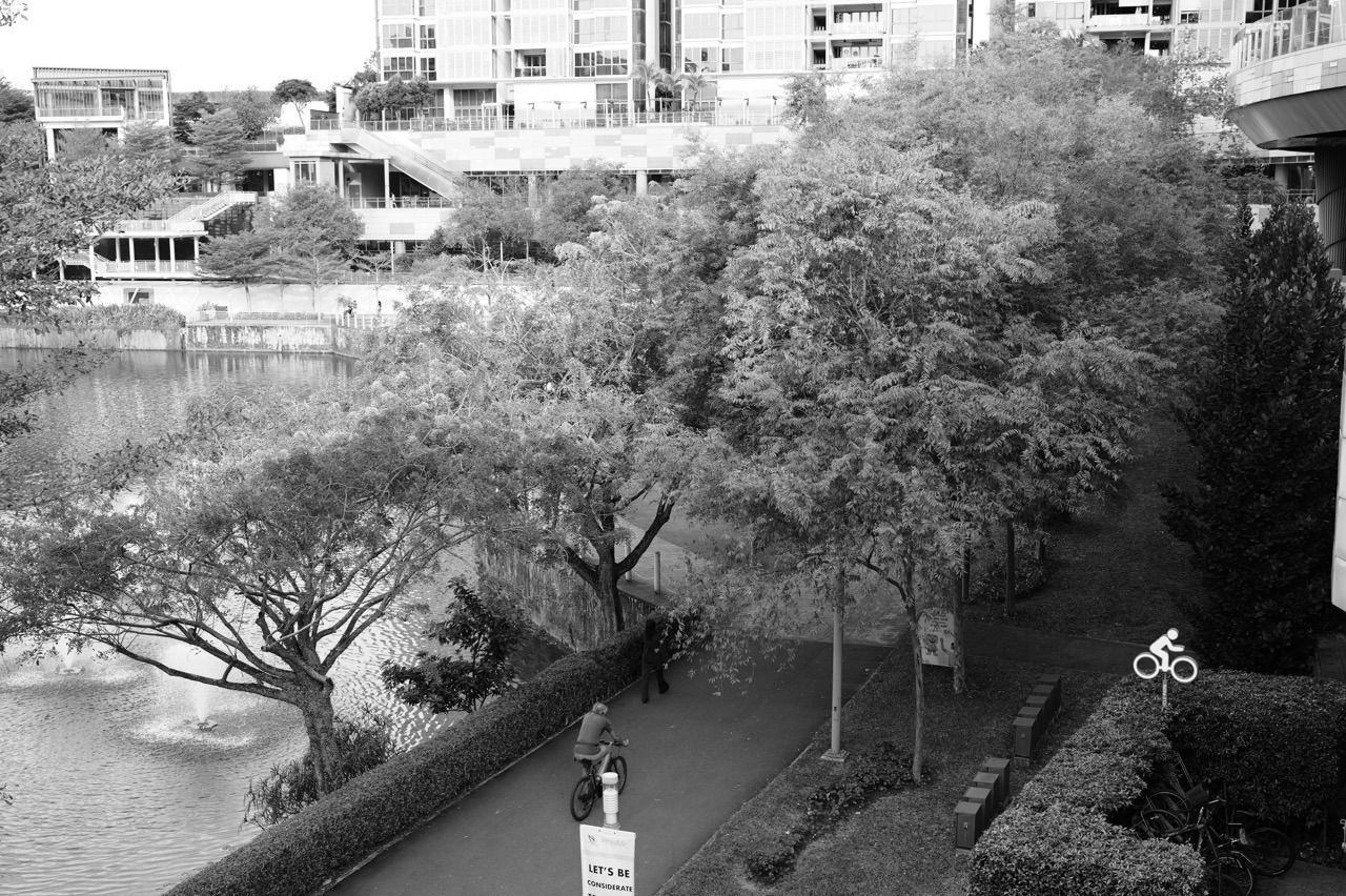
Punggol is a useful reminder that residents and visitors can value a waterfront differently, but no local observation should be treated as proof of a destination’s overall tourism economy. The tutor uses proper case-study evidence when the question requires a named destination. Local examples can spark discussion; verified cases support formal answers.
A good evaluation considers both the intended effect and the conditions limiting it. A tourism-management strategy might reduce particular pressures, but its success could depend on visitor behaviour, enforcement, local capacity and economic incentives. The student learns to identify a specific mechanism rather than write a generic “advantages and disadvantages” essay.
Tectonic hazards: explaining risk rather than drawing one dramatic volcano
Tectonic questions often separate confident readers from students who rely on spectacular imagery. Earthquakes and volcanic eruptions emerge from physical processes associated with plate tectonics. However, the risk of disaster loss is shaped by more than the magnitude or physical characteristics of a hazard. Exposure and vulnerability of communities and infrastructure also matter.
In an illustrative comparison, two places experience similar shaking but have different building quality, population exposure and emergency preparedness. The consequences can differ substantially. A student who uses only the strength of the earthquake as the explanation misses the human geography of disaster risk. The tutor shows how physical and human conditions interact.
Singapore lies away from most major tectonic hazard zones but may still be affected by regional events and related disruptions. The precise syllabus treatment should be checked against official requirements. A Geography tutor should avoid suggesting that every nearby earthquake produces a particular impact in Punggol or that local risk can be inferred from dramatic online videos.
Students study strategies such as land-use planning, building design, monitoring and warning, preparedness and coordinated response where relevant. The point is not to memorise a catalogue. For each strategy, they should identify which part of risk it may reduce, what resources it requires and under what conditions it might be less effective.
Worked example: same hazard, different vulnerability
Imagine a fictional comparison. Community A has more people living in buildings designed to withstand shaking and practises emergency drills. Community B has many poorly constructed buildings and limited access to emergency support. A student explains why an earthquake of similar characteristics could cause greater harm in B. The answer links vulnerability and preparedness to possible consequences without claiming an exact number of casualties.
Now the tutor asks a tougher question: does better building design eliminate risk? It may reduce some structural vulnerabilities but cannot guarantee safety under all conditions or address every secondary hazard. The student is learning evaluation, not cynicism. A geographical strategy should be judged by what it can realistically change.
Thinking across scales: Punggol, Singapore, Southeast Asia and the world
Secondary 3 students are expected to reason across places and scales with more flexibility. A decision made by one neighbourhood authority can matter locally, while the processes shaping that decision may involve regional supply chains or global environmental change. A place can be simultaneously connected to other places and distinctive in its own conditions.
A tutor might ask how a global tourism trend could affect the kinds of visitors arriving in a particular destination, or how a regional tectonic event could disrupt transport beyond the immediate hazard zone. The student separates the global driver, regional connection and local effect. This prevents explanations that leap from a large trend straight to one household without describing the intermediate mechanism.
At a different temporal scale, a daily weather event and a multi-decade climate trend operate over different periods. The student should habitually name both where and when an observation applies. Mature Geography answers respect scale rather than treating all evidence as universal.
Map, photograph and graph skills do not disappear in upper secondary
Students sometimes focus so intensely on new case studies that they neglect basic source work. Yet the marks may depend on reading an unfamiliar map, finding a trend in a graph, comparing proportions or interpreting a photograph. The tutor therefore keeps short source-retrieval drills running throughout the year.
A graph question should begin with the variable, units, interval and comparison. If two countries have different population sizes, absolute totals may be less informative than rates for some questions. If two datasets cover different years, a child must notice before calculating change. An elegant written paragraph cannot rescue a conclusion built on misread evidence.
Map-reading tasks may involve location, distribution, clustering, direction, distance or association. The tutor distinguishes a spatial pattern that can be described from a causal explanation that requires additional knowledge. A map can show where events occurred; it does not automatically prove why they occurred.
Photographs require the same caution. A visible building or landscape feature is observable; a claim about economic impact, temperature or residents’ opinions may require other information. Teaching these boundaries saves students from the common habit of inventing evidence to sound decisive.
Interpreting new data: make the calculation answer the Geography question
Suppose a fictional source reports annual visitors to two destinations, one as a raw total and another as arrivals per resident. The numbers cannot be directly compared as though they measure the same thing. The tutor teaches a student to standardise where appropriate and to explain what each indicator captures.
A percentage change is equally easy to misuse. If a value rises from 40 to 50 units, the absolute increase is 10 and the percentage increase relative to the starting value is 25%. A child who says “it rose by 10%” has confused the absolute difference with a rate. The calculation matters because it changes the scale of the geographical conclusion.
Now introduce uncertainty. Are the counts estimates? Are they collected at regular intervals? Does the source describe all visitors or a sample? A good student does not have to dismiss the data; they have to know which conclusions it can reasonably support. Strong data literacy is what allows case studies to become analysis rather than decoration.
Case studies: remember the mechanism, then the distinctive place evidence
The biggest upper-secondary memory trap is treating a case study as a block of prose to be repeated verbatim. A tutor can reorganise each case as five linked questions: What is the geographical issue? Why does it arise here? Who or what is affected? What actions were taken? What evidence helps us judge the result?
This method encourages active recall. Students learn core mechanisms first, then retrieve a small set of trustworthy details—locations, dated events, features or quantitative evidence when required—supporting the mechanism. Specific evidence is valuable, but invented numbers are worse than a clearly explained point with properly sourced facts.
Different cases should never be silently fused. For example, a policy from one city cannot be presented as though it was used in another merely because both faced a similar challenge. The tutor asks students to attach every key detail to its place, date and context. That discipline is especially helpful when revision files grow.
A learner can practise transferring by comparing two hypothetical destinations. The process might be similar while vulnerability, management or stakeholder interests differ. If the student can predict how those conditions alter consequences, they are learning Geography rather than reciting a guidebook.
A practical case-study bank that is small enough to retrieve
Rather than collecting twenty pages for every example, a student can build a compact case card with a title, location, issue, mechanism, evidence, response and limitation. A diagram of the causal relationship often belongs beside the card. For longer cases, link two or three cards to a common concept rather than memorising them as unrelated essays.
In revision, cover the completed card and reconstruct it from a prompt. Check against the reliable source, mark only the missing facts and try again a few days later. The tutor should prioritise the concepts and examples prescribed for the student’s syllabus, not an ever-expanding internet scrapbook.
A useful transfer challenge asks, “Which two details would you choose for this exact question, and why?” The child learns the difference between possessing information and selecting evidence. This also improves exam timing because irrelevant case facts no longer occupy the answer.
Geographical investigation grows up in Secondary 3
Geographical investigation involves more than completing a fieldwork worksheet. Students must connect an inquiry question with a workable method, obtain suitable information, represent and interpret findings, then evaluate limitations. The tutor helps learners see the whole chain, because weakness at one stage can make the conclusions unreliable.
A question such as “Are all public spaces in Punggol environmentally sustainable?” is too broad to answer through a short student investigation. A more focused classroom prompt might ask how shade cover varies between teacher-selected observation points. Students define shade cover, choose an observation method, control the time of day where relevant and recognise that changing sun position could affect comparisons.
Actual observations must follow school instructions, safeguarding rules and relevant permissions. Mock datasets are useful for learning methods without collecting information from members of the public. Students should avoid recording identifiable people or making environmental claims about named locations without verified measurements.
The tutor can strengthen evaluation by asking for a meaningful limitation, not a ritual line saying “not enough time”. Does the observation period miss busy intervals? Does the instrument measure the intended variable? Would a different sampling approach improve representation? A useful limitation should explain how it could affect the conclusion.
The structured-answer method: content selected by the question
A strong Geography answer begins with the exact task. Students underline the command word, identify the process or strategy, circle any place or timeframe restriction and note whether source evidence is required. Only then do they choose knowledge. This short planning move can prevent a great deal of irrelevant writing.
For an explain question, the student needs a geographical mechanism. A cause is linked through intermediate processes to an outcome. For an assess question, the student needs criteria and a judgement supported by evidence. For a compare question, the two items should be examined on the same dimensions.
The tutor might give a prompt about two risk-management strategies. One student writes a long list of advantages. Another explains what each strategy changes, compares their reach and feasibility under the specified conditions and concludes which is more suitable for the stated risk. The second approach answers the decision the question requires.
Students are not forced into one rigid acronym. They are trained to inspect the meaning of the task. A paragraph frame may help at first, but it must eventually give way to independent selection and flexible writing.
Worked example: upgrade an incomplete paragraph
Suppose the question asks why an early-warning system may reduce some disaster losses. A weak answer states, “It warns people and protects them.” A developed answer explains that timely warnings may give exposed communities time to evacuate or take protective action when they have access to the message and an effective response plan, potentially reducing casualties or losses.
A further evaluation notes that a warning alone cannot guarantee safety, particularly when there is little lead time, communication fails or resources for evacuation are limited. Each sentence performs a different job: mechanism, conditions and limitation. This is precisely why length without structure does not ensure marks.
The tutor changes the scenario and asks the student to rebuild the logic independently. A memorised sentence may survive one question; a reasoned mechanism can survive many.
How to teach evaluation without empty ‘on the other hand’ paragraphs
Evaluation is not the act of writing one positive paragraph and one negative paragraph regardless of relevance. It involves a reasoned judgement against meaningful criteria. Before answering, students should ask what the measure is meant to achieve, for whom, at what scale, over what timeframe and using which resources.
Take an imagined proposal to limit visitor numbers at a protected destination. Such a measure might reduce certain environmental pressures. Its wider effect could depend on enforcement, visitor distribution, livelihood reliance and available alternatives. The student needs to weigh these conditions against the stated goal rather than write “good for nature but bad for money” and stop.
A tutor can ask learners to rate the relevance of three pieces of evidence to the same evaluation question. One might be directly about the site and timeframe; another might be a global trend; a third an unsupported opinion. Discussing the ranking helps students learn why some facts do more work than others.
Getting the first assessment under control
Secondary 3 students often feel they have enough time during revision and not enough time during assessment. Part of the problem is spending several minutes deciding which facts belong to an answer. The tutor can practise brief planning under a reasonable time limit, then compare plans before full writing begins.
A useful routine is: read the entire question, interpret the command, select a small number of relevant points, check the source and build the explanation. Time spent planning should be proportionate to the mark allocation and complexity. The student should not write a mini-essay for a task that simply asks for a value from a graph.
After a timed task, feedback distinguishes a knowledge gap from a speed problem. A child who knows the process but spends too long producing decorative introductions needs practice in economy. A child who responds quickly with unsupported assertions needs a different kind of correction. Timing is a symptom; diagnosing the cause matters.
Inside a realistic Secondary 3 Punggol Geography tutorial
Imagine an illustrative small-group lesson of about ninety minutes. The tutor begins with targeted retrieval: a causal chain from last week, one source question and a case detail. Students then review an error from a recent school assignment. The focus is deliberately narrow so the teaching can go deep.
The main work presents an unfamiliar source set: perhaps a map, a short passage and a graph about a geographical issue. Each learner identifies the task, selects evidence and drafts an explanation. The tutor questions assumptions, models any missing first principle and asks for an improved second attempt.
The class then compares how a changed condition affects the answer. If the exposed population differs, does the risk analysis change? If management resources are limited, is the preferred strategy still suitable? The tutor checks whether the child can reason beyond the exact worked example.
The session closes with a short independent exit task and a home prescription: one case recall, one unfamiliar data question and one improved structured response. A lesson is successful when the child can say which thinking move they repaired and demonstrate it without prompting.
The Secondary 3 revision system that protects Secondary 4
A sustainable year-long plan does not leave every chapter untouched until the next major test. Students should cycle through retrieval of ideas, application to fresh sources, correction of precise errors and cumulative mixing of topics. Short, spaced practice can reveal forgotten mechanisms early.
One folder can contain case cards; another holds source tasks. A third, much smaller log records recurring errors such as missing units, confusing impacts with responses or making unsupported evaluation claims. These are different resources with different jobs. Combining them into a single giant notebook makes revision look impressive but can make retrieval less efficient.
As the year progresses, students should be able to attempt mixed questions without being told which chapter is being tested. That is the real preparation for Secondary 4: recognising the applicable idea from the question, not waiting for a worksheet heading to supply it.
The mistakes that distinguish a content gap from a thinking gap
- Case dumping: writing an entire memorised example rather than the two facts needed to support the question.
- Process skipping: naming a cause and jumping straight to the outcome without explaining what happens between them.
- Vague evaluation: calling a strategy “effective” without criteria, conditions or evidence.
- Source mismatch: using an argument about a different place, period or group from the one specified.
- Concept confusion: mixing hazard intensity with risk, or adaptation with mitigation, without checking definitions.
- Overwriting: using scarce examination time on unrequested background detail instead of completing the required explanation.
An error log should be diagnostic, not punitive. Each entry records a real first-attempt sentence, identifies the missing reasoning and creates one short transfer exercise. If the student can repair the same mistake under a changed task, the tutor can move on. If not, the first principle needs another explanation.
Parents may see fewer worksheets after teaching becomes more targeted. The meaningful question is whether their child can now solve a fresh version of the problem. More pages are not automatically more progress.
What parents in Punggol can do without becoming the Geography examiner
Ask the student one friendly question about their current issue: “What is the process?” or “What evidence supports this?” or “Would this answer still work in a different place?” Do not demand that the child reproduce an entire model essay at the dinner table. The purpose is to practise explaining, not to make Geography an interrogation.
You can also help protect a manageable weekly schedule. Secondary 3 often brings demanding subject combinations, CCAs and growing independence. An effective Geography revision routine may involve brief case-card recall on one day, source interpretation on another and one improved explanation later in the week.
If your child says, “I studied for hours but nothing came out,” look at what those hours contained. Rereading a highlighted file feels familiar; retrieving ideas from memory and applying them to a changed question provides stronger evidence of readiness. The tutor should help the child make this distinction kindly but clearly.
How to tell whether a Secondary 3 tutor is making progress
Look for improvement in four observable behaviours. First, the student can tell you which syllabus and question type they are preparing for. Second, they can explain relevant geographical processes accurately. Third, they can use sources and case evidence rather than merely decorate answers with examples. Fourth, they can judge a strategy with stated criteria and limitations.
Compare first-attempt answers from different weeks under similar conditions. Has the student stopped confusing command words? Are their causal chains clearer? Do they recognise irrelevant facts and leave them out? Can they complete a new source task without hints? These changes are more durable indicators than a polished practice answer produced alongside the tutor.
The best next step sometimes is a deeper concept lesson; sometimes it is a small retrieval plan; sometimes it is a time-management adjustment. A responsible tutor changes the plan according to evidence, not according to a fixed number of worksheets per month.
Helpful eduKate routes and official references
For the broader senior-secondary method, read The Core Aim of Punggol Geography Tuition: O-Level Geography Exam Preparation and Structured Answers. To practise getting the correct information from an unfamiliar source, see Geographical Data Interpretation and Evidence.
For the fieldwork route, use Geographical Investigation and Fieldwork Skills. The official 2027 SEAB G3 SEC list and 2026 SEAB O-Level list help families distinguish examination cohorts and syllabus references.
The guiding eduKate teaching principle—diagnose the first weak link, rebuild the reasoning, test it on a changed problem and confirm independence—also appears in the eduKateSG small-group tutorial benchmark. Here the principle is adapted to geographical systems, cases and evaluation rather than Mathematics content.
Next in the four-year Geography progression: move to What Happens in Secondary 4 Punggol Geography Tuition, which develops syllabus-aligned O-Level and SEC revision, unfamiliar sources, evaluation and timed examination practice. Read it when the current year’s foundations are secure, not as a race to finish the syllabus.
Secondary 3 Geography tuition in Punggol: parents’ frequently asked questions
Is Pure Geography automatically harder than Elective Geography?
The standalone and Humanities-combination courses differ in scope and assessment demands; the more useful comparison is between your child’s actual syllabus, workload, interests and subject combination. “Pure” should not be used as a substitute for checking the official requirements. A tutor must plan for the subject the student is actually studying.
Do Secondary 3 students need to memorise every case-study number?
No sensible learner should invent details, but neither should every statistic receive equal attention. Prioritise reliable place evidence relevant to the prescribed issue and question types. Students need the mechanism first, then a concise set of accurate case details that can be retrieved and used appropriately.
How does O-Level preparation differ from 2027 SEC preparation?
The examination framework depends on the cohort. The 2026 O-Level school-candidate syllabuses and the 2027 SEC G2/G3 syllabuses are published separately by SEAB. Confirm the specific syllabus, level and subject code for your learner before selecting papers or planning revision.
Will weekly tests improve Geography grades?
Testing helps when tasks reveal what the student can retrieve and apply independently and when mistakes produce targeted feedback. Repeating the same test format without explaining errors may only train recognition. Mix familiar retrieval with unfamiliar sources and changed conditions.
What if my child likes Geography but writes slowly?
First identify what slows them: retrieving knowledge, decoding the question, planning, constructing English sentences or physical writing speed. Each has a different remedy. Timed practice is useful only after the underlying issue is understood.
What if my child is good at essay writing but weak in source questions?
Treat evidence interpretation as a distinct skill. Drill reading axes and units, locating patterns, distinguishing observation from explanation and using the precise data supplied. Fluency with prose does not automatically establish accuracy with maps and graphs.
Can Geography help with future careers?
Geographical reasoning can support interests in environmental management, planning, sustainability, data analysis, logistics, policy, research and many other fields. Secondary 3 need not decide a career now; a stronger immediate goal is developing an accurate, adaptable way to understand systems and human choices.
What is the ideal position by the end of Secondary 3?
The student understands the correct syllabus, has coherent case and concept notes, can interpret unfamiliar sources, selects relevant content, builds causal explanations and makes evidence-based evaluations. They should be ready for cumulative mixed practice in Secondary 4 without needing to relearn every foundational habit.
The outcome that matters before Secondary 4
A strong Secondary 3 learner does not greet every new Geography question with “Which essay should I copy from my memory?” Instead, they recognise the issue, check the source, identify the mechanism, choose relevant case evidence and build an answer that fits the command. That is a quiet form of academic confidence, and it is earned through careful practice.
Good Punggol Geography tuition should help students reach that point while keeping their curiosity about places and people alive. The next year will demand more efficient retrieval and examination execution, but Secondary 3 is where the thinking becomes stable enough to carry that weight.


