
A parent searching for Geography tuition in Punggol, Geography fieldwork tuition, Secondary Geography project help or O-Level Geographical Investigation support may be surprised by the student’s complaint: ‘I know the topic, but I don’t know how to investigate it.’ Reading about a town is one thing. Forming a geographical question, collecting observations fairly, organising them and deciding what they actually show is a different kind of thinking.
The core aim of Punggol Geography tuition for Geographical Investigation and fieldwork skills is to help students turn curiosity into a credible, manageable inquiry. They should be able to identify a geographical issue, frame a question that can be answered, choose appropriate methods, collect and record evidence safely, evaluate limitations and communicate a conclusion that stays faithful to the data. Those habits matter in lower secondary inquiry and upper secondary Geography where geographical methods and evidence-based reasoning are essential.
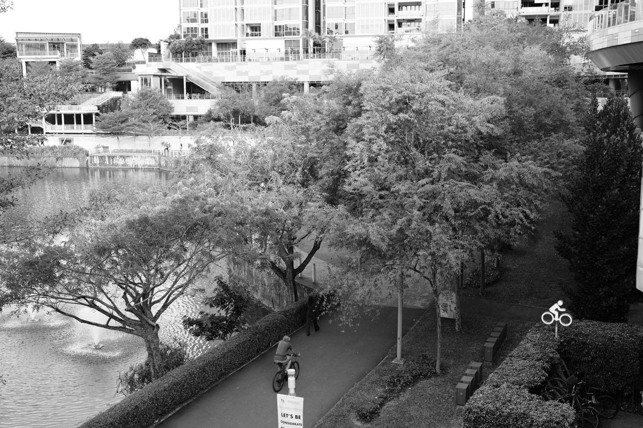
Punggol supplies a friendly setting for exploring this process. A student might notice that one walkway seems shadier than another, that different public spaces attract different activities or that the appearance of a neighbourhood changes across the day. But good Geography does not begin with declaring the answer. It begins by asking what would need to be measured, observed or compared to find out.
The Core Aim: Make an Investigation Answerable
‘Is Punggol a good place to live?’ sounds interesting but is too broad for a small school investigation. It includes housing, accessibility, schools, safety, public spaces, affordability and many different people’s needs. A student would struggle to decide what data to collect or when the investigation was complete.
‘How does the availability of shade differ along two selected public walking routes during a specified observation period?’ is narrower. It has a phenomenon, a place, a comparison and a possible observation method. The question still needs careful definitions, but a learner can imagine what evidence would help answer it.
Good tuition teaches that narrowing a question is not a failure of curiosity. It is the act that makes curiosity testable. A manageable investigation permits clear choices, more consistent data and a conclusion that means something.
Parents can recognise progress when their child stops announcing grand topics and begins proposing researchable questions. The pupil is learning to treat the world as something that can be examined rather than merely described.
Geography Inquiry Is More Than a School Excursion
Fieldwork may involve walking outdoors, but the outdoor element is not its defining purpose. A class can spend hours outside taking photographs and collecting facts without developing a meaningful inquiry. What makes it geographical investigation is the relationship between a question, a method, evidence and a justified conclusion.
An investigation may include primary observations, secondary datasets, published maps, questionnaires, photographs, systematic counts or measurements. Different questions require different methods. Counting pedestrians does not directly measure satisfaction with a public space; asking for opinions does not directly measure air temperature.
The inquiry process is both practical and intellectual. Students decide what to record, how to record it, why the method fits the question and what its limitations are. Then they analyse patterns and test whether the evidence supports their original idea.
This is particularly important when a student has become used to model answers. In an investigation, there may be an unexpected result, missing observation or conflicting piece of evidence. The right response is not to force the figures into a textbook story. It is to reconsider the question or explanation.
The First Decision: What Exactly Is the Question?
A useful enquiry question names the subject, location and kind of comparison. ‘Do people like parks?’ does not identify the population or what counts as liking a park. ‘What activities are visible at two selected public spaces at comparable times?’ is much easier to investigate through non-intrusive observation.
A good tutor can guide the student through four questions: What are we trying to understand? Where will we investigate? What evidence would count as an answer? What would make the conclusion uncertain? If the student cannot answer these, the research question probably needs refinement.
It also helps to distinguish descriptive, explanatory and evaluative questions. A descriptive question asks what patterns exist. An explanatory one investigates possible reasons. An evaluative one weighs the effectiveness of a measure or competing choices. Each level requires its own evidence.
For a first investigation, description may be enough. Once a learner can collect consistent observations, the tutor can introduce cautious explanation and evaluation. Building the ladder in order is far better than demanding a complicated judgement from unreliable data.
Hypotheses Are Ideas to Test, Not Answers to Protect
Some assignments use a hypothesis: a statement proposed before data collection. A hypothesis might be that a route with more tree cover will offer more shaded sections at a chosen time. It can guide the investigation, but its purpose is to be tested.
Students sometimes feel that the hypothesis must be proven for the project to succeed. That is a misunderstanding. A well-conducted investigation can reveal that the proposed relationship is weak, inconsistent or unsupported. This is a useful result if the data were collected carefully and the conclusion is accurate.
Good tuition therefore teaches honest language. ‘The observations support the hypothesis within the sampled locations’ is different from ‘The hypothesis is always true everywhere’. And ‘The results did not show a clear difference’ can be an excellent conclusion when the evidence justifies it.
A strong learner knows how to respond to a surprising finding: check the method, look for error, consider alternative explanations and report the uncertainty. This is the opposite of simply writing what the adult expected to hear.
Choosing a Study Site Responsibly
The best fieldwork location is not necessarily the most dramatic landscape. A nearby public path, accessible park edge or familiar open space can provide enough variation for a carefully designed school inquiry. The location should be relevant to the question and practical to observe safely.
Punggol offers visible interactions between homes, public space, transport and water. Yet the student should avoid assuming that every waterfront, construction area or wetland route is open for unrestricted access. Public guidance, school instructions and current site conditions take priority. Never enter closed, unsafe or environmentally sensitive areas for an assignment.
Accessibility matters for data quality too. If one location requires a long walk in unsafe weather, students may collect fewer observations there and mistake the unequal effort for a geographical difference. A good research plan accounts for travel, supervision, rest, weather and time limits.
For a home practice activity, use a safe public location and non-invasive observations. Formal school fieldwork should follow the school’s directions, permissions and risk assessment.
Methods Must Match the Question
A student studying perceived convenience may use an appropriately designed questionnaire or interview with proper permissions. A student studying pedestrian flow may need systematic counts at specified points. A student studying shade availability may use an observational checklist based on clearly defined sections of a route. A student studying temperature differences would need suitable instruments and careful measurement controls.
The method should explain why it is likely to produce evidence relevant to the question. ‘Because my friends did it’ is not enough. The student should also consider whether the method could produce misleading results.
Suppose a pupil wants to know why people visit a public space. Observing where people walk can show movement but does not establish their reasons. A survey might ask about reasons, yet it introduces sampling and question-design issues. Often two complementary kinds of evidence can build a richer, though still limited, picture.
A tutor should encourage method choice as a reasoning task. Instead of handing out a generic questionnaire template, ask the student to defend each question and explain which part of the inquiry it serves.
Observation Checklists: Small Definitions Make Big Differences
Observations are useful when different observers would record broadly the same event in the same category. If students are counting ‘active users’, what counts as active? Walking? Jogging? Cycling? Standing and stretching? Without a working definition, data collected by two students may not be comparable.
A checklist should use clear, mutually understandable categories. It should distinguish what can be seen from what is inferred. Observing a person waiting near a bench does not prove they are dissatisfied or that the waiting area is poorly designed.
Time intervals must be fixed. If the first location is observed for fifteen minutes and the second for five, raw counts are not directly comparable. Students can sometimes calculate rates per unit time, but it is often better to design consistent observation periods from the start.
An effective lesson asks students to pilot the checklist briefly and discuss disagreements. That small trial can prevent a much larger problem later when the group discovers that its data have been recorded in incompatible ways.
Sampling: Who or What Did We Actually Study?
Sampling means selecting a subset of possible observations. A student might count users at two locations rather than every location in Punggol. That is often necessary and entirely reasonable, provided the conclusion remains tied to the sample.
Convenience sampling is easy but may be biased. A group surveying only friends after school will hear from a narrow group, not from every possible user of the public space. Systematic observation across pre-planned time slots may improve coverage, but even a structured sample can omit weekdays, weather conditions or age groups.
Students should learn to state who or what was included and who or what was not. This is not a ceremonial limitation paragraph added at the end of a report. It shapes what the results can legitimately mean.
For schools using formal geographical inquiry assessment, the exact method expectations should be checked against current teacher guidance. This article teaches the underlying judgement rather than prescribing one mandatory sampling scheme.
Questionnaire Design Is Also a Geography Skill
A good questionnaire gathers data that answer the inquiry question while respecting the person responding. Questions should be clear, relevant, not leading and easy to interpret. ‘Don’t you agree this path is badly designed?’ pressures respondents toward a view. A neutral question about perceived ease of movement would be more appropriate.
Avoid asking several things at once. ‘Is the park convenient, beautiful and safe?’ contains three separate ideas; a single answer cannot reveal which one the respondent means. Use wording and response options appropriate to the participants and school requirements.
Students should also consider privacy. Do not collect names, contact details, photographs identifying people or sensitive personal information unless it is genuinely required, authorised and handled appropriately. A school project often needs far less personal data than students imagine.
Permission and consent matter. Young learners should not approach strangers independently for interviews without suitable school or adult guidance. A thoughtful geographical investigator values the rights and comfort of participants as much as the eventual chart.
Designing a Fair Comparison
Suppose two paths are being compared for shade. If one is observed at 9 a.m. and another at 2 p.m., the difference may reflect the sun’s position rather than the routes alone. If one is observed on a cloudy day and the other under clear skies, weather becomes another possible influence.
The lesson is not that every fieldwork comparison can be perfectly controlled. Real environments are complex. The lesson is to make relevant conditions visible and collect data as consistently as possible.
Students can write a brief comparison plan: same measurement definition, comparable time, comparable duration, consistent route length and notes on exceptional conditions. If full comparability cannot be achieved, the limitation should be reported honestly.
In tuition, use a small scenario exercise. Present two badly matched observation schedules and ask the student to redesign them. The answer reveals whether the learner understands fairness in method more effectively than reciting the word ‘bias’.
A Worked Punggol Fieldwork Example: Shade Along a Walking Route
Imagine a hypothetical learning investigation, not a report of actual measured conditions. The question is: ‘How does visible shade availability compare along two selected public routes during a specified time?’ Students divide each route into equal-length sections and record whether substantial shade is present at the observation time using a definition agreed in advance.
Before setting out, the group sketches or obtains a suitable map and identifies safe observation points. They choose comparable times and record date, weather and route sections. A pilot test checks whether everyone understands ‘substantial shade’ the same way.
During data collection, students mark the sections and note unusual conditions, such as temporary obstructions or cloud cover. They avoid blocking paths and do not photograph identifiable people unnecessarily. The exercise should be stopped or rescheduled if heat, storms or other conditions make it unsuitable.
Back indoors, they calculate the proportion of sections recorded as shaded on each route. A graph may reveal a difference. The class then asks whether trees, built structures, time of day or measurement choices could have influenced the result.
The conclusion must remain modest. The group may say what was observed on those routes at those times. It cannot automatically claim which path is cooler in all weather or which route every resident prefers. That restraint is part of the achievement.
A Second Worked Example: Public Space and Activity Patterns
Another hypothetical inquiry examines how visible activity types vary between two accessible public spaces at matched observation times. The students define categories such as walking, cycling, sitting and group exercise. They decide how to avoid double-counting and how long each observation will last.
A data sheet records the place, date, time, conditions and count for each category. Students should not infer participants’ ages, income, occupation or motivations from appearance. If these variables are not measured, they do not belong in the findings.
The analysis may compare the relative mix of activities. Perhaps one site appears to have more movement while the other has more stationary activity during the recorded period. The next question is whether path design, nearby facilities, shade or timing might help explain the difference.
None of the proposed explanations is automatically proven by counts alone. The group could consider photographs of spatial features, a map or a separate authorised questionnaire to investigate alternatives. A well-scoped investigation is a chain of reasonable decisions rather than a collection of impressive-looking charts.
Recording Data So Someone Else Can Check It
Good field notes are not polished essays. They are reliable records of what happened. Every sheet should identify the observation site, date, time, variable, unit, method and recorder as appropriate. Corrections should be transparent; missing values should not be silently filled with invented numbers.
This is a powerful learning opportunity. Students can compare two records and discover how difficult interpretation becomes when a column lacks units or an observation point is unnamed. Suddenly careful notation stops looking like teacher fussiness and begins looking like an essential research tool.
Photographs and sketches may complement written notes. Captions should identify what the image illustrates, not claim more than it proves. Students should keep the original order and context of observations so that later analysis does not distort them.
Digital spreadsheets can help organise results, but they do not repair a badly defined category or biased sample. A neat bar chart produced from unclear observations is still uncertain evidence.
From Raw Observation to Pattern
Raw data become useful when organised in a way that answers the question. Counts may be summarised in a table, compared through a bar chart or placed on a simple map. Observations of shade along a route might be displayed as sections rather than a single average, allowing the reader to see variation.
Students should choose a representation suited to the question. A line graph may be useful for change over time. A bar chart can compare categories. A map can reveal spatial distribution. Different representations can highlight different aspects of the same data.
Teach learners to describe the principal pattern with numbers or clear observations, then note exceptions. If the data are sparse, the conclusion should remain narrow. If two points differ only slightly, the student should not exaggerate that difference for dramatic effect.
This links geographical investigation to Geographical Data Interpretation and Evidence, the companion tuition guide devoted to reading charts, values and claims accurately.
Primary and Secondary Data Play Different Roles
Primary data are collected for the current investigation. Secondary data come from other sources, such as published maps, agencies, research articles or earlier surveys. Both can be valuable; neither is automatically perfect.
Primary data can closely match the student’s particular question but may be limited in scale and resources. Secondary data can cover broader places or longer periods but may use different definitions, collection methods or dates. Students need to assess suitability rather than assume ‘official’ means directly comparable.
An investigation might combine a short local observation with published information about urban planning or environmental conditions. The learner should identify which conclusion rests on which source and whether the data can fairly be placed together.
Good Geography tuition makes this provenance visible. Every graph and map should have a stated origin. Every important conclusion should point to supporting evidence. This practice benefits ordinary school reports and later independent learning.
Reliability, Validity and Limitations in Plain English
Reliability asks whether a method yields sufficiently consistent results under comparable conditions. Validity asks whether the method actually measures what the investigation claims to measure. Limitations identify what the data or method cannot establish.
A count taken at one location for ten minutes may be recorded very consistently but still fail to represent the whole day’s activity. A questionnaire asking ‘Was your visit enjoyable?’ may measure reported enjoyment but not physical accessibility. These are different weaknesses.
Students sometimes write that data are ‘unreliable because the sample is small’ without explaining how that affects the claim. Encourage precision: a small number of observations may make a general conclusion more uncertain; a single time period cannot reveal daily or seasonal variation; respondents selected from one group may not reflect the wider population.
The strongest evaluation proposes a realistic improvement tied to the weakness. More comparable observation periods, clearer categories, different sites or appropriate follow-up questions can address specific limitations. ‘Collect more data’ is not enough unless the student explains which data and why.
Ethical Fieldwork Is Good Fieldwork
Geography is about people and environments, so a student’s method affects more than marks. A considerate investigator avoids disturbing public users, respects sensitive habitats, obtains required permissions and treats participants with care.
Public spaces are shared spaces. Fieldworkers should not obstruct movement, enter restricted areas or pressure people into responding. Students should never be encouraged to record identifiable information they do not need. Where school policy requires adult supervision or consent, those conditions are part of the task rather than optional extras.
Environmental care also matters. An educational study does not justify harming vegetation, removing wildlife, entering water or moving into unsafe drainage or coastal areas. Many strong investigations use observation and public secondary datasets without touching the environment at all.
Tuition can teach ethics through design choices. Ask, ‘Could we answer this question in a less intrusive way?’ The answer often produces a better investigation as well as a safer one.
The Tutor’s Role: Coach Decisions, Not Manufacture Results
A poor fieldwork shortcut is to provide a sample report and tell the student to imitate its numbers, charts and conclusion. This may look efficient under deadline pressure, but it removes the central learning. The student does not learn why the method was chosen or how to respond to evidence that differs from the example.
A good tutor helps students refine questions, test checklists, organise data, check calculations and evaluate reasoning. The tutor can model an investigation with explicitly fictional data, but submitted school work should use the student’s own authorised observations and properly credited sources in accordance with school rules.
When a student has made a methodological mistake, the goal is to understand the consequence. A badly timed comparison may limit what can be concluded. Sometimes the correct next move is to recollect data if feasible; sometimes it is to write a more cautious conclusion.
That decision-making is valuable. Responsible research does not always produce a neat answer, but it does produce a more trustworthy one.
Building Geographical Investigation Skills Across Secondary School
In the early stages, students benefit from a short, highly structured inquiry with clear definitions and safe observation tasks. The emphasis is on asking an answerable question, recording accurately and describing a pattern.
As learners grow, they can compare methods, consider sampling, use more complex representations, evaluate conflicting evidence and discuss alternative explanations. Stronger students should be challenged to justify design choices rather than simply receive a larger quantity of work.
Upper secondary requirements can differ depending on subject, pathway and examination cohort. The current SEAB school-candidate syllabus information should be consulted alongside school instructions for assessment-specific details. This article describes transferable research habits rather than claiming that every Geography course uses identical fieldwork assessment.
The unifying aim is independence. A student should eventually be able to design a modest inquiry, explain its choices and acknowledge its limits without a tutor deciding everything.
An Illustrative Four-Week Tuition Plan
Week one — Question design. Turn three broad interests into one answerable geographical question. Identify place, population or site, variable, comparison and plausible evidence. Test whether the learner can explain what would count as an answer.
Week two — Method and pilot. Choose a practical, safe method, define categories and test the recording sheet. Compare good and flawed sampling examples. Revise the plan before collecting a larger amount of data.
Week three — Analysis. Use suitably collected or explicitly fictional practice data to produce a clear table, chart or map. Describe patterns and exceptions. Separate observed results from possible explanations.
Week four — Evaluation and communication. Write a concise conclusion, identify meaningful limitations and propose one realistic improvement for each weakness. Present the inquiry to another reader who asks how each conclusion follows from the evidence.
The plan is adaptable. A student preparing a real school project must follow the school timeline, teacher requirements and approval process. A student learning the method for future assessments can practise with safe classroom simulations.
What Parents Should Look for in Completed Work
A good report is traceable. A parent should be able to find the question, method, observation record, analysis and conclusion, and understand the connection between them. Decorative charts alone do not show that the inquiry was sound.
Look for clear definitions. Were variables described? Are time periods and sites named? Is there evidence of a pilot or method check? Do the graphs accurately represent recorded values? Does the student explain limitations in specific terms?
Also look for authorship. Can the child explain the study without reading every line? Can they say why the method was chosen and what they would change next time? If the report is polished but the learner cannot explain any design choice, the adult support may have overtaken the learning.
The most meaningful progress appears when a student can make a reasonable decision at the next unfamiliar step. That is what geographical investigation should build.
Common Investigation Errors and Their Repairs
- Question too broad. Narrow the place, variable, time and comparison until the evidence required becomes clear.
- Method does not match the question. Identify what each instrument, count or question actually measures.
- Unclear categories. Write operational definitions and pilot them with another observer.
- Incomparable conditions. Match observation duration, timing and other relevant conditions as far as practical.
- Unsupported generalisation. Limit the conclusion to the sampled sites, people and times.
- Confusing opinion with observation. Record each separately and use wording suited to the evidence.
- Ignoring ethical issues. Remove unnecessary personal data and follow consent, supervision and access requirements.
- Generic limitations. Explain exactly how a weakness might alter the finding and how a realistic adjustment addresses it.
- Forcing the expected answer. Preserve the observations, reconsider the hypothesis and explain contradictory results.
The useful repair is always visible. A student should be able to show the revised question, checklist, comparison plan or conclusion, not merely say they will ‘be more careful’.
A Mini Inquiry Kit for Punggol Families
Question card: Write one sentence identifying the phenomenon, place and comparison. Underneath, write what a good answer would need to show.
Method card: Name the intended evidence and explain why it answers the question. List the definitions, sampling plan, date and safety conditions.
Record card: Use a small blank table with location, time, unit, observation and notes on unusual conditions. Do not make up values to complete empty rows.
Analysis card: State the main pattern, an exception and one point that requires further evidence. Choose a chart or map only when it communicates the pattern more clearly.
Reflection card: Ask what the evidence supports, what it cannot establish, how the method may have affected results and which improvement would be most useful.
A parent can use these cards during a short discussion even if no outdoor data are collected that day. A simulated dataset, clearly labelled as fictional, is often enough to practise sound inquiry decisions.
Frequently Asked Questions About Geography Fieldwork Tuition
Does Geography fieldwork mean students must travel far?
No. A modest, safe and accessible study site can support meaningful geographical reasoning when the question and method are well designed. A distant location is not automatically educationally superior. Some inquiries can be practised through classroom data and public secondary sources.
Can parents help with a child’s Geographical Investigation?
Yes, with safe transport, discussing questions, checking permissions and prompting the child to explain choices. However, the research decisions, analysis and school-submitted work should remain the student’s own within the school’s rules.
Why do students need to discuss limitations?
Because every method observes only part of the world. Identifying specific limitations prevents overly broad conclusions and shows that the student understands what the evidence can support. A limitation is not necessarily a failure of the project.
Are questionnaires always needed?
No. They are useful for gathering appropriately obtained responses about perceptions or experiences, but many geographical questions are better served by observation, measurements, maps or secondary datasets. The question should determine the method.
Can a student use Google Maps or GIS for investigation?
Digital maps can help define sites, distances, routes and spatial relationships, subject to the accuracy and terms of the data used. They do not eliminate the need for clear questions, suitable methods and thoughtful interpretation.
Is an unexpected result a problem?
Not automatically. If the method was suitable and the observations were recorded honestly, a result that does not support a hypothesis may be scientifically and geographically valuable. The student should explain what the evidence shows and consider plausible reasons.
Should students include photographs of people?
Only when necessary, authorised and appropriate. Many school enquiries can use photographs of physical features without identifiable people. Protect privacy and follow the school’s consent and data-handling rules.
What if rain disrupts fieldwork?
Safety comes first. The group can reschedule, use an approved alternative method or transparently discuss how the change affected the investigation. It is never worth entering unsafe conditions simply to finish a data sheet.
What is the difference between a fieldwork method and a conclusion?
The method explains how evidence was obtained. The conclusion answers the question using the resulting evidence. A detailed method does not compensate for an unsupported conclusion, and an attractive conclusion does not repair a badly defined method.
How can tuition prepare a child for future Geography assessments?
By building portable decisions: frame the question, choose methods, identify bias, evaluate evidence and explain findings. Exact assessment demands should then be matched to the child’s current syllabus and school expectations.
The Learning Route Forward
Map reading helps a student locate and decode geographical representations. Geographical Data Interpretation and Evidence teaches them to describe and explain what sources show. Secondary Geography Map Reading Skills builds the spatial foundations. Geographical investigation brings both skills into an inquiry that the learner must design and evaluate.
The broader Punggol Education and Town-Life Index helps families connect school demands to the realities of local routines. For deeper disciplinary reading on place, environment, scale and spatial evidence, continue into eduKateSG’s How Geography Works library.
The real success of a Geography investigation is not a thick file with beautiful colours. It is a student looking at an ordinary place and knowing what to ask next: ‘What do I want to find out? How could I find out fairly? And what would convince me that my answer is right?’
That question is the beginning of independent geographical thinking.
Next in the Punggol Geography Tuition series: O-Level Geography Exam Preparation and Structured Answers. Follow the next learning target and its parent guide, worked examples, progress checks and practical questions.


