
“Singapore gets so much rain. Why do we still have to worry about water?” It is the sort of sensible question a Secondary 1 child asks when the family is walking beside Punggol Waterway or looking out at a sudden afternoon downpour. Parents searching for Secondary 1 Geography tuition in Punggol, water resources Geography notes, the water cycle or Singapore’s Four National Taps are often looking for more than a textbook definition. They want to know how their child learns to turn that curiosity into an accurate explanation.
In Secondary 1 Punggol Geography tuition, a water-resources lesson connects the natural water cycle to human demand, water supply, management choices and sustainability. The student learns the difference between rainfall and usable water, between a catchment and a tap, and between having a resource and managing it reliably. Good tuition uses labelled diagrams, maps, careful sources and short explanation questions to make those relationships clear before asking the child to memorise Singapore’s supply strategies.
The most interesting part is that water seems ordinary until a learner follows it. Rain falls over different surfaces. Some infiltrates, some evaporates, some moves into waterways and storage. Water is treated and delivered to people, used for many purposes, then managed through a separate used-water system. Each step has geographical and engineering choices behind it. A glass of water at home becomes a small window into an island’s physical environment and its planning.
This is the third set of our Secondary 1–4 Punggol Geography progression, with one distinct learning focus for each school year. This Secondary 1 article examines water as a resource in detail rather than repeating our earlier map-reading and weather foundations or revision notes and study skills. Singapore’s 2021 lower-secondary Geography G2/G3 syllabus identifies water and tropical rainforests as natural-resource topics; check the student’s school sequence and subject arrangements rather than assuming a fixed test week.
Explore the lesson: the core inquiry · water cycle · Four National Taps · worked question · data skills · inside tuition · parent help · FAQs.
The core Geography question: how can water be abundant and scarce at the same time?
Water availability is not one number. A place may receive heavy rainfall but have limited land to capture and store it, high demand, variable rainfall, infrastructure constraints or water of unsuitable quality without treatment. Another place may have significant freshwater but limited access for communities. Students should distinguish physical availability, accessibility, quality, reliability and demand.
Consider two hypothetical locations. One receives substantial rain, yet cannot store enough during drier spells and has growing demand. The other receives less rain but has well-managed storage, treatment and recycling. Which has a more secure supply? Rainfall alone cannot answer. The learner must look at the wider water system.
The tutor makes this distinction visual: one column lists natural inputs such as precipitation; another lists human factors such as storage, treatment, distribution and consumption. The child then explains how a constraint in one part changes the usefulness of water elsewhere. This is the first step beyond “too little rain causes water shortage”.
A good Geography answer also resists exaggeration. Water stress, a temporary supply disruption and unsafe drinking water are related but distinct issues. The tutor identifies what the source actually states and teaches the student to avoid treating them as interchangeable.
Where water resources sit in lower-secondary Geography
In the lower-secondary Geography framework, the resource-management theme asks how societies can use natural resources sustainably. Water provides an accessible way to understand physical processes, human dependence and competing decisions. School programmes may vary in the depth or sequence of teaching, and students at different subject levels may require different scaffolds.
Singapore’s MOE Lower Secondary Geography syllabus is a curriculum reference. The school’s current worksheets, topics and assessment scope determine immediate preparation. A tutor should use the official framework for conceptual accuracy while teaching the task the child will actually face.
Students do not need to solve national infrastructure planning at age thirteen. They do need to ask geographical questions, locate relevant information, explain why some places face constraints and identify how choices alter resource security. Those skills transfer to the subsequent natural-resource and sustainable-city topics.
How a tutor teaches the water cycle without turning it into a label test
The water cycle describes movement and storage of water in the environment. Sunlight provides energy for evaporation and helps drive the cycle. Water vapour condenses into droplets under suitable conditions, leading to cloud formation; precipitation returns water to the surface. Water may infiltrate into soil, move through the ground or travel overland into streams and other water bodies.
Many students can place arrows on a familiar water-cycle picture and still cannot explain why they point in those directions. The tutor gives a blank diagram and asks the learner to narrate a water molecule’s possible route, including where it can remain stored for some time. There is no single guaranteed short path for every drop of water.
A misconception appears when the child says water “disappears” after evaporation. The repair is precise: water changes state and moves into the atmosphere; it has not ceased to exist. Another misconception treats all falling rain as flowing straight into reservoirs. Depending on the surface, some water may infiltrate, evaporate or follow other pathways.
Strong explanations identify processes and conditions. “Rain happens because water evaporates” leaves out condensation and the circumstances necessary for precipitation. A tutor models the missing links and then changes the scenario to a forest, built-up surface or bare field.
Water cycle: the difference between a store and a flow
A store holds water for a period: the atmosphere, soil, groundwater, lakes and oceans are examples at different scales. A flow moves water between stores: precipitation, evaporation, infiltration, surface runoff and river flow. Mixing these two is a common reason diagrams become confusing.
Ask the child to colour stores one way and flows another. Then remove the colours and ask them to rebuild the distinction verbally. In Geography, a correct diagram is valuable because the learner can explain its parts, not because the page looks impressive.
A small extension asks what might change after several days of heavy rain. Soil may become more saturated under relevant conditions, affecting how much additional rain can infiltrate and how much may move over the surface. This introduces a conditional explanation without suggesting every rainy day produces flooding.
Infiltration and runoff: physical processes with local meaning
Punggol’s mixture of greenery, pavements, buildings and waterways provides useful visual reference for thinking about surfaces, though specific drainage performance requires verified measurements. Permeable surfaces can allow water to pass into the ground under suitable conditions. Less permeable paved areas may produce more surface runoff, depending on rainfall, drainage and local design.
The tutor shows two hypothetical ground surfaces under equal rainfall. In one, water can infiltrate through soil; in another, it encounters a largely impermeable surface. The child explains how this difference could affect the amount or speed of runoff. The explanation must remain conditional because ground saturation, slope and drainage also matter.
A weak answer says, “Concrete causes floods.” A stronger one states that impervious surfaces limit infiltration and may increase surface runoff during rainfall, potentially placing more demand on drainage systems. That is a causal chain with qualifications.
Notice the relationship to other school subjects: Science helps explain changes of state, Mathematics helps compare rates and amounts, and Geography asks how the processes vary in real places and interact with people.
What a water catchment is—and what it is not
A water catchment is an area from which water drains toward a common outlet or collection system. Its shape, surface, rainfall and engineered drainage influence how water moves through it. A reservoir is a place where water may be stored; the catchment is the broader contributing area, not simply the visible surface of the reservoir.
Students sometimes mistake a blue line on a map for evidence that all nearby rainwater flows into one reservoir. That is not a safe assumption. A tutor asks them to trace drainage directions only when the relevant map or contour information supports the inference.
Singapore’s local catchment strategy collects rainwater through managed waterways and reservoirs. For the current system and names of water sources, the best reference is PUB’s Singapore Water Story. A learner should distinguish this documented national system from any speculative claims about a particular segment of Punggol Waterway.
A tutor might use a simplified fictional catchment map rather than a real engineering plan. Students can then practice locating land-use differences, measuring area and discussing how storage and water quality considerations affect management.
Water shortage, water security and demand
A water-shortage question may concern insufficient accessible water relative to a need. A water-security question is broader: whether reliable, acceptable-quality water can be provided sustainably for people and the economy. A tutor should help students distinguish supply amount from resilience of the system.
Imagine a location whose usual demand is comfortably met but whose only supply source is vulnerable to drought. It may appear secure in an average week while facing risk during disruption. Compare a system using several sources with different vulnerabilities. Diversification may improve resilience because the same event is less likely to affect every source identically.
Demand also changes with population, economic activity and usage behaviour. Water management therefore includes both supply strategies and demand management. Students should not conclude that new plants are always the answer: conservation, leakage reduction, efficiency and protection of water sources are also relevant.
Singapore’s Four National Taps, explained accurately
Singapore’s water system is an excellent case for learning how engineering, geography and planning connect. PUB identifies water from local catchment, imported water, NEWater and desalinated water as the Four National Taps. They serve different roles in a diversified supply strategy.
| National Tap | What the source means | Concept to learn |
|---|---|---|
| Local catchment water | Rainwater collected through managed waterways and reservoirs, then treated | Catchment management, rainfall variability and storage |
| Imported water | Water obtained from across the border under supply arrangements | Dependence on an external source and supply diversification |
| NEWater | High-grade reclaimed water produced by further treating used water | Water reuse, technology and closing the water loop |
| Desalinated water | Freshwater produced from seawater through treatment | Weather resilience, energy needs and costs |
The tutor should not teach the Four Taps as merely four labels. For each, the learner asks where the source originates, which treatment or infrastructure makes it usable, which constraint it addresses, and what trade-off remains. Only then do the labels become meaningful geographical knowledge.
Local catchment: useful rainfall still needs managed systems
Rainfall becomes a water resource through collection, storage, water-quality management and treatment. Singapore’s urban land is valuable for many purposes; making space work for both living and water collection requires careful design. The lesson is not that rainfall directly enters a household tap untouched.
A good explanation might begin: collecting rainwater through catchment systems helps add to domestic supply, while storage and treatment make the resource more useful. Its reliability still depends on conditions, infrastructure and careful management.
Imported water: geographical connections cross national boundaries
Water is not limited by the map border of the community using it. Imported supply illustrates dependence, agreements and regional resource links. Tutors should use PUB’s up-to-date account instead of guessing current volumes or renegotiation details.
A useful discussion asks what makes dependence on a single source risky and why a country would want a portfolio of sources. The student can reason about resilience without turning a Geography answer into unsupported geopolitical commentary.
NEWater: reuse is not the same as untreated wastewater
NEWater is a high-grade reclaimed-water product created through advanced purification of treated used water. Students should be clear that it is not simply sewage sent directly back to consumers. PUB explains the additional treatment and quality framework on its official pages.
This opens a powerful concept: the water loop. Water supplied to users can enter used-water collection and treatment systems. Reclamation enables some of that water to become a resource again. The student learns how technology changes the effective availability of water without suggesting that recycling requires no energy or infrastructure.
Desalination: why seawater is a resource only after treatment
The ocean contains abundant water, but seawater’s salt content makes it unsuitable for ordinary drinking without treatment. Desalination produces freshwater from seawater and provides a source that is not directly dependent on local rainfall. Yet it requires technology, energy, infrastructure and environmental management.
A stronger geographical answer considers both benefits and trade-offs. “Singapore is surrounded by sea, so it cannot have a water problem” ignores the difference between having water nearby and producing safe, reliably delivered freshwater.
Which National Tap is best? A question worth rewording
Parents may ask which water source is “the best”. A tutor can turn that into a more careful question: best for what objective—resilience during low rainfall, cost, energy efficiency, available land or security of supply? Sources have different advantages and constraints. Singapore’s policy logic is diversification rather than a single winner.
If the prompt asks how NEWater can support water security, a student should describe a mechanism of reuse. If it asks why desalination may face sustainability trade-offs, energy and infrastructure become relevant. If it asks how demand can be reduced, discussing source expansion alone misses the task.
This teaches a general Geography habit that will matter in Secondary 2 housing and Secondary 4 climate action: identify the decision criterion before making the judgement.
Worked Geography question: why doesn’t abundant rain guarantee secure water?
Practice question: A tropical city receives high annual rainfall but has limited land for water storage and rising freshwater demand. Explain why it may still face challenges maintaining a reliable water supply.
Weak response: “There is a lot of rain, but there are too many people.” This identifies one possible pressure but does not explain why rain alone fails to solve the supply problem.
Improved response: “High rainfall does not guarantee a secure water supply because rainwater must be collected, stored, treated and delivered. If the city has limited suitable space for storage while demand increases, rainfall may not be available in adequate usable amounts throughout the year. The city may therefore need water-saving measures or additional sources to improve reliability.”
The important change is not the number of words. The learner has stated the physical input, the infrastructure constraint, the demand pressure and the management consequence. The causal links are visible.
For a transfer question, change the city to one with ample reservoir capacity but highly variable rainfall. Which part of the original explanation still applies, and which must change? The child should preserve the general logic but adapt the specific constraint.
Reading rainfall and water-demand data correctly
Water topics provide ideal practice for Geography data skills. A rainfall graph has a unit, measurement period and location. A consumption table may show litres per person per day, total volume or industrial share. A comparison is only useful when the measures and time frames are understood.
Suppose a fictional class dataset records monthly rainfall of 180 mm, 230 mm and 150 mm. A student can state that the second month has the highest recorded total in this three-month sample. They cannot claim the second month is the wettest month every year or that the city has enough drinking water merely from these three figures.
Next, imagine daily water demand increases from 40 to 50 units in a hypothetical system. The absolute rise is 10 units; the percentage rise relative to the starting value is 25%. The tutor checks that students do not confuse a unit increase with a percentage increase.
A useful source question may combine rainfall and demand but should never automatically claim rainfall caused the observed change in demand. Correlation, seasonality and causation require careful consideration. Geographical data are evidence to interpret, not decorations for a predetermined conclusion.
Water access affects people differently
A water-supply challenge is experienced by people, businesses and ecosystems in different ways. Household needs, agriculture, industry and environmental protection may place different demands on the same resource. Geography asks how these uses can be managed fairly and sustainably.
An effective classroom exercise gives three fictional stakeholders limited water during a disruption. The learner must identify each group’s basic needs, possible conservation measures and which trade-offs arise. It is not a contest to dismiss one stakeholder. It is an exercise in defining criteria and understanding consequences.
Students should avoid treating all people as if they have the same access to infrastructure. Affordability, geographic location and service reliability may matter in different places. A source that describes a national average cannot automatically tell us how every household experiences water provision.
Water conservation: small actions and large systems
Water conservation can include reducing unnecessary use, improving efficiency, fixing leaks and building habits that support long-term resource management. A short classroom project may compare two hypothetical household-use patterns to identify where saving water is possible.
The tutor should not suggest that household behaviour alone solves every infrastructure problem. Demand management is one component of a system that also requires safe treatment, reliable distribution, diversification and environmental care. Mature Geography recognises different scales of action.
For current Singapore public guidance, families can visit PUB’s Water Loop and its water-conservation resources. The official description is more reliable than an unattributed infographic with impressive but unexplained statistics.
How Punggol Waterway can make the lesson memorable
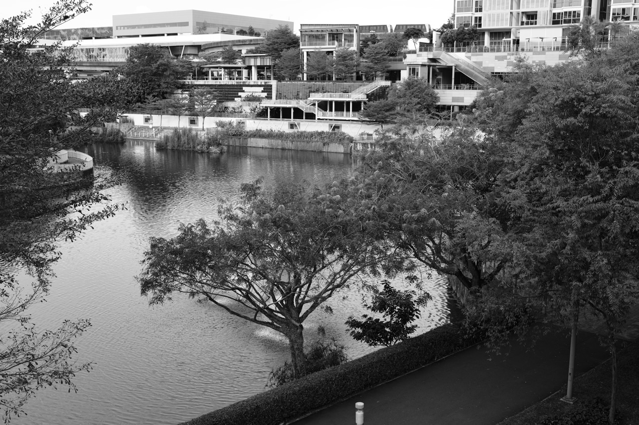
Punggol Waterway is a visible local feature that helps students think about water, bridges, paths, landscape design and human enjoyment of urban space. A tutor can invite children to identify what the photograph actually shows: water, built structures, adjoining land uses and access routes. From there, they can ask what additional information would be needed to explain its wider management.
A photograph cannot establish the drinking-water treatment route, drainage capacity or water-quality status of the feature. Such claims require engineering or agency sources. This distinction is an opportunity to teach disciplined inference: what can we observe, what can we reasonably hypothesise, and what must we verify?
An engaging activity is to compare a Punggol landscape photograph with a carefully chosen public diagram from PUB showing the national water system. The learner should explain why one is a local observation and the other a broader infrastructure representation. Scale is the hidden lesson.
Using maps to explain water resources
A water-resources map may show rivers, reservoirs, catchment boundaries, land use or rain distribution. Students should first identify the map’s purpose and symbols. Next they describe a supported pattern. Only then do they propose explanations informed by terrain, rainfall and relevant infrastructure.
A student who sees several blue areas may say “there is plenty of freshwater for people”. That exceeds what a general land-cover map can prove. The tutor asks whether the blue areas are freshwater reservoirs, coastline, channels or something else, and whether their quality and treatment status are provided.
Map literacy is an essential foundation for later fieldwork and upper-secondary source questions. A careful Secondary 1 tutor spends time teaching the limits of the representation, not only how to locate a feature.
A comparison exercise: two towns, different water strategies
Imagine Town A has reliable rainfall but very little room for reservoirs. Town B has greater storage but longer dry periods. A student first lists the relevant physical differences. Next they consider how demand, recycling, treatment and source diversification could change the vulnerability of each. The final answer should not claim one town will always be more secure.
Students can use a simple comparison matrix with criteria: natural supply, storage, demand, treatment and resilience during disruption. Such matrices are especially useful for learners who write long unordered paragraphs. They force the writer to apply the same dimensions to both places.
After the structured comparison, remove the table. Ask the child to write a short judgement based on the question’s actual criterion. The goal is not permanent dependence on a graphic organiser but a mental habit of comparing like with like.
Seven water-resources mistakes worth correcting early
- Rainfall equals drinking water: collection, treatment, storage and distribution must be considered.
- Water evaporates and vanishes: evaporation is a change of state and movement, not destruction of water.
- A reservoir is the same as a catchment: one stores water while the other is a contributing drainage area.
- NEWater is untreated wastewater: it is a purified reclaimed-water product.
- Seawater is automatically freshwater supply: desalination requires treatment and infrastructure.
- One water source is universally best: effectiveness depends on objectives, constraints and complementary sources.
- A small graph proves a long-term trend: time frame, sample and other evidence must match the claim.
A good error log describes the student’s actual first wrong move and one changed question that verifies the repair. The purpose is not to build a very long list of weaknesses, but to make each misconception less likely to return under unfamiliar wording.
Inside a realistic Secondary 1 water-resources tuition session
An illustrative 90-minute lesson starts with an easy question about the water cycle and a short source-reading check. The tutor asks students to explain where they think the water in a household tap comes from, then separates natural processes from the managed supply system. The aim is to surface assumptions before presenting the Four National Taps.
The main teaching section uses a clear water-cycle diagram and an official PUB overview. Students label flows and stores, trace the Singapore water-supply pathways and compare sources based on their characteristics. They answer a short cause-and-effect question, receive precise feedback and retry a changed prompt.
In a well-run small group, one learner may need help distinguishing infiltration from runoff, another may need to understand why rainwater requires treatment and a third may need to choose the right evidence for an explain question. The tutor should be able to see and respond to each need rather than treating the group as a chorus copying one solution.
The lesson ends with a brief independent task: explain why rainfall alone cannot guarantee secure supply, name a meaningful management strategy, and identify one limitation. A successful exit ticket shows the child can connect the idea without the tutor finishing the sentence.
A weekly practice plan that does not become another mountain of homework
A short routine can use three types of work. First, reconstruct the water-cycle diagram and explain its arrows without notes. Second, read an unfamiliar rainfall or water-demand chart with units. Third, write a concise explanation of one water-management strategy with a limitation.
Parents can ask, “What does the source actually prove?” or “Which step comes between rain falling and water reaching the tap?” These questions do not require advanced Geography knowledge. They invite the learner to trace a causal chain.
The family can also make a modest conservation observation—perhaps noticing when water is used unnecessarily—but it should never be presented as a scientific measure of national demand. If the child wants to investigate household patterns, discuss what an accurate, safe and respectful method would require.
What progress should look like in the student’s own words
The early milestone is conceptual accuracy: the child can explain what evaporation, precipitation and storage mean. The next is system understanding: they can name the Four National Taps and explain why diversifying sources matters. The third is transfer: they can handle a fictional town with different constraints without simply reproducing Singapore’s example.
Compare two independent answers several weeks apart. Look for clearer links, more accurate units, sensible distinctions between observation and inference, and less need for the tutor to prompt. A well-coloured notebook alone cannot prove these improvements.
A learner’s best sign of confidence is often a precise question: “Do we know this from the rainfall graph, or are we assuming it?” That is the beginning of independent geographical reasoning.
How this Secondary 1 foundation leads to Secondary 2
Water resources introduce a larger idea: people depend on environmental systems and make decisions under constraints. In Secondary 2, students can carry that idea into housing, transport and the challenge of developing liveable cities with limited land. The content changes, but the method—define the need, identify resources, examine trade-offs and justify decisions—travels with them.
Students should not be pushed into upper-secondary examination essays because they have just learnt the Four Taps. A stronger next step is to compare two everyday management choices fairly and explain the consequences with appropriate evidence.
Questions to ask before choosing Secondary 1 Geography tuition
Ask how the tutor will identify your child’s first weak link. Will they inspect a marked map or source answer? Will they teach the correct school topic rather than a generic folder? Will they allow the student to explain without prompts? Will they show a changed question after correction?
Also ask how the support fits the actual school programme and the family’s timetable. Short, well-reviewed work can be more valuable than a large weekly worksheet bundle. The most useful teaching agreement is about what independent improvement should look like.
Reliable reading inside and beyond eduKate
For official information on Singapore’s actual system, use PUB’s Singapore Water Story and PUB’s overview of the Four National Taps. For curriculum alignment, consult the MOE Lower Secondary Geography syllabus alongside current school materials.
If the difficulty is source-reading rather than the water concept itself, the focused eduKate guide to geographical data interpretation and evidence provides a useful repair route. To establish the habit of working independently, see our Secondary 1 Geography revision notes and study skills guide.
The immutable teaching-quality reference is eduKateSG’s Clementi small-group tutorial benchmark: diagnose the first wrong move, make principles visible, correct precisely and verify independence. This Geography article borrows the learning discipline, not claims about the location or enrolment conditions of a Mathematics class.
Next in this four-year Geography progression: continue to Secondary 2 Punggol Geography Tuition: Housing, Urban Planning and Sustainable Cities, where students transfer resource-management thinking into choices about limited land, accessibility, different households and the trade-offs of city development.
Secondary 1 Punggol Geography tuition: water-resources FAQs
Is water resources really part of lower-secondary Geography?
Water is one of the natural-resource topics in Singapore’s 2021 lower-secondary G2/G3 Geography framework. The exact teaching sequence and assessment emphasis come from the student’s school, so bring the current topic outline to tuition.
Does my child have to memorise all four National Taps?
The four names are useful knowledge, but an answer is stronger when the student can explain how each source works and why diversification matters. Memorisation should support understanding, not replace it.
Why does the tutor ask about treatment when the question is about rainfall?
Rainfall is a natural input; usable drinking water requires systems that collect, treat, store and distribute it. The tutor is teaching the link between environmental resources and human management. The exact answer should still follow the command and scope of the question.
Can a map of Punggol Waterway explain our drinking-water supply?
A local photograph or map helps illustrate landscape and water-related thinking. It does not by itself establish the waterway’s role in treatment or supply. Use PUB’s official diagrams and descriptions for claims about the national system.
What is the difference between the water cycle and the water loop?
The water cycle describes natural movements and stores of water. The managed water loop describes how people collect, treat, supply, use, reclaim and manage water through infrastructure. The two are connected but not identical.
Is desalination the same as water recycling?
No. Desalination makes freshwater from seawater; NEWater reclaims water through further purification of treated used water. Both require technological systems, but their starting sources and processes differ.
Should Secondary 1 Geography tuition include data questions?
Yes, where appropriate to the school’s learning goals. Basic map and graph interpretation, units, comparisons and evidence-based explanation form a useful foundation. A tutor should adapt their difficulty to the student’s readiness.
How can parents help without becoming Geography teachers?
Ask your child to explain one process and show one source that supports their answer. Keep practice manageable and encourage careful questions. A tutor should handle the detailed academic diagnosis.
What is a good result after several weeks?
The student can explain the water-cycle processes, understand the purpose of Singapore’s diversified sources, interpret new data accurately and answer a changed water-resource question with limited prompting. Those behaviours give better evidence than the number of pages copied.
The quiet achievement: a familiar glass of water becomes a geographical explanation
At the beginning, a child sees a full waterway and thinks Singapore must have more water than it needs. After a good Secondary 1 lesson, the same child asks how the water was collected, which sources support supply, what conditions make a system reliable and how future needs can be managed. The place is still familiar; the thinking has changed.
That is what water-resources Geography tuition should accomplish in Punggol: a student who can see the natural process, understand the human system and explain the connection carefully. The knowledge is useful for school—and the method will travel through every later year of Geography.


