
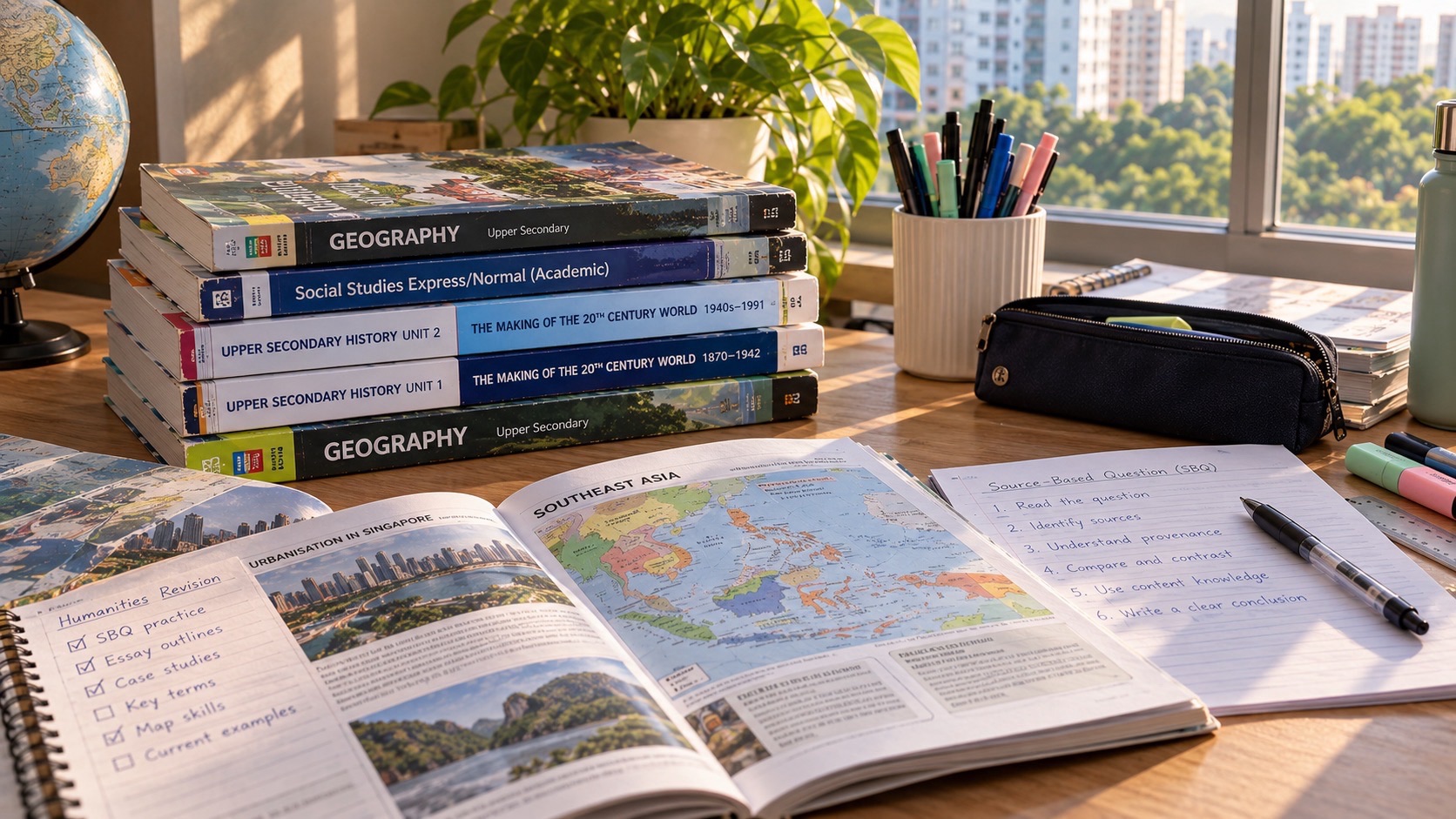
A student opens a Geography textbook to a photograph of a cracked road and writes, “Earthquakes happen when plates collide.” It is a reasonable first attempt, but it cannot explain earthquakes at other plate boundaries, why some communities suffer much greater losses than others, or what can be done before the ground begins to shake. Parents searching for Geography tuition in Punggol, O-Level Geography plate tectonics notes, Sec 3 Geography earthquakes tuition or disaster risk management revision are looking for a way to turn these fragments into a proper understanding.
The core aim of Punggol Geography tuition for plate tectonics, earthquakes and disaster risk is to help students explain Earth’s internal processes, interpret the spatial patterns of tectonic hazards and evaluate how exposure, vulnerability and preparedness shape their consequences. A learner should move from a plate-boundary diagram to a physical mechanism, from a hazard map to a defensible risk statement, and from a management strategy to a considered judgement. Memorising the names of three plate boundaries is only the beginning.
Punggol may feel far removed from the volcanoes and tectonic plate boundaries in a school atlas. That geographical distance is useful, because it reminds students that what they observe in their neighbourhood is not representative of every place on Earth. Geography asks why hazards cluster in some regions, why their effects differ and how people adapt to the environments they inhabit.
The Core Aim: Connect Physical Process to Human Risk
A well-developed answer has two linked parts. First comes the physical process: what changes in the Earth’s crust or at a plate boundary, how stress or magma movement is involved and what hazard may result. Second comes the human and environmental consequence: where people and assets are exposed, what makes them vulnerable and how preparedness or planning can change the outcome.
A student who writes only about the force of an earthquake may miss why damage varied between settlements. A student who writes only about emergency shelters may miss the cause and spatial pattern of the hazard. Good geographical understanding needs both.
The teaching destination is independent transfer. Place an unfamiliar map, cross-section or disaster scenario in front of the learner. Can they identify the relevant tectonic processes and distinguish those processes from social vulnerabilities? Can they evaluate a response against explicit criteria rather than treating every measure as an automatic success?
If the student can, the work has moved beyond remembering a dramatic case study.
Plate Tectonics Begins Beneath the Surface
Earth is layered. Students encounter the crust, mantle and core, and learn that the rigid lithosphere consists of the crust and uppermost solid mantle. This lithosphere is broken into tectonic plates that move over geological timescales.
Do not picture the mantle as a giant ocean of liquid rock in which continents simply float. The mantle is predominantly solid but can deform and flow very slowly over long periods under suitable conditions. This difference between everyday rigidity and geological deformation is a valuable conceptual bridge.
Plate motion reflects interactions between forces, including gravitational slab pull at subduction zones and mantle dynamics. School diagrams simplify a complex system, so students should understand what each arrow represents rather than assume a cartoon convection loop is a literal photograph of Earth’s interior.
The exam skill is to explain movement using appropriate mechanisms and then connect that movement to geological structures and hazards.
How Scientists Developed Plate Tectonic Theory
Plate tectonics is powerful because it connects independent lines of evidence. The fit of continental margins and related fossils or rock formations helped generate earlier ideas about continental movement. Evidence from the ocean floor later strengthened understanding of how plates move.
At mid-ocean ridges, new oceanic crust forms through volcanic activity and seafloor spreading. Rock ages and magnetic patterns provide evidence about the formation and movement of seafloor material.
Students should not simply memorise that “magnetic stripes prove plate tectonics.” They need to explain that some rocks preserve the direction of the magnetic field as they form, while reversals and spreading can create corresponding patterns across oceanic ridges.
A tutor can place an unfamiliar seafloor diagram in front of the learner and ask what the distribution would look like if the model were broadly correct. The ability to reason from evidence is the real achievement.
Divergent Boundaries: Moving Apart Does Not Mean Nothing Happens
At divergent plate boundaries, plates move away from one another. Magma may rise and create new crust, commonly associated with mid-ocean ridges. Continental rifting may also produce distinctive landforms and tectonic activity.
Some students assume that separating plates cannot cause an earthquake because the motion seems less forceful than a collision. Yet faults and stress changes can still generate earthquakes at divergent settings.
A diagram-based explanation should begin with the direction of movement, identify the geological mechanism and link it to the resulting landform or hazard. If a student labels a ridge but cannot say why it forms, the learning remains incomplete.
Ask learners to reconstruct the diagram without looking, using only the movement direction and their understanding of the process.
Convergent Boundaries: The Collision Needs a Type
At convergent boundaries, plates move toward each other, but outcomes depend on the plate types and properties involved. Where denser oceanic lithosphere subducts beneath another plate, deep ocean trenches and volcanic activity can be associated with the boundary, and earthquakes can occur over a broad depth range.
When continental crust collides with continental crust, crustal shortening and uplift can form large mountain belts. The exact volcanic pattern is not the same as at typical oceanic subduction settings.
A weak answer may say every convergent boundary produces the same volcano. A stronger answer specifies what is converging and traces the physical mechanism accordingly.
Students should use cross-section labels carefully: subducting slab, overriding plate, trench, fault zone, magma movement and relevant landforms. They should not confuse the movement of the plates with the direction of every magma pathway shown in the picture.
Transform Boundaries: Moving Past Is Still Movement
At transform boundaries, plates slide laterally past each other. Friction can inhibit smooth motion while stress accumulates along faults. Sudden movement can release energy as seismic waves, producing earthquakes.
These boundaries help correct the popular oversimplification that earthquakes only occur where plates collide. The wider distribution of earthquakes corresponds with different boundary types, although not every earthquake lies exactly on a simple mapped plate-boundary line.
A student should connect relative movement, friction or locking, stress accumulation and sudden slip. The physical chain can then be applied to an unfamiliar diagram.
Teach the word “transform” as a description of boundary motion, not as a synonym for all earthquakes.
Focus, Epicentre, Magnitude and Intensity
Earthquake vocabulary becomes useful only when its distinctions are secure. The focus, or hypocentre, is the location within Earth where an earthquake begins. The epicentre is the point at Earth’s surface directly above it.
Magnitude describes an earthquake’s size in terms of energy-related measurements under a specified magnitude scale. Intensity describes the effects of shaking at particular locations and can vary from one place to another during the same event.
A student may see two towns reporting very different damage after one earthquake. That does not mean the earthquake had two unrelated magnitudes. Distance, ground conditions, depth, building characteristics and other factors help explain variations in shaking and consequences.
Ask students to label a three-dimensional sketch, then explain how magnitude and local intensity answer different questions. This usually reveals more than memorising one definition at a time.
What Happens When a Fault Slips?
Tectonic stress can accumulate as parts of a fault remain locked while surrounding crust deforms. When resistance is overcome and the fault ruptures, energy is released and seismic waves travel through Earth.
Shaking at the surface can damage buildings, infrastructure and ecosystems. The severity of impacts depends on the earthquake’s characteristics and local conditions. Ground amplification and vulnerable construction may affect consequences.
The statement “earthquakes occur when plates move” is directionally related to the idea, but examination explanations benefit from the missing middle: stress accumulation and sudden rupture.
A tutor should ask the learner to produce a four-step chain and to state where the energy is released. Once that sequence is clear, unfamiliar earthquake scenarios become easier to reason through.
The Earthquake Hazard Map Is Not a Damage Map
A hazard map may show seismic activity, expected shaking or a related measure under defined assumptions. A map of population exposure answers a different question. A map of historical disaster losses answers something different again.
Students must read legends, time periods, scales and definitions before comparing them. A place with frequent earthquakes may have fewer losses than another place with less frequent but more damaging events, depending on exposure and vulnerability.
The difference between a physical hazard and a disaster consequence is central to Geography. Do not automatically treat a dark colour on a hazard map as the highest number of deaths or the highest economic loss.
This builds directly on Secondary Geography Map Reading Skills and Geographical Data Interpretation and Evidence.
Volcanoes: Magma, Eruption and More Than Lava
Volcanic eruptions can involve lava, fragmented rock, ash, gases and other products. The style and severity of an eruption depend on magma properties, dissolved gases, the volcanic system and surrounding conditions.
Students often focus entirely on flowing lava because it is visually memorable. Yet pyroclastic density currents, ash or tephra fallout, lahars and volcanic gases may produce serious consequences even where a dramatic lava stream is not the central hazard.
Each process needs its own mechanism. A lahar is a water-rich flow of volcanic material; it should not be described as simply molten rock moving downhill. Pyroclastic flows can be fast-moving, hot mixtures of particles and gases. Ash can disrupt transport and affect health or infrastructure, depending on exposure.
Learning the process protects a student from giving one generic volcanic danger as the answer to every question.
Why People Live Near Volcanoes
Tectonic landscapes can also provide benefits. Weathered volcanic material may contribute to fertile soils in suitable settings. Geothermal resources, minerals, landscape tourism and cultural ties can influence the decision to live or work near volcanic regions.
The presence of benefits does not erase the hazard. Nor does it mean that residents have the same choices or capacity to relocate. Livelihoods, land rights, family networks, affordability and local institutions shape decisions.
A strong Geography response explains the advantages alongside exposure and vulnerability without portraying affected communities as irrational.
This is an important ethical dimension of the subject. Students should learn to understand a place from the conditions facing the people who inhabit it rather than judging decisions from a distant classroom.
Hazard, Exposure, Vulnerability and Capacity
The United Nations Office for Disaster Risk Reduction distinguishes disaster risk from the physical hazard alone. Risk concerns potential losses and is shaped by hazard, exposure, vulnerability and capacity.
Hazard refers to the potentially damaging natural phenomenon or process. Exposure concerns people, buildings, infrastructure or assets located where they could be affected. Vulnerability concerns conditions that increase susceptibility to harm. Capacity includes resources and abilities that help people manage risk.
A town with high exposure may reduce some vulnerability through strong building design, education and planning. Another town facing a comparable physical event may suffer greater losses if infrastructure is fragile or emergency response is limited.
These concepts are explained in the UNDRR disaster-risk terminology, and their careful use makes disaster-risk answers far more precise.
Why Similar Earthquakes Can Produce Different Outcomes
Imagine two hypothetical towns exposed to earthquakes of similar magnitude. One has enforced building standards, well-practised evacuation procedures and robust public services. The other has vulnerable structures, limited emergency access and insufficient healthcare capacity.
Even before considering differences in depth or local ground conditions, their potential consequences may be very different. A student should be able to explain the pathways through which construction quality and preparedness influence loss.
However, do not assume that a wealthier place is automatically risk-free or that a poorer place is incapable of resilience. Specific infrastructure, community organisation, experience and hazard characteristics matter.
A carefully reasoned response considers both physical and human factors instead of treating income alone as a universal explanation.
Monitoring Does Not Mean Predicting an Exact Earthquake
Monitoring networks help researchers track seismic activity and analyse hazards. They can support risk assessment and, in some areas, early-warning systems that detect an earthquake after it begins and send alerts ahead of the arrival of stronger shaking at some locations.
That is not the same as predicting the exact time, location and magnitude of a future major earthquake before it starts. The U.S. Geological Survey’s explanation of earthquake prediction is a useful reference for understanding the distinction.
A student who writes “scientists can predict earthquakes so nobody will be harmed” has made two errors: misunderstanding current prediction capability and assuming that a warning eliminates exposure or vulnerability.
Good tuition asks what a technology actually does, how much warning it can provide, who receives the information and what actions people can realistically take.
Volcanic Monitoring Has Its Own Methods and Limits
Scientists may monitor seismicity, ground deformation, gas emissions, temperature and other indicators at active volcanoes. These observations can inform assessments of unrest and potential activity, but uncertainty remains.
Monitoring is valuable only when information is interpreted well and connected to communication and response systems. A warning that is poorly understood or inaccessible may not reduce harm as intended.
Students should distinguish between monitoring instruments, forecast or warning interpretation and the social response. Each link can fail for a different reason.
A mature evaluation considers the physical science and the community institutions required to turn information into useful action.
Land-Use Planning Can Reduce Exposure
One approach to risk reduction is to avoid placing highly vulnerable development in the most hazardous areas, where the land-use choices and local circumstances permit. Hazard mapping, zoning and careful siting of infrastructure can all matter.
But relocation or restrictions may impose large social and economic costs. Communities may be attached to land, livelihoods or cultural sites. Suitable alternative land may be scarce or expensive.
A geography student should not write “move everyone away” as a universal solution. The answer needs feasibility, fairness, resources and the particular hazard zone.
The strongest judgement often compares risk reduction against the impact of the intervention on affected people.
Building Design Can Reduce Vulnerability
Appropriate engineering and building standards can help structures withstand shaking or reduce the risk of catastrophic collapse. The suitability of a design depends on the hazard, construction quality, maintenance and other constraints.
Do not claim that an “earthquake-proof” building guarantees zero damage. Engineering seeks to improve performance and safety under defined conditions; extreme events and implementation failures remain possible.
A good evaluation considers new construction and existing building stock separately. Retrofitting may be beneficial, but cost, access and enforcement can be difficult, particularly where many structures already exist.
This gives the student a mechanism to explain: hazard-resistant design changes the vulnerability of an exposed asset, even when it does not stop the earthquake itself.
Preparedness, Response and Recovery Are Different Stages
Preparedness includes education, drills, communication systems, emergency plans and supplies where appropriate. Response addresses immediate needs during and after a damaging event, such as rescue, healthcare and emergency shelter. Recovery concerns restoring livelihoods, infrastructure and essential services over time.
Students should not assume that distributing a pamphlet alone solves disaster risk. Preparedness can improve outcomes when people understand, trust and can act upon guidance, but larger systems also need coordination and resources.
After a disaster, recovery decisions can affect future vulnerability. Rebuilding the same fragile infrastructure in an equally exposed location without addressing underlying weaknesses may reproduce risk.
An effective Geography lesson traces time: before the event, during the emergency and during recovery. Each stage has different priorities and measures.
Disaster Risk Management and Sustainable Development
Disasters can undermine years of progress by damaging homes, transport, schools, livelihoods and ecosystems. Risk reduction can therefore support sustainable development, not merely reduce immediate deaths or repair bills.
However, resources devoted to protection must be managed alongside other needs. Governments and communities make choices about health, education, housing, infrastructure and the level of risk they can tolerate.
Students should use explicit evaluation criteria: likely reduction in harm, cost, feasibility, long-term effectiveness, coverage of vulnerable groups and the ability to adapt as conditions change.
One measure may work especially well where institutions are strong, while a community-based response may be more practical where other resources are limited. The task is to explain the circumstances rather than rank every strategy identically.
Worked Example: Two Towns With Different Risk Profiles
Consider a fictional exercise. Town A has more frequent moderate shaking but reinforced schools and public buildings. Town B experiences less frequent events but has weak construction across a densely settled zone.
The student must distinguish hazard likelihood from expected losses. Town A may face a more frequent physical hazard, but Town B’s combination of exposure and vulnerability could produce greater losses in a serious event. The exercise does not supply enough detail to calculate actual risk numerically.
Next, ask which interventions address which component. Better building design reduces vulnerability. Land-use planning can reduce exposure in suitable contexts. Monitoring can inform hazard assessment and, where available, warning responses. Training can strengthen preparedness.
A strong answer identifies what each measure can change without claiming to stop the tectonic process.
Worked Example: Choosing a Volcanic Risk Strategy
Imagine a hypothetical town considering three measures: a revised land-use plan, improved volcano monitoring and public education with evacuation planning. The learner is asked which combination offers the strongest protection.
Monitoring may provide more information about unrest. Land-use planning can reduce exposure to particular hazards. Education and evacuation systems may help people act on warnings. The relative importance of each depends on the hazards, communities, geography, institutions and resources.
An outstanding student does not claim one measure is universally best. They identify the weakest links and propose a combination proportionate to the context.
The conclusion should be conditional and evidence-based: which risk is being reduced, whose vulnerability changes and which uncertainty remains.
How to Write a Plate Tectonics Explanation
Begin by naming the specific boundary or process relevant to the question. State how the plates move. Explain the mechanism producing a landform, earthquake or volcanic feature. Then connect the outcome to the evidence or diagram supplied.
Do not start every answer with a memorised history of continental drift. If the command asks how a subduction zone produces particular hazards, focus on that process. If the command asks students to describe a map pattern, read the mapped distribution before explaining it.
A tutor can highlight the point where the physical chain jumps. “Plates converge; volcano forms” may omit important mechanisms. “Plates slide; earthquake happens” needs the role of fault stress and sudden slip.
The aim is not maximum length. It is sufficient causal explanation with accurate terms and no unnecessary invention.
How to Write a Disaster Risk Evaluation
A useful response names the strategy and its objective, explains how it reduces exposure, vulnerability or improves preparedness, and uses relevant evidence or examples. Evaluation then considers constraints and alternatives.
A student might argue that enforced building standards are valuable because they improve structural performance. A balanced evaluation asks about existing buildings, cost, enforcement, available construction expertise and how the measure fits with other preparedness efforts.
A judgement should reflect those details. The strongest conclusion is not always that the most expensive or technologically impressive measure wins.
For broader writing practice, students can revisit O-Level Geography Exam Preparation and Structured Answers.
A Four-Week Tectonics Tuition Learning Cycle
Week one — Build the physical model. Revise Earth’s structure, plate movement and evidence for tectonic theory. Explain ridges, trenches and fault movement using simple cross-sections.
Week two — Understand hazards. Practise earthquake processes, focus and epicentre, magnitude versus intensity, volcanic hazards and associated benefits. Use unfamiliar diagrams and maps to test transfer.
Week three — Explain uneven risk. Distinguish hazard, exposure, vulnerability and capacity. Analyse hypothetical communities and select evidence that supports a claim about likely consequences.
Week four — Evaluate management. Compare planning, construction, monitoring, preparedness, response and recovery. Write an unseen structured response aligned with the student’s current syllabus and review the first reasoning error.
The schedule is a diagnostic teaching cycle, not a guarantee of marks. A student may need longer on plate-boundary mechanisms or graph interpretation before evaluative work becomes productive.
What Families Should Look for in Geography Tuition
Ask whether the tutor can identify the child’s first incorrect reasoning move. Is the student confusing transform and convergent boundaries? Do they understand the diagram but misuse magnitude and intensity? Are their physical descriptions accurate while their risk evaluation remains generic?
Each weakness needs a different repair. Repeating a plate-boundary diagram does not directly fix an unsupported judgement about building regulations. Memorising another disaster case study does not repair an incorrect understanding of subduction.
Small-group discussion can help students compare alternative interpretations, but each learner still needs individual opportunities to answer unfamiliar questions. The best format is the one that makes the child’s actual error visible and provides time to correct it.
The goal is increasing independence, not permanent reliance on the tutor to identify every command word and mechanism.
Common Tectonics Mistakes—and Better Repairs
- “All earthquakes occur when plates collide.” Compare divergent, convergent and transform settings, then explain the relevant stress or slip.
- “The mantle is entirely molten.” Distinguish slow deformation of mostly solid mantle material from magma where it forms.
- “Focus and epicentre are the same point.” Identify the location within Earth and the point vertically above it at the surface.
- “Magnitude tells us how many buildings will collapse.” Separate event magnitude from local shaking intensity, exposure and vulnerability.
- “Every eruption is mainly dangerous because of lava.” Identify the specific ash, gas, lahar, pyroclastic or other hazards relevant to the case.
- “A monitoring system predicts the exact day.” Distinguish hazard monitoring, forecasting and post-onset early warning.
- “A rich town will always be safe.” Evaluate actual construction, infrastructure, exposure and response capacity.
- “Relocation is easy if the area is dangerous.” Consider livelihoods, land, finances and community consequences.
- “Risk reduction stops tectonic movement.” Identify whether the measure changes exposure, vulnerability, preparedness or recovery.
Each correction should be checked on a new context so the learner cannot simply repeat the sentence they were taught.
Practice Questions for Secondary Geography Students
Question one: The plate-boundary sketch. Draw and label three boundary motions. For each, explain one associated feature or hazard, then identify one common misconception.
Question two: The seafloor evidence. Examine an unfamiliar diagram of rock ages or magnetic patterns near a mid-ocean ridge. State the pattern and explain how it relates to seafloor spreading.
Question three: The earthquake comparison. Given two fictional towns with different populations, building types and ground conditions, describe why impacts may differ without assuming the earthquake magnitudes are different.
Question four: The volcano hazard card. Choose one volcanic hazard and explain its mechanism, one likely consequence and one limitation of a possible response.
Question five: The risk evaluation. Compare two measures according to cost, feasibility and expected reduction in exposure or vulnerability. Reach a judgement that matches the evidence.
Question six: The transfer test. One week later, use a new map and scenario. The student should identify the relevant process and evaluate it without the original prompts.
Frequently Asked Questions About Tectonics Tuition in Punggol
Is plate tectonics included in O-Level or SEC Geography?
Yes, tectonics is included in the upper-secondary Geography framework. The route and examination structure differ between full Geography and the Humanities Geography component, so refer to the correct syllabus and exam year.
Does the 2027 G3 Elective Geography student answer both Climate and Tectonics questions?
The 2027 SEC G3 Humanities (Social Studies, Geography) examination scheme includes a Section B choice between a Climate question and a Tectonics question. Full G3 Geography has its own two-paper scheme. Students should still follow the curriculum and revision guidance provided by their school.
Why do earthquakes happen at transform boundaries?
Relative plate movement along faults can build stress where slip is resisted. When a fault ruptures, energy is released as seismic waves. The explanation needs the process, not merely the words “slide past.”
Can earthquakes be predicted precisely?
Scientists cannot currently reliably predict the exact time, place and magnitude of a major future earthquake. Long-term hazard estimates and some early-warning systems serve different purposes and have important limitations.
Are all volcanoes associated with the same type of plate boundary?
No. Volcanism occurs in different tectonic settings, and volcanic activity may also be associated with hotspots. Students should identify the setting required by their syllabus and explain the relevant process.
Does living far from a plate boundary mean zero earthquake risk?
Not necessarily. Seismic waves can travel considerable distances, and some earthquakes occur away from major plate boundaries. Site-specific risk should be assessed using credible hazard and engineering information, not a generalised classroom map.
What is the difference between an earthquake hazard and a disaster?
The hazard is the potentially damaging physical event. A disaster concerns serious disruption or losses when a hazard interacts with exposed and vulnerable systems. The severity of impact depends on more than earthquake magnitude alone.
Why do people choose to live near volcanoes?
Livelihoods, fertile soils, geothermal energy, tourism opportunities, community ties and limited alternatives can influence where people live. These benefits and constraints must be evaluated alongside the hazard.
What makes a strong disaster risk case study?
A useful example includes the event and place, the relevant physical processes, specific factors affecting exposure and vulnerability, responses and limitations. It should be fact-checked and applied only when relevant to the question.
How can I tell if my child has truly mastered the topic?
Give them an unseen plate-boundary diagram and an unfamiliar community-risk scenario. They should explain the mechanism accurately and justify a risk-management decision with stated criteria rather than copy a rehearsed answer.
The Core Geography Journey Continues
The foundational Map Reading Skills guide helps learners locate and decode hazards. Data Interpretation and Evidence helps them interpret measurements and compare impacts. Geographical Investigation and Fieldwork develops the discipline of asking answerable questions. Tectonics brings these skills to Earth’s dynamic physical systems and the decisions communities make.
The subject’s official requirements can be checked through the 2026 O-Level syllabus listings or the 2027 SEC G3 listings, as appropriate. The wider How Geography Works library supports further thinking about place, scale and human–environment relationships.
The best moment in a tectonics lesson is when a student no longer stares at a disaster photograph and offers only a dramatic adjective. They point to the process, the place and the people affected. They explain why it happened, why outcomes differ and what might reduce the next loss. That is Geography working as it should.


