
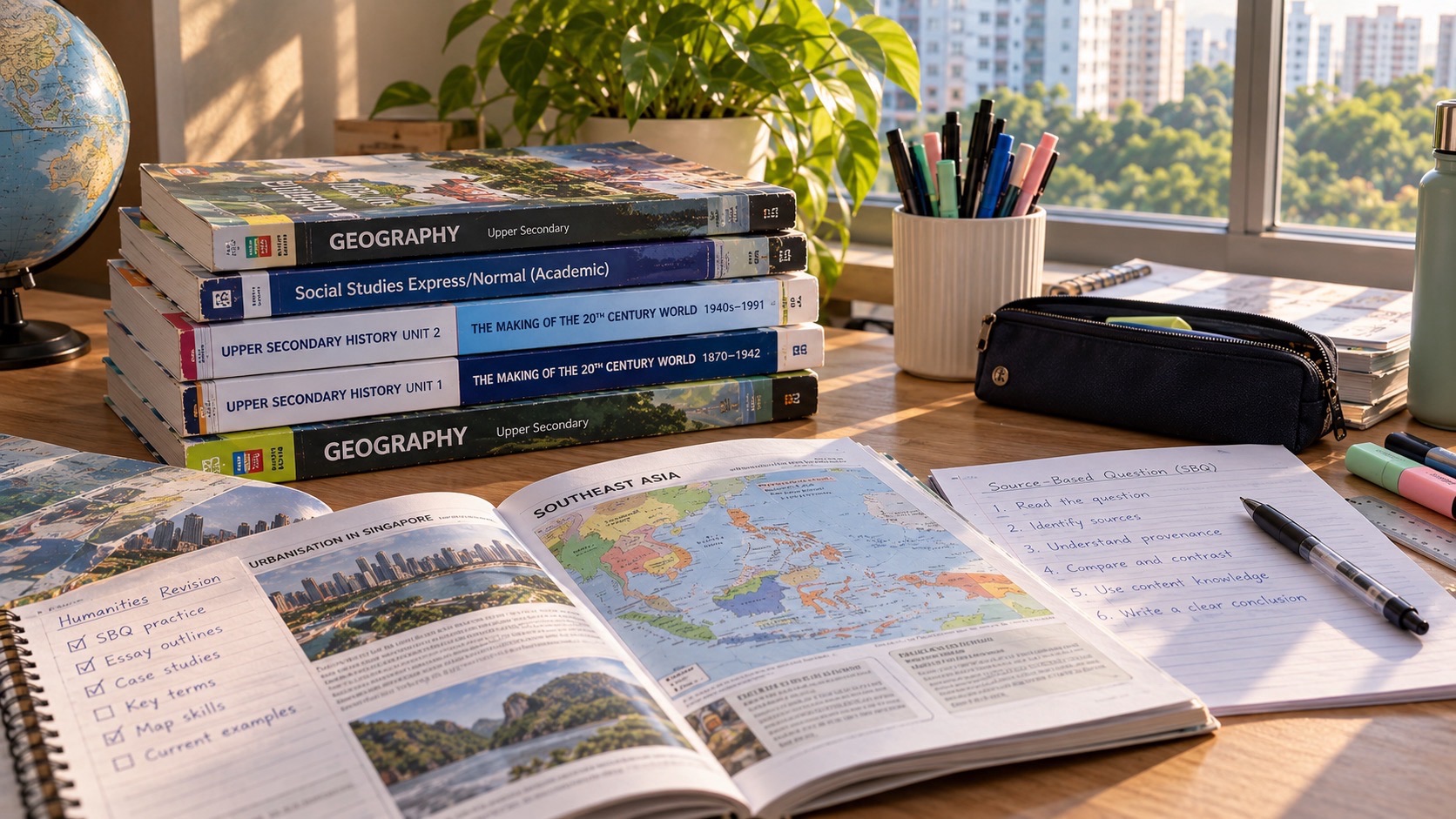
For a Punggol family choosing standalone G3 Geography, the correct 2027 SEC syllabus is K329, not the Geography component of combined Humanities K335. The national examination has two compulsory papers, both lasting 1 hour 45 minutes, 50 marks and 50% of the subject result. Paper 1 tests geographical fieldwork, Tourism and Climate; Paper 2 tests Everyday Geography, Tectonics and Singapore. The immediate parent move is to verify the child’s subject code and inspect how they interpret maps, graphs and evidence rather than asking them to memorise an entire assessment book.
This independent eduKate Punggol guide translates the published MOE–SEAB 2027 specification into a realistic 2027/2028 learning plan. PG3 is a secondary-school admission Posting Group; G3 is the level of an individual subject. Standalone Geography requires broader assessment than combined Humanities Geography, and the school must confirm whether it offers this subject to the student. The first SEC examination is in 2027. A student entering Secondary 1 in 2027 would normally sit the national exam years later, so recheck their examination-year syllabus when issued. The aim is mastery of geographical reasoning, not a claim that parents can control future papers or grades.
- Exact 2027 code: G3 Geography K329, formerly 2279; distinct from Humanities (Social Studies, Geography) K335.
- Paper 1: 1h45, 50 marks, 50%; fieldwork 20, Tourism 15 and Climate 15 marks.
- Paper 2: 1h45, 50 marks, 50%; Geography in Everyday Life 15, Tectonics 15 and Singapore 20 marks.
- Every question is compulsory: standalone K329 has no option to skip Climate or Tectonics.
- Fieldwork: the syllabus calls for ten weeks of extended school learning and enquiry, not a separate third examination paper.
- Reasoning skills: collect trustworthy data, interpret patterns, explain processes and evaluate decisions using criteria.
- Punggol approach: use safe neighbourhood observations and authoritative public data as examples, never predicted SEC questions.
- Careful planning: check the school programme, examination-year document and future course prerequisites.
1. The most important distinction: K329 is not K335
K329 is a standalone G3 Geography subject with two full Geography papers. K335 is a combined Humanities subject containing Social Studies and Geography, with different Geography scope, paper design and weighting. The combination a school offers is an educational decision. Parents should not buy the K335 workbook for a K329 child or assume studying standalone Geography automatically replaces the school’s Humanities obligations.
The former O-Level reference for standalone Geography was 2279; the 2027 SEC school-candidate code is K329. SEAB’s directory lists both subjects separately. An old resource may explain a useful topic, but its examination structure cannot be trusted until compared with the current K329 PDF. Ask the school to identify the exact upper-secondary subject and any prerequisites. Under Full SBB, admission through PG3 does not automatically register every student for all G3 subjects.
2. What the 2027 SEC transition changes
Beginning in 2027, the Singapore-Cambridge Secondary Education Certificate replaces the earlier separate N-Level and O-Level examinations for the relevant cohorts. Students may receive results for different subjects at different levels under Full Subject-Based Banding. MOE sets the school framework and SEAB publishes national candidate syllabuses and examination instructions. School candidates enter through their schools; a parent must verify the school-supplied subject list and report any discrepancy by the official deadline.
An incoming Secondary 1 student in 2027 should not study as though their SEC examination occurs that year. The upper-secondary Geography specification is helpful for understanding long-term outcomes but not a replacement for the school’s lower-secondary Geography lessons. For a student actually graduating in 2027, the published K329 paper scheme is directly relevant. A 2028 candidate must check the 2028 SEAB list when available rather than assume nothing can change.
3. The examination: Paper 1 is fieldwork, Tourism and Climate
In 2027, Paper 1 lasts 1 hour 45 minutes and carries 50 marks, 50%. It has three compulsory structured questions: Question 1 on geographical methods and fieldwork, 20 marks; Question 2 on Tourism, 15 marks; Question 3 on Climate, 15 marks. The fieldwork context may come from any relevant geographical cluster, not only the local place a school visited.
One of the later questions contains a nine-mark judgement-and-decision-making task, assessed with generic level descriptors. A student should understand that evaluation requires more than a list of advantages and disadvantages. A developed response identifies criteria, considers relevant evidence and constraints, weighs alternatives, and gives a justified overall view. Simply adding a conclusion that repeats the question will not create a sound judgement.
4. Paper 2: Everyday Geography, Tectonics and Singapore
Paper 2 also lasts 1 hour 45 minutes for 50 marks, 50%. It includes Question 1 on the concepts of thinking geographically and sustainable development, 15 marks; Question 2 on Tectonics, 15 marks; and Question 3 on Singapore, 20 marks. All three questions are compulsory. One nine-mark evaluation task appears in either Question 2 or 3.
The syllabus permits an approved calculator in both K329 papers. A calculator can help with percentages, rates or averages, but it cannot decide whether the data are valid or whether a conclusion follows from a map. Teach the child to show essential working where appropriate, use units, and explain what the calculation means. Strong Geography answers integrate knowledge with data analysis and judgement.
5. Five clusters, one connected discipline
The K329 content is grouped into Geography in Everyday Life, Tourism, Climate, Tectonics and Singapore. These are not five unrelated sets of vocabulary. They are different ways of studying places, processes and people’s interactions with environments. A geographical question asks where something occurs, why it occurs there, how patterns have changed, who is affected and what sustainable responses might be possible.
When studying a new cluster, encourage the child to ask the same five enquiry questions: What is happening? Where and at what scale? Which factors help explain it? What evidence supports the explanation? What limits or trade-offs affect a response? This creates transfer between Tourism, Climate, hazard risk and urban sustainability without turning the curriculum into a list of memorised model essays.
6. Geographical methods and the ten-week fieldwork requirement
SEAB’s 2027 K329 syllabus calls for students to undertake extended fieldwork over ten weeks as part of their school learning. Students should learn to frame a geographical question, choose a sampling approach, collect and present quantitative or qualitative observations, interpret patterns and evaluate the limitations of their investigation. The national assessment includes a written fieldwork question. The ten-week learning period is not a separate third SEC examination paper.
Parents should ask the Geography teacher what investigations are planned, what permission or equipment is required and how students will learn safe procedures. Do not organise unapproved surveys of strangers, collect identifiable personal data without consent or send children to observe hazardous areas. Good geographical fieldwork relies on honest methods and safe, appropriate locations, not dramatic photographs.
A practice plan can be entirely paper-based: take an invented data table about pedestrian shelter and ask the child to design a sampling method, identify independent and dependent variables where appropriate, choose a graph and explain the limitations. An investigation can be more convincing if it recognises that a small sample at one time does not describe an entire estate.
7. Punggol as a familiar example, not a predicted paper
Punggol’s mix of homes, transport, waterways, public spaces and new development makes it possible to discuss geographical decisions in familiar terms. A child might ask how shared land is used, how shading affects comfort or what factors encourage use of an accessible public space. These are teaching prompts only; they are not claims about actual examination topics, local measured conditions or official fieldwork sites.
For a safe family activity, use a map and public information to compare possible walking routes in a generic area. Identify what information the map shows and what it omits, such as weather conditions, surface quality or changes in construction. Ask which additional evidence is needed before making a recommendation. That is geographical reasoning: a decision depends on evidence and criteria, not just one attractive map.
8. Tourism: development, stakeholders and sustainability
Tourism questions can examine visitor activity, development, environmental impacts and sustainable management. Instead of memorising one case study word for word, encourage the child to identify stakeholders and competing outcomes. A destination may gain employment and infrastructure but face pressures on local services or ecosystems. The importance of each factor depends on the context and evidence.
A useful writing method is to separate the phenomenon from the mechanism. ‘Tourism increases employment’ is a claim; a stronger explanation describes how visitor spending creates demand for services, why the opportunities may vary and which groups benefit. In an evaluation question, ask whether the expected benefits justify the costs and what management strategies could change the balance.
A parent can provide a short public tourism report and ask the student to read its date, geographic scope and measurement definition. A graph of arrivals is not the same as a graph of spending, and increases in visitor numbers do not prove every community benefits equally. Teach the habit of checking what the indicator actually measures.
9. Climate: distinguish long-term patterns and daily weather
The Climate cluster includes weather and climate, climate change and climate action. Students should interpret climate data carefully rather than use the terms ‘hot weather’ and ‘global climate change’ interchangeably. Weather describes conditions at a particular time; climate involves patterns over a longer period. A single unusual day cannot demonstrate a multi-decade trend, even when it raises questions worth investigating.
Teach learners to distinguish natural climate processes, human influences, observed evidence and proposed responses. When comparing adaptation and mitigation, ask what each strategy tries to change and what constraints it faces. Responses may operate at local, national or global scales. A good answer explains why a strategy fits the risk rather than merely praising it as sustainable.
Parents should be careful with web sources. A dramatic online image may have been captured elsewhere, in another year or without enough context to support a claim. Use trusted scientific or government materials and check dates, definitions and units. Geography literacy is valuable beyond the examination because it helps teenagers evaluate environmental claims responsibly.
10. Tectonics: hazard does not equal identical risk
Tectonics covers plate processes, earthquakes and volcanoes, and disaster risk management. The central reasoning is causal: identify the geological process, show how it generates a hazard, and explain why the consequences differ by exposure, vulnerability and preparedness. Two communities affected by similar physical events may experience very different outcomes because of population distribution, building design, warning systems and resources.
A simple concept map can connect plate boundaries to physical processes, observable hazards and social impacts. Then introduce risk reduction strategies such as monitoring, planning, safer construction and public education as examples to evaluate according to the syllabus. Avoid pretending one measure can eliminate all hazard. Judgement is stronger when students distinguish prevention of exposure from reduction of harm.
11. Singapore cluster: resilience in a small island city-state
The Singapore cluster asks students to understand the opportunities and challenges of a small island city-state and how sustainability and resilience relate to planning. Students may consider competing land uses, limited resources, urban opportunities and the needs of different groups. Teach trade-offs without implying that every development choice is simply ‘good’ or ‘bad’. Singapore’s geography provides a context in which many decisions involve constraints.
For an evidence-based classroom discussion, ask how a decision might affect residents, workers, visitors and future generations. What data would reveal a problem? Which objective should be prioritised, and why? Are there unintended consequences? This approach supports a reasoned evaluation and helps the student understand why Geography combines scientific observation with human values.
12. Maps and graphs: read before calculating
Students should check a figure’s title, date, legend, units, scale and geographic coverage before describing it. A graph with a narrowed vertical range may make a modest change look large. A map may use colours that imply similarity across areas while obscuring variation. A photograph records one angle and one time. Each representation is useful but has limits.
Use the three-layer answer: describe the actual pattern; explain a relevant process or relationship; evaluate how far the available evidence supports a conclusion. Keep these verbs distinct. A calculation that produces the right percentage does not by itself explain why a trend occurred. Equally, a compelling story without the required data reference may not answer the question.
13. Nine-mark judgement: criteria before conclusions
K329 includes a higher-level nine-mark decision question in each paper. A strong response must engage with the particular proposal or situation rather than offering a generic statement that ‘both sides have benefits’. First identify the decision being made and its relevant criteria, such as sustainability, feasibility, equity or risk reduction. Then use evidence to compare plausible options and justify the recommended choice.
Students should be able to distinguish a compromise from a well-reasoned judgement. Sometimes one option is stronger on the evidence; sometimes a combination is appropriate. The important issue is the logic behind the conclusion. Parents can help by asking, ‘Which point affects your choice most, and what would cause you to change your mind?’
14. An error log for Geography that actually teaches
Take one school script and mark only the first error in each problematic response. It may be a missing unit, a misread graph, a causal link left unexplained, a vague evaluation or an unsupported claim about a place. Label the type of mistake, then ask the student to revise it. A week later, use a different graph or case study testing the same skill. Record independent success, not merely completion.
- Evidence error: the response invents facts that a map or graph does not show.
- Scale error: a local observation is treated as proof of a national pattern.
- Concept error: a process such as mitigation is confused with adaptation.
- Causation error: an observed correlation is called a proven cause.
- Evaluation error: competing options are listed without a justified conclusion.
- Method error: an investigation omits sampling, relevant variables or limitations.
- Response error: the command word is ignored or units are absent.
15. A twelve-week parent-supported Geography cycle
Weeks 1–3: baseline and geographical vocabulary
Collect a graph response, a fieldwork-method answer and a longer explanation. Identify one interpretation error and one causal or evaluation issue. Use a school topic to demonstrate the correct process. Build a short glossary with context, including words such as vulnerability, reliability, distribution, sustainability and exposure. The child should explain each term, not merely copy a definition.
Weeks 4–6: new data, same principles
Move from one map to another and from one graph type to a different representation. The student must identify what the new source measures and where its limits lie. For fieldwork, give a safe hypothetical enquiry and ask how to improve its sampling. For Tourism, choose an unfamiliar destination; for Climate, use a new dataset. This tests transfer rather than memory of one textbook page.
Weeks 7–9: integrate explanations and judgement
Work on questions that combine geographic processes with stakeholder decisions. Ask the learner to state a position, compare evidence and justify a conclusion. Introduce limited timed practice once the response is accurate. If the student struggles, distinguish lack of content knowledge from inability to organise an argument. Give specific feedback on the missing link.
Weeks 10–12: independent retest and next choice
Compare fresh work to the baseline for accuracy in describing patterns, causal explanation, use of methods and sound evaluation. Ask the student which study technique made improvement possible. Discuss persistent concerns with the Geography teacher, and choose the next two goals. More practice pages are not a substitute for understanding the underlying error.
16. Secondary 1–4: the right timing for the right student
Secondary 1: learn to ask geographical questions
Start with everyday observations, basic maps, simple data and understanding how human activity relates to environments. There is no need to force full K329 papers before the student has learnt the upper-secondary content. Keep reading and numerical skills strong, as Geography requires both.
Secondary 2: explore subject choice and readiness
Ask which Geography combinations the school offers and whether K329 is available. Check the student’s interest in fieldwork, environmental processes, place-based investigation and reasoned writing. Contrast it with K335 combined Humanities and other upper-secondary options without claiming that one route is automatically superior.
Secondary 3: map the confirmed syllabus
Once K329 is confirmed, organise the five clusters and the school’s fieldwork plan. Record practice in maps, graphs, short explanations and judgements. The ten-week fieldwork experience should include careful methods and honest reflection. Support planning without replacing the student’s investigation work.
Secondary 4: use the examination-year blueprint
For the 2027 graduating cohort, use the 2027 K329 paper structure and the official timetable. For a candidate graduating in 2028 or later, check the updated SEAB syllabus. Incorporate a limited number of timed complete papers after content learning, review errors carefully and prepare for the two compulsory paper structures. Do not apply the K335 Climate-versus-Tectonics choice to K329.
17. A weekly plan that fits Punggol family life
Some students commute beyond Punggol, return from CCA late and share space with siblings. Choose a sustainable schedule after noting school commitments and bedtime. A possible week includes one fieldwork/data session, one topic explanation, one map or chart exercise and a short correction review. This is a suggested family routine, not an official MOE requirement.
Good practice can be done with a school textbook, a trustworthy open-data graph and a notebook. A family does not need to buy multiple atlas apps or arrange an expensive field trip. Fieldwork at school remains the primary supervised investigation setting. When community observations are used, respect privacy and choose safe routes and locations.
18. When tutoring is helpful and when it may not be
A useful tutor should check how the student reads evidence, explains a geographical process and evaluates a decision. Ask how they diagnose a response and test a new unfamiliar question after teaching it. An instructor should know that standalone K329 has two full Geography papers and no optional Climate-versus-Tectonics section. A tuition service selling K335 combined worksheets as a complete K329 programme needs closer scrutiny.
The immutable Clementi Maths article demonstrates the value of small-group observation and targeted correction, but it does not prove that an identical three-student Geography tutorial operates in Punggol. Check actual service details. A child making steady progress with school support and sound home habits may not need additional tuition.
19. Future pathways: preserve options without making guarantees
Geography supports critical interpretation of data, environmental awareness and human-context reasoning. These may help students exploring science, social sciences, planning, business and many other fields, but no single SEC Geography grade guarantees access to a programme. MOE plans revised post-secondary admissions arrangements from 2028. JC, MI, polytechnic, PFP and ITE eligibility depend on current year-specific criteria and accepted subject levels.
A Secondary 1 entrant in 2027 should not choose every subject now on a speculative forecast of university admission years later. When upper-secondary subject selection arrives, compare actual school offerings and prerequisites. For graduating students, consult the current institution’s entry rules before applying.
20. Frequent misunderstandings and quick answers
- Wrong: K329 is combined Humanities. Correct: K329 is standalone Geography; K335 includes Social Studies and Geography.
- Wrong: the student may skip Tectonics by choosing Climate. Correct: both appear in compulsory K329 papers.
- Wrong: a ten-week fieldwork programme is a third written SEC paper. Correct: fieldwork is taught and assessed within the syllabus and written papers.
- Wrong: a correct numerical calculation automatically explains a geographical process. Correct: interpretation and causal explanation are separate tasks.
- Wrong: a local anecdote establishes a national trend. Correct: sample, scale and evidence must be checked.
- Wrong: every evaluation requires equal agreement with all choices. Correct: justify a defensible conclusion using relevant criteria.
21. Frequently asked questions
How many papers does K329 have in 2027?
Two compulsory written papers, each 1 hour 45 minutes, 50 marks and 50% of the subject result.
Does K329 examine Tourism, Climate and Tectonics?
Yes. Paper 1 includes Tourism and Climate; Paper 2 includes Tectonics and the Singapore cluster. The fieldwork and Everyday Geography elements are also compulsory.
Does the ten-week fieldwork requirement produce a separate examination grade?
The official syllabus requires extended fieldwork learning but the national examination structure shown is two written papers; there is no separate third SEC fieldwork paper.
Is K329 automatically offered to every PG3 child?
No. The school decides its subject combination offerings and applicable criteria. Parents must confirm the child’s official subject plan.
Can I use 2027 K329 papers to guarantee 2028 readiness?
They can be useful reference materials when aligned with the school curriculum. They do not prove that the 2028 syllabus or examination arrangements are identical. Check SEAB for the relevant year.
Official sources and related Punggol guides
This independent resource is not an MOE, SEAB or school publication. Use official syllabuses and the school’s current instructions to verify subject entries, assessment conditions and deadlines.
- 2027 SEAB G3 school candidate syllabuses
- SEAB official 2027 G3 Geography K329 syllabus
- SEC overview and examination guidance
- Detailed Punggol K329 syllabus, fieldwork and paper design
- Standalone K329 versus combined Humanities K335
- Top 200 geographical terms for K329
- Secondary 4 G3 fieldwork and sustainability vocabulary
- Punggol Secondary 4 Geography fieldwork and decisions
- Local Punggol environmental case discussion
- Related PG3 combined Humanities Geography learning guide
- Correct SEC school-candidate subject code
- Immutable Clementi format reference


